Tag Archives: Cave

Borjomi and Vardzia, Georgia

Our final stop in Georgia was the once thriving southern spa town of Borjomi, famous for its warm and fizzy restorative mineral waters as well as being the gateway to the Borjomi-Kharagauli National Park. Sadly we didn’t have time for the latter as we’d planned to spend most of our penultimate day exploring the nearby cave monastery of Vardzia.

Vardzia, Georgia

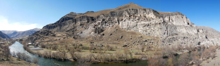
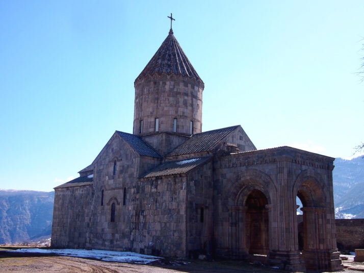
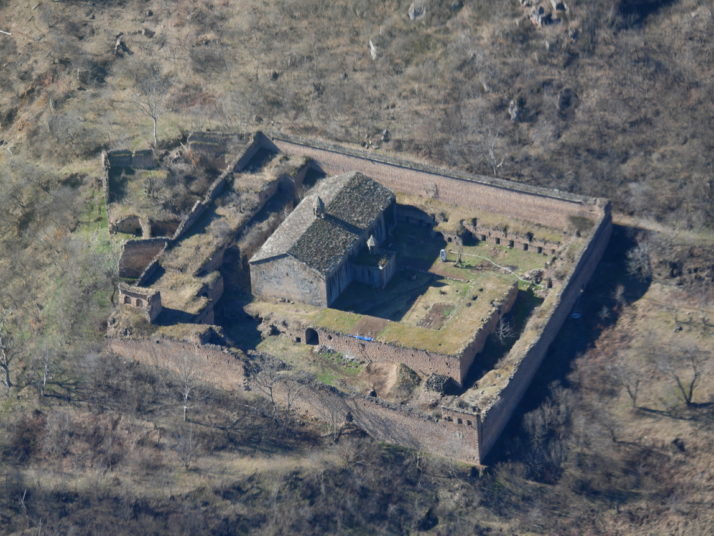
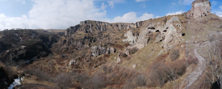
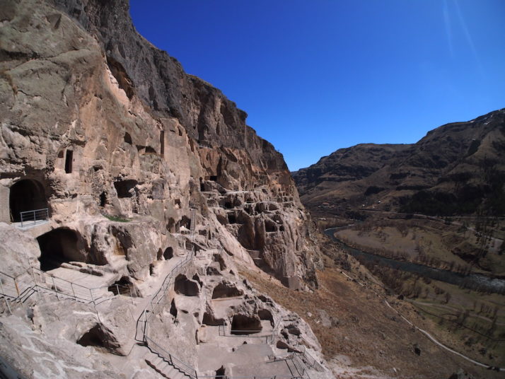
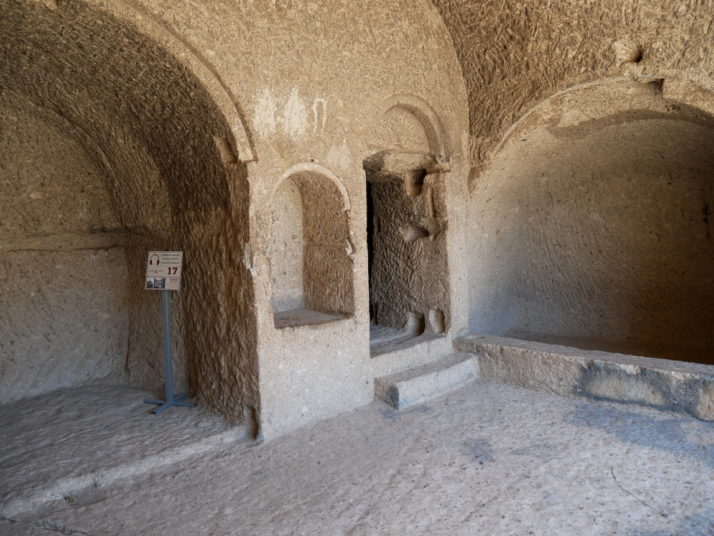
And we thought Davit Gareja was big! At its peak, Vardzia had over 400 rooms, 13 churches, 25 wine cellars, a bakery and a forge all spread over 19 levels. That said, it’s a quarter of the size of Old Khndzoresk in southern Armenia

Although excavations show the area has been inhabited since the Bronze Age, with cave settlements starting around the 5th century BC, the remains at Vardzia date back to the reign of King Giorgi III in the 12th century and continued in phases for the next 100 years or so. They’re still excavating and adding caves to the site as they’re being restored.

Vardzia, Georgia

Look at all of those caves.. it’s immense!

We’d read the guides rarely speak English so we opted for the cheap audioguide (quick tip – they provide a set of headphones but bring extra ones and a splitter to share – you’ll hear it better too, and don’t forget some ID to leave as a deposit) which was great for the history and context but we felt went into a little too much detail about some of the rooms and frescoes.

The Bakery, Vardzia, Georgia

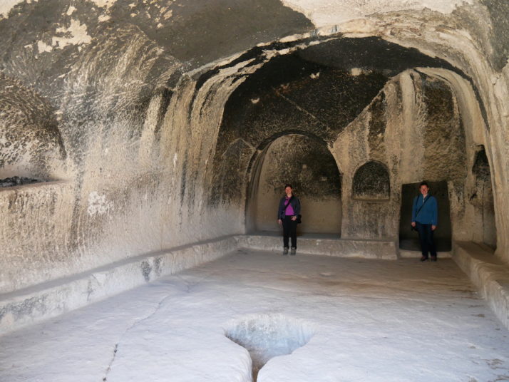
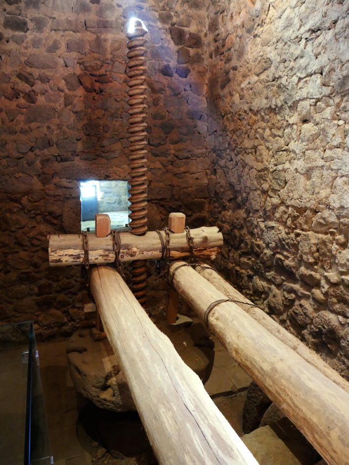
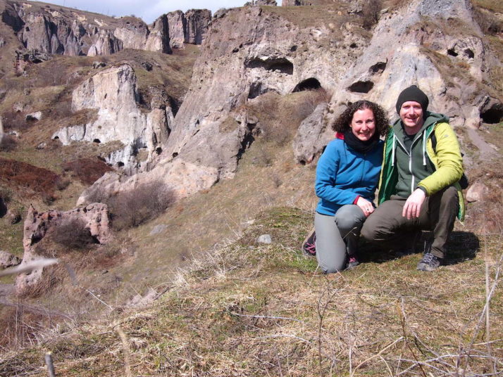
Jo and Julie in the wine press, some of the caves are huge inside

Queen Tamar's Room, Vardzia, Georgia

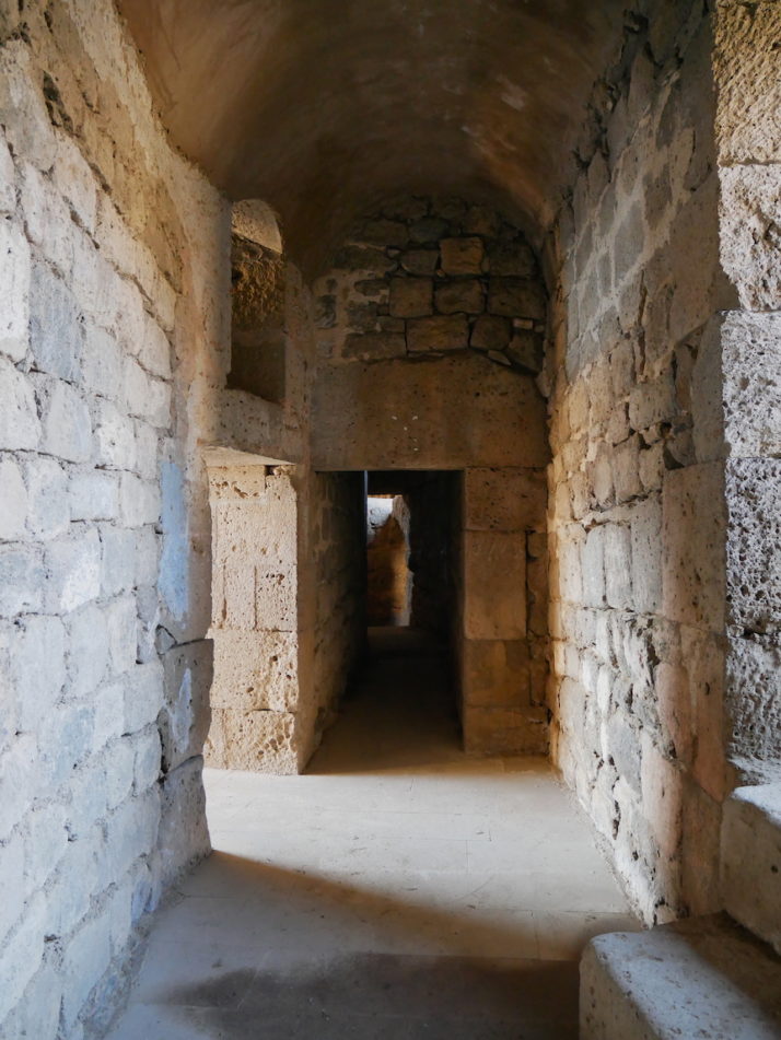
While others are intricate, like this one which was Queen Tamar’s, daughter of King Giorgi III and continuer of the Vardzia Monastery. Most of the cave cells are simpler than this one but had a similar layout

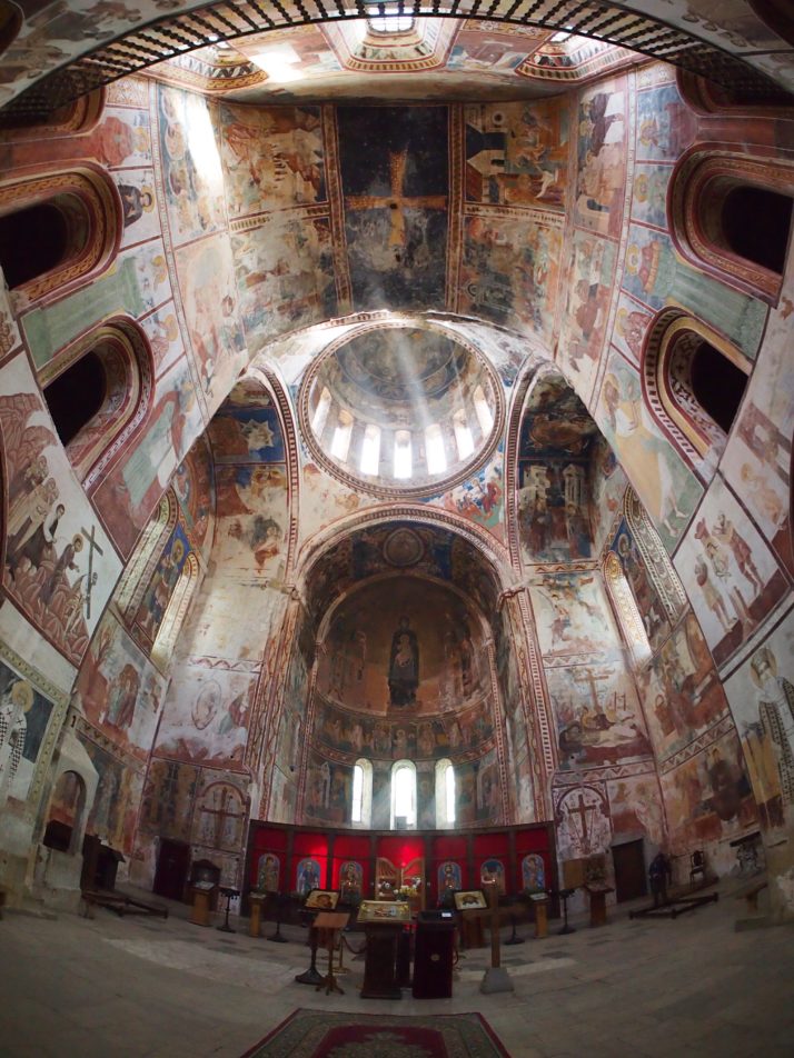
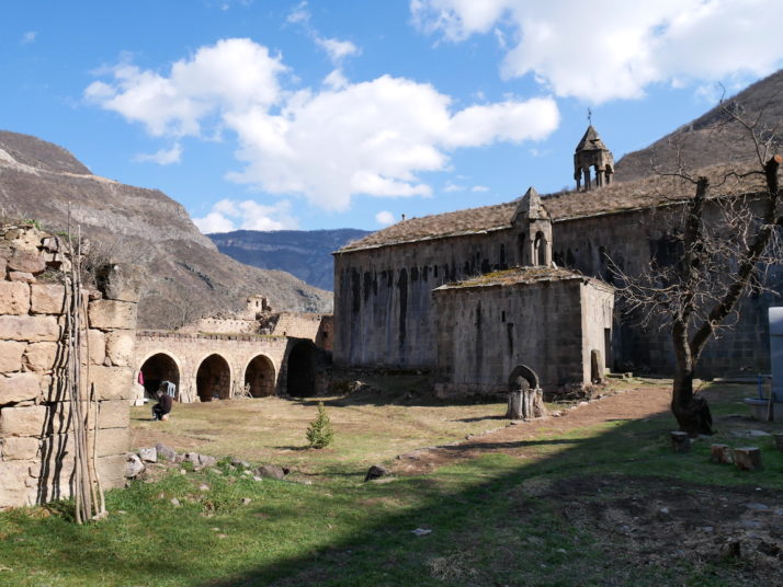
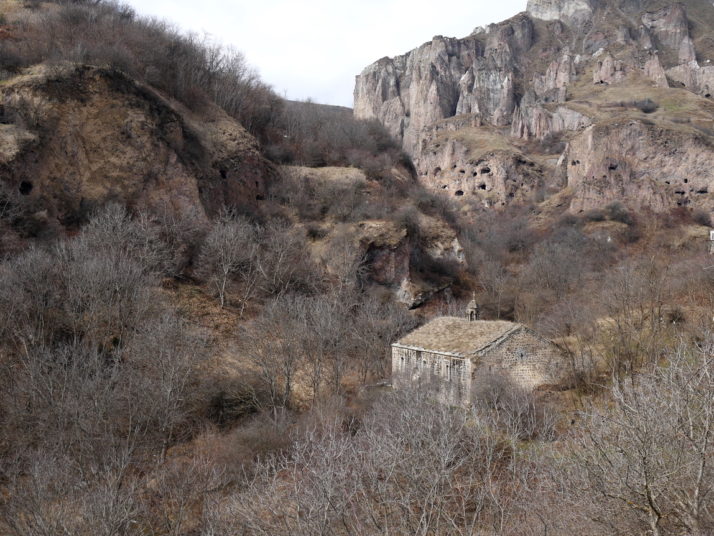
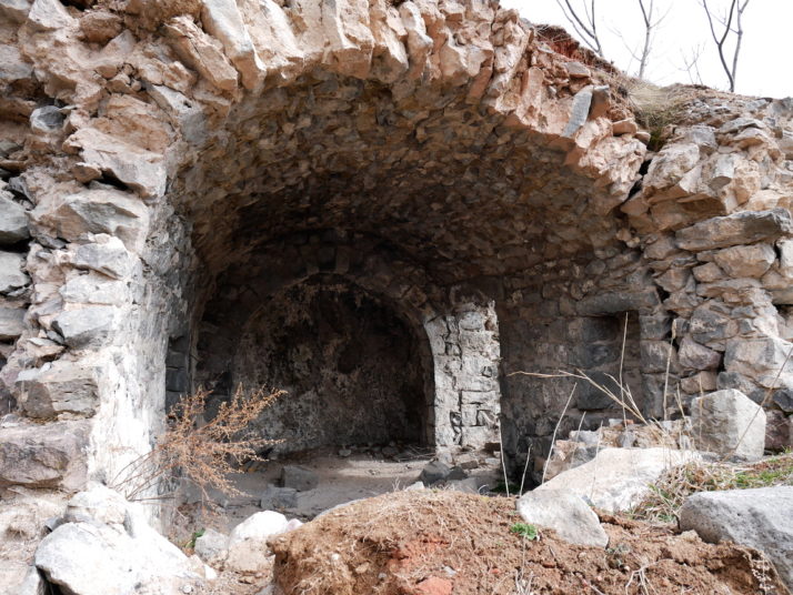
The cave complex is centred around the very impressive Church of the Assumption which is set back into the cliff face, saving it from the earthquake of 1283 that destroyed the outer tunnel network and exposed a lot of the caves to the open air. I say it’s impressive but we weren’t able to see inside for ourselves despite hovering around another couple who were with a guide who had a set of keys on him. I suspect that it was being renovated ahead of the main tourist season as we could see a lot of scaffolding inside through the cracks in the doors, so we made do with the overly detailed audioguide, recollections of our research, and photographing the frescoes on the outside!

Church of the Assumption, Vardzia, Georgia

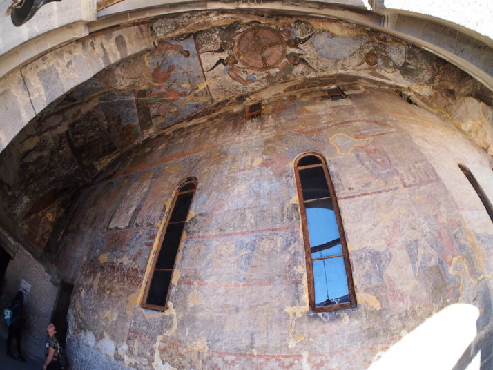
The wonderful frescoes on the outside of the Church of the Assumption. The audioguide added history and context to our visit, but sometimes it was difficult to hear and we started skipping some of the more laboured descriptions

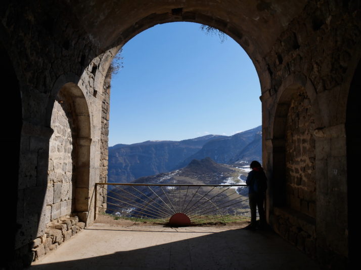
Had it not been locked, the Church of Assumption would likely have been the highlight of an altogether astounding visit, pipping it to first prize therefore goes to The Refuge, a secret chamber accessed through a narrow, dark 150m tunnel complete with defences that winds its way from chambers behind the church up through the rock.

The Refuge Tunnel, Vardzia, Georgia

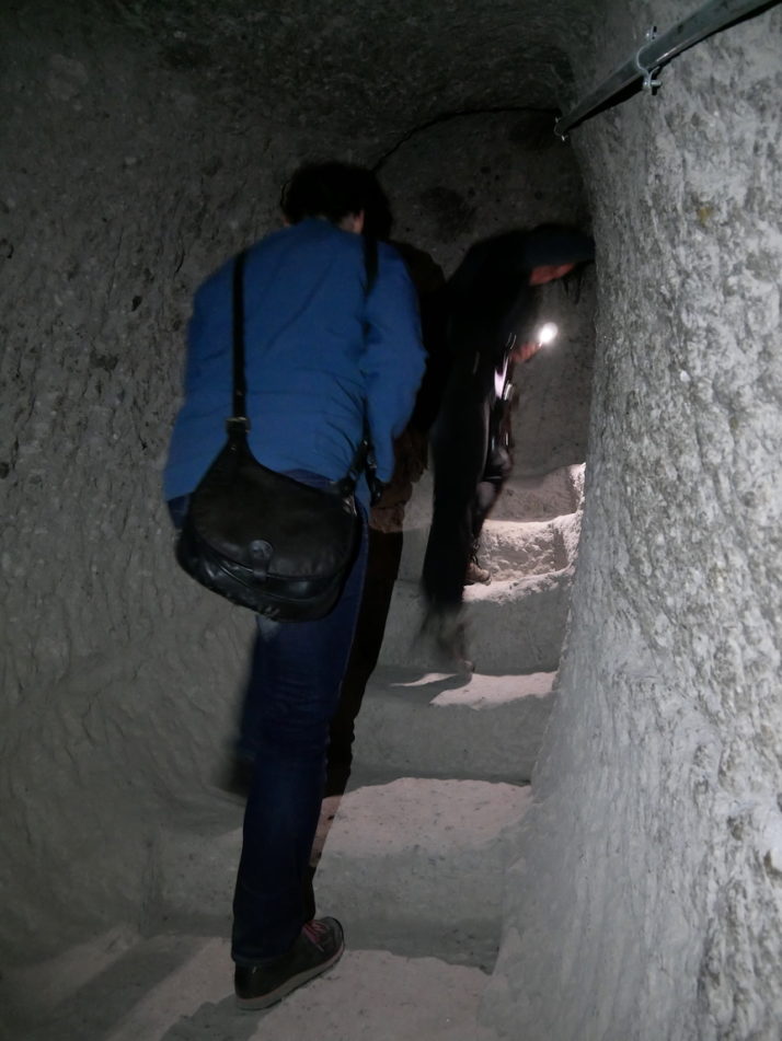
Exploring the escape tunnel to The Refuge with torches was exciting and a little bit scary as we were on our own. The tunnel has two heavy rock doors that could be closed behind those fleeing, and a battlement style murder hole

The Refuge, Vardzia, Georgia

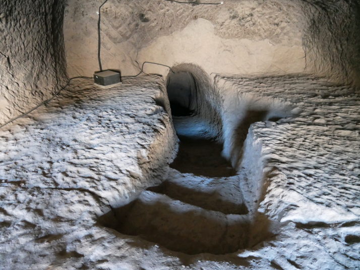
The Refuge! This is the exit from the tunnel and the room itself has a couple of tall, narrow windows for firing arrows and catapults through in defence

We really enjoyed our time exploring the multiple levels and variety of caves. Taking our time and taking lots of photos we found it was just the right length. Before heading back to Borjomi we picked one of the on-site restaurants for a bite to eat and were pleasantly surprised at the quality and the price compared to similar captive audience establishments back home. We’d had a similar experience at the Prometheus Cave just outside Kutaisi too.

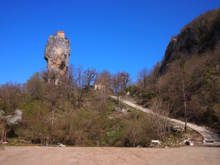
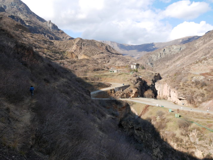
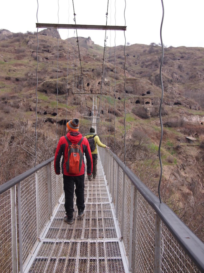
Even stopping for 10 minutes at the Khertvisi Fortress for a quick photo opportunity and to stretch our legs on the way back to Borjomi, we had time to dust off our clothes from scrambling around the caves and tunnels and head to the Mineral Water Park for one last hike in this beautiful country.

Khertvisi Fortress, Georgia

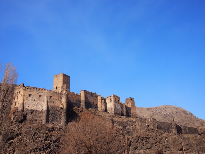
The impressive Khertvisi Fortress sits atop a rocky crag and is best photographed from a pedestrian suspension bridge that spans the Mtkvari river

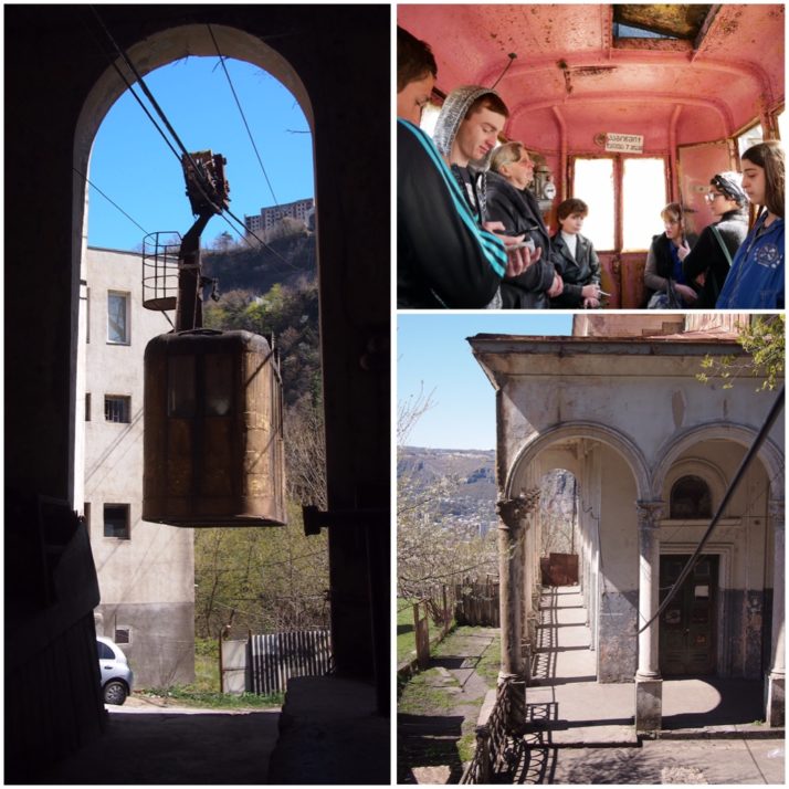
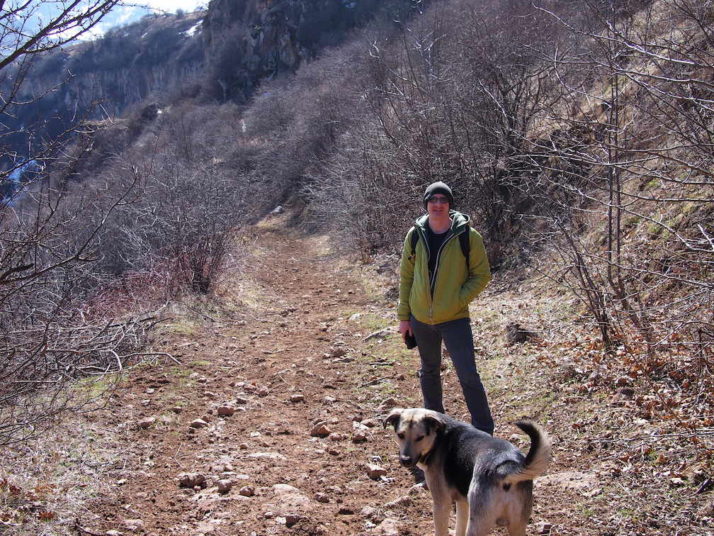
Borjomi’s central Mineral Water Park is on the site of the first spring (which is named Ekaterina), and contains the original bottling plant which looks like it was gearing up to be a museum. We filled our bottles and weren’t too put off by the sulphuric smell, or the fizzy, salty taste. Refuelled for our hike we took yet another cable car to the top of the park and followed the 3km forest trail back down.

Borjomi Mineral Water Park

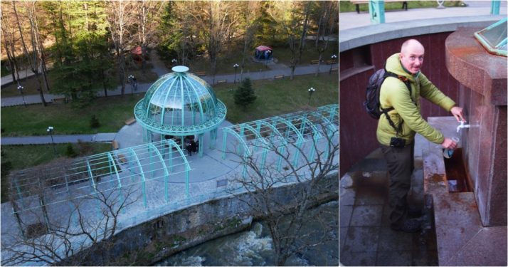
Filling up with Borjomi’s biggest export – there are some 40 bottling factories in the area and the waters are exported throughout Georgia. Truth be told, we drank about half a bottle between us as the taste was pretty strong!

Forest trail in the Borjomi Mineral Water Park, Georgia

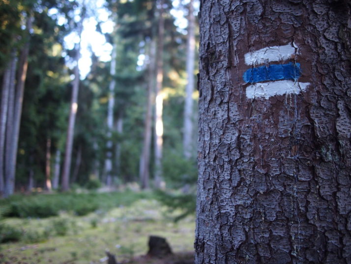
Though the trail was marked, spotting the markers was tricky at times as new barbed wire fences had gone up right across the path!

Forest trail in the Borjomi Mineral Water Park, Georgia

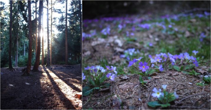
Still, we were treated to a fantastic tranquil sunset through the trees

Open air mineral pools in the Borjomi Mineral Water Park, Georgia

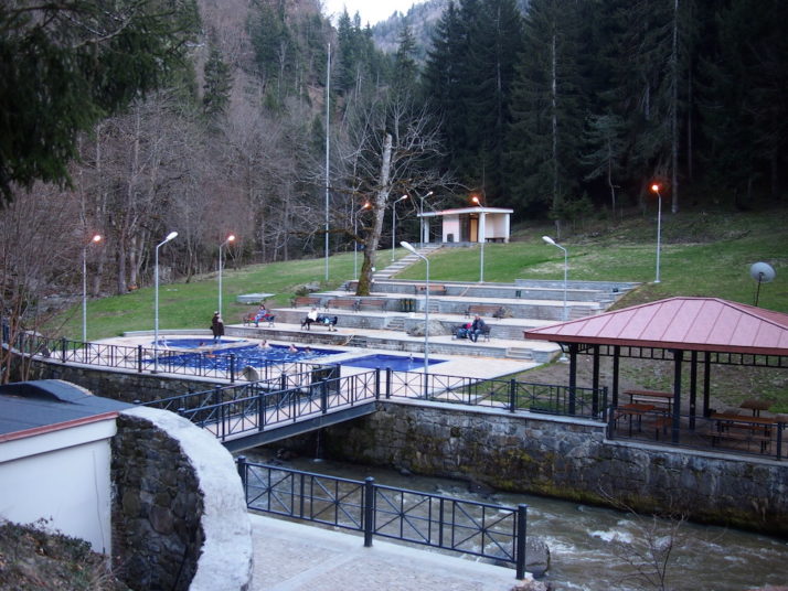
Near the end of the trail are public open-air mineral water swimming pools, time for a dip..

Us swimming in the open air mineral pools in the Borjomi Mineral Water Park, Georgia

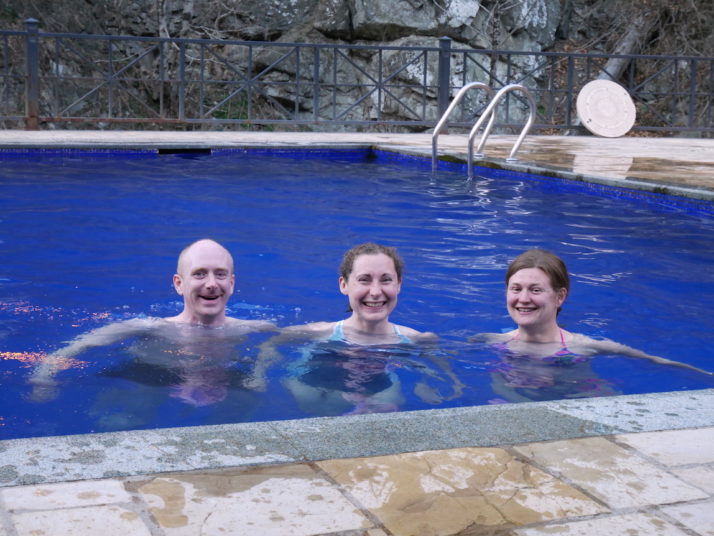
Good thing we’d brought our swimming costumes!

The water wasn’t as warm as we’d hoped, and the changing room block was closed so we did the wrap-around towel thing but it was a perfect end to an amazing day and a relaxing end to our time in Georgia.

Kutaisi, Georgia

Kutaisi is the second largest city in Georgia though much smaller than the capital Tbilisi. It has a relaxed, friendly vibe and we really liked the central area with its bustling park, elaborate fountain and excellent market. There are plenty of interesting sites within day trip distance too, so in order to do them justice as well as reach a few other places in central Georgia we hired a car for our final week.

Colchis fountain, Kutaisi

The Colchis Fountain stands in front of the Drama Theatre in the centre of Kutaisi. The Bagrati Cathedral is on the hilltop in the background

The Colchis Fountain forms a roundabout in the city centre and is decorated with large scale replicas of 2000 year old gold jewellery excavated from a tomb in nearby Vani. The Colchis civilization which was responsible for the jewellery has been linked to the Ancient Greek legends of Jason and the Argonauts and their search for the Golden Fleece. (Note to Kutaisi City Council: please make a pedestrian crossing to the fountain so that tourists can get a closer look at the sculptures without getting run over…)

The market was just as friendly as the one we visited in Tbilisi with sellers eager to chat, offer samples and let us photograph their wares

The Georgian Parliament was moved from Tbilisi to Kutaisi by the government of Mikheil Saakashvili to decentralise power from the capital and boost economically deprived Kutaisi. The futuristic building was opened in 2012. Tours inside need to be booked in advance so we just parked up and had a look around outside.

The new Georgian Parliament building in Kutaisi

On a hill overlooking the city centre stands Bagrati Cathedral, one of two UNESCO listed sites close to Kutaisi. The pale stone walls and green roof have been pretty much completely rebuilt after lying in ruins since 1692 when it was destroyed by the Ottomans. The grounds around it and the view over the city to the Lesser Caucasus mountains are beautiful but we found it rather staid inside.

Bagrati Cathedral has been almost completely rebuilt from its ruined state

Under the same UNESCO World Heritage listing as the Bagrati Cathedral is Gelati Monastery, just a 20 minute drive into the hills to the north-east of Kutaisi. We found this much more interesting, from the old monk poking about in the engine of his equally aged car just inside the entrance to the stunning frescoed interior of the main church. The monastery was founded in 1106 by King David the Builder (guess what he was famous for!) as a centre of culture and learning and it retained that reputation until the communists arrived in the 1920s.

Gelati monastery (clockwise from top): restoration works were being carried out during our visit with rather natty green roof tiles being added to the buildings; Andrew and Jo taking photographs beside the grave of King David the Builder; the small Church of St Nicholas stands on an unusual arcaded base

King David the Builder wanted to be buried in one of the monastery gates so that visitors would have to step on him to enter the complex. The gate is now permanently closed for passing through and today’s visitors take care to not step on the gravestone!

Frescoes dating from the 12th to 18th centuries cover the whole interior of the Cathedral of the Virgin at Gelati monastery

Just down the hill from Gelati is the tiny Motsameta Monastery. Even by Georgian standards its location is spectacular. The church is home to the tomb of two brothers who were killed during an 8th century massacre by the Arabs and who were miraculously carried up to the monastery site by lions. The faithful believe that their tomb grants wishes.

Motsameta monastery has a stunning location on the edge of a gorge above the River Tskaltsitela

As a break from the churches and monasteries we headed out to see the natural beauty of the area north of Kutaisi. Our first destination was the walkway along Okatse Canyon. Unfortunately I can’t tell you much about it as our GPS directed us onto a rough unsurfaced road which was bad enough, but by the time we reached the bridge at the bottom of the valley that it expected us to cross we decided to give it up and head on to our next stop instead.

Rough road detour north of Kutaisi: (top) with hindsight we should have turned around here instead of driving for half an hour to the river where we were forced to retrace our steps rather than crossing this very rickety looking bridge (bottom)

The Prometheus Cave is 1.4km long and the concrete walkway passes through six large chambers full of impressive stalactites and stalagmites. Entry is by guided tour only and we ended up with a Russian group rather than waiting over an hour for an English-speaking one. In the end that was probably better as we didn’t feel obliged to keep up to hear what the guide was saying and just hung back taking photos! Our Lonely Planet describes the lighting in the cave as ‘discreet’, the word I would use is lurid, but I suppose it creates some interesting effects on the rock formations. I found the Vivaldi background music less offensive as it served to dampen the echoes from the large group.

Prometheus Cave (clockwise from left): Andrew admiring some stalactites; the ‘discreet’ lighting on the rock formations; cross-section through a broken stalactite

Our final stop of the day was at the Sataplia Nature Reserve, an area of sub-tropical Colchic forest, home to birds, wildlife, and fossilised dinosaur footprints! Spring flowers were beginning to bloom on the forest floor and with the sun shining it was a very pleasant walk along the trail to the Sataplia Cave, which honestly was not particularly impressive after the Prometheus Cave.

Sataplia Nature Reserve: one minute you’re walking along a woodland path…the next, dinosaurs!

The word Sataplia means ‘place of honey’ and is so called because of the tradition of collecting honey from the bees found in this area. There are a couple of great viewpoints along the trail including a glass floored walkway which reminded us of the glass path that we walked on at Zhangjiajie in China. The one here was closed when we visited but we could get close enough to see the view.

Gorgeous view over Kutaisi and the Lesser Caucasus from Sataplia

The highlight of the Sataplia trail was the well-presented pavilion containing fossilised dinosaur footprints

70km east of Kutaisi is the small mining town of Chiatura. It’s very much off the standard tourist radar but we’d read that there are several still-functioning Soviet era cable cars linking the town centre with the mines and residential areas in the hills above so we stopped off for a brief visit to frighten ourselves with the rickety contraptions.

On the way to Chiatura we visited the Katskhi Pillar, a monastery atop a rocky outcrop. Apparently one monk still lives up there!

The first cable car we rode had a lady operator who was in charge of locking the door and stopping and starting the system. At the top we seemed to have reached a residential area though we didn’t venture far from the station. That car ran at 15 minute intervals and there was no charge or ticket. On the way down we were sharing with (among others) a chatty old lady who wasn’t going to let her lack of English or our lack of either Georgian or Russian stop her from finding out all about us!

Chiatura cable cars (clockwise from left): cable car arriving at the bottom station; inside the cable car, the lady in the leather jacket (centre left) is the operator; the stations must once have been grand but are now in the same level of disrepair as the cable cars

The second cable car we rode was on a particularly steep line. At the top we found a mine entrance and a spectacular view down to the town

Final mention should go to our rental apartment in Kutaisi. We didn’t quite believe the pictures on the booking website but it really was as grand as it looked!

Our rental apartment felt like a stately home!

Southern Armenia – Goris and around

The southern-most destination of our Armenian road trip was the once prosperous industrial town of Goris, still quite bustling but very much past its heyday. The long main streets with their two-storey houses with large wooden balconies stretching out over the pavement contrast with the functional concrete Soviet-era municipal buildings and residential apartment blocks. Everything has a partially abandoned shabbiness to it that’s quite endearing.

Goris, Armenia

Goris’ central town square is quite grand. It’d be nice in the summer with all the fountains working

The main highway from Yerevan skirts the top of the town on its way to the Nagorno-Karabakh Republic and Iran further south (two more places to visit that we’ve added to our ever-expanding list!), but our reason for stopping in Goris was the nearby sights of Tatev Monastery and the cave settlement of Khndzoresk.

Tatev Monastery

Tatev Monastery, Armenia

Another monastery? We weren’t kidding when we said we thought every other site might be a monastery or church!

The journey to Tatev is a little more exciting than most as it involves a cable car. Somewhat ostentatiously called ‘The Wings of Tatev Aerial Tramway’, it’s in the Guinness Book of World Records as the longest non-stop double-track cable car – which makes it sound a lot more impressive that it actually is! However, all is forgiven for the views over the small village of Halidzor, the remains of a warning bell tower and the spectacular view of the monastery itself, perched on the edge of the plateau.

Church of St Paul and St Peter, Tatev, Armenia

The church of St Paul and St Peter looks impressive and commands an enviable view down the valley

Although there was a small church on the site from the 4th century, Tatev grew into a thriving academic monastery after the main Surp Poghos-Petros (St Paul and St Peter) church was built in the 9th century to house important relics, and at its peak was home to some 1,000 clergy and students.

Former monk cells, Tatev, Armenia

I enjoyed exploring the old monk cells more than Julie did!

When we visited in March 2017 the restoration works were well underway and we read that the intention is to restore Tatev to a working monastic university which will include an interactive museum. I hope it’ll still be possible to visit some of the monk’s cells in the outer walls that look down the valley as we enjoyed exploring the rabbit-warren of interconnected rooms.

View from the monk cells, Tatev, Armenia

The view from the monk cells down the valley. Apparently there’s a tunnel carved into the hillside to the valley below!

The other highlight of Tatev for us was the huge communal oil press sited just outside the monastery so the nearby villagers could use it without disturbing the monks. At first glance we thought the giant screw end did the pressing but a video showed us that we had it the wrong way round – the sacks of seeds sit under the other end of the long wooden beams, and the screw end is used to control the compression.

Oil pressing house, Tatev, Armenia

Oil presses were common in monasteries all around Armenia, but Tatev’s has been reconstructed to show how they worked

Having taken the cable car to Tatev we decided to hike the 9 miles (15km) back which meant we could visit Tatevi Mets Anapat (Tatev Hermitage) and the Devil’s Bridge both located in the valley below. After a spot of lunch on the outskirts of Tatev village, we were adopted by our requisite tour guide dog whom we named Grigor and set off on the well trodden trail down the hillside.

Andrew and Grigor, Tatev, Armenia

Have pooch, will hike. It’s worth mentioning that the offline maps.me app was very helpful hiking down from Tatev Monastery as there are a few forks in the track and very few markers

Tatevi Mets Anapat

Tatevi Mets Anapat, Tatev, Armenia

The Tatev Hermitage viewed from the cable car

Concerned that we were running a little short of time to make it back to the car park before it closed at 6pm, we gave ourselves 20 minutes to poke around the ruined hermitage of Tatev and that was plenty of time, though I still couldn’t find the tunnel that apparently links it with the monastery we’d hiked from!

Tatevi Mets Anapat, Tatev, Armenia

Inside the Tatev Hermitage, complete with a hermit! We offered him a biscuit but he politely declined

Devil’s Bridge

Devil's Bridge, Tatev, Armenia

The Devil’s Bridge, also known as Satan’s Bridge, is a naturally created, 50m wide bridge spanning the river at the bottom of the valley

Filling up our water bottles from the natural spring at the Devil’s Bridge gave us two surprises: firstly, the tepid sulphuric taste was a bit of a shock to our hiker’s thirst and we were re-united with Grigor! He’d gone walkabout as we’d left him outside while we were in the hermitage and he was delighted as only dogs can be when they see you again!

Grigor reunited! Tatev, Armenia

Reunited! Grigor finds us at Devil’s Bridge

By now it was getting on for 4pm and we were both getting a little anxious about making it back in time to retrieve the hire car. We had 2 hours to hike 6 miles (9km) up the switchback valley road which was doable, but it would be close! After about 3 quarters of an hour we spotted some cars going our way and we were able to flag one of them down. As we set off with the 2 reserved Armenians in the front of their luxurious 4×4 we realised how far 6 miles is and were very thankful they had stopped for us!

Old Khndzoresk cave settlement

Khndzoresk, Armenia

The old cave settlement of Khndzoresk, all of those black dots are dwellings or storehouses

Old Khndzoresk is a large abandoned village of cave dwellings cut into the steep valley walls. The information board at the entrance said that at its peak in the early 20th century it comprised 9 districts, 1800 homes, 7 schools, shops, and workshops. We reckoned that meant the population would have been over 7,000!

Khndzoresk suspension bridge, Khndzoresk, Armenia

The caves are reached by a 160 metre suspension bridge that was hand-made by the locals to encourage tourism. They’re very proud that no heavy machinery was used!

Khndzoresk cave, Armenia

A lot of the caves were simple one-room dug outs, but some had corridors and doorways to larger rooms deeper into the rock we assumed would have been for storage

Church, Khndzoresk, Armenia

There are a few churches dotted throughout the settlement and they’re a more typical building construction which makes for a nice contrast against the caves

Khndzoresk cave, Armenia

While the higher caves were used for storage and reached by rope ladders, the lower caves were often extended with porches that doubled as yards or gardens for the caves directly above them

Us in Khndzoresk, Armenia

We took a little picnic with us and really enjoyed spending the day exploring the caves.