Author Archives: Andrew

Lascaris War Rooms, Valletta

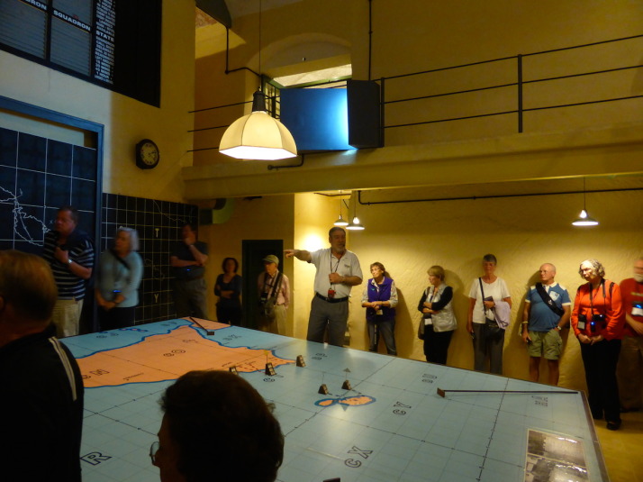
Our excellent guide Tony showing us through the Lascaris War Rooms in Valletta. Here he's explaining how the island was defended

Our excellent guide Tony showing us through the Lascaris War Rooms in Valletta. Here he’s explaining how the island was defended

The Lascaris War Rooms were Malta’s best kept secret of the Allied forces World War II efforts. They’re a series of tunnels and chambers dug some 150m into the bedrock of Valletta – by hand and mostly at night – that were used as the Allied HQ for the invasion of Sicily on the 9th of July 1943, 11 months before the D-Day landings of Normandy on the 6th of June 1944.

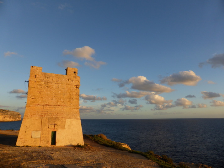
The name ‘Lascaris’ comes from Giovanni Paolo Lascaris, a descendant of the Greek Byzantine emperors of the same name – yes, the same Byzantine Empire that had Istanbul (nee Constantinople) as its capital – who was elected Grand Master of the Order St John (the same knights who built the Co-Cathedral). After a year in office Grand Master Lascaris ordered the construction of defensive towers along the coastline of Malta, one of which you’ve already seen as it’s the sunset picture at the end of our Dingli Cliffs walk.

After the British took control of the Maltese Islands in 1800, they extended the fortifications built by the Knights, and in 1854 started the Lascaris Fort and Battery – a defensive platform for cannon which overlooks the southern harbour of Valletta, so named because they were built on the site of Lascaris’ former private garden.
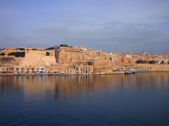
View of Fort Lascaris and the Lascaris Battery from the other side of the harbour. The Battery is the row of arches right in the middle, and the Lascaris War Rooms are underneath the giant wall just in front, with Fort Lascaris sitting on the waterfront - the high walls with two rows of small defensive windows

View of Fort Lascaris and the Lascaris Battery from the other side of the harbour. The Battery is the row of arches right in the middle, and the Lascaris War Rooms are underneath the giant wall just in front, with Fort Lascaris sitting on the waterfront – the high walls with two rows of small defensive windows

When Italy declared war on France and Great Britain on the 10th of June 1940, work started to enlarge the tunnel that ran from Fort Lascaris up to the main ditch in Valletta which was originally dug by the Knights, as the island needed bomb shelters. Soon rooms were carved out and as there was need for a central place to coordinate war efforts in the Mediterranean, the Allied HQ moved in.
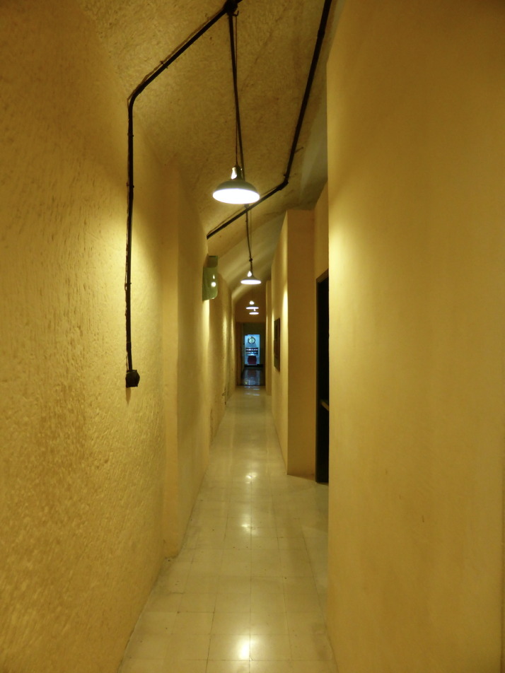
The upper corridor of the Lascaris War Rooms, they carved out two floors of rooms and decorated it with scrap material from bombed houses. All of the metal  was recovered from ships sunk in the harbour

The upper corridor of the Lascaris War Rooms, they carved out two floors of rooms and decorated it with scrap materials from bombed houses such as the floor tiles. All of the metal was recovered from ships sunk in the harbour

When I mentioned earlier that Malta has had a surprisingly long and eventful history for such a tiny landmass, this was what I was referring to – we had no idea of the pivotal role that Malta played in the events of World War II. The story of these tunnels and command rooms is absolutely fascinating, and expertly brought to life by the amazing restoration work and by the simply outstanding storytelling guide Tony – whose father helped dig them!
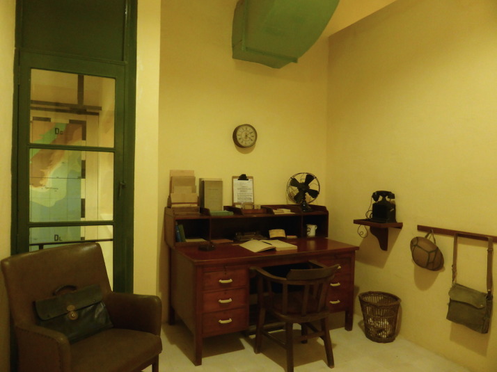
The office of Admiral Andrew Cunningham, Commander-in-Chief of the British naval forces, looks out over the command room of Operation Husky

The office of Admiral Andrew Cunningham, Commander-in-Chief of the British naval forces, looks out over the command room of Operation Husky

We got to the museum early on a week day, and I’d recommend you do the same – especially as we visited in the middle of off-peak November. The tour begins with a short Pathé newsreel broadcast of a supply convoy’s journey from Britain to Malta which showed the logistical and life-threatening challenge of keeping strategically important Malta defended. There were only ever enough supplies to last 3 months, and if just two of these convoys didn’t make it in succession then the island would have had no choice but to surrender.
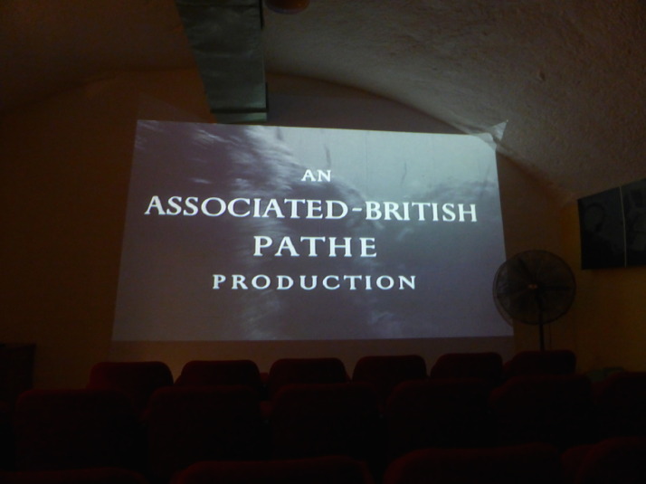
The museum opens with an Associated British Pathe newsreel story about a supply convoy from Britain to Malta

The museum opens with an Associated British Pathé newsreel story about the supply convoys from Britain to Malta

After the video, the audioguide took us through the rooms and rather dryly explained what each room was used for and who was stationed there, but when we got to the first of the main rooms – command room for the offensive Operation Husky, Tony picked up the commentary and started filling in the history with anecdotes of the various commanders and their rivalries.
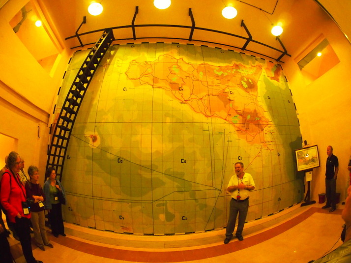
The heart of Operation Husky, the massive plan of the invasion of Sicily and the start of the Allied offensive campaign against the Axis in World War II

The heart of Operation Husky, the massive plan of the invasion of Sicily and the start of the Allied offensive campaign against the Axis in World War II

When a tour group arrived he apologised and left to meet them, so we continued through the narrow corridors and past the second major room, the defensive situation room where attacks on Malta were tracked and squadrons of aeroplanes were organised to defend the island.
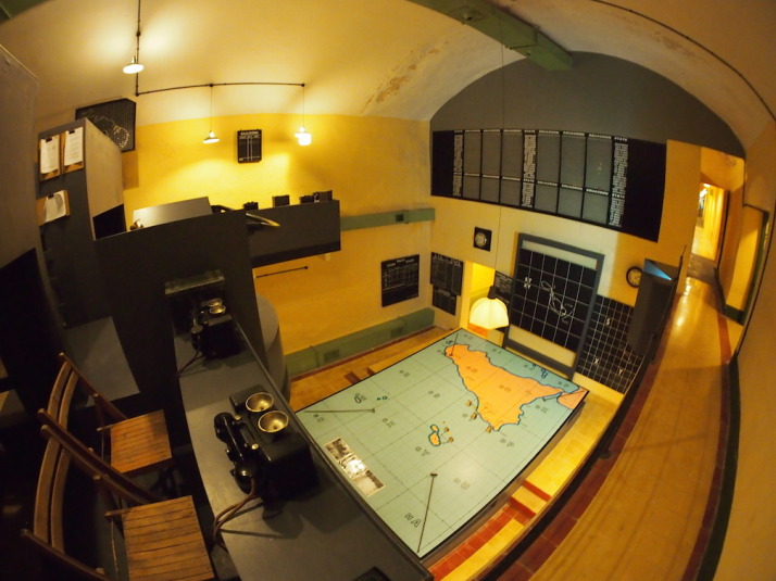
The defence command  and situation room. The board at the back (top-right) records the state of the 12 defensive flying squadrons and the big map in the middle records the last confirmed location of enemy aircraft

The defence command and situation room. The board at the back (top-right) records the state of the 12 defensive flying squadrons and the big map in the middle records the last confirmed location of enemy aircraft

Pretty soon we heard Tony again as he was showing the group around the maze of tunnels so we decided we’d tag along! While the audioguide had told us what the squadron board was for in the island defence command room, Tony filled in the details of how the squadrons were rotated. Because radar was crude and aeroplanes were slow to climb by todays standards, it was too late to scramble them to intercept bombers so constant air cover was used. This decision, with the limitations of fighter aircraft having a maximum 90-odd minutes of flight time, meant they had to launch new squadrons every 15 minutes! It took each squadron 30 minutes to get up to altitude, and another 15 to get down which meant they could provide about 30 to 45 minutes of cover before they had to return to refuel. Imagine the effort of the ground crew preparing for 12 aircraft taking off and another landing every 15 minutes. Astounding.
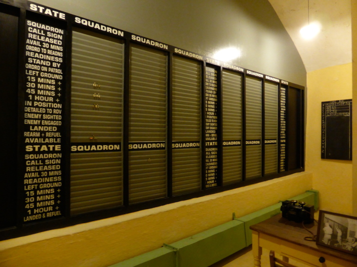
The defensive squadron situation room sits behind the squadron board shown in the last photo above - it's a series of slats that the operators on this side update with little metal tags as new information comes in

The defensive squadron situation room sits behind the squadron board shown in the last photo above – it’s a series of angled slats that the operators on this side update with little metal tags as new information comes in

From there we returned to the heart of Operation Husky, the room where General Eisenhower and his Supreme Commanders Admiral Cunningham, Field Marshal Montgomery and Air Marshal Tedder planned their attack on Sicily. Tony told us how Eisenhower had great trouble getting the two large egos of the American and British commanders to work together and in the end decided to give them the same objective but start them from different beaches – a tactic that brought out their competitiveness and which Eisenhower used again in the D-Day landings – no British and American forces landed on the same beach in either operation.
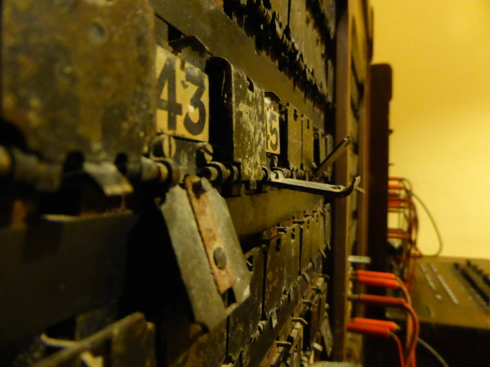
One of the telephone switchboards in a small communications room. Every time we see one of these manual switchboards I can't help but remark that my Mum used to operate one like it when she started working - not one quite this old, mind you!

One of the telephone switchboards in a small communications room. Every time we see one of these manual switchboards I can’t help but remark that my Mum used to operate one like it when she started working – not one quite this old, mind you!

Recognised as strategically important to the outcome of the war, the Axis forces ran more than 3,000 bombing raids in 2 years over Malta, making it the most intensively bombed area of the conflict. For maintaining control of Malta, King George VI awarded the nation the George Cross for Gallantry, the first time in history it was bestowed to a collective.
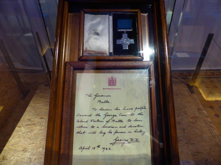
The George Cross for Gallantry awarded to the people of Malta and which adorns the nation's flag. The accompanying letter reads: "The Governor, Malta. To honour her brave people I award the George Cross to the Island Fortress of Malta to bear witness to a heroism and devotion that will long be famous in history. George R.I. April 15th 1942"

The George Cross for Gallantry awarded to the people of Malta and which adorns the nation’s flag. The accompanying letter reads: “The Governor, Malta. To honour her brave people I award the George Cross to the Island Fortress of Malta to bear witness to a heroism and devotion that will long be famous in history. George R.I. April 15th 1942”

After World War II the Lascaris War Rooms continued to be used by the British as their Mediterranean Fleet HQ until 1967 when NATO took over to use them as a Communications Centre for the interception of Soviet submarine transmissions during the Cold War. NATO also added a lot more rooms on the other side of tunnel and they’re currently being restored to be opened to the public in 2015 as a Cold War Museum right opposite the WWII Lascaris War Rooms. It would be equally fascinating to return to Valletta to visit these more modern bunkers, especially as we’ve seen their Soviet equivalent in Latvia earlier in our trip!

Megalithic Malta: A walk along Dingli Cliffs to prehistoric temples

Sitting in the Mediterranean Sea closer to Sicily in the North than Libya and Tunisia to the south, Malta has had a surprisingly long and eventful history for such a tiny landmass of only 315km2 (112 square miles).

Despite its small size, or perhaps because of it, Malta is the 3rd most densely populated country or sovereign state in Europe (after Monaco and Gibraltar) and 8th most in the world – though it magically maintains a desolate, isolated feel as we found out on our first stroll along a section of its south-western coastline.

The walk: Dingli, Fawwara, and Wied iż-Żurrieq

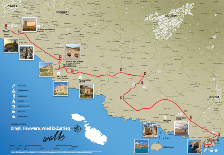
Map of the Dingli Cliffs walk. Source: Malta Tourism Authority

The map of the Dingli Cliffs walk. The Malta Tourism Authority helpfully provide paper versions in all of the Tourist Information offices (including the airport), and online in PDF format too. Source: Malta Tourism Authority

Looking at the map we thought we were in for a long stroll, until we remembered that the entire coastline of Malta is only 196.8km (122 miles) which means this walk is an easy 11.2km, or about 7 miles.

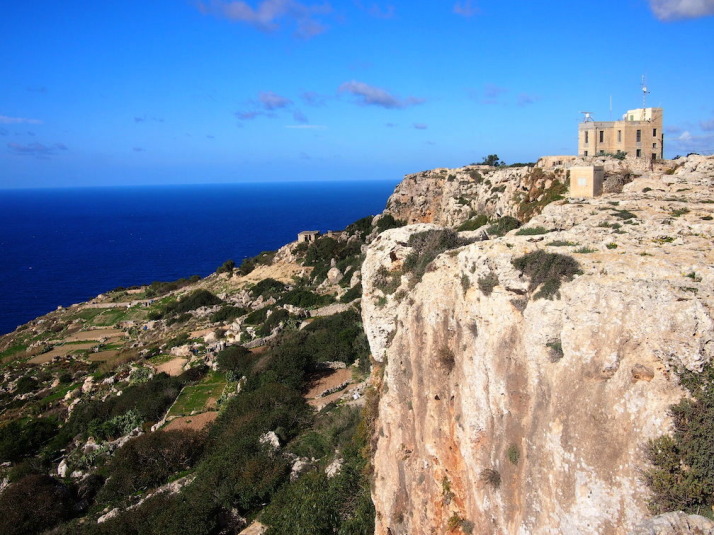
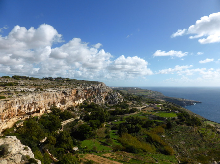
Looking back towards the start of the walk at Dingli Cliffs. Not bad for a day in November

Looking back towards the start of the walk at Dingli Cliffs. Not bad for a day in November

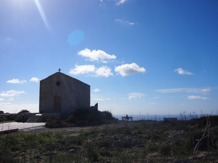
Just past a couple of radar stations at the highest point of the island, we arrived at St Mary Magdalene Church, an isolated, simple place of worship teetering on the cliff edge.

St Mary Magdalene Church on the edge of Dingli Cliffs

Tranquil reflection at St Mary Magdalene Church on the edge of Dingli Cliffs

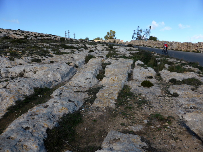
Described as 'Cart Ruts', these man-made grooves in the garigue weren't actually created by carts - the truth is we just don't know how or why they were made!

Described as ‘Cart Ruts’, these man-made grooves in the garigue weren’t actually created by carts – the truth is no-one knows how or why they were made!

From the roadside path it looked like a sheer drop into the Mediterranean from the rocky edge, but when we ventured closer we found that while there was a drop that would probably sting a little bit, there’s a second terraced plateau with yet another sizeable drop-off before the sea. Most of this was given over to agriculture, with the odd house or church between the fields.

Looking south over the cultivated fields of Fawwara from a Bronze Age village site that juts out almost to the sea

Looking south over the cultivated fields of Fawwara from a Bronze Age village site that juts out almost to the sea

According to the map, there’s an old Bronze Age village site at Fawwara but all that we could discern from the remains was its natural vantage point that extends out from the cliffs almost to the sea, commanding amazing views up and down the coastline.

From here we descended to the lower plateau and continued south to within a kilometre or two of the end where we stopped at Ħaġar Qim and Mnajdra – 2 prehistoric temple sites and outdoor museum..

Megalithic Malta: The temples of Ħaġar Qim and Mnajdra

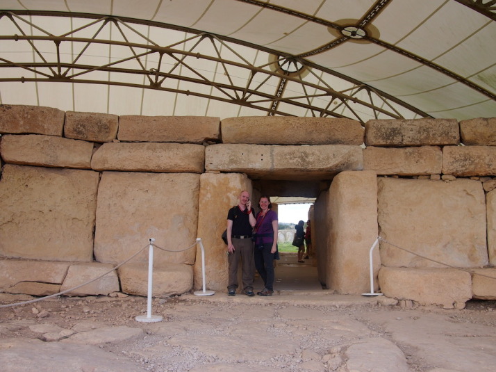
Us at the entrance to Hagar Qim, the 5,000 year-old monolithic temples. I'm listening to the audioguide which poses more questions about the site and its purpose than it answers

Us at the entrance to Ħaġar Qim, the 5,000 year-old megalithic temples. I’m listening to the audioguide which poses more questions about the site and its purpose than it answers

Before we explored the remains of the temples, we wandered through the small but excellent museum, which, given how little is known about the origins of these temples and the peoples that built them, is mostly given over to how we think they were built, how they were rediscovered, and how they’re being preserved.

Here’s a short excerpt from the museum’s guide:

“The prehistoric site of Ħaġar Qim consists of a group of monumental megalithic buildings. These were built during the late Neolithic, around 5,000 years ago. Similar buildings have been found in more than twenty different places in Malta and Gozo. Today these buildings are usually called “temples”. However we know very little about what went on inside them.” – Ħaġar Qim Temples, a brief guide, Heritage Malta

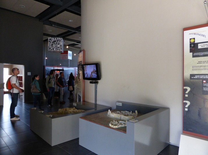
Inside the museum. The 2 models  show how the temples are aligned with the equinoxes and solstices

Inside the museum. The 2 models show how the temples are aligned with the equinoxes and solstices

The museum includes a 10 minute “4D” introduction video experience – the 4th dimension being blasts of cold air and scented water droplets – alongside the 3D visuals that imagine the construction through to the present day ruins. It was well done and the visuals were good as they show the temples against the landscape, which isn’t possible to see anymore because there’s now a giant protective tent over each temple shielding the stone from the elements.

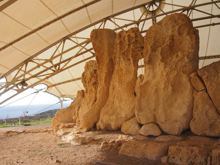
Some of the stones used in the construction are simply massive, and reminded us of Stone Henge back home

Some of the stones used in the construction are simply massive, and reminded us of Stonehenge back in England

Ħaġar Qim is the first of two temple sites and is the more impressive for its relative completeness – it’s more compact and the walls are still standing tall. We enjoyed wandering through the ruins, though some sections are roped off we were still surprised how accessible they were. The audioguide was only €2 more and is good for pointing out the most interesting aspects of the construction, but almost every clip ends with a “what do you think this was for?” or “why do you think this is here?” which left us with more questions than answers!

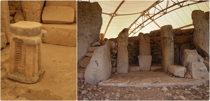
Details of Hagar Qim: relief sculptures found during excavations include altar pieces and decorative stone carvings; One of the many altars of the temple but the only one open to the outside

Details of Ħaġar Qim: relief sculptures found during excavations include altar pieces and decorative stone carvings; One of the many altars of the temple but the only one open to the outside

500 metres down the hillside and closer to the cliffs is the 2nd megalithic temple site of Mnajdra, a much larger set of ruins and in a worse state of repair than Ħaġar Qim.

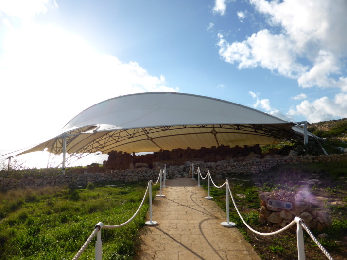
The approach to the Mnajdra Temples, these too are protected from the rain and the sun by a giant tent

The approach to the Mnajdra Temples, these too are protected from the rain and the sun by a giant tent

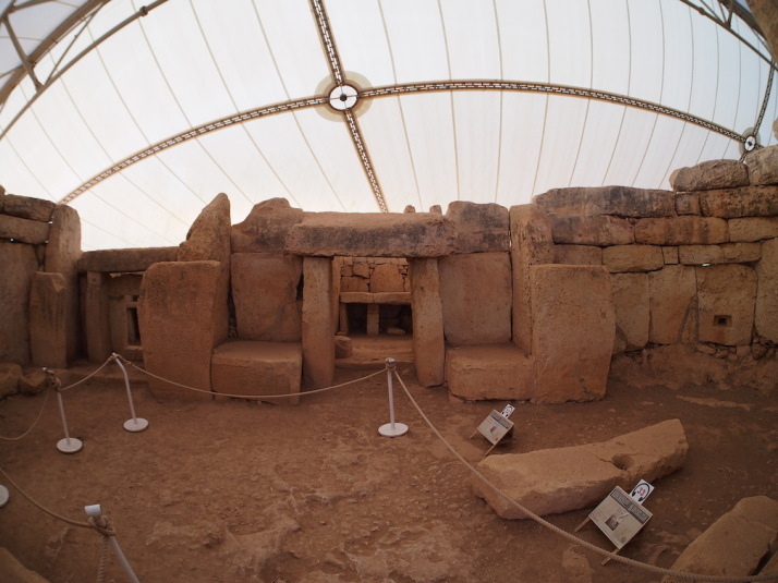
Mnajdra is actually a complex of 3 buildings..

“The first and oldest structure is the small three-apsed temple (on the right), built in the Ġgantija Phase, around 3,600-3,200BC. The South Temple (on the left), with its concave facade was next to be completed early in the Tarxien Phase, shortly after 3,000BC, followed by the Central Temple which was built on an artificial platform between the two earlier buildings.

The South Temple at Mnajdra was built in such a way that its main doorway is aligned with sunrise during the spring and autumn equinoxes (30th March and 22nd September). During the winter and summer solstices (21st June and 21st December) the beams of the rising sun pass along the sides of the main doorway hitting two decorated slabs within the first chamber.” – Mnajdra Temples, a brief guide, Heritage Malta

Inside the first chamber of Mnajdra's South Temple - during the equinoxes and solstices the sunrise hits the blocks either side of this doorway, again reminding us of Stonehenge. Wow!

Inside the first chamber of Mnajdra’s South Temple – during the equinoxes and solstices the sunrise hits the blocks either side of this doorway, again reminding us of Stonehenge. Wow!

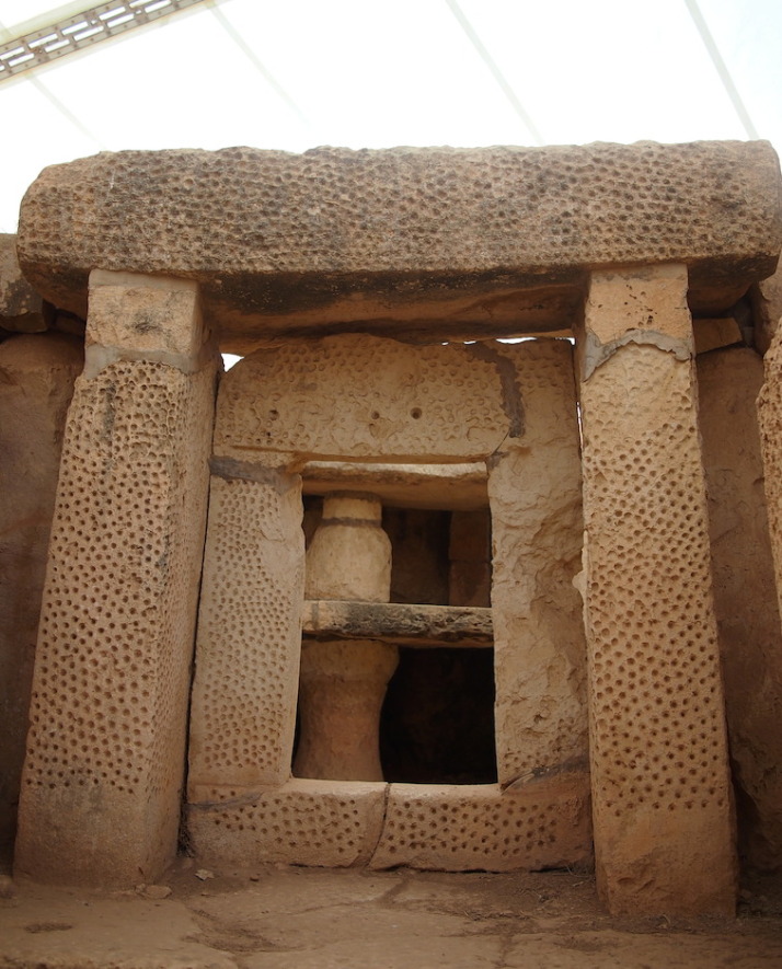
The beautiful pitted decoration of another doorway in the South Temple

The beautiful pitted decoration of another doorway in the South Temple

We liked the different levels and scale of these three very different temples which at first glance just looked like one giant building. The middle temple has the most dramatic example of erosion we’ve seen – the north side of the room shows some damage but the south side is almost completely eroded. I’d have thought they’d have been equally damaged because they’d have received equal rainfall, but the museum explained that it’s the sun that does the most damage!

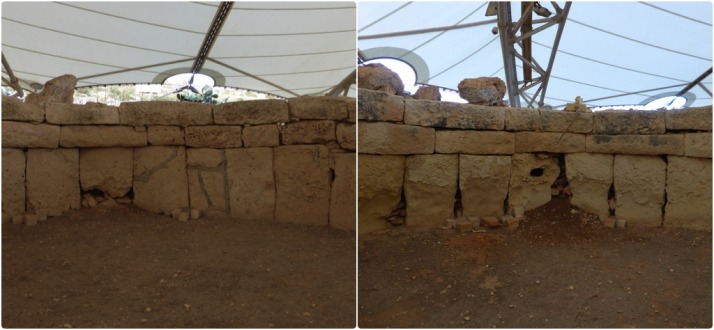
The north facing wall (left) of the Central Temple is in relatively good condition, but the lower south facing stones (right) of the same room have almost completely eroded. Most surprisingly for me was that the heat of the midday sun has done the most damage

The north facing wall (left) of the Central Temple is in relatively good condition, but the lower south facing stones (right) of the same room have almost completely eroded. Most surprisingly for me was that the heat of the midday sun has done the most damage

From the museum there was a final downhill stretch to the tiny fishing village of Wied iż-Żurrieq (which we have no idea how to pronounce!), where we watched the sun set while we waited for our bus back to the other side of the island.

The sun sets on our first day of strolling through the countryside and history of the tiny island of Malta

The sun sets on our first day of strolling through the countryside and history of the tiny island of Malta

We really enjoyed the feeling of remoteness; to walk so closely to the cliff edge with the deep blue Mediterranean stretching out to the horizon on one side, and a view across the island to the Mediterranean on the other, made Malta feel really small. It’s a very easy walk too, it starts near the highest point of the island which means it’s pretty much all downhill!

Slowing down again, this time it snuck up on us..

After our immensely enjoyable time in Istanbul, which included a lovely visit from Julie’s family, we’d outlined rough plans to travel on through Turkey. Standing at the entrance to the Metro station which would take us to our bus and the next 4 or 5 weeks of travelling every few days, we realised our hearts weren’t in it..

We didn’t get on the Metro.

Instead, we stayed in Istanbul for a couple of extra days, re-evaluated, and then we got on an aeroplane to Malta*.

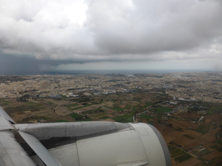
A wet welcome to Malta, from here it's easy to imagine this was part of the United Kingdom!

A wet welcome to Malta, from here it’s easy to see how this was once part of the United Kingdom!

We had a list of some simply amazing experiences lined up in Turkey – visiting Troy, taking a dip in the carbonate white pools of Pamukalle, and hot air ballooning over the other-worldly landscape of Cappadocia – but when we stopped for a moment we realised we just weren’t as excited about our impending travel as we thought we ought to be. As we talked about it, we remembered that it was about this time last year we decided to slow down, which resulted in a laid-back couple of months in Northern Thailand. Many of the reasons we had back then applied once more.

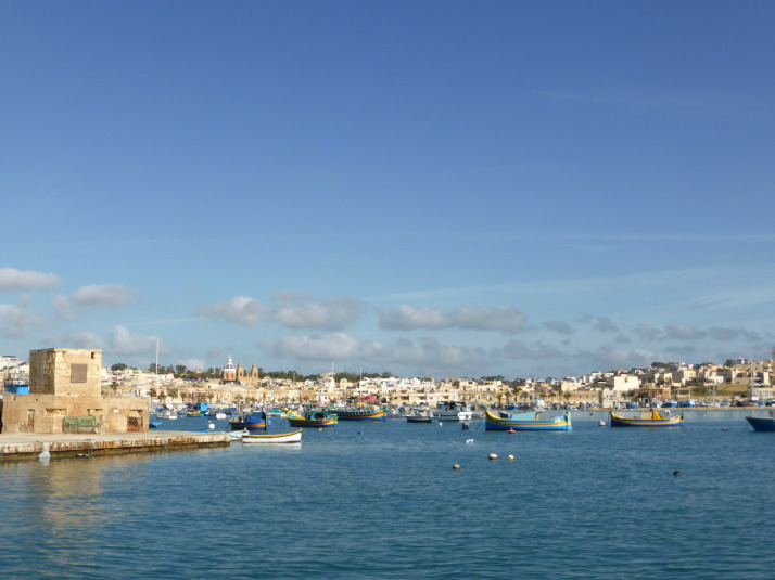
The southern fishing village of Marsaxlokk, home to Malta's Sunday market and just the kind of tranquility we were looking for

The southern fishing village of Marsaxlokk, home to Malta’s Sunday market and just the kind of tranquility we were looking for

And so, we decided we would take some time for ourselves, to catch up with the blog, and to rest, recuperate, and get ready to continue the adventure.

Oh, and we’ll definitely be back to Turkey for the hot air ballooning, the food and the genuinely warm hospitality if nothing else!


* Why Malta? Well, when we were wow’ing our way around Uzbekistan with Jo, she had nothing but praise for this small Commonwealth island. As it was fresh in our minds, and we were going to be working our way homeward through Europe, we looked at a few other countries but Malta had the right mix of interesting sights, quietness and winter warmth we were looking for. Thanks again Jo :o)

Haghia Sophia and the Basilica Cistern

As we knew Julie’s sister and family were coming out to join us, we held off visiting two of the best and most exciting sites in Istanbul so we could experience them with Steph, Tom and two-year-old son Oliver.

Haghia Sophia

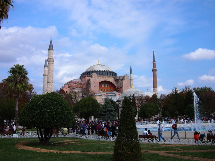
Haghia Sophia, probably the most impressive historical sight, and the second most visited museum in Istanbul

Haghia Sophia – built as an orthodox cathedral in 537, had a brief 57 year stint as a roman catholic church starting in 1204, converted to a mosque in 1453 and finally a museum in 1935

Nearly 1500 years old, Haghia Sophia has seen the pinnacle of the Byzantine and Ottoman periods, held the title of the largest cathedral in the world for a thousand years, and has dominated the Istanbul skyline of the First Hill since it was completed in 537.

The present Haghia Sophia is the 3rd church of that name to have been built on the site, the first two burnt down during separate riots; the first one in 404, and the second in 532. This 3rd one, completed in 537 was rebuilt on the order of Justinian, who envisioned it on an even grander scale than those before.

Haghia Sophia was an Eastern Orthodox cathedral and the seat of the Patriarchate of Constantinople, except for a brief period between 1204 and 1261 when it was converted to a Roman Catholic cathedral under the Latin Empire. When Sultan Mehmet II took Constantinople in 1453 he converted it to a mosque, and in 1931 the doors closed for worship, opening 4 years later in as a museum in 1935.

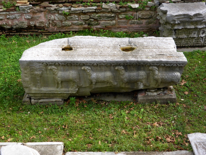
The entrance walks you past excavated remains of the previous structure on this site - the Theodosian Haghia Sophia built in the 5th century which burnt down during the Nika Revolt in AD 532

The entrance walks you past excavated remains of the previous structure on this site – the Theodosian Haghia Sophia built in the 5th century which burnt down during the Nika Revolt in AD 532

Haghia Sophia is a massive building that, when we first saw it, we wondered what all the fuss was about because, well, I’ll just say it; it’s not very attractive to look at. The intricate dome looks like it has been dropped on some hulking, unfinished, fortress-like structure. It’s only when we learnt that the unsightly rose coloured buttresses were added in 1317 to prevent the weight of the dome from pushing the walls out and causing the whole thing to collapse, that we could start to see the building without its protective concrete corset.

The entrance to Haghia Sophia is through one of the 5 western doors into the exonarthex. The massive central largest door on the left was known as Orea Porta or the Beautiful Gate and was reserved for the Emperor

The entrance to Haghia Sophia is through one of the 5 western doors into the exonarthex. The massive central door on the left was known as Orea Porta or the Beautiful Gate and was reserved for the Emperor

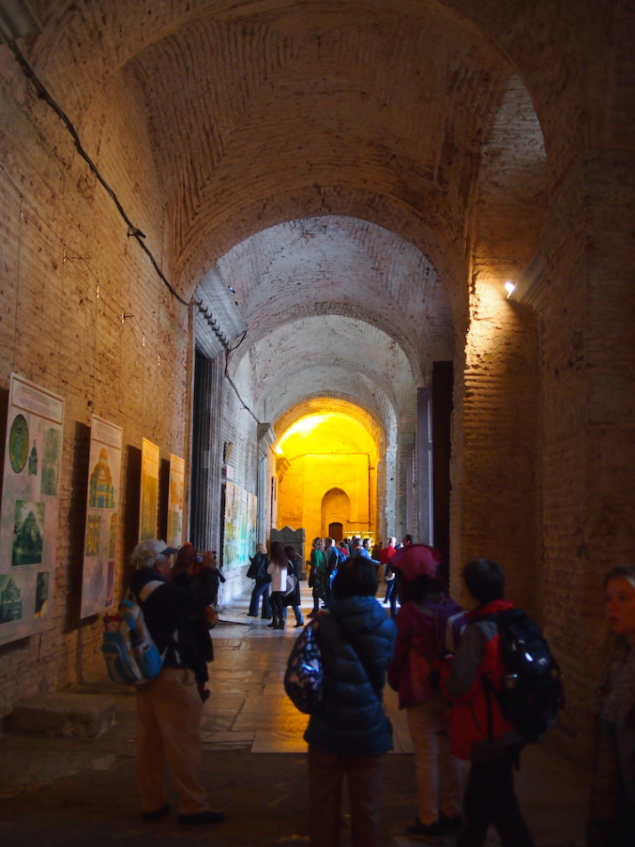
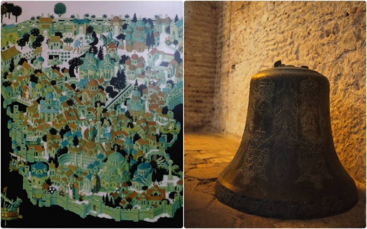
There are two narrow narthexes (or porches) which mark the entrance to the Haghia Sophia. The first one is quite plain and giant posters give an extremely brief summary of the building’s history, though one of them does show a nice illustration of ‘Constantinopolis’ when the Hippodrome still existed.

This exonarthex also has a few artefacts on display such as a large bronze Christian bell and a sarcophagus believed to belong to Empress Eirene, wife of Emperor John II (r. 1118 to 1143).

Our favourite of the displays in the exonarthex, an illustration of Constantinopolis that shows Haghia Sophia as a Christian church, the Hippodrome and the aquaduct surrounded by the Theodosian walls; and the bronze bell with Greek inscriptions and Christian crosses

Our favourite of the displays in the exonarthex, an illustration of Constantinopolis that shows Haghia Sophia in its original Orthodox Christian church for (bottom centre), the Hippodrome and the aqueduct, and the city surrounded by the Theodosian walls; the bronze bell with Greek inscriptions and Christian crosses

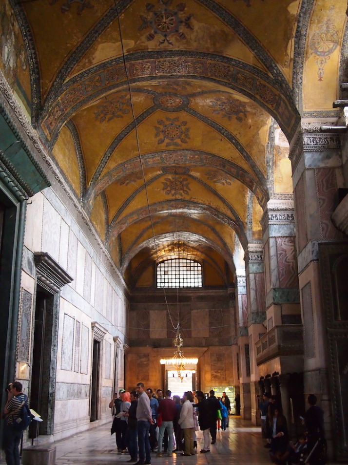
From the exonarthex we passed through the Emperor’s Beautiful Gate and into the narthex, which gave us the best impression of what the newly completed Haghia Sophia would have looked like – according to records, the ceiling of the entire church was covered in gold mosaic tiles and geometric and floral designs, an area of more than 4 square acres – that’s over 16,000m2 or about 2½ football pitches!

This amazing ceiling was rediscovered in 1933. When it was converted to a mosque the mosaics were plastered over - thank goodness they weren't destroyed

This amazing ceiling was rediscovered in 1933. When it was converted to a mosque the mosaics were plastered over – thank goodness they weren’t destroyed

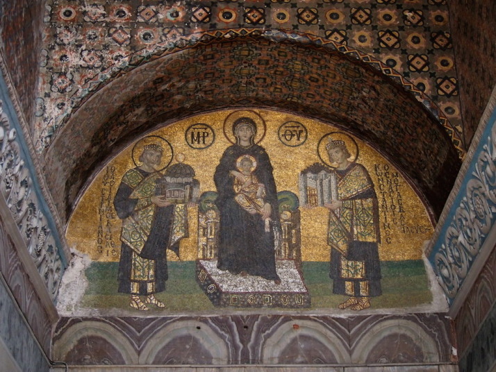
At the end of the narthex is a small corridor known in Byzantine times as the Vestibule of Warriors which is now the public exit, and hung above the bronze-clad doors is a giant mirror so you don’t miss another golden mosaic they found under the plaster and whitewash in 1933..

Mosaic of the Mother of God holding the Christ Child and flanked by Constantine the Great on the left offering a model of Constantinople, and Justinian on the right offering a model Haghia Sophia

Mosaic of the Mother of God holding the Christ Child and flanked by Constantine the Great on the right offering a model of Constantinople, and Justinian on the left offering a model Haghia Sophia

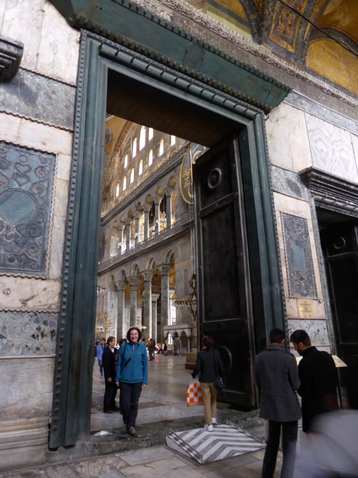
We backtracked into the narthex and stepped through the Imperial Gate into the vast open nave..

Julie standing in the Imperial Gate - the Emperor's door from the narthex into the nave of church. Just how big were these Emperors?!

Julie standing in the Imperial Gate – the Emperor’s door from the narthex into the nave of church. Just how big were these Emperors?!

To borrow our word from Uzbekistan.. Wow.

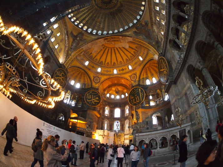
Wow. Standing in the nave is to be dwarfed by the sheer scale of the space and mighty 31.24 diameter dome whose crown is 56 metres from the floor - that's a 15 storey building!

Wow. Standing in the nave is to be dwarfed by the sheer scale of the space and the mighty dome

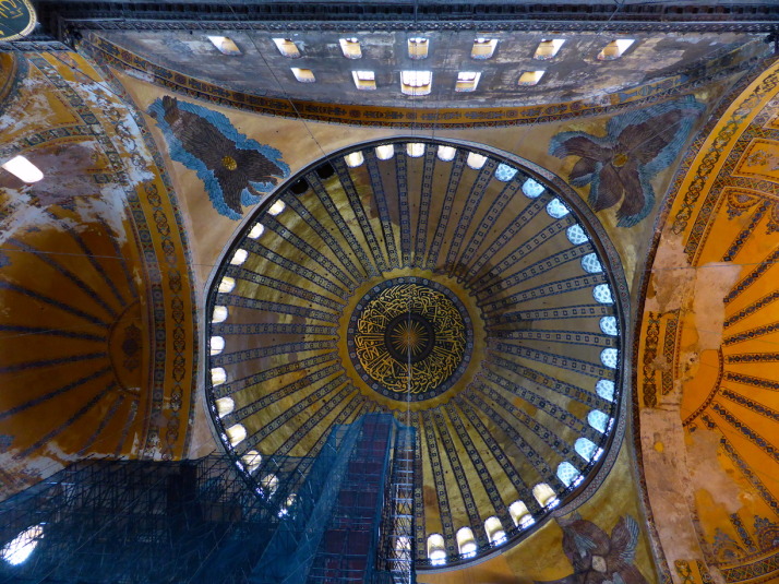
Even the size of the Emperor’s gates just didn’t prepare us for the sheer scale and architectural achievement of Haghia Sophia. The effect is a huge, almost square open space uncluttered by supporting columns, that stretches so high that the size of the dome is nearly lost as an optical illusion. The crown of the dome is 56 metres from the floor – the equivalent of a 15 storey building!!

The dominating dome of Haghia Sophia

The dominating dome of Haghia Sophia

We took our time to explore this resplendent, religiously repurposed super-structure. The Islamic adornments seemed both at home with their extravagant design, but at the same time looked temporary, a bit like birthday party decorations. I guess that’s because the restoration has uncovered the Christian mosaics which makes the museum theologically schizophrenic.

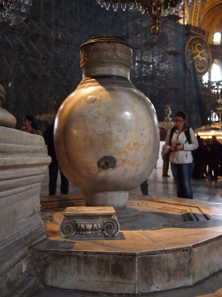
In the nave we loved the mighty marble supporting columns so cleverly engineered to maximise the space which make the dome appear almost unsupported. Also the two lustration (ritual purification) urns either side of the entrance that are hewn from single blocks of marble.

One o f the two huge marble lustration (ritual purification) urns that were brought from Pergamon during the reign of Sultan Murad III (r. 1574 to 1595)

One of the two huge marble lustration urns that were brought from Pergamon during the reign of Sultan Murad III (r. 1574 to 1595)

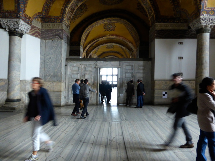
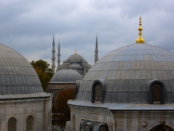
After turning our thumb through 360° in the hole on the weeping column which is believed to cure many illnesses, we headed upstairs to the galleries. A few more golden mosaics have been rediscovered along the galleries, but we liked the Marble Door, and the view past the türbes outside to Sultan Ahmet Camii or The Blue Mosque

The Marble Door. We're not sure if the name comes from the door in the middle, or that either side are double-doors representing Heaven and Hell

The Marble Door. We’re not sure if the name comes from the door in the middle, or that either side are double-doors representing Heaven and Hell

Sultan Ahmet Camii (The Blue Mosque) in the background, past the domes of 3 of the Turbes in the grounds of Haghia Sophia

Sultan Ahmet Camii (The Blue Mosque) in the background, past the domes of 3 of the türbes in the grounds of Haghia Sophia

Despite the lacklustre first impression, we really enjoyed exploring the expansive Haghia Sophia. Describing it as a museum doesn’t really set the right expectations either, as there isn’t a lot of information about it inside – this is one of those places that the more you read about it the more impressive it becomes, and the more you understand the reverence in which it is held.

Basilica Cistern

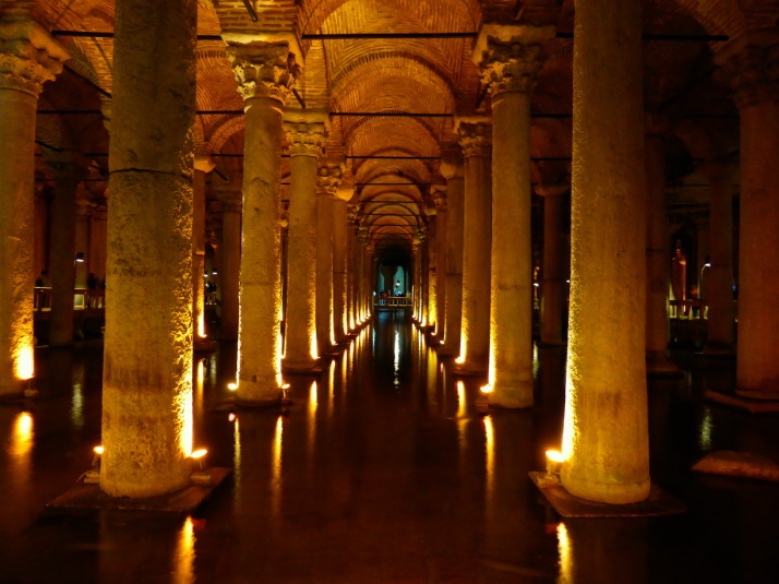
The Basilica Cistern, 9,800m<sup>2</sup> in size, can hold 80,000 cubic metres (2,800,000 cu ft) of water, and was forgotten for nearly a hundred years!

The Basilica Cistern, 9,800m2 in size, can hold 80,000 cubic metres (2,800,000 cu ft) of water, and was forgotten for nearly a hundred years!

When we were researching what to see and do in Istanbul, we read the almost incredulous story of the rediscovery of the Basilica Cistern. To quote our guidebook..

The structure was known in Byzantium as the Basilica Cistern because is lay underneath the Stoa Basilica, the second of the two great squares on the First Hill. The Basilica Cistern was built by Justinian after the Nika Revolt in 532, possibly as an enlargement of an earlier cistern of Constantine. Throughout the Byzantine period the Basilica Cistern was used to store water for the Great Palace and the other buildings on the First Hill, and after the Conquest its waters were used for the gardens of Topkai Sarayi. Nevertheless, general knowledge of the cistern’s existence seems to have been lost in the century after the Conquest, and it was not rediscovered until 1546. In that year Petrus Gyllius, while engaged in his study of the surviving Byzantine antiquities in the city, learned that the people in this neighbourhood obtained water by lowering buckets through holes in their basement floors’ some even cause fish from there. Gyllius made a through search through the neighbourhood and finally found a house through whose basement he could go down into the cistern, probably at the spot where the modern entrance is located. – Strolling Through Istanbul (p135)

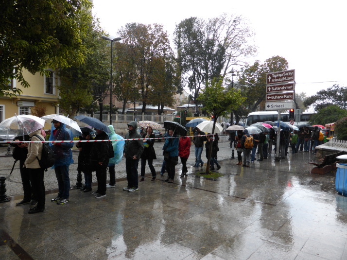
Steph and Julie queueing in the howling, miserable rain while Tom and I look after Olly in the shelter of the modern entrance. Perfect weather for going underground..

Steph and Julie queueing in the howling, miserable rain while Tom and I look after Olly in the shelter of the modern entrance. Perfect weather for going underground..

Descending 100m into the cistern, we were greeted by rows upon rows of marble columns, now standing in a reservoir of about half a metre of water. And yes, there are still plenty of fish, their ghostly shadows cast by the uplight against the pillars. People take food down there for them, and as I guess they’re no longer caught, there are some monsters lurking under the walkways!

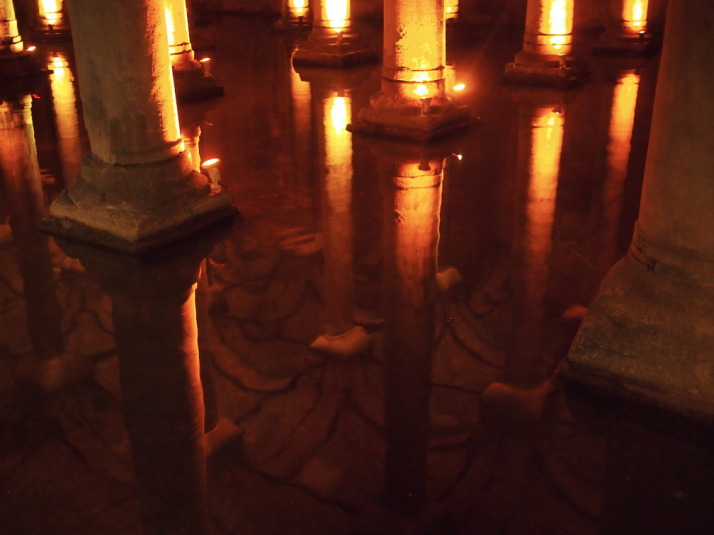
When the fish weren't around the reflections of the columns and the vaulted ceiling where lovely

When the fish weren’t around the reflections of the columns and the vaulted ceiling where lovely

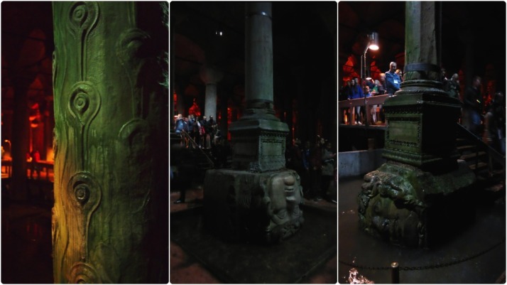
Besides the spectacle of the cistern itself, there are 3 columns to look out for along the route. The first is a column repurposed from the now long gone Triumphal Gate of the Forum of Theodosius I – the distinctive peacock eye relief stands out against all of the other smooth columns.

The second and third are two ancient classical bases that can breathe after centuries underwater. These are depictions of Gorgons, which in Greek mythology are 3 sisters, one of whom you’ll undoubtedly have heard of – Medusa – and indeed she is touted as one of the heads, though according to the legend all three sisters had hair made of living, venomous snakes.

Column details in the Basilica Cistern, from left to right: Supporting column originally from the triumphal arch in the Forum of Theodosius I; The Medusa head Gorgon base which is inverted because it is said to negate the power of the gaze; The second Medusa base, this one rotated which also counts as a negating strategy

Column details in the Basilica Cistern, from left to right: Supporting column originally from the triumphal arch in the Forum of Theodosius I; The Medusa head Gorgon base which is inverted because it is said to negate the power of the gaze; The second Medusa base, this one rotated which also counts as a negating strategy

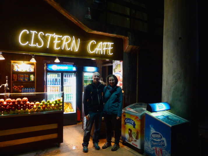
Like Haghia Sophia, we really enjoyed the Basilica Cistern (and dodging the awful weather outside was a bonus!) – they’re both larger than we thought they’d would be, even having read about them before we visited. Indeed, the Basilica Cistern even has a small cafe!

Us at the Cistern Cafe in the Basilica Cistern. We didn't buy anything but the coffee smelled good

Us at the Cistern Cafe in the Basilica Cistern. We didn’t buy anything but the coffee smelled good

Self-guided food tour of Istanbul

Food tours are an excellent way of finding the local delicacies and the little out-of-the-way places that make the best versions of them. They’re also great for presenting things that you wouldn’t ordinarily try, such as the prawn cakes made from whole prawns that we enjoyed so much in Vietnam that we went back for seconds when Jo came out to join us!

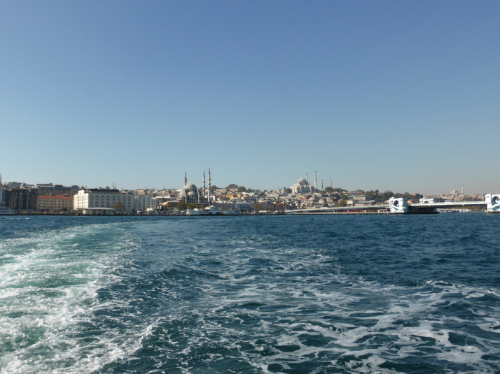
Approaching the busy ferry port of Eminönü in Istanbul - the start of our self-guided food tour

Approaching the busy ferry port of Eminönü in Istanbul – the start of our self-guided food tour

As we knew we’d be spending a bit of time in Istanbul, we looked for a street food tour but were quickly put off by the prices – some as high as $145 USD, about £92 GBP. Each. Yes, this is a big, bustling city but we didn’t want to pay big city prices. A little bit of research later and I had compiled a list of foods to look out for while we strolled around.

Here then, is our list of what to try and where to find it presented in a vaguely sensible order that has been curated over the course of weeks, and could be tackled in a day or so depending on your appetite..

First though, a quick summary of what you’re about to eat, and how much (roughly) it’ll cost.

Cost (Turkish Lira)
Coffee and baklava 10
Spices, dried fruit and lokum (Turkish delight) 20
Borek and çay (tea) 9
Simit on the ferry 2
Balik ekmek and turnip juice 6
Turkish ice cream (two scoops) 5
Kokoreç and ayran 9
Delicatessen ~20
Coffee 8
Dinner at either Kadi Nimet or Çiya Sofrasi ~50
Total (TRY): ~119
Total (GBP): ~£34

Eminönü: Coffee and Baklava at Develi Baklava

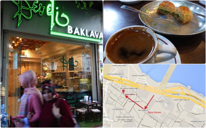
First stop - coffee and pastry at the tiny Develi Baklava. Click for a map

First stop – coffee and pastry at the tiny Develi Baklava. Click the image for a map

The best way to start the day with the one-two punch of strong coffee and sweet, sweet baklava – a small Turkish dessert made of pastry, nuts and soaked in honey!

Directions:
Starting in Eminönü, in the square outside the Yeni Cami and the Spice Bazaar, keep the Spice Bazaar on your left as you walk up the right-hand side of it, then take your first right up a small alley – there’s a very busy coffee shop that sells fantastic freshly ground Turkish coffee on the corner (we’ll be back this way soon, so you can try it first and buy some on the way back). After about 150 metres look out for the green neon of Develi Baklava, a little coffee shop with astroturf and two little tables outside. Pop in and choose 2 or 3 different baklava from the counter to go with your Turkish coffee. Try to grab one of the outside tables as this alley is great for people watching.

Eminönü: Spice Bazaar, Spices, Dried Fruit and Lokum

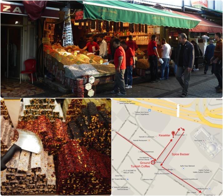
Time to graze on nuts, dried fruit, spices and Turkish delight in the ever-busy Spice Bazaar. Click for a map

Time to graze on nuts, dried fruit, spices and Turkish delight in the ever-busy Spice Bazaar. Click on the image for a map

We’re in Turkey, so we are obligated to try the other sweet they’re internationally famous for, Lokum or Turkish Delight.

Directions:
Head back towards the Spice Bazaar, stopping for a take-away bag of ground coffee from the shop on the right-hand corner if you wish.
Next, we’re going to wander through the Spice Bazaar, but if you’re after lokum or Turkish Delight then the best place is actually on the outside of the Bazaar – it’s the on the street to your left, along the side of the Bazaar, called Kesekler (it’s the 3rd shop from the end). Why’s it the best? The plain lokum is less than half the price you’ll pay inside the bazaar (7 TL/kg) and they sell a lot so it’s fresh too. The lokum is at the back, be sure to point at any of the logs of nut, flower or chocolate covered lokum and they’ll offer a free taste! (the logs are 46TL/kg, or about 8-10 TL/kg per log)

The Spice Bazaar is a big ‘L’ shape, so follow it along stopping to sample the nuts and dried fruits or smell the spices, teas and soaps, and exit from the long end, near the back of Yeni Cami.

Eminönü: Borek and Çay

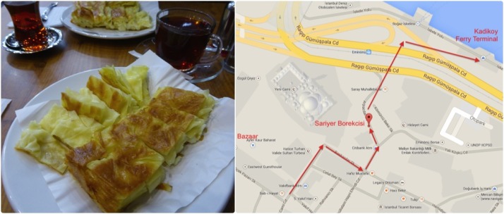
The best Istanbul breakfast - borek. Brilliant. Click for a map

The best Istanbul breakfast – borek. Brilliant. Click on the image for a map

Time for breakfast! Borek is a traditional Turkish dish that consists of layers of pastry and cheese, a bit like a light cheese-only lasagne. And it’s a great as it sounds!

Directions:
Exiting from the Spice Bazaar, turn left and you’ll see Yeni Cami again. When you reach it, turn right past the Sultan’s entrance (the long ramp up the rear of the mosque) then take the next left. Follow ‘Arpacilar Caddesi’ round to the left then look out for the red sun-shade of ‘Sariyer Borekcisi’ (No 10). Pop in and order borek and çay (pronounced “chai” – tea!). The tea is served quite differently to other countries we’ve visited. Here it’s served in a small handle-less glass cup, without milk and is very strong. We rarely managed a glass without adding sugar and we like strong flavours!

Eminönü to Kadiköy: From Europe to Asia

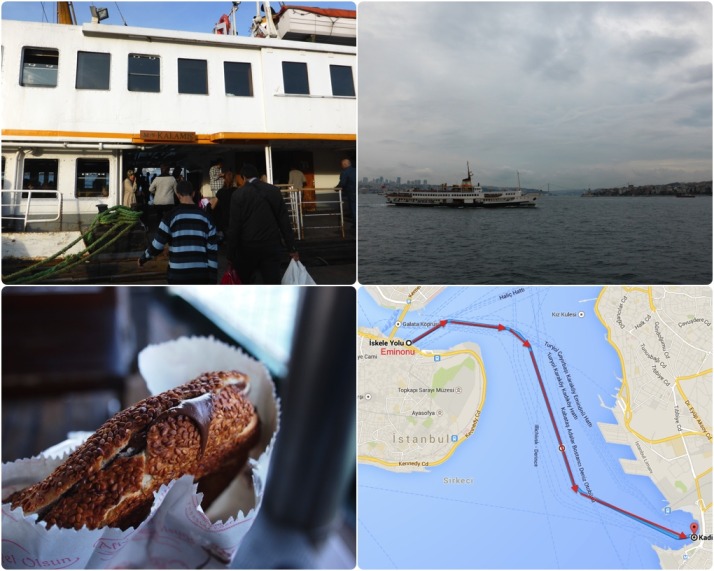
Let's go to Asia - and don't forget to pick up a Nutella simit in case you're still peckish! Click for a map

Let’s go to Asia – and don’t forget to pick up a Nutella simit in case you’re still peckish! Click the image for a map

Do as the İstanbullu do and sip çay while reading the newspaper or catching up on email and Facebook as you cruise across the Bosphorus to the Asian side of the city.

Directions:
15 metres further along Arpacilar Cadesi and you’ll be at Eminönü tram station. Use the crossing to your left to cross the road, the tramlines and the road again until you’re at the water’s edge and look for the ferry terminal to Kadiköy – it’s the one on your right with Kadiköy written on it. If you’re still a little hungry, pick up a simit for the journey – they’re a small, crispy, round bread covered in sesame seeds. For another Lira you can have it filled with Nutella! The ferry to Kadiköy takes about 25 minutes.

Kadiköy: Balik Ekmek and Turnip Juice

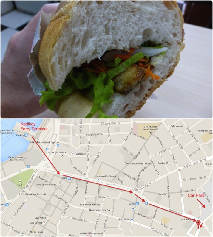
It's not quite fish and chips, but it is very tasty indeed! We found this place because we stayed in an apartment next door, or rather, I should say that the smell of frying fish found us..  Click for a map

It’s not quite fish and chips, but it is very tasty indeed! We found this place because we stayed in an apartment next door, or rather, I should say that the smell of frying fish found us.. Click the image for a map

Time for a spot of lunch and one of our favourites: Balik Ekmek literally “fish bread” or fish sandwich, washed down with the traditional accompaniment of turnip juice. Yum! The fish is pan-fried mackerel, and does contain some bones.

Directions:
The place we recommend is about a 15 minute walk, which gives us chance to work up an appetite! Exit from the Kadiköy Ferry terminal and cross the big pedestrian square in front of you – keep the bus station to your left and the only building in the square to your right – just follow the crowds from the ferry – everyone heads for ‘Söğütlü Çeşme Caddesi’, the main street. Cross over to the right-hand side and follow the tram tracks up the hill, then cross the tracks as they veer right up a cobbled road. Continue straight and downhill on ‘Kuşdili Caddesi’ past the busy bus stop, past the banks and rows of clothes shops and take the right at the crossroads onto ‘Hasirci Başi Caddesi’. There’s a fancy cake shop on the corner and a car park opposite. About 5 or 6 shops down on your right is Albatross – order your balik ekmek, find a table inside and help yourself to a turnip juice from the fridge. Oh, and say hi to Mehmet for us :)

Kadiköy: Turkish Ice Cream

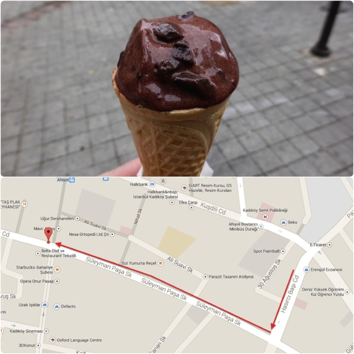
Amazing Turkish chocolate ice cream. Save yourself the walk back and just order two scoops the first time..  Click for a map

Amazing Turkish chocolate ice cream. Save yourself the walk back and just order two scoops the first time.. Click on the image for a map

There’s always room for ice cream, and Turkish ice cream is some of the best in the world – thick, creamy, and intensely flavoured.

Directions:
Watch your step as you leave Albatross, continue up ‘Hasirci Başi Caddesi’ and take the first right – not the first small turning, the one with the corner shop on the corner of ‘Süleyman Paşa Sokaği’. Walk uphill until you reach the tram tracks on the cobbled street, cross them and the road, and you’re on the top of the hill. Immediately to your right, the 2nd shop along is our destination. The scoops are small, which is enough of an excuse to order two. I’d suggest two scoops of chocolate unless another flavour takes your fancy!

Kadiköy: Kokoreç and Ayran

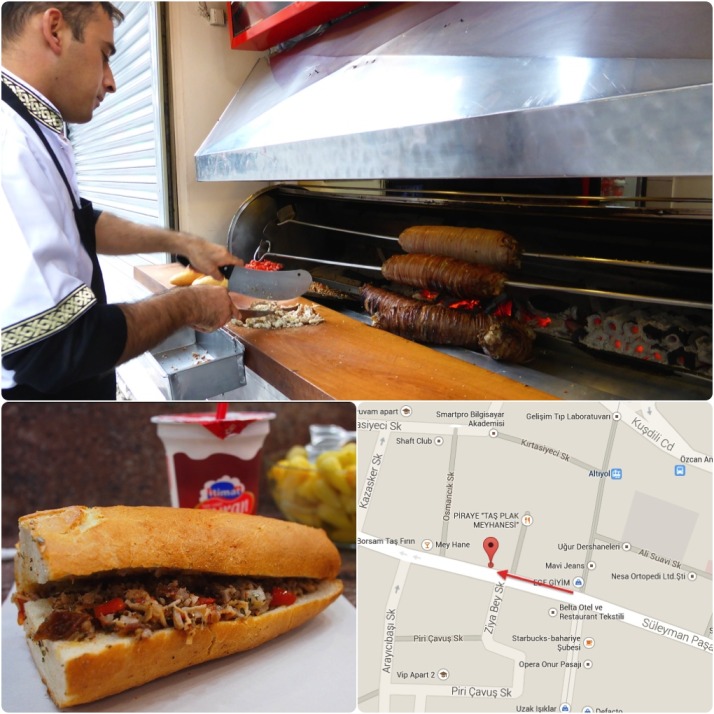
Kokoreç washed down with ayran at Kokoretto in Kadiköy. Click for a map

Kokoreç washed down with ayran at Kokoretto in Kadiköy. Click the image for a map

Lunch isn’t over yet, it’s time for another Istanbul speciality – Kokoreç (pronounced ‘kokoretch’) washed down with ayran. If you’re reaching bursting point, maybe get one to share or ask for a taste.

Directions:
Continue downhill on the same street, and at about the point where you run out ice cream, you’ll find ‘Kokoretto’ on your right. Kokoreç is cooked outside like a kebab, but it’s horizontal as opposed to vertical, and cooked over charcoal. Ayran is a great accompaniment, it’s a light yoghurt drink, similar to Indian Lassi, though it’s not as sweet. What is Kokoreç, you ask? Hmm.. I think I’ll tell you after you’ve eaten it. All you need to know now is that it’s tasty!

Kadiköy: A wander around the delicatessens

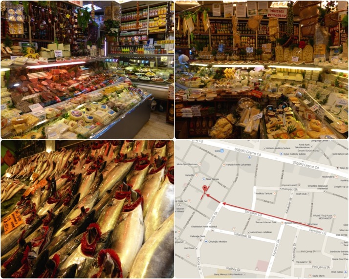
Take your time to wander through the deli counters on delicatessen street. Click for a map

Take your time to wander through the deli counters on delicatessen street. Click on the image for a map

This next area doesn’t involve eating, though you’re welcome to sample or take some home for later, in fact, it would surprise us if you didn’t!

Directions:
Staying on the same downhill street, keep going as it twists a little left then a little right until you cross the road into the steeper, narrower pedestrian (and occasional scooter) alleyways of the old Kadiköy market area. The clothes and mobile phone shops are replaced by cafes and wholesale dried goods, and at the next junction you’ll be surrounded by fresh fishmongers – we’ll call this fishmonger junction for future reference.

There are a few delicatessens on the perpendicular street – ‘Güneşli Bahçe Sokaği’, so pick a direction (either left or right) and pop into one or two for a good look around. One of our favourite things to do is buy 5 or 6 different dishes and a fresh baguette to create our very own Istanbul meze dinner – great if you’re staying in an apartment or for a picnic in one of the city’s many parks or a trip to the Princes’ Islands.
Kadiköy: More Turkish Coffee!

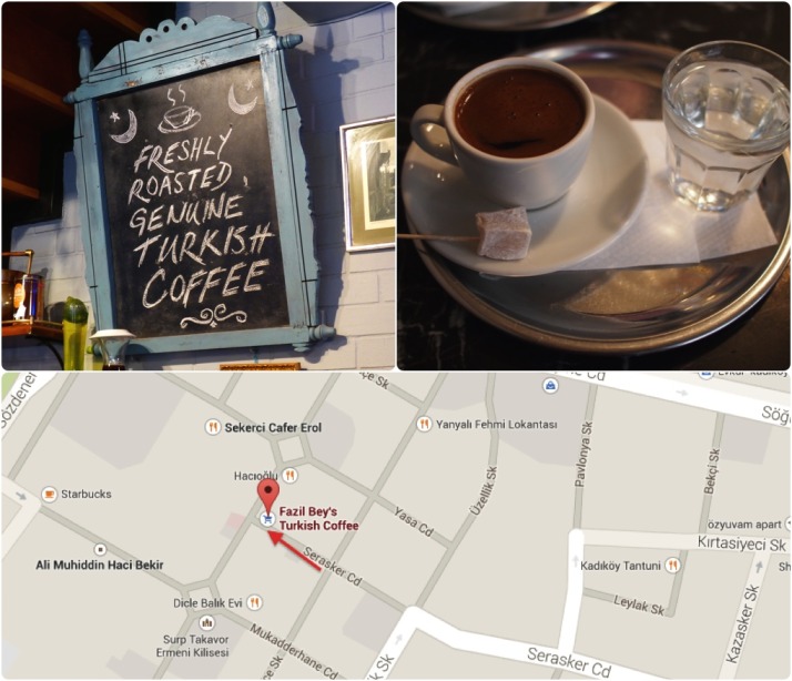
Turkish coffee at its finest served at Fazil Bey. How do you know it's Turkish coffee?  The lokum gives it away..  Click for a map
Turkish coffee at its finest served at Fazil Bey. How do you know it’s Turkish coffee? The lokum of course! Click the image for a map

There are plenty of little cafes in this narrow, compact area of Kadiköy, and the most famous of them is Fazil Bey where we’ll soak up the cafe culture until we find ourselves ready for a spot of dinner.

Directions:
Return to the fishmonger junction, and turn downhill along ‘Serasker Caddesi’ from the smells of fresh produce to the smells of freshly ground coffee. Fazil Bey is just before the next junction on your right, find a seat and you’ll be presented with a menu.

Kadiköy: Dinnertime – Meat or Fish?

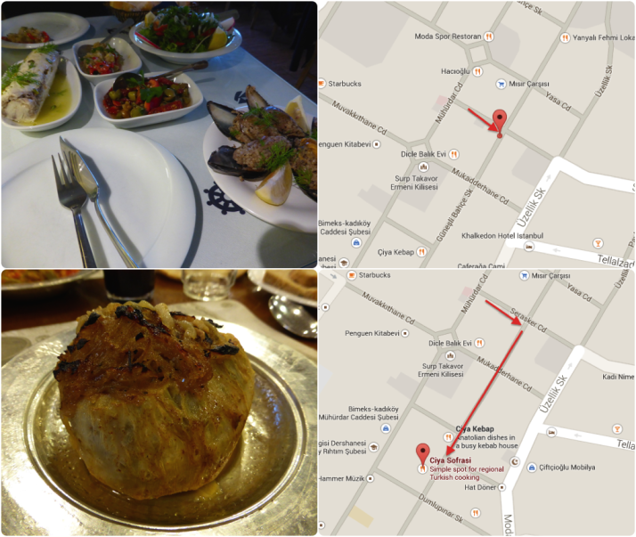
Your choice for dinner - fantastic fresh fish dishes at Kadi Nimet Balikçilik (top); and remarkable regional specialities at Çiya Sofrasi (bottom). Both feature in the Lonely Planet  Click for a map

Your choice for dinner – fantastic fresh fish dishes at Kadi Nimet Balikçilik (top); and remarkable regional specialities at Çiya Sofrasi (bottom). Both feature in the Lonely Planet Click on the image for a map

It’s eating time again! There are two very good restaurants just around the corner, one ‘Kadi Nimet Balikçilik‘ specialises in fish and the other, ‘Çiya Sofrasi‘ (pronounced ‘Chiya Sofrasi’) specialises in family recipes from around Turkey and is where a few of the guided food tours end up for dinner. We’ve eaten at both and they’re both great.

Directions: Kadi Nimet Balikçilik
Head back up the alley to the fishmonger junction and Kadi Nimet Balikçilik is on the corner on your right. There are plenty of seats inside and upstairs though it does get very busy. I can heartily recommend the levrek dolma or stuffed sea bass meze and the stuffed mussels (pictured above) – the sea bass is amazing!

Directions: Çiya Sofrasi
Head back up the alley to the fishmonger junction and turn right down ‘Güneşli Bahçe Sokaği’, Çiya Sofrasi is about 130 metres along on your left. This place also gets busy and for very good reason. They have 3 restaurants in this street that specialise in different styles of Turkish food but Sofrasi is the one to choose. They have a great salad bar and a wide selection of vegetarian dishes. Definitely order the ‘puff lavash‘ because it sounds funny (and it’s tasty)!

Fin.
That’s it, do you have room for a mint? It’s only a tiny little thin one.

Further eating..

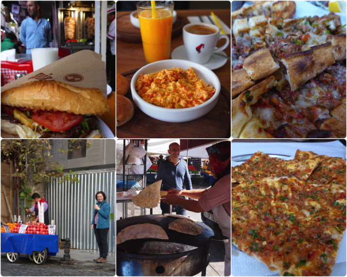
You want more? You piggy! I like you! Clockwise from top-left: Doner Kebab - beef or chicken are the most common and they're made from pieces of meat and cut with a long knife rather than the sheared mince back home; Menemen - tomatoes, eggs, cheese and spices; Pide - Turkish pizza; Lahmacun - thin crispy pizza-like base with a tomato and minced meat paste, tasty!; Gozleme - cheese and spinach wrapped in a soft tortilla; Julie enjoying a freshly squeezed orange juice from an uncharacteristically shy juice vendor

You want more? You piggy! I like you! Clockwise from top-left: Doner Kebab – beef or chicken are the most common and they’re made from pieces of meat and cut with a long knife rather than the sheared mince back home; Menemen – tomatoes, eggs, cheese and spices; Pide – Turkish pizza; Lahmacun – thin crispy pizza-like base with a tomato and minced meat paste, tasty!; Gozleme – cheese and spinach wrapped in a soft tortilla; Julie enjoying a freshly squeezed orange juice from an uncharacteristically shy juice vendor

Here’s a list of some other Turkish specialities that you can look out for while strolling through this great city:

  • Doner Kebabs – they’re everywhere, and very tasty. Our favourite options are ‘lavash’ which means in a wrap, ‘portion’ where you get chips on the side and ‘pilav’ which comes with rice
  • Menemen – tomatoes, green peppers and eggs cooked with onions and spices. The best can be found in Beyoğlu at the Setup Cafe just up the hill from Kabataş tram stop. Add the feta – you will not be disappointed
  • Pide – this is what I call Turkish pizza. That’s enough of a reason
  • Lahmacun – usually found alongside pide, it’s like a very thin crust pizza without the cheese, and makes a great pre-pide starter!
  • Gozleme – this is one of our favourite lunch-time goto’s, a soft tortilla-like bread usually filled with feta and spinach or potato and cooked on a big domed hotplate by women with big wooden paddles
  • Fresh orange or pomegranate juice – you’re never far from a cart selling freshly squeezed orange or pomegranate juice, and at 2 TL a cup they’re a great thirst quencher after you’ve just walked up one of the many hills and need an excuse to stand still for 5 minutes to catch your breath

Ahh yes, kokoreç.. if you don’t know what ‘sweetbread’ is then I suggest you maintain a state of blissful ignorance. And definitely try it before you look it up.