Tag Archives: Malta

Malta Round Up

What photo takes you right back to Malta?

There were so many historic highlights of our trip to Malta, but our morning of touring the northern coast of Gozo on Segways was so much fun that we’ll always remember it!

Summarise Malta in three words.

You really know you’re in Malta when…

… you can see the Mediterranean Sea no matter where you are, and in a few higher places on the islands it’s possible to see the sea in all directions!

What one item should you definitely pack when going to Malta?

A torch for when you visit all of the underground caves, catacombs, and wartime bunkers

Gozo Highlights

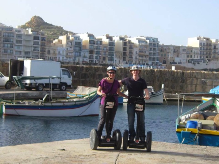
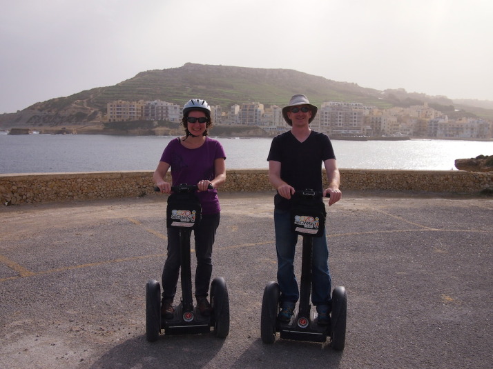
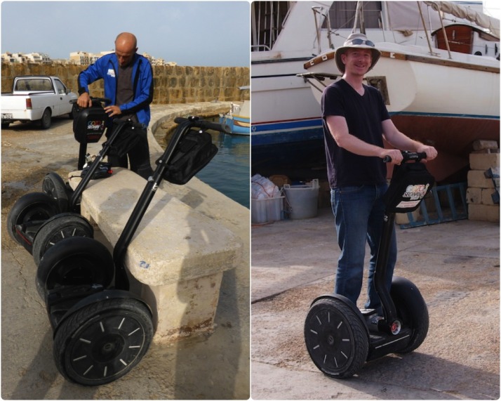
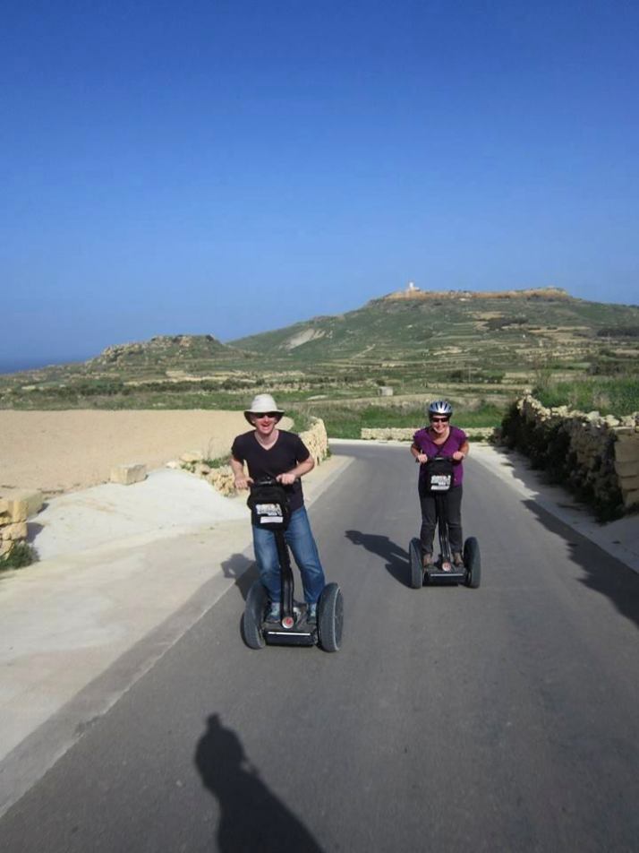
As well as doing a Segway tour on Gozo, we explored some of the island by bicycle and then had to return for a third day, this time travelling by bus, as we weren’t able to cover as much ground as we’d hoped by bike, hindered both by the exceptionally hilly terrain and the shockingly poor condition of the gears on our rental bicycles.

Approaching Gozo by ferry
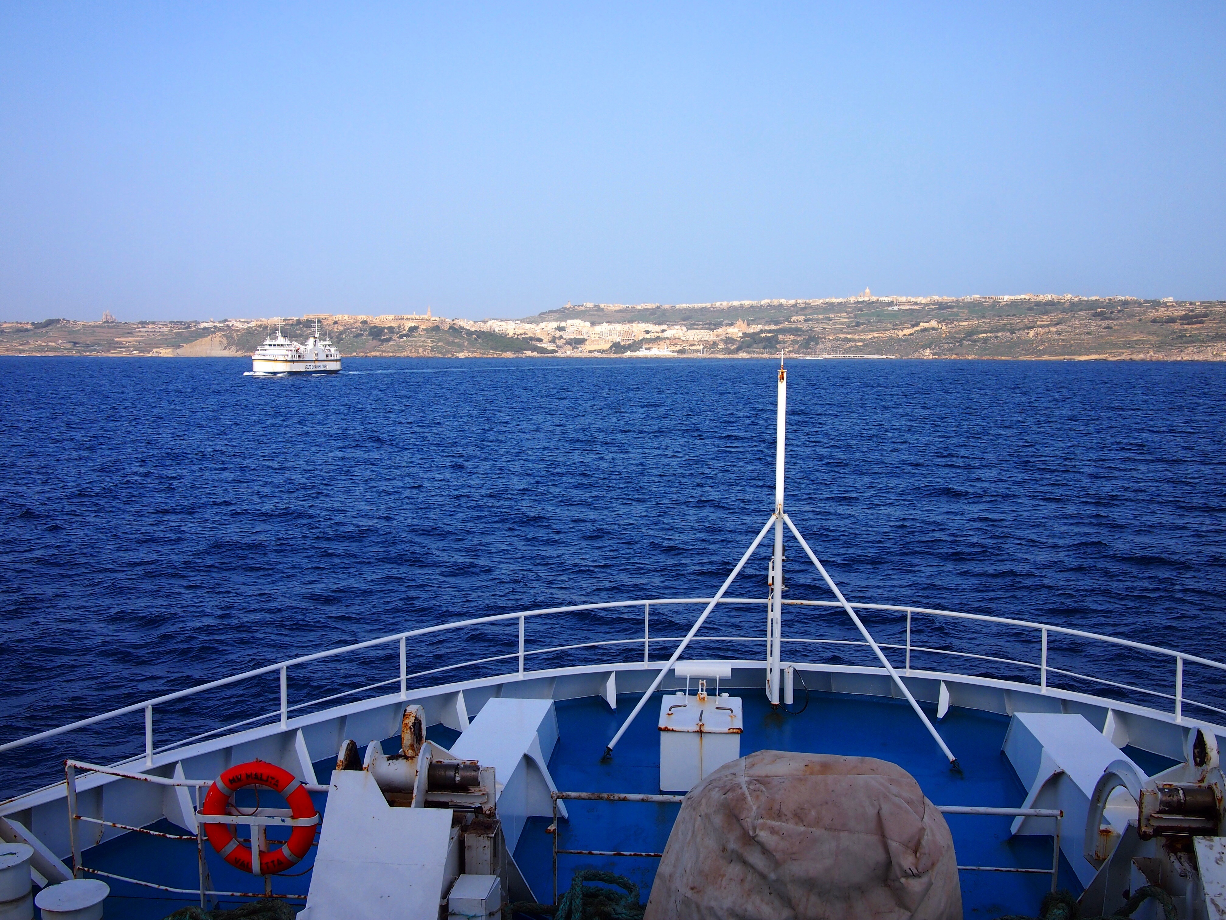
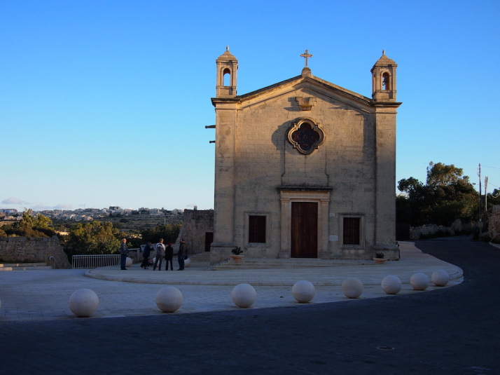
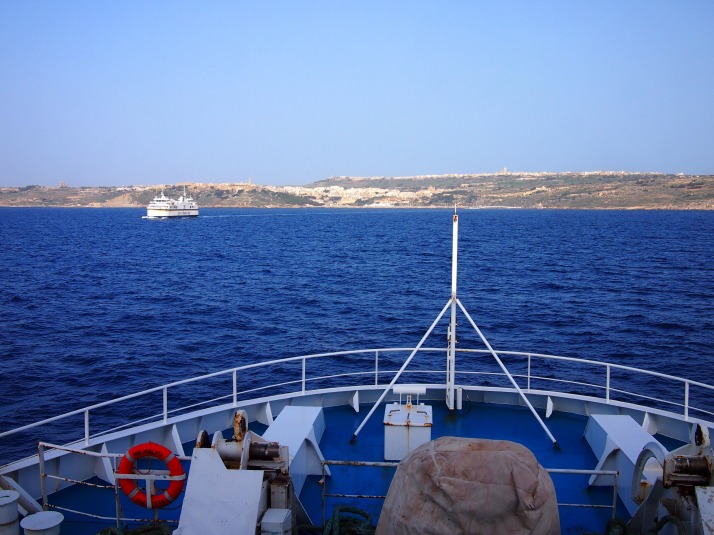
The small island of Gozo is a 25 minute ferry ride north of Malta

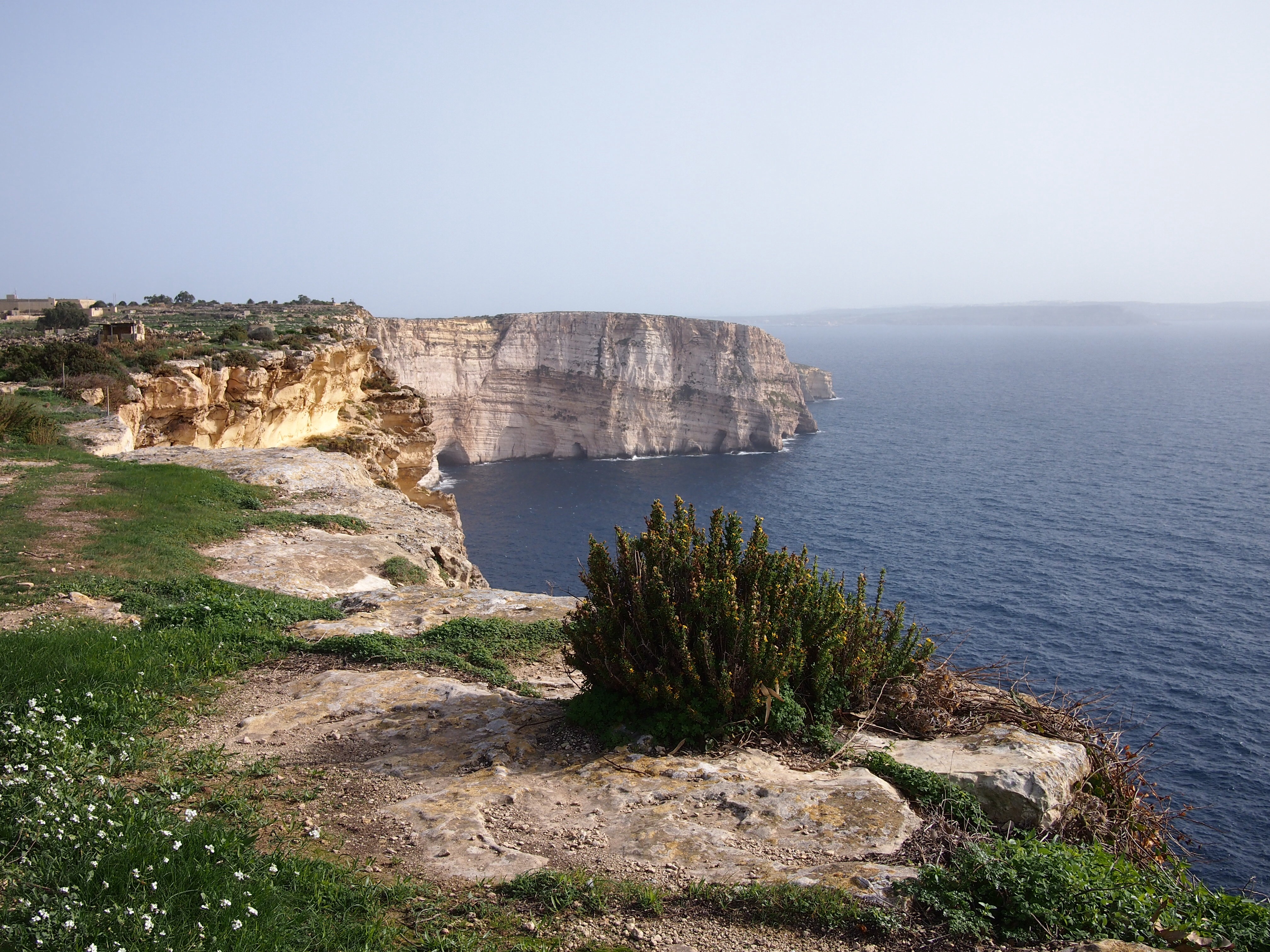
Cliffs and countryside

We spent much of our cycling day around the southern coast exploring the beautiful coastline and riding down narrow lanes between fields separated by dry stone walls. Most of the fields seemed to be grassy but I don’t remember seeing any livestock, although sheep would be the most logical inhabitants based on the terrain. We did spot a vineyard though and a few fields of vegetables.

Ta' Seguna cliffsThe beautiful Ta’ Seguna cliffs on the southern coast of Gozo

We had a map of the island which showed a roughly coastal route and gave approximate times to either walk, run or cycle four separate sections. We encountered our first problem when approaching the section just to the west of the ferry port – it was a footpath. Hmm, I guess we have to detour by road then… Unfortunately the map only had the major roads marked so we had to rely on the GPS maps on Andrew’s camera to find our way. The second problem was that the suggested times would probably only apply if you were riding a decent bike on a flat, smooth road, taking no account of interest in surroundings or requirement to get off and walk up hills.

Cycling around Gozo
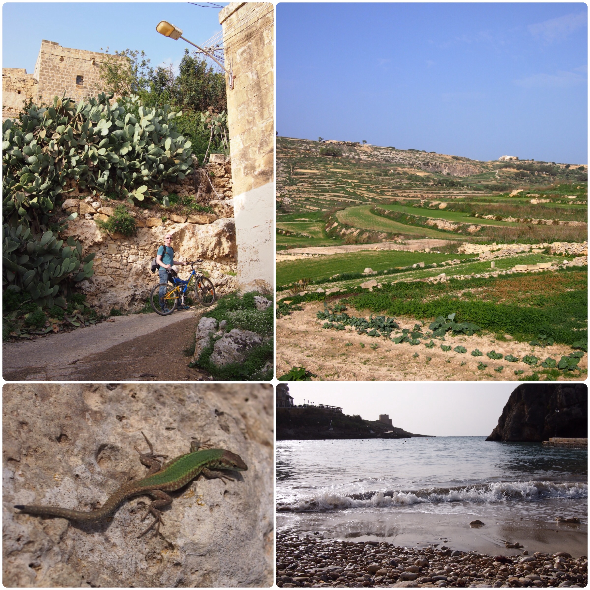
Clockwise from top left: Andrew walking a steep uphill section; Terraced fields in southern Gozo; Surf on the beach at Xlendi; the Maltese Wall Lizard has four subspecies endemic to the islands
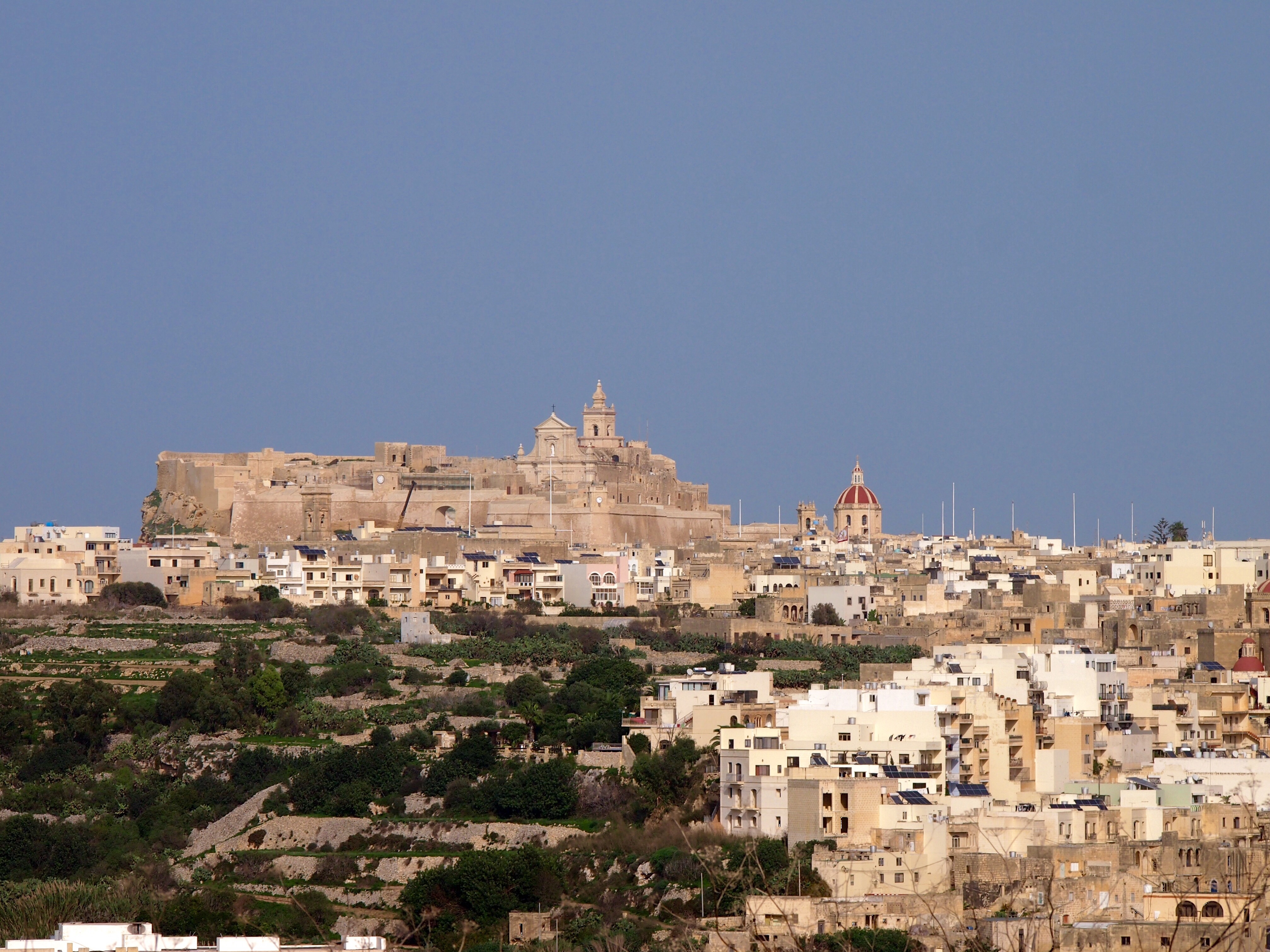
Cittadella

Gozo’s capital city, Victoria, contains a walled town known as Cittadella, similar to Mdina in Malta but even smaller. Disappointingly for us, it’s currently undergoing extensive renovation works which mean you can’t fully explore the inner streets and walls, although from the areas where you can get onto the walls there are good views to all sides of the island.

Victoria, GozoThe Cittadella towers over the centre of Gozo. Currently it looks better from a distance from where you can’t see all the scaffolding and piles of building materials.

Cannon on the city walls
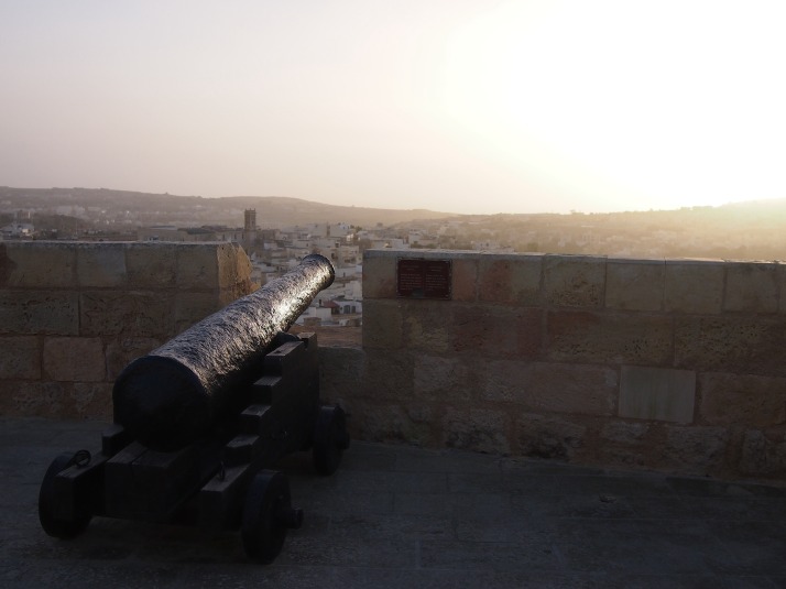
Cannon on the Cittadella walls
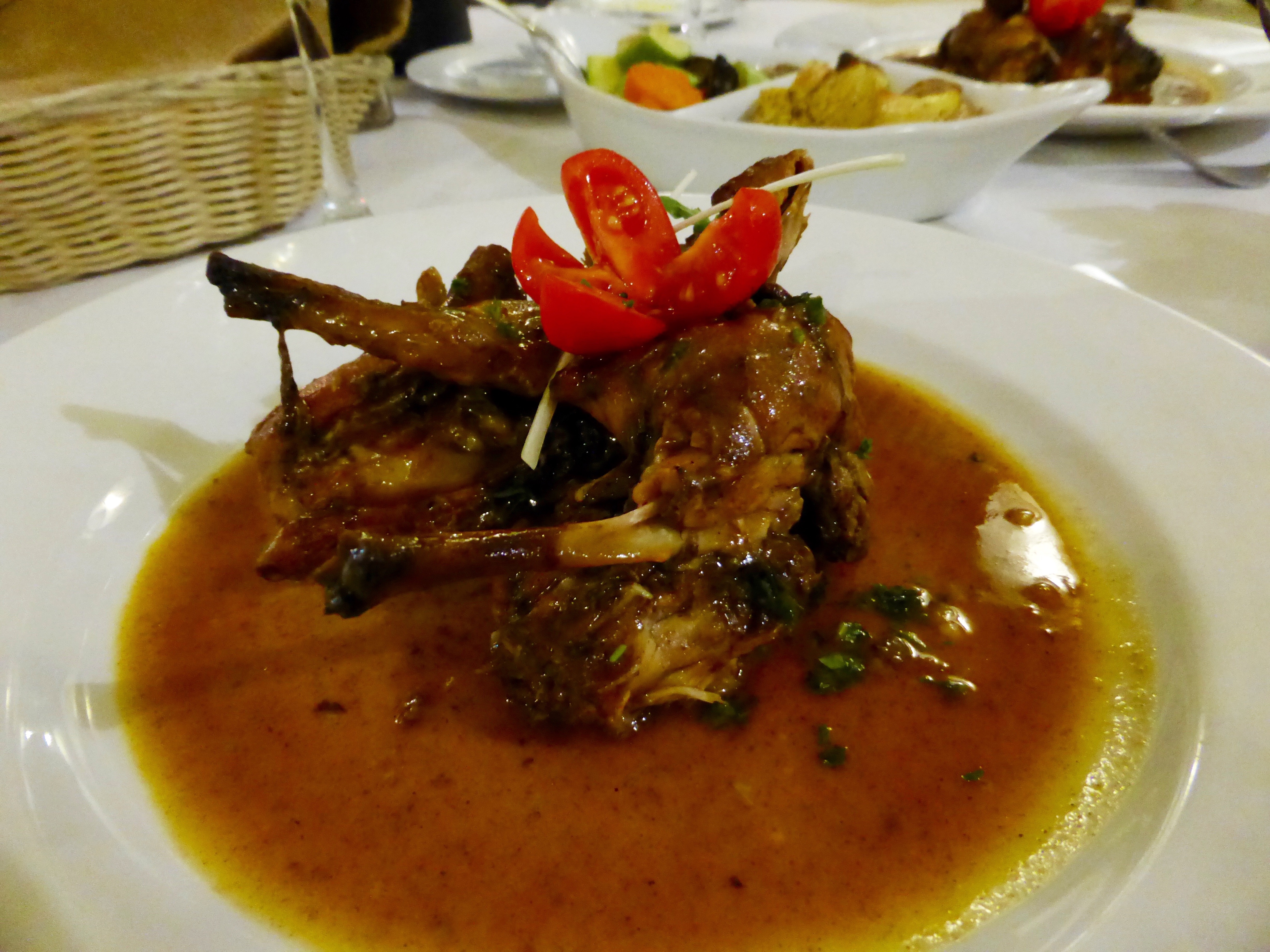
Rabbit stew

We spent one night on Gozo and that evening, feeling a little saddlesore from a day’s biking, we went out for dinner determined to try the rabbit stew which the Maltese islands are famous for. We weren’t disappointed, with rich gravy and meat so tender it was falling off the bone it definitely lived up to the hype.

Maltese rabbit stewDelicious rabbit stew at Pulena in Marsalforn

Ggantija Temples

Similarly to the temples at Hagar Qim and Mnajdra, the Ggantija temples were built by the Maltese Temple Culture around 3600BC. They are the oldest known manmade stone structures on the planet predating Stonehenge by at least 500 years and the Egyptian pyramids by 1000 years.

Ggantija temples
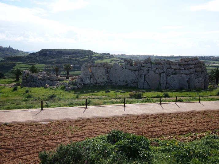
The Ggantija Temples are situated on a hilltop commanding magnificent views over the south-east of the island

Prior to their excavation in the 1820s, local people believed that the ruins which lay under the earth mound were the remains of a tower built by an ancient race of giants, hence the name which comes from the Maltese word for giant. The complex consists of two temples side by side inside an outer wall and, like the other temples we’ve visited, there are some huge stones used in the construction. Having struggled to move our own weight up some of the surrounding hills, the mind boggles at how the prehistoric builders moved everything into place.

Ggantija Temple
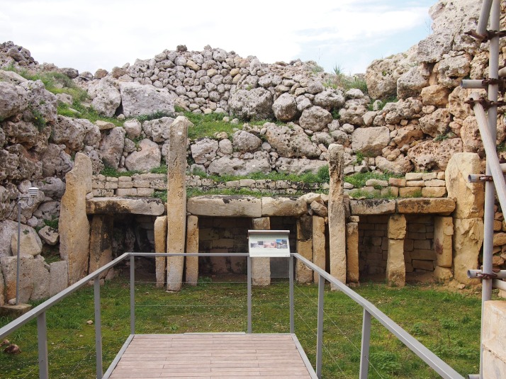
Altar arrangement in the South Temple

Us at Ggantija Temples
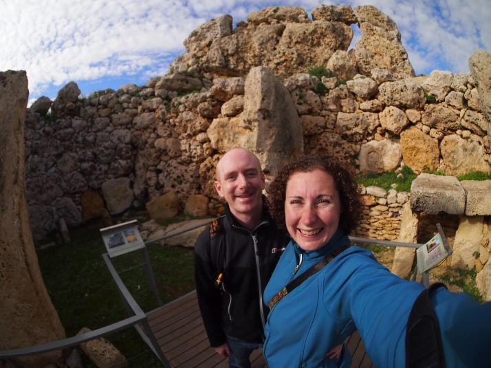
Us inside the inner room of the North Temple
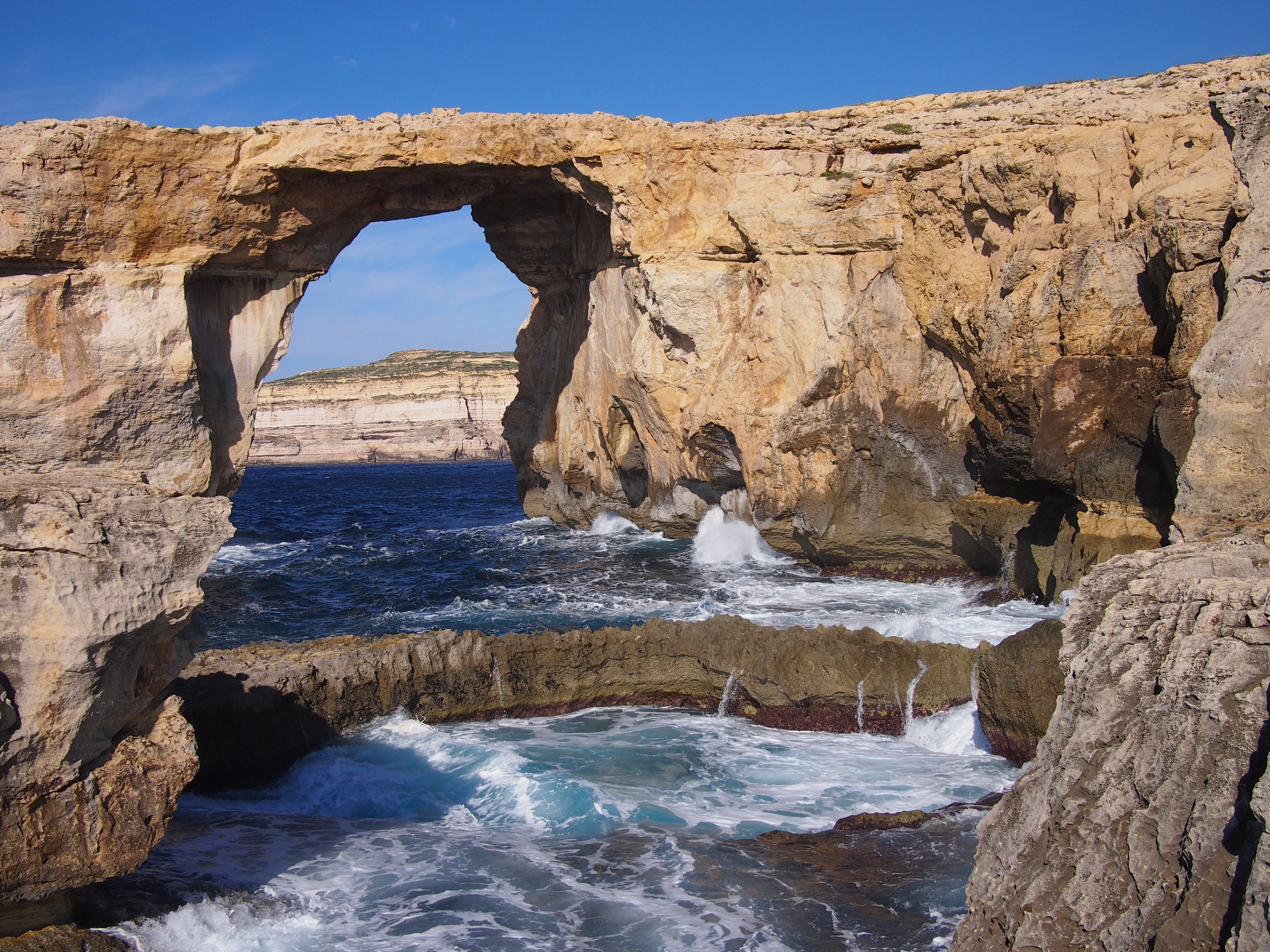
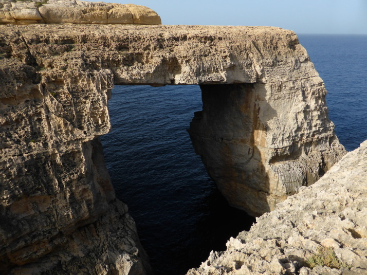
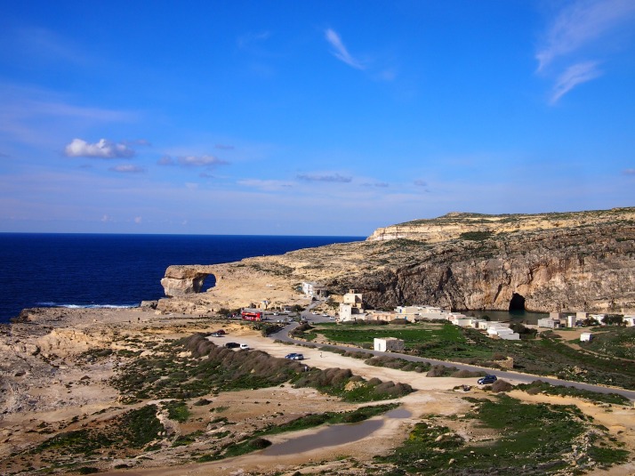
Dwejra Bay

We were aiming to arrive at Dwejra Bay on our cycling day but, although we were within sight of the sea, we got lost amongst the narrow unsignposted back roads and eventually had to give up so that we wouldn’t be riding in the dark. When we finally arrived by bus, we ate our picnic lunch on the rocky beach overlooking the choppy sea around the Azure Window, a natural rock arch which protrudes from the cliff side.

Azure Window
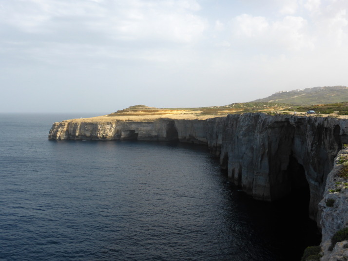
The Azure Window is a natural rock arch

We were hypnotised by the waves crashing on the rocks below us and had to drag ourselves away to climb up the hill to visit Dwejra Tower. Here we watched a short video explaining the history and ecology of the area as well as getting some terrific views along the coast from the roof. The watchtower was built during the reign of Grand Master Lascaris in 1651, principally to safeguard ‘Fungus Rock’ a small islet in the bay which is home to a plant that was believed by the Knights of St John to have medicinal properties. It was interesting to finally have a look inside one of these coastal defence towers as we have seen a lot of them on our travels around the islands. It was surprisingly small inside due to the thickness of the walls and had only one room on each level.

Dwejra Tower
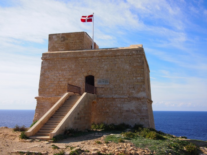
Dwejra Tower flying the flag of the Order of St John. When the flag is raised the tower is open for visits.

Dwejra Bay
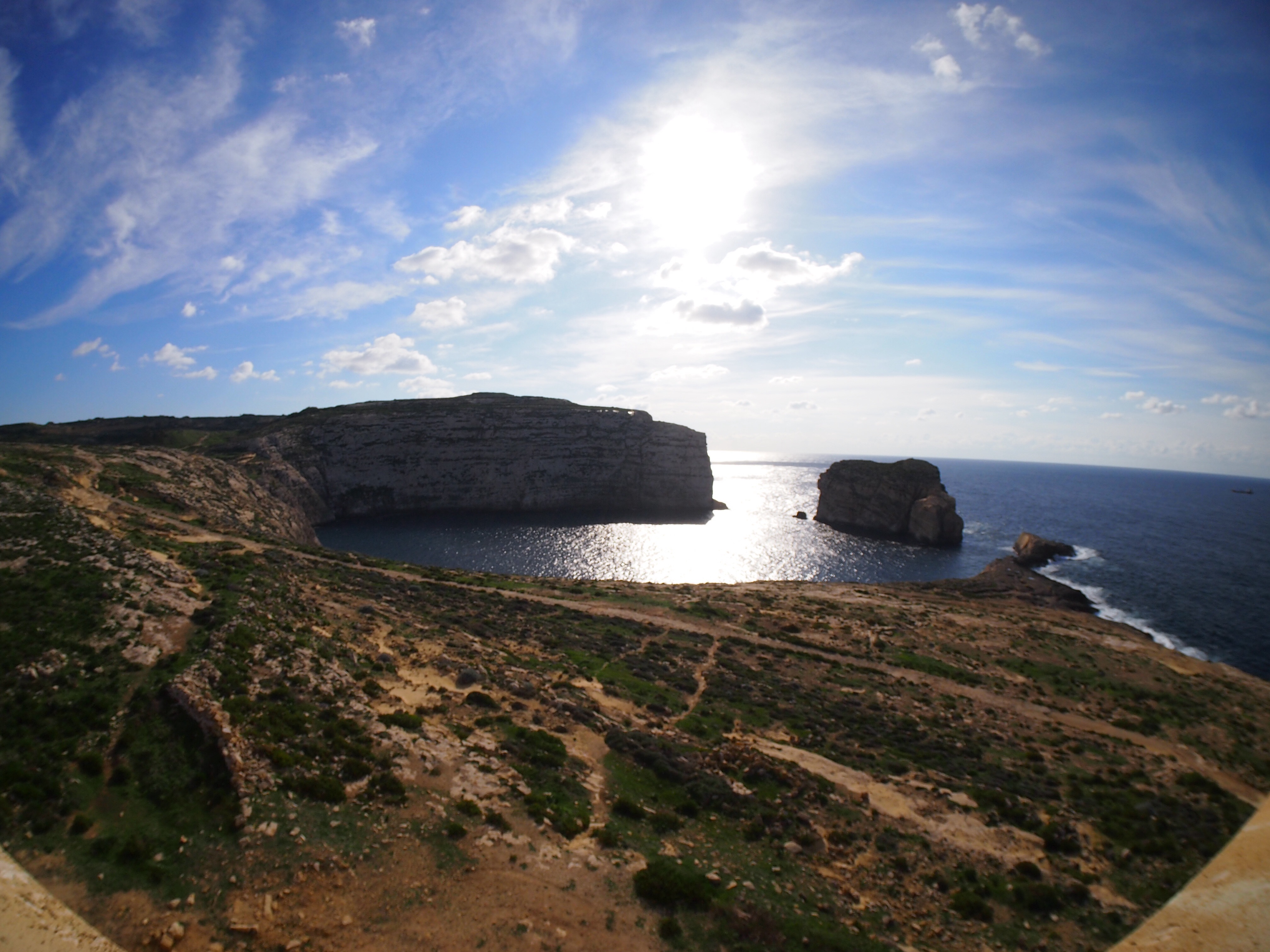
Dwejra Bay was formed when the roof of a huge cave collapsed. Fungus Rock is the remnants of the wall which separated it from the sea

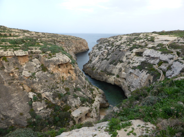
On the other side of the cliff which forms one side of the Azure Window is a different kind of geological phenomenon. A doline called the Inland Sea which, like the almost circular Dwejra Bay, was formed by the collapse of a cave roof millions of years ago. Nowadays it is a popular spot for sunbathing and swimming as well as the jumping off point for boat trips through the tunnel connecting it to the open sea, though in early December with a chill in the air and rough waters assaulting the cliffs none of those activities was in evidence.

Azure Window and Inland SeaThe Azure Window and Inland Sea (centre right) from the top of Dwejra Tower

We’re really glad we didn’t miss out on a visit to Dwejra Bay, it was a beautiful end to our explorations and different to anything we’d seen on Malta itself.

Countryside walks in Malta

After thoroughly strolling our way through Istanbul, we decided to continue this form of sightseeing experience and we were delighted to find the Malta Tourism Authority provide leaflets for varying length walks that cover most of the island. We picked up copies from the Tourist Information offices in the airport and Valletta, but they’re also available online, and in at least 3 languages: English, French and German.

Of the 7 routes, we did 5 of them over the course of our months stay on Malta..

Dingli, Fawwara, Wied iż-Żurrieq Walk

Map: Dingli, Fawwara, Wied iż-Żurrieq Walk
Distance: 11.2km / 7miles
Difficulty: (moderate – long but mostly downhill)
What we liked: Great scenery of the Dingli cliffs, includes the mysterious ‘Cart Ruts’ of Malta and Gozo, goes past the temples of Ħaġar Qim and Mnajdra, and it’s downhill
Dingli - Fawwara - Wied iż-Żurrieq walk map, Malta

Dingli – Fawwara – Wied iż-Żurrieq map. Source: Malta Tourism Authority

Looking south over the cultivated fields of Fawwara, from a Bronze Age village site that juts out almost to the sea

Looking south over the cliffs near Fawwara

Inside the first chamber of the South Temple of the Mnajdra temple complex

Inside the first chamber of the South Temple of the Mnajdra temple complex

This was the first walk we did on Malta, and gives a great taste of the megalithic history of the islands as it includes the mysterious ‘Cart Ruts‘ near the start, and ends near the megalithic temples of Ħaġar Qim and Mnajdra. We liked that it was largely downhill, and there’s a good variety of sights too. One thing though – bring a packed lunch with you as the route is fairly remote, though there are cafes and restaurants at the end in Wied iż-Żurrieq.

Watchtowers Walk

Map: Watchtowers Walk
Distance: 14.45km / 9miles
Difficulty: (hard – long with some uphill sections)
What we liked: Good variety of sights – watchtowers, beaches, holiday bays, local bird traps and the odd church, and having a beer and a packet of crisps on the Għadira beach at the end!
Watchtowers Walk map, Malta

Watchtowers Walk map. Source: Malta Tourism Authority

The aptly named Paradise Bay is on the route - don't forget your swimming costume!

The aptly named Paradise Bay is on the route – don’t forget your swimming costume!

St Agatha's Tower - otherwise known as the Red Tower, dominates the northern peninsula of Malta and is the final stop of the walk

St Agatha’s Tower – otherwise known as the Red Tower, dominates the northern peninsula of Malta and is the final stop of the walk

This walk circumnavigates the very northern outcrop of Malta, and it took us over an hour to get there by bus from Valletta where we were greeted by an uphill hike! As we were off-season a lot of the little holiday bays and lovely secluded beaches were very quiet though I suspect it’d be very different in the summer. Still, this walk includes a nice variety of sights and the highlight of the Red Tower is saved for the end.

Windmills Walk

Map: Windmills Walk
Distance: 8.8km / 5.5miles
Difficulty: (easy)
What we liked: Spotting the windmills, reading the information boards at the Tal-Ġibjun Garden viewpoint about ⅓rd of the way around
Windmills Walk map, Malta

Windmills Walk map. Source: Malta Tourism Authority

The view across Malta from the Tal-Gibjun Garden viewpoint is worth the visit to Żurrieq even if you don't do the walk!

The view across Malta from the Tal-Ġibjun Garden viewpoint is worth the visit to Żurrieq even if you don’t do the walk!

.. but then you'd miss out on the milling history of the island!

.. but then you’d miss out on the milling history of the island!

First, a confession – we skipped out the Bakkari Remains and stayed in Żurrieq because we’d spent so much time at the excellent Tal-Ġibjun Garden viewpoint reading about the sights, events and identifying the landmarks from this natural vantage point. Of all the windmills, only one is still active, and it sits atop some old burial pits! This is quite a compact walk so we twinned it with a stop at the Blue Grotto to make a day of it.

Girgenti Walk

Map: Girgenti Walk
Distance: 7.7km / 4.8miles
Difficulty: (moderate – some uneven ground and an easy scramble to visit the Big Cave)
What we liked: The amazing start – the complicated collection of ‘Cart Ruts’ nicknamed Clapham Junction (yes, seriously!) and the aptly named ‘Big Cave’
Girgenti Walk map, Malta

Girgenti Walk map. Source: Malta Tourism Authority

A small section of the 'Cart Ruts' at the so-called 'Clapham Junction' - what were they used for?

A small section of the ‘Cart Ruts’ at the so-called ‘Clapham Junction’ – what were they used for?

View from inside part of Ghar il-Kbir which literally translates to 'Big Cave'. It's a cave. And, you guessed it, it's big

View from inside part of Ghar il-Kbir which literally translates to ‘Big Cave’. It’s a cave. And, you guessed it, it’s big

The huge bronze Laferla Cross next to the Assumption Church sits on the edge of the hill with lovely views over the second half of the walk

The huge bronze Laferla Cross next to the Assumption Church sits on the edge of the hill with lovely views over the second half of the walk

This is our favourite of the walks we’ve done on Malta because the detour to the field of ‘Cart Ruts’ just points you at the right place but leaves you to find them. It was really enjoyable trying to actually find the famous ‘Clapham Junction’ and then further up the same field are burial pits and the ‘Big Cave’ that was inhabitanted until 1835. Other highlights for us were the huge bronze Laferla Cross (which we saw from the viewpoint of the previous Windmills walk), the figures surrounding the dome of the Providence Church, and serendipitously visiting on the annual St Nicholas Parish church open day, where they opened up the roof and the organ pit. We got great views from the top of the church, and befriended a local guy who showed us the belfry and invited us to the village festival at the end of July next year!

Maqluba Walk

Map: Maqluba Walk
Distance: 6km / 3.7miles
Difficulty: (easy)
What we liked: The small chapels that bestrew the countryside, getting out into the farming fields of the island
Maqluba Walk map, Malta

Maqluba Walk map. Source: Malta Tourism Authority

The start of the walk is Siggiewi Parish Church. When we tried to enter we were told that the entrance was through the belfry! For a small mandatory donation we got to climb onto the roof and on the way down we were given an introduction to the church's organ!

The start of the walk is Siġġiewi Parish church. When we tried to enter we were told that the entrance was through the belfry! For a small mandatory donation we got to climb onto the roof and on the way down we were given an introduction to the Church’s organ!

Aerial photo of the giant sinkhole that appeared on the 23rd of November 1343 during a severe winter storm

Aerial photo of the giant sinkhole that appeared on the 23rd of November 1343 near Qrendi during a severe winter storm. Photo source: onsite information board

And we end with yet another church - this time Qrendi's St Matthew's Chapel as the sun sets

And we end with yet another church – this time Qrendi’s St Matthew’s Chapel as the sun sets

As this walk starts at the end of the previous Girgenti Walk, we did them both in the same day, stopping in Siġġiewi for a spot of lunch between them. This is very much a rural Maltese countryside walk far from any tourist attractions, but our timing was impeccable as the lovely little Hal-Xluq Church was home to a local artists’ exhibition – which is the only other time of the year the church opens its doors besides the village festivities! The other highlight for us was the giant sinkhole in the Maqluba valley that appeared in 1343, just outside Qrendi, and almost took the then smaller chapel of St. Matthew with it!

Maltese Architecture

As soon as we arrived in Malta we noticed that the buildings here share some features which make them quite distinctive.

Building materials

There aren’t any forests on Malta and wood is in short supply so there isn’t any traditional wooden architecture such as we’ve seen in Latvia, Russia and Japan. Fortunately for the Maltese much of the island is composed of a soft limestone which is easy to quarry and is used to build everything from dry stone walls and houses to churches and fortifications. Its soft honey colour is very easy on the eye and gives a uniform, cohesive look to any town viewed from a distance.

Valletta's limestone architectureValleta’s limestone architecture seen from across the Grand Harbour

There isn’t much in the way of modern architecture here (outside the resort areas anyway), and certainly no skyscrapers, but at the entrance to Valletta a new Parliament building is nearing completion. Designed by the high profile architect Renzo Piano (one of his other recent projects is The Shard in London) it has caused controversy and apparently UNESCO are considering whether Valletta’s World Heritage status should be revoked because of it. I hope it doesn’t come to that, it is definitely modern but use of the traditional limestone means that it blends in nicely. We like it. We also like that it’s been nicknamed the ‘Cheese Grater’.

New Parliament building in VallettaThe ‘Cheese Grater’, Malta’s new parliament building

Fortifications

It’s not only the buildings here that are built from the local limestone but also the island’s many fortifications – city walls, coastal watchtowers and forts. In the rather clunkily named but nevertheless fascinating Fortifications Interpretation Centre we learnt that military engineers would dig out the limestone to create a defensive ditch surrounding the city and use the blocks to build up the walls.

Senglea fortificationsFortifications at the land-side of Senglea, one of the Three Cities

Balconies

One of the most obvious features of Maltese houses are the balconies. They’re usually wooden, closed in and painted in bright colours. Although it’s not clear exactly what their origins are, it’s thought that they were influenced by the Arabic muxarabija balconies, possibly arriving via Spain. They gained popularity in the 18th century and were sometimes added to the house later. Because of the high price of timber they became something of a status symbol amongst the country’s elite, however when the British took over in the 19th century timber became more affordable making balconies available to those of lower means.

Wooden balconies in VallettaBalconies along Republic Street in Valletta

Front doors

The Maltese do an interesting line in what we might call door furniture. There are extravagant door knockers, plaques of saints next to front doors and, as every house has its own name, a wide variety of name plaques in different designs and styles. It’s been fun to spot different ones as we walk the streets.

Door knockers and icon plaques

Shops

Of course there are shopping malls with the usual chain stores, but many of the shopfronts in Malta’s towns seem to hark back to an earlier time with small windows and hand-painted signs making them look a bit retro. They also have old fashioned opening times with pretty much all small businesses closing for lunch at 12pm and (perhaps) reopening at 4pm for 2-3 hours. Maybe this makes more sense in August when the midday temperature averages 32°C but in late autumn there doesn’t appear to be a clear explanation and at first it was confusing to us.

Valletta shopfrontValletta shopfront

Religious bits and bobs

Malta is predominantly Catholic (over 90%) and, as well as the saint plaques beside front doors, there are frequent roadside shrines and street corner niches containing saints, plus lots of churches. The larger churches often follow a similar design with two bell towers flanking the entrance and a dome over the nave.

Vittoriosa churchSt Lawrence Church in Vittoriosa

Maltese shrinesTwo street corner niches and a roadside shrine

British influence

Malta was a British colony for 164 years until it gained its independence in 1964. There are a few telltale signs that make us feel a bit nostalgic and homesick, most obviously the red postboxes and phone booths.

Maltese phone boothRed phone booths are rare in the UK now, but everywhere in Malta

Segueing around Gozo, on a Segway!

The country of Malta is a Mediterranean archipelago, and only the 3 largest islands are inhabited. The main one is Malta, then Gozo to the north, and between them is a small island called Comino which only has 4 permanent residents.

Given their proximity, Gozo shares a lot of the same history as Malta, and in looking for places to visit and things to do for a couple of days there we found GozoSegway – a small company that operates guided tours of Gozo while you operate a Segway!

Us on Segways having just passed our Compulsory Basic Training, which consists of an emergency stop, hill start and smiling from ear to ear

Us on Segways having just passed our Compulsory Basic Training, which consists of an emergency stop, hill start and smiling from ear to ear

A Segway is a two-wheeled form of personal transportation, similar to a motorised skateboard, but way smarter – using gyroscopes developed by BAE Systems and a lot of very clever electronics it uses your centre of gravity to control motion and direction. Like us, you may have seen them in movies or in the odd city centre, and riding on one is something I’ve wanted to try since they came out in 2001.

We weren’t sure how easy it was going to be to learn how to ride, and as we wanted to see quite a bit of Gozo we booked their longest 2½ hour tour of north-western coastline.

Kevin (the Boss) and Peter (our Guide) met us in Marsalforn with their truck-full of Segways and after a short explanation we were up and whizzing around the car park like a pair of two-wheeled tearaways, grinning from ear to ear!

Getting acquainted: Peter our guide makes sure he's packed everything we need for the trip; My Segway and I getting to know each other as we whizz up and down the car park of Marsalforn Bay harbour

Getting acquainted: Peter our guide makes sure he’s packed everything we need for the trip; My Segway and I getting to know each other as we whizz up and down the car park of Marsalforn Bay harbour

Our initial concerns about how difficult we’d find them to ride were completely unfounded – basically, if you can stand upright then you’ll have no problems whatsoever controlling a Segway! We could call it an amazing technical achievement, or we could just simply say its magic how they actively maintain balance, and with the slightest shift in weight forward or backward it starts moving exactly how you would expect it to. Very quickly we understood why Peter said that the Segway becomes an extension of the body.

After the Segway driving test equivalent of emergency stops and hill starts, Peter led the way along the coastline towards our first stop – the salt pans of Gozo.

The Gozo Salt Pans, still in use after more than 2000 years

The Gozo Salt Pans, still in use after more than 2000 years

Dating to the time of the Romans (264BC to 395AD), the salt pans have been in use for thousands of years. The closest ones to Marsalforn are irregular and organic in shape as they’re the oldest and were carved out with simple hand tools; further along the pattern of salt pans becomes regular, ordered and each pan is bigger as better tooling and machinery improved not only their creation but the harvesting of the salt.

The evolution of man and tools is evident in the shape of the salt pans. Left: the oldest salt pans were created with crude hand tools; right: modern tools allow larger and more regular salt pans

The evolution of man and tools is evident in the shape of the salt pans. Left: the oldest salt pans were created with crude hand tools; right: modern tools allow larger and more regular salt pans

Wied il-Ghasri, a deep valley used by pirates and smugglers of the Mediterranean, so much so that they built a shaft into the side of the cliff to lower supplies and raise booty!

Wied il-Għasri, a deep valley used by pirates and smugglers of the Mediterranean, so much so that they built a shaft into the side of the cliff to lower supplies and raise booty!

Peter stopped to prepare a prickly pear. Gozo, like Malta, gets a lot of sunshine and the prickly pear, like all the fruit here was very sweet. The thick, heavy leaves of the cactus make a great chopping board too

Peter stopped to prepare a prickly pear. Gozo, like Malta, gets a lot of sunshine and the prickly pear, like all the fruit here was very sweet. The thick, heavy leaves of the cactus make a great chopping board too

We stopped for a coffee and biscuits a little further along the cliff tops, where we watched a guy raising fishing baskets

We stopped for a coffee and biscuits a little further along the cliff tops, where we watched a guy raising fishing baskets

The naturally formed window at the end of Wied il-Mielah, just a little further west along the northern coastline of Gozo

The naturally formed window at the end of Wied il-Mielaħ, just a little further west along the northern coastline of Gozo

Next we headed inland and after a quick glide through the small town of Gharb (in Maltese, ‘gh’ is silent, as you might remember we learned in Mdina & Rabat), and we were back out on the open road towards the dominating Basilica of the Blessed Virgin of Ta’ Pinu.

Famous as a place of pilgrimage for those seeking answers to prayers for miraculous recoveries, the The Basilica of the Blessed Virgin of Ta' Pinu has an extended chapel where letters and artefacts of prayer and gratitude from around the world are on display

Famous as a place of pilgrimage for those seeking answers to prayers for miraculous recoveries, the The Basilica of the Blessed Virgin of Ta’ Pinu has an extended chapel where letters and artefacts of prayer and gratitude from around the world are on display

The Basilica of the Blessed Virgin of Ta’ Pinu. The story goes that in 1833 a spinster by the name of Karmina Grima was walking past the then dilapidated chapel on the site and heard a voice asking her to recite 3 Hail Marys’, she did and shortly afterwards her neighbour’s mother was miraculously healed. As word spread many started pilgrimages to ask for temporal and spiritual favours and the church was rebuilt in 1932 to accommodate both the visitors and their ex-voto.

The basilica is also known for a painting of the Virgin Mary which depicts her hands in prayer though one hand is white and the other is black. It’s not clear if it was the artist’s intent to show her black hand in shadow, or, as some have suggested, a sign of the multi-ethnicity of Christianity.

From here we took a long and winding road back down to Marsalforn and while we waited for Kevin to return with the truck, we chatted with Peter over a coffee about travelling – he’s from Prague in the Czech Republic – how he ended up living on Gozo and, of course, Segways!

Segways - easily the most enjoyable way to climb the hills of Gozo!

Segways – easily the most enjoyable way to climb the hills of Gozo!

We really enjoyed the experience, the Segways are great fun and a fantastic way to see this hilly little island.