Tag Archives: temple

Valley of the Temples, Agrigento

Agrigento is a small town on the south-western coast of Sicily. It’s quite a distance from the island’s other tourist sights but definitely on the tourist trail, and well worth the trip for its star attraction, the remains of the Greek city of Akragas. Founded in 582BC it was one of the most important Greek colonies on Sicily. In English it’s commonly known as the Valley of the Temples although it’s not clear why as its Italian name is Collina dei Templi which translates as ‘Hill of the Temples’ and indeed the temple remains are arranged along a ridge.

Valley of the Temples
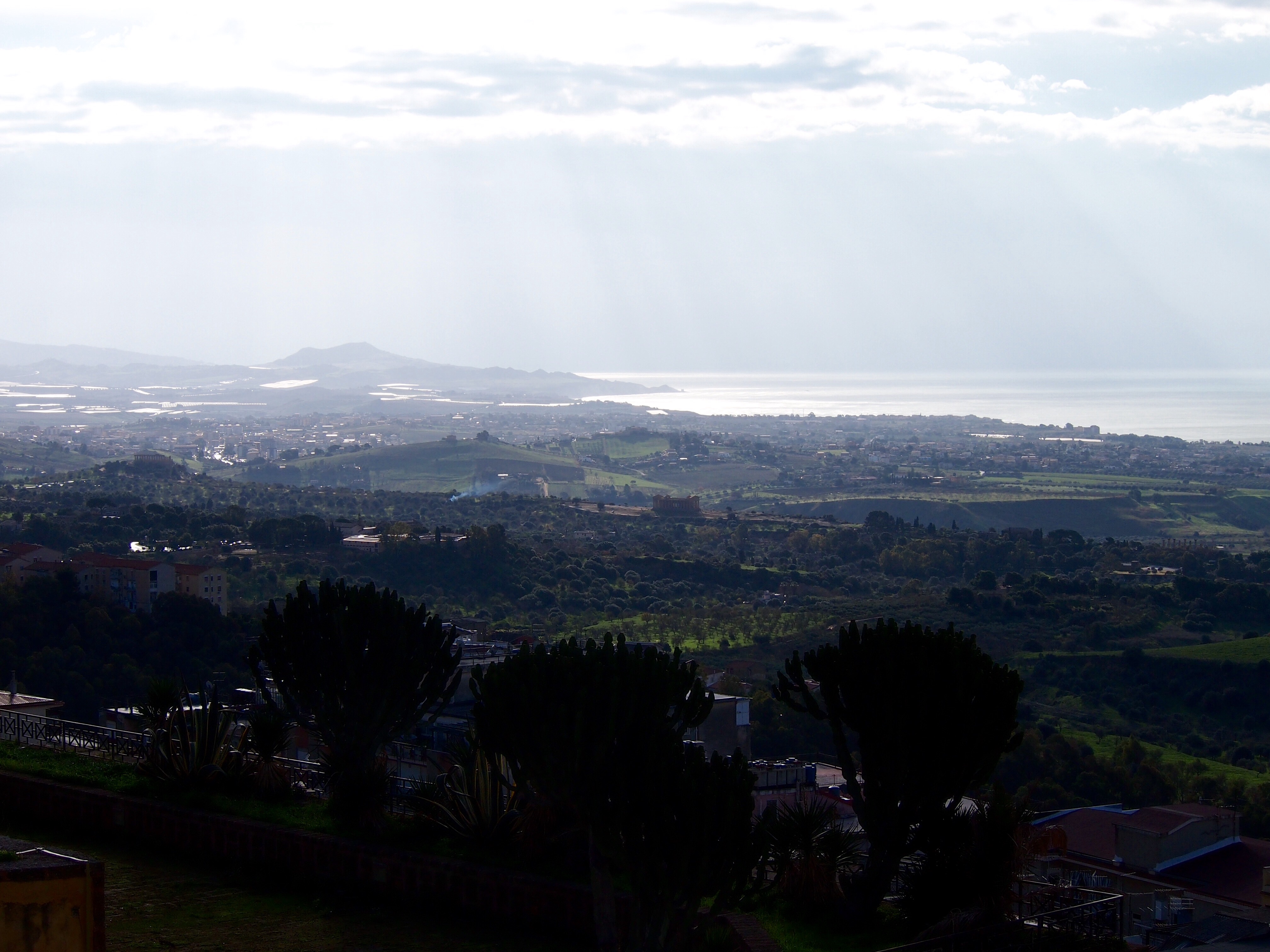
Valley of the Temples from modern Agrigento town, the Temple of Concord is in the centre of the picture, Temple of Juno far left and you can just make out the columns of the Temple of Heracles on the right

The bus driver unhelpfully drove right past the sight even though 80% of his passengers were clearly tourists, and so we had to walk back up the road for 15 minutes to get to the ticket office. There was a definite cold snap in the air when we visited but we were fortunate to have bright sunshine (and gloves) for our day of exploring.

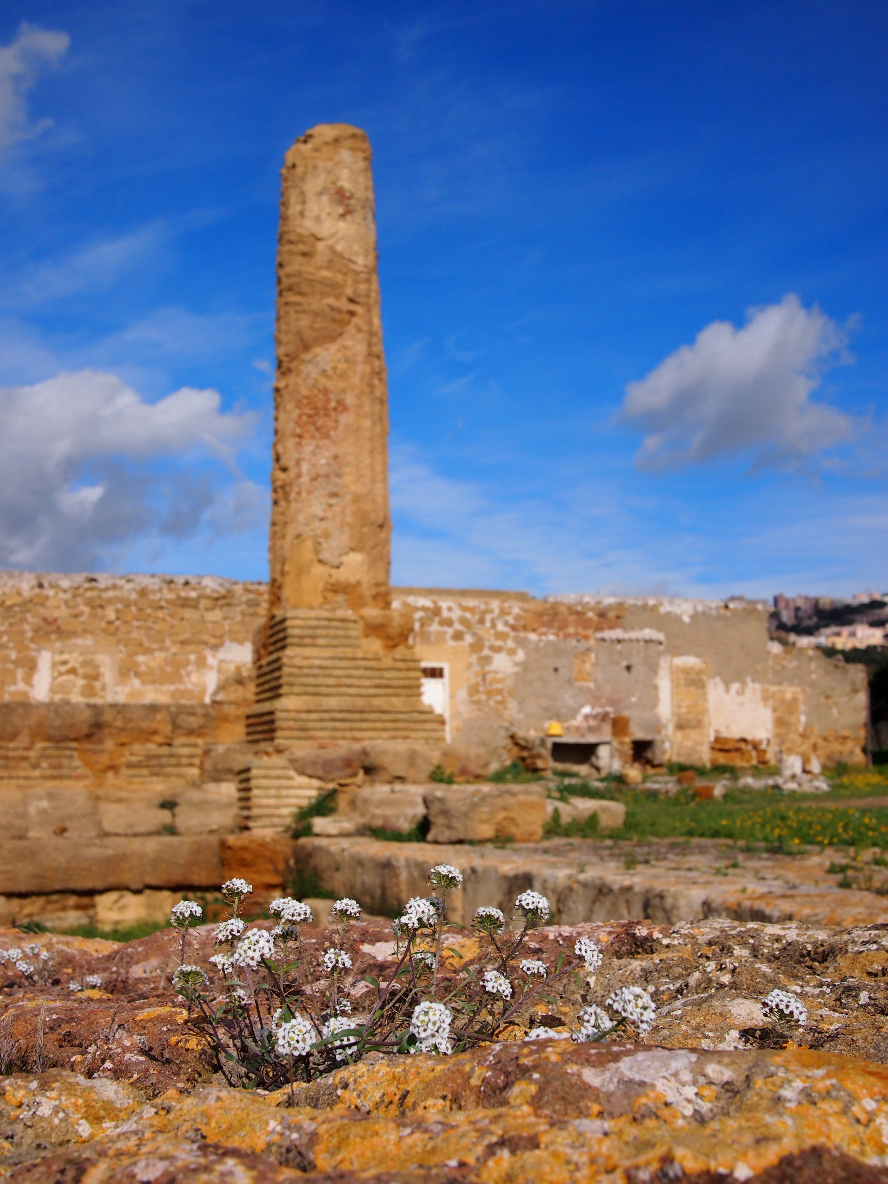
First we explored the western temples starting with what would have been the biggest, the Temple of Olympian Zeus. This huge temple was 113m by 56m (almost the area of a football pitch) and was not even completed before the city was sacked by the Carthaginians in 406BC. Its stones were raided for use in later constructions right through to the 18th century when some were used for building the nearby port of Porto Empedocle. Because of this, it’s quite hard to imagine how it would have looked. The most interesting features of the temple which can still be seen are eight huge figures of Atlas which supported part of the structure. Several of them have been reconstructed (lying down) and, although they are badly weathered, you can still make out their arms and legs.

Atlas figure, Temple of Olympian Zeus
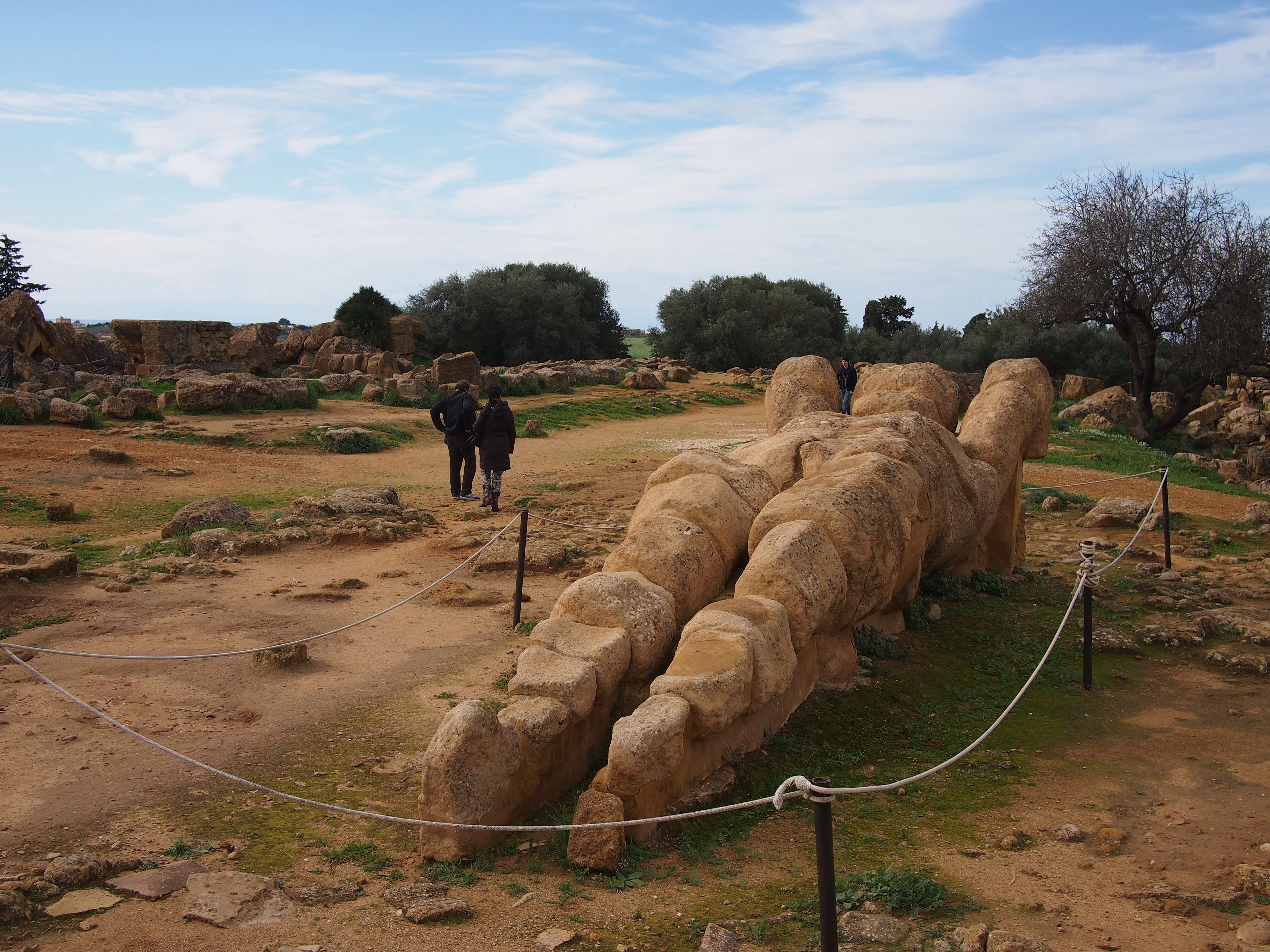
Atlas figures in the ruins of the Temple of Olympian Zeus

Further west is the Temple of Castor and Pollux. The temple would have had six columns along the front and back and thirteen down the sides. Its north-western corner was reconstructed in 1836, although apparently somewhat unreliably as they used features from different ages. Despite this these four pillars are now an emblem of Agrigento.

Temple of Castor and Pollux
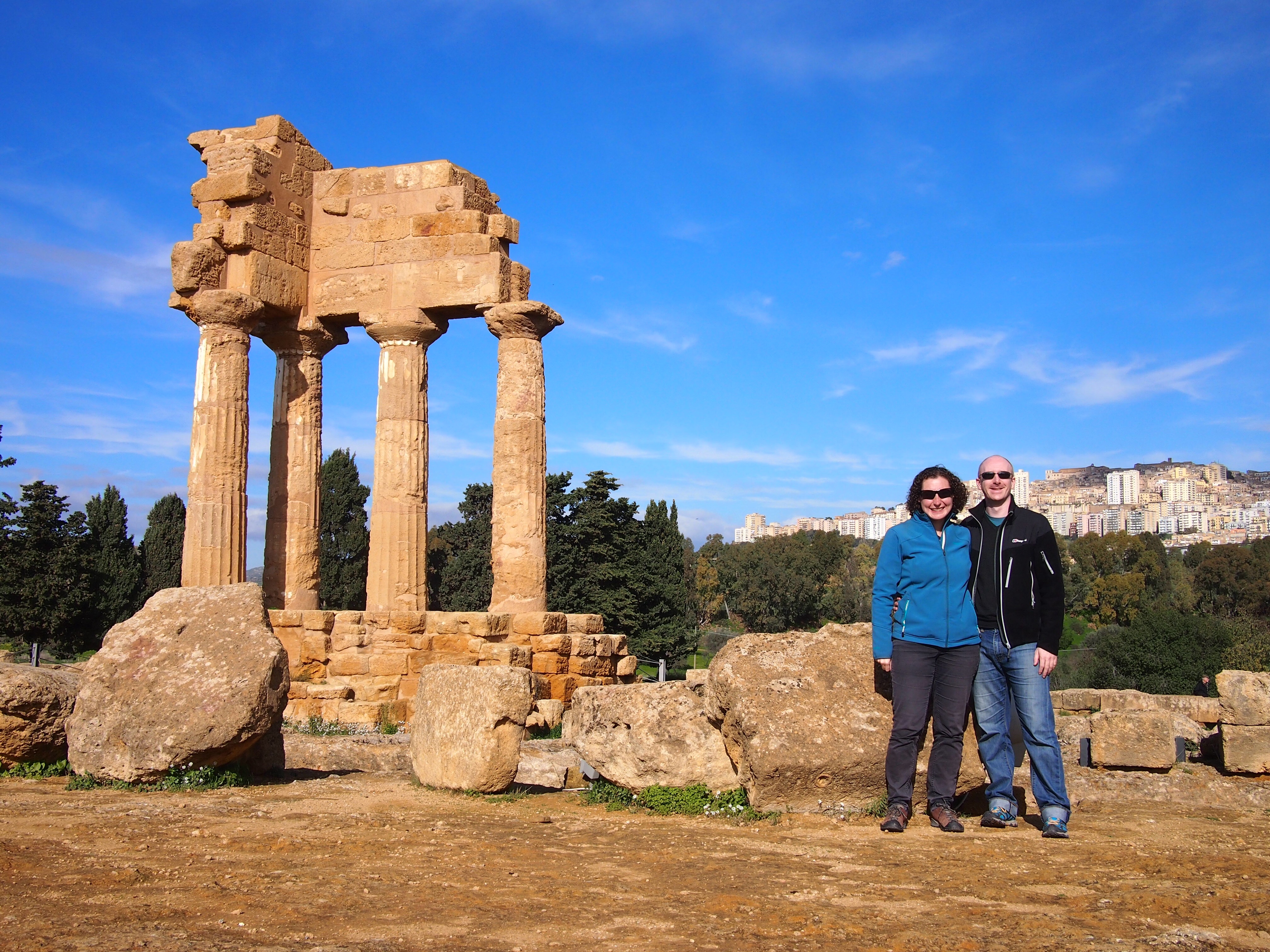
Us in front of the remains of the Temple of Castor and Pollux

The land pitches sharply downwards next to the Temple of Castor and Pollux. This was the city boundary and during Greek times held a reservoir of water. It was filled in around the 2nd century AD to become fertile agricultural land. Known as the Garden of Kolymbetra, nowadays it has been restored by the Italian equivalent of the National Trust and is a wonderful citrus orchard kept using traditional irrigation and farming techniques.

Garden of Kolymbetra
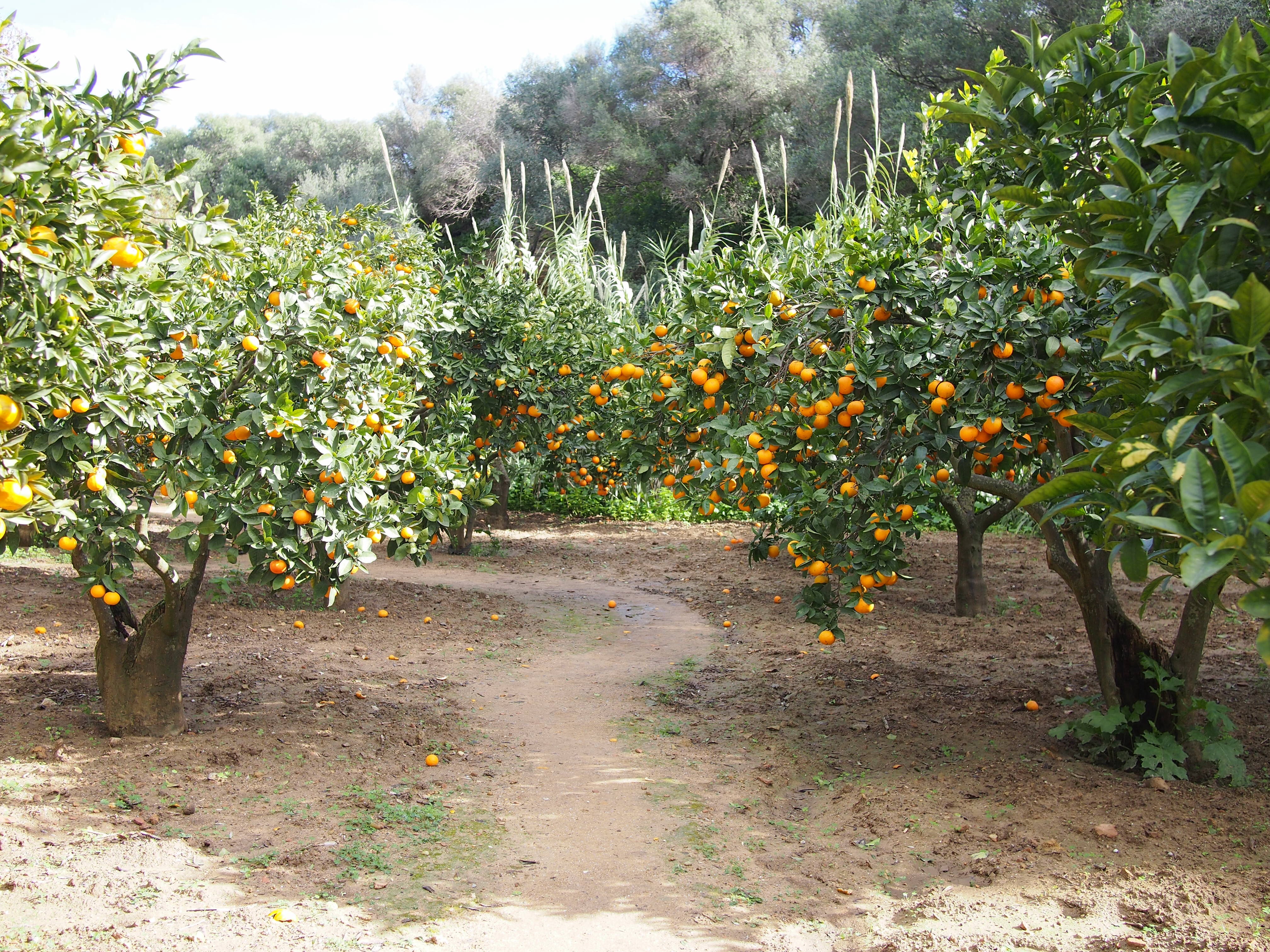
Citrus orchard in the Garden of Kolymbetra

We loved wandering through the trees and looking at all the different citrus varieties, familiar ones like orange, lemon, mandarin and grapefruit and unfamiliar ones like the knobbly citron (an ancestor of modern lemons) and the fragrant bergamot orange prized in perfume-making. We took to scratching the fruits’ skins and sniffing to help us identify them. If that sounds a bit naughty, it’s nothing compared to the Italian visitors who were picking and eating oranges, discarding the peels as they went despite the signs forbidding it!

Garden of Kolymbetra
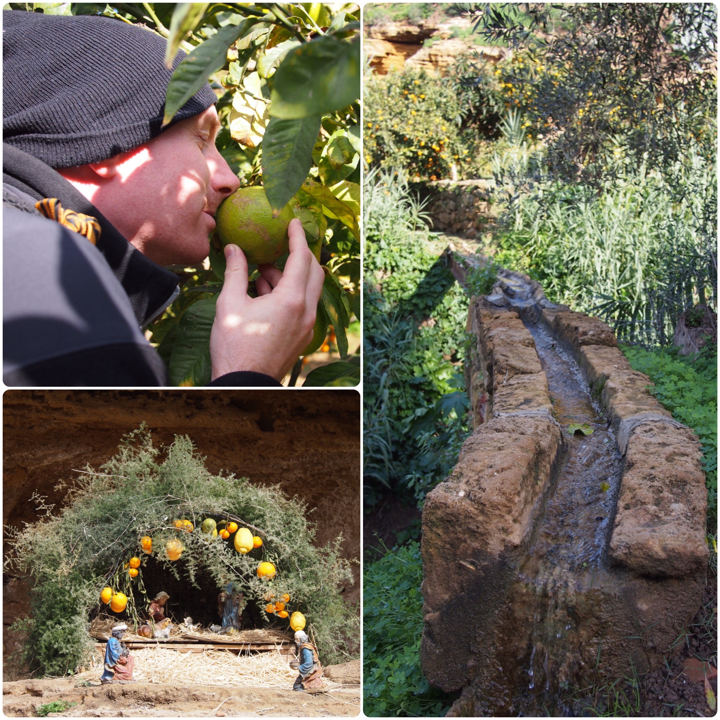
Garden of Kolymbetra (clockwise from top left): Andrew sniffing the bergamot orange; traditional irrigation system; nativity scene in a chapel cut into the cliff – I love that it’s decorated with a variety of citrus fruits

Temple of VulcanoBeyond the garden, standing beside the train tracks, are the remains of the Temple of Jupiter. Just a couple of columns and the outline of a building whose stones are covered in plants

Making our way back to the ticket office and the eastern area, our first stop was another Doric style temple and the most ancient one here dating to the 6th century BC, the Temple of Heracles. As with many of the temples, reconstruction work to put up the row of eight columns was done in the 1920s on the instigation of an Englishman who settled in the area, Captain Alexander Hardcastle.

Temple of Heracles
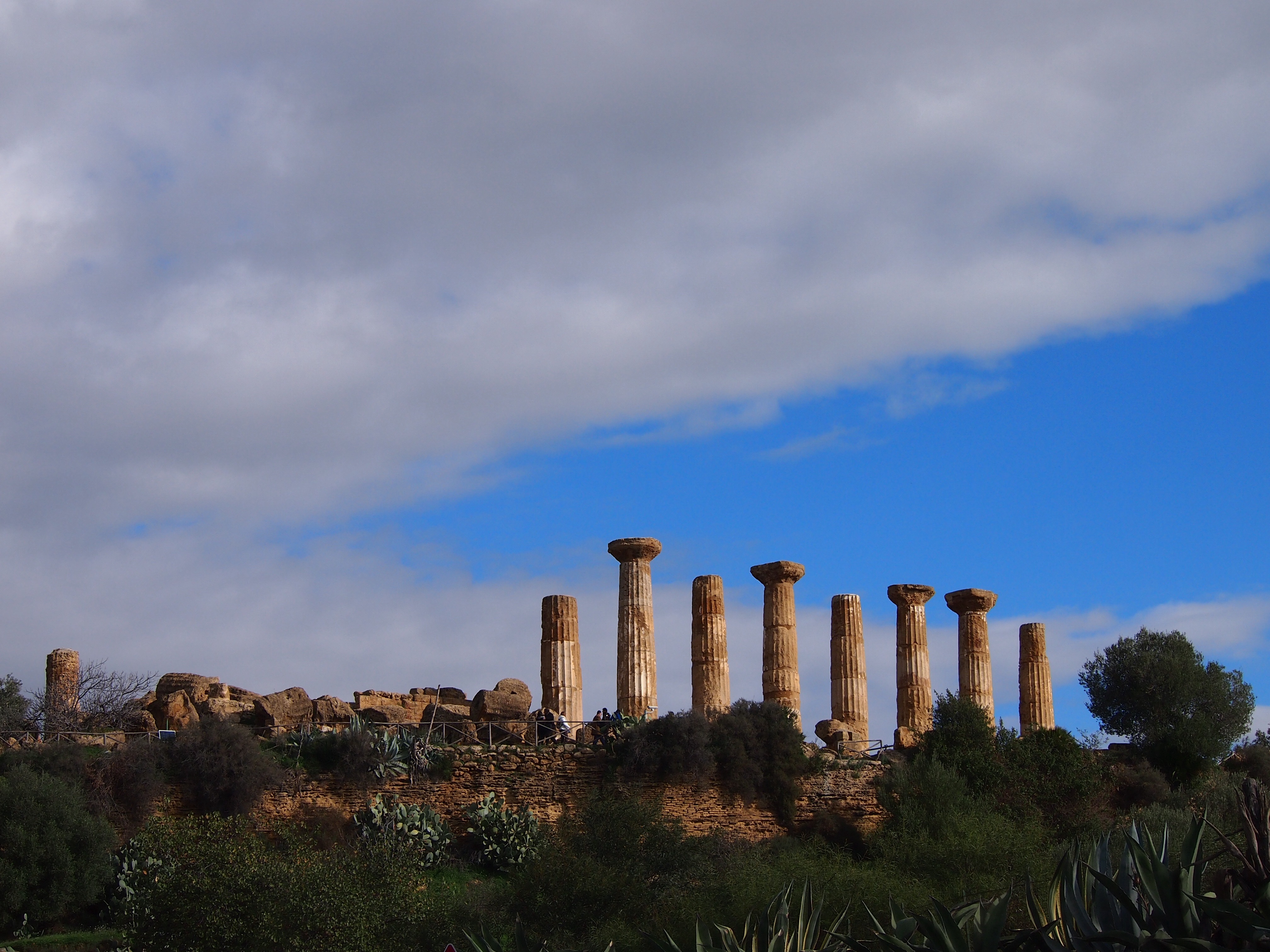
Temple of Heracles as seen from the road which runs through the centre of the site

Olive treeThroughout the Kolymbetra Garden and around the temples twisted old olive trees were growing

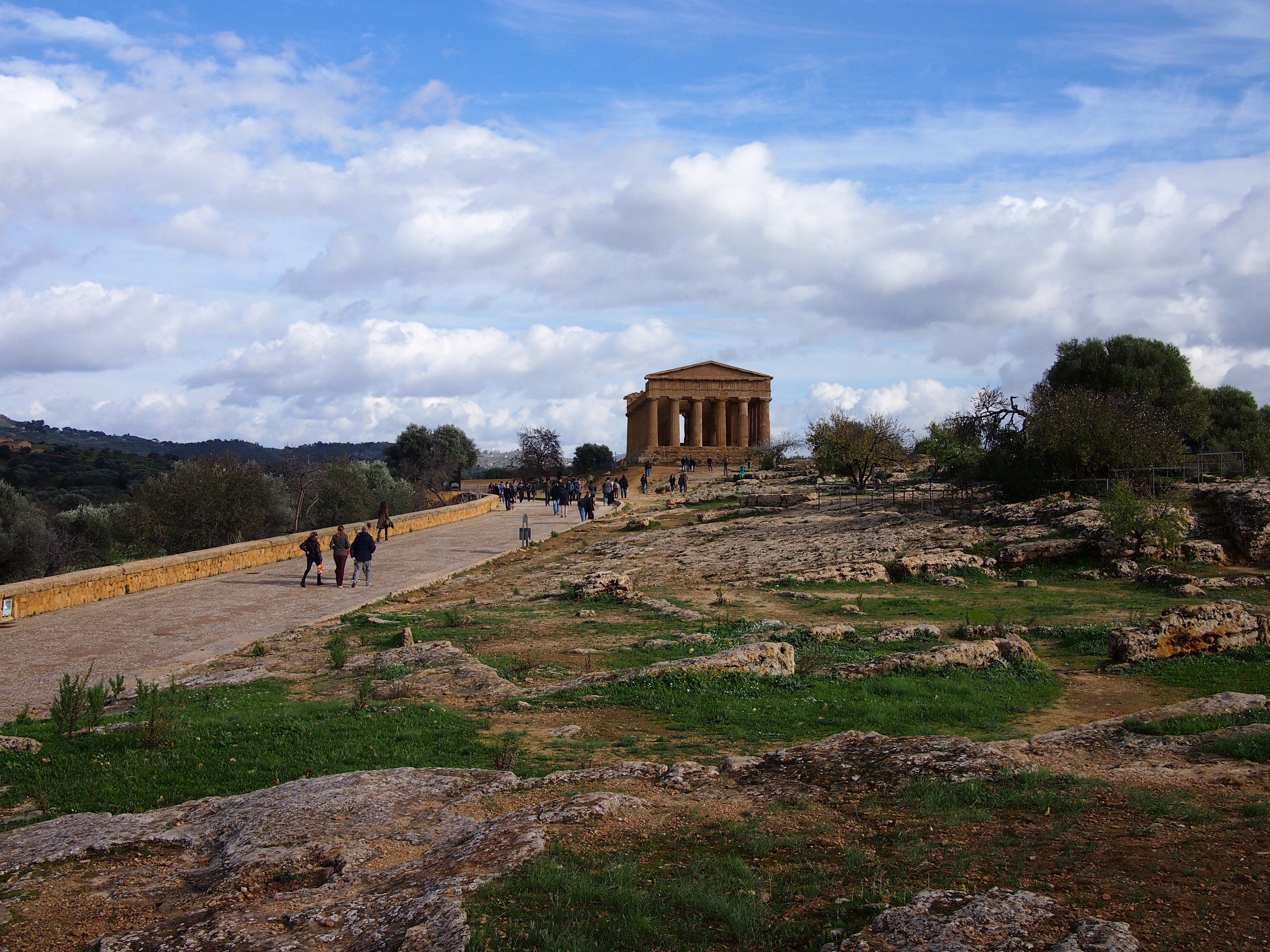
In 210BC the Romans conquered the area and changed the name to Agrigentum. Under their rule, the city was again prosperous and churches and cemeteries were built on the Collina dei Templi. In the centre of the eastern complex is the incredible Temple of Concord, one of the temples which was converted into a Christian basilica. It is amazingly well preserved and although, unfortunately, it is not possible to enter, you can still see the walls of the inner room, original apart from the arches cut by the early Christians.

Temple of ConcordThe Temple of Concord is where everyone makes a beeline for the obligatory selfie. There was even a wedding party there taking photos in front of it when we arrived

Temple of Concord
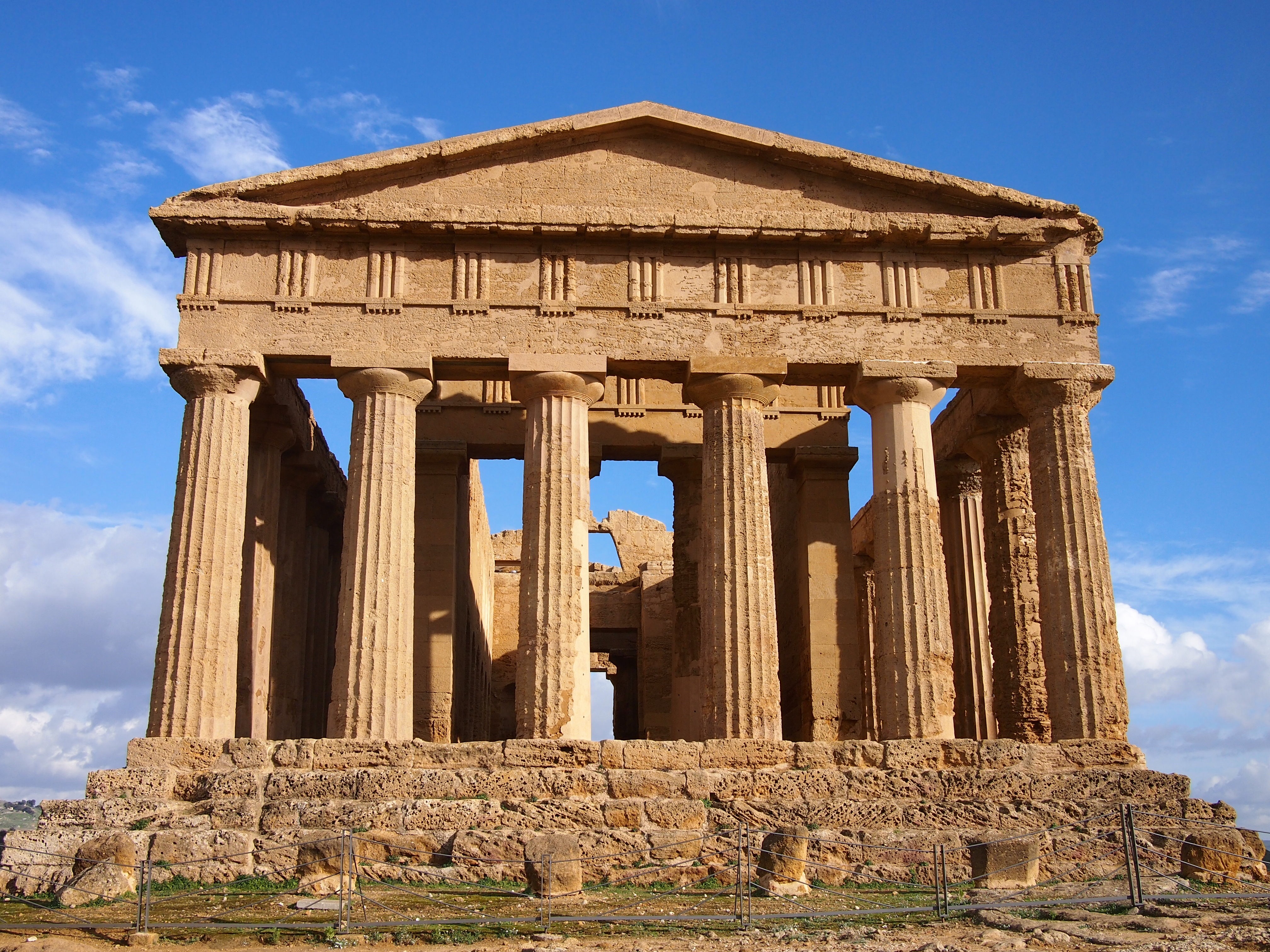
Temple of Concord from the front

Walking further east we passed the remains of tombs cut from the rock, another legacy from the site’s Christian heritage. At the extremity of the ridge is the Temple of Juno.

Temple of JunoTemple of Juno

We’re really glad that we went to Agrigento to see the Valley of the Temples and enjoyed the town itself too. Its historic centre is on a steep hillside with narrow twisting streets and a church at every turn. The cathedral has a spectacular 16th century wooden ceiling which we sadly couldn’t get a very good look at as the nave is surrounded with scaffolding and they’re trying to raise funds to complete the restoration. It’s just as well that we liked the town as we were stranded there for a couple of days over the New Year because of unseasonal snowfalls! Both buses and trains were prevented from crossing the hills to Palermo on the north coast of the island. We were trying to stay in southern Europe to escape the worst of the winter weather but maybe we’re just in the wrong hemisphere…

Gozo Highlights

As well as doing a Segway tour on Gozo, we explored some of the island by bicycle and then had to return for a third day, this time travelling by bus, as we weren’t able to cover as much ground as we’d hoped by bike, hindered both by the exceptionally hilly terrain and the shockingly poor condition of the gears on our rental bicycles.

Approaching Gozo by ferryThe small island of Gozo is a 25 minute ferry ride north of Malta

Cliffs and countryside

We spent much of our cycling day around the southern coast exploring the beautiful coastline and riding down narrow lanes between fields separated by dry stone walls. Most of the fields seemed to be grassy but I don’t remember seeing any livestock, although sheep would be the most logical inhabitants based on the terrain. We did spot a vineyard though and a few fields of vegetables.

Ta' Seguna cliffsThe beautiful Ta’ Seguna cliffs on the southern coast of Gozo

We had a map of the island which showed a roughly coastal route and gave approximate times to either walk, run or cycle four separate sections. We encountered our first problem when approaching the section just to the west of the ferry port – it was a footpath. Hmm, I guess we have to detour by road then… Unfortunately the map only had the major roads marked so we had to rely on the GPS maps on Andrew’s camera to find our way. The second problem was that the suggested times would probably only apply if you were riding a decent bike on a flat, smooth road, taking no account of interest in surroundings or requirement to get off and walk up hills.

Cycling around GozoClockwise from top left: Andrew walking a steep uphill section; Terraced fields in southern Gozo; Surf on the beach at Xlendi; the Maltese Wall Lizard has four subspecies endemic to the islands

Cittadella

Gozo’s capital city, Victoria, contains a walled town known as Cittadella, similar to Mdina in Malta but even smaller. Disappointingly for us, it’s currently undergoing extensive renovation works which mean you can’t fully explore the inner streets and walls, although from the areas where you can get onto the walls there are good views to all sides of the island.

Victoria, GozoThe Cittadella towers over the centre of Gozo. Currently it looks better from a distance from where you can’t see all the scaffolding and piles of building materials.

Cannon on the city wallsCannon on the Cittadella walls

Rabbit stew

We spent one night on Gozo and that evening, feeling a little saddlesore from a day’s biking, we went out for dinner determined to try the rabbit stew which the Maltese islands are famous for. We weren’t disappointed, with rich gravy and meat so tender it was falling off the bone it definitely lived up to the hype.

Maltese rabbit stewDelicious rabbit stew at Pulena in Marsalforn

Ggantija Temples

Similarly to the temples at Hagar Qim and Mnajdra, the Ggantija temples were built by the Maltese Temple Culture around 3600BC. They are the oldest known manmade stone structures on the planet predating Stonehenge by at least 500 years and the Egyptian pyramids by 1000 years.

Ggantija templesThe Ggantija Temples are situated on a hilltop commanding magnificent views over the south-east of the island

Prior to their excavation in the 1820s, local people believed that the ruins which lay under the earth mound were the remains of a tower built by an ancient race of giants, hence the name which comes from the Maltese word for giant. The complex consists of two temples side by side inside an outer wall and, like the other temples we’ve visited, there are some huge stones used in the construction. Having struggled to move our own weight up some of the surrounding hills, the mind boggles at how the prehistoric builders moved everything into place.

Ggantija TempleAltar arrangement in the South Temple

Us at Ggantija TemplesUs inside the inner room of the North Temple

Dwejra Bay

We were aiming to arrive at Dwejra Bay on our cycling day but, although we were within sight of the sea, we got lost amongst the narrow unsignposted back roads and eventually had to give up so that we wouldn’t be riding in the dark. When we finally arrived by bus, we ate our picnic lunch on the rocky beach overlooking the choppy sea around the Azure Window, a natural rock arch which protrudes from the cliff side.

Azure WindowThe Azure Window is a natural rock arch

We were hypnotised by the waves crashing on the rocks below us and had to drag ourselves away to climb up the hill to visit Dwejra Tower. Here we watched a short video explaining the history and ecology of the area as well as getting some terrific views along the coast from the roof. The watchtower was built during the reign of Grand Master Lascaris in 1651, principally to safeguard ‘Fungus Rock’ a small islet in the bay which is home to a plant that was believed by the Knights of St John to have medicinal properties. It was interesting to finally have a look inside one of these coastal defence towers as we have seen a lot of them on our travels around the islands. It was surprisingly small inside due to the thickness of the walls and had only one room on each level.

Dwejra TowerDwejra Tower flying the flag of the Order of St John. When the flag is raised the tower is open for visits.

Dwejra BayDwejra Bay was formed when the roof of a huge cave collapsed. Fungus Rock is the remnants of the wall which separated it from the sea

On the other side of the cliff which forms one side of the Azure Window is a different kind of geological phenomenon. A doline called the Inland Sea which, like the almost circular Dwejra Bay, was formed by the collapse of a cave roof millions of years ago. Nowadays it is a popular spot for sunbathing and swimming as well as the jumping off point for boat trips through the tunnel connecting it to the open sea, though in early December with a chill in the air and rough waters assaulting the cliffs none of those activities was in evidence.

Azure Window and Inland SeaThe Azure Window and Inland Sea (centre right) from the top of Dwejra Tower

We’re really glad we didn’t miss out on a visit to Dwejra Bay, it was a beautiful end to our explorations and different to anything we’d seen on Malta itself.

Megalithic Malta: A walk along Dingli Cliffs to prehistoric temples

Sitting in the Mediterranean Sea closer to Sicily in the North than Libya and Tunisia to the south, Malta has had a surprisingly long and eventful history for such a tiny landmass of only 315km2 (112 square miles).

Despite its small size, or perhaps because of it, Malta is the 3rd most densely populated country or sovereign state in Europe (after Monaco and Gibraltar) and 8th most in the world – though it magically maintains a desolate, isolated feel as we found out on our first stroll along a section of its south-western coastline.

The walk: Dingli, Fawwara, and Wied iż-Żurrieq

Map of the Dingli Cliffs walk. Source: Malta Tourism Authority

The map of the Dingli Cliffs walk. The Malta Tourism Authority helpfully provide paper versions in all of the Tourist Information offices (including the airport), and online in PDF format too. Source: Malta Tourism Authority

Looking at the map we thought we were in for a long stroll, until we remembered that the entire coastline of Malta is only 196.8km (122 miles) which means this walk is an easy 11.2km, or about 7 miles.

Looking back towards the start of the walk at Dingli Cliffs. Not bad for a day in November

Looking back towards the start of the walk at Dingli Cliffs. Not bad for a day in November

Just past a couple of radar stations at the highest point of the island, we arrived at St Mary Magdalene Church, an isolated, simple place of worship teetering on the cliff edge.

St Mary Magdalene Church on the edge of Dingli Cliffs

Tranquil reflection at St Mary Magdalene Church on the edge of Dingli Cliffs

Described as 'Cart Ruts', these man-made grooves in the garigue weren't actually created by carts - the truth is we just don't know how or why they were made!

Described as ‘Cart Ruts’, these man-made grooves in the garigue weren’t actually created by carts – the truth is no-one knows how or why they were made!

From the roadside path it looked like a sheer drop into the Mediterranean from the rocky edge, but when we ventured closer we found that while there was a drop that would probably sting a little bit, there’s a second terraced plateau with yet another sizeable drop-off before the sea. Most of this was given over to agriculture, with the odd house or church between the fields.

Looking south over the cultivated fields of Fawwara from a Bronze Age village site that juts out almost to the sea

Looking south over the cultivated fields of Fawwara from a Bronze Age village site that juts out almost to the sea

According to the map, there’s an old Bronze Age village site at Fawwara but all that we could discern from the remains was its natural vantage point that extends out from the cliffs almost to the sea, commanding amazing views up and down the coastline.

From here we descended to the lower plateau and continued south to within a kilometre or two of the end where we stopped at Ħaġar Qim and Mnajdra – 2 prehistoric temple sites and outdoor museum..

Megalithic Malta: The temples of Ħaġar Qim and Mnajdra

Us at the entrance to Hagar Qim, the 5,000 year-old monolithic temples. I'm listening to the audioguide which poses more questions about the site and its purpose than it answers

Us at the entrance to Ħaġar Qim, the 5,000 year-old megalithic temples. I’m listening to the audioguide which poses more questions about the site and its purpose than it answers

Before we explored the remains of the temples, we wandered through the small but excellent museum, which, given how little is known about the origins of these temples and the peoples that built them, is mostly given over to how we think they were built, how they were rediscovered, and how they’re being preserved.

Here’s a short excerpt from the museum’s guide:

“The prehistoric site of Ħaġar Qim consists of a group of monumental megalithic buildings. These were built during the late Neolithic, around 5,000 years ago. Similar buildings have been found in more than twenty different places in Malta and Gozo. Today these buildings are usually called “temples”. However we know very little about what went on inside them.” – Ħaġar Qim Temples, a brief guide, Heritage Malta

Inside the museum. The 2 models  show how the temples are aligned with the equinoxes and solstices

Inside the museum. The 2 models show how the temples are aligned with the equinoxes and solstices

The museum includes a 10 minute “4D” introduction video experience – the 4th dimension being blasts of cold air and scented water droplets – alongside the 3D visuals that imagine the construction through to the present day ruins. It was well done and the visuals were good as they show the temples against the landscape, which isn’t possible to see anymore because there’s now a giant protective tent over each temple shielding the stone from the elements.

Some of the stones used in the construction are simply massive, and reminded us of Stone Henge back home

Some of the stones used in the construction are simply massive, and reminded us of Stonehenge back in England

Ħaġar Qim is the first of two temple sites and is the more impressive for its relative completeness – it’s more compact and the walls are still standing tall. We enjoyed wandering through the ruins, though some sections are roped off we were still surprised how accessible they were. The audioguide was only €2 more and is good for pointing out the most interesting aspects of the construction, but almost every clip ends with a “what do you think this was for?” or “why do you think this is here?” which left us with more questions than answers!

Details of Hagar Qim: relief sculptures found during excavations include altar pieces and decorative stone carvings; One of the many altars of the temple but the only one open to the outside

Details of Ħaġar Qim: relief sculptures found during excavations include altar pieces and decorative stone carvings; One of the many altars of the temple but the only one open to the outside

500 metres down the hillside and closer to the cliffs is the 2nd megalithic temple site of Mnajdra, a much larger set of ruins and in a worse state of repair than Ħaġar Qim.

The approach to the Mnajdra Temples, these too are protected from the rain and the sun by a giant tent

The approach to the Mnajdra Temples, these too are protected from the rain and the sun by a giant tent

Mnajdra is actually a complex of 3 buildings..

“The first and oldest structure is the small three-apsed temple (on the right), built in the Ġgantija Phase, around 3,600-3,200BC. The South Temple (on the left), with its concave facade was next to be completed early in the Tarxien Phase, shortly after 3,000BC, followed by the Central Temple which was built on an artificial platform between the two earlier buildings.

The South Temple at Mnajdra was built in such a way that its main doorway is aligned with sunrise during the spring and autumn equinoxes (30th March and 22nd September). During the winter and summer solstices (21st June and 21st December) the beams of the rising sun pass along the sides of the main doorway hitting two decorated slabs within the first chamber.” – Mnajdra Temples, a brief guide, Heritage Malta

Inside the first chamber of Mnajdra's South Temple - during the equinoxes and solstices the sunrise hits the blocks either side of this doorway, again reminding us of Stonehenge. Wow!

Inside the first chamber of Mnajdra’s South Temple – during the equinoxes and solstices the sunrise hits the blocks either side of this doorway, again reminding us of Stonehenge. Wow!

The beautiful pitted decoration of another doorway in the South Temple

The beautiful pitted decoration of another doorway in the South Temple

We liked the different levels and scale of these three very different temples which at first glance just looked like one giant building. The middle temple has the most dramatic example of erosion we’ve seen – the north side of the room shows some damage but the south side is almost completely eroded. I’d have thought they’d have been equally damaged because they’d have received equal rainfall, but the museum explained that it’s the sun that does the most damage!

The north facing wall (left) of the Central Temple is in relatively good condition, but the lower south facing stones (right) of the same room have almost completely eroded. Most surprisingly for me was that the heat of the midday sun has done the most damage

The north facing wall (left) of the Central Temple is in relatively good condition, but the lower south facing stones (right) of the same room have almost completely eroded. Most surprisingly for me was that the heat of the midday sun has done the most damage

From the museum there was a final downhill stretch to the tiny fishing village of Wied iż-Żurrieq (which we have no idea how to pronounce!), where we watched the sun set while we waited for our bus back to the other side of the island.

The sun sets on our first day of strolling through the countryside and history of the tiny island of Malta

The sun sets on our first day of strolling through the countryside and history of the tiny island of Malta

We really enjoyed the feeling of remoteness; to walk so closely to the cliff edge with the deep blue Mediterranean stretching out to the horizon on one side, and a view across the island to the Mediterranean on the other, made Malta feel really small. It’s a very easy walk too, it starts near the highest point of the island which means it’s pretty much all downhill!

Daegu, South Korea

We’ve been using Airbnb to find accommodation on and off throughout the trip and it’s been especially useful for finding apartment rentals for a few weeks as it’s really nice to have a kitchen and a bit more space than the average hotel room. Another option is to rent someone’s spare room, which at its best is basically living with locals in a local neighbourhood. This is what we opted for in Daegu and we felt like we’d struck gold staying with lovely Gabby and Andrew. On our final evening we all had takeaway fried chicken and beers sitting in their living room watching Korean soap operas – it doesn’t get much more homely than that!

Gatbawi hike

July is the rainy season in Korea and we’ve sometimes had to juggle our plans a liitle to better suit the weather. On our first day in Daegu, the forecast was for a cloudy day but with no rain so we set out on the hour long bus ride north from Daegu to the Palgongsan Provincial Park and the fairly short but steep hike to Gatbawi shrine. The mountains were shrouded in clouds when we arrived and rain seemed inevitable but we’d come too far to turn back now and anyway I had an umbrella and Andrew had his hat, we’d be fine…

20140727-224318-81798526.jpgVery cloudy path up through the forest

Halfway up the hill there was a heavy shower which we were able to shelter from in a rest pavillion before continuing upwards through the damp air and dripping trees. The stairs were unrelenting with no flat sections at all but it wasn’t far really and we soon arrived at the shrine. The Buddha statue is carved from a single piece of stone and its official name is ‘Stone Seated Medicine Buddha’, but he is popularly called ‘Gatbawi’ which means ’Buddha of the Stone Gat’ (the traditional wide brimmed Korean hat) referring to his very obvious headgear.

20140727-224829-82109843.jpgLady praying next to Gatbawi Buddha

20140727-225114-82274061.jpgThe area around the statue is set up for the devout rather than for tourists with piped monk chants coming from speakers and stacks of mats which Koreans use when bowing, a kind of meditative humbling process to bring them closer to the Buddha Nature

The view might have been fabulous but all we could see was cloud and then it started to rain again. This time it was more than just a shower and the tarpaulin over the bowing area wasn’t really keeping the wet out anyway so we decided to head back down the hill. The Lonely Planet said there were two routes between the bus stop and the shrine, we opted for the non-step route for our return. It wasn’t any easier going, if anything it was harder as the path was sometimes rocky and slippy in the wet which required more care than the reasonably regular steps.

20140727-225222-82342665.jpgAndrew on the downward trail

Eventually we reached a crossroads with signs pointing off to different temples in each direction. The name of the one off to the left rang a bell, but that made no sense at all so by mutual agreement we set off on the path heading down the mountain. Of course, what we should have done was consult the photo of the trail that we took at the bottom of the hill and match up the Korean symbols with the sign, but it was raining, we were wet and trying to juggle camera and umbrella without getting more wet was too difficult so we just set off plodding downhill.

20140728-171431-62071187.jpgHollyhock in the rain

After a while we rounded a corner to arrive at a car park and (closed) information point. It was clear that we were in entirely the wrong place and to make matters worse, the trails marked on the map in the car park, the photo we’d taken of the map at the bus stop and our memory of the crossroads didn’t tally up at all. We ate our lunch on a wet seat before trudging back up the hill to the last temple we’d passed to see if we could work out how to cross the ridge. Fortunately the rain had more or less stopped and it didn’t take long to arrive at the seemingly deserted Yongjuam temple.

Lots of BuddhasDozens of Buddha statues at the entrance to Yongjuam Temple

After admiring the bell and ruing the lack of view due to the still massed clouds we thought to pass by the main hall in search of a trail down the other side; cue very loud barking dogs who obviously were not keen on letting us past. At last a groundskeeper appeared, shouted at the dogs and pointed out the trail to Gwanamsa temple from where we could pick up the original path down to the bus stop.

20140728-172133-62493607.jpgWe were very glad to spot Gwanamsa temple at last!

The supposed two hour round trip hike took us more than four hours, it’s a good thing we didn’t need to be anywhere else that afternoon!

Daegu markets

On our final day, we spent the morning chilling in a traditional Korean bathhouse before meeting Gabby for lunch at Seomun Market. She took us to “the best” food stall to sample tteokbokki, noodles and pancakes. After the delicious lunch we wandered through some of the stalls. Saturday afternoon is probably the busiest time of the week and it was packed. I was surprised that many of the clothes shops had an almost boutique look to them, much more upmarket than the clothes usually for sale in markets in England.

imageCooking up tteokbokki, rice cakes in spicy sauce, in Seomun Market

Daegu is well known in Korea for its traditional medicine market. This dates back to the 17th century when the king decreed that a medicine market should be set up there. It wasn’t quite what we expected. I thought it would be a big covered hall with shops and stalls (like a regular market) but it’s actually a couple of streets in the city centre which are lined with shops selling herbs and offering traditional medical services such as acupuncture.

20140725-212812-77292131.jpgA look through one of the shop’s doorways. The large glass jars contain ginseng, a vital ingredient in many Korean herbal remedies.

20140725-212834-77314442.jpgMost of the shops had piles of what to our untrained eyes looked like bundles of twigs

Yangneongsi Oriental Medicine Museum is just off the market’s main street. It is nicely set up but has essentially no English signage so the friendly lady on reception gave us a tour in broken English. It begins with a few dioramas showing the history of the area, followed by an overview of the different plants (and animals) used in the remedies, and some scary looking acupuncture needles. On the lower floor was an interactive space where quiz machines would work out which of the four body types you are, and we learnt how to make remedies, as well as being able to try a small cup of herbal medicine tea (quite tasty!) and try on a traditional hanbok.

20140725-214221-78141276.jpgYangneongsi Oriental Medicine Museum (clockwise from top left): reconstruction of an old style traditional doctor’s consulting room; medicinal herbs; learning to make herbal medicine in the interactive area; herbal tea dispenser

imageUs in traditional Korean hanbok. It’s unclear what link this has to traditional medicine but it was a fun activity. The hat Andrew is wearing is the ‘gat’ which the Gatbawi Buddha is named after.

Gyeongju, South Korea

Gyeongju was once the capital of the long-lasting Silla dynasty which started in 57 BC, ran for almost a thousand years, and grew to rule most of the Korean peninsula. Often described as a ‘museum without walls’ the area in and around the main city has more palace ruins, burial mounds, rock carvings and Buddha statues than anywhere else in South Korea. With so much to see, it was tough to decide where to spend our time..

The Gyeongju “Tumuli” (Burial Mounds)

Tumuli or Burial mounds in Gyeongju

Tumuli or burial mounds in Gyeongju. These ones are in the Daereungwon Tomb Complex which has a small entrance fee, but there are so many more that are in open parkland

The tumuli, or burial mounds, were a lot bigger than we thought they’d be, and the many open parks to the south of the city are full of them. Their size denotes the importance of the person buried inside, and while some have been looted or excavated over the years, a lot of them have been left untouched.

In the Daereungwon Tomb Complex, the highlight is the Cheonmachong tumulus – half of the mound has been hollowed out so you can see the construction from the inside. In this tomb, believed to be that of an unknown Silla King, the body was laid east-to-west, surrounded by a large, thick wooden coffin, which was covered in rocks, then covered in earth to form the mound. Replicas of the items buried with the King are on display, including a piece of his saddle that depicts a flying horse which gives the tumulus its name.

Cheonmachong tumulus is so-named because of a painted saddle found inside that depicts a flying horse

Cheonmachong tomb is so-named because of a painted saddle found inside that depicts a flying horse

Just next to the tumuli is the Cheomseongdae Observatory. Built around 632~647, it is the oldest astronomical observatory in East Asia. It has 12 main stones forming the base – 1 for each month, 30 layers – one for each day of the month, and is constructed of 366 stones – one for each day of the year (OK, they’re one or two off!). Unlike the tumuli, we were expecting the tower to be a lot bigger than its description belies!

Us at the Cheomseongdae Observatory

Us at the Cheomseongdae Observatory

Still surrounded by tumuli (yes, there are a lot of them!), are several lotus ponds. We were just a little late to catch them at their best, but we were just in time to see the tadpoles turning into itty-bitty frogs!

Frogs and lotus flowers

Frogs and lotus flowers

Bulguksa Temple and Seokguram

Us at the Bulguksa temple

Us at the Bulguksa temple

Bulguksa temple is on the UNESCO World Heritage list and if that isn’t reason enough to visit, it’s also listed as a national Historic and Scenic Site and home to a number of designated national treasures as well as being the head temple of the 11th district of the Jogye Order of Korean Buddhism!

We arrived by bus and made our way up the steep winding pathway and through the lovely landscaped pond area to be greeted by the two magnificent stone staircases that lead up to the temple. In the main courtyard are Dabotap and Seokgatap – a pair of stone pagodas that are national treasures, one of which features on the ₩10 coin.

One of a pair of UNESCO recognised stone pagodas in the Gulguksa temple courtyard

Dabotap stone pagoda in the main Bulguksa temple courtyard

Dabotap features on the ₩10 coin (Photo source: <a href="http://www.koreanclicks.com/do-you-know/dabotap-%EB%8B%A4%EB%B3%B4%ED%83%91-drawing-on-koreas-10-won-coin">KoreanClicks</a>)

Dabotap features on the ₩10 coin (Photo source: KoreanClicks)

Bulguksa temple is beautiful. We especially loved the brightly painted eaves and the separate courtyards that had their own distinctive styles – particularly Nahanjeon which was surrounded by little piles of stones, and the surprise of a finding a bronze pig in front of Geuknakjeon!

Some of our favourite things at the Bulguksa Temple: beautifully carved and decorated eaves; Julie playing with the bronze pig; South Korean cairns, which are said to bring good luck, surround Nahanjeon

Some of our favourite things at the Bulguksa Temple: beautifully carved and decorated eaves; Julie playing with the bronze pig; South Korean cairns, which are said to bring good luck, surround Nahanjeon

From Bulguksa, we made the short hike through the forest to the Seokguram Grotto..

Hike from Bulguksa to Seokguram Grotto

Hike from Bulguksa to Seokguram Grotto

The Seokguram Grotto was completed in 772 and is home to a large stone sculpture of the Seokgamoni Buddha, the historic Buddha at the moment of enlightenment, which is regarded as one of the best examples in the world.

Seokguram grotto. Repair work was being carried out (very noisily I might add) but we could still get in to see it

Seokguram Grotto. Repair work was being carried out (very noisily I might add) but we could still get in to see it

Seokgamoni Buddha statue inside the Seokguram Grotto (Photo source: <a href="http://commons.wikimedia.org/wiki/File:Seokguram_Buddha.JPG#mediaviewer/File:Seokguram_Buddha.JPG" title=""Seokguram Buddha" by Richardfabi - Wikipedia">Wikipedia</a>)

Seokgamoni Buddha statue inside the Seokguram Grotto (Photo source: Wikipedia)

Brightly coloured lanterns outside Seokguram grotto

Brightly coloured lanterns outside Seokguram Grotto, where we paused for ice cream :o)

Golgulsa Temple, home of the Sunmudo Martial Art

Golgulsa Temple with a carved Tathagata Buddha under the canopy in the background

Golgulsa Temple with a carved Tathagata Buddha under the canopy in the background

The Golgulsa temple is the home of Sunmudo, a Korean martial art practiced by Buddhist monks initially as a method of dynamic meditation, and later revived to help repel invasions from the Japanese.

Set in a valley up the the side of Mt. Hamwol, the road through the grounds gets progressively steeper, and culminates in a hillside temple with an outside training area and display platform where demonstrations take place. As we had some time, we climbed up to see the Buddha carvings, and watched a chanting monk in Korea’s only cave temple.

Sunmudo martial arts demonstration

Sunmudo martial arts demonstration

Every day at 11am and 3:30pm (except Mondays), students of the temple give a short demonstration of their skills and flexibility, which was very impressive indeed! The head monk’s routine looked more like Ashtanga yoga to our eyes, and in his Korean speech afterward we heard him say ‘yoga’ a few times. It made us want to take up our practice again..

Sunmudo martial arts demonstration

Sunmudo martial arts demonstration

Namsan Mountain Range Hike – the museum without walls

While the whole of Gyeongju befits its description of a ‘museum without walls’, we agree with Jim Cheney’s sentiment that nowhere in Gyeongju is this truer than the Namsan mountain range.

The range itself is 8km by 12km and contains various artefacts thought to date from the Silla period. We chose a simple yet steep climb up the Samneung Valley to the top of Mt Geumobong (468m high), and down the Yongjanggol valley on the same side of the Namsan range.

The start of the path in Samneung Valley. Just around the corner it got very steep, very quickly!

The start of the path in Samneung Valley. Just around the corner it got very steep, very quickly!

I don’t think it would have mattered which path we chose, it seemed like every few steps there was a signpost directing us left or right a few metres to some carving, statue or other point of interest. Not only was it great to see so many works of art in such close proximity (and without barriers or ropes), but it helped break up the hike so it didn’t feel so strenuous!

Stone seated Buddha in Samneung Valley

Stone seated Buddha in Samneung Valley

The popular 7-metre tall Maitreya Buddha carving, sadly undergoing some preservation works during our visit so we could only see it from afar

The popular 7-metre tall Maitreya Buddha carving, sadly undergoing some preservation works during our visit so we could only see it from afar

The views over Gyeongju were very nice too

The views over Gyeongju were very nice too

Our favourite of the artefacts we saw on Mt Namsan -  the three-storey stone pagoda at the top of the Yongjanggol Valley

Our favourite of the artefacts we saw on Mt Namsan – the three-storey stone pagoda at the top of the Yongjanggol Valley

We were only in Gyeongju for a few days and we packed quite a bit of sightseeing in. We’re glad we did – there’s so much to see here and having a lot of it outside is a welcome change from air-conditioned museums!