Tag Archives: Church

Hebridean Way: Day 3 – Grimsay, North Uist

Distance cycled 15.5 miles / 25 km
Cumulative distance cycled 90.2 miles / 145.2 km
Islands visited (daily total) Grimsay, North Uist
Total islands visited 7 of 10
Average speed 10.2 mph / 16.4 kmph
Weather conditions Cloudy with sunny spells, no wind

After a rude awakening just before 5am when the truck started up his engines we dozed for a while. The wind had dropped overnight and a glance through the mesh windows of the tent showed an alarming number of midges gathering in our porches… We packed as much as we could inside but eventually we had to run the gauntlet and unzip the tent. Fortunately, it wasn’t too bad once we were outside and there was enough breeze that we felt safe to boil the kettle and have a spot of breakfast without being eaten alive.

Cycling the gentle roads on North Uist

Cycling the gentle roads on North Uist

The road barely touches the corner of Grimsay and we were soon across the next causeway onto North Uist, where we found a lot more water than the earlier islands with the gently rolling road across the moorland passing many small lochs. Entering the village of Carinish, I saw an information board in front of a small church. Tourist information boards had been few and far between so far, so I pulled across to see what it said. It referred to the ruins of Trinity Temple (Teampull in gaelic) which was along the track behind the chapel and across a field of grazing sheep. A medieval ecclesiastical college and monastery, we had a quick look around but it was built above swampy ground and was swarming with midges.

The remains of Trinity Temple in Carinish

The remains of Trinity Temple in Carinish

We didn’t want to take the ferry to Harris until tomorrow which meant we either had a short day and a stay at the campsite at Balranald in the island’s north-west corner or carry on a bit further and look for another wild camping spot. Tired from yesterday’s ride and fancying a shower we opted for the former. An early finish to the day’s cycling meant that we had time to wander the circular path around the neighbouring RSPB reserve. Mainly consisting of machair, a wildflower filled coastal grassy plain, it is an important habitat for ground nesting wading birds as well as the endangered corncrake. The charity also works with local crofters to preserve traditional farming techniques which protect the nests.

 The path through the machair at Balranald Nature reserve

The path through the machair at Balranald Nature reserve

On the way to the campsite we had stopped in the very tempting factory shop of the Hebridean Smokehouse so our dinner of pasta pesto was made much more luxurious with a side of smoked scallops, afterwards we retired to the tent to sample a couple of miniatures of the local Downpour gin.

Hebridean Way: Day 2 – South Uist, Benbecula, Grimsay causeway

Distance cycled 42.2 miles / 67.9 km
Cumulative distance cycled 74.7 miles / 120.3 km
Islands visited (daily total) South Uist, Benbecula, Grimsay
Total islands visited 6 of 10
Average speed 9.4 mph / 15.1 kmph
Weather conditions Partly cloudy, headwind

Weather being much the same as the day before made for an easy and very enjoyable start to our second day and by the end of the day we’re over half-way through the islands! Julie had found an architectural trail of the Outer Hebrides and along the route on South Uist is the little ‘brutalist’ church Our Lady of Sorrows. I’m a big fan of the brutalist architectural style which explains why I enjoyed Russia so much!

Our Lady of Sorrows church on South Uist, Outer Hebrides

The ‘brutalist’ church Our Lady of Sorrows on South Uist, Outer Hebrides

We continued along the western coastline of South Uist and after stopping at a tiny cemetery containing Commonwealth war graves, we completely failed to find the Cladh Hallan Roundhouses, even though we’d seen a photo, found a signboard, and had some rough co-ordinates we still weren’t quite sure what we were looking for! When the route re-joined the main road we stopped at a Co-op for provisions and received a wild-camping spot recommendation from a lone cyclist enjoying his 4 days of leave from working on the ferries that service the islands.

Then disaster strikes – Julie’s pannier rack breaks after one too many cattle grids. We’ve a full toolkit so after a spot of lunch we bust out the cable-ties and patch it up as best we can until we reach the house of one of 3 bicycle repair places listed on our map – armed with only a phone-number we find out he’s only 3 miles away! When we arrive he nods approval at our bodge, but he only has front salvaged pannier racks. “Stornoway’s your only bet for a new one”, he says and adds a washer to hold it together while we make friends with his 2 sheepdogs, then he checks we have spare cable-ties (we do) and won’t take any payment whatsoever “because I can’t guarantee it’ll hold”.

Cable-tied rear bike pannier

Our improvised roadside repair – fortunately the break left an ‘n’ shape sitting over the bolt so the cable-ties just had to stop it jumping out. Spoiler alert.. the addition of a washer and some careful riding makes it all the way home to Newcastle!

The final section on South Uist is on the main fast road through the centre of the island and while it wasn’t busy and we found the traffic very courteous to laden cyclists, we were pulling in often to let cars, trucks and motorhomes past. It seemed like we’d no sooner get our speed up than we would need to pull over which was a little frustrating.

It’s a short causeway to Benbecula and again the route takes us along the western coast. The afternoon sun is out and we’re feeling good so we skip the proposed campsite and its luxuries and press on to our first wild camping experience!

Tent pitched by the side of a causeway

Our first wild campsite experience – the instructions were “there’s a gap in the wall along the causeway onto a little outcrop, you’ll be hidden behind the wall with lovely views and a little breeze to keep the midges down.” A delivery truck had nabbed the lay-by but we were knackered and decided to pitch up anyway!

Kutaisi, Georgia

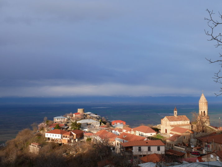
Kutaisi is the second largest city in Georgia though much smaller than the capital Tbilisi. It has a relaxed, friendly vibe and we really liked the central area with its bustling park, elaborate fountain and excellent market. There are plenty of interesting sites within day trip distance too, so in order to do them justice as well as reach a few other places in central Georgia we hired a car for our final week.

Colchis fountain, Kutaisi

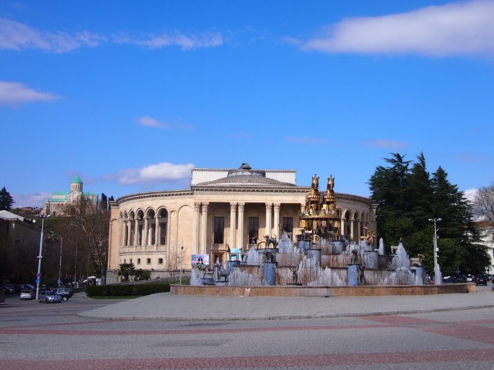
The Colchis Fountain stands in front of the Drama Theatre in the centre of Kutaisi. The Bagrati Cathedral is on the hilltop in the background

The Colchis Fountain forms a roundabout in the city centre and is decorated with large scale replicas of 2000 year old gold jewellery excavated from a tomb in nearby Vani. The Colchis civilization which was responsible for the jewellery has been linked to the Ancient Greek legends of Jason and the Argonauts and their search for the Golden Fleece. (Note to Kutaisi City Council: please make a pedestrian crossing to the fountain so that tourists can get a closer look at the sculptures without getting run over…)

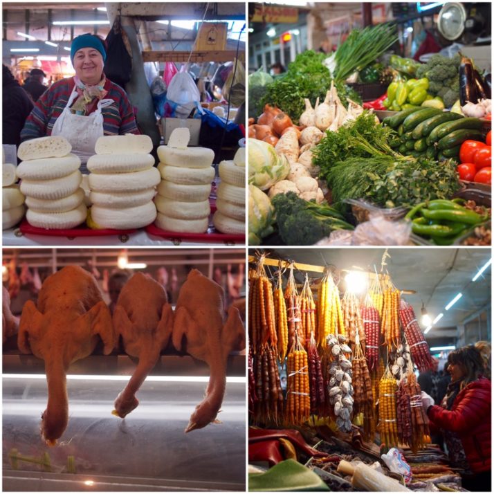
The market was just as friendly as the one we visited in Tbilisi with sellers eager to chat, offer samples and let us photograph their wares

The Georgian Parliament was moved from Tbilisi to Kutaisi by the government of Mikheil Saakashvili to decentralise power from the capital and boost economically deprived Kutaisi. The futuristic building was opened in 2012. Tours inside need to be booked in advance so we just parked up and had a look around outside.

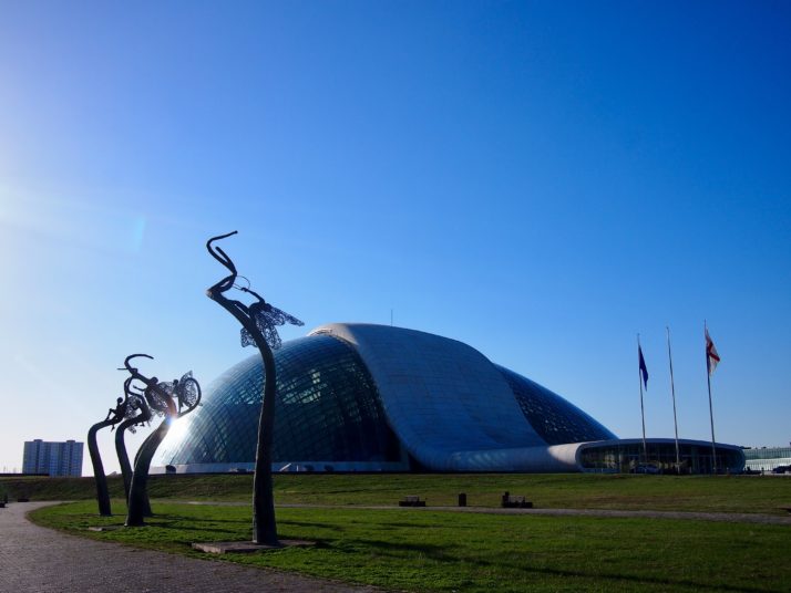
The new Georgian Parliament building in Kutaisi

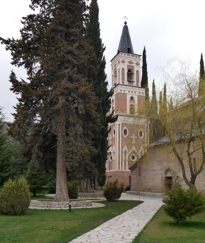
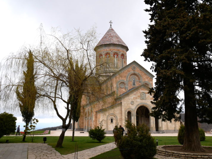
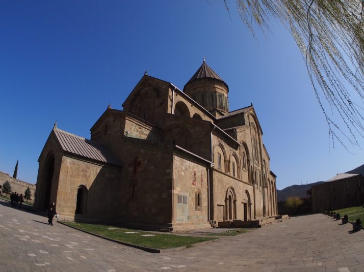
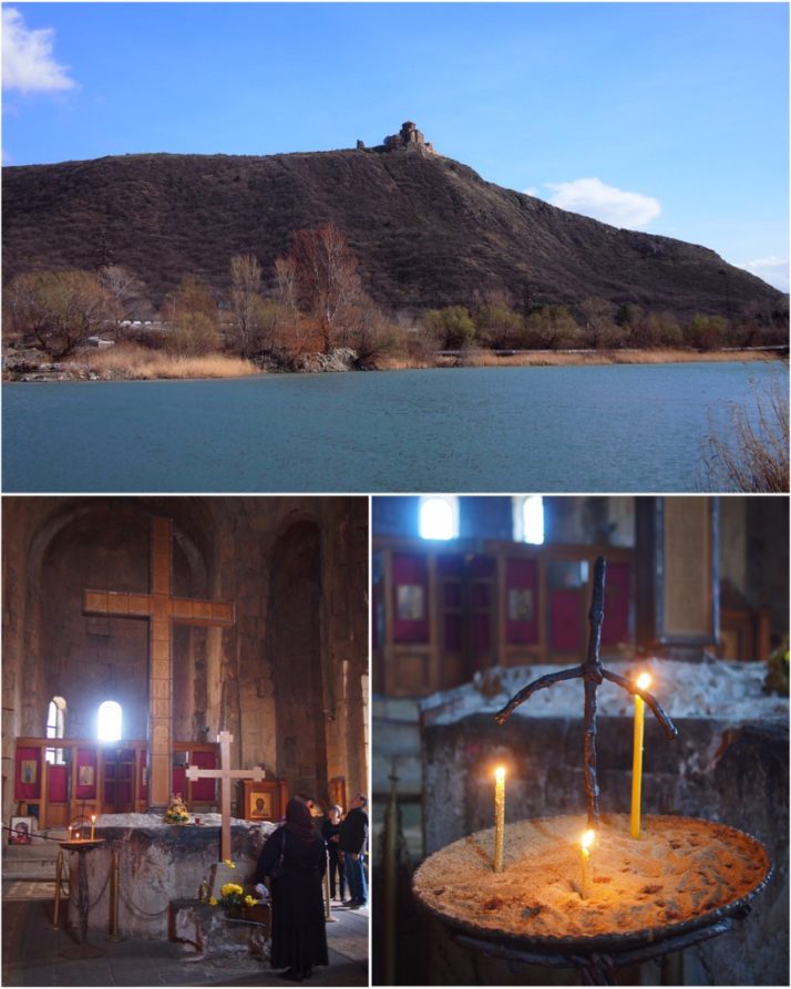
On a hill overlooking the city centre stands Bagrati Cathedral, one of two UNESCO listed sites close to Kutaisi. The pale stone walls and green roof have been pretty much completely rebuilt after lying in ruins since 1692 when it was destroyed by the Ottomans. The grounds around it and the view over the city to the Lesser Caucasus mountains are beautiful but we found it rather staid inside.

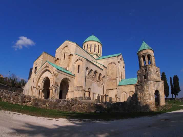
Bagrati Cathedral has been almost completely rebuilt from its ruined state

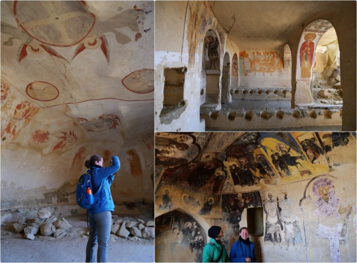
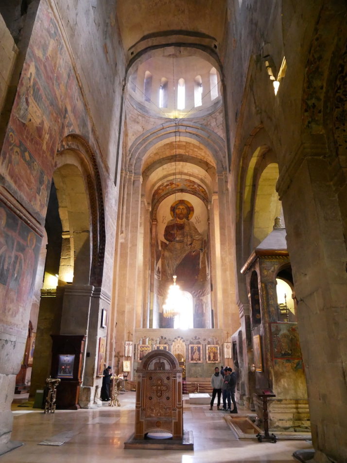
Under the same UNESCO World Heritage listing as the Bagrati Cathedral is Gelati Monastery, just a 20 minute drive into the hills to the north-east of Kutaisi. We found this much more interesting, from the old monk poking about in the engine of his equally aged car just inside the entrance to the stunning frescoed interior of the main church. The monastery was founded in 1106 by King David the Builder (guess what he was famous for!) as a centre of culture and learning and it retained that reputation until the communists arrived in the 1920s.

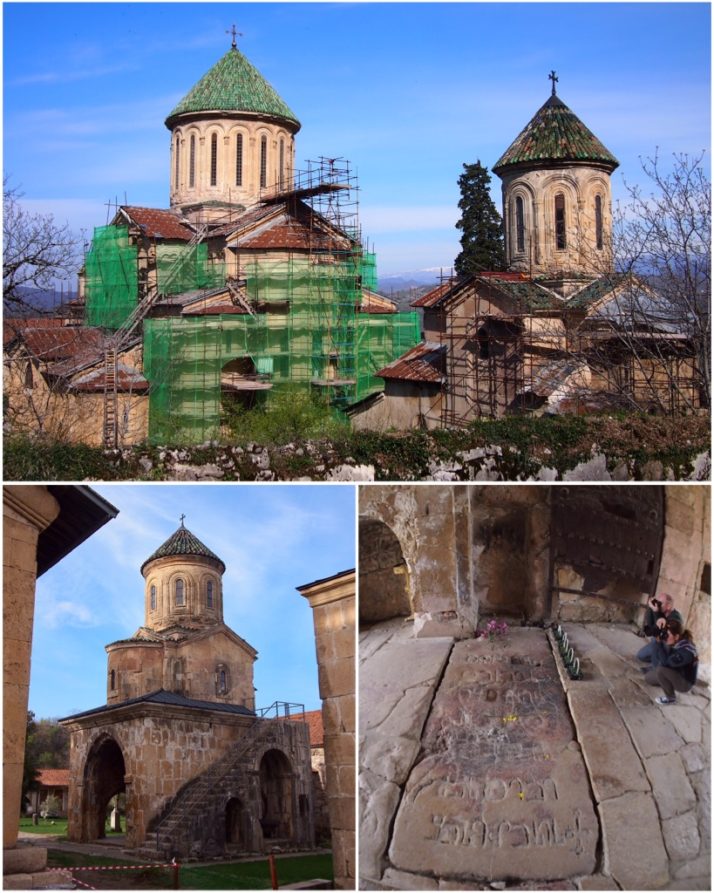
Gelati monastery (clockwise from top): restoration works were being carried out during our visit with rather natty green roof tiles being added to the buildings; Andrew and Jo taking photographs beside the grave of King David the Builder; the small Church of St Nicholas stands on an unusual arcaded base

King David the Builder wanted to be buried in one of the monastery gates so that visitors would have to step on him to enter the complex. The gate is now permanently closed for passing through and today’s visitors take care to not step on the gravestone!

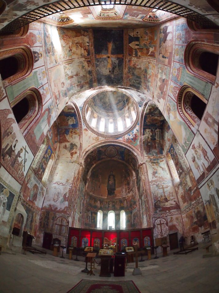
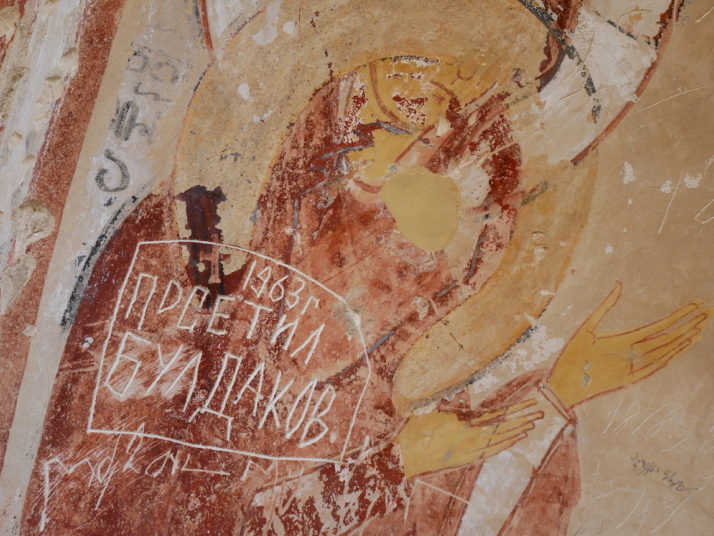
Frescoes dating from the 12th to 18th centuries cover the whole interior of the Cathedral of the Virgin at Gelati monastery

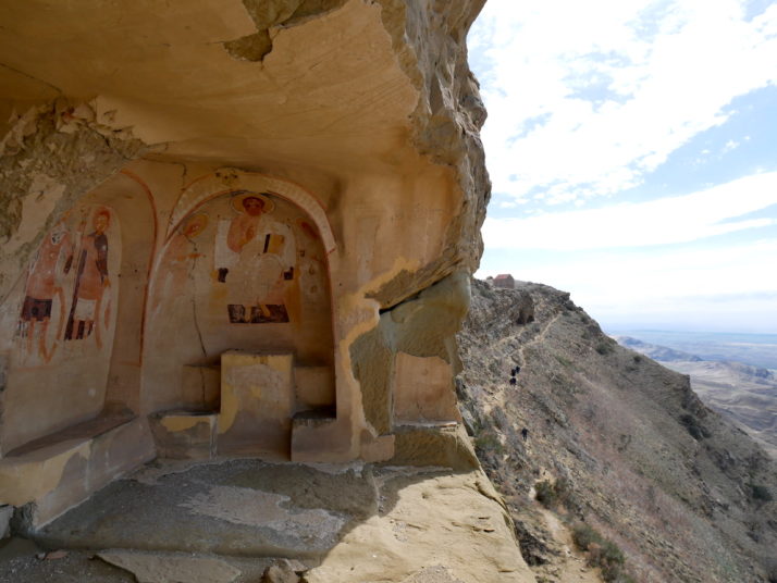
Just down the hill from Gelati is the tiny Motsameta Monastery. Even by Georgian standards its location is spectacular. The church is home to the tomb of two brothers who were killed during an 8th century massacre by the Arabs and who were miraculously carried up to the monastery site by lions. The faithful believe that their tomb grants wishes.

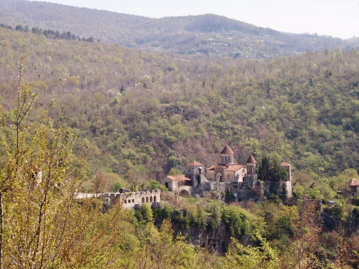
Motsameta monastery has a stunning location on the edge of a gorge above the River Tskaltsitela

As a break from the churches and monasteries we headed out to see the natural beauty of the area north of Kutaisi. Our first destination was the walkway along Okatse Canyon. Unfortunately I can’t tell you much about it as our GPS directed us onto a rough unsurfaced road which was bad enough, but by the time we reached the bridge at the bottom of the valley that it expected us to cross we decided to give it up and head on to our next stop instead.

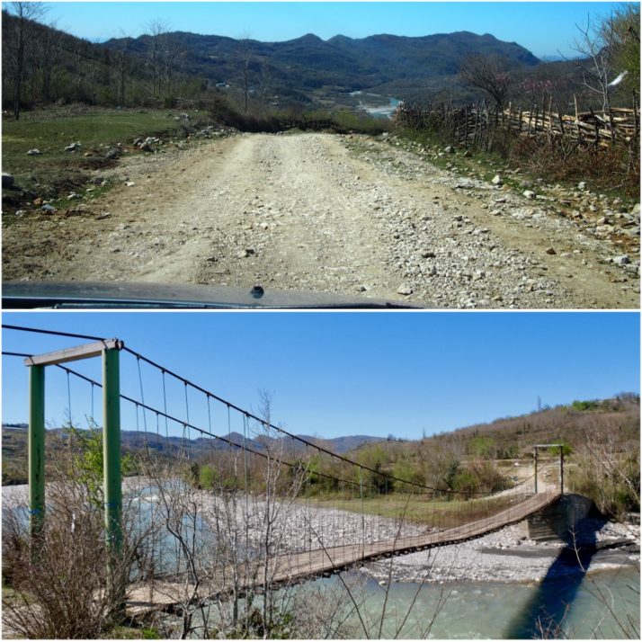
Rough road detour north of Kutaisi: (top) with hindsight we should have turned around here instead of driving for half an hour to the river where we were forced to retrace our steps rather than crossing this very rickety looking bridge (bottom)

The Prometheus Cave is 1.4km long and the concrete walkway passes through six large chambers full of impressive stalactites and stalagmites. Entry is by guided tour only and we ended up with a Russian group rather than waiting over an hour for an English-speaking one. In the end that was probably better as we didn’t feel obliged to keep up to hear what the guide was saying and just hung back taking photos! Our Lonely Planet describes the lighting in the cave as ‘discreet’, the word I would use is lurid, but I suppose it creates some interesting effects on the rock formations. I found the Vivaldi background music less offensive as it served to dampen the echoes from the large group.

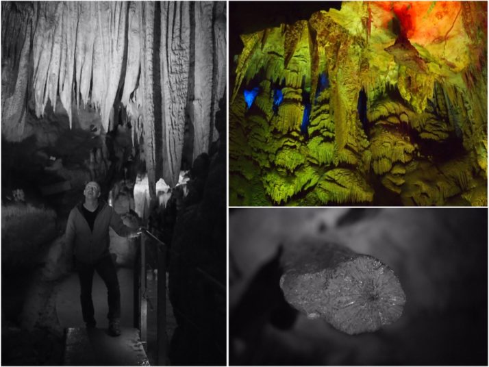
Prometheus Cave (clockwise from left): Andrew admiring some stalactites; the ‘discreet’ lighting on the rock formations; cross-section through a broken stalactite

Our final stop of the day was at the Sataplia Nature Reserve, an area of sub-tropical Colchic forest, home to birds, wildlife, and fossilised dinosaur footprints! Spring flowers were beginning to bloom on the forest floor and with the sun shining it was a very pleasant walk along the trail to the Sataplia Cave, which honestly was not particularly impressive after the Prometheus Cave.

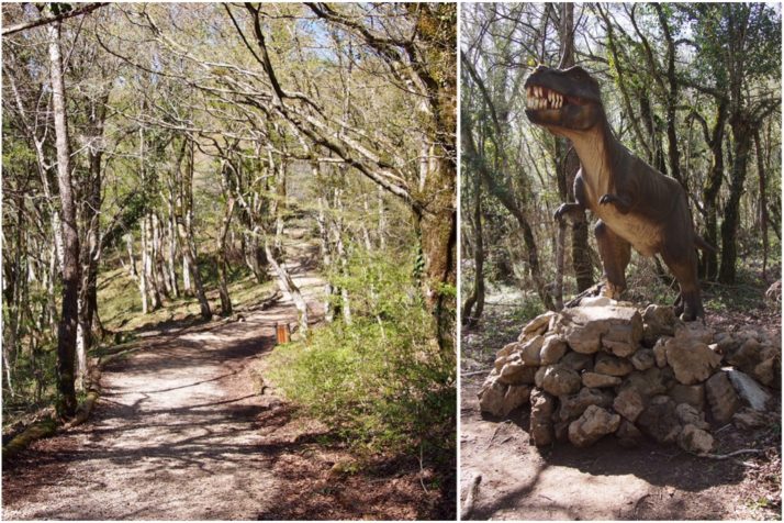
Sataplia Nature Reserve: one minute you’re walking along a woodland path…the next, dinosaurs!

The word Sataplia means ‘place of honey’ and is so called because of the tradition of collecting honey from the bees found in this area. There are a couple of great viewpoints along the trail including a glass floored walkway which reminded us of the glass path that we walked on at Zhangjiajie in China. The one here was closed when we visited but we could get close enough to see the view.

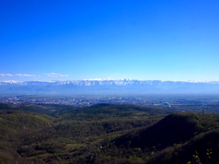
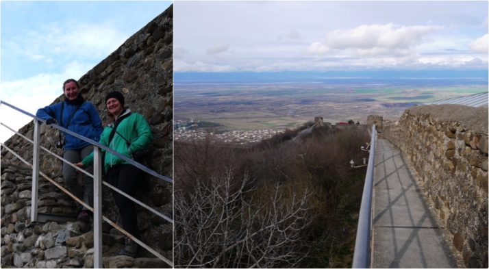
Gorgeous view over Kutaisi and the Lesser Caucasus from Sataplia

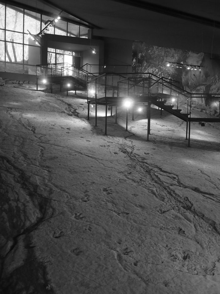
The highlight of the Sataplia trail was the well-presented pavilion containing fossilised dinosaur footprints

70km east of Kutaisi is the small mining town of Chiatura. It’s very much off the standard tourist radar but we’d read that there are several still-functioning Soviet era cable cars linking the town centre with the mines and residential areas in the hills above so we stopped off for a brief visit to frighten ourselves with the rickety contraptions.

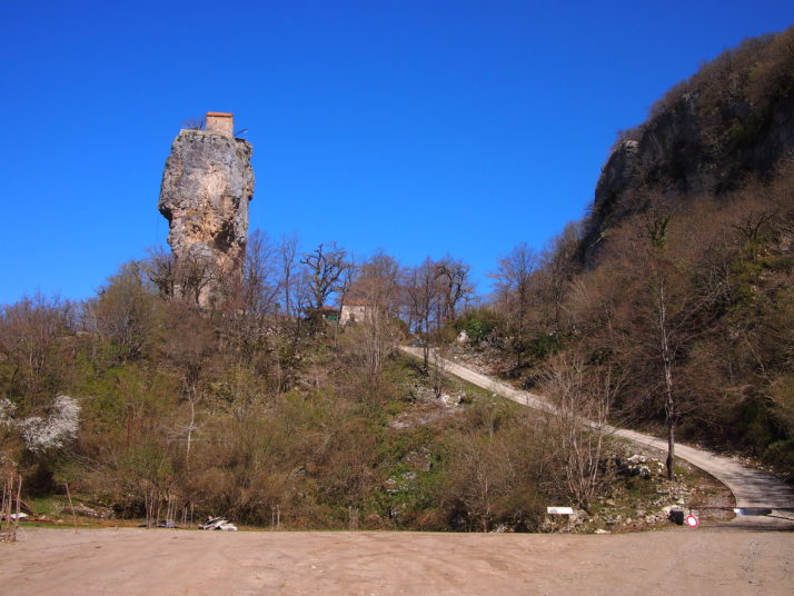
On the way to Chiatura we visited the Katskhi Pillar, a monastery atop a rocky outcrop. Apparently one monk still lives up there!

The first cable car we rode had a lady operator who was in charge of locking the door and stopping and starting the system. At the top we seemed to have reached a residential area though we didn’t venture far from the station. That car ran at 15 minute intervals and there was no charge or ticket. On the way down we were sharing with (among others) a chatty old lady who wasn’t going to let her lack of English or our lack of either Georgian or Russian stop her from finding out all about us!

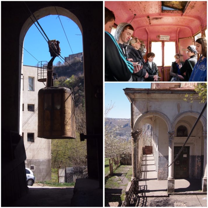
Chiatura cable cars (clockwise from left): cable car arriving at the bottom station; inside the cable car, the lady in the leather jacket (centre left) is the operator; the stations must once have been grand but are now in the same level of disrepair as the cable cars

The second cable car we rode was on a particularly steep line. At the top we found a mine entrance and a spectacular view down to the town

Final mention should go to our rental apartment in Kutaisi. We didn’t quite believe the pictures on the booking website but it really was as grand as it looked!

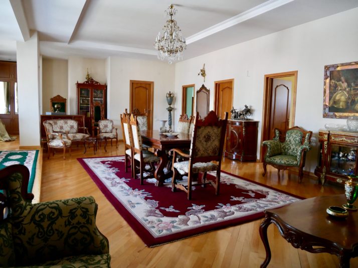
Our rental apartment felt like a stately home!

Sighnaghi and Davit Gareja, Georgia

After our day trip to Mtskheta, we ventured a little further afield to the south eastern region of Kakheti which, as well as the following sites, is also famed for its wine. Enroute to our destination of Sighnaghi and straddling the border with Azerbaijan is the 6th century cave monastery of Davit Gareja. Using public transport to get out this way would have doubled the time we needed, so we took the easy option and hired a guide-taxi through our Tbilisi guesthouse.

Davit Gareja

Davit Gareja, Georgia

Looking down into Lavra monastery on the Georgian side of the Davit Gareja complex. The surrounding stripy red hills reminded us of the colourful landscape of Tsagaan Suvraga in Mongolia

After a long 2 hour drive through increasingly bleak and sparsely populated land we arrived at the remote monastery of Davit Gareja, a relative oasis compared to the dry and treeless surroundings. Our guide Giorgi explained that as well as carving out their single-cell shelters, the monks used diagonal channels in the rock faces to collect the little rainwater the area gets.

Davit's Cave, Davit Gareja

Davit’s cave, most likely dug by himself ~1,500 years ago

We were surprised to find much of this part of the complex is in use; the larger caves looked inhabited, some areas were cordoned off requesting visitors to kindly respect monk’s privacy, and there were about a half-dozen monks saying prayers in the small chapel which made it feel almost bustling.

From the upper courtyard we took an energetic trail up through the monastery, past a few more basic caves and a couple of armed Georgian border guards to the top of the ridge before dropping a little way down the other side. I wasn’t entirely sure why we’d left the monastery and were following a path that is essentially the border with Azerbaijan until we’d gone about 100 meters..

Davit Gareja, Georgia

Oh! That’s why! Obviously we knew it was a cave monastery but I had no idea how big it had been and that a lot of the caves had been covered in frescoes painted in the 10th to 13th centuries

Frescoes, frescoes everywhere!

Davit Gareja collage

Exploring the frescoes, including the dinner hall (top right) with a depiction of the last supper

We spent a good hour or so working our way along the remains of the frescoed caves, many of which were just open to the elements. It was amazing how well they’d held up to the weather given a lot of walls had fallen away, but it was bittersweet that some Soviet visitors had scratched their names into the plaster.

Davit Gareja, Georgia - Close up of the Soviet graffiti

Soviet era graffiti – it’s a shame but it’s also a reminder of that period in the monastery’s history

Bodbe Convent

Bodbe Convent, Georgia

The church (right) and bell tower of Bodbe Convent. The grave of St. Nino is inside

From Davit Gareja we drove another 2 hours to reach the outskirts of Sighnaghi. We’d planned to visit Bodbe Convent the following day, but as Giorgi and our fellow tourist Daniel were due to head back to Tbilisi the same day it made sense to include this small but important site in the itinerary. Set amongst tall cypress trees and lush, immaculately kept grounds, the peaceful Bodbe Convent is the final resting place of St. Nino, who converted the King and ultimately Georgia to Christianity.

New church, Bodbe Convent, Georgia

They’d nearly finished a new cathedral-sized church in the grounds of the convent. It looks almost complete from the outside with a lovely mix of texture and materials but it was still a building site inside

Sighnaghi

Sighnaghi, Georgia
Our base for a couple of nights was Signhaghi, a laid-back, quiet, picturesque hill-top town ringed by a turret studded wall. Given that we’d already done our day’s sightseeing activity before we’d arrived, we took a leisurely wander around the town’s walls which afford spectacular views of the wine growing Alazani valley and Caucasus mountains beyond (when there aren’t clouds in the way!).

Sighnaghi walls collage

One of the few staircases onto the walls around Sighnaghi that aren’t in the round turrets

Sighnaghi Museum, Georgia

Just off the main town square is the small but excellent Signhaghi Museum which finishes with a collection of works by the famous pauper painter Pirosmani who was born in Kakheti

After a lazy day of wandering around in the morning and catching up with photos and diary writing in the afternoon we spent the evening indulging in great food and very good, very local wine!

Pheasant's Tears, Sighnaghi, Georgia

We opted for the wine tasting menu to accompany the food at the renowned Pheasant’s Tears which consisted of 6 wines from vineyards across Georgia

Pheasant's Tears, Sighnaghi, Georgia

The food we had in Sighnaghi deserves a mention too – we unconsciously ordered fish and chips with our wine tasting – how does the saying go? you can take the British out of Britain..

The Kakheti region makes up about 60% of Georgia’s vineyards and has been a wine producing area for over 8,000 years. To this day the Georgians take enormous pride in their traditional method of natural fermentation in large clay pots called qvevri sunken into the ground. They also use the whole grape – skin and pips – which turns their white wines a rich sunset amber colour, though they’re still light and refreshing. Delicious!

Mtskheta, Georgia

On our final day in Tbilisi we took the short marshrutka (minibus) trip north to Mtskheta, spiritual home of Georgian Christianity and a UNESCO World Heritage Site.  First stop was the Svetitskhoveli Cathedral which dominates the small town’s centre.

Svetitskhoveli Cathedral

The Svetitskhoveli Cathedral in Mtskheta. We noticed that a lot of Georgian churches have little model churches on their roof ridges and this one is no exception

Svetitskhoveli means ‘Life-Giving Column’, a reference to the legend surrounding the building of the first cathedral on this site in the 4th century. Long before, the robe from Christ’s crucifixion was brought to Mtskheta by a local Jew and ended up buried nearby although the site had been forgotten by the time King Mirian, Georgia’s first Christian king, had been converted and decided to build a cathedral here.  When they tried to raise the cathedral’s central pillar it could not be lifted from the ground, but after much praying by St Nino (more about her presently) the pillar moved of its own accord to stand over the spot where Christ’s robe was buried.

Svetitskhoveli Cathedral Interior

There are some beautiful frescoes inside the cathedral

We loved the cathedral’s decoration, with the Christ fresco in the apse reminding us of churches we’d seen in Sicily, notably Cefalù and Monreale, and the icons with hanging lamps in front. The gravestones in the floor give hints as to the history of the area and the different rulers who have had influence here at various times, we spotted several Cyrillic (Russian) and Arabic, as well as ancient and modern Georgian scripts. In one of the side aisles there’s a copy of the Chapel of the Holy Sepulchre in Jerusalem erected to mark Svetitskhoveli as the second most holy place in the world (after the original chapel) and today visited by many Georgians who are not able to travel to Jerusalem.

Svetitskhoveli Cathedral

Svetitskhoveli Cathedral (clockwise from top left): Jo and I had to don headscarves and apron-like ‘skirts’ before we could enter (Andrew just had to take off his hat); the original ‘Life-Giving Column’ was on the site of this monument; as you might expect St George is a common subject for icons all around Georgia

After visiting the cathedral we were starting to get hungry. The Lonely Planet told us that lobio, casseroled kidney beans with herbs and spices, are a specialty in Mtskheta so that was what we sought out. They’re served in individual clay pots and were even tastier than we expected. With some bread and salad they made for a nutritious and cheap lunch!

Lobio

Lobio for lunch in a Mtskheta cafe

After lunch we made our way to the Jvari Church, sitting on a ridge over the town.  As the crow flies it’s not far, but to get there by road it’s 11km each way and, as it’s not served by public transport, most visitors take a taxi.  But that’s not our style, it was a glorious day and a bit of exercise would do us good, so we checked with the helpful lady in the Tourist Information Office who informed us that it was possible to walk there in about an hour.  The only hitch was crossing the dual carriageway that separates the town from the hill where the church is.  Fortunately the road wasn’t too busy, the visibility was good and there was a nice high central reservation to wait on in the middle, still it wasn’t the nicest road crossing we’ve ever done – though less stressful than navigating the hundreds of teeming scooters in Vietnam!

View of Mtskheta from Jvari church

From the Jvari church there’s a spectacular view of Mtskheta and the confluence of the Aragvi (blue) and Mtkvari (grey) rivers

The Jvari Church itself is small and simply constructed but very holy for Georgians as it stands on the site where King Mirian erected a wooden cross soon after his conversion by St Nino in around 327AD. St Nino was a missionary from a Greek-speaking Roman family. Reputedly related to St George, she travelled to Georgia from Constantinople (modern day Istanbul) and became one of the most important saints in the Georgian Orthodox church. Her grapevine cross is a symbol of Georgian Christianity, and Nino is a very popular girls name too – it sometimes seemed like every other local woman we met was called Nino!

Jvari church

The small and symmetrical Jvari church

It was extremely windy on the ridge outside the church though the view was worth being blown about for. The inside is a big contrast to the Svetitskhoveli Cathedral, with bare stone walls rather than frescoes, the small circular space is dominated by a large wooden cross, and there’s a rather sombre atmosphere with a black-clad old lady shushing anyone who speaks too loudly.

Jvari church

Jvari church (clockwise from top): the church stands on a ridge across the river from Mtskheta town; a representation of the cross of St Nino; inside the church is dominated by a large wooden cross