Tag Archives: Beach

Hebridean Way Round Up

What photo takes you right back to the Hebridean Way?

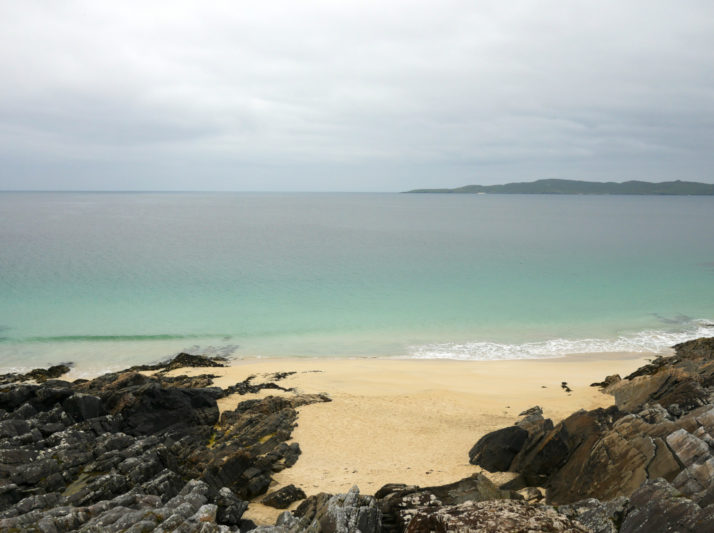
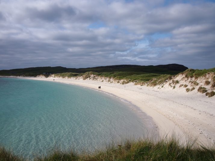
Vatersay beach

The spectacular beaches made us get our cameras out every time, no matter the weather the sea seemed to glow turquoise and they were usually more or less deserted too. This is Vatersay on our first day

Summarise the Hebridean Way in three words.

  • Remote – not only are the islands themselves remote from the mainland but cycling there we often felt ourselves to be remote from the conveniences that we’re used to – there often isn’t a shop, cafe, restaurant, campsite or public toilet for tens of miles and we made sure to always have some food supplies in reserve, just in case
  • Rolling – the Hebridean Way isn’t a physically challenging route and we often found ourselves nicely rolling along up and down on the undulating roads
  • Resilient – from the neolithic standing stones dotted around the islands, to the remains of the village at St Kilda, and the museum in Stornoway, imagining how people have lived here over the centuries and dealt with the harsh conditions was a theme of our visit

You really know you’re in the Outer Hebrides when…

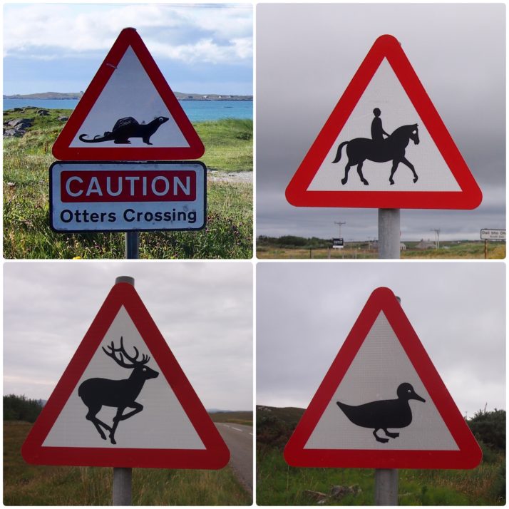
…all of the caution animal signs have googly eyes! We have no idea who travelled the islands adding these but they were there from the causeway at Eriskay all the way to Stornoway. Any humans in similar signs (riding the horse, pedestrians) were always blind.

What one item should you definitely pack when going to the Outer Hebrides?

Midge headnet and insect repellent. To be fair most of the time the midges weren’t too bad but when they did come out they were very annoying! We picked up headnets in Tarbert and they made the rest of our stay much more comfortable.

Hebridean Way: Day 9 – Lewis (Uig Sands to Shawbost)

Distance cycled 37.9 miles / 61 km
Cumulative distance cycled 239.2 miles / 385.1 km
Islands visited (daily total) Lewis
Total islands visited 10+1 of 10
Average speed 10.7 mph / 17.2 kmph
Weather conditions Overcast with mizzly rain showers

When we were packing, we’d debated whether we should pack our swimwear and in the end decided yes – I’d had visions of lounging in the sun on the white sand beaches. As it turned out, it was a bit chilly for sunbathing but Andrew was adamant that he wanted a swim in the sea and as we were camped right next to the beach, today seemed the best opportunity. I wasn’t brave enough for full immersion and went for a paddle instead though actually the water was a lot warmer than I’d expected and maybe I would have been OK.
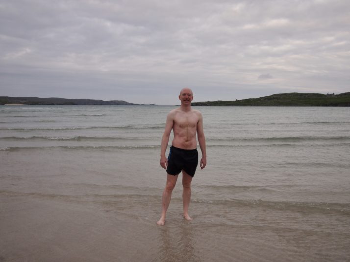
Andrew on Uig Sands after a swim in the sea

Andrew refreshed from his early morning dip in the sea

We set off cycling back towards the Hebridean Way route. For the first 10 miles we had a headwind but eventually the road turned and the going was easier. First stop of the day was at Callanish IV, a small stone circle which we’d seen from the road as we passed by 2 days before. I always find ancient sites like this magical, it blows my mind to think about how long they’ve been there and the people who constructed them.
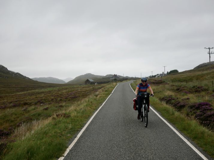
Cycling on the road near Loch Roag Beag

Julie battling the headwind on the road near Loch Roag Beag
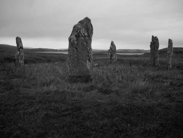
Callanish IV stone circle

Callanish IV: there are more than 15 other sites with stone circles or standing stones in the area surrounding the Callanish Standing Stones

From there it was only a few miles to the famous stone circle at Callanish known simply as the Callanish Standing Stones. The weather wasn’t great with intermittent drizzly rain so I’d hoped we might be able to get lunch at the cafe. Unfortunately it’s closed on Mondays so we sheltered under the canopy over their outdoor tables and ate the bread and pate that we’d bought earlier.
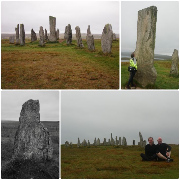
Callanish Standing Stones

Callanish Standing Stones (clockwise from top left): the stone circle; Julie with the central monolith; us with the Stones; many of the stones had wonderful patterns in them

The Stones themselves form a cross shaped pattern around a central stone circle and were erected 5,000 years ago which makes them older than Stonehenge. Unlike at the more famous stone circle you can walk right up to them, and they’re free to visit too. We spent quite a while wandering around, taking photos from different angles and admiring the patterns in the stones and the height of the central monolith (4.75m).

After a quick diversion when we noticed a roadside stall advertising fudge we stopped in at Dun Carloway, the remains of a 2,000 year old broch, a kind of double walled roundhouse.
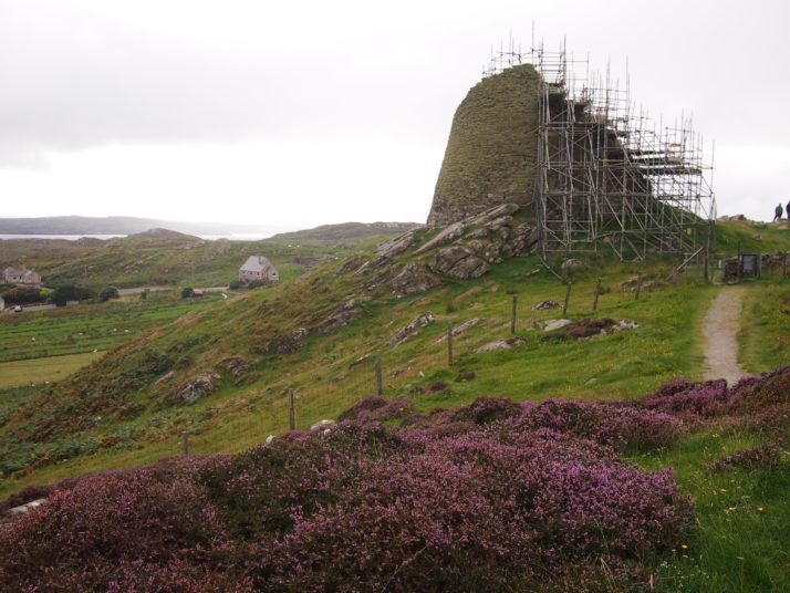
Dun Carloway broch

Unfortunately at the moment the broch is shrouded in scaffolding awaiting work to reseat loose stones

The poor weather had made for a tiring day and we were on the look out for somewhere to eat dinner so that we wouldn’t have to cook for ourselves. After the false promise of a knife & fork symbol on our route map we arrived in Shawbost. I was in favour of giving up and just checking into the campsite but Andrew had found the pin for a cafe on the online map so we detoured up a side road. We almost didn’t find Mollan’s Rainbow Shed and even when we did it didn’t look promising for dinner unless we wanted cake, but Andrew asked the owner, Julie, if she had anything more substantial. “Oh yes, there are homemade curries and pilau rice in the freezer, I can warm them up for you if you like”. Finished off with her chocolate “peat-bog” pudding, and with interesting conversation thrown in as well it was a perfect end to the day.
Hebridean Way: Day 8 – Day off at Uig Sands

Distance cycled 0 miles / 0 km
Cumulative distance cycled 201.3 miles / 324.1 km
Islands visited (daily total) Lewis
Total islands visited 10+1 of 10
Average speed n/a mph / n/a kmph
Weather conditions Windy and rainy. Very rainy

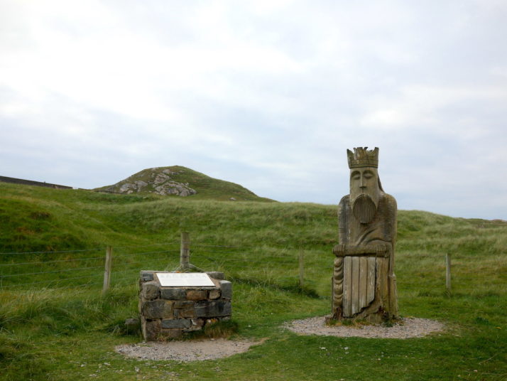
Joining 2 days worth of cycling together gave us a fantastic semi-wild camping spot and day off to recover and explore an area of Lewis that’s a good 20 miles away from the official Hebridean Way route. We’d seen a large wood carving near the entrance to the Uig Sands and Ardroil Beach community campsite so we went back to learn a little more about it..

Large wood carving of the King piece from the Uig Chessmen chess set, and explanation board

The very much enlarged wood carving of the king from the Uig Chessmen

This sculpture is based on one of the kings in the collection of walrus ivory chess pieces which were discovered nearby in a sand dune in 1831. According to the information board they’re believed to be of Norse origin, and 82 of the pieces are now in the British Museum, with 11 in the National Museum of Scotland.

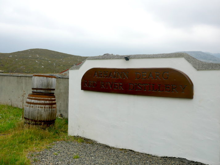
Abhainn Dearg (Red River) distillery sign board and 2 whisky barrels

A few miles down the road is the first single-malt whisky distillery on the Outer Hebrides since 1829 – Abhainn Dearg or Red River. We understood they were open with limited spaces for tours, but like most of the businesses on the islands they’re closed on Sundays.

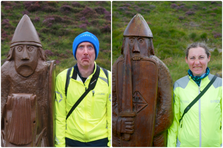
However, in their car park were 2 more Uig Chessmen carvings..

Andrew and Julie pulling silly faces in the style of the 2 Uig Chessmen carved statues

Two more carved Uig Chessmen were guarding the empty car park of the distillery – a knight on the left and a berserker on the right. Berserkers would bite their shields before battle to get themselves into a state of frenzy. Look out!

Another reason for the timing of our day off was the weather forecast we’d been keeping a keen eye on and sure enough, at this point the weather started turning for the worse. We headed back to camp via the sandy beach as the drizzle started and before the wind picked up. From the inside it felt like our little tent took a battering!

Hebridean Way: Day 7 – Harris, Lewis (Likisto to Uig Sands)

Distance cycled 65.7 miles / 105.8 km
Cumulative distance cycled 201.3 miles / 324.1 km
Islands visited (daily total) Harris, Lewis
Total islands visited 10+1 of 10
Average speed 11.2 mph / 18 kmph
Weather conditions Overcast

If anything, the midges were even worse in the morning. After eating our breakfast in the blackhouse, we struck camp as quickly as we could and struggled to get the panniers loaded on the bikes while keeping the clouds of midges off our faces. The only relief was to begin cycling, at which point they couldn’t keep up with us. Ha!

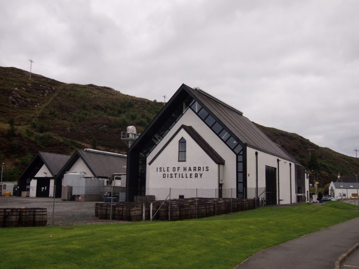
We retraced our route back through the rocky landscape to the main road and soon arrived in Tarbert, the capital of Harris. We restocked our food supplies making sure we had enough to get us through the weekend until the shops reopened. That left our panniers pretty full but passing the Isle of Harris gin distillery on the road out of town we found that we had space for a bottle of gin and some tonics!

Isle of Harris distillery, Tarbert

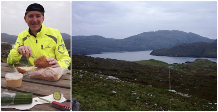
For the most part the Hebridean Way is quite flat with gentle ups and downs, we’d heard that the exception to this was just after Tarbert when there was A HILL. It was definitely the most uphill section but really not that bad, neither particularly steep nor long. From there it was rolling ups & downs between dramatic craggy hills until we stopped for an early lunch in a spot with a beautiful view over Loch Seaforth.

From there we were zipping down the other side of the hills at a rather alarming top speed of 37mph which brought us into Lewis, our final island. Confusingly its not actually a separate island to Harris though they are very distinct in landscape. Heading north and with a slight tailwind and pretty flat road the cycling felt really good. There’s a real lack of campsites in this part of Lewis and we’d thought to wild camp, but having arrived at our potential camping spot around 3pm and with knowledge of bad winds and rain forecast for tomorrow we decided to press on and do 2 days of cycling in 1.

View towards Harris mountains

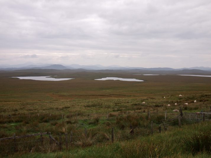
As we crossed the island from the eastern coast to the west we had a constant view of the hills of Harris to our left. They looked like a painting of an imaginary mountain range.

Reaching the western coast we turned off the official Hebridean Way trail towards Uig. At about 45 miles into the ride, I was still feeling pretty good though Andrew was starting to tire. The last 20 miles felt never-ending though the scenery made up for the tired legs. Eventually we arrived at the beautiful campsite in the dunes at Ardroil beach though as we pitched the tent the midges were annoying again. Instead of setting up the beds we went for a walk on the huge beach accompanied by a tailless dog who kept bringing us bits of seaweed stalk and looking at us expectantly.

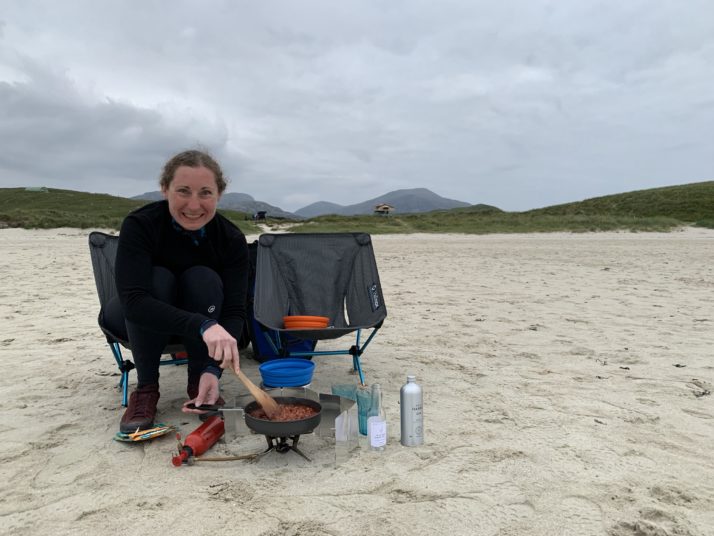
Cooking dinner on Uig Sands

We decided to take everything out on the sands and make dinner there. It ended up being one of our favourite memories of the trip, in our new camping chairs, eating dinner and drinking Harris gin and tonics as the light slowly faded.

An epic day, over 65 miles which would be a long day for us even without the extra weight of the bags.

Hebridean Way: Day 6 – Harris (Leverburgh to Likisto)

Distance cycled 18.5 miles / 29.8 km
Cumulative distance cycled 135.6 miles / 218.3 km
Islands visited (daily total) Harris
Total islands visited 9+1 of 10
Average speed 10 mph / 16.1 kmph
Weather conditions Overcast and very still (perfect if you’re a midge)

After the long, tiring but extremely enjoyable previous day hiking around Hirta, and after many a discussion with our wonderful bed and breakfast hosts about locations of suitable wild camping spots the other side to Tarbet (which they lamented the lack of given the unsuitable moorland landscape), we decided to stop a little short and set off for a campsite just before it on the ‘Golden Road’.

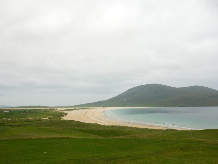
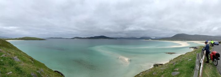
The western coast of Harris, like the western coasts of the isles so far, is a string of white sandy beaches and gorgeous turquoise waters, each one as breathtaking as the last. We were compelled to stop at every one to pause, take in the view, and take a photo!

Scarista Mhor

Horgabost

Seilebost. I think it’s a requirement to pull into the lay-by and appreciate this view. While we were here a guy hopped out of a camper van and said “Devon & Cornwall aren’t a patch on this”

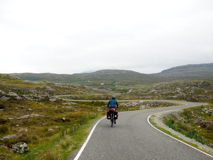
After crossing to the east coast of Harris we turned south away from Tarbet and onto a lovely twisty single-carriageway called the Golden Road – very nice on a bicycle!

Julie on the Golden Road

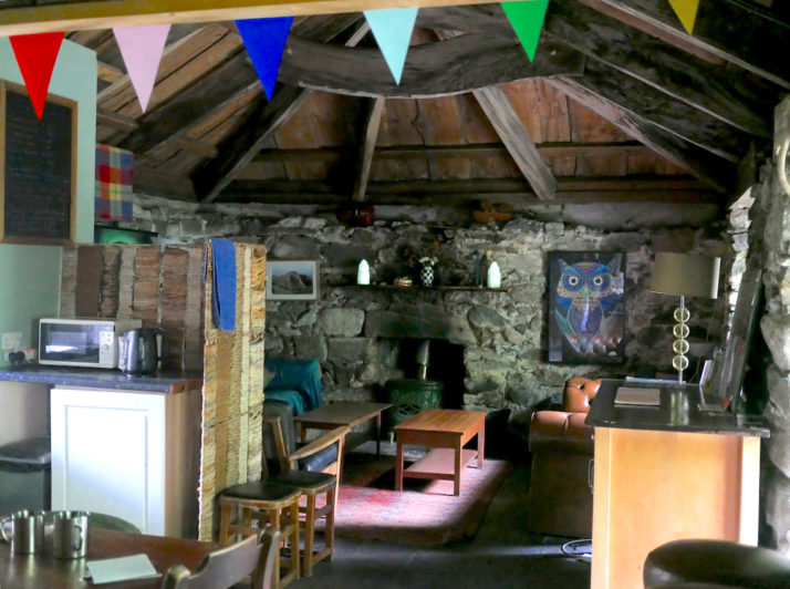
Soon we arrived at Likisto and our home for the evening, but the welcoming party of midges soon found us and with no breeze whatsoever at our pitch they were about as thick as we’ve seen them. We just managed to put the tent up then retreated into the converted blackhouse where we found not only a small kitchen, bathroom and shower, but a huge lounge and dining table! Best of all it was a midge free zone!

Inside a converted blackhouse

Inside the very homely converted blackhouse. We spent the remainder of the afternoon drinking tea and writing up our diaries, then set up the stove in one of the fireplaces to avoid the midges!

Julie had explored the campsite and found another pitch named ‘Otter Watch’ right by the loch side and with just enough breeze to keep the midges away the spot proved true to its name – we spotted one, then two, then three sea otters – shame we’d left both the cameras and the binoculars in the tent!