Tag Archives: UK

G2C2C Day 6: Rookhope to Tynemouth (then home)

Distance cycled to Tynemouth 43.2 miles / 69.5 km
Distance cycled from Tynemouth to home 12.4 miles / 20 km
Cumulative distance cycled 298.2 miles / 479.9 km
Elevation (daily total) 2050 feet / 625 m
Total cycling time 5h
Total time (including breaks) 6h 20
Average speed 11.1 mph / 17.9 kmph
Weather conditions Sunny

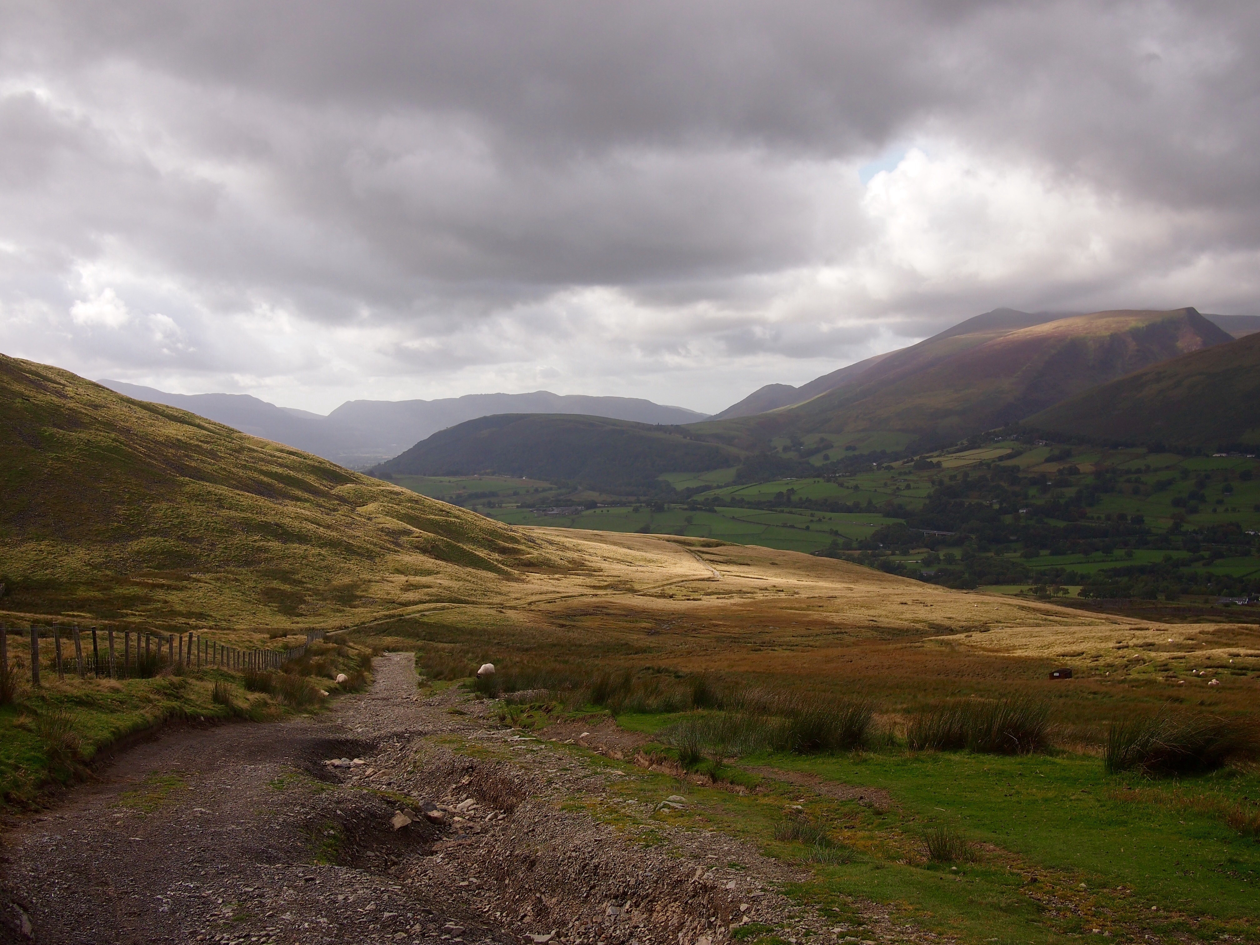
After a solid 9 hours sleep we departed for the final day of riding from Rookhope. The official route is often closed during shooting season and an on-road alternative must be taken. Fortunately for us, there is no shooting on a Sunday and so after a hard 1 mile climb up a rocky track (with tired legs and cold muscles) we emerged onto beautiful moorland with just the occasional grouse cackle to break the silence and the morning’s mist swirling in the valley below.

Moorland track above Rookhope
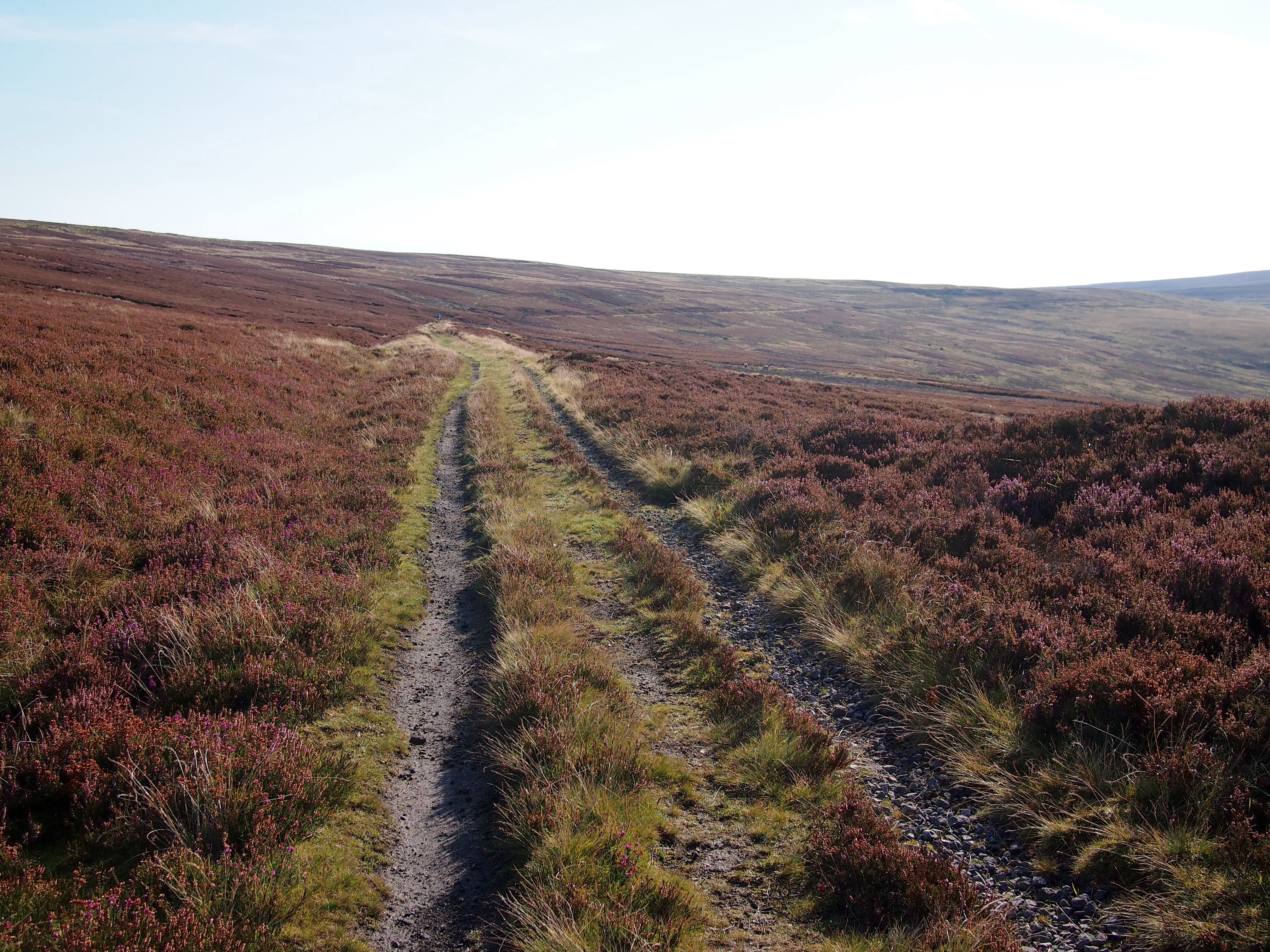
Deserted moorland track above Rookhope

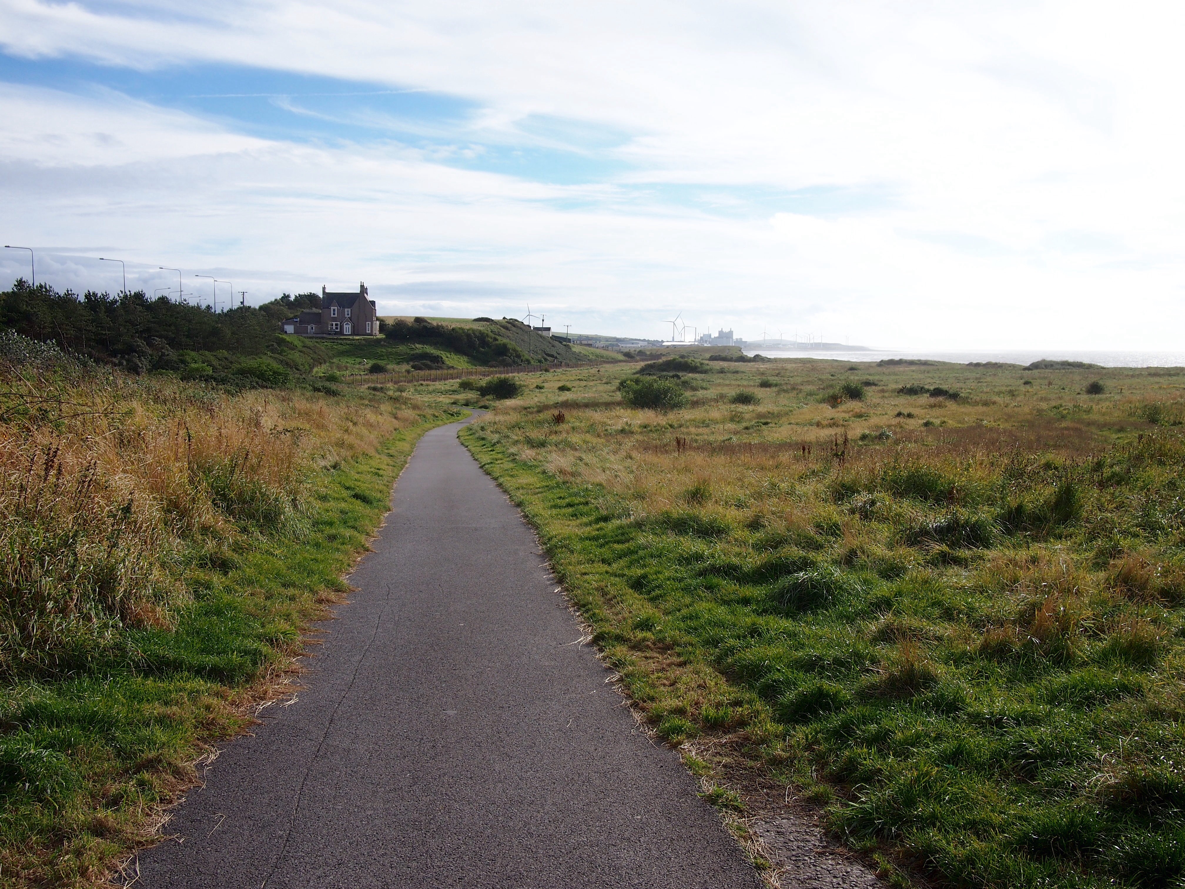
The four miles of moorland path ended at Parkhead Station from where we blasted downhill along the Waskerley Way path and it wasn’t long before we arrived at the old smelt wagon at Lydgett’s Junction in Consett and started along paths well known to us from our training rides. The Derwent Valley path has some great downhills through forest and over viaducts before emerging on the south side of the River Tyne.

Derwent Valley path
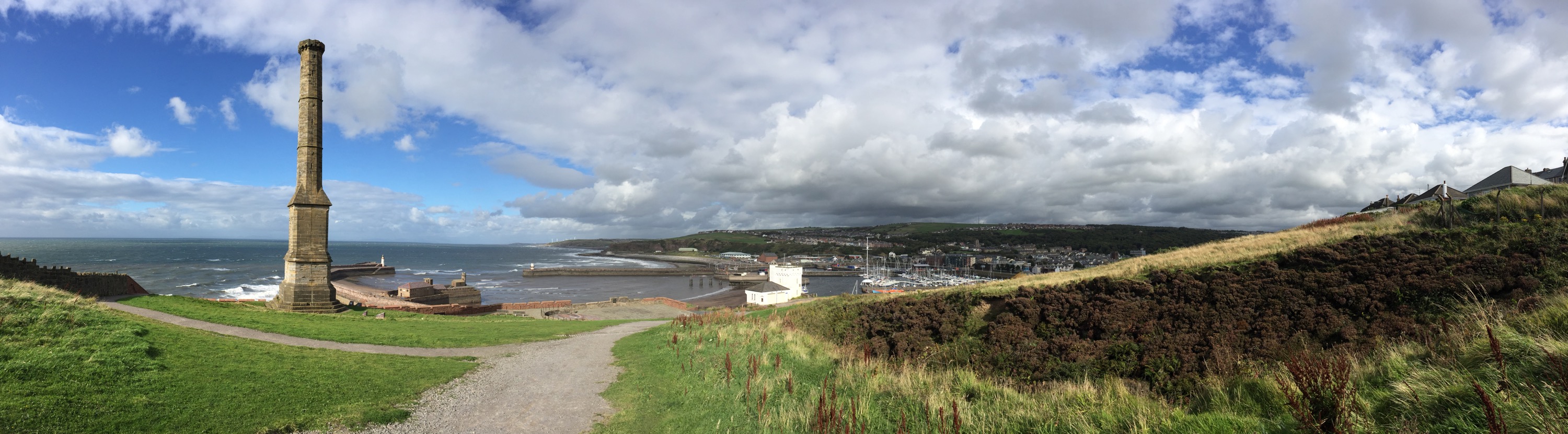
Zooming along the Derwent Valley

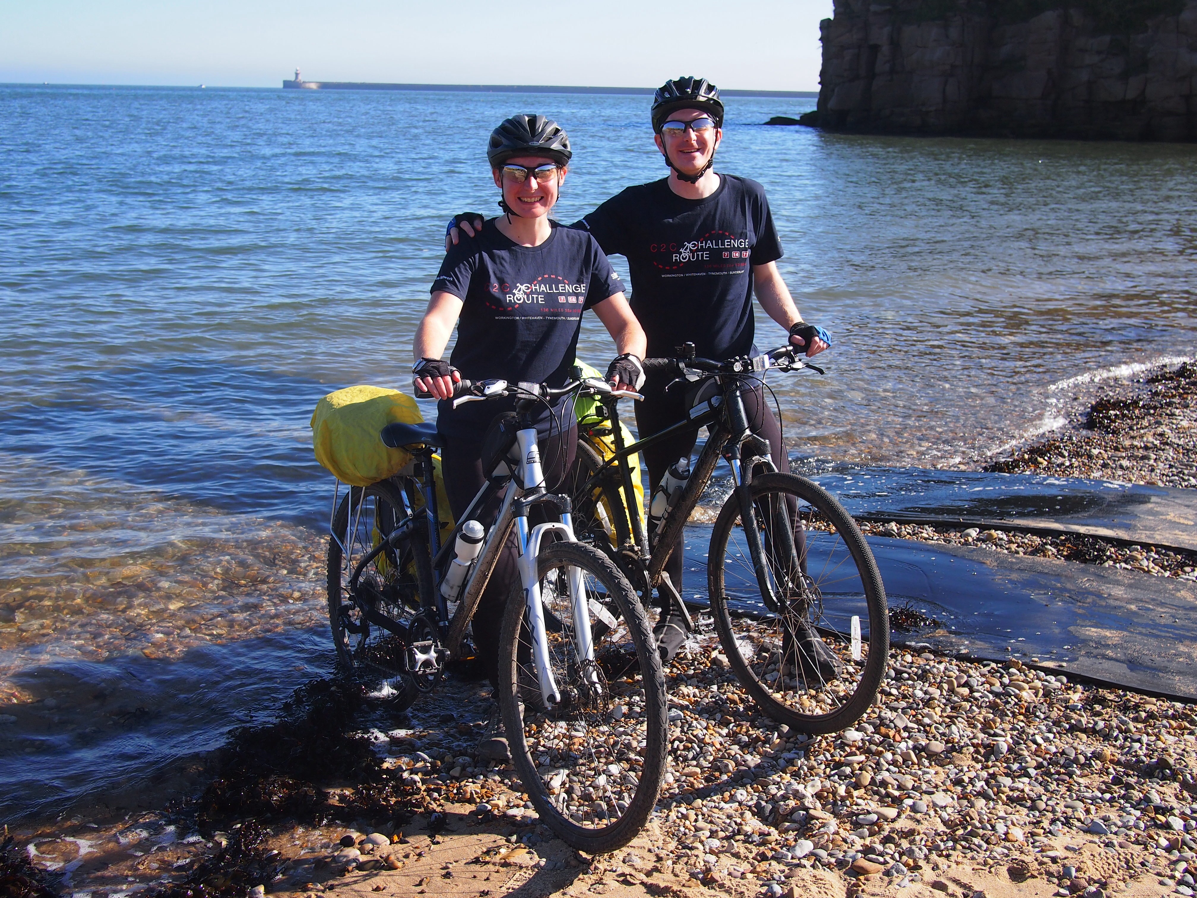
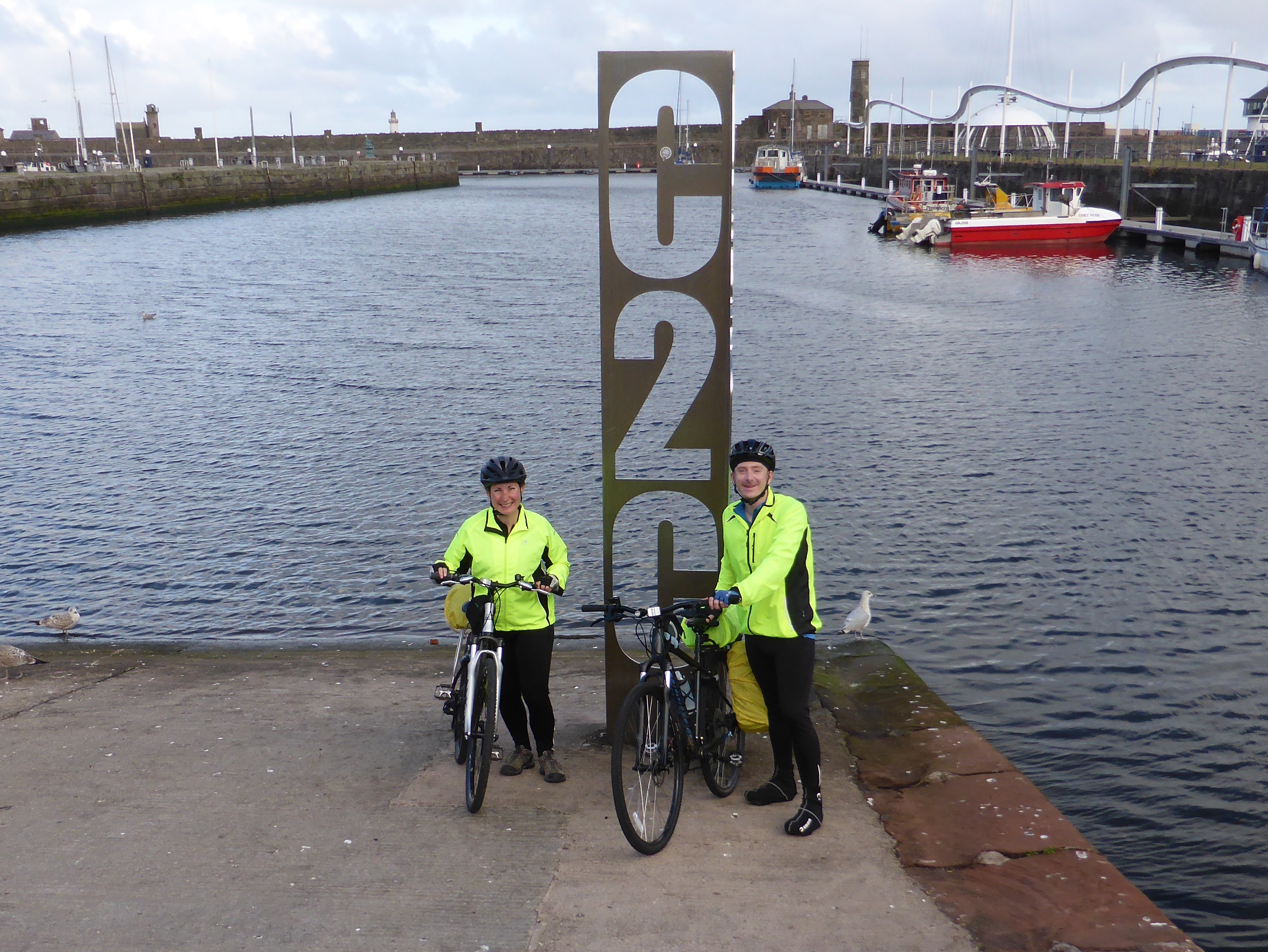
We’d arranged to meet family in Tynemouth for celebratory fish and chips so by the time we reached Newcastle, lunch was overdue and despite our best efforts at refueling with biscuits and jelly babies (pro-tip, thanks Jo!) we were getting tired and the last few miles were a bit of a struggle. We had a real sense of achievement as we crested the cliff near Tynemouth Priory before descending to the beach for the obligatory photo with the back wheel in the sea.

C2C - the end!

G2C2C Day 5: Penrith to Rookhope

Distance cycled 40.1 miles / 64.5 km
Cumulative distance cycled 242.6 miles / 390.4 km
Elevation (daily total) 4922 feet / 1500 m
Total cycling time 4h 10min
Total time (including breaks) 7h 25min
Average speed 9.7 mph / 15.6 kmph
Weather conditions Perfect for hills – overcast and little to no wind
Punctures One

If the word of Day 2 was headwind, then the word of today was hillclimb – anyone we’ve spoken to that has either done the C2C or knows the route mentions the 4mile climb up Hartside.

The start from Penrith was a series of small but challenging uphills of varying gradients which nicely warmed the legs, but our heads were full of thoughts of the Hartside climb to come, and a little under 2 hours in we’d started.. 40 odd minutes later we were sitting at the infamous Hartside Cafe wondering what all the fuss was about! I’m not saying Hartside wasn’t tough, but we agreed that Whinlatter Pass the previous day was tougher.

Made it!

After a hot chocolate and slice of cake at the cafe, we set off towards Rookhope. The smooth declining road on the other side of the climb restored our average speed and with spectacular scenery was infinitely more enjoyable than the way up.

But what goes down must come up.

Obviously we’d looked at the profile of the day’s ride, but all eyes were on Hartside with just a cursory mention of the subsequent peaks.. and with our guards lowered the route delivered punishing steep hill after punishing steep hill. We’re talking easiest gear and out of the saddle steep. Like a grownup version of the roller coaster start out of Brampton on day 2, we climbed and then dropped through spectacular scenery.

Scenery entering Northumberland on C2C

Stopping to take a picture after a crest and after we’d just crossed into Northumberland, I heard a babbling brook on one side and a curious popping noise coming from my back wheel. I looked down to find the seal of my rear tyre valve blowing bubbles! Over 200 miles and we have our first puncture..

Andrew's impromptu bike workshop on the side of the road.  As we'd brought spare inner tubes we just swapped it out rather than finding and patching the hole

Andrew’s impromptu bike workshop on the side of the road. As we’d brought spare inner tubes we just swapped it out rather than finding and patching the hole

Thankfully we ended the day on a nice 5mile downhill stretch past abandoned mines and mills into Rookhope, where we’ll be staying for the night in a cartoon-decorated caravan!

Our cartoon caravan home in Rookhope!

Our cartoon caravan home in Rookhope!

G2C2C Day 4: Whitehaven to Penrith

Distance cycled 59.4 miles / 95.6 km
Cumulative distance cycled 202.5 miles / 325.9 km
Elevation (daily total) 5355 feet / 1632 m
Total cycling time 6h 44min
Total time (including breaks) 10h
Average speed 8.8 mph / 14.2 kmph
Weather conditions Mostly cloudy with the sun breaking through occasionally, and no wind!

C2C Start in WhitehavenAt the C2C start sculpture in Whitehaven harbour

Phew, that was a tough day. The first section of the C2C out of Whitehaven is a really nice surfaced railway path rising slowly up into the Lake District, this is followed by undulating country roads past Ennerdale Water, around Loweswater, and across the top of Crummock Water. So far, so good, and great views as well.

LoweswaterView across Loweswater from the C2C path

Next was the day’s first serious climb up to Whinlatter Pass. The first part was steep but on road and then forest trail and we reached the top with just a couple of rest stops and no walking so were feeling pretty good about it, then it was a fun descent through the forest towards Keswick. After Keswick we deviated slightly from the standard path up another steep climb to Castlerigg Stone Circle.

Castlerigg Stone CircleThe standing stones at Castlerigg Stone Circle have been in place for 4,500 years. They are situated on a natural plateau surrounded on all sides by mountains

Andrew had twisted my arm to continue on the alternative route, from this point it’s called the Old Coach Road section. On our map it is marked as suitable for “experienced mountain bikers only” but he insisted it would be fine. At first it was, but the path soon got too steep and covered in loose rock and gravel for us to ride up (Andrew fell over three times before he relented – he’s fine) and we had to walk most of the way to the top. Once it had levelled out we could ride OK and the views were superb, but it really slowed us down and tired us out.

Old Coach RoadThe rutted gravelly path of the Old Coach Road section, and the amazing views

It seemed like an awfully long way down to Penrith but we made it and hopefully not too worse for wear. A shorter distance tomorrow but lots of hills.

G2C2C Day 3: Whitehaven Rest Day

This being our first cycling trip, we planned in a rest day at Whitehaven and our legs and posteriors thanked us for our forethought and decision!

Spectacular views of Whitehaven from the Kells. This giant chimney is affectionately known as the Candlestick, and provided ventilation to the coal mines that once reached 15 miles out under the sea. It got its nickname as gasses from the mine would occasionally ignite as they left the top!

After a full English breakfast with all the trimmings, we went for a wander around this lovely port town. In its heyday, Whitehaven was the 2nd largest port in the UK after London, and while most of the coal, ship building and commerce has closed down or moved on, hints of the past glory days are everywhere throughout the harbour and the valley hillsides.

Looking back at what would have been the rear of St Nicholas Church, sadly ravaged by fire in 1971. Only the bell tower and side chapel were left

Looking back at what would have been the rear of St Nicholas Church, sadly ravaged by fire in 1971. Only the bell tower and side chapel are left

On our way to the harbour we stopped at St Nicholas Church which burnt down almost 80 years to the day after it was completed. Parts of the exterior walls and the bell tower are all that remain, and is now home to a small chapel and a nice little tea room. We liked the information leaflet detailing the church’s history, including the building costs right down to 2 shillings and a half-penny!

One of the old lighthouses at the end of the outer pier. It’s a pretty sharp photo considering the buffeting the wind was giving us!

Similar to our arrival yesterday it was a gusty day and we really felt the wind as we walked along the walls of the inner harbour, which because it has a lock between them, it’s possible to walk all the way around!

G2C2C Day 2: Brampton to Whitehaven

Distance cycled 80.4 miles / 129.4 km
Cumulative distance cycled 143.1 miles / 230.3 km
Elevation (daily total) 2096 feet / 640 m
Total cycling time 7h 53 mins
Total time (including breaks) 10h
Average speed 10.2 mph / 16.4 kmph
Weather conditions Started out fine getting steadily more cloudy until 1pm when we had 2 hours of light drizzle. Strong headwind along the coast

After a short climb out of Brampton we descended along quiet country roads to Carlisle. We felt like we were going pretty fast and the weather was lovely. As we neared the Solway Firth coastal road the clouds darkened and we hit a horrible headwind which stayed with us for the whole day and seriously tired us out. The majority of the day was essentially flat and we felt as if we should have been zooming along but it wasn’t to be.

Beside the Solway FirthThe views along the Solway Firth were the highlight of the day

We found the signposting along today’s section to be a bit patchy and had to cross-check our route against what we had loaded into Strava several times. As we were finishing up our lunchtime Ullswater pie we could feel the temperature dropping and the drizzle soon began. It wasn’t as bad as the full afternoon of rain which the forecast had promised but we definitely couldn’t appreciate the scenery as much as if it had been dry and sunny.

Ullswater pieAfter yesterday’s post I know that you’re all dying to know what Ullswater Pie is – here you go, imagine a lattice topped pork pie filled with ham, chicken and stuffing. Yum!

G2C2C Day 2 - Rainy selfieStill smiling despite the rain

For the final twenty miles towards Whitehaven the path followed the coast through Maryport and Workington, the sun came out for a while which improved our mood but didn’t chase away the headwind. As we rounded the corner before arriving in Whitehaven, we thought we were going to have to climb the steep road onto the clifftop, but fortunately the path peeled off beside the railway line along the base of the cliffs, a dramatic end to the day.

Hadrian's Cycleway between Maryport and WorkingtonA bit of sunshine on the coastal path between Maryport and Workington

No cycling tomorrow, we’re going to have a good long sleep, a full English breakfast and a day of lazing around. There may or may not be a blog post depending on how we feel.