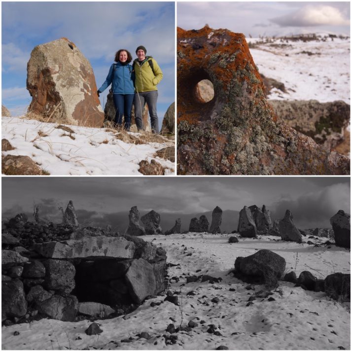
Author Archives: Julie

Travelling in the Georgian Caucasus: Kazbegi and Svaneti

Georgia is a mountainous land.  There’s a low, flattish strip running from the Black Sea in the west to the Azerbaijan border in the south-east, but everywhere else is high ground with the mighty Caucasus mountains forming the country’s northern border with Russia.  Visiting at the end of March we weren’t sure whether the snow would have melted and how accessible the mountains would be but we wanted to try to get to them.

Snowy mountains

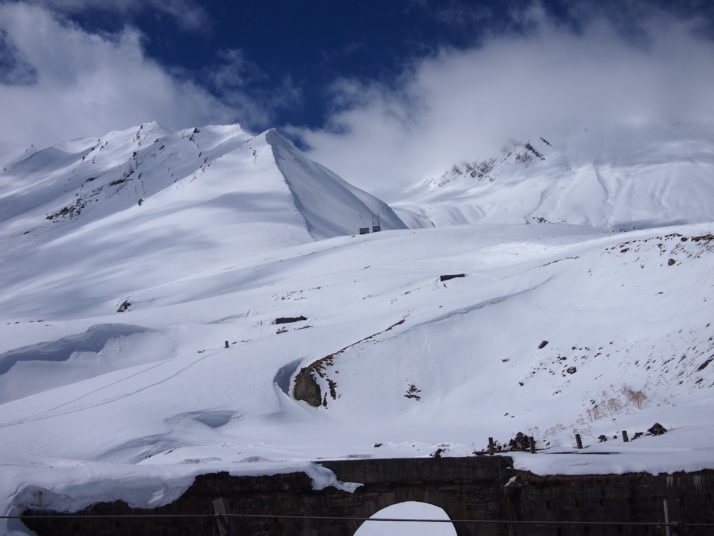
Into the mountains! There was still a lot of snow as we crossed the Jvari pass before dropping down a little into Kazbegi

From Sighnaghi we returned to Tbilisi and took another marshrutka along the Georgian Military Highway to Stepantsminda, also known as Kazbegi.  This small town is home to one of the most famous views in the country and if you look at any tourism material about Georgia you’ll almost certainly see a picture of the small monastery perched on a ridge with a towering mountain behind it.  We’d booked rooms in a guesthouse before arriving, saw that it was marked on our offline map and confidently struck out from the bus stop in the centre of town for what looked to be about a five minute walk.

Cloudy Kazbegi view

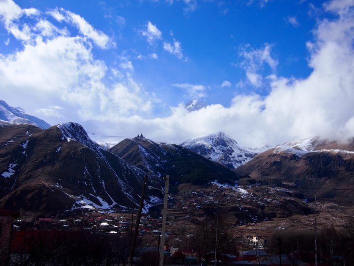
View from our guesthouse, Homestay Lela and Mari. We originally thought that Mt Kazbek was the snowy section to the right of the monastery, and then we saw the peak poking out from the clouds above!

Suffice to say, the guesthouse wasn’t where the map said, and after knocking on the door of a random lady, walking up and down the street for 20 minutes, bothering several other passersby and three phone calls to the guesthouse who spoke limited English, we were a little nervous about all the trouble we’d caused when our host Gela pulled up next to us in his car. No need to worry! He brushed off our apologies, drove 30 seconds to the house (just round the corner from where the map said it was), presented us with plates full of biscuits and sweets and offered us coffee or tea.  We gratefully accepted a coffee and he confidently added ‘chacha?’  Not wishing to be rude we tentatively accepted a glass of the local firewater, distilled from the second pressing of the grapes, which with Gela’s hospitality swiftly became three and then five shots so that when we later set out to explore the town we were all a little giggly!

Kazbegi

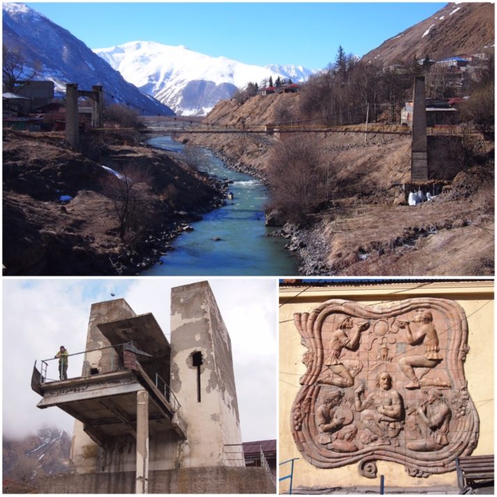
Kazbegi (clockwise from top): the River Terek runs through the town; Soviet era mural adorning the end of a building in the centre; parts of the town are looking a bit run down including this now defunct cable car station

The following morning I woke quite early, peeped around the curtain to see what the weather was like and my jaw dropped.  Mt Kazbek had emerged from the clouds and the pink light of the sunrise was making its way down the peak towards the Gergeti monastery.  We oohed and aahed, taking lots of (almost identical) photos until Gela bundled us all into the car and we sped off up the hill.  We weren’t entirely clear on where we were going but shortly arrived at a small monastery above the town opposite Mt Kazbek. As we got out of the car we saw a young monk hurrying across the snow covered grounds to ring the bell and a few minutes later we were standing at the back of the tiny colourfully frescoed church listening to the monks’ morning prayer chants. Gela gave us each a candle to light and place in front of one of the icons and I said a small thank you to the world for such a magical start to the day.

On our second morning in Kazbegi, Andrew got his camera set up to take a time-lapse of the sunrise.

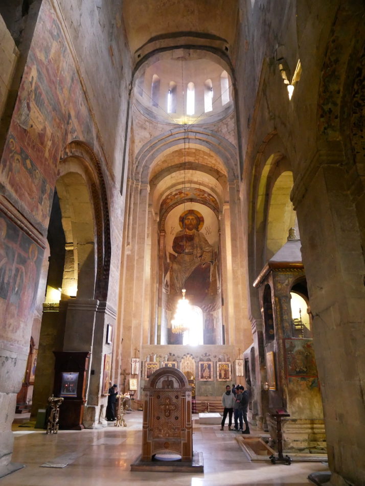
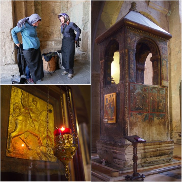
After breakfast we set off to hike up to the Tsminda Sameba (Holy Trinity) monastery which we’d been admiring from below since the previous afternoon. We refused the many offers of ‘taxi?’ as we walked through the town, crossed the river and passed through the opposite village of Gergeti. The hike was steep but not difficult and with a few pauses to catch our breath admire the spectacular view we made it up to the monastery in about an hour from the valley floor.

Cows beside the path

Cows beside the path as we pass through Gergeti village on the way to the monastery

Having seen no other tourists on the walk up it was a bit of a shock to find several groups armed with selfie sticks spilling out of cars at the monastery. The church itself is small and architecturally nothing special, it’s really the location that counts here. Even historically, when enemies threatened, the Georgians brought their sacred treasures from Mtskheta and put them in the monastery for safe keeping.

Gergeti Tsminda Sameba church

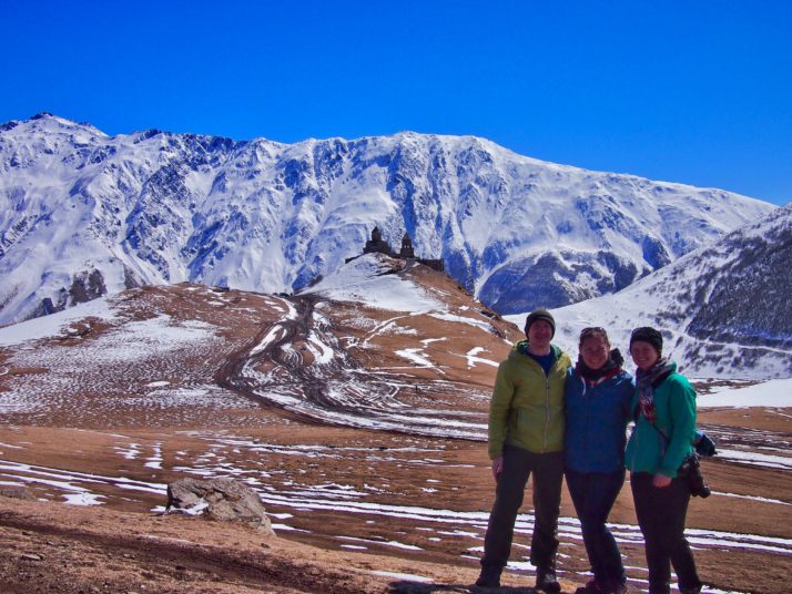
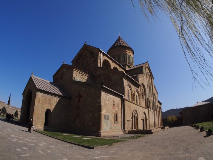
Andrew, Jo and I in front of the postcard perfect view of Gergeti Tsminda Sameba church

Gergeti Tsminda Sameba monastery

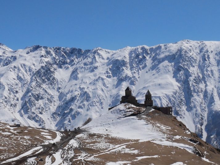
The Gergeti Tsminda Sameba monastery really does have a stunning location

Thermal pool near Kazbegi

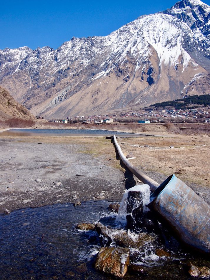
On our second day in Kazbegi we walked along the valley to the village of Pansheti. On the way we passed this swimming pool fed from a mineral spring

Overnight train to Zugdidi at Tbilisi station

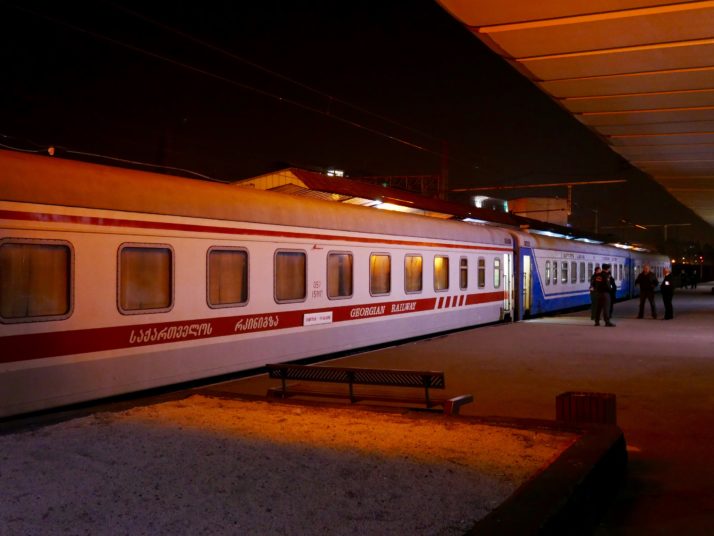
We took the afternoon marshrutka back to Tbilisi in time to catch the overnight train to Zugdidi. We love sleeping in the rocking motion of a slow train but this one would have been a bit more comfortable if they’d turned the heating down a few notches

We arrived in Zugdidi in north-western Georgia at 6am after an uncomfortably hot overnight train journey.  From there it was a three hour marshrutka ride up increasingly twisty roads with increasingly stunning views to Mestia, the main town of the Svaneti region.  The Svaneti region of the Caucasus has its own distinct culture, food, traditions and even language, and the Svan people are very proud that they’ve never been ruled by outsiders.  The most obvious and distinctive part of their culture are the defensive towers.

Mestia

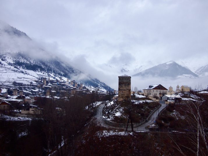
Mestia and its distinctive defensive towers

We’d seen an example of a Svan tower at the Ethnographic Museum in Tbilisi but here we were able to go inside and climb up to the top even sticking our head through the roof hatch in one case! Some levels had stone floors and others wood but each was small and had bare stone walls.  The tradition of the towers dates back to the Middle Ages and each family had its own attached to the main living hall to be used for protection of the owners and their animals in case of attack from invaders or raiders.  Some of the towers were also used for signalling with fires being lit in a chain down the valley to warn of an impending attack. The excellent museum in Mestia had an exhibit of photographs taken by Italian Vittorio Sella in the 1890s and the town’s architecture is still recognisable 125 years later.

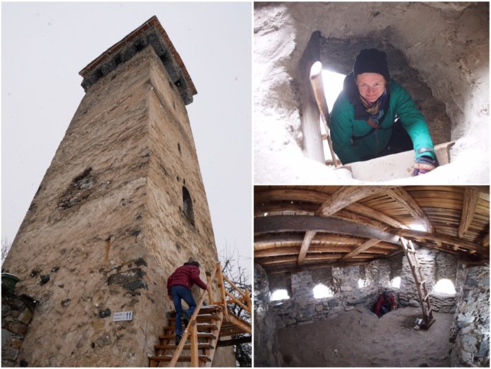
Svan towers (clockwise from left): the tower entrance is part way up the side to aid with defence; Jo climbing up one of the ladders, stone slabs would be used to close these holes in case of attack; only the top floor of the tower has windows

Although Mestia is at roughly the same altitude as Kazbegi, around 1500m, the sunny spring weather that we’d experienced in the eastern mountains didn’t quite seem to have arrived here yet.  There was still snow on the ground and on our second day we were more or less snowed in as the fluffy flakes fell continuously from early morning to late evening.  We ventured out for a walk to the cathedral (locked) and for lunch at a local cafe but mostly we just holed up in our guesthouse around the cosy wood burning stove.

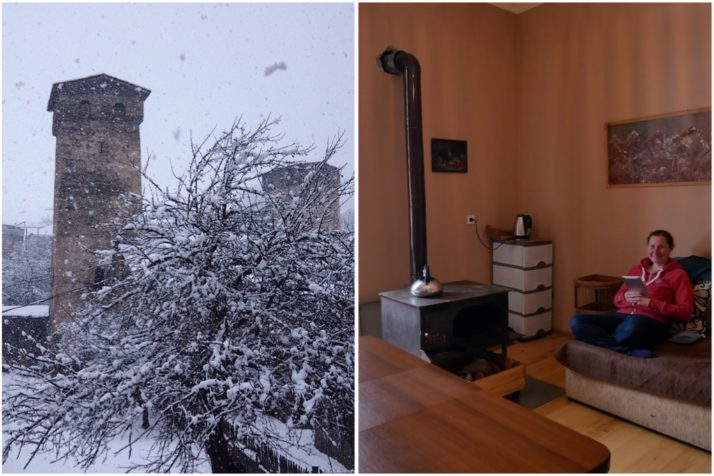
Holed up in the guesthouse on a snowy day in Mestia

Fortunately by the following morning the sun had appeared and was starting to lift the clouds from the mountains.  We’d arranged a trip to Ushguli, a UNESCO listed village further into the mountains with Vakho, our guesthouse owner’s brother.  Also joining us were a Korean woman and a Japanese man who we’d met in town.  It’s a rough road passable only by 4WD vehicles even in the summer and the 47km (29 miles) takes over 2 hours to drive.  We reached a point where no other vehicles had driven and were cruising along downhill when suddenly a Russian made jeep flew around the corner ahead of us. CRUNCH! There was nowhere for us to go and the front corner and headlight unit of our Mitsubishi was caved in by the impact.

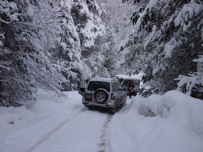
Crash on the snowy road to Ushguli

Luckily no-one was hurt and the engine wasn’t damaged so after a short while we were back on our way though Vakho was understandably upset at the damage which would likely cost him significantly more to fix than the 200GEL that we were paying him for the day’s excursion. There’s no car insurance here and the other vehicle’s owner didn’t seem to be overly concerned about helping out though technically it was his fault as he was driving uphill.

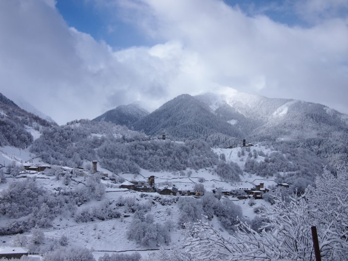
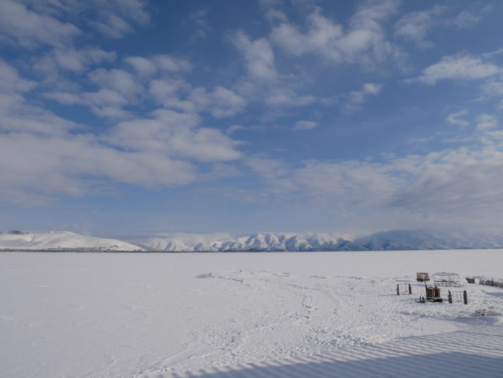
The previous day’s snow made the view from the road to Ushguli even prettier

The community of Ushguli stands at the foot of Mt Shkhara, Georgia’s highest peak, and is made up of five villages, one of which was inscribed on the UNESCO World Heritage List in 1996 as an “exceptional example of mountain scenery with medieval-type villages and tower-houses”. At an altitude of between 2060 and 2200m it also lays claim to being the highest permanently (i.e. year round) inhabited settlement in Europe. It must be a difficult place to live, bitterly cold in the winter (it was bad enough in late March), two hours on a bad road to the nearest small town, and five or more to anything bigger, the people must be hardy and self-sufficient in ways that are difficult for us to imagine.

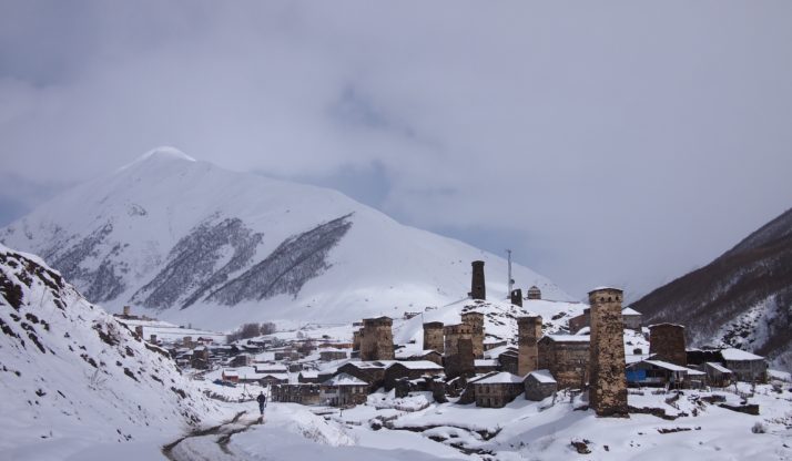
The villages of Ushguli, in the foreground UNESCO listed Chazhashi, with Chvibiani behind

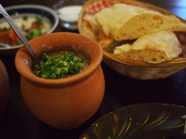
One Svan culinary specialty is the kubdari, similar to the cheese-filled khachapuri found in the rest of Georgia, but stuffed with seasoned meat.  In Ushguli we got an impromptu cooking lesson from a cafe owner as we watched her make pies for our lunch. I suspect that getting the filling to stay neatly inside the dough is not nearly as easy as she made it look. Once made, the kubdari were cooked on top of and then inside the traditional wood-fired stove which is the heart of every Svan home and kitchen.

Making kubdari in Ushguli

Cafe owner making kubdari, Svan meat pie, in Ushguli

After lunch, Vakho and the cafe owner scrambled the security guard and museum keeper to open the small ethnographic museum up for us. Located in a fat tower in Chazhashi, it houses treasures from Ushguli’s seven churches including gold and silver chalices, icons and crosses as well as jewellery and drinking horns.

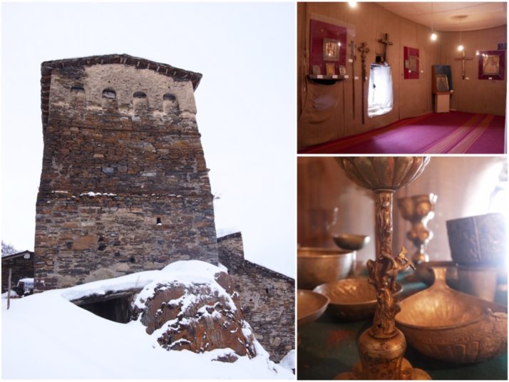
Ushguli ethnographic museum

Emerging from the museum we trudged through the snow a little further along the street when we heard loud barking and saw an enormous Caucasian shepherd dog bearing down on us. A woman shouted at him but we beat a hasty retreat all the same. The dogs in the streets of both Ushguli and Mestia are quite intimidating. Not so bad if it’s a cute waddling sausage dog, but others are descended from the mountain dogs bred to protect the sheep from wolves and bears and could do quite a bit of damage if they felt so inclined. Locals told us that they are generally safe as the dogs have learnt that tourists will give them food but I didn’t enjoy having a pack follow us around especially as we had no intention of feeding them.

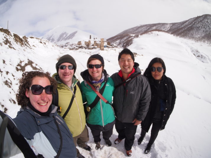
Our tour group in Ushguli (left to right): Julie, Andrew, Jo, Masato, Hyunja

Feral dogs aside, the mountains were a highlight of the trip for all of us and we vowed to return in the summer for some hiking!

Mtskheta, Georgia

On our final day in Tbilisi we took the short marshrutka (minibus) trip north to Mtskheta, spiritual home of Georgian Christianity and a UNESCO World Heritage Site.  First stop was the Svetitskhoveli Cathedral which dominates the small town’s centre.

Svetitskhoveli Cathedral

The Svetitskhoveli Cathedral in Mtskheta. We noticed that a lot of Georgian churches have little model churches on their roof ridges and this one is no exception

Svetitskhoveli means ‘Life-Giving Column’, a reference to the legend surrounding the building of the first cathedral on this site in the 4th century. Long before, the robe from Christ’s crucifixion was brought to Mtskheta by a local Jew and ended up buried nearby although the site had been forgotten by the time King Mirian, Georgia’s first Christian king, had been converted and decided to build a cathedral here.  When they tried to raise the cathedral’s central pillar it could not be lifted from the ground, but after much praying by St Nino (more about her presently) the pillar moved of its own accord to stand over the spot where Christ’s robe was buried.

Svetitskhoveli Cathedral Interior

There are some beautiful frescoes inside the cathedral

We loved the cathedral’s decoration, with the Christ fresco in the apse reminding us of churches we’d seen in Sicily, notably Cefalù and Monreale, and the icons with hanging lamps in front. The gravestones in the floor give hints as to the history of the area and the different rulers who have had influence here at various times, we spotted several Cyrillic (Russian) and Arabic, as well as ancient and modern Georgian scripts. In one of the side aisles there’s a copy of the Chapel of the Holy Sepulchre in Jerusalem erected to mark Svetitskhoveli as the second most holy place in the world (after the original chapel) and today visited by many Georgians who are not able to travel to Jerusalem.

Svetitskhoveli Cathedral

Svetitskhoveli Cathedral (clockwise from top left): Jo and I had to don headscarves and apron-like ‘skirts’ before we could enter (Andrew just had to take off his hat); the original ‘Life-Giving Column’ was on the site of this monument; as you might expect St George is a common subject for icons all around Georgia

After visiting the cathedral we were starting to get hungry. The Lonely Planet told us that lobio, casseroled kidney beans with herbs and spices, are a specialty in Mtskheta so that was what we sought out. They’re served in individual clay pots and were even tastier than we expected. With some bread and salad they made for a nutritious and cheap lunch!

Lobio

Lobio for lunch in a Mtskheta cafe

After lunch we made our way to the Jvari Church, sitting on a ridge over the town.  As the crow flies it’s not far, but to get there by road it’s 11km each way and, as it’s not served by public transport, most visitors take a taxi.  But that’s not our style, it was a glorious day and a bit of exercise would do us good, so we checked with the helpful lady in the Tourist Information Office who informed us that it was possible to walk there in about an hour.  The only hitch was crossing the dual carriageway that separates the town from the hill where the church is.  Fortunately the road wasn’t too busy, the visibility was good and there was a nice high central reservation to wait on in the middle, still it wasn’t the nicest road crossing we’ve ever done – though less stressful than navigating the hundreds of teeming scooters in Vietnam!

View of Mtskheta from Jvari church

From the Jvari church there’s a spectacular view of Mtskheta and the confluence of the Aragvi (blue) and Mtkvari (grey) rivers

The Jvari Church itself is small and simply constructed but very holy for Georgians as it stands on the site where King Mirian erected a wooden cross soon after his conversion by St Nino in around 327AD. St Nino was a missionary from a Greek-speaking Roman family. Reputedly related to St George, she travelled to Georgia from Constantinople (modern day Istanbul) and became one of the most important saints in the Georgian Orthodox church. Her grapevine cross is a symbol of Georgian Christianity, and Nino is a very popular girls name too – it sometimes seemed like every other local woman we met was called Nino!

Jvari church

The small and symmetrical Jvari church

It was extremely windy on the ridge outside the church though the view was worth being blown about for. The inside is a big contrast to the Svetitskhoveli Cathedral, with bare stone walls rather than frescoes, the small circular space is dominated by a large wooden cross, and there’s a rather sombre atmosphere with a black-clad old lady shushing anyone who speaks too loudly.

Jvari church

Jvari church (clockwise from top): the church stands on a ridge across the river from Mtskheta town; a representation of the cross of St Nino; inside the church is dominated by a large wooden cross

Armenia Round Up

What photo takes you right back to Armenia?

Us at Zorats Karer

Us at Zorats Karer. Just one of the many spectacular sights that we had to ourselves in Armenia.

Summarise Armenia in three words.

  • Khachkar – the carved stone crosses are everywhere in the country, especially in graveyards and on church walls
  • Pothole – we really enjoyed having a car to explore some of the out of the way corners of Armenia but driving required a lot of concentration as even the main roads had some impressive potholes!
  • History – we found the depth and breadth of history in this small country staggering – from ancient standing stones to medieval monasteries to 20th century tragedy and politics

You really know you’re in Armenia when…

…your guesthouse seems to be doing their best to overfeed you! We didn’t know much about Armenian food before we arrived so it was a pleasant surprise to find something akin to a mixture of eastern Mediterranean and northern European cuisines. Just as well as our hosts regularly plied us with more food than we could possibly manage.

What one item should you definitely pack when going to Armenia?

Your thermals. Pretty much the whole country is at high altitude so if you’re travelling in the winter or early spring as we did you’ll need some warm clothes – it gets bitterly cold.

Armenian Road Trip

We generally prefer to get around by public transport when we travel – it’s much cheaper, there’s less to worry about and it can be a good way to learn how locals live and move around.  However, when we were researching Armenia there were several sights that we were keen to see but seemed difficult to link together with public transport without using up more days than we had, so we decided to hire a car for just under a week.

Andrew and rental car

Andrew with our Armenian rental car

After collecting the car in the centre of Yerevan we drove north for about an hour to Lake Sevan, one of the largest freshwater high-altitude lakes in the world.  About 35km to the south along the lakeside road we arrived at the small village of Noratus and one of my favourite sights in Armenia.  The graveyard here is incredible, it dates back to medieval times and contains over 800 khachkars (literally ‘cross stones’) carved between the 9th and 17th centuries. It looked even more magical as the ground was covered in a thick layer of snow and the sun came out just as we arrived.

Noratus cemetery

One of the two small chapels at Noratus cemetery surrounded by khachkars

Walking around we could see how the khachkar developed from the early cradle stones, so called as they mimic the shape of a traditional hanging cradle, into more and more intricately carved crosses.  Khachkars are found all over Armenia, particularly around churches and monasteries, and they seem to have a wider cultural rather than just religious significance. The cross often grows from a representation of the Tree of Life and they can be decorated with carvings of the sun and moon, plants or people.

Khachkars at Noratus

Khachkars at Noratus (clockwise from top left): cradle stones from the 17th century; a row of simple crosses from the 10th-11th centuries; khachkars from the later stages of development; a modern take on the khachkar

The cemetery is still in use, unfortunately we didn’t have much time to look around the modern section as it was beginning to snow and, despite our best efforts, forging our own path through the snow had resulted in wet socks and cold feet.  Nevertheless by the end of that first afternoon we’d already decided that the car hire had been a splendid idea.  

Frozen Lake Sevan

Frozen Lake Sevan from our hotel room. It’s not usual for the lake to freeze, but locals told us that 2016/17 had been a particularly cold winter.

Next morning, we cleared 5cm of snow off the top of the car and set off on the longest drive of the week to Syunik, the southernmost province of Armenia.  During the summer the journey might be a bit shorter, but in early March the most direct mountain pass is still closed by snow and our only option was to take the road back to Yerevan and continue from there along the main highway to the south.

Armenian motorway detour

Armenian roads require a lot of concentration to drive, even when we thought we’d found a smooth stretch of motorway it turned out that bridges were being built and we frequently had to slow down or detour off the main carriageway

By late afternoon, we arrived at another equally remarkable but even older site.  Just outside the town of Sisian, Zorats Karer is also known as the Armenian Stonehenge but is actually even older.  Sited on a plateau surrounded by hills, archaeologists have dated the stones and tombs to 3000BC.  Again the weather was kind, the sun came out and we had the place to ourselves though it was bitterly cold on the exposed hilltop.

Zorats Karer

The standing stones at Zorats Karer

The standing stones are arranged in an oval around a central burial tumulus and sweeping off in two arms to the north and south so that it probably looks a bit like a galaxy from above.  Around 80 of the 223 stones contain holes near their top which are believed to be aligned with the stars making it an ancient astronomical observatory.

Zorats Karer

Zorats Karer (clockwise from top left): the biggest stones stand 2.5-3m tall; many of the stones contain a neatly bored hole close to their top; the burial tumulus in the central oval

Sisian

We spent the second night of our road trip in Sisian, a town which has fallen on hard times since the collapse of the Soviet Union

Next day our target was Goris, just 40km away, but we took advantage of the freedom we had driving ourselves to stop at a few places on the way.

The tower tomb at Aghitu dates to the 7th century and has seemingly been plonked in the centre of an otherwise small and unremarkable village.  We had a good look around and were heading back to the car when we noticed an elderly lady walking down the road giving us a pretty obvious side-eye once over.  We responded to this in our usual way by smiling broadly and calling out ‘barev dzez!’ (Hello!) to which we received the very unusual response of said elderly lady stopping and engaging us in fluent (though clearly not recently practiced) and unaccented English, telling us she was a graduate of the Foreign Languages Institute.  You could have knocked us over with a feather!

Aghitu tower tomb

Aghitu tower tomb

Just a bit further down the road is the monastery of Vorotnavank.  In a commanding position above the river Vorotan the monastery was largely destroyed in an earthquake in 1931 and has been rebuilt.  We enjoyed looking at the carved stone fragments which litter the grounds.

Vorotnavank monastery

There’s a fantastic view down the valley from Vorotnavank monastery

After a bit of an adventure trying (and failing) to go up a road which we eventually decided was far too rocky and rutted for our car, we arrived at our final stop, Kotrats Caravanserai.  With nothing more than a signpost pointing away from the road to guide us we trotted off down a snowy track.  Fortunately the ruined caravanserai was quite easy to spot.  A modestly sized building, which could easily have been mistaken for a barn were it not for the inscription in Persian and Armenian over the main entrance, the caravanserai dates to 1319 and the vaulted chambers inside were used as a secure resting place by merchants travelling along the Silk Road.

Kotrats caravanserai

Kotrats caravanserai (clockwise from top): the ruins are in the middle of a field; inside are three vaulted chambers; over the main entrance is an inscription in Armenian and Persian

By the time we got back to the car we were hungry and as we drove the final 17km to Goris the weather turned into a steady downpour, making us very glad to arrive at our friendly B&B, home for the next few nights.

Yerevan, Armenia

Yerevan was the starting point for our exploration of Armenia and Georgia and in early March it was chilly, with snow on the ground and freezing fog obscuring our view most mornings, but pretty much every afternoon the sun broke through and we enjoyed its mixture of old and new buildings, public parks and lots of art.

St Gregory the Illuminator Cathedral

The St Gregory the Illuminator Cathedral looked very atmospheric in the snow and fog. It was consecrated in 2001 having been built to celebrate 1700 years of Christianity in Armenia.

In the 1920s there was a grand plan to redesign Yerevan, it took a few years to be completed but Republic Square was the centre of that plan and today is the focal point of the city.  Around its sides are impressive government buildings in the pink tufa stone characteristic of Yerevan, and in the centre is a pedestrianised square which is supposedly paved to look like a traditional Armenian carpet from above.  I’m not sure that it manages to look like a carpet, but in the summer I’m sure it’s bustling with crowds watching the musical fountains whose pools were still empty after the winter when we visited.

Republic Square

Government offices and the History Museum of Armenia (right) flank the ‘carpet’ section of Republic Square

Cafesjian Art Centre

At the northern edge of the city centre is the Cafesjian Art Centre, also known as the Cascade due to its stepped appearance and fountains (also not working in March)

The Cafesjian Art Centre is a modern art space unlike anything we’ve seen before.  Housed in a huge staircase with fountains, called the Cascade, it houses sculptures beside the escalators which run between the levels and an external sculpture park in the gardens at the front and on the building’s terraces with a funky range of modern art.  On each internal level are galleries including two permanent exhibitions with huge pieces commissioned specifically for the museum – a mural of the History of Armenia by Grigor Khanjyan and a relief carving of the epic David of Sassoon.

Cafesjian Art Centre

Cafesjian Art Centre (clockwise from left): escalators run inside the building; ‘The Knot’ by Stephen Kettle is made of Welsh slate; ‘Gendrd I’ by Barry Flanagan is situated in the external sculpture garden

Mother Armenia

Following the steps above the Cascade building we came out at Victory Park which contains a fun fair and a large statue representing Mother Armenia

We also visited a couple of smaller art museums including the excellent museum dedicated to Yervand Kochar, a contemporary of Picasso, whose 4D sculptures were unlike anything we’ve seen before – rotating pieces of curved metal, slotted together and painted on all sides to create something not quite like a painting or a sculpture – Kochar called them “Painting in Space”.

Vardan Mamikonyan statue

Several of Kochar’s more traditional sculptures are placed around the city including the statue of 5th century military leader Vardan Mamikonyan in the Circular Park, notable for all four of the horse’s feet being off the ground

We visited a LOT of churches and monasteries during our weeks in Armenia and Georgia but on our first afternoon in Yerevan we had one of those serendipitous moments that remind us why we travel. We’d read about a small church surrounded by apartment blocks and as we approached at 5pm its bells were ringing.  We entered just as a service started and sat quietly at the back watching people come and go while priests chanted, candles were lit and incense pervaded the air.

Zoravor Surp Astvatsatsin Church

The Zoravor Surp Astvatsatsin Church doesn’t look so remarkable from the outside, but inside it felt other worldly

On Tsitsernakaberd hill overlooking the city sits the genocide memorial, a sobering monument to the thousands of Armenians who lost their lives in ethnic cleansing carried out by the Ottoman Empire in 1915-22. The well laid out museum chronicles the story and includes historical documents, photographs, personal possessions and testimonies.  It reminded us of the Nanjing Massacre Memorial Hall and the atomic bomb memorial museums in Hiroshima and Nagasaki.  Outside, the eternal flame burns in a circle of 12 slabs which is beside a splintered needle representing the provinces of Western Armenia lost to Turkey in a post WWI deal between Ataturk and Lenin.

Armenian Genocide Memorial

As we exited the museum a Russian delegation was visiting the monument and laying flowers so we had to wait for them to leave before we could approach the eternal flame

To the west of the city centre there’s a former railway tunnel that runs down the hill to the park beside the Hrazdan river. It’s been converted for pedestrian use and is full of graffiti, nevertheless it probably wouldn’t be all that interesting were it not for the unusual zig-zag lighting which makes for a great photo.

Kond pedestrian tunnel

Kond pedestrian tunnel

Armenians are very proud of their culture, and nowhere is this more obvious than at the Matenadaran, literally “book depository” where historical documents and precious manuscripts are kept and displayed. Honestly, I don’t think we got the most out of this museum, the manuscripts had English labels with their age and what they were (e.g. gospel) but there wasn’t any explanation of the context or history contained and we wished we’d paid extra for a guided tour. Still, the illuminated documents, some of them over 1000 years old were very beautiful.

Matenadaran

In front of the Matenadaran is a statue of Mesrop Mashtots the creator of Armenia’s alphabet

Food is always high up on our list of things to explore when we visit a new country and we struck gold in our choice of Airbnb room in the apartment of Astghik and her family. Each morning her mother, Shoghik, produced some new homemade wonder from her fridge or oven for us to try.  With a bizarre combination of her limited English, our very limited Russian, sign language and Google Translate she explained to us how each item was made, from homecured meat (basturma), preserved cheese (khorats panir) and pickles to pumpkin swirl cheesecake and the best coffee in Armenia.  

Consequently our Armenian vocabularly is about 50% food words and when we finally visited the large GUM market we recognised a lot of what we saw.  In the summer months I think the fresh produce would play more of a starring role but in the winter there were nuts and preserved fruit galore alongside the butchers, greengrocers, spice stalls and clothes sellers and a fabulous second-hand “junk shop” like corner of the upper level which is where we agreed we would find the furnishings for our Yerevan apartment if we lived here!

GUM market, Yerevan

One corner if the market hall is devoted to the huge Armenian flatbreads called lavash

No sooner had we entered the market than the dried fruit and nut sellers started to bombard us with samples and start off on their spiel at breakneck speed (usually in Russian). This was a little intimidating and we were wandering along trying to keep our heads down when an enthusiastic vendor started thrusting spices under our nose and feeding us samples of his barberries. We politely agreed that they smelt wonderful but thank you we don’t want any, undeterred he took us to his store room at the side of the market hall and started plying us with samples of pomegranate wine and apricot vodka (we refused the latter as it was 10.30am but it smelt wonderful). We gave in and bought a litre of the pomegranate wine and he decanted from the large container into an old Coke bottle before we made our escape!

GUM market, Yerevan

Yerevan’s GUM market (clockwise from top left): orderly displays of dried fruit and nuts; salad and herbs; go on, pretend you don’t want to delve into this lot for treasure; there was a lot of locally produced honey for sale

We’d read of the long tradition of viniculture in this part of the world but didn’t expect to encounter good beer.  However, during my research on Yerevan I’d come across Dargett Craft Beer, a microbrewery serving interesting craft beers.  Oh, and it was good!  We visited three times and (with the help of their taster flights) tried almost all of the 20ish beers on offer, and there wasn’t a bad one among them.  My favourite was the apricot ale.

Dargett Craft Beer

On our final afternoon in the city we took a tour of one of the city’s two brandy factories, the Noy Brandy Company.  Originally set up in the 19th century it closed down and fell into disrepair in the second half of the 20th century.  It’s now been renovated and reopened complete with cellars full of old wine barrels (though they only produce brandy here now).  During the Soviet era Armenian brandy was prized across the USSR and Noy are proud that they are still the official brandy supplier to the Kremlin.

Noy Brandy Factory tasting

Trying brandies in the Noy Brandy Company’s tasting room

Before our visit we’d read and seen pictures of Mt Ararat which is supposedly visible from many points in Yerevan.  It’s the mountain where Noah’s Ark came to rest and is sacred to Armenians though it is now across the border in Turkey and they can only look at it.  Unfortunately for us it was quite shy and seemed to be shrouded in cloud most of the time so that we didn’t even get a peek for the whole week that we were there.