Category Archives: Experiences

Cefalù, Sicily

Cefalù is another Sicilian beach town like Taormina that we imagine would be very popular and very busy in the summer, however on a crisp and somewhat windswept day in early January it was largely deserted. Most of the restaurants and cafes were closed, with only the odd souvenir shop spilling out into the pretty cobbled streets.
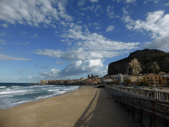
Cefalù, Sicily

Cefalù is the nicest beach town we’ve visited so far in Sicily. You can see the Cathedral in the middle and the massive fortress rock to the right

Cefalù has the nicest beach we’ve visited so far in Sicily, it’s long and sandy, and just like Taormina, there are plenty of other reasons to visit if beaches aren’t your thing, or, as it was for us in January, not quite beach weather.

Lavatoio Medievale

While looking for possible things to see or do in Cefalù, I found the curiously named Lavatoio Medievale – and thinking that Lavatoio sounded like lavatory my first thought was this was a medieval bathroom, and I was close.. turns out the translation actually means wash house!
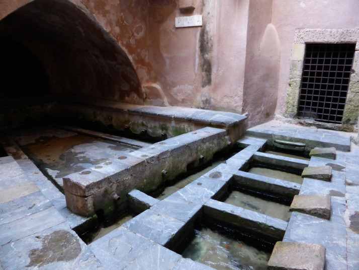
Lavatoio Medievale, Cefalù, Sicily

A very practical last use of the little Cefalino river that runs through Cefalù before it reaches the sea – a medieval wash-house!

Cefalù Duomo

Built by the then King of Sicily, Roger II in 1131 as an act of gratitude for surviving a bad storm and landing on the town’s beach, the Cefalù Cathedral pokes its head and shoulders above the rest of the town, still holding a commanding position despite itself being towered over by the almighty backdrop of the giant La Rocca behind it.
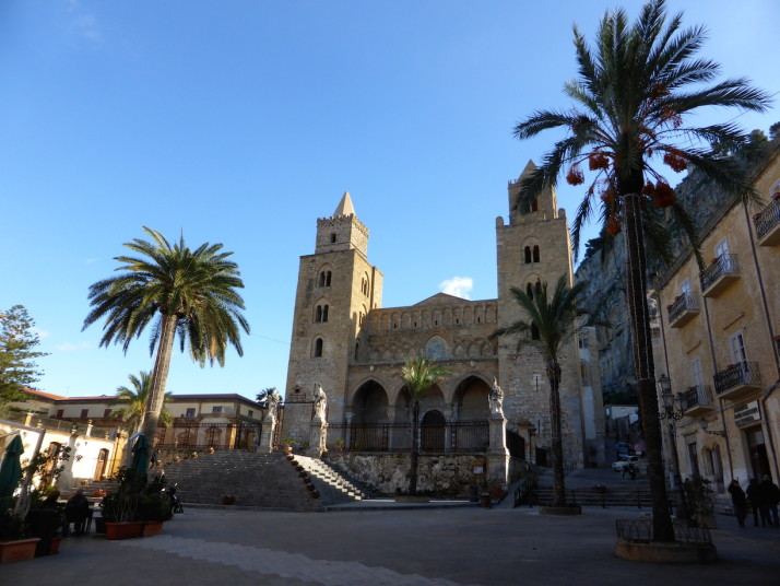
Cefalù Cathedral, Sicily

The two large Norman towers of the Cefalù Cathedral

We knew we were going to like the Cefalù Cathedral before we saw it, and we were looking forward to seeing the mosaic of Christ Pantocrator in the apse, but for all we knew what we were expecting to find, the scale and magnificence still surprised us.
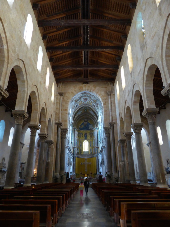
Apse, Cefalù Cathedral, Sicily

The nave and apse of Cefalù Cathedral. No matter how many times we walk into a cathedral or mosque we’re always impressed at how big they are inside
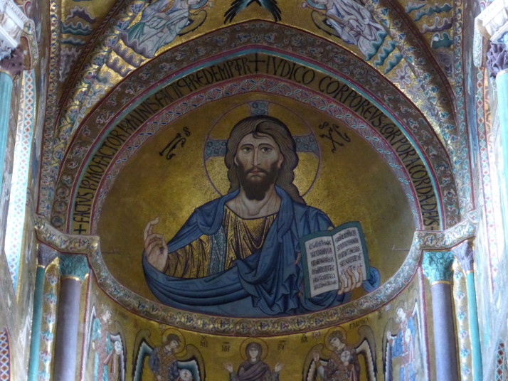
Christ Pantocrator, Chefalù Cathedral, Sicily

Close up of the Christ Pantocrator mosaic. Pantocrator means “almighty” or “all powerful” and refers to this specific style of the depiction of Christ

One thing we noticed about the Cathedral that we haven’t seen in any other was that the stained glass didn’t have the usual depictions of the life of Christ, but were instead a series of abstract colours and shapes reminiscent of a smudged Frank Lloyd Wright. If it were possible to smudge a stained glass window!
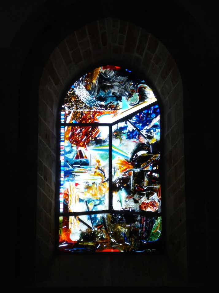
Stained glass, Cefalù Cathedral, Sicily

We really liked the unconventional stained glass in the Cefalù Cathedral

Cefalù Cloister

Next we went to the adjoining cloister which is a sort of museum – a small entry fee bought us a ticket and a translated map. We felt the guy on the desk was a little disappointed that we asked for the English version given that he had pretty much every language. In Bangladesh we were often mistaken for Japanese (yes, you read that correctly), so we wondered what nationality we looked like.
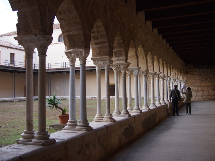
The Cefalù Cathedral Cloisters, Sicily

We weren’t the only ones trying to identify some of the capitals in the Cefalù Cathedral cloisters

The map guided us around the outer path of the cloister, highlighting the capitals of the supporting pilars which have been carved into various forms, including a section of bible stories. Some have been lost to erosion or collapse, and most were of acanthus plants.
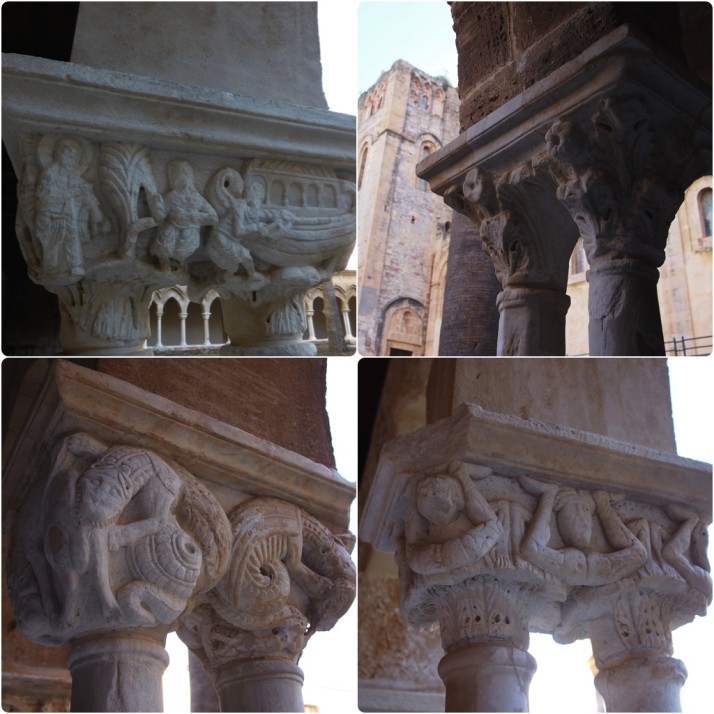
Cloister capitals, Cefalù Cathedral, Sicily

Our favourite of the decorative capitals: clockwise from top left: Building the Ark; If in doubt, it’s an acanthus; The acrobats; Hungry crocodiles

Cefalù Beach
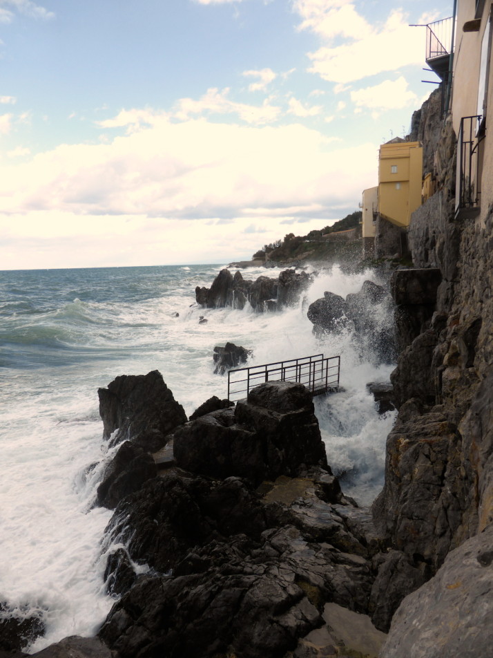
Coastal path outside the megalithic wall, Cefalù, Sicily

It’s possible to walk along the outside of the old megalithic fortress walls, at least, it would be when the sea isn’t trying to smash you against them.. we decided to walk back through the town..

Nope, that last picture isn’t the beach but a walkway outside the megalithic walls that used to protect the town. We decided to go the other way as the sea was testing the defences! Once we got to the beach, and even though it was the 5th of January and everyone was walking around in big coats, scarves and gloves, I’d brought my swimming shorts for a quick New Years dip..
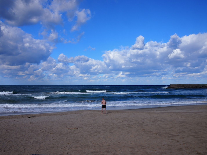
Time for a swim, Cefalù beach, Sicily

Time for a swim in the rough Tyrrhenian Sea. Yes, I am slightly insane

It wasn’t as cold as I remember Lake Baikal being, but I still couldn’t feel my hands or feet after I’d dried off!

La Rocca – The Fortress

I made sure to get all of the sand from between my toes as the next thing on our itinerary was to climb the 270 metres to the top of La Rocca – the giant calcareous crag backdrop to Cefalù. Once a mighty fortress, hence its name, the ancient Greek inhabitants saw it as a gigantic head, and “head” is in fact the meaning of the town’s name.
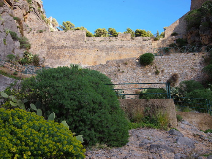
Climbing La Rocca, Cefalù, Sicily

Easy steps to the top of La Rocca, just a lot of them!

The hike wasn’t difficult as the way is clearly marked and before we knew it we were looking down on all the sights we’d just visited – when the clouds rolled past the view from the top was beautiful.
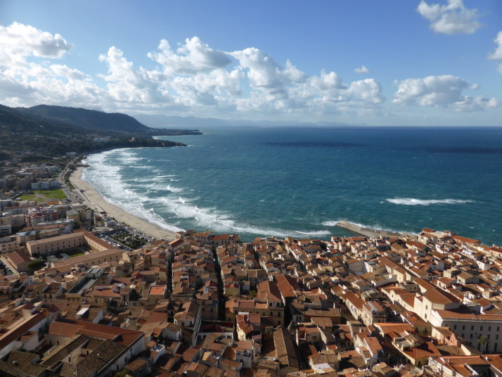
Cefalù from the top of La Rocca, Sicily

The view back over the town of Cefalù from the top of La Rocca was easily worth the climb – we were just down there!
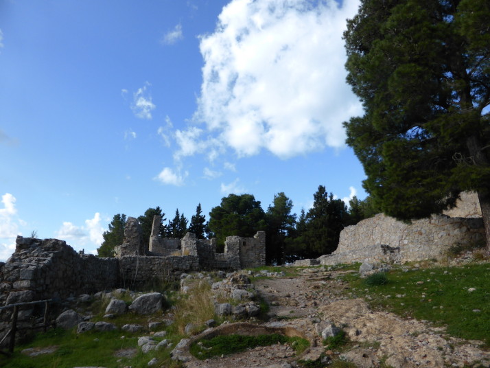
The living quarters and bakery on La Rocca, Cefalù, Sicily

Remains of the fortifications on top of the crag include some old living quarters and a bakery on the right
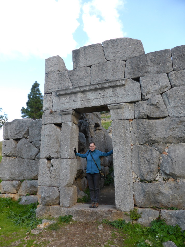
Julie at the Tempio di Diana, La Rocca, Cefalù, Sicily

Julie at the Tempio di Diana, a 9th century BC megalithic temple believed to have been used for the worship of water and likely also for defence
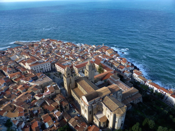
View of Cefalù Cathedral from La Rocca, Cefalù, Sicily

Further round the cliff top trail is the most amazing view of the Cefalù Cathedral
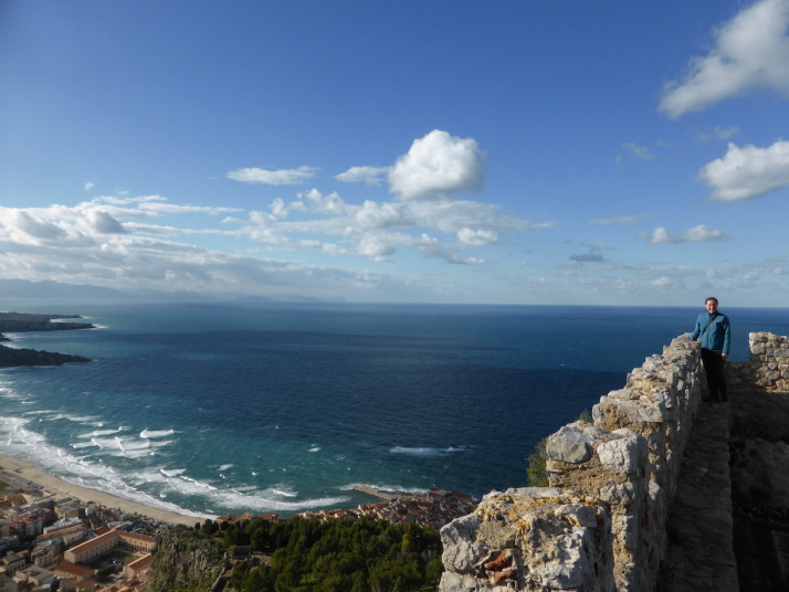
Atop the fortifications on La Rocca, Cefalù, Sicily

After a little scramble up the rubble track we reached the remains of the old castle that once stood at the very top

Cefalù castle dates back to the 13th-14th centuries, and consisted of two towers and twelve rooms. There’s not much left of it save for the floorplan evident from the bottom half of the walls that are about hip-deep in places, and a section of the outer ramparts.

Also visible from the fortress are the remains of the Abbey of Thelema, a small house which was used as a temple and spiritual centre founded by Aleister Crowley and Leah Hirsig in 1920. I must admit that I didn’t know anything about it before we started researching Cefalù, but Aleister Crowley was ranked 73rd in a 2002 BBC poll of the greatest Britons of all time, having been denounced in the popular press of his day as “the wickedest man in the world” and erroneously labelled a Satanist.
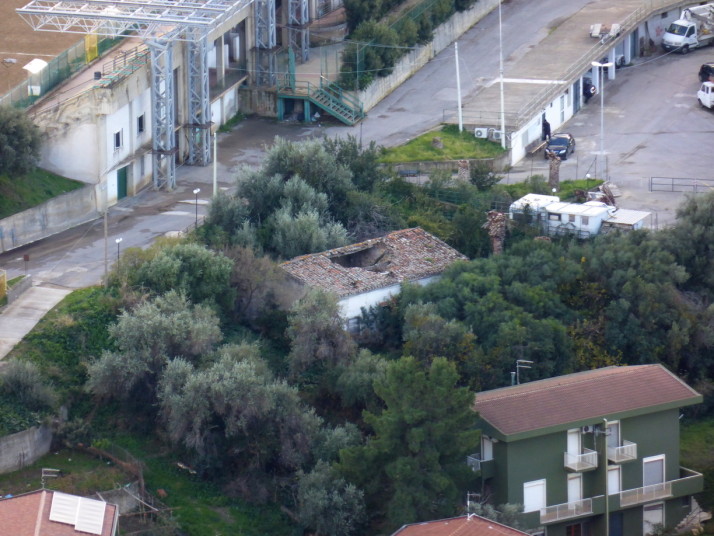
Remains of the Abbey of Thelema, Cefalù, Sicily

The remains of the Abbey of Thelema as seen from the top of La Rocca

Cefalù is a perfectly sized day-trip from Palermo, and we loved the variety of sights and activities.

Hiking up Mount Etna, Sicily

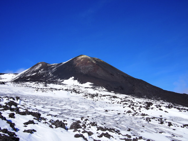
As we mentioned in our post about Catania, the town sits at the foot of Mount Etna – Europe’s tallest active volcano at a height 3,329m (10,922ft). Having climbed Mt Fuji earlier this year, we wondered if it would still be possible to hike on Mt Etna this far into the winter season, and to our delight, it appears that only eruptions cause it to close!

Mt Etna, Sicily

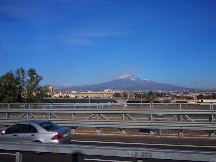
Our first glimpse of Mt Etna on the ferry transfer from Pozzallo to Catania having just arrived on Sicily

Mt Etna is a still very much an active volcano and had erupted in August this year – just 4 months ago – and a couple of craters near the top are still emitting a little ash. I’ll say at this point that we didn’t know about the August activity until I was researching this post.. not that it would have changed our plans!

Getting there

As we’re finding in Sicily, information about public transport is relatively easy to find, but locations of bus and train stations are a bit trickier, and the English versions of websites aren’t as complete as their native Italian counterparts. This is just a little niggling pain when trying to plan our manoeuvres..

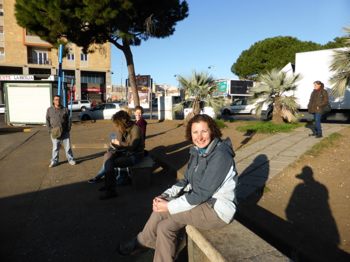
Waiting for the bus to Mt Etna, Catania

Waiting for the bus to Mt Etna with a few locals and 3 other tourists: 2 from Holland and 1 from Turkey

Anyhow, we confirmed our plans with the very friendly lady at the Catania Tourist Information office who also checked the weather and suggested we go sooner than we’d originally planned. Two days later we were up and out at the bus station near the train station waiting for the 08:15 bus that goes to Rifugio Sapienza some 1,910m (6,266ft) up Mt Etna.

08:15 came and went. Then 08:30. The somewhat official guy at the bus stop kept checking his watch and reassuring us in Italian, but when he showed us a pricelist for a tour of Etna by taxi we started to get a little concerned.. he kept checking his watch so we decided to keep waiting with the other handful of others clutching their coffees.

5 minutes later the bus came hurtling around the corner. We picked our seats and tried to catch up on a little sleep during the 1½ hour journey.

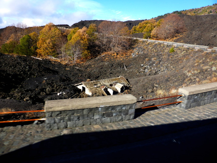
House submerged by lava, Mt Etna, Sicily

We spotted the roof of this house submerged in lava on the final approach to Rifugio Sapienza. Yep, we’re on a volcano!

The Hike

The friendly bus conductor told us all that he’d return to the drop-off point in front of the semi-circle of souvenir shops at 16:30 to take us back to Catania. Rifugio Sapienza is just over half-way up the side of Mt Etna, and this large open-air car park offers little protection from the bitter winds that whip through – it was a very cold first experience, and for the other 3 tourists who hadn’t come dressed to hike in winter conditions we think it put them off as we didn’t see them again until the return journey!

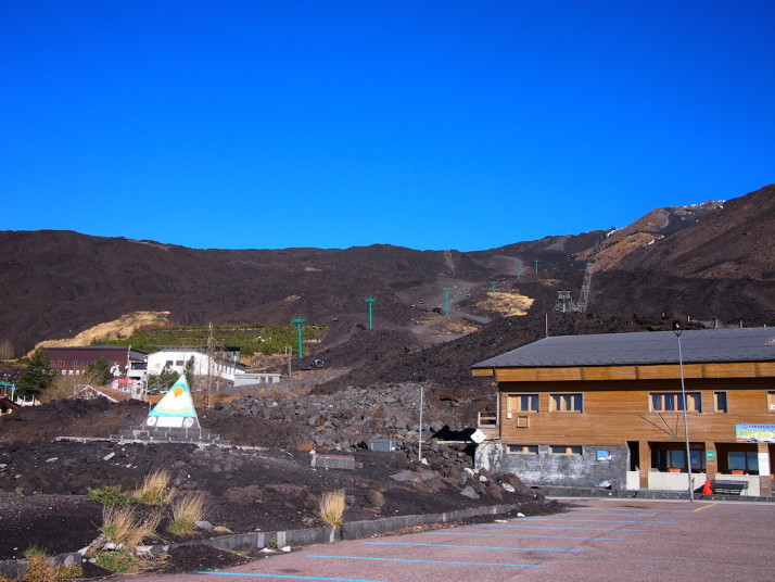
Rifugio Sapienza, Mt Etna, Sicily
1910m: Rifugio Sapienza, the starting point is very similar to the Yoshida-guchi 5th Station on Fuji, in that it’s a giant car park with cafes, restaurants, a hotel and, of course, souvenir shops.

Cable-car at Montagnola, Mt Etna, Sicily
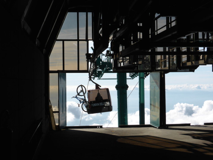
1910m: While it’s possible to hike up from Rifugio Sapienza, we decided to take the cable-car to Montagnola and hike further from there. We’d read this section takes about 4 hours to hike or about 20 minutes on the cable-car

Jeep-busses at Montagnola, Mt Etna, Sicily
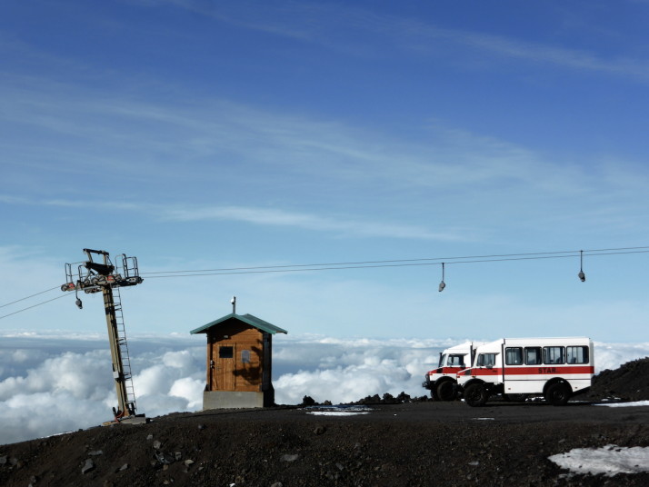
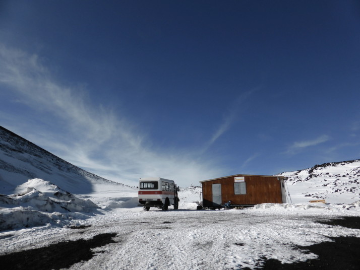
2500m: From Montagnola we could have taken one of the cool Unimogs to the guide station at 2920m, but it wouldn’t be much of a hike if we didn’t actually do any hiking!

Mt Etna, Sicily
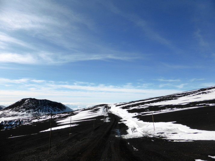
~2600m: Starting out on our hike to Torre del Filosofo. At this point we were starting to feel a little short of breath because of the altitude

Mt Etna, Sicily
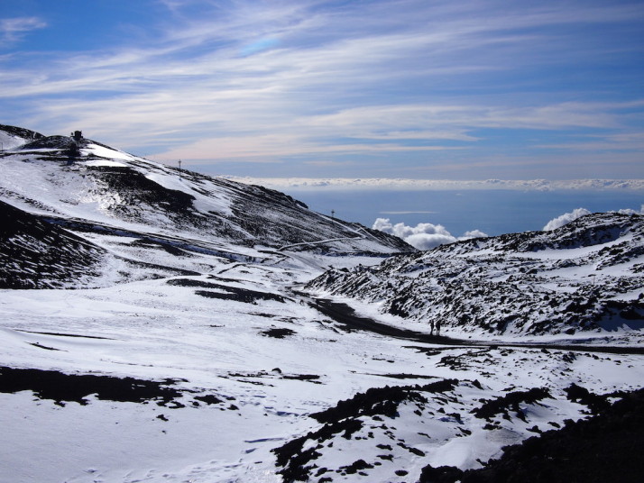
~2650m: Looking back down the trail. The landscape is binary – coffee black volcanic rock and egg-white snow with the sky providing the only colour

Mt Etna, Sicily
~2700m: Finally, the sulphur yellow of the top of Mt Etna pops into view

Torre del Filosofo, Mt Etna, Sicily
2920m: Torre del Filosofo, or the top station. We’d read that it’s not permissible to venture further without a guide, but aside from a signpost there wasn’t anyone there to stop us if we were so inclined

Craters near Torre del Filosofo, Mt Etna, Sicily
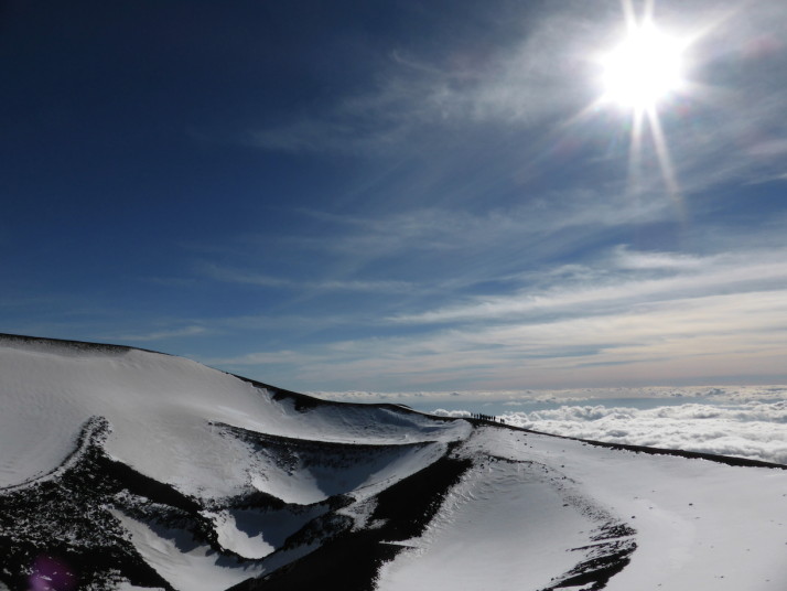
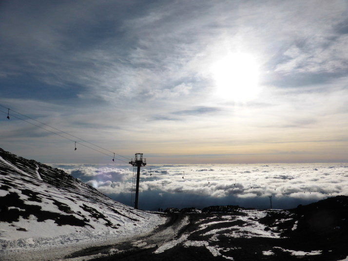
~2950m: We climbed the ridge of the nearby craters and were rewarded with amazing views of Etna behind and above us, and a blanket of cloud below that covered Catania. Views like this are usually the reserve of aeroplane journeys! We’d arrived at the top just after a Jeep-Bus, which made for some great photos – having people in our shots gives some perspective of how massive these volcanic craters are!

Craters near Torre del Filosofo, Mt Etna, Sicily
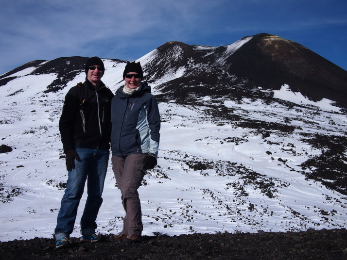
~2950m: The highest point we reached was on the ridge of one of the large craters. Time to pose for a photo with Mt Etna herself!

After circling the craters (and taking a lot of photographs), we headed back down the same track alongside a couple of mountain bikers and 3 skiers!

Mt Etna, Sicily
~2550m: The downhill was a lot easier and as we didn’t have to stop to catch our breath as often it was quicker too. We made it back to Montagnola and then via the cable-car to Rifugio Sapienza with plenty of time to spare before the return bus to Catania!

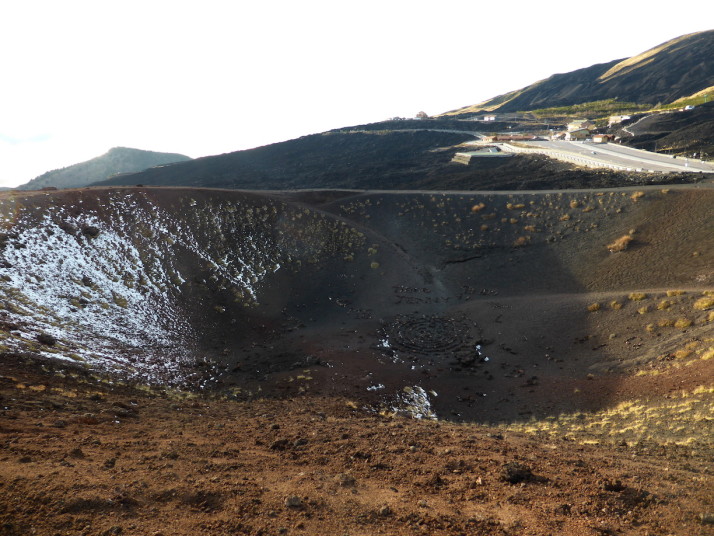
Crateri Silvestri 1986, Mt Etna, Sicily
~1915m: Just to the east of the big car parks are a couple of recent craters that we decided to wander around while we waited for the bus. This is the Crateri Silvestri which was formed in 1986.

Despite hiking in December rather than July, Mt Etna was warmer than Fuji, and was nowhere near as arduous. Next time we’re bringing skis for the downhill leg though!

Malta Round Up

What photo takes you right back to Malta?

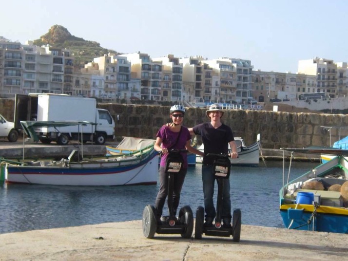
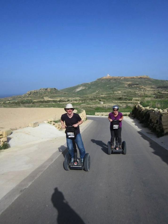
There were so many historic highlights of our trip to Malta, but our morning of touring the northern coast of Gozo on Segways was so much fun that we’ll always remember it!
Summarise Malta in three words.

You really know you’re in Malta when…

… you can see the Mediterranean Sea no matter where you are, and in a few higher places on the islands it’s possible to see the sea in all directions!

What one item should you definitely pack when going to Malta?

A torch for when you visit all of the underground caves, catacombs, and wartime bunkers

Countryside walks in Malta

After thoroughly strolling our way through Istanbul, we decided to continue this form of sightseeing experience and we were delighted to find the Malta Tourism Authority provide leaflets for varying length walks that cover most of the island. We picked up copies from the Tourist Information offices in the airport and Valletta, but they’re also available online, and in at least 3 languages: English, French and German.
Of the 7 routes, we did 5 of them over the course of our months stay on Malta..

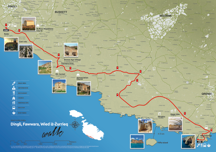
Dingli, Fawwara, Wied iż-Żurrieq Walk

Map: Dingli, Fawwara, Wied iż-Żurrieq Walk
Distance: 11.2km / 7miles
Difficulty: (moderate – long but mostly downhill)
What we liked: Great scenery of the Dingli cliffs, includes the mysterious ‘Cart Ruts’ of Malta and Gozo, goes past the temples of Ħaġar Qim and Mnajdra, and it’s downhill
Dingli - Fawwara - Wied iż-Żurrieq walk map, Malta

Dingli – Fawwara – Wied iż-Żurrieq map. Source: Malta Tourism Authority

Looking south over the cultivated fields of Fawwara, from a Bronze Age village site that juts out almost to the sea

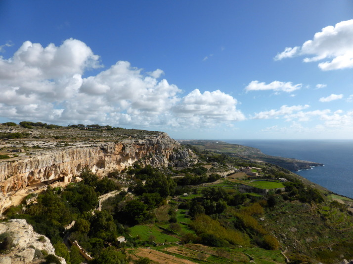
Looking south over the cliffs near Fawwara

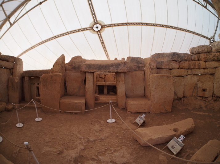
Inside the first chamber of the South Temple of the Mnajdra temple complex

Inside the first chamber of the South Temple of the Mnajdra temple complex

This was the first walk we did on Malta, and gives a great taste of the megalithic history of the islands as it includes the mysterious ‘Cart Ruts‘ near the start, and ends near the megalithic temples of Ħaġar Qim and Mnajdra. We liked that it was largely downhill, and there’s a good variety of sights too. One thing though – bring a packed lunch with you as the route is fairly remote, though there are cafes and restaurants at the end in Wied iż-Żurrieq.

Watchtowers Walk

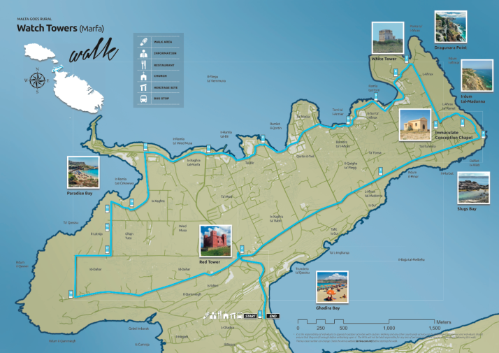
Map: Watchtowers Walk
Distance: 14.45km / 9miles
Difficulty: (hard – long with some uphill sections)
What we liked: Good variety of sights – watchtowers, beaches, holiday bays, local bird traps and the odd church, and having a beer and a packet of crisps on the Għadira beach at the end!
Watchtowers Walk map, Malta

Watchtowers Walk map. Source: Malta Tourism Authority

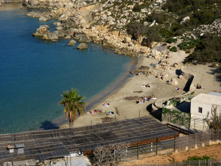
The aptly named Paradise Bay is on the route - don't forget your swimming costume!

The aptly named Paradise Bay is on the route – don’t forget your swimming costume!

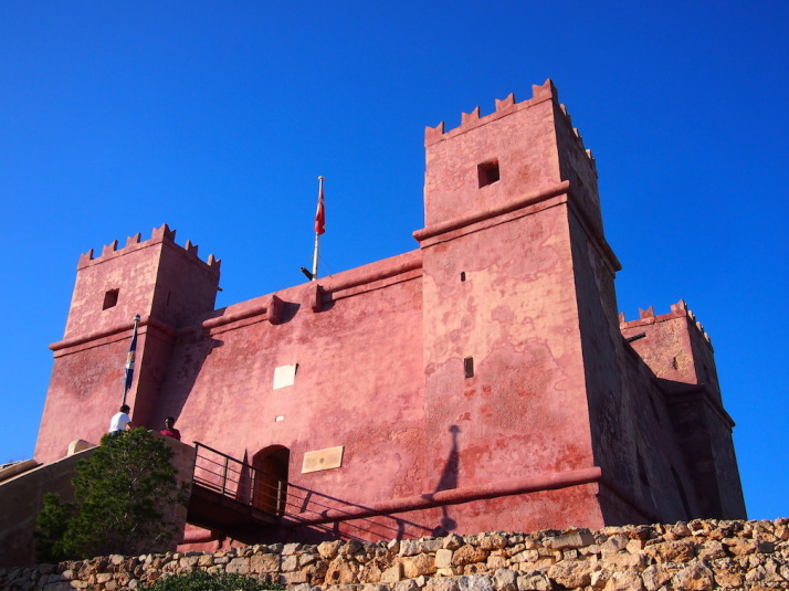
St Agatha's Tower - otherwise known as the Red Tower, dominates the northern peninsula of Malta and is the final stop of the walk

St Agatha’s Tower – otherwise known as the Red Tower, dominates the northern peninsula of Malta and is the final stop of the walk

This walk circumnavigates the very northern outcrop of Malta, and it took us over an hour to get there by bus from Valletta where we were greeted by an uphill hike! As we were off-season a lot of the little holiday bays and lovely secluded beaches were very quiet though I suspect it’d be very different in the summer. Still, this walk includes a nice variety of sights and the highlight of the Red Tower is saved for the end.

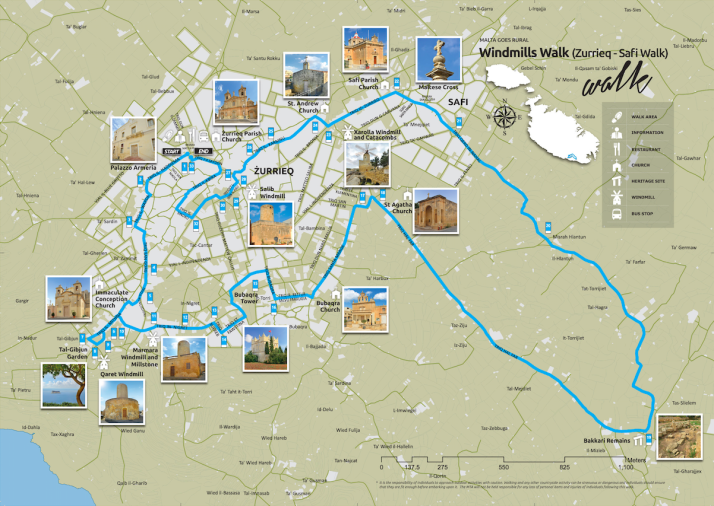
Windmills Walk

Map: Windmills Walk
Distance: 8.8km / 5.5miles
Difficulty: (easy)
What we liked: Spotting the windmills, reading the information boards at the Tal-Ġibjun Garden viewpoint about ⅓rd of the way around
Windmills Walk map, Malta

Windmills Walk map. Source: Malta Tourism Authority

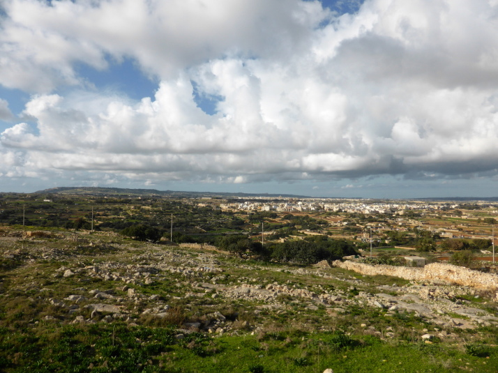
The view across Malta from the Tal-Gibjun Garden viewpoint is worth the visit to Żurrieq even if you don't do the walk!

The view across Malta from the Tal-Ġibjun Garden viewpoint is worth the visit to Żurrieq even if you don’t do the walk!

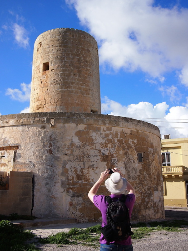
.. but then you'd miss out on the milling history of the island!

.. but then you’d miss out on the milling history of the island!

First, a confession – we skipped out the Bakkari Remains and stayed in Żurrieq because we’d spent so much time at the excellent Tal-Ġibjun Garden viewpoint reading about the sights, events and identifying the landmarks from this natural vantage point. Of all the windmills, only one is still active, and it sits atop some old burial pits! This is quite a compact walk so we twinned it with a stop at the Blue Grotto to make a day of it.

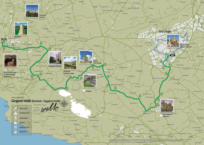
Girgenti Walk

Map: Girgenti Walk
Distance: 7.7km / 4.8miles
Difficulty: (moderate – some uneven ground and an easy scramble to visit the Big Cave)
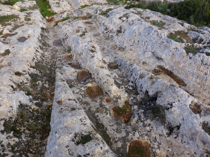
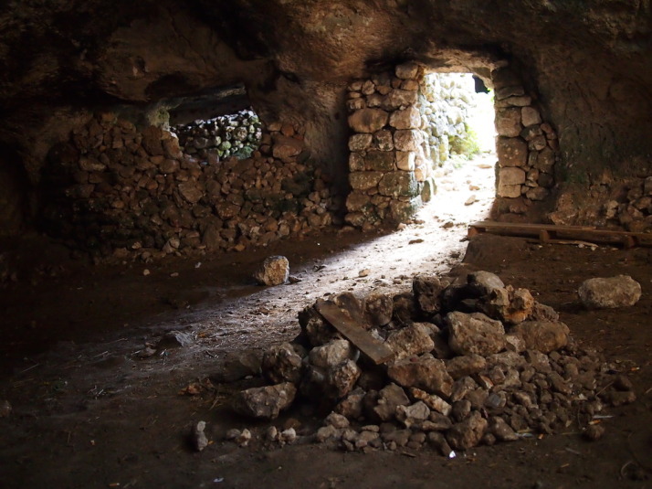
What we liked: The amazing start – the complicated collection of ‘Cart Ruts’ nicknamed Clapham Junction (yes, seriously!) and the aptly named ‘Big Cave’
Girgenti Walk map, Malta

Girgenti Walk map. Source: Malta Tourism Authority

A small section of the 'Cart Ruts' at the so-called 'Clapham Junction' - what were they used for?

A small section of the ‘Cart Ruts’ at the so-called ‘Clapham Junction’ – what were they used for?

View from inside part of Ghar il-Kbir which literally translates to 'Big Cave'. It's a cave. And, you guessed it, it's big

View from inside part of Ghar il-Kbir which literally translates to ‘Big Cave’. It’s a cave. And, you guessed it, it’s big

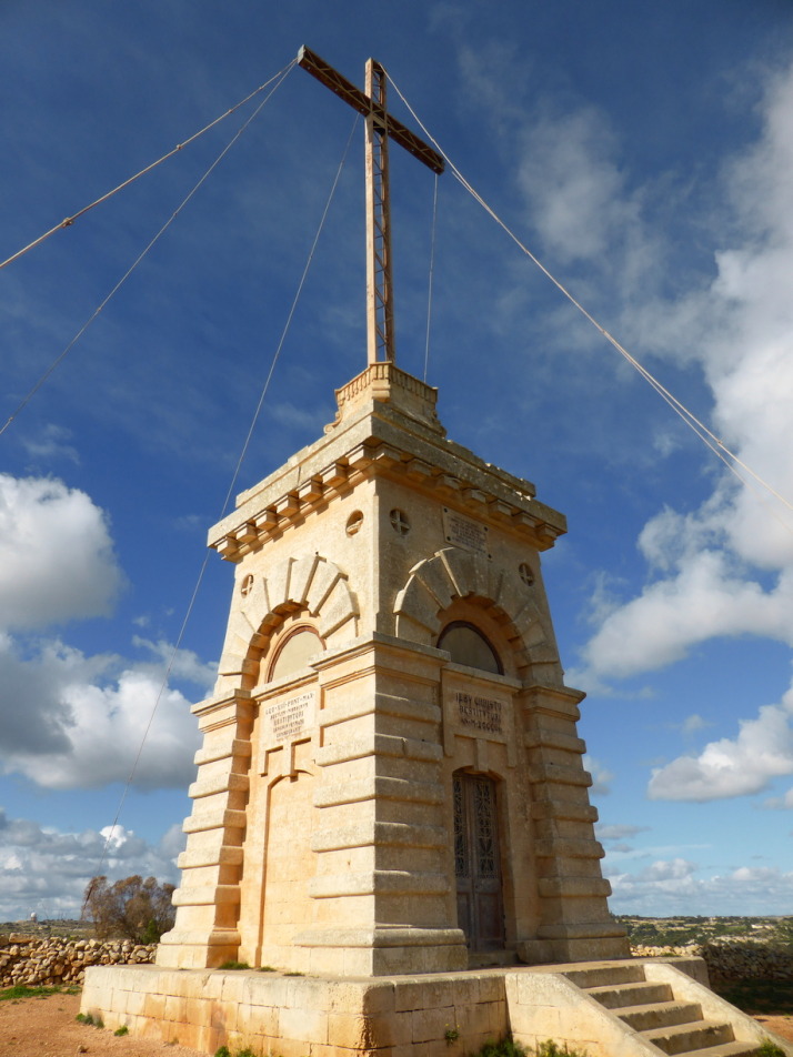
The huge bronze Laferla Cross next to the Assumption Church sits on the edge of the hill with lovely views over the second half of the walk

The huge bronze Laferla Cross next to the Assumption Church sits on the edge of the hill with lovely views over the second half of the walk

This is our favourite of the walks we’ve done on Malta because the detour to the field of ‘Cart Ruts’ just points you at the right place but leaves you to find them. It was really enjoyable trying to actually find the famous ‘Clapham Junction’ and then further up the same field are burial pits and the ‘Big Cave’ that was inhabitanted until 1835. Other highlights for us were the huge bronze Laferla Cross (which we saw from the viewpoint of the previous Windmills walk), the figures surrounding the dome of the Providence Church, and serendipitously visiting on the annual St Nicholas Parish church open day, where they opened up the roof and the organ pit. We got great views from the top of the church, and befriended a local guy who showed us the belfry and invited us to the village festival at the end of July next year!

Maqluba Walk

Map: Maqluba Walk
Distance: 6km / 3.7miles
Difficulty: (easy)
What we liked: The small chapels that bestrew the countryside, getting out into the farming fields of the island
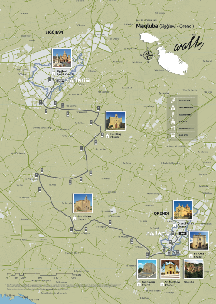
Maqluba Walk map, Malta

Maqluba Walk map. Source: Malta Tourism Authority

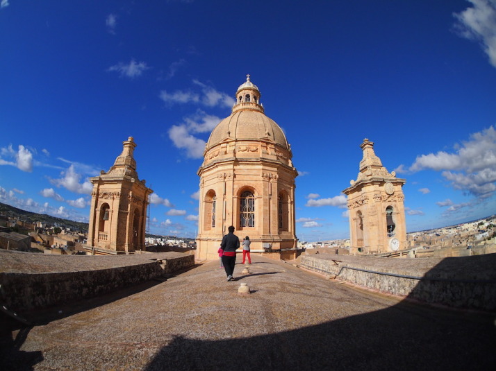
The start of the walk is Siggiewi Parish Church. When we tried to enter we were told that the entrance was through the belfry! For a small mandatory donation we got to climb onto the roof and on the way down we were given an introduction to the church's organ!

The start of the walk is Siġġiewi Parish church. When we tried to enter we were told that the entrance was through the belfry! For a small mandatory donation we got to climb onto the roof and on the way down we were given an introduction to the Church’s organ!

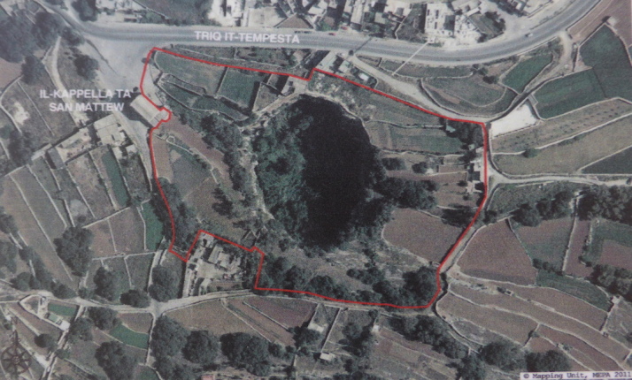
Aerial photo of the giant sinkhole that appeared on the 23rd of November 1343 during a severe winter storm

Aerial photo of the giant sinkhole that appeared on the 23rd of November 1343 near Qrendi during a severe winter storm. Photo source: onsite information board

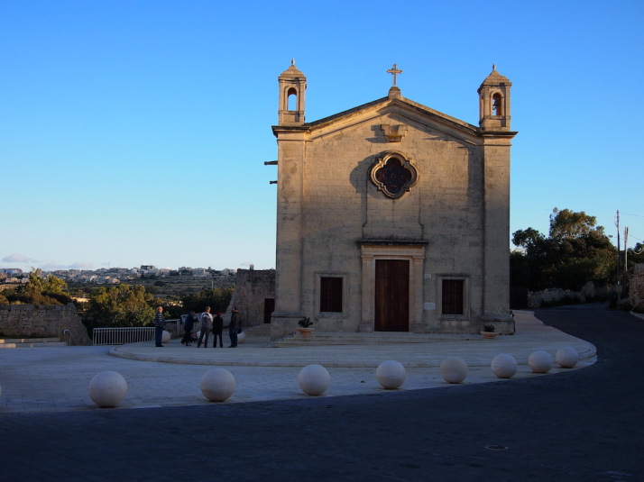
And we end with yet another church - this time Qrendi's St Matthew's Chapel as the sun sets

And we end with yet another church – this time Qrendi’s St Matthew’s Chapel as the sun sets

As this walk starts at the end of the previous Girgenti Walk, we did them both in the same day, stopping in Siġġiewi for a spot of lunch between them. This is very much a rural Maltese countryside walk far from any tourist attractions, but our timing was impeccable as the lovely little Hal-Xluq Church was home to a local artists’ exhibition – which is the only other time of the year the church opens its doors besides the village festivities! The other highlight for us was the giant sinkhole in the Maqluba valley that appeared in 1343, just outside Qrendi, and almost took the then smaller chapel of St. Matthew with it!

Segueing around Gozo, on a Segway!

The country of Malta is a Mediterranean archipelago, and only the 3 largest islands are inhabited. The main one is Malta, then Gozo to the north, and between them is a small island called Comino which only has 4 permanent residents.

Given their proximity, Gozo shares a lot of the same history as Malta, and in looking for places to visit and things to do for a couple of days there we found GozoSegway – a small company that operates guided tours of Gozo while you operate a Segway!

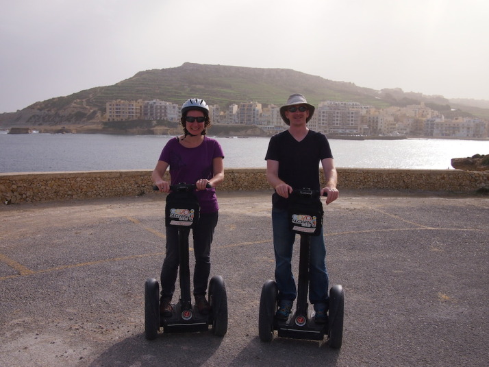
Us on Segways having just passed our Compulsory Basic Training, which consists of an emergency stop, hill start and smiling from ear to ear

Us on Segways having just passed our Compulsory Basic Training, which consists of an emergency stop, hill start and smiling from ear to ear

A Segway is a two-wheeled form of personal transportation, similar to a motorised skateboard, but way smarter – using gyroscopes developed by BAE Systems and a lot of very clever electronics it uses your centre of gravity to control motion and direction. Like us, you may have seen them in movies or in the odd city centre, and riding on one is something I’ve wanted to try since they came out in 2001.

We weren’t sure how easy it was going to be to learn how to ride, and as we wanted to see quite a bit of Gozo we booked their longest 2½ hour tour of north-western coastline.

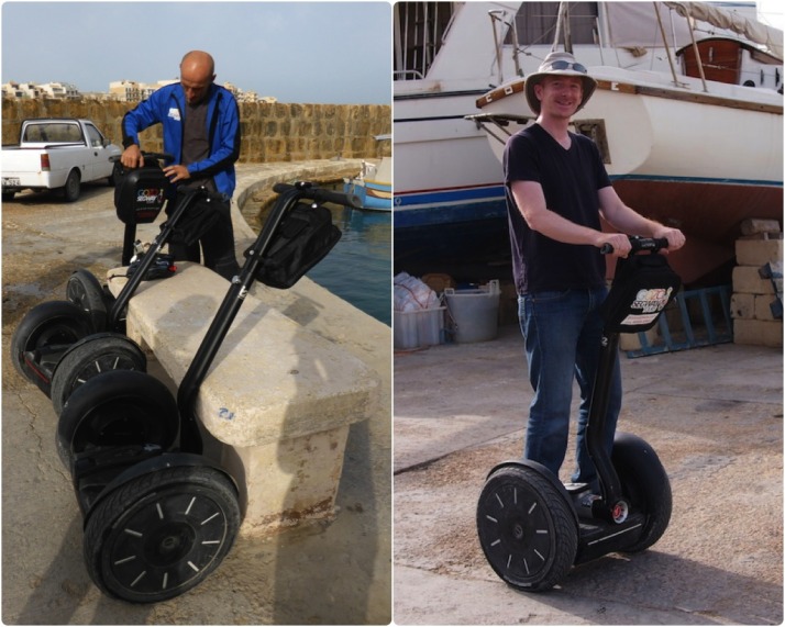
Kevin (the Boss) and Peter (our Guide) met us in Marsalforn with their truck-full of Segways and after a short explanation we were up and whizzing around the car park like a pair of two-wheeled tearaways, grinning from ear to ear!

Getting acquainted: Peter our guide makes sure he's packed everything we need for the trip; My Segway and I getting to know each other as we whizz up and down the car park of Marsalforn Bay harbour

Getting acquainted: Peter our guide makes sure he’s packed everything we need for the trip; My Segway and I getting to know each other as we whizz up and down the car park of Marsalforn Bay harbour

Our initial concerns about how difficult we’d find them to ride were completely unfounded – basically, if you can stand upright then you’ll have no problems whatsoever controlling a Segway! We could call it an amazing technical achievement, or we could just simply say its magic how they actively maintain balance, and with the slightest shift in weight forward or backward it starts moving exactly how you would expect it to. Very quickly we understood why Peter said that the Segway becomes an extension of the body.

After the Segway driving test equivalent of emergency stops and hill starts, Peter led the way along the coastline towards our first stop – the salt pans of Gozo.

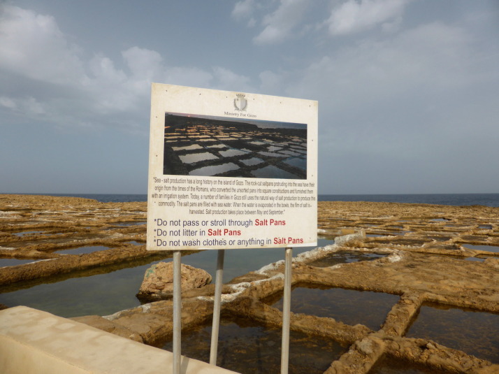
The Gozo Salt Pans, still in use after more than 2000 years

The Gozo Salt Pans, still in use after more than 2000 years

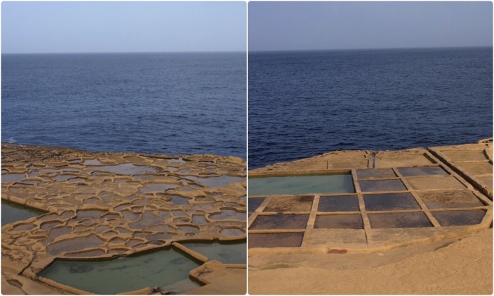
Dating to the time of the Romans (264BC to 395AD), the salt pans have been in use for thousands of years. The closest ones to Marsalforn are irregular and organic in shape as they’re the oldest and were carved out with simple hand tools; further along the pattern of salt pans becomes regular, ordered and each pan is bigger as better tooling and machinery improved not only their creation but the harvesting of the salt.

The evolution of man and tools is evident in the shape of the salt pans. Left: the oldest salt pans were created with crude hand tools; right: modern tools allow larger and more regular salt pans

The evolution of man and tools is evident in the shape of the salt pans. Left: the oldest salt pans were created with crude hand tools; right: modern tools allow larger and more regular salt pans

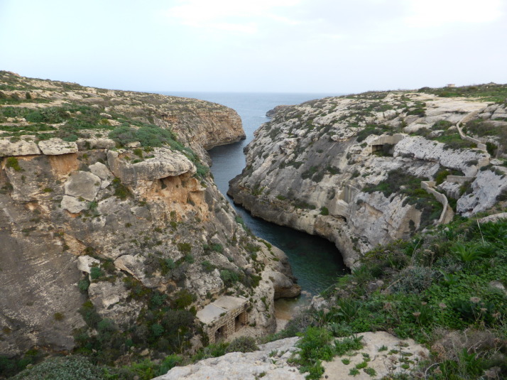
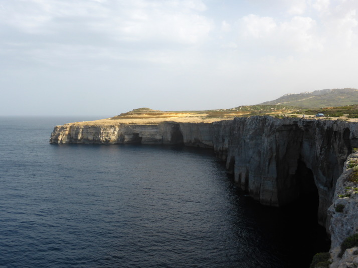
Wied il-Ghasri, a deep valley used by pirates and smugglers of the Mediterranean, so much so that they built a shaft into the side of the cliff to lower supplies and raise booty!

Wied il-Għasri, a deep valley used by pirates and smugglers of the Mediterranean, so much so that they built a shaft into the side of the cliff to lower supplies and raise booty!

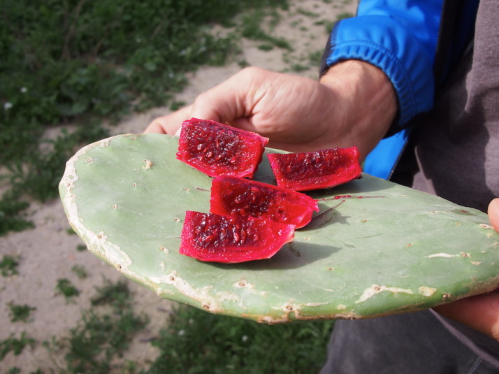
Peter stopped to prepare a prickly pear. Gozo, like Malta, gets a lot of sunshine and the prickly pear, like all the fruit here was very sweet. The thick, heavy leaves of the cactus make a great chopping board too

Peter stopped to prepare a prickly pear. Gozo, like Malta, gets a lot of sunshine and the prickly pear, like all the fruit here was very sweet. The thick, heavy leaves of the cactus make a great chopping board too

We stopped for a coffee and biscuits a little further along the cliff tops, where we watched a guy raising fishing baskets

We stopped for a coffee and biscuits a little further along the cliff tops, where we watched a guy raising fishing baskets

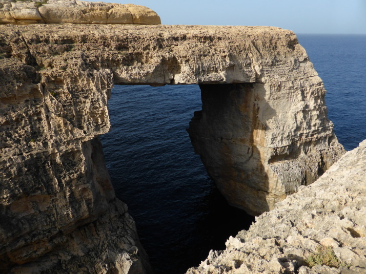
The naturally formed window at the end of Wied il-Mielah, just a little further west along the northern coastline of Gozo

The naturally formed window at the end of Wied il-Mielaħ, just a little further west along the northern coastline of Gozo

Next we headed inland and after a quick glide through the small town of Gharb (in Maltese, ‘gh’ is silent, as you might remember we learned in Mdina & Rabat), and we were back out on the open road towards the dominating Basilica of the Blessed Virgin of Ta’ Pinu.

Famous as a place of pilgrimage for those seeking answers to prayers for miraculous recoveries, the The Basilica of the Blessed Virgin of Ta' Pinu has an extended chapel where letters and artefacts of prayer and gratitude from around the world are on display

Famous as a place of pilgrimage for those seeking answers to prayers for miraculous recoveries, the The Basilica of the Blessed Virgin of Ta’ Pinu has an extended chapel where letters and artefacts of prayer and gratitude from around the world are on display

The Basilica of the Blessed Virgin of Ta’ Pinu. The story goes that in 1833 a spinster by the name of Karmina Grima was walking past the then dilapidated chapel on the site and heard a voice asking her to recite 3 Hail Marys’, she did and shortly afterwards her neighbour’s mother was miraculously healed. As word spread many started pilgrimages to ask for temporal and spiritual favours and the church was rebuilt in 1932 to accommodate both the visitors and their ex-voto.

The basilica is also known for a painting of the Virgin Mary which depicts her hands in prayer though one hand is white and the other is black. It’s not clear if it was the artist’s intent to show her black hand in shadow, or, as some have suggested, a sign of the multi-ethnicity of Christianity.

From here we took a long and winding road back down to Marsalforn and while we waited for Kevin to return with the truck, we chatted with Peter over a coffee about travelling – he’s from Prague in the Czech Republic – how he ended up living on Gozo and, of course, Segways!

Segways - easily the most enjoyable way to climb the hills of Gozo!

Segways – easily the most enjoyable way to climb the hills of Gozo!

We really enjoyed the experience, the Segways are great fun and a fantastic way to see this hilly little island.