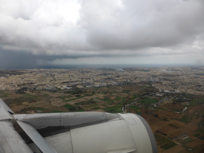
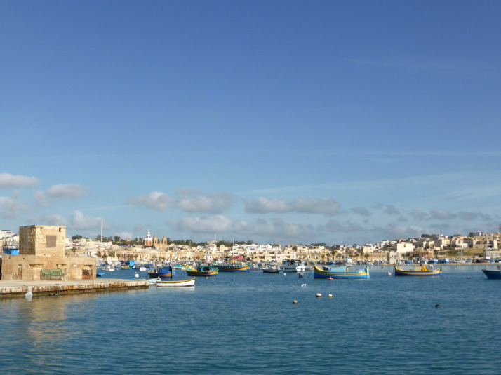
Sitting in the Mediterranean Sea closer to Sicily in the North than Libya and Tunisia to the south, Malta has had a surprisingly long and eventful history for such a tiny landmass of only 315km2 (112 square miles).
Despite its small size, or perhaps because of it, Malta is the 3rd most densely populated country or sovereign state in Europe (after Monaco and Gibraltar) and 8th most in the world – though it magically maintains a desolate, isolated feel as we found out on our first stroll along a section of its south-western coastline.
The walk: Dingli, Fawwara, and Wied iż-Żurrieq
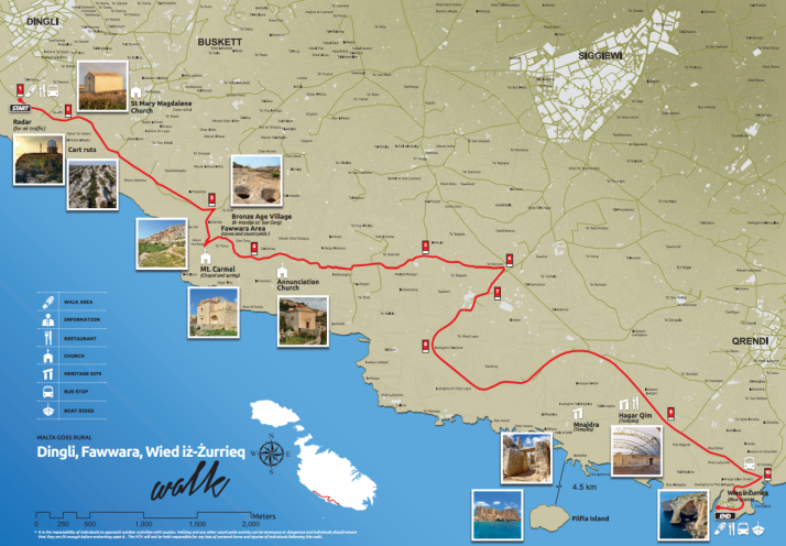
The map of the Dingli Cliffs walk. The Malta Tourism Authority helpfully provide paper versions in all of the Tourist Information offices (including the airport), and online in PDF format too. Source: Malta Tourism Authority
Looking at the map we thought we were in for a long stroll, until we remembered that the entire coastline of Malta is only 196.8km (122 miles) which means this walk is an easy 11.2km, or about 7 miles.
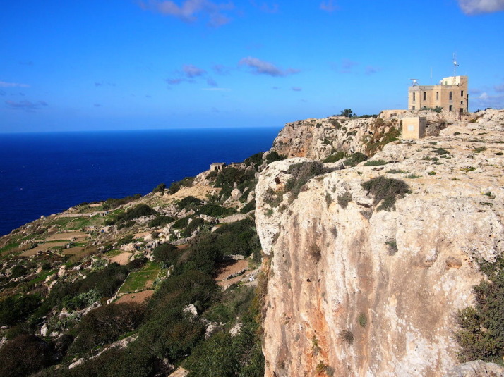
Looking back towards the start of the walk at Dingli Cliffs. Not bad for a day in November
Just past a couple of radar stations at the highest point of the island, we arrived at St Mary Magdalene Church, an isolated, simple place of worship teetering on the cliff edge.
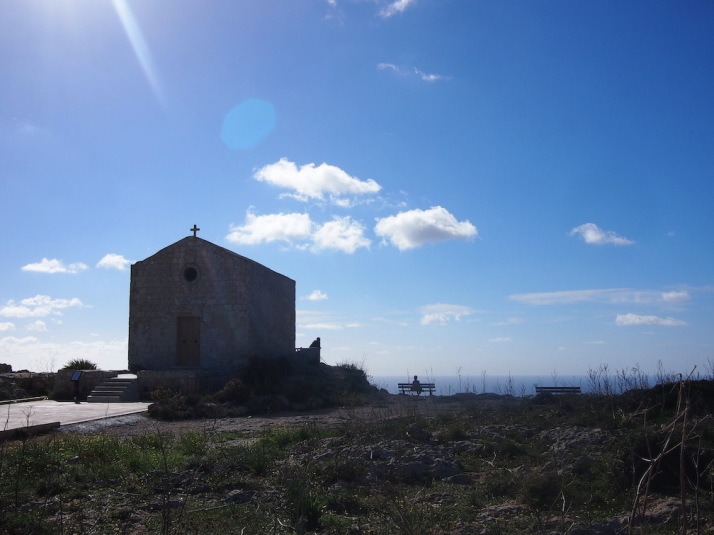
Tranquil reflection at St Mary Magdalene Church on the edge of Dingli Cliffs
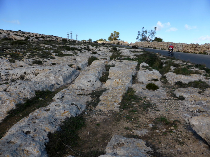
Described as ‘Cart Ruts’, these man-made grooves in the garigue weren’t actually created by carts – the truth is no-one knows how or why they were made!
From the roadside path it looked like a sheer drop into the Mediterranean from the rocky edge, but when we ventured closer we found that while there was a drop that would probably sting a little bit, there’s a second terraced plateau with yet another sizeable drop-off before the sea. Most of this was given over to agriculture, with the odd house or church between the fields.
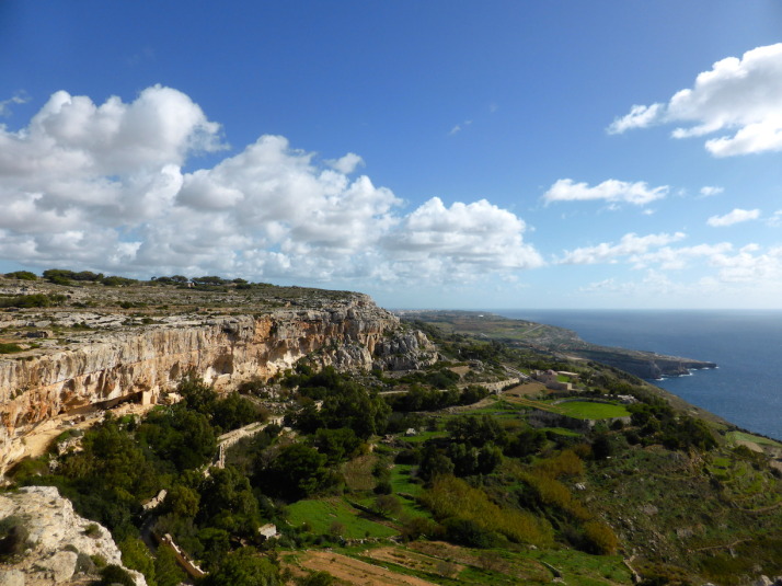
Looking south over the cultivated fields of Fawwara from a Bronze Age village site that juts out almost to the sea
According to the map, there’s an old Bronze Age village site at Fawwara but all that we could discern from the remains was its natural vantage point that extends out from the cliffs almost to the sea, commanding amazing views up and down the coastline.
From here we descended to the lower plateau and continued south to within a kilometre or two of the end where we stopped at Ħaġar Qim and Mnajdra – 2 prehistoric temple sites and outdoor museum..
Megalithic Malta: The temples of Ħaġar Qim and Mnajdra
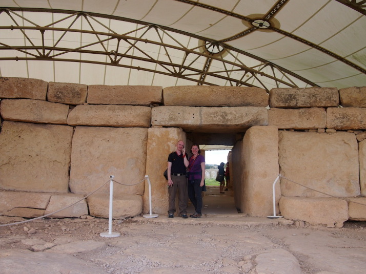
Us at the entrance to Ħaġar Qim, the 5,000 year-old megalithic temples. I’m listening to the audioguide which poses more questions about the site and its purpose than it answers
Before we explored the remains of the temples, we wandered through the small but excellent museum, which, given how little is known about the origins of these temples and the peoples that built them, is mostly given over to how we think they were built, how they were rediscovered, and how they’re being preserved.
Here’s a short excerpt from the museum’s guide:
“The prehistoric site of Ħaġar Qim consists of a group of monumental megalithic buildings. These were built during the late Neolithic, around 5,000 years ago. Similar buildings have been found in more than twenty different places in Malta and Gozo. Today these buildings are usually called “temples”. However we know very little about what went on inside them.” – Ħaġar Qim Temples, a brief guide, Heritage Malta
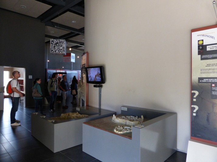
Inside the museum. The 2 models show how the temples are aligned with the equinoxes and solstices
The museum includes a 10 minute “4D” introduction video experience – the 4th dimension being blasts of cold air and scented water droplets – alongside the 3D visuals that imagine the construction through to the present day ruins. It was well done and the visuals were good as they show the temples against the landscape, which isn’t possible to see anymore because there’s now a giant protective tent over each temple shielding the stone from the elements.
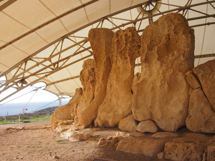
Some of the stones used in the construction are simply massive, and reminded us of Stonehenge back in England
Ħaġar Qim is the first of two temple sites and is the more impressive for its relative completeness – it’s more compact and the walls are still standing tall. We enjoyed wandering through the ruins, though some sections are roped off we were still surprised how accessible they were. The audioguide was only €2 more and is good for pointing out the most interesting aspects of the construction, but almost every clip ends with a “what do you think this was for?” or “why do you think this is here?” which left us with more questions than answers!
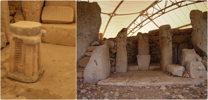
Details of Ħaġar Qim: relief sculptures found during excavations include altar pieces and decorative stone carvings; One of the many altars of the temple but the only one open to the outside
500 metres down the hillside and closer to the cliffs is the 2nd megalithic temple site of Mnajdra, a much larger set of ruins and in a worse state of repair than Ħaġar Qim.
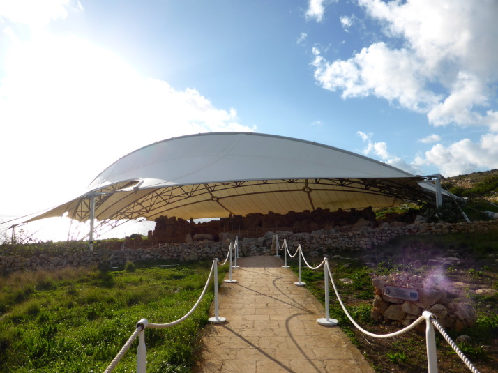
The approach to the Mnajdra Temples, these too are protected from the rain and the sun by a giant tent
Mnajdra is actually a complex of 3 buildings..
“The first and oldest structure is the small three-apsed temple (on the right), built in the Ġgantija Phase, around 3,600-3,200BC. The South Temple (on the left), with its concave facade was next to be completed early in the Tarxien Phase, shortly after 3,000BC, followed by the Central Temple which was built on an artificial platform between the two earlier buildings.
The South Temple at Mnajdra was built in such a way that its main doorway is aligned with sunrise during the spring and autumn equinoxes (30th March and 22nd September). During the winter and summer solstices (21st June and 21st December) the beams of the rising sun pass along the sides of the main doorway hitting two decorated slabs within the first chamber.” – Mnajdra Temples, a brief guide, Heritage Malta
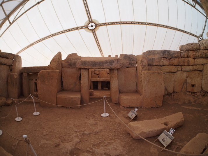
Inside the first chamber of Mnajdra’s South Temple – during the equinoxes and solstices the sunrise hits the blocks either side of this doorway, again reminding us of Stonehenge. Wow!
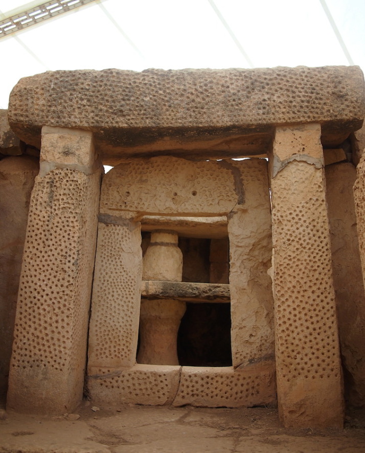
The beautiful pitted decoration of another doorway in the South Temple
We liked the different levels and scale of these three very different temples which at first glance just looked like one giant building. The middle temple has the most dramatic example of erosion we’ve seen – the north side of the room shows some damage but the south side is almost completely eroded. I’d have thought they’d have been equally damaged because they’d have received equal rainfall, but the museum explained that it’s the sun that does the most damage!
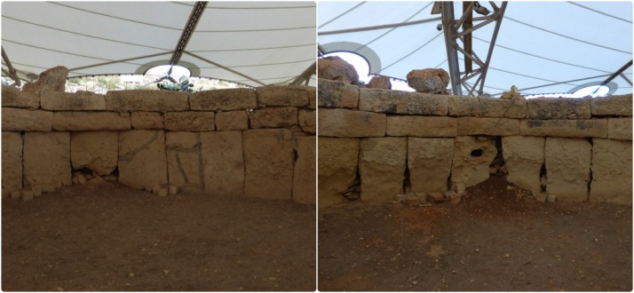
The north facing wall (left) of the Central Temple is in relatively good condition, but the lower south facing stones (right) of the same room have almost completely eroded. Most surprisingly for me was that the heat of the midday sun has done the most damage
From the museum there was a final downhill stretch to the tiny fishing village of Wied iż-Żurrieq (which we have no idea how to pronounce!), where we watched the sun set while we waited for our bus back to the other side of the island.
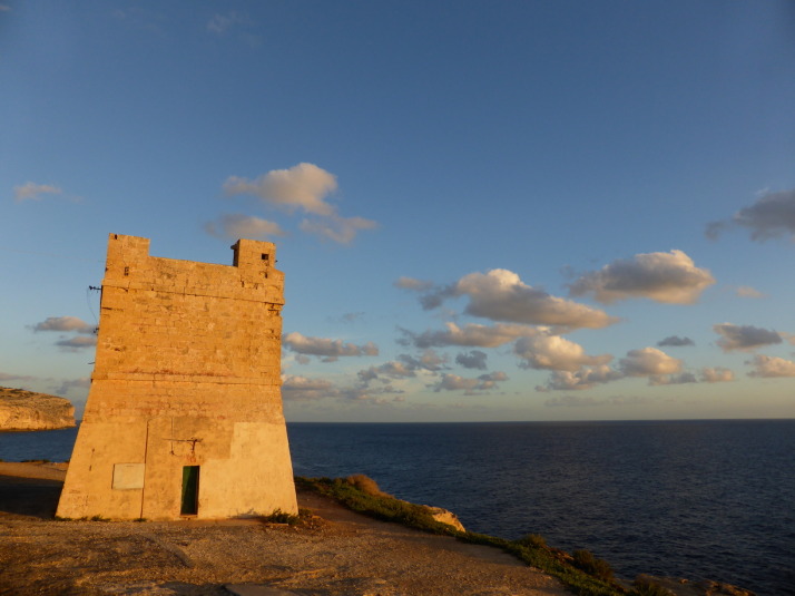
The sun sets on our first day of strolling through the countryside and history of the tiny island of Malta
We really enjoyed the feeling of remoteness; to walk so closely to the cliff edge with the deep blue Mediterranean stretching out to the horizon on one side, and a view across the island to the Mediterranean on the other, made Malta feel really small. It’s a very easy walk too, it starts near the highest point of the island which means it’s pretty much all downhill!

 two year trip