Yearly Archives: 2014

Mdina & Rabat, Malta

Mdina is the ancient capital of Malta, it’s believed that there has been a settlement here for over 2000 years and it easily predates the Knights of St John who landed in 1530 and promptly moved the capital to Vittoriosa, and then to Valletta in 1571. Centrally located atop a hill it looks very much like you would expect an impregnable fortress to look with thick stone walls and a deep moat, although nowadays the moat is a green park.

Mdina Gate
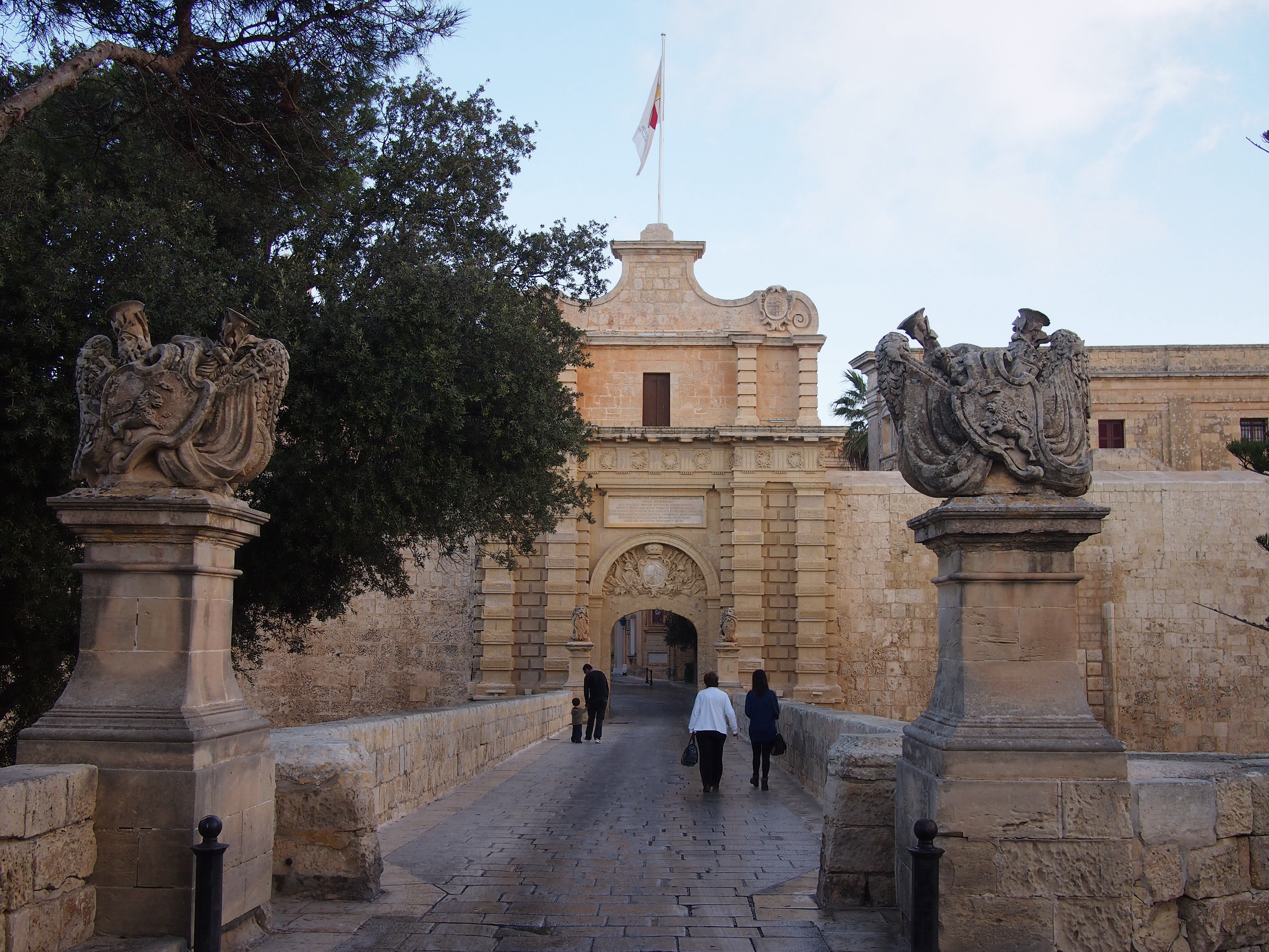
The city is entered through the impressive Mdina Gate

The defensive walls evolved over hundreds of years under different ruling groups. The final changes were made during the Arab occupation of AD870-1250 and the name derives from the Arabic word for city, ‘medina’. To call it a city is perhaps a little misleading, I was surprised by how tiny the area inside the walls is. The narrow streets seem almost labyrinthine but it’s difficult to get lost as before long you inevitably end up at an outer wall or the central street. Still it’s very picturesque and we enjoyed doing a little exploring.

Mdina street
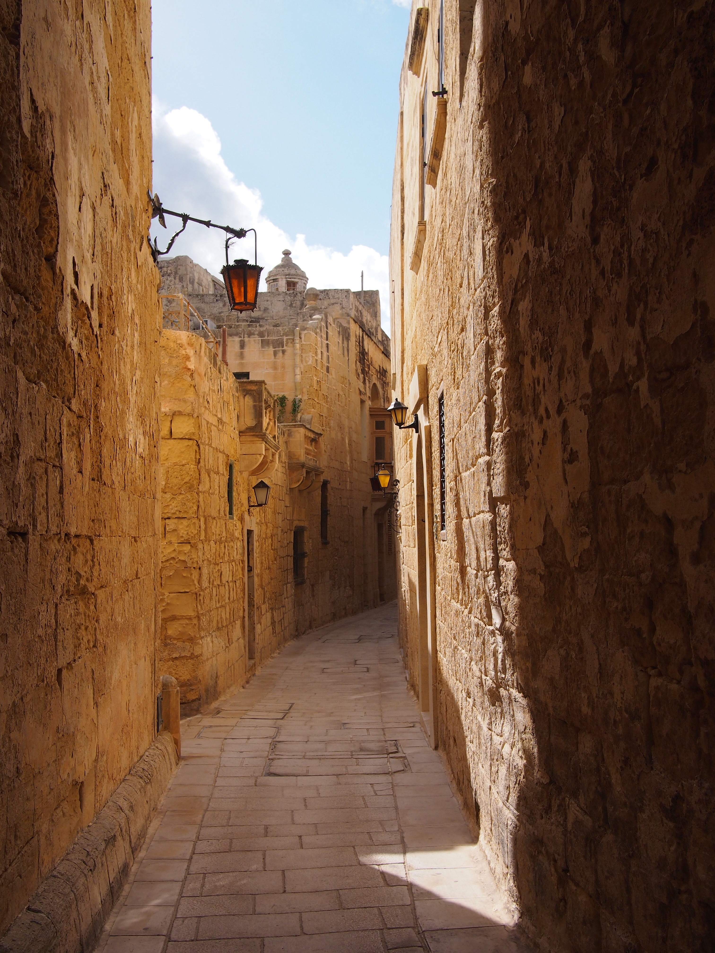
A typical Mdina street

Mdina detailsClockwise from left: there are several churches, convents and monasteries inside the walls along with numerous statues of saints on street corners; nearly every house has a small icon by the door, a feature common across the island; Mdina street sign; at night the streets are lit by lanterns

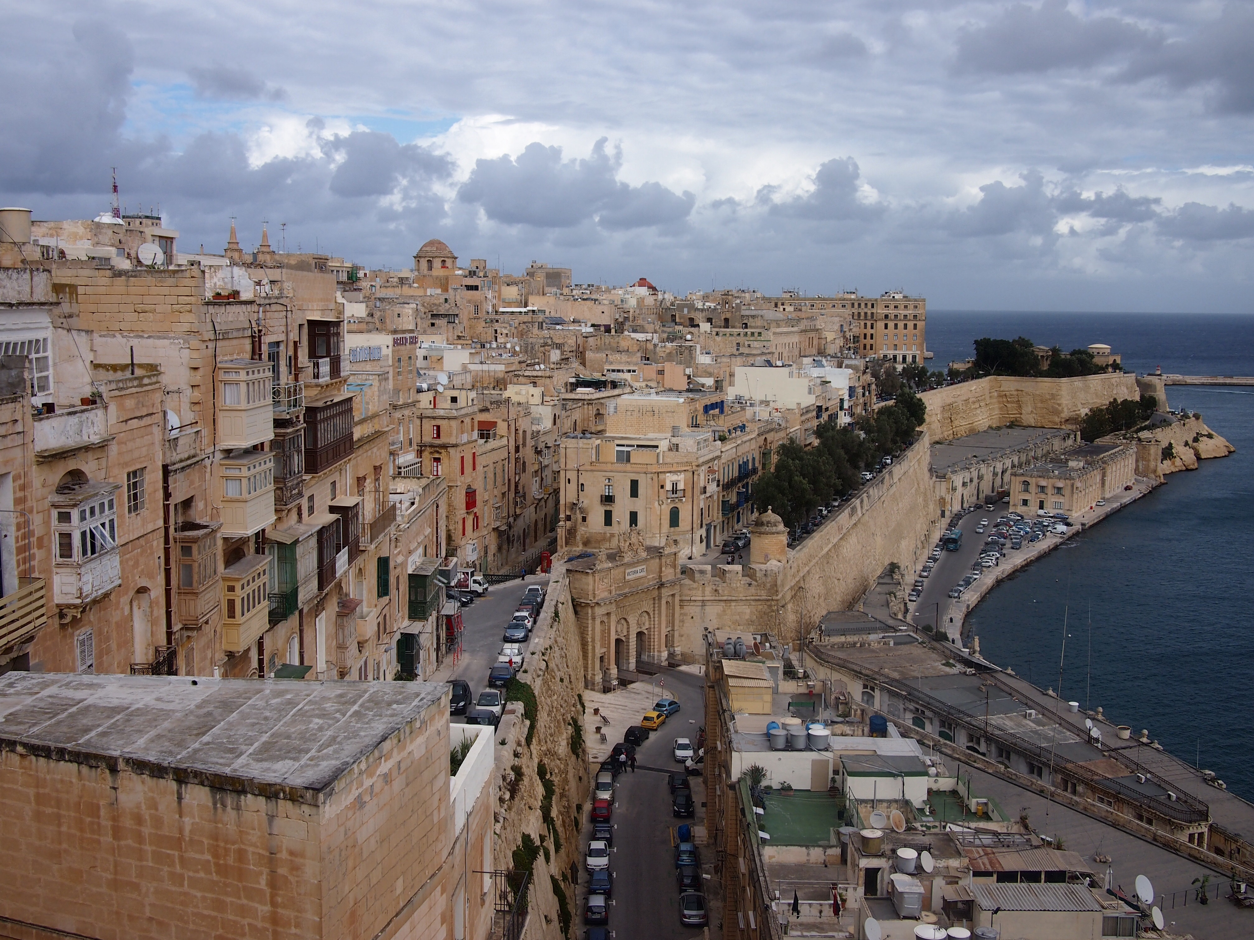
From the north-eastern walls you can see all the way to the coast and to Valletta, and I’m sure that the corner towers command views over pretty much the whole island which I suppose was the idea for defensive purposes.

View from Mdina walls
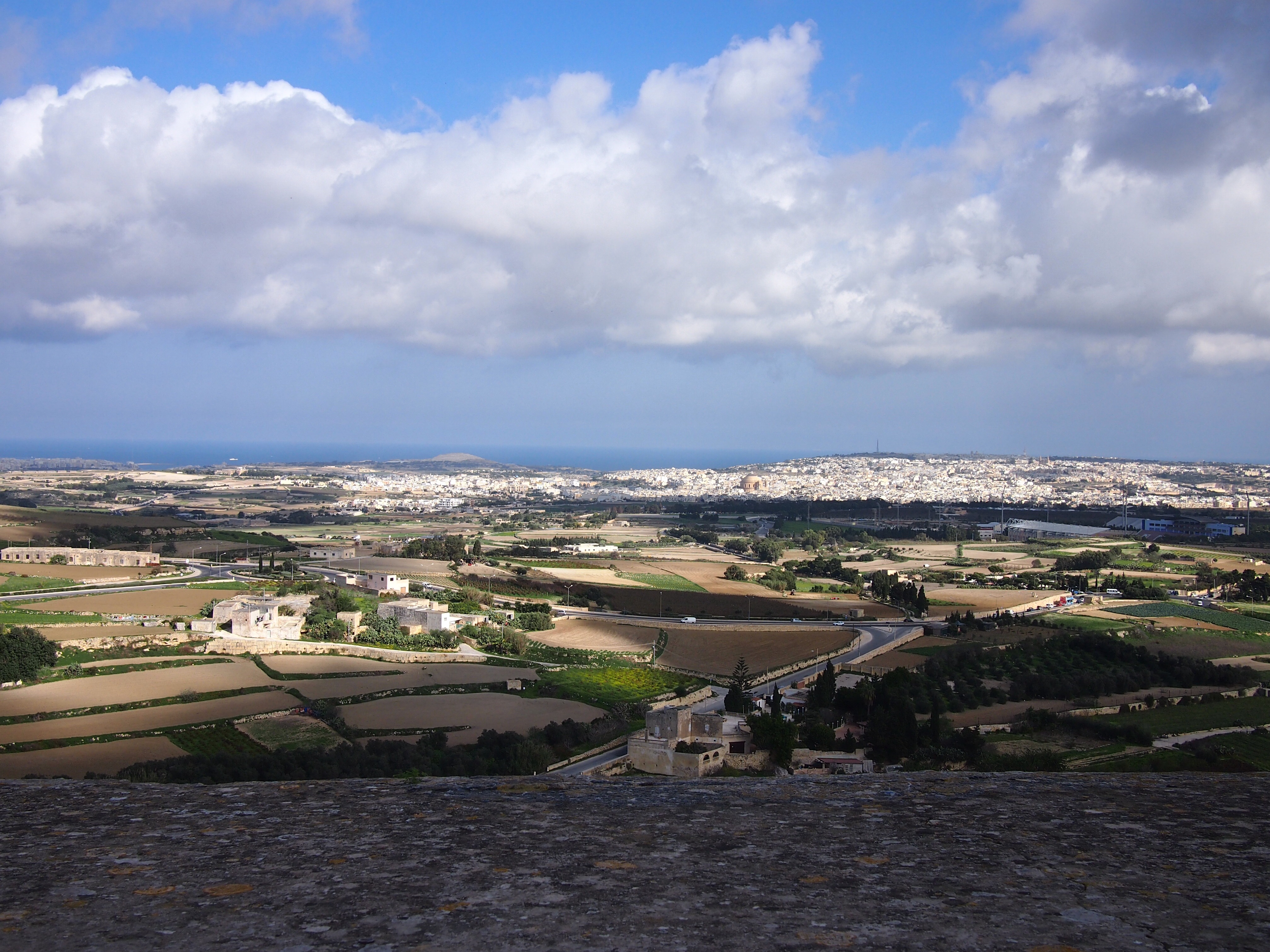
View to the Mediterranean Sea from Mdina’s walls

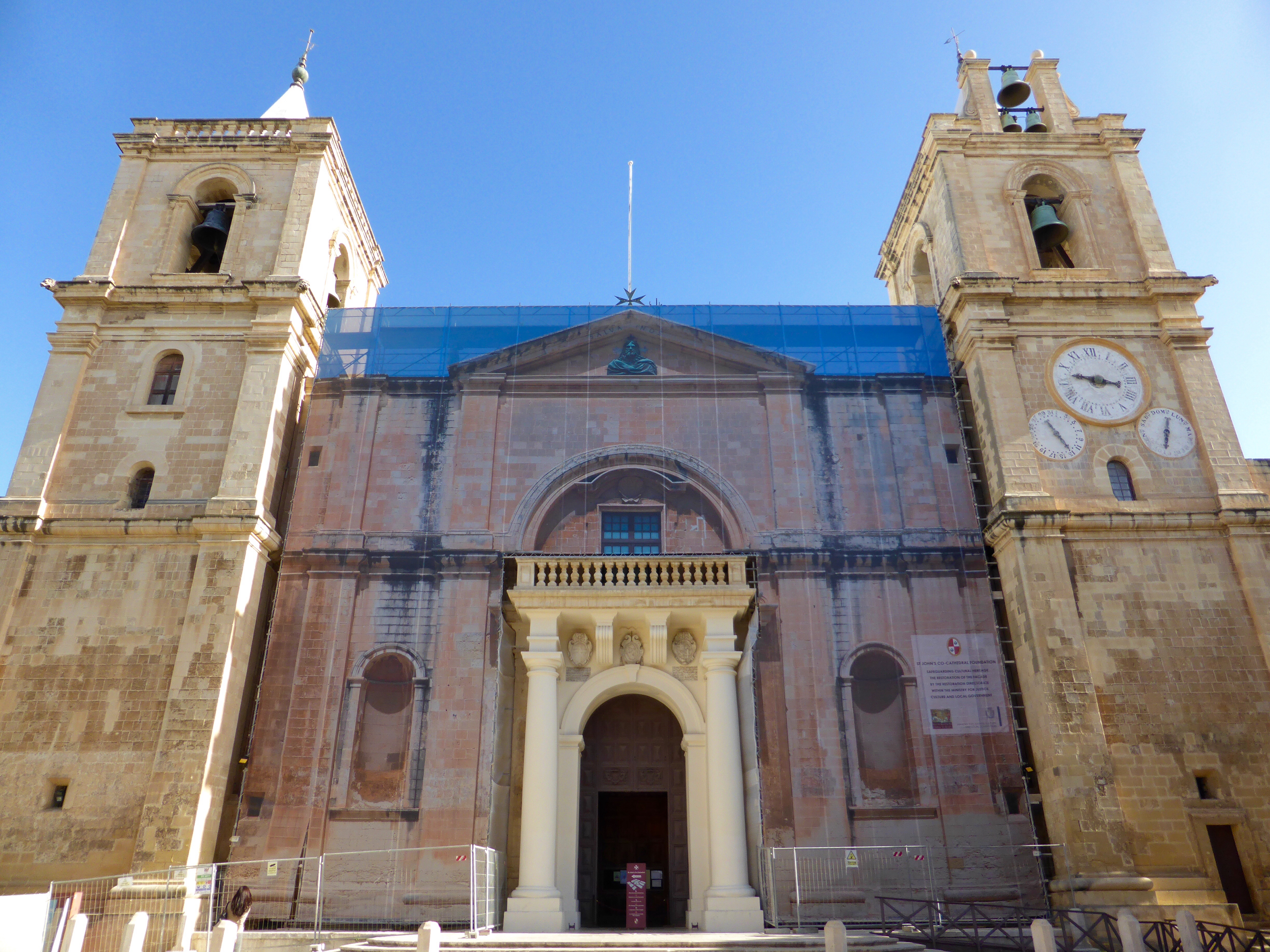
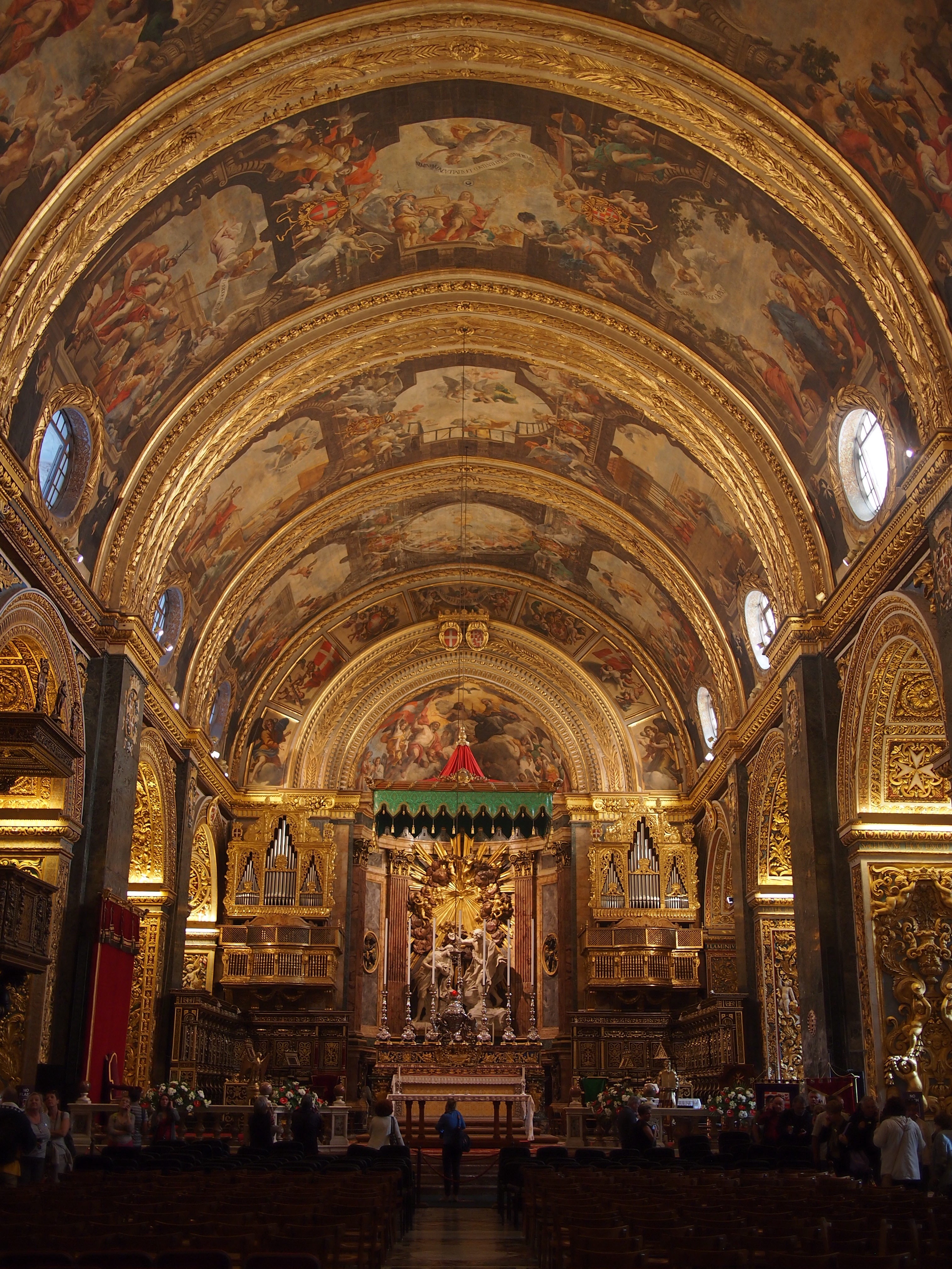
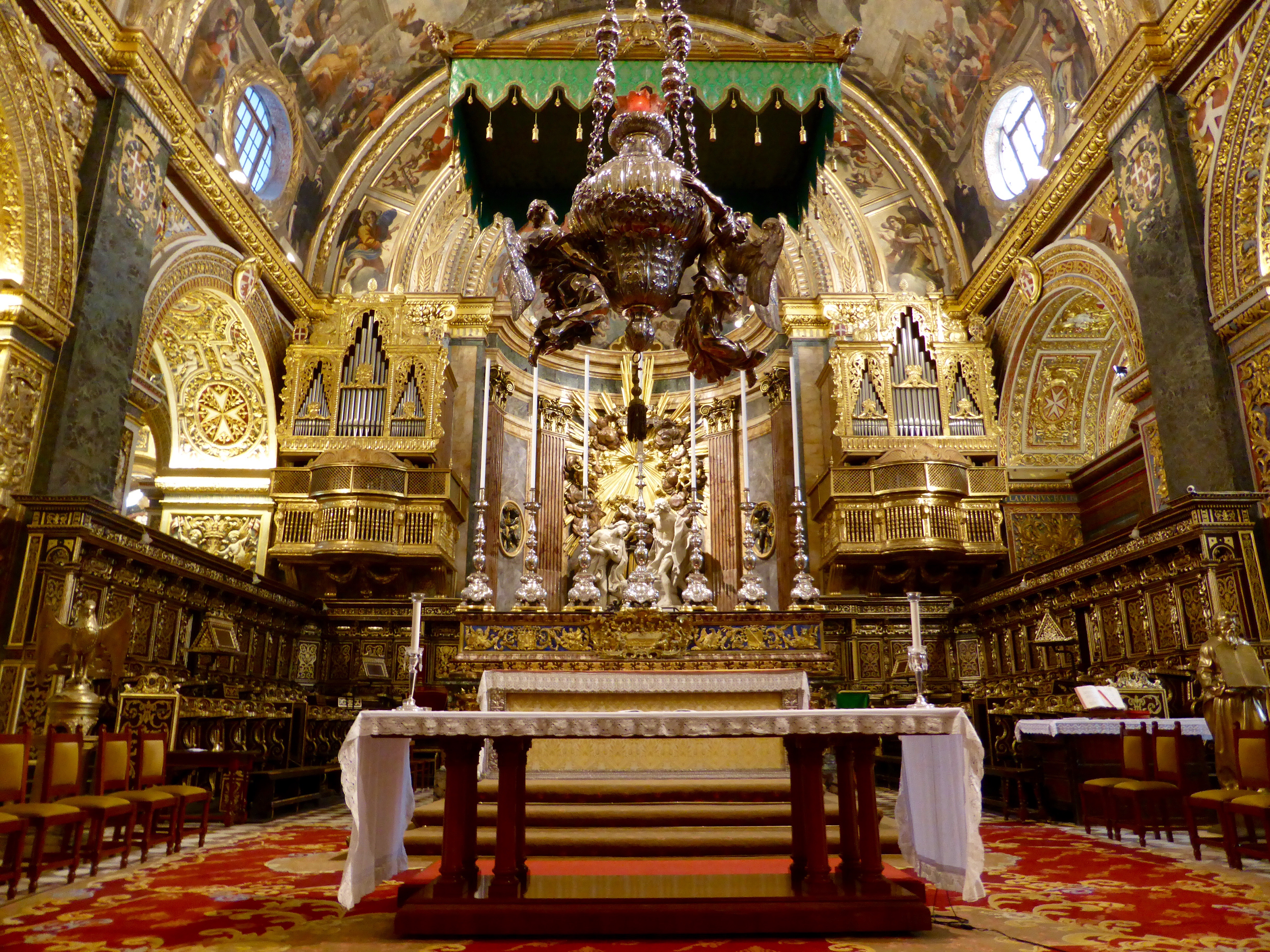
The Bishop of Malta’s palace is situated within Mdina and his seat is the Cathedral here. It’s nowhere near as impressive as St John’s Co-Cathedral in Valletta but in its own way it’s quite pretty and much more peaceful than that busier church.

Mdina Cathedral
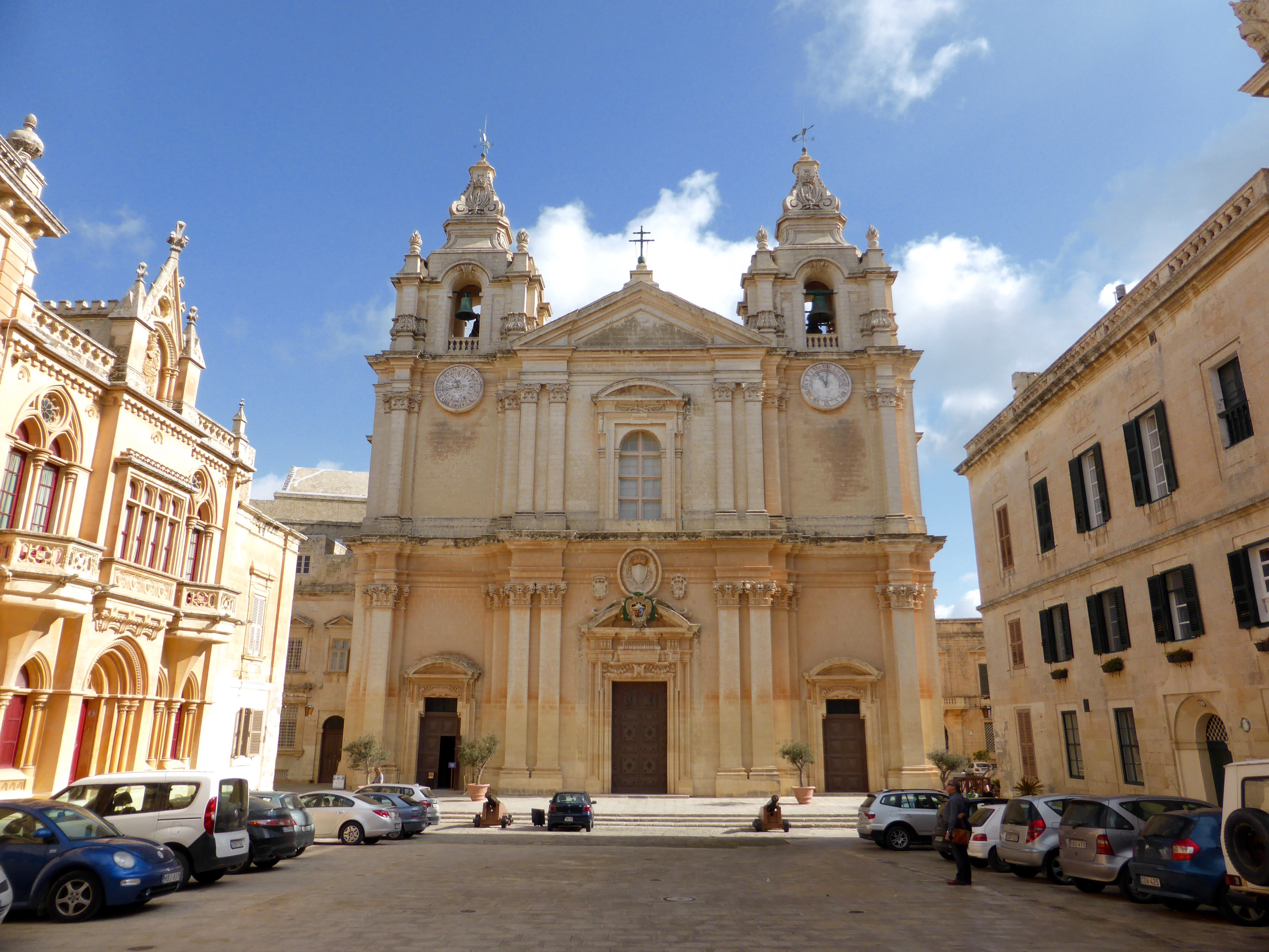
Mdina Cathedral makes up one side of St Paul’s Square

Cathedral details
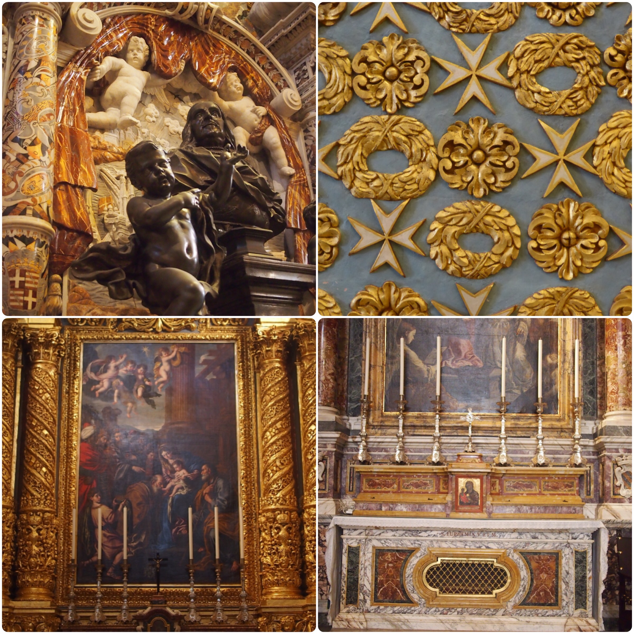
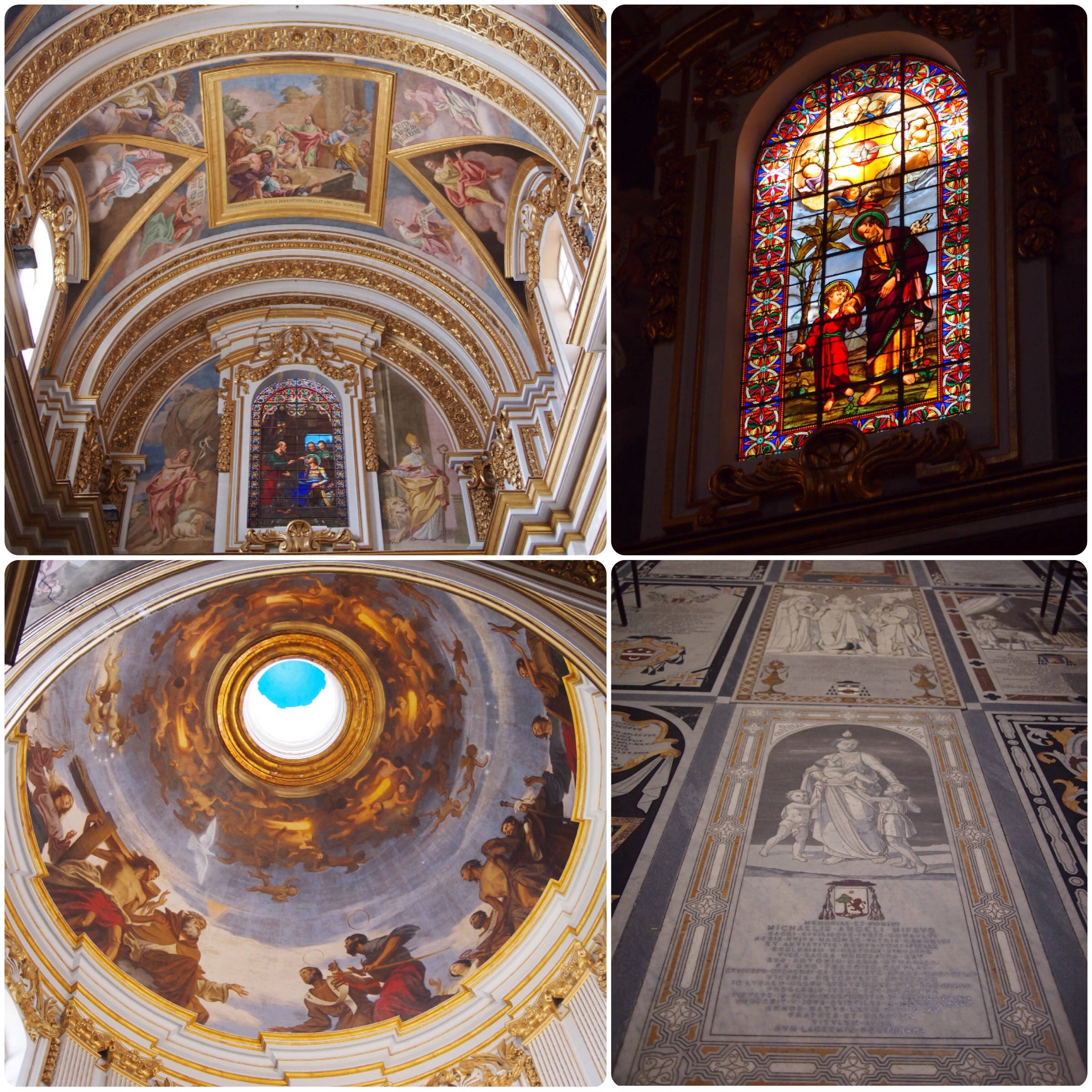
Cathedral interior (clockwise from top left): frescoes on the walls and ceiling; the cathedral has some beautiful stained glass windows; the floor consists of inlaid marble gravestones; I really liked the paintings inside the dome

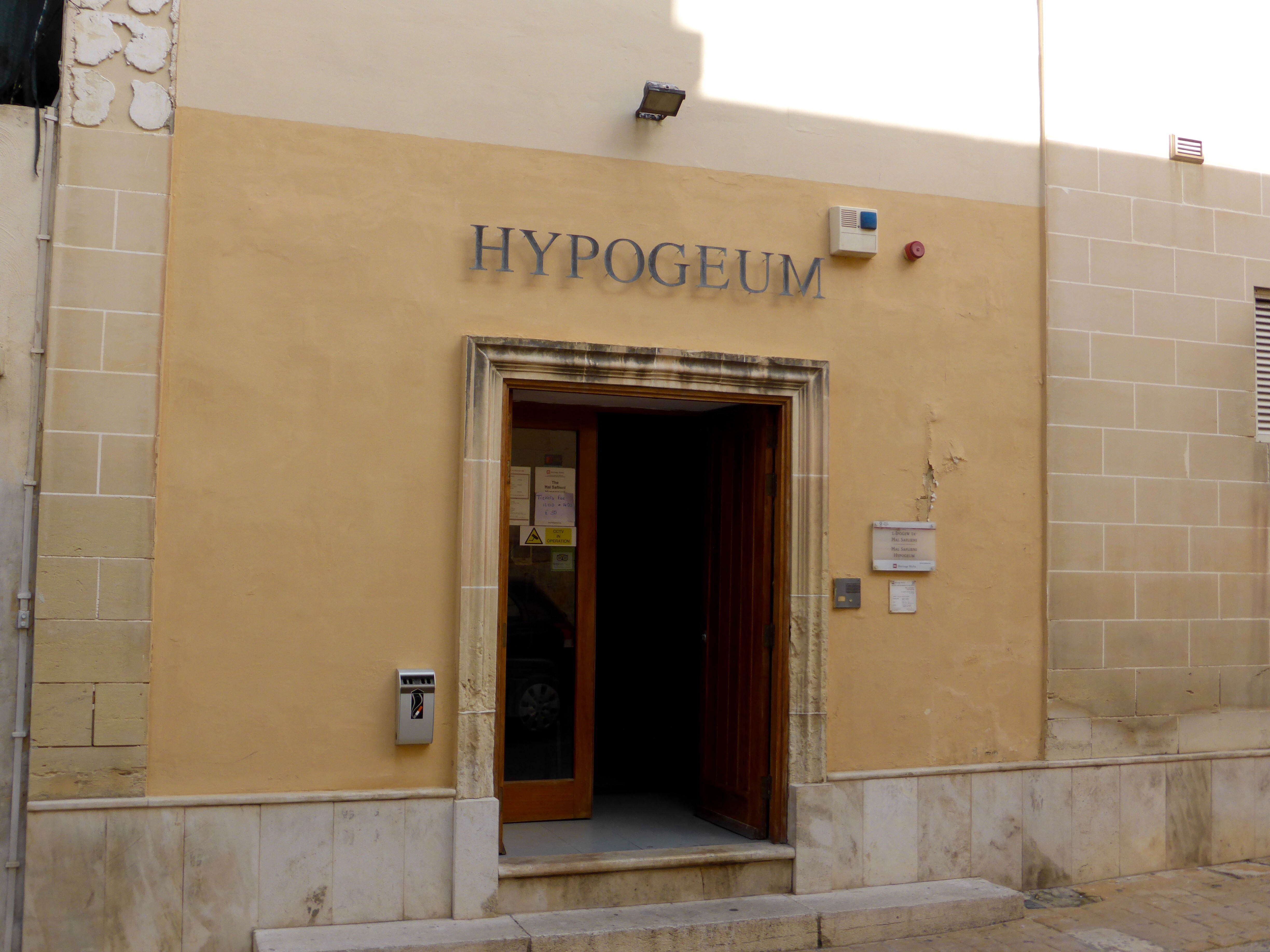
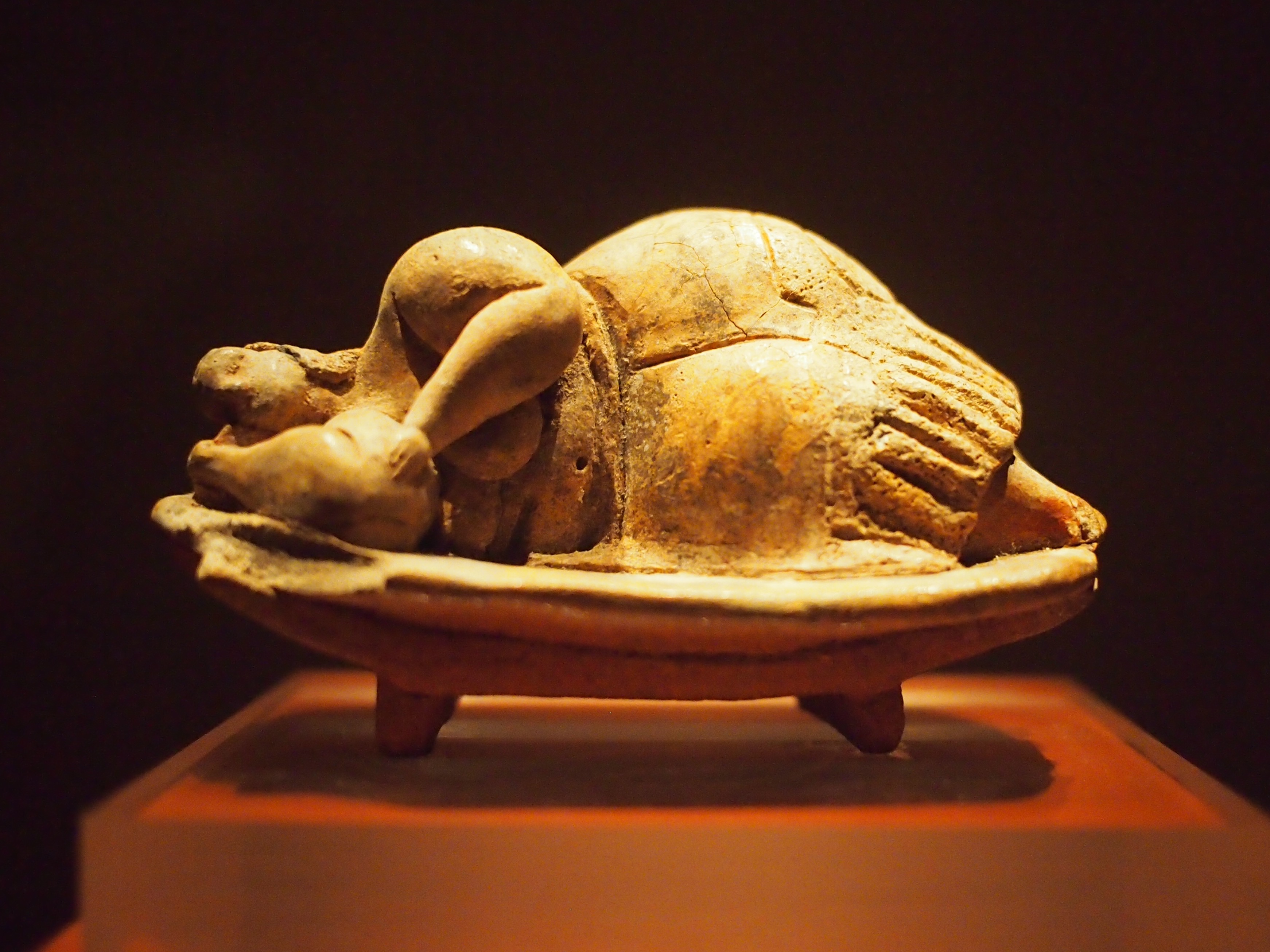
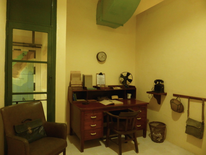
Just outside Mdina’s walls is the town of Rabat, also named from the Arabic it means suburbs. There are a few museums here too, we chose to visit the complex beside and underneath St Paul’s Church – St Paul’s Grotto, World War II Shelters, Catacombs and the Wignacourt Museum which are all on one combined ticket. Like many churches on the island, this one is dedicated to St Paul who was shipwrecked on Malta for three months on his way to Rome in AD60. The first stop downstairs from the ticket desk, and directly underneath the church, is the grotto where St Paul is said to have lived and preached during his time here, nowadays it’s a chapel.

St Paul's Grotto
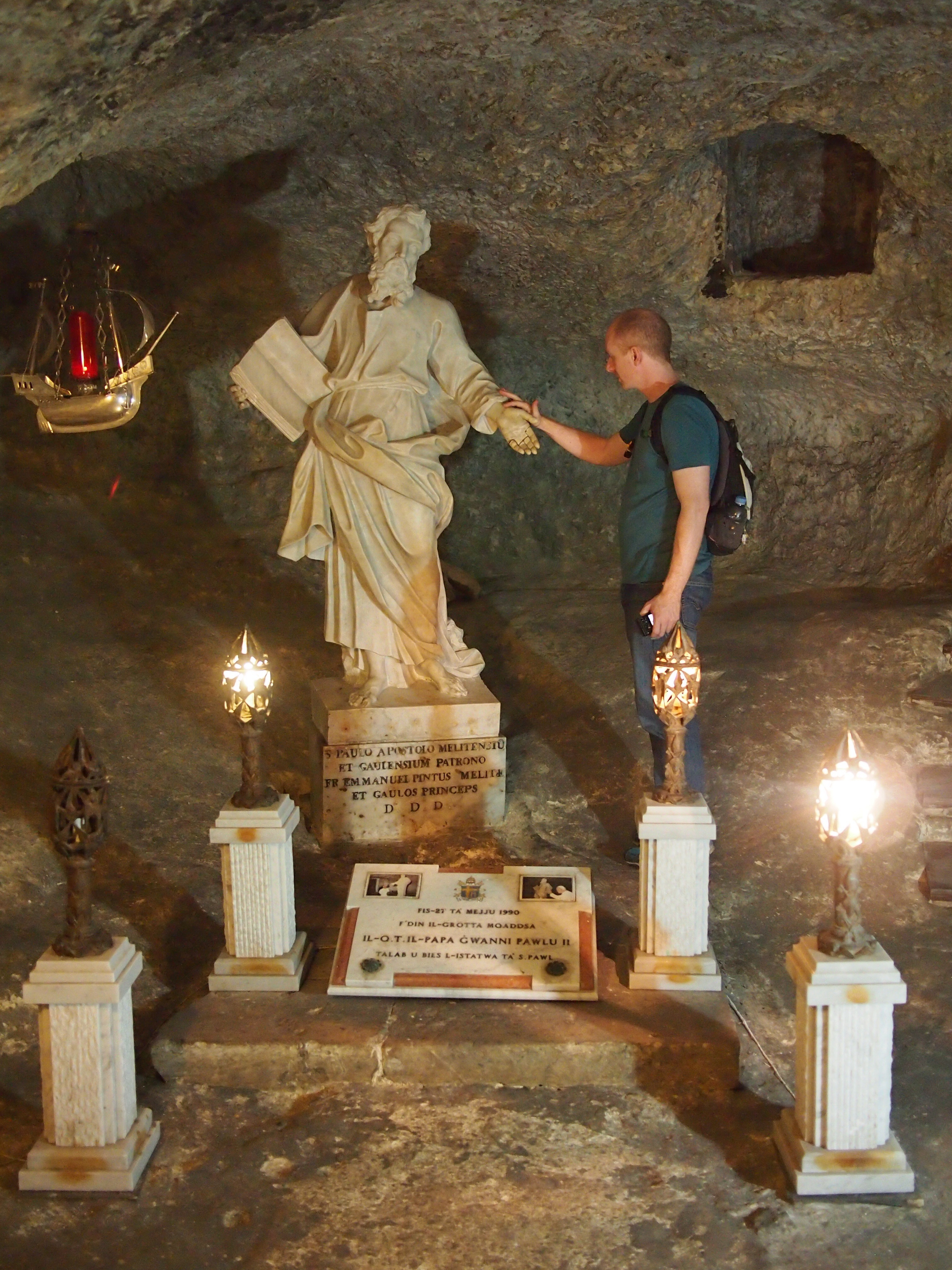
Andrew in St Paul’s Grotto

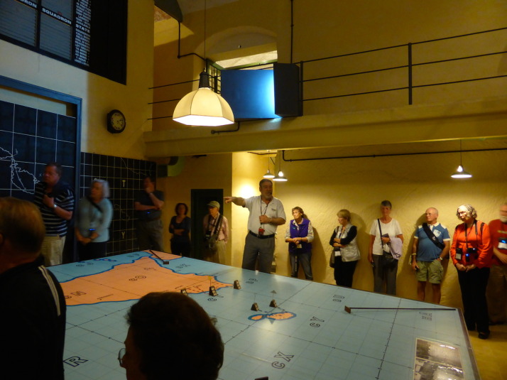
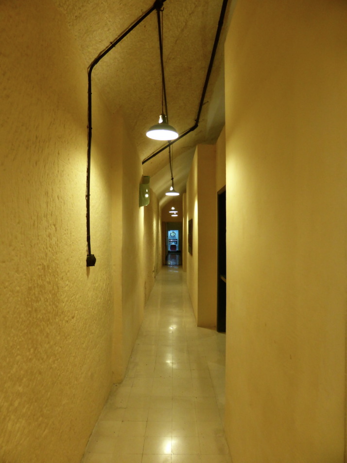
Deeper underground is the entrance to the bomb shelters which were built for the town’s inhabitants during WWII. They seemed to go on forever, there are fifty small rooms directly off the main corridors. However they are now all empty apart from a few floor tiles and there wasn’t much in the way of explanatory notices so we had to use our imaginations to guess what it might have been like to shelter down there. It’s safe to say that the residents spent a lot of time down here as there were 3340 air raid alerts between 1940-44 and during the peak months in the first half of 1942 there were an average of eight or nine alerts every day!

World War II bomb shelters
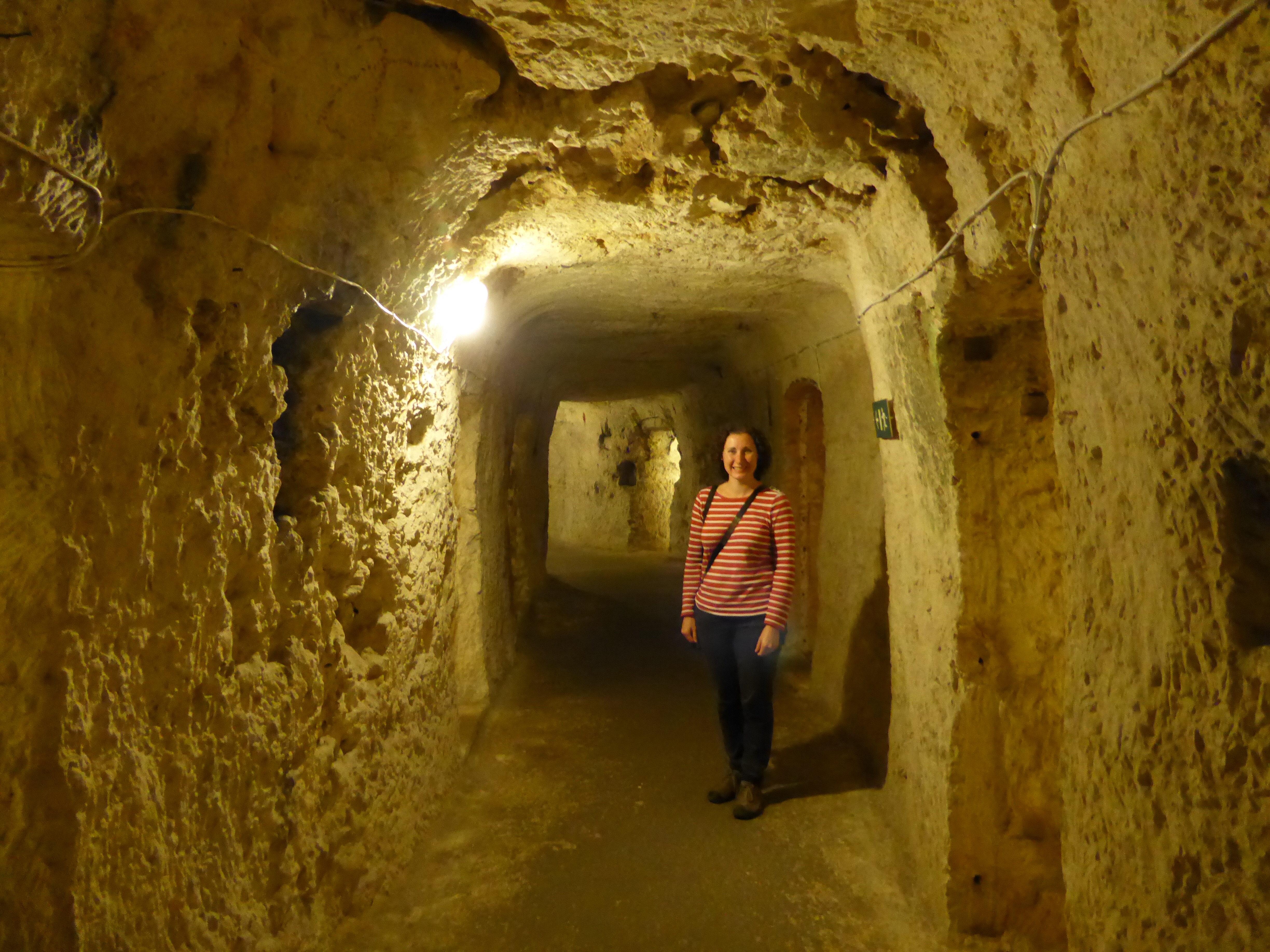
Me in the corridor of the World War II bomb shelters underneath St Paul’s Church

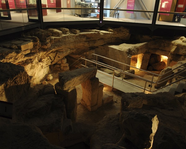
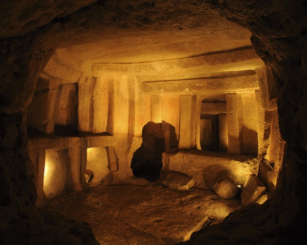
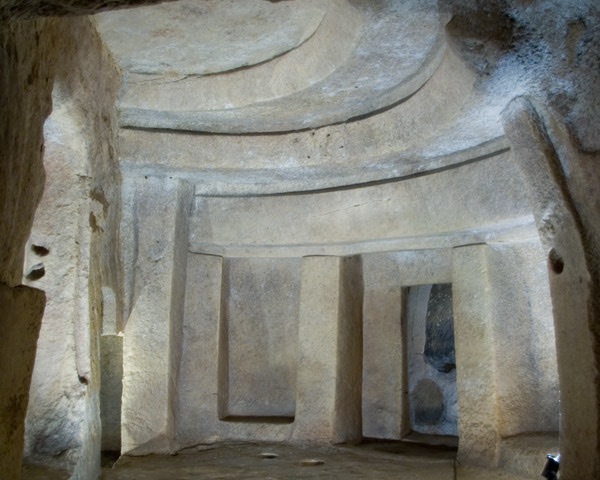
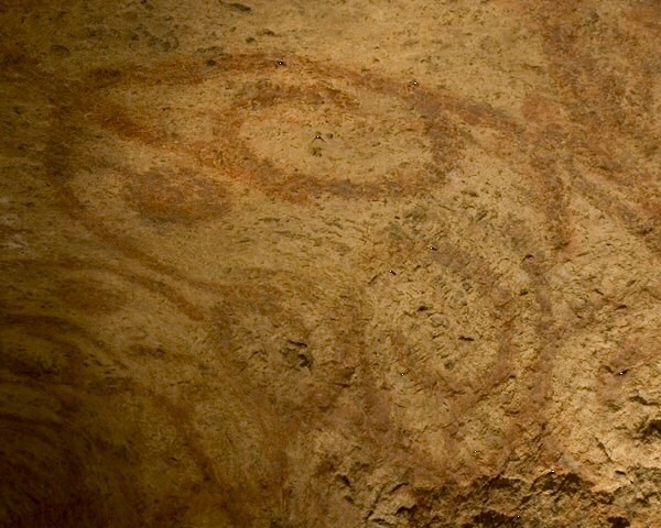
Leading off from the bomb shelters are two sections of catacombs. These pre-date the church and are part of what would have been a large cemetery complex going back to Roman times when it was forbidden to have burials inside the city walls. They are also, thankfully, empty. The structure was quite distinct from the bomb shelters, we found them pretty cramped with narrow, twisting passages.
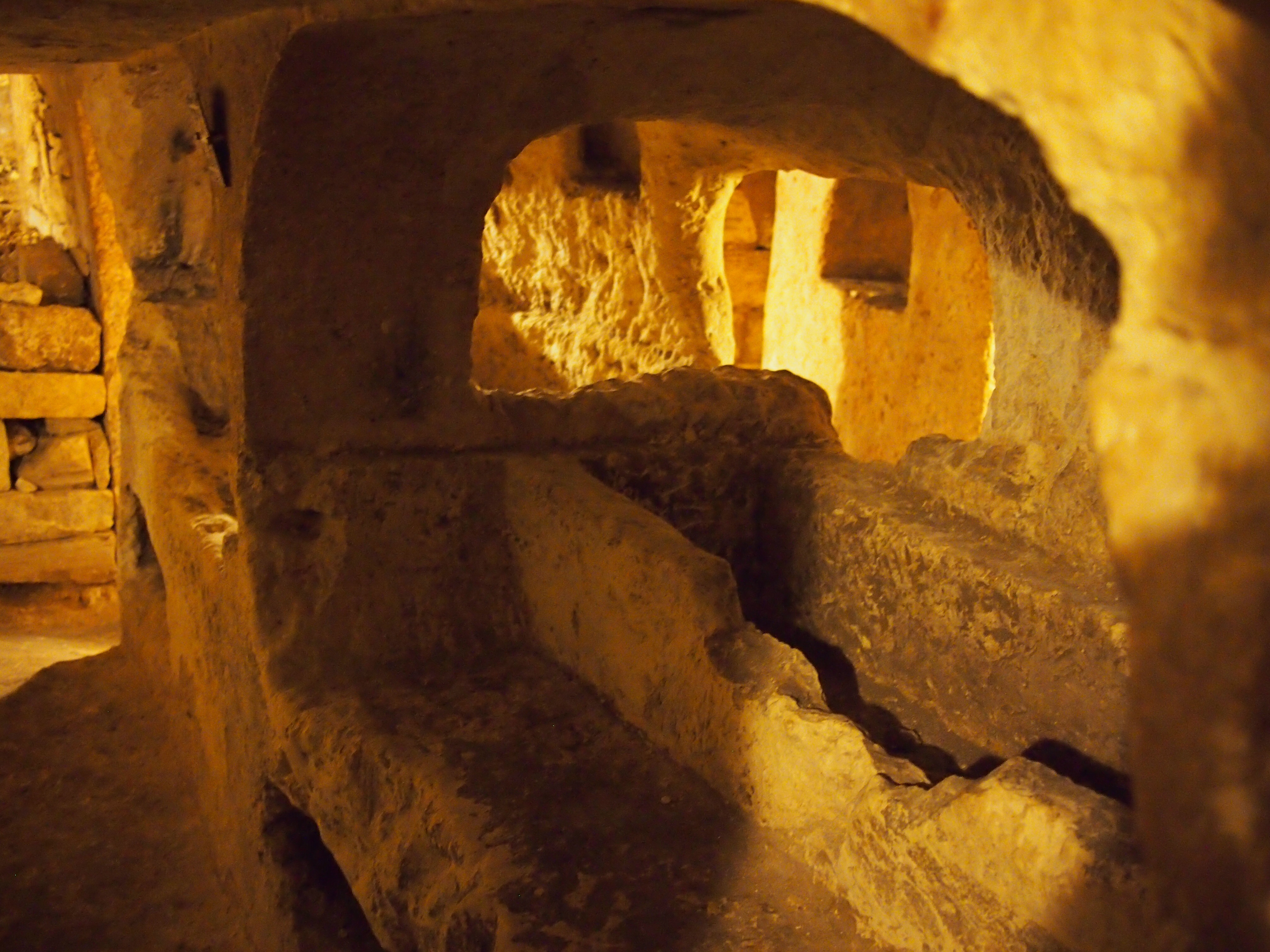
St Paul's CatacombsSt Paul’s Catacombs

We ended our visit with a quick look around the Wignacourt Museum. It’s pretty modern and nicely set up but the contents consisted mostly of old oil paintings and local religious memorabilia which weren’t of much interest to us. The highlight was a 1937 Austin Six Limousine in mint condition which used to belong to the Bishop of Malta. It seemed to have been assembled in the exhibition room as it was too big to fit through either the door or the window.

Austin Six Limousine
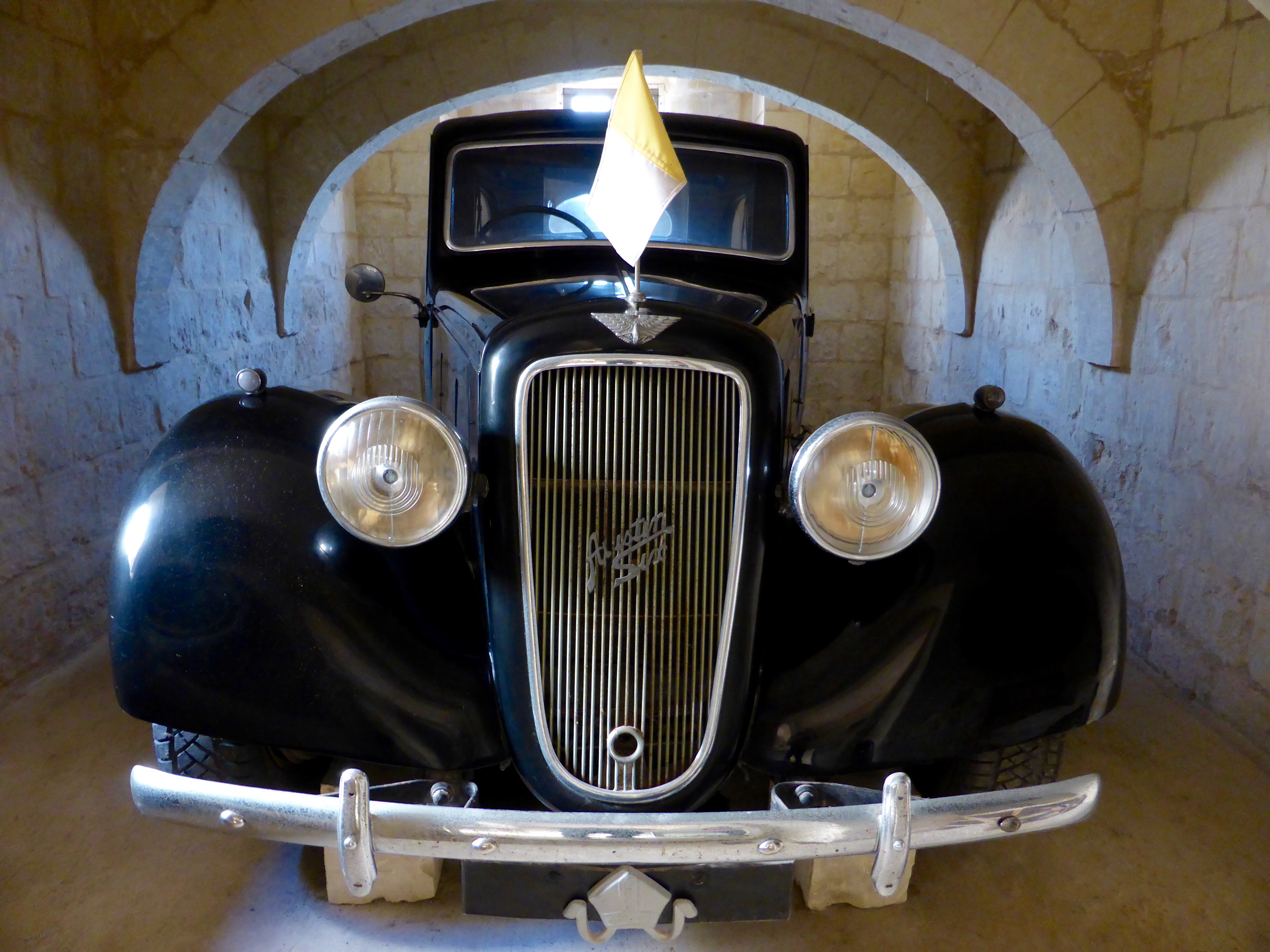
Austin Six Limousine in the Wignacourt Museum

Next door to the museum is a bakery and it would have been rude not to buy a traditional Maltese cake. We chose one that in English is called “honey ring”, it’s a pastry case filled not with honey but a spicy black treacle mixture which tasted like a very dense gingerbread. We asked the girl in the shop how to say its name in Maltese, “Qaghaq tal-ghasel”, she explained that the ‘gh’ is silent, but didn’t look too impressed by our pronunciation efforts… Oh well, it tasted good however you say it.

Honey ring
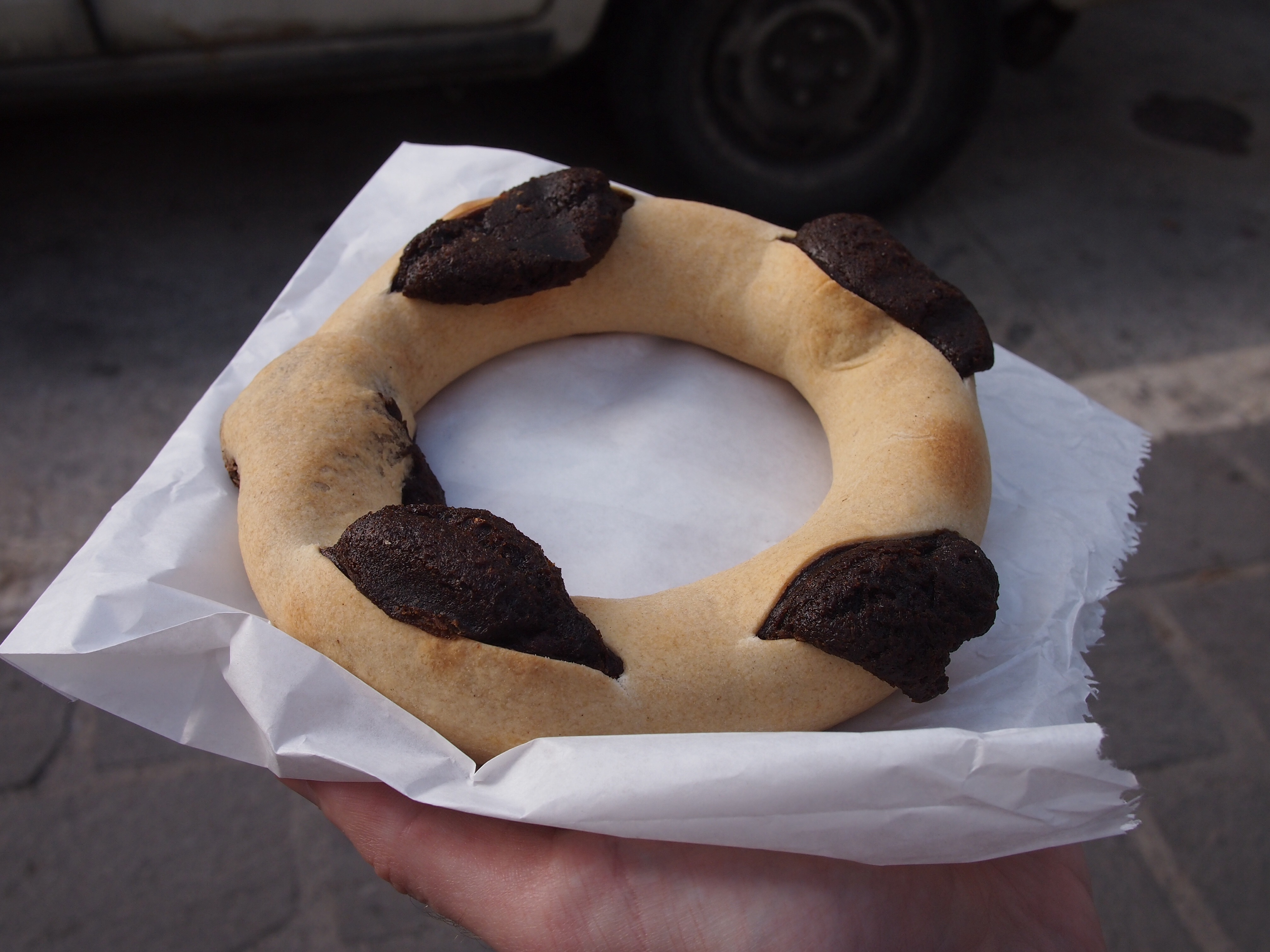
Our Qaghaq tal-ghasel

Hal Saflieni Hypogeum, Malta

The Hal Saflieni Hypogeum feels like a bit of an exclusive place to visit. Only ten people an hour are admitted, you need to book in advance and tickets are pricy at €30 (£24) each. Frankly, we wondered whether it would be worth it, but we needn’t have worried as it was fascinating. So, first things first, what is a hypogeum? Pretty simple really, it’s a fancy word for an underground burial chamber. In this case the structure is hewn from the solid limestone rock which makes up much of Malta’s geology.

Hal Saflieni HypogeumHal Saflieni Hypogeum – it doesn’t look like much from the outside

As instructed, we arrived 15 minutes before our tour time whereupon I got a bit of a fright as the man on the desk looked at my booking confirmation and said “11am, yes, that’s for tomorrow!” Of course I’d checked it multiple times before and was just about to argue when I saw that he was pulling my leg. Of course, Andrew thought this was hilarious…

As the group gathered at the entrance, our bags and cameras were put into a locker and each person was given an audio guide. First we were ushered into a small exhibition room and then shown a short film about the history of the hypogeum. It was built between 3600BC and 2400BC and consists of three levels. The level closest to the surface is the oldest and sustained some damage when the hypogeum was rediscovered in 1902 by a stonemason laying foundations for new houses.

Hypogeum top levelLooking down at the top level of the Hypogeum [photo credit: Heritage Malta]

As we descended through the top level, the audio guide explained that the builders who rediscovered the structure didn’t report it right away which meant that quite a bit of damage occurred here and anything that might have survived of surface features was completely lost. Unfortunately the first man to oversee the excavations then died unexpectedly while out of the country and his four years of dig notes have never been found.

Hypogeum main chamberThe main chamber on the middle level of the Hypogeum [photo credit: Heritage Malta]

It was interesting to see how the chambers had been carved out from the stone often using natural fault lines to dictate where walls would be. The finish in some of the chambers imitates the look of above ground temples built in Malta at the same time, like the ones we visited at Hagar Qim and Mnajdra. At the farthest extent of the tour walkway was the chamber which archaeologists have called the Holy of Holies where this is most apparent. Indeed the corbelled design of the carved roof can clearly be seen here and added weight to theory that the above ground temples had roofs constructed using this method.

Holy of HoliesHoly of Holies [photo credit: Heritage Malta]

Also in the middle level, in the Oracle Chamber, some of the roof paintings have survived.  Unfortunately the symbolism of the swirling pattern hasn’t come down to us, but archaeologists speculate that the red ochre colour used was because of its similarity to blood and may represent life. In the same room, the audioguide brought our attention to doorways raised above the level of the floor and explained that when the Hypogeum was in use this was likely because the floor would have been several centimetres deep in a mix of soil and skeletal remains – a slightly gruesome thought.

Roof paintings in the Oracle ChamberRoof paintings in the Oracle Chamber [photo credit: Heritage Malta]

As well as the structure itself, archaeologists unearthed human bone fragments as well as a number of other artefacts, including personal ornaments and various types of figurines. It is thought that around 7000 people were buried there over the course of 1000 years which didn’t sound like many to me (only seven per year) but no other explanation was given so perhaps it isn’t so remarkable. The most famous of the statues found here is the ‘Sleeping Lady’ which we later saw in the Museum of Archaeology in Valletta.

Sleeping LadyThe ‘Sleeping Lady’ was much smaller than we expected, only about 10cm from head to toe

Afterwards it was very clear to us why there are all the restrictions on entry – only ten people per tour, no bags or photos inside, etc. Quite apart from the conservation concerns (erosion from increased carbon dioxide levels from more people, photography flashes damaging wall paintings), the place is pretty small and even with a group of ten there was a certain amount of shuffling around at each stage so that everyone got a look at the interesting elements in each chamber, and photography would have slowed the tour down even more.

It is humbling to think about the people who constructed the Hypogeum 5000 years ago. They wouldn’t have had metal tools, just flints and bone and would have been shrouded in darkness – obviously no electric lights in those days and no soot marks have been found so no fixed torches either. The audio guide really added to the experience too, it was well put together with atmospheric background music composed for it by Renzo Spiteri and actually recorded inside the Hypogeum. The vision and dedication which must have been passed down from generation to generation in its building is mind blowing.

Lascaris War Rooms, Valletta

Our excellent guide Tony showing us through the Lascaris War Rooms in Valletta. Here he's explaining how the island was defended

Our excellent guide Tony showing us through the Lascaris War Rooms in Valletta. Here he’s explaining how the island was defended

The Lascaris War Rooms were Malta’s best kept secret of the Allied forces World War II efforts. They’re a series of tunnels and chambers dug some 150m into the bedrock of Valletta – by hand and mostly at night – that were used as the Allied HQ for the invasion of Sicily on the 9th of July 1943, 11 months before the D-Day landings of Normandy on the 6th of June 1944.

The name ‘Lascaris’ comes from Giovanni Paolo Lascaris, a descendant of the Greek Byzantine emperors of the same name – yes, the same Byzantine Empire that had Istanbul (nee Constantinople) as its capital – who was elected Grand Master of the Order St John (the same knights who built the Co-Cathedral). After a year in office Grand Master Lascaris ordered the construction of defensive towers along the coastline of Malta, one of which you’ve already seen as it’s the sunset picture at the end of our Dingli Cliffs walk.

After the British took control of the Maltese Islands in 1800, they extended the fortifications built by the Knights, and in 1854 started the Lascaris Fort and Battery – a defensive platform for cannon which overlooks the southern harbour of Valletta, so named because they were built on the site of Lascaris’ former private garden.

View of Fort Lascaris and the Lascaris Battery from the other side of the harbour. The Battery is the row of arches right in the middle, and the Lascaris War Rooms are underneath the giant wall just in front, with Fort Lascaris sitting on the waterfront - the high walls with two rows of small defensive windows

View of Fort Lascaris and the Lascaris Battery from the other side of the harbour. The Battery is the row of arches right in the middle, and the Lascaris War Rooms are underneath the giant wall just in front, with Fort Lascaris sitting on the waterfront – the high walls with two rows of small defensive windows

When Italy declared war on France and Great Britain on the 10th of June 1940, work started to enlarge the tunnel that ran from Fort Lascaris up to the main ditch in Valletta which was originally dug by the Knights, as the island needed bomb shelters. Soon rooms were carved out and as there was need for a central place to coordinate war efforts in the Mediterranean, the Allied HQ moved in.

The upper corridor of the Lascaris War Rooms, they carved out two floors of rooms and decorated it with scrap material from bombed houses. All of the metal  was recovered from ships sunk in the harbour

The upper corridor of the Lascaris War Rooms, they carved out two floors of rooms and decorated it with scrap materials from bombed houses such as the floor tiles. All of the metal was recovered from ships sunk in the harbour

When I mentioned earlier that Malta has had a surprisingly long and eventful history for such a tiny landmass, this was what I was referring to – we had no idea of the pivotal role that Malta played in the events of World War II. The story of these tunnels and command rooms is absolutely fascinating, and expertly brought to life by the amazing restoration work and by the simply outstanding storytelling guide Tony – whose father helped dig them!

The office of Admiral Andrew Cunningham, Commander-in-Chief of the British naval forces, looks out over the command room of Operation Husky

The office of Admiral Andrew Cunningham, Commander-in-Chief of the British naval forces, looks out over the command room of Operation Husky

We got to the museum early on a week day, and I’d recommend you do the same – especially as we visited in the middle of off-peak November. The tour begins with a short Pathé newsreel broadcast of a supply convoy’s journey from Britain to Malta which showed the logistical and life-threatening challenge of keeping strategically important Malta defended. There were only ever enough supplies to last 3 months, and if just two of these convoys didn’t make it in succession then the island would have had no choice but to surrender.

The museum opens with an Associated British Pathe newsreel story about a supply convoy from Britain to Malta

The museum opens with an Associated British Pathé newsreel story about the supply convoys from Britain to Malta

After the video, the audioguide took us through the rooms and rather dryly explained what each room was used for and who was stationed there, but when we got to the first of the main rooms – command room for the offensive Operation Husky, Tony picked up the commentary and started filling in the history with anecdotes of the various commanders and their rivalries.

The heart of Operation Husky, the massive plan of the invasion of Sicily and the start of the Allied offensive campaign against the Axis in World War II

The heart of Operation Husky, the massive plan of the invasion of Sicily and the start of the Allied offensive campaign against the Axis in World War II

When a tour group arrived he apologised and left to meet them, so we continued through the narrow corridors and past the second major room, the defensive situation room where attacks on Malta were tracked and squadrons of aeroplanes were organised to defend the island.

The defence command  and situation room. The board at the back (top-right) records the state of the 12 defensive flying squadrons and the big map in the middle records the last confirmed location of enemy aircraft

The defence command and situation room. The board at the back (top-right) records the state of the 12 defensive flying squadrons and the big map in the middle records the last confirmed location of enemy aircraft

Pretty soon we heard Tony again as he was showing the group around the maze of tunnels so we decided we’d tag along! While the audioguide had told us what the squadron board was for in the island defence command room, Tony filled in the details of how the squadrons were rotated. Because radar was crude and aeroplanes were slow to climb by todays standards, it was too late to scramble them to intercept bombers so constant air cover was used. This decision, with the limitations of fighter aircraft having a maximum 90-odd minutes of flight time, meant they had to launch new squadrons every 15 minutes! It took each squadron 30 minutes to get up to altitude, and another 15 to get down which meant they could provide about 30 to 45 minutes of cover before they had to return to refuel. Imagine the effort of the ground crew preparing for 12 aircraft taking off and another landing every 15 minutes. Astounding.

The defensive squadron situation room sits behind the squadron board shown in the last photo above - it's a series of slats that the operators on this side update with little metal tags as new information comes in

The defensive squadron situation room sits behind the squadron board shown in the last photo above – it’s a series of angled slats that the operators on this side update with little metal tags as new information comes in

From there we returned to the heart of Operation Husky, the room where General Eisenhower and his Supreme Commanders Admiral Cunningham, Field Marshal Montgomery and Air Marshal Tedder planned their attack on Sicily. Tony told us how Eisenhower had great trouble getting the two large egos of the American and British commanders to work together and in the end decided to give them the same objective but start them from different beaches – a tactic that brought out their competitiveness and which Eisenhower used again in the D-Day landings – no British and American forces landed on the same beach in either operation.

One of the telephone switchboards in a small communications room. Every time we see one of these manual switchboards I can't help but remark that my Mum used to operate one like it when she started working - not one quite this old, mind you!

One of the telephone switchboards in a small communications room. Every time we see one of these manual switchboards I can’t help but remark that my Mum used to operate one like it when she started working – not one quite this old, mind you!

Recognised as strategically important to the outcome of the war, the Axis forces ran more than 3,000 bombing raids in 2 years over Malta, making it the most intensively bombed area of the conflict. For maintaining control of Malta, King George VI awarded the nation the George Cross for Gallantry, the first time in history it was bestowed to a collective.

The George Cross for Gallantry awarded to the people of Malta and which adorns the nation's flag. The accompanying letter reads: "The Governor, Malta. To honour her brave people I award the George Cross to the Island Fortress of Malta to bear witness to a heroism and devotion that will long be famous in history. George R.I. April 15th 1942"

The George Cross for Gallantry awarded to the people of Malta and which adorns the nation’s flag. The accompanying letter reads: “The Governor, Malta. To honour her brave people I award the George Cross to the Island Fortress of Malta to bear witness to a heroism and devotion that will long be famous in history. George R.I. April 15th 1942”

After World War II the Lascaris War Rooms continued to be used by the British as their Mediterranean Fleet HQ until 1967 when NATO took over to use them as a Communications Centre for the interception of Soviet submarine transmissions during the Cold War. NATO also added a lot more rooms on the other side of tunnel and they’re currently being restored to be opened to the public in 2015 as a Cold War Museum right opposite the WWII Lascaris War Rooms. It would be equally fascinating to return to Valletta to visit these more modern bunkers, especially as we’ve seen their Soviet equivalent in Latvia earlier in our trip!

St John’s Co-Cathedral, Valletta

Like many of Europe’s medieval cities, Malta’s capital Valletta is fairly compact and surrounded by walls. Unlike most of the other cities which retain their walls e.g. York, Bruges, Tallinn, here the walls are not surrounded by modern city, because on three sides Valletta’s walls are bounded by the sea.

VallettaValletta’s southern walls meet the sea

The Knights Hospitaller, or Order of St John, was formed in the 11th century as a Christian military order. In 1530 they established themselves on Malta and ruled the island nation for 268 years until it was taken by Napoleon. In the centre of their fortified capital the Knights built St John’s Co-Cathedral, dedicated to the patron saint of their order. It is called Co-Cathedral as it has equal status on the island with St Paul’s Cathedral in the inland fortified city of Mdina, the seat of the Bishop of Malta, although this wasn’t the case until the 1820s.

Exterior of St John's Co-CathedralThe exterior of St John’s Co-Cathedral is rather plain and currently undergoing restoration

Inside, the cathedral is pretty much the exact opposite of its austere exterior and it seems that every surface is covered with some form of decoration. Whether painted, gilded, carved or inlaid it’s quite an assault on the eyes. The nave is barrel vaulted and each of the six ceiling bays contains three scenes from the life of St John painted by Mattia Preti, unusually using oil based paints directly on the stone.

Nave of St John's Co-CathedralThe spectacular nave with its painted ceiling

The High Altar is even more extravagant than the rest of the interior adorned with various gifts from Grand Masters and high-ranking knights who seem to have been trying to outdo each other by contributing rare marbles and exquisite carvings. The huge Sanctuary lamp hanging at the front of the space is made of solid silver!

High AltarThe High Altar is the centrepiece of the interior

Along each side of the nave are eight equally elaborately decorated chapels. The Knights were gathered from all across Europe and each of these chapels is dedicated to one of the ‘langues’ or places of origin. It was interesting to try to spot the details which tied the chapels back to the original country, for example, the double headed eagle emblem in the German chapel, or the fleur-de-lys in the French one.

Chapel of AragonChapel of Aragon; we weren’t sure exactly where Aragon was and were interested to find that it is an autonomous community in northern Spain

Each chapel has its own altar along with magnificent marble tombs of the langue’s distinguished knights.

Chapel detailsChapel details (clockwise from top left): tomb in the French Chapel; even the ‘plain’ walls are covered with gilded carvings; altar in the Italian Chapel; Spanish Chapel altarpiece

Of all the Cathedral’s magnificence, for us the highlight was definitely the floor. It’s completely made up of gravestones, and not just normal grey gravestones with carved inscriptions, these are brightly coloured pictures often containing crests, weaponry and skeletons as well as an inscription, all made up of inlaid marble in an amazing variety of colours.

Inlaid marble floorInlaid marble gravestones cover the floor of St John’s Co-Cathedral

The audio guide route ends with the cathedral’s museum. In the first room of which, the Oratory, are two paintings by Caravaggio. Caravaggio seems to have been quite a troubled figure, he was quite famous in Rome during his lifetime but was forced to flee after killing a man in a brawl. Arriving in Malta he became a knight and carried out several commissions on the island before landing in prison again, this time for injuring a fellow knight in a fight. The two works in the Oratory are dramatic and show his innovative use of light to illuminate the central figures while leaving much of the scene in darkness.

Caravaggio's Beheading of St John the Baptist
‘The Beheading of St John the Baptist’ by Caravaggio [photo credit: St John’s Co-Cathedral]

The rest of the museum is devoted to the set of enormous 17th century Flemish tapestries which are hung in the nave for special occasions (e.g. when the Pope visited), several beautiful illuminated choral books, various items of ecclesiastical clothing and a few paintings.

We spent a couple of hours exploring the cathedral and trying to take in all of the artwork and spot details (like an elephant on one of the gravestones). In contrast, we saw several groups from the cruise ships which dock in Malta being led in by their guide, doing a quick circuit around the nave and exiting through the gift shop. It seems a shame that they miss out on so much of this showcase of the Knights’ splendour.

Megalithic Malta: A walk along Dingli Cliffs to prehistoric temples

Sitting in the Mediterranean Sea closer to Sicily in the North than Libya and Tunisia to the south, Malta has had a surprisingly long and eventful history for such a tiny landmass of only 315km2 (112 square miles).

Despite its small size, or perhaps because of it, Malta is the 3rd most densely populated country or sovereign state in Europe (after Monaco and Gibraltar) and 8th most in the world – though it magically maintains a desolate, isolated feel as we found out on our first stroll along a section of its south-western coastline.

The walk: Dingli, Fawwara, and Wied iż-Żurrieq

Map of the Dingli Cliffs walk. Source: Malta Tourism Authority

The map of the Dingli Cliffs walk. The Malta Tourism Authority helpfully provide paper versions in all of the Tourist Information offices (including the airport), and online in PDF format too. Source: Malta Tourism Authority

Looking at the map we thought we were in for a long stroll, until we remembered that the entire coastline of Malta is only 196.8km (122 miles) which means this walk is an easy 11.2km, or about 7 miles.

Looking back towards the start of the walk at Dingli Cliffs. Not bad for a day in November

Looking back towards the start of the walk at Dingli Cliffs. Not bad for a day in November

Just past a couple of radar stations at the highest point of the island, we arrived at St Mary Magdalene Church, an isolated, simple place of worship teetering on the cliff edge.

St Mary Magdalene Church on the edge of Dingli Cliffs

Tranquil reflection at St Mary Magdalene Church on the edge of Dingli Cliffs

Described as 'Cart Ruts', these man-made grooves in the garigue weren't actually created by carts - the truth is we just don't know how or why they were made!

Described as ‘Cart Ruts’, these man-made grooves in the garigue weren’t actually created by carts – the truth is no-one knows how or why they were made!

From the roadside path it looked like a sheer drop into the Mediterranean from the rocky edge, but when we ventured closer we found that while there was a drop that would probably sting a little bit, there’s a second terraced plateau with yet another sizeable drop-off before the sea. Most of this was given over to agriculture, with the odd house or church between the fields.

Looking south over the cultivated fields of Fawwara from a Bronze Age village site that juts out almost to the sea

Looking south over the cultivated fields of Fawwara from a Bronze Age village site that juts out almost to the sea

According to the map, there’s an old Bronze Age village site at Fawwara but all that we could discern from the remains was its natural vantage point that extends out from the cliffs almost to the sea, commanding amazing views up and down the coastline.

From here we descended to the lower plateau and continued south to within a kilometre or two of the end where we stopped at Ħaġar Qim and Mnajdra – 2 prehistoric temple sites and outdoor museum..

Megalithic Malta: The temples of Ħaġar Qim and Mnajdra

Us at the entrance to Hagar Qim, the 5,000 year-old monolithic temples. I'm listening to the audioguide which poses more questions about the site and its purpose than it answers

Us at the entrance to Ħaġar Qim, the 5,000 year-old megalithic temples. I’m listening to the audioguide which poses more questions about the site and its purpose than it answers

Before we explored the remains of the temples, we wandered through the small but excellent museum, which, given how little is known about the origins of these temples and the peoples that built them, is mostly given over to how we think they were built, how they were rediscovered, and how they’re being preserved.

Here’s a short excerpt from the museum’s guide:

“The prehistoric site of Ħaġar Qim consists of a group of monumental megalithic buildings. These were built during the late Neolithic, around 5,000 years ago. Similar buildings have been found in more than twenty different places in Malta and Gozo. Today these buildings are usually called “temples”. However we know very little about what went on inside them.” – Ħaġar Qim Temples, a brief guide, Heritage Malta

Inside the museum. The 2 models  show how the temples are aligned with the equinoxes and solstices

Inside the museum. The 2 models show how the temples are aligned with the equinoxes and solstices

The museum includes a 10 minute “4D” introduction video experience – the 4th dimension being blasts of cold air and scented water droplets – alongside the 3D visuals that imagine the construction through to the present day ruins. It was well done and the visuals were good as they show the temples against the landscape, which isn’t possible to see anymore because there’s now a giant protective tent over each temple shielding the stone from the elements.

Some of the stones used in the construction are simply massive, and reminded us of Stone Henge back home

Some of the stones used in the construction are simply massive, and reminded us of Stonehenge back in England

Ħaġar Qim is the first of two temple sites and is the more impressive for its relative completeness – it’s more compact and the walls are still standing tall. We enjoyed wandering through the ruins, though some sections are roped off we were still surprised how accessible they were. The audioguide was only €2 more and is good for pointing out the most interesting aspects of the construction, but almost every clip ends with a “what do you think this was for?” or “why do you think this is here?” which left us with more questions than answers!

Details of Hagar Qim: relief sculptures found during excavations include altar pieces and decorative stone carvings; One of the many altars of the temple but the only one open to the outside

Details of Ħaġar Qim: relief sculptures found during excavations include altar pieces and decorative stone carvings; One of the many altars of the temple but the only one open to the outside

500 metres down the hillside and closer to the cliffs is the 2nd megalithic temple site of Mnajdra, a much larger set of ruins and in a worse state of repair than Ħaġar Qim.

The approach to the Mnajdra Temples, these too are protected from the rain and the sun by a giant tent

The approach to the Mnajdra Temples, these too are protected from the rain and the sun by a giant tent

Mnajdra is actually a complex of 3 buildings..

“The first and oldest structure is the small three-apsed temple (on the right), built in the Ġgantija Phase, around 3,600-3,200BC. The South Temple (on the left), with its concave facade was next to be completed early in the Tarxien Phase, shortly after 3,000BC, followed by the Central Temple which was built on an artificial platform between the two earlier buildings.

The South Temple at Mnajdra was built in such a way that its main doorway is aligned with sunrise during the spring and autumn equinoxes (30th March and 22nd September). During the winter and summer solstices (21st June and 21st December) the beams of the rising sun pass along the sides of the main doorway hitting two decorated slabs within the first chamber.” – Mnajdra Temples, a brief guide, Heritage Malta

Inside the first chamber of Mnajdra's South Temple - during the equinoxes and solstices the sunrise hits the blocks either side of this doorway, again reminding us of Stonehenge. Wow!

Inside the first chamber of Mnajdra’s South Temple – during the equinoxes and solstices the sunrise hits the blocks either side of this doorway, again reminding us of Stonehenge. Wow!

The beautiful pitted decoration of another doorway in the South Temple

The beautiful pitted decoration of another doorway in the South Temple

We liked the different levels and scale of these three very different temples which at first glance just looked like one giant building. The middle temple has the most dramatic example of erosion we’ve seen – the north side of the room shows some damage but the south side is almost completely eroded. I’d have thought they’d have been equally damaged because they’d have received equal rainfall, but the museum explained that it’s the sun that does the most damage!

The north facing wall (left) of the Central Temple is in relatively good condition, but the lower south facing stones (right) of the same room have almost completely eroded. Most surprisingly for me was that the heat of the midday sun has done the most damage

The north facing wall (left) of the Central Temple is in relatively good condition, but the lower south facing stones (right) of the same room have almost completely eroded. Most surprisingly for me was that the heat of the midday sun has done the most damage

From the museum there was a final downhill stretch to the tiny fishing village of Wied iż-Żurrieq (which we have no idea how to pronounce!), where we watched the sun set while we waited for our bus back to the other side of the island.

The sun sets on our first day of strolling through the countryside and history of the tiny island of Malta

The sun sets on our first day of strolling through the countryside and history of the tiny island of Malta

We really enjoyed the feeling of remoteness; to walk so closely to the cliff edge with the deep blue Mediterranean stretching out to the horizon on one side, and a view across the island to the Mediterranean on the other, made Malta feel really small. It’s a very easy walk too, it starts near the highest point of the island which means it’s pretty much all downhill!