Category Archives: Places

Yakushima, Japan

While we were chatting to the owner of the hostel where we stayed in Nara and telling him our rough plans for our travels in Japan he asked if we’d heard about Jomon Sugi, a really old tree in the centre of an island off the south coast of Kyushu. Well, we hadn’t but it sounded intriguing and after a little more research we found that the name of the island is Yakushima and that 20% of it has been designated as a UNESCO World Heritage site on account of the value of its ancient cedar forests. It was quickly added into our itinerary.
20140620-115346-42826164.jpg
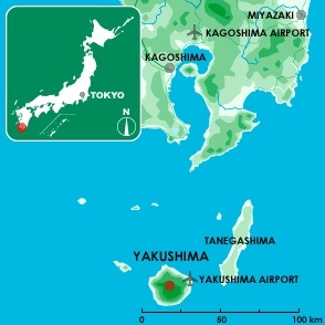
Yakushima’s location [Image source: Yakumonkey]

Several weeks later we had made our way as far south as Kagoshima. Our final day in the city was grey and rainy so it was a pleasant surprise when we woke the following morning to blue skies and bright sunshine. Especially pleasant as we had a four hour ferry journey ahead of us which really wouldn’t be nice if it was windy and raining.

Yakushima is 60km south of Kagoshima and there are three ways to get there, flight (very fast and very expensive), hydrofoil (takes about two hours and more moderately priced) and car ferry (takes twice as long as the hydrofoil and is half the price). We opted for the cheapest option but would recommend it to others if they have the time. The ferry was comfortable, uncrowded and Andrew was thrilled to discover that there’s an onboard sauna, although he didn’t get chance to make use of it.
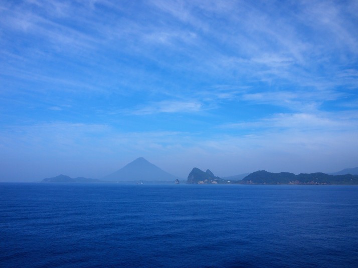
20140620-142138-51698352.jpgThe end of the Satsuma peninsula seen from the ferry to Yakushima. The conical mountain in the centre of the photo is Mt Kaimon-dake.
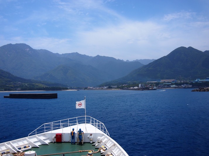
20140620-142446-51886607.jpgAs the ferry approached Miyanoura port we were delighted to see flying fish scooting away from the ship (and stunned at how far they can travel). I was also surprised by how mountainous the island looked and began to feel a little nervous about the long walk to the old tree which we planned to do the following day.

Our first stop was the tourist office where picked up what has to be my favourite information handout ever – an A3 sheet with a map of the whole island, all the bus stops, points of interest and a complete bus timetable for all the routes – an obsessive travel planner’s dream tool! Next we wandered along the main street in search of lunch, eventually settling on Satchan where the friendly waitress managed to translate enough of the menu for us to decide on a set meal of Yakushima specialties. It was a delicious feast of sashimi, fishcake and grilled fish although the fact that it contained lots of flying fish made us feel a little guilty after admiring them so much from the ferry…
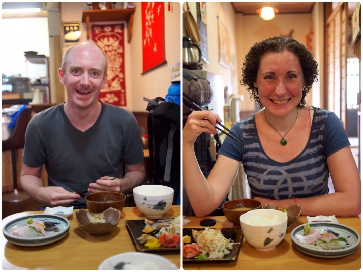
20140620-142630-51990576.jpgExcited to dig into our lunch!

Yakushima is famous for its ancient cedar forests and also has the rather dubious honour of being the wettest place in Japan receiving up to 10,000mm of rainfall per year. To put that into perspective, the wettest town in Britain, Dalness in the Scottish Highlands, gets an average of 3,300mm per year. Yes, that’s right, this place is three times wetter than Scotland! We had our fingers crossed for a dry day for the walk up the mountain and the forecast looked promising.
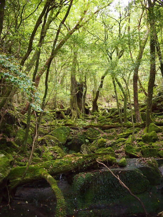
20140624-163013-59413220.jpgYou can tell how wet the climate is by the amount of moss in the forest

Our accomodation was a one hour bus ride from Miyanoura which Andrew managed to sleep through while I followed the route closely with my new favourite piece of paper. Alighting from the bus we found ourselves in the company of two other travellers, Brian from New York and Claudia from Zurich, and quickly realised that we were all staying at the same guesthouse. We spent the rest of the evening talking them into the early start that was necessary to join us for the 10 hour hike to Jomon Sugi. The only public transport option to the Arakawa Trail Head meant that we had to get up at 4.30am…
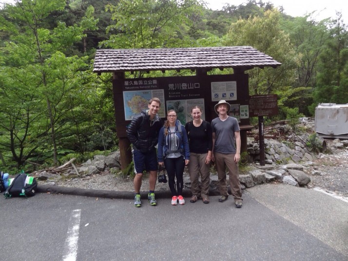
20140620-151456-54896440.jpgBrian, Claudia, Julie and Andrew looking pretty chipper at the start of the trail at 6.45am

The first three-quarters of the trail are not too challenging. The path is along an old logging railway and the incline is very gentle although the distance is long (just over 8km or about 5 miles). We were by no means the only group to be doing the hike although most of the others seemed to be small groups of mostly middle-aged Japanese ladies with tour guides. Everyone was very friendly and by the end of the day, having passed each other numerous times, we almost felt like honorary members of some of the groups!
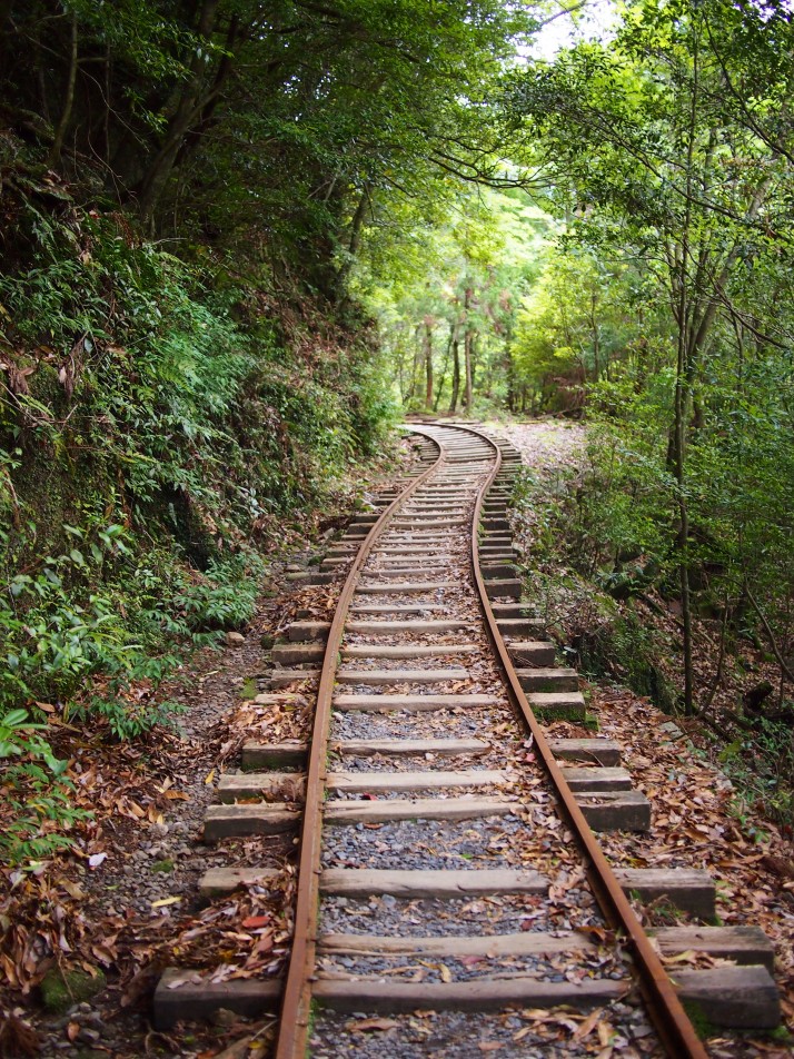
20140620-152337-55417183.jpgWalking the railway line

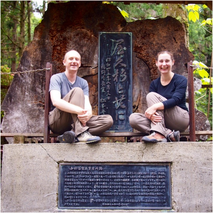
20140620-152528-55528348.jpgUs with a slice of the trunk of a felled cedar at the site of an abandoned loggers’ village part way along the trail.

The last section of the trail is only 2.7km (about 1.7 miles) but it is steep and the path is a combination of steps, boardwalk and twisty tree roots so we really needed to watch our step. This is close to the highest part of the island, where the old growth forest still survives. There are many old trees along the path and a couple of stumps too. Wilson’s Stump is big enough to fit about eight people inside and, when looked through from the right angle, the view up to the canopy from its centre is heart shaped.
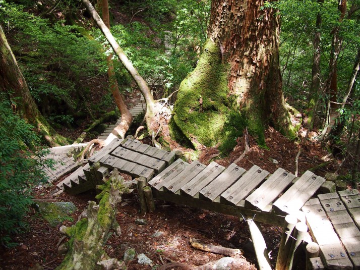
20140620-152658-55618179.jpgThe last part of the trail seemed to be a never ending series of steps
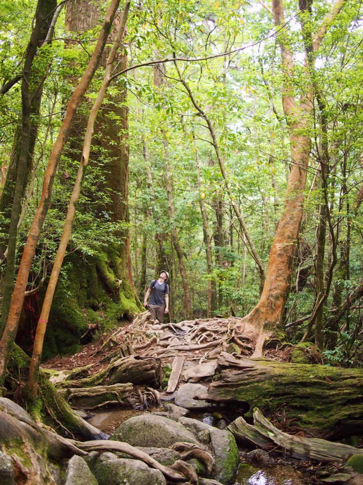
20140620-153021-55821590.jpgAndrew checking out the height of one of the ancient cedar trees

After seeing some incredible huge trees we thought that Jomon Sugi might be a bit of an anti-climax, but when we arrived it made us gasp. It’s the largest cedar ever found in Japan at 25.3m tall and 16.4m in circumference. Estimates of its age range from 2,170 to 7,200 years old, based on a scientific sampling of the trunk, and an estimate from its size respectively.
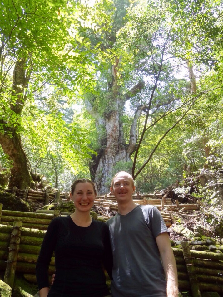
20140620-153219-55939190.jpgUs with Jomon Sugi. Unfortunately this is as close as you’re allowed to go to prevent erosion around the tree’s roots.

After stopping for lunch, we then had to turn around and do it all in reverse. We just pressed on to get the hard part over and done with quickly and we were back on the railway line in about an hour and a half from where, even with tired legs, the going wasn’t too bad. Highlights of the walk back were seeing deer and a couple of monkeys (both sub-species indigenous to Yakushima) and also a brief stop away from the track at the riverside – the water is crystal clear and looks wonderfully turquoise blue in the sunlight. I was very tempted to give my feet a soak but eventually decided against it worried that once off, I might not be able to get my boots back on!
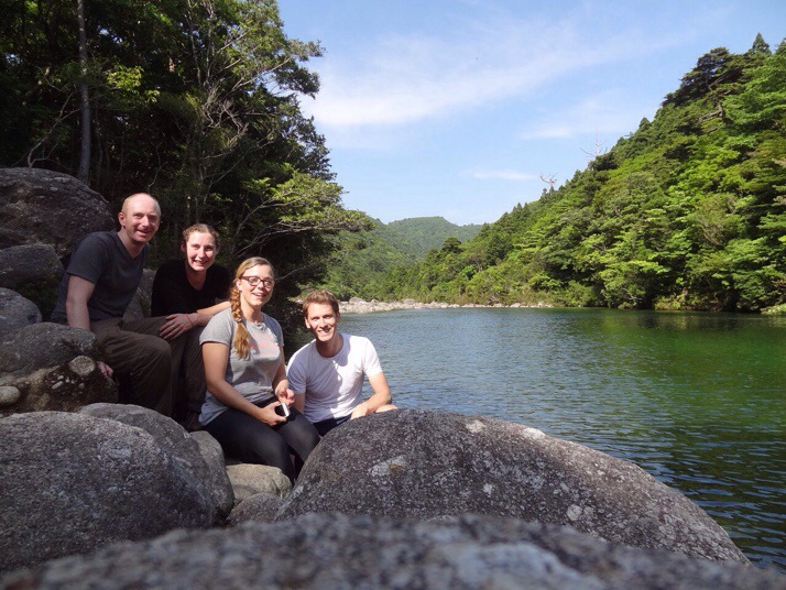
20140622-165114-60674312.jpgAt the river in the afternoon sunshine

At last we made it back to the trail head in time to catch the bus back to the guesthouse. All four of us exhilarated but exhausted.

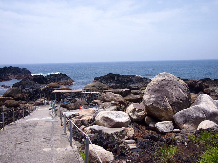
You’d think that after all that exertion we’d take it easy the next day but we only had two full days on Yakushima and we wanted to make the most of it so we hired bikes from the guesthouse and set off to explore the southern coast of the island. After picking up a picnic lunch, we made our way to Hirauchi Onsen to coincide with low tide. This hot spring bath is very much au natural, the sulphurous spa water bubbles up from beneath the rocks and is contained in crude concrete baths. It’s so close to the sea that it can only be used for a few hours either side of low tide.

20140622-170326-61406668.jpgHirauchi Seaside Onsen

The onsen was exactly what we needed to ease our aching muscles and it left us feeling so relaxed that we thought we might go straight back to the guesthouse, but after a bite of lunch and a sugary drink we had a bit more energy and decided to carry on to see if we could reach the waterfall marked on our map. Turns out it was a bit further than we’d expected, but by the time we’d realised we were only a few kilometres away and so we pressed on.
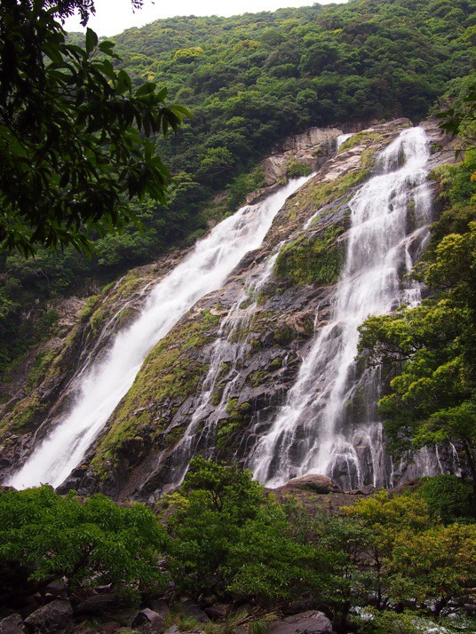
20140622-171057-61857508.jpgOhko-no-taki waterfall with a drop of 88m was much more impressive than we’d expected especially considering that it was the end of the dry season.

By the time we got back to the guesthouse we were completely exhausted and when we worked out that we’d cycled a total of about 50km we joked that all we needed now was to swim back to Kagoshima and it would be like a three day triathlon! In the end though we decided to get the ferry instead…
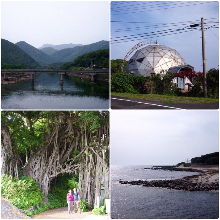
20140622-171617-62177015.jpgYakushima’s southern coast (clockwise from top left): Mountainous scenery above the bridge at Kurio, a very strange house, beach at Nakama, a huge banyan tree

One of the very few things that we don’t like about travelling in Japan is that reasonably priced accommodation can get booked up fast and so we’ve found it necessary to have our accommodation booked well in advance. This denies us the flexibility to stay in places that we really like for longer than our initial estimate. We could easily have stayed on Yakushima for a week, gradually exploring the whole island and chilling out in its quiet greenness but unfortunately it wasn’t possible this time. We also started daydreaming about island hopping between the remote and small inhabited islands even further south so I think there’s a pretty good chance that we’ll be back!

Volcanic activity near Kagoshima, Japan

In Kyushu, the southernmost of Japan’s four main islands, the volcanic activity of the archipelago is obvious and nowhere more so than near Kagoshima towards its southernmost tip. Incidentally the area around Kagoshima is called the Satsuma Peninsula which we found endlessly amusing even before we found out it actually is famous for citrus fruits. The Komikan tangerine is a variety indiginous to the area and tastes a bit like a cross between an orange and a lime – very yummy!

One of the reasons we visited Kagoshima was the fish market tour, but we were also keen to see the volcanic activity and how it affects the day-to-day life of the residents.

Sakurajima

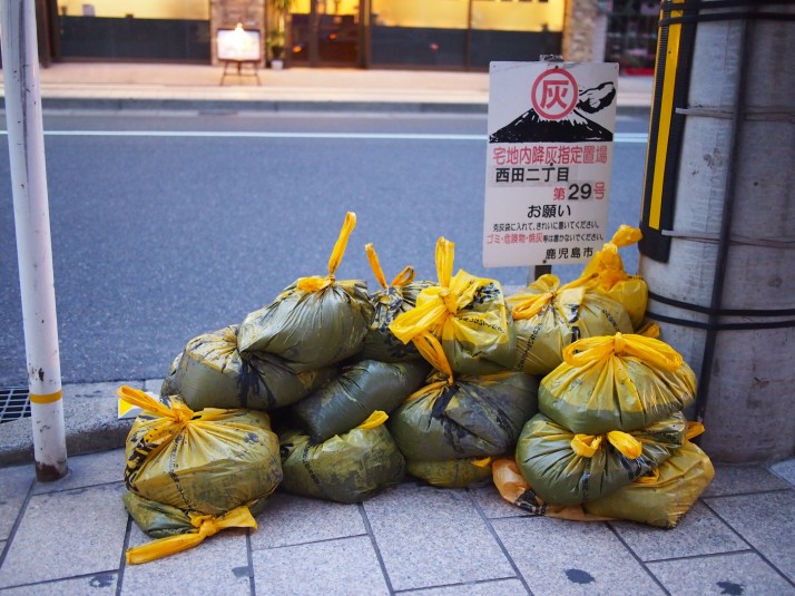
Just 4km across the bay from Kagoshima is the very active Mt Sakurajima (cherry blossom island). It streams smoke almost constantly and erupts more than 1000 times a year although mostly just small quantities of ash. The falling ash is a fact of life for local residents and bags of it are cleaned up from the streets. Seeing the volcano billowing on the day that we visited was pretty awe inspiring and every so often we would turn to each other to say ‘Wow!’

20140619-135311-49991692.jpgBags of ash awaiting collection on a street corner in Kagoshima
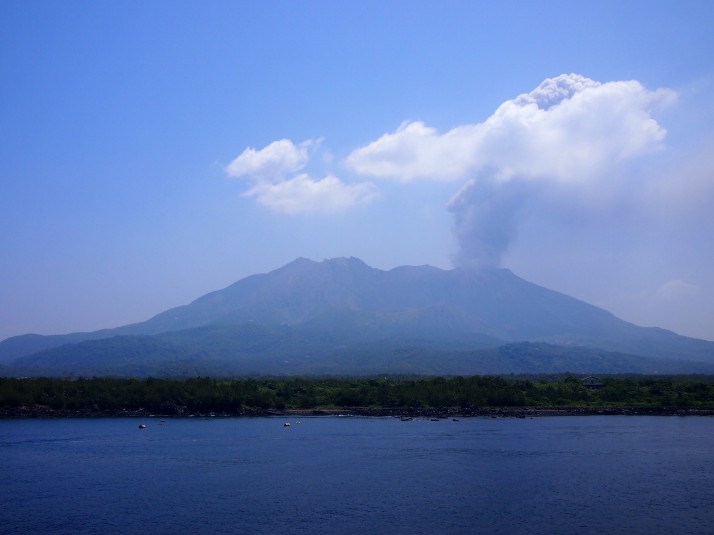
We took the cruise ferry, which departs once a day from Kagoshima, and takes 50 minutes instead of the 15 minutes of the direct ferry. It skirted the lava fields around the south-west part of the volcano before arriving at the port.

20140619-135523-50123323.jpgSakurajima billowing smoke, seen from the cruise ferry
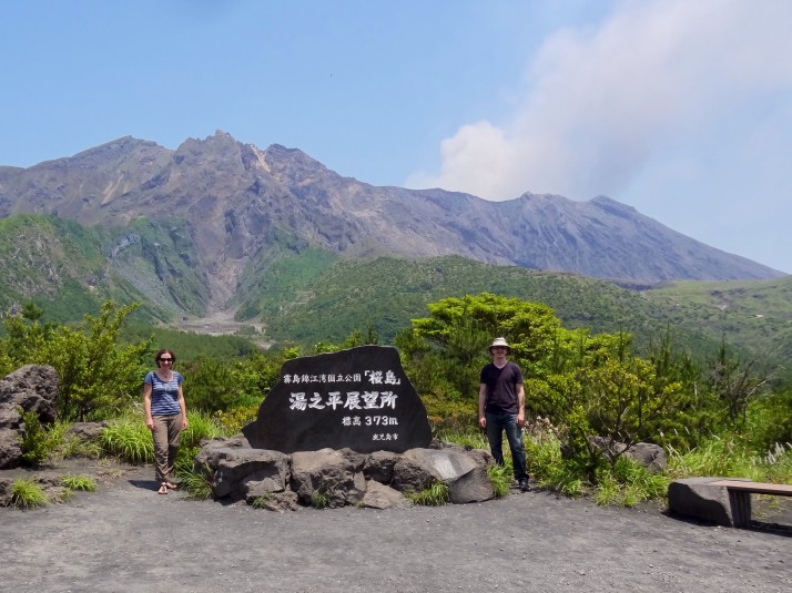
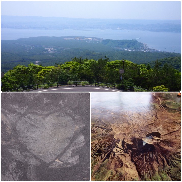
At the port we hopped onto the ‘island view’ bus to head up to the Yunohira Observatory, the closest access point to the crater. At 373m above sea level it’s just over a third of the way up. After we’d taken some photos of the volcano and admired the view of Kagoshima, there didn’t seem to be much more to do there and we still had 45 minutes to wait before the next bus. Then we noticed that the information leaflet said there were seven heart shaped stones hidden around. It seemed like a reasonable way to pass the time but even after a thorough search including the car park we only managed to find four, perhaps the rest were covered in ash!

20140619-140115-50475158.jpgUs at Yunohira Observatory

20140619-140831-50911093.jpgYunohira Observatory (clockwise from top): View across the bay to Kagoshima, aerial view of the three craters in the visitor centre, one of the heart shaped stones once we’d cleared the ash away
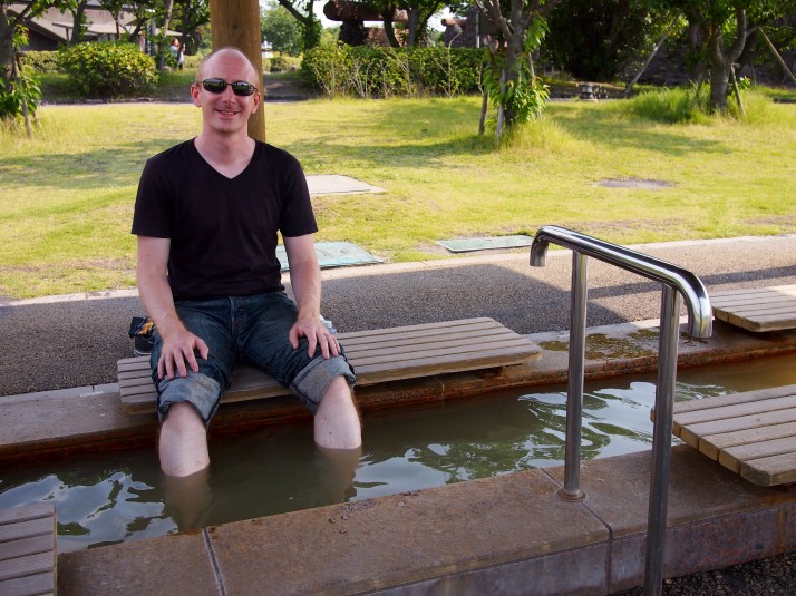
Back on the bus, we descended from the observatory to Karasujima Viewpoint where we read that it used to be an island 500m away from the volcano until the 1914 eruption. This is the most recent big eruption of Sakurajima and it not only buried this small islet under 20m of lava but also filled the strait between the volcano and the mainland, and destroyed three villages. Reading this we were shocked that Sakurajima still has a population of 5000 people but I suppose the economic lure of tourism, fertile fields and ash that can be mined is hard to resist. The tourism leaflet says that the population ‘live in harmony with the volcano’ but I’m not convinced that anyone has fully explained that to Sakurajima…

20140619-141616-51376083.jpgFrom Karasujima we walked the 3km trail back to the port town to end the day with a soak of our feet in the public foot bath
Ibusuki Sand Baths

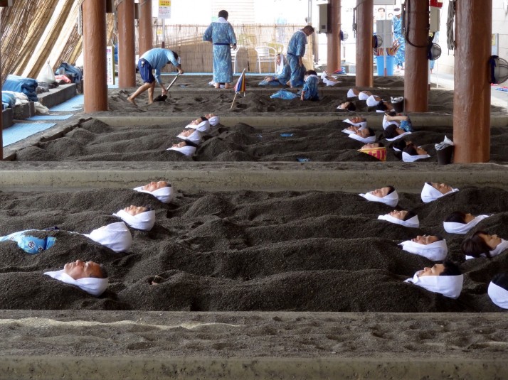
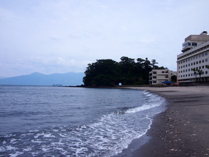
An interesting effect of the volcanic activity can be experienced in Ibusuki, an hour south of Kagoshima by train, where steam bubbles up through the sand heating it to spa temperatures. We like a good hot bath and so we were keen to try the hot sand. First we wandered along the deserted seafront and ate our packed lunch sitting on the seawall and gazing out to sea before making our way back to Sunamushi Kaikan Saraku (Natural Sand Bath) and paying the entry fee.

20140612-115025-42625167.jpgDeserted sea front at Ibusuki

Ibusuki Sand BathsRows of spa goers buried in sand at Sunamushi Kaikan Saraku
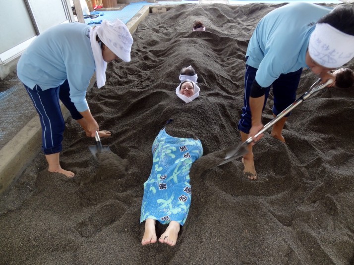
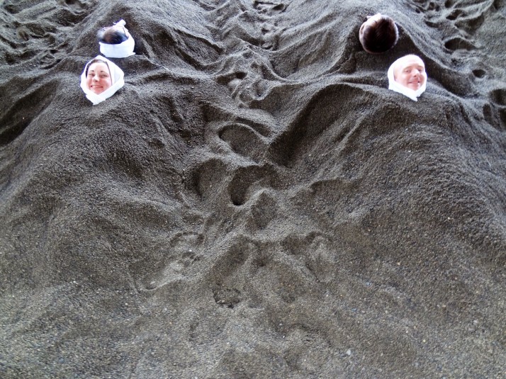
In the changing rooms we put on the provided yukata (imagine a kind of cotton dressing gown) and made our way to the beach where we lay down in a hollow and the staff began to shovel hot sand over us, something like you might have done to your dad on the beach as a kid. It was a relaxing experience and not actually as hot as we’d expected. The recommended time to stay covered for the full blood cleansing benefits is 10 minutes but we both managed at least 15 minutes.

Julie getting covered in sandStaff shovelling sand over Julie

Taking a sand bathBuried up to our necks! You wrap a small towel around your head to protect your head and neck from the heat
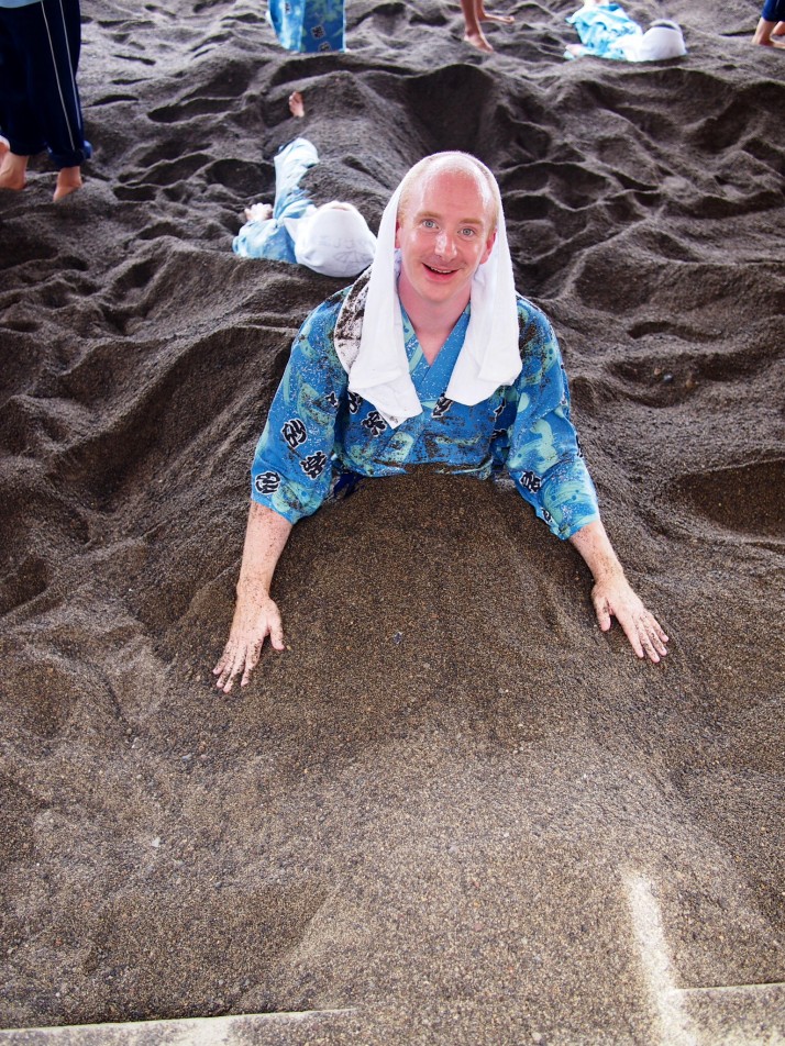
Andrew getting out of the sandAndrew escaping from under the sand

After wriggling our way out we made our way back up to the onsen building to rinse the sand out of all the places it had worked its way into. The sand bath was a fun and unique experience and left our skin feeling thoroughly cleansed.

Kumamoto, Japan

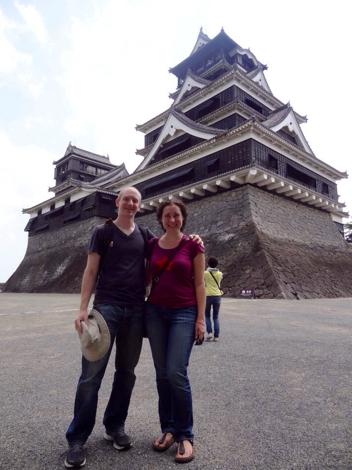
Kumamoto’s Castle is one of many in Japan which have been reconstructed, however it is pretty unique in that it was neither deconstructed during the mass modernisation of the Meiji period at the end of the 19th century, nor bombed during WW2, but destroyed in battle during the Satsuma Rebellion in 1877. The story behind its demise under Saigō Takamori is dramatic and culminated in a 54 day siege but ultimately it is unclear how the fire which destroyed the castle broke out. Saigō’s story inspired the film ‘The Last Samurai’ starring Tom Cruise although Hollywood invented the involvement of an American soldier.

20140605-081803-29883719.jpgUs in front of the main keep of Kumamoto Castle
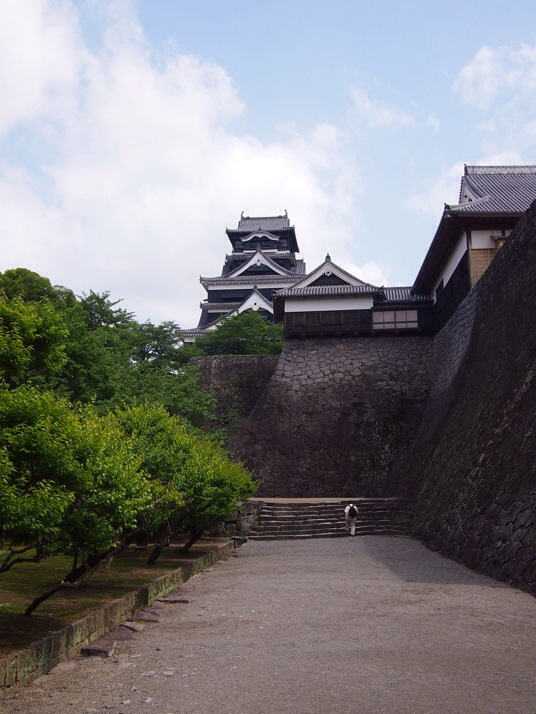
The castle was built in 1607 by Kato Kiyomasa and was widely admired. It is a maze of huge stone walls leading to the main buildings, an impressive keep tower which was used for defensive purposes and a reconstruction of the Honmaru Palace where the lord and his family would have lived. In addition there is one turret which is an original structure and several more around the perimeter walls which have been reconstructed.

20140605-081700-29820425.jpgMassive stone walls protect the castle

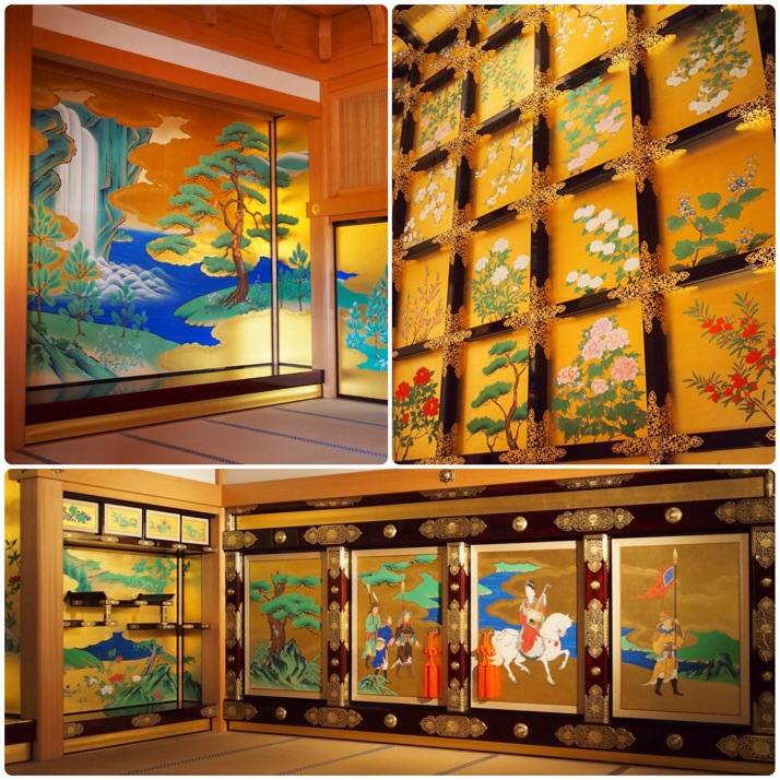
20140605-082327-30207266.jpgThe Shokun-no-ma room in the guest hall of the Honmaru Palace reconstruction is extravagantly decorated in gold leaf and bright colours. Even the ceiling is covered with gold and painted with flowers (top right).
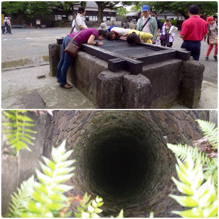
20140605-082256-30176887.jpgThere are several wells around the castle grounds which were used to provide drinking water during the siege period. This one was deep!
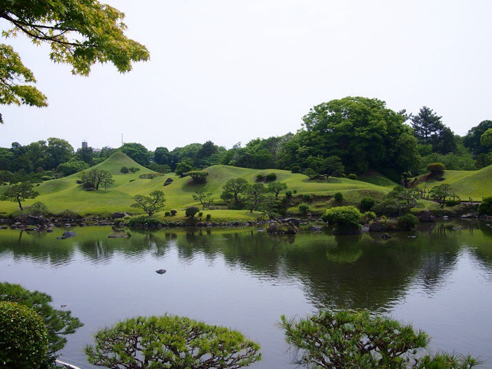
Next day we planned to catch the afternoon bus to Kagoshima which meant that we had time in the morning to visit Suizenji Garden. Construction of the garden began in 1636 for Tadatoshi, the third Lord of Hosokawa, as his tea retreat. Its design represents the 53 stations of the old Tōkaidō post road although apart from the grassy mound shaped like Mt Fuji any other features were fairly obscure to us. Maybe I shouldn’t have been expecting something like a miniature village with model buildings and explanatory notices…

20140606-083818-31098399.jpgLooking across the pond towards the carefully manicured slopes of ‘Mt Fuji’ (towards the left of the picture)
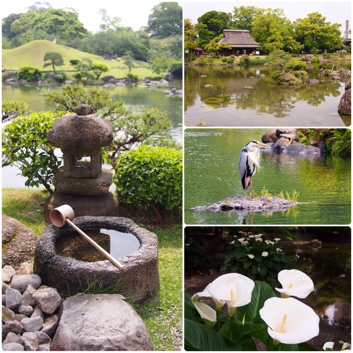
The garden is quite small and it doesn’t take more than half an hour to walk around it all. Nevertheless the peaceful pond was a lovely place to sit for a while watching the herons, egrets and the ever present koi. There is a Noh Theater stage in the garden as well as a couple of shrines, one of which features a fountain of longevity.

20140606-083850-31130004.jpgSuizenji garden (clockwise from left): Well, teahouse across the pond, heron, Arum lilies
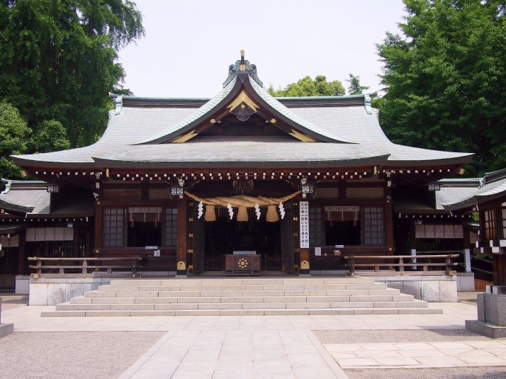
20140608-104531-38731824.jpgShrine in the grounds of Suizenji Garden
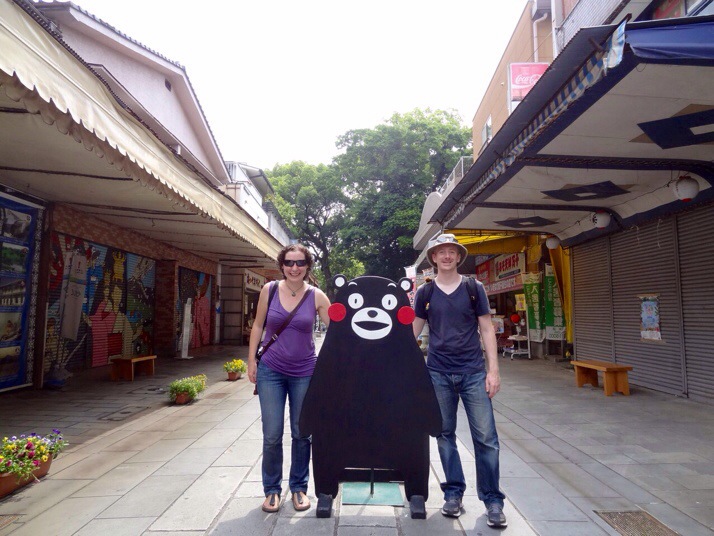
Most Japanese cities have mascots, a friendly looking cartoon character which they use on their tourist materials. Kumamoto’s mascot is a black bear called Kumamon and he really seemed to be everywhere, popping up on street signs, postcards, T-shirts and even in the lobby of our hotel, often with different expressions.

20140603-190813-68893611.jpgUs with a Kumamon cut-out near Suizenji Garden
Nagasaki, Japan

On August the 11th 1945, three days after the bombing of Hiroshima, Nagasaki became its atomic sibling – forever to be known as the second city destroyed by an atomic weapon.

This tragic event was the only thing we knew about Nagasaki before we arrived, and it turned all the more tragic when we learned of its rich and important history.

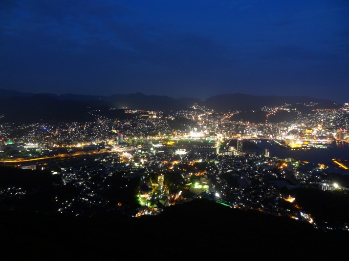
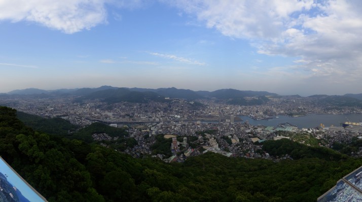
Nagasaki, as viewed from Mt Inasa

Nagasaki, as viewed from Mt Inasa

Nagasaki was originally founded by the Portuguese and had long been Japan’s main trade gateway with the rest of the world. As well as goods, news, knowledge, food and religion passed through Nagasaki – including the quintessential Japanese cuisine tempura, which actually arrived with the Portuguese!

Dejima

Scale model of Dejima in the north-eastern garden area, Dejima

Scale model of Dejima in the north-eastern garden area, Dejima

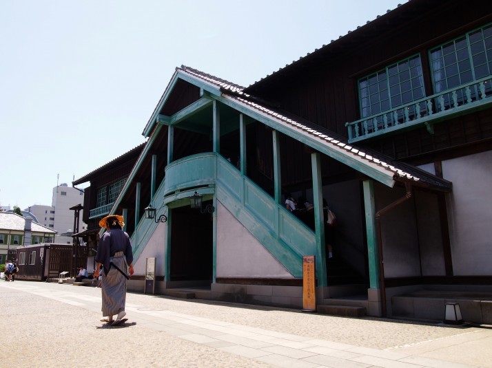
During the Edo period (1603 to 1868), the Japanese cautiously opened up to trade with the west, but in an effort to keep the trade at arms length because of concerns over the the spread of Christianity through Japan, it annexed foreign traders to a small fan-shaped island called Dejima. Initially inhabited by the Portuguese, and later by the Dutch, all cargo from foreign ships had to pass through this 120m x 75m islet, where Japanese officials could monitor and record all transactions.

Opperhoofd's (Chief Factor's) residence on Dejima. The ground floor was used for storage and the first floor for entertaining and living

Opperhoofd’s (Chief Factor’s) residence on Dejima. The ground floor was used for storage and the first floor for entertaining and living

The trade brought many benefits to Japan and Dejima became known as a centre of medicine, military science, and astronomy. Many samurai travelled here for so called “Dutch studies”.

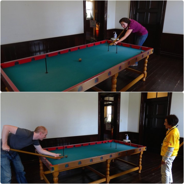
The Dutch also brought billiards - more pockets than a magician's jacket. Julie beating me, and the attendant beating me

The Dutch also brought billiards – more pockets than a magician’s jacket. Julie beating me, and the attendant beating me

As Nagasaki grew in the late 18th century, Dejima was reclaimed as part of the mainland and was lost until 1922 when the Japanese Government designated the land a National Historic Site and work began on restoring the canal that was originally dug to create Dejima, and re-establishing the buildings.

Because Dejima is still landlocked (save for the Nakashima River), it was difficult to visualise just how small it must have felt when it was surrounded by water, still, it was nice to see staff dressed in period costume, and there was plenty of information in English. Some of the exhibits felt a little sparse, but that’s understandable as most of the buildings would have been used for storage and exhibits of crate-filled warehouses would get boring very quickly!

Chinese settlement

While the Dutch were restricted to Dejima, the Chinese traders were supposedly confined to a square walled section of the port’s mainland, but in reality they had almost free movement within the city.

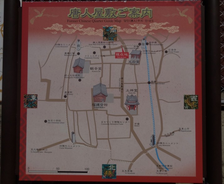
Map of the old Chinese quarter in Nagasaki

Map of the old Chinese quarter in Nagasaki

On the side of the valley overlooking the port, the old Chinese settlement was a little difficult to find because all that really remains of it are parts of the moat and some of the temples – the houses themselves have long since been replaced and it was very easy to get lost wandering through them.

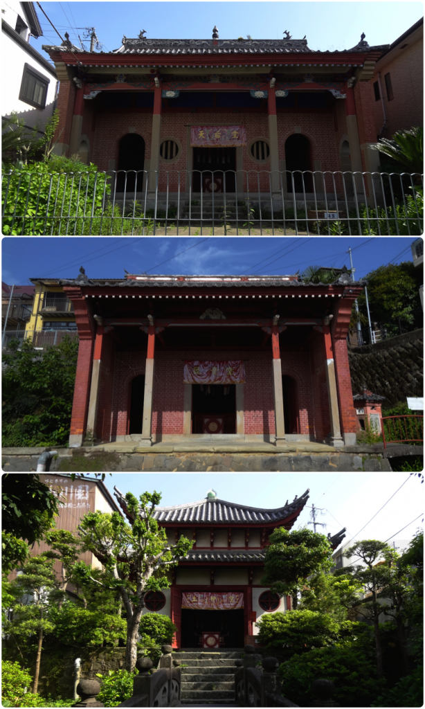
The Temples of the Chinese Quarter in Nagasaki;  Fukken-Kaikan; Kannon-do; Dojin-Do

The Temples of the Chinese Quarter in Nagasaki; Fukken-Kaikan; Kannon-do; Dojin-Do

We enjoyed the peace and tranquility of the Chinese temples, and it was nice to wander through the maze of narrow streets, peering into the homes and lives of normal people.

Glover Garden

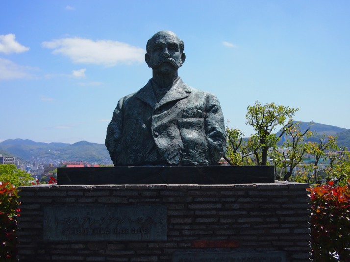
With the Meiji Restoration (1868 to 1912), Japan reversed its isolated stance and foreign trade was once again encouraged. No longer confined to walled settlements, early merchants built lavish western-style homes overlooking the port, among them Thomas Blake Glover who was born in Scotland and moved to Nagasaki in 1859 at the age of 21.

Bust of Thomas Blake Glover

Bust of Thomas Blake Glover

Glover is credited with developing western industrialisation and manufacturing in Japan; his shipbuilding business and dry dock later became the Mitsubishi Corporation of Japan; and he also helped found the Japan Brewery Company which became the Kirin Brewery Company – now the largest domestic beer producer in Japan and whose logo is said to be based on a dragon statue in his house and incorporates his legendary moustache.

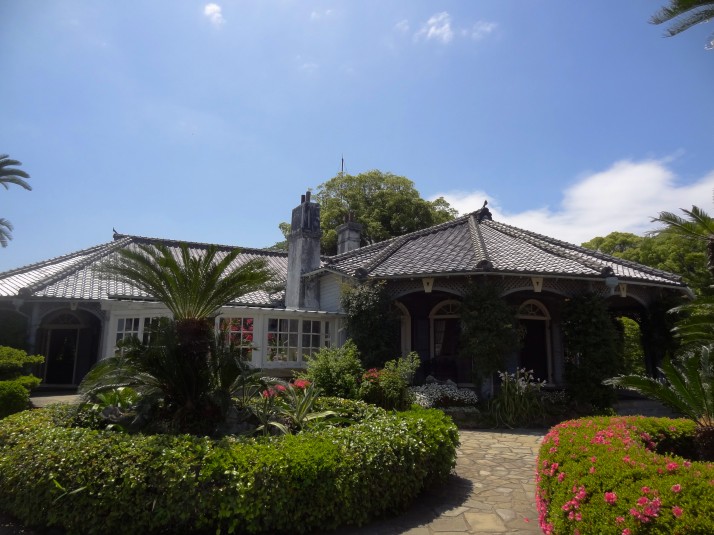
Glover's house in the Glover Gardens, Nagasaki. The first western style house built in Japan

Glover’s house in the Glover Gardens, Nagasaki. The first western style house built in Japan

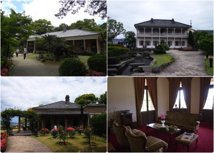
The Glover Garden is a collection of British entrepreneurial expat houses built on the same hillside overlooking the port of Nagasaki. All are very western in style and layout, and it was a bit like wandering through a well-to-do version of the Beamish museum back home!

Glover's neighbours; Clockwise from top left: Former Alt Residence; Former Mitsubishi No. 2 Dock; The Sitting Room of the Former Alt Residence; Former Ringer House

Glover’s neighbours; Clockwise from top left: Former Alt Residence; Former Mitsubishi No. 2 Dock; The Sitting Room of the Former Alt Residence; Former Ringer House

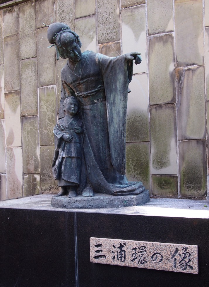
It was really interesting to learn about the strong British-Japanese connection. We also learned that Madame Butterfly is set in the same hills of Nagasaki, and there’s a statue of Japan’s most famous Madame, Tamaki Miura, in the garden.

Statue of Tamaki Miura, Japan's most famous Madame Butterfly

Statue of Tamaki Miura, Japan’s most famous Madame Butterfly

Mt Inasa

We took the cablecar to the peak of Mt Inasa, some 333m above the city. Because we were the only foreign tourists making the journey, we suspect the attendant played the English translation for our benefit, which we couldn’t help but laugh at – according to the recording, Nagasaki is in the top 3 night-time city port views in the world, alongside Hong Kong and Monaco. Yeah, right..

Nagasaki by night. One of the top 3 night-time city port views in the world. According to Nagasaki..

Nagasaki by night. One of the top 3 night-time city port views in the world. According to Nagasaki..

The view from the observation deck over the city was good, but Nagasaki lacks an iconic skyline that would make it immediately recognisable. As the sun started setting we settled down with a glass of wine at the mountain-top restaurant and watched the darkness descend and the lights come on.

According to the restaurant’s menu, Nagasaki’s local dish is “Turkey Rice”

What is “Turkey Rice”?
Turkey rice is a dish in which pork cutlet, pilaf and spaghetti are served together on one plate, Nagasaki’s local dish

In England, I guess it’d be called Turkey Rice Surprise.

Hypocenter, Atomic Bomb Museum and Peace Park

Having already visited Hiroshima’s Atomic Bomb Museum and Peace Park, we knew about the terrifyingly destructive power of atomic weapons, and we wanted to learn about the different consequences to Nagasaki.

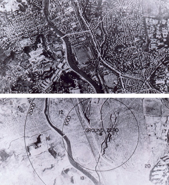
Nagasaki 1945 - Before and after the atomic bombing (Source: Wikipedia)

Nagasaki 1945 – Before and after the atomic bombing (Source: Wikipedia)

Nagasaki is a series of narrow valleys and hillsides that feed into the main Urakami valley, which meant that while the atomic explosion was more powerful than that over Hiroshima, the geography confined the damage to a smaller area. This in turn meant there were far fewer injuries, but there were a similar number of fatalities.

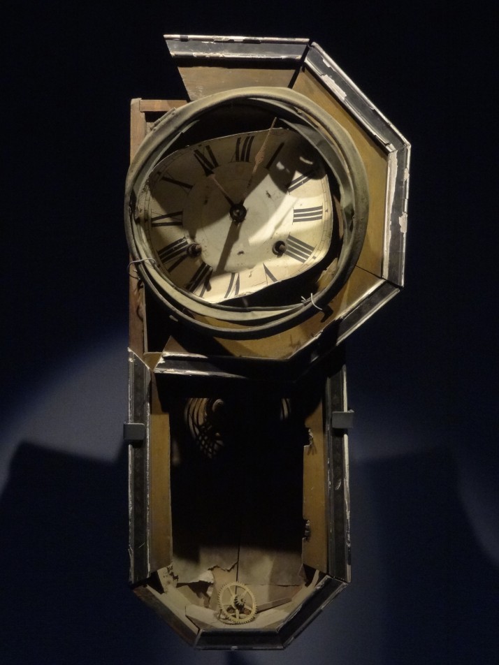
Wall Clock stopped at 11:02, found 800 metres from the hypocenter and on display in the Nagasaki Atomic Bomb Museum

Wall Clock stopped at 11:02, found 800 metres from the hypocenter and on display in the Nagasaki Atomic Bomb Museum

Of the two, we preferred the layout, organisation and smaller size of Nagasaki’s Atomic Bomb Museum, and the more contemplative, greener and spacious Peace Park in Hiroshima.

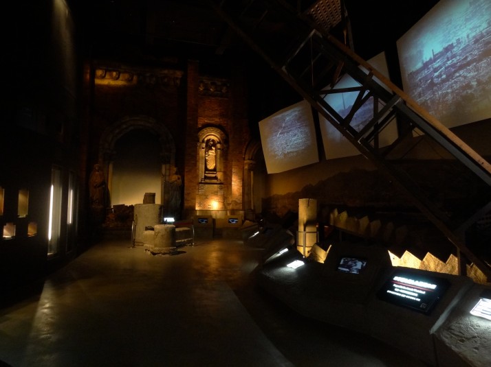
The first room of the Nagasaki Atomic Bomb Museum. Wreckage of destroyed buildings and screens showing photographs of the aftermath makes a powerful first impression

The first room of the Nagasaki Atomic Bomb Museum. Wreckage of destroyed buildings and screens showing photographs of the aftermath makes a powerful first impression

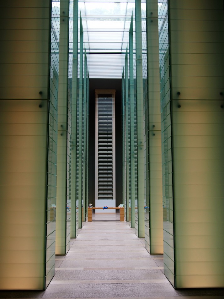
The main hall of the the Nagasaki National Peace Memorial building is a beautiful, modern, remembrance space that reminded us of the DT Suzuki Zen Museum in Kanazawa. We all but had the place to ourselves while we sat in quiet contemplation

The main hall of the the Nagasaki National Peace Memorial building is a beautiful, modern, remembrance space that reminded us of the DT Suzuki Zen Museum in Kanazawa. We all but had the place to ourselves while we sat in quiet contemplation

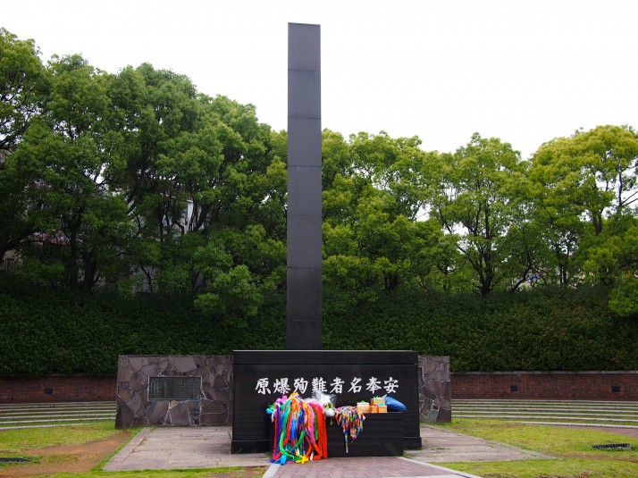
The black triangular monument at the Nagasaki hypocenter

The black triangular monument at the Nagasaki hypocenter

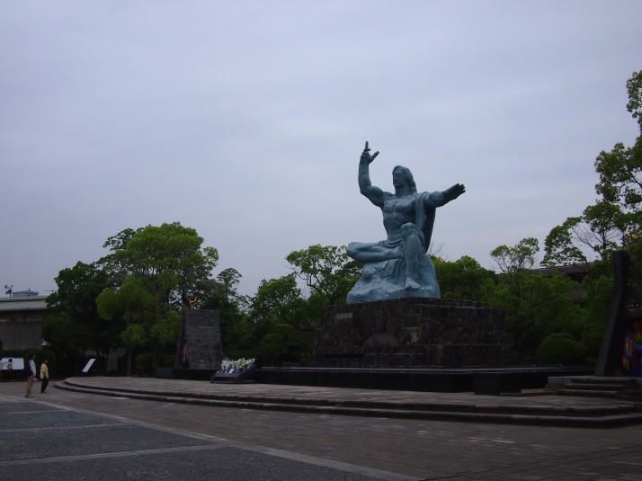
The Peace Statue at the Nagasaki Peace Park. The right hand pointing to the sky symbolises the threat of nuclear weapons, the flat left hand represents eternal peace and the eyes are closed in prayer for the souls of the victims

The Peace Statue at the Nagasaki Peace Park. The right hand pointing to the sky symbolises the threat of nuclear weapons, the flat left hand represents eternal peace and the eyes are closed in prayer for the souls of the victims

We found Nagasaki to be a historically rich destination, and we were pleased we made the effort to visit.

Kawachi Fuji Garden, Kyushu

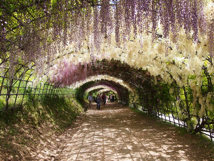
Just after we arrived in Japan, I found myself reading a list of 75 colourful places (found through some trail of links that I no longer remember). I love beautiful travel photos and find them very good inspiration for adding items to the already huge list of places that I want to visit, but the first photo on this list, a beautiful tunnel of wisteria flowers, really caught my attention. When I realised that it was on Kyushu, the southernmost of Japan’s four biggest islands and somewhere that was already on our itinerary, I was determined to visit. However, that seemed easier said than done as its internet presence is very sketchy and very little concrete information is available (certainly not in English) – if you’ve come here on your own search for information I’ve put a practical guide on getting there at the bottom of this post.

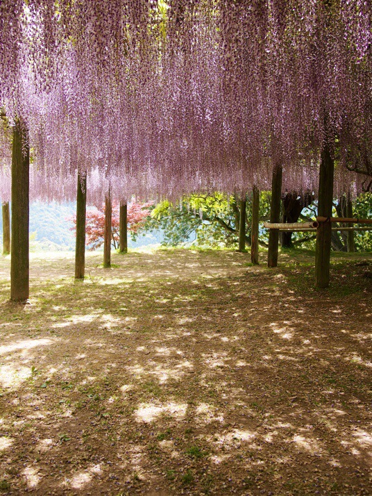
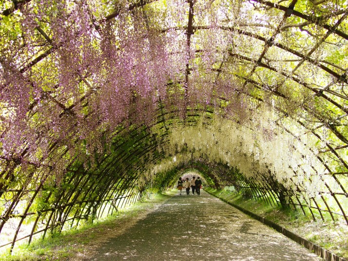
20140531-115601-42961869.jpgWhen we entered the garden we were directed first down one of the wisteria tunnels

The wisteria blooms from late April onwards with peak time varying slightly from year to year. We visited 10th May 2014 and the wisteria were already past their prime but absolutely magnificent all the same. At the end of the tunnel there is a short uphill climb to a vast and even more spectacular canopy of wisteria.

20140531-115646-43006580.jpgSun shining through the wisteria canopy

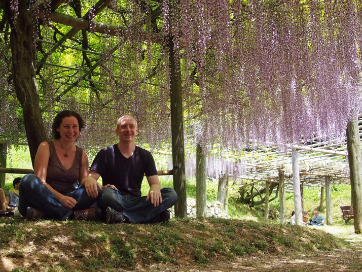
20140531-192915-70155273.jpgUs under the wisteria canopy

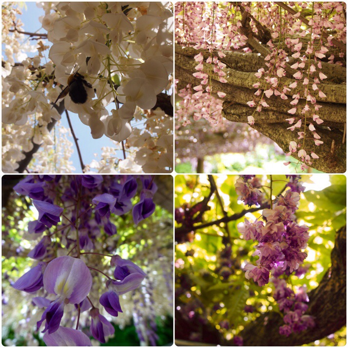
I’d always thought of wisteria as purple but there were many different colours and varieties at the Kawachi Fuji Garden, from white through pink and various shades of purple to an unusual double flowered variety.

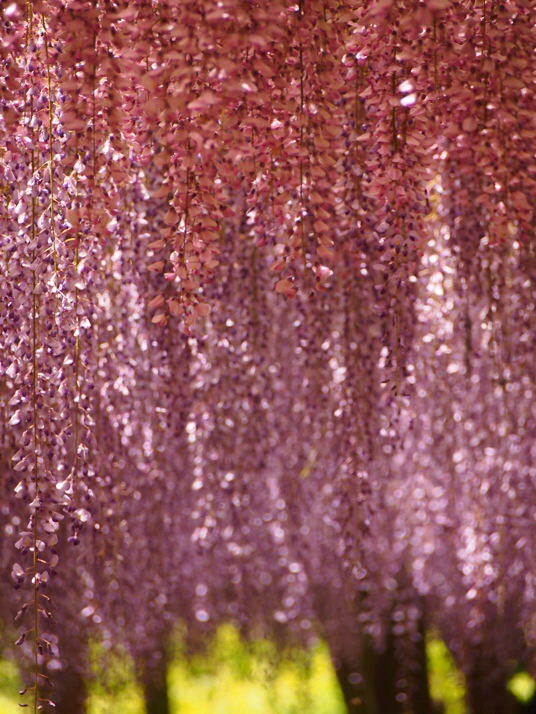
20140531-115739-43059039.jpgA blur of colours

20140531-193012-70212708.jpgWhite, pink, purple and even double petalled flowers

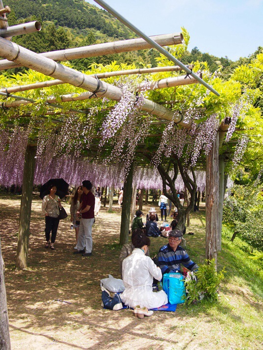
20140531-115927-43167270.jpgAs with cherry blossom viewing, many Japanese brought a picnic lunch to eat under the blooms and we did the same.

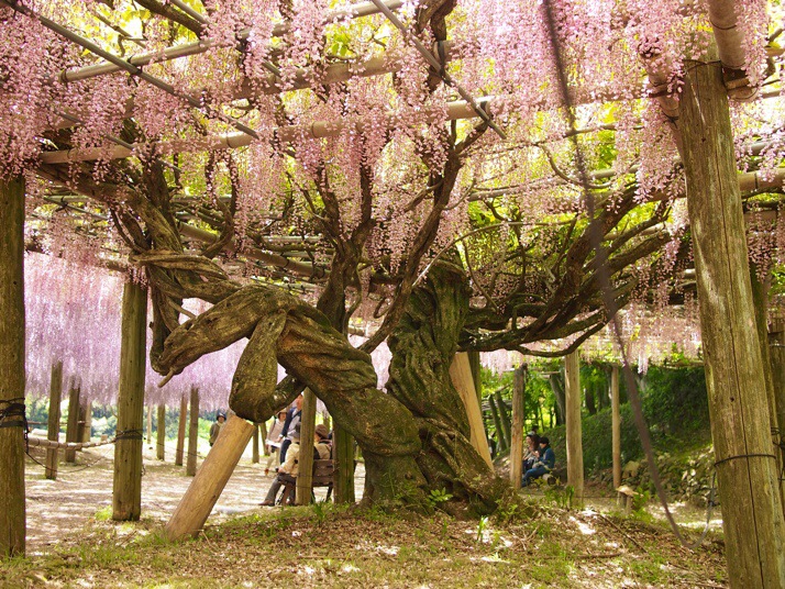
20140531-120005-43205960.jpgThe twisted trunks of the vines were almost as photogenic as the flowers

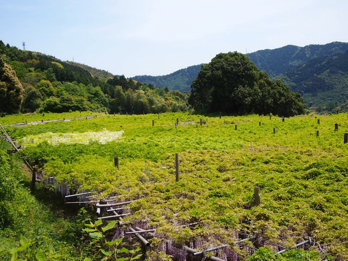
20140531-120114-43274090.jpgThe canopy from above – it doesn’t look like much from this angle does it?

Wisteria tunnelWe descended back to the entrance through a second wisteria tunnel

After a couple of laps of the garden and a couple of hundred photos, we stopped at the next door onsen for a soak in the hot spring bath. A relaxing end to a day which more than lived up to our high hopes.

Practical guide on how to get to Kawachi Fuji Garden

First get to Yahata station on the JR Kagoshima Line. We stayed at the Comfort Hotel in Kurosaki just one station away and found it to be a very pleasant business hotel, but making a day trip from Kitakyushu or Fukuoka would be very doable as well. At Yahata station you will find a number of bus stops on the left side of the car park as you exit the station building. The final one of these (furthest from the station building) is where the shuttle bus to Ajisai-no-yu onsen leaves from. I advise arriving 20-30 minutes early and queueing as there were more people than the bus could hold for the first bus when we visited and the driver did not allow standing passengers.

The shuttle bus is free and is supposed to be only for customers of the onsen. There was zero checking of this on our trip but I would recommend that you do as we did and make a full day of it with a visit to the onsen after the garden (the onsen is ¥800 for an adult with lots of different pools as well as a sauna and steam room). When you arrive at the onsen walk up the hill for a couple of minutes to find the entrance to the garden which will be on your right. When we visited entrance to the garden was ¥500 although I believe it varies according to how in bloom the flowers are.

It’s lovely to sit under the wisteria canopy and eat a picnic lunch but if you prefer there’s a restaurant in the onsen and snacks and drinks sold in its reception area. There aren’t any other shops or cafes near to the garden.

Shuttle bus timetable – the first bus leaves Yahata station at 10:15 and then 25 past the hour except 14:25. Buses back leave the onsen on the hour except at 14:00. You can check the timetable on the onsen website (Japanese only but here’s an automatic translation).