Category Archives: Places

Hebridean Way: Day 4 – North Uist, Berneray, Harris

Distance cycled 26.9 miles / 43.3 km
Cumulative distance cycled 117.1 miles / 188.5 km
Islands visited (daily total) North Uist, Berneray, Harris
Total islands visited 9 of 10
Average speed 10 mph / 16.1 kmph
Weather conditions Blue skies & sunshine, cool breeze

We woke to a beautifully clear, crisp and sunny morning with a fairly short ride ahead of us to make the second and final inter-island connecting ferry. This north western area of North Uist is how I had imagined the Outer Hebrides: Remote. Sparse.

Small stone folly or tower on an island in the middle of a loch

Scolpaig Tower, a small folly built on an island in a loch. A suitable metaphor for the sparseness of this part of the Outer Hebrides and is why I think North Uist is my favourite of the trip
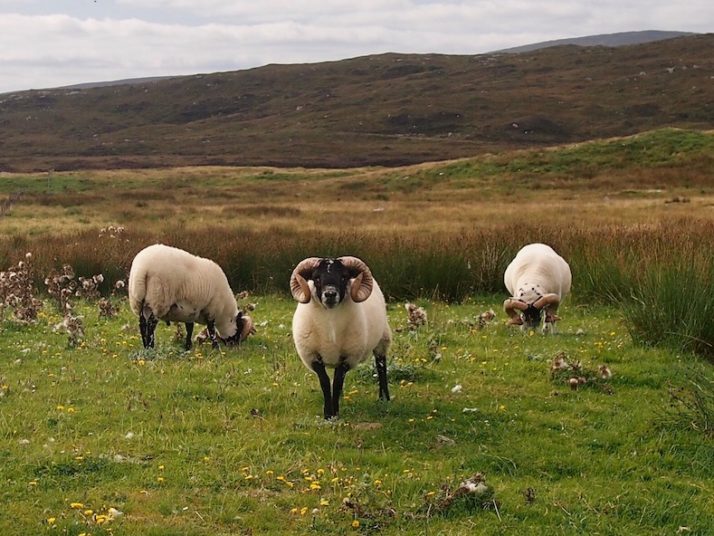
3 horned sheep grazing with rolling hills behind them

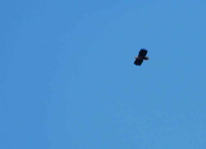
Sea Eagle souring high in a clear blue sky

A Sea Eagle! It was circling overhead long enough to get the zoom lens on the camera and this is the best photo – it was about a mile away at this point

The causeway onto Berneray seemed like it was always going to be over the next rise or just around the next corner, instead it teased us, just out of reach with more sparse rolling countryside until eventually we were leaving North Uist. After a very decadent packed lunch of local smoked salmon and seaweed water biscuits, we took the ferry hoping we’d see sea otters. Sadly it wasn’t to be, and as the terminal is pretty much at the causeway we didn’t see much of Berneray either.

We dropped our bags at the bed and breakfast in Leverburgh – our home for the next couple of nights – and with lightened bikes headed south east to Rodel to visit St Clement’s church which has some very detailed carvings inside and out.
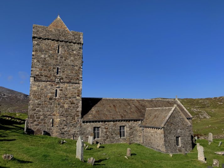
St Clements Church, a small church

St Clements Church at Rodel. We got to it and the signs said follow the road to the right (even though the parking was straight in front of us) and we ended up cycling all the way around it where we serendipitously passed The Girnal – an old storehouse in Rodel’s tiny fishing harbour

We ended the day with a lovely meal in The Anchorage.

Hebridean Way: Day 3 – Grimsay, North Uist

Distance cycled 15.5 miles / 25 km
Cumulative distance cycled 90.2 miles / 145.2 km
Islands visited (daily total) Grimsay, North Uist
Total islands visited 7 of 10
Average speed 10.2 mph / 16.4 kmph
Weather conditions Cloudy with sunny spells, no wind

After a rude awakening just before 5am when the truck started up his engines we dozed for a while. The wind had dropped overnight and a glance through the mesh windows of the tent showed an alarming number of midges gathering in our porches… We packed as much as we could inside but eventually we had to run the gauntlet and unzip the tent. Fortunately, it wasn’t too bad once we were outside and there was enough breeze that we felt safe to boil the kettle and have a spot of breakfast without being eaten alive.

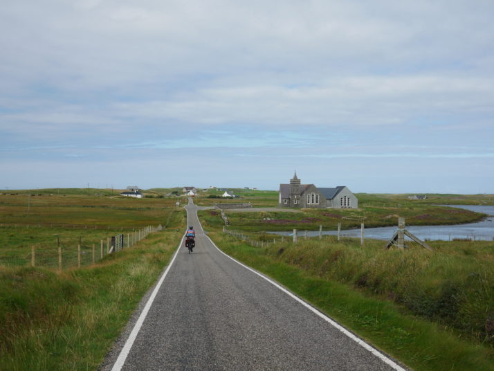
Cycling the gentle roads on North Uist

Cycling the gentle roads on North Uist

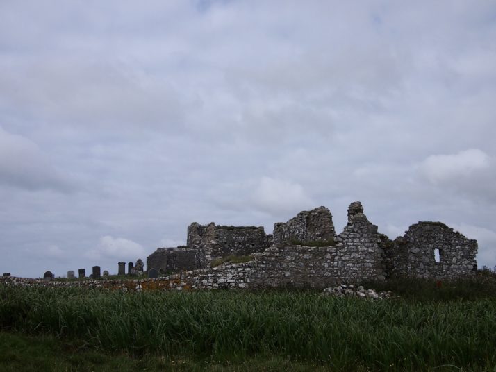
The road barely touches the corner of Grimsay and we were soon across the next causeway onto North Uist, where we found a lot more water than the earlier islands with the gently rolling road across the moorland passing many small lochs. Entering the village of Carinish, I saw an information board in front of a small church. Tourist information boards had been few and far between so far, so I pulled across to see what it said. It referred to the ruins of Trinity Temple (Teampull in gaelic) which was along the track behind the chapel and across a field of grazing sheep. A medieval ecclesiastical college and monastery, we had a quick look around but it was built above swampy ground and was swarming with midges.

The remains of Trinity Temple in Carinish

The remains of Trinity Temple in Carinish

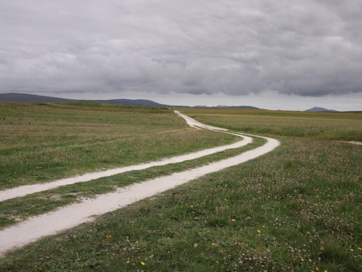
We didn’t want to take the ferry to Harris until tomorrow which meant we either had a short day and a stay at the campsite at Balranald in the island’s north-west corner or carry on a bit further and look for another wild camping spot. Tired from yesterday’s ride and fancying a shower we opted for the former. An early finish to the day’s cycling meant that we had time to wander the circular path around the neighbouring RSPB reserve. Mainly consisting of machair, a wildflower filled coastal grassy plain, it is an important habitat for ground nesting wading birds as well as the endangered corncrake. The charity also works with local crofters to preserve traditional farming techniques which protect the nests.

 The path through the machair at Balranald Nature reserve

The path through the machair at Balranald Nature reserve

On the way to the campsite we had stopped in the very tempting factory shop of the Hebridean Smokehouse so our dinner of pasta pesto was made much more luxurious with a side of smoked scallops, afterwards we retired to the tent to sample a couple of miniatures of the local Downpour gin.

Hebridean Way: Day 2 – South Uist, Benbecula, Grimsay causeway

Distance cycled 42.2 miles / 67.9 km
Cumulative distance cycled 74.7 miles / 120.3 km
Islands visited (daily total) South Uist, Benbecula, Grimsay
Total islands visited 6 of 10
Average speed 9.4 mph / 15.1 kmph
Weather conditions Partly cloudy, headwind

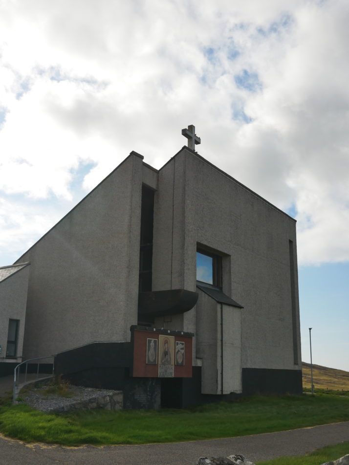
Weather being much the same as the day before made for an easy and very enjoyable start to our second day and by the end of the day we’re over half-way through the islands! Julie had found an architectural trail of the Outer Hebrides and along the route on South Uist is the little ‘brutalist’ church Our Lady of Sorrows. I’m a big fan of the brutalist architectural style which explains why I enjoyed Russia so much!

Our Lady of Sorrows church on South Uist, Outer Hebrides

The ‘brutalist’ church Our Lady of Sorrows on South Uist, Outer Hebrides

We continued along the western coastline of South Uist and after stopping at a tiny cemetery containing Commonwealth war graves, we completely failed to find the Cladh Hallan Roundhouses, even though we’d seen a photo, found a signboard, and had some rough co-ordinates we still weren’t quite sure what we were looking for! When the route re-joined the main road we stopped at a Co-op for provisions and received a wild-camping spot recommendation from a lone cyclist enjoying his 4 days of leave from working on the ferries that service the islands.

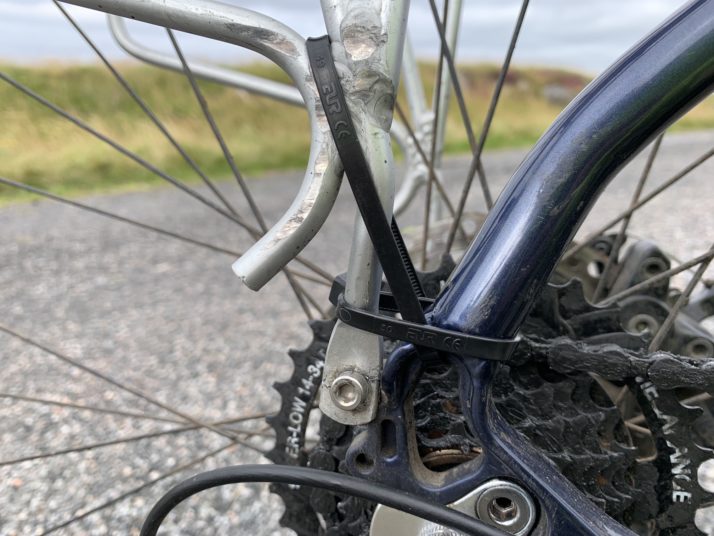
Then disaster strikes – Julie’s pannier rack breaks after one too many cattle grids. We’ve a full toolkit so after a spot of lunch we bust out the cable-ties and patch it up as best we can until we reach the house of one of 3 bicycle repair places listed on our map – armed with only a phone-number we find out he’s only 3 miles away! When we arrive he nods approval at our bodge, but he only has front salvaged pannier racks. “Stornoway’s your only bet for a new one”, he says and adds a washer to hold it together while we make friends with his 2 sheepdogs, then he checks we have spare cable-ties (we do) and won’t take any payment whatsoever “because I can’t guarantee it’ll hold”.

Cable-tied rear bike pannier

Our improvised roadside repair – fortunately the break left an ‘n’ shape sitting over the bolt so the cable-ties just had to stop it jumping out. Spoiler alert.. the addition of a washer and some careful riding makes it all the way home to Newcastle!

The final section on South Uist is on the main fast road through the centre of the island and while it wasn’t busy and we found the traffic very courteous to laden cyclists, we were pulling in often to let cars, trucks and motorhomes past. It seemed like we’d no sooner get our speed up than we would need to pull over which was a little frustrating.

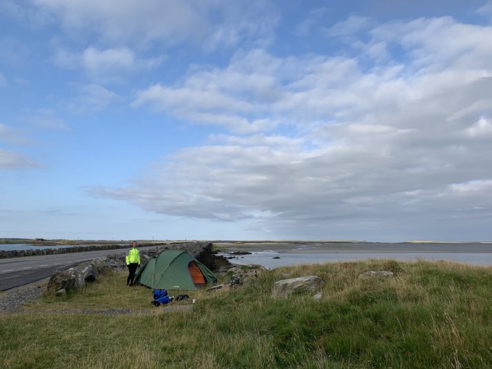
It’s a short causeway to Benbecula and again the route takes us along the western coast. The afternoon sun is out and we’re feeling good so we skip the proposed campsite and its luxuries and press on to our first wild camping experience!

Tent pitched by the side of a causeway

Our first wild campsite experience – the instructions were “there’s a gap in the wall along the causeway onto a little outcrop, you’ll be hidden behind the wall with lovely views and a little breeze to keep the midges down.” A delivery truck had nabbed the lay-by but we were knackered and decided to pitch up anyway!

Hebridean Way: Day 1 – Vatersay, Barra, Eriskay, South Uist

Distance cycled 29.9 miles / 48.1 km
Cumulative distance cycled 32.5 miles / 52.3 km
Islands visited (daily total) Vatersay, Barra, Eriskay, South Uist
Total islands visited 4 of 10
Average speed 8.9 mph / 14.3 kmph
Weather conditions Started overcast but quickly cleared, blue skies & sunshine

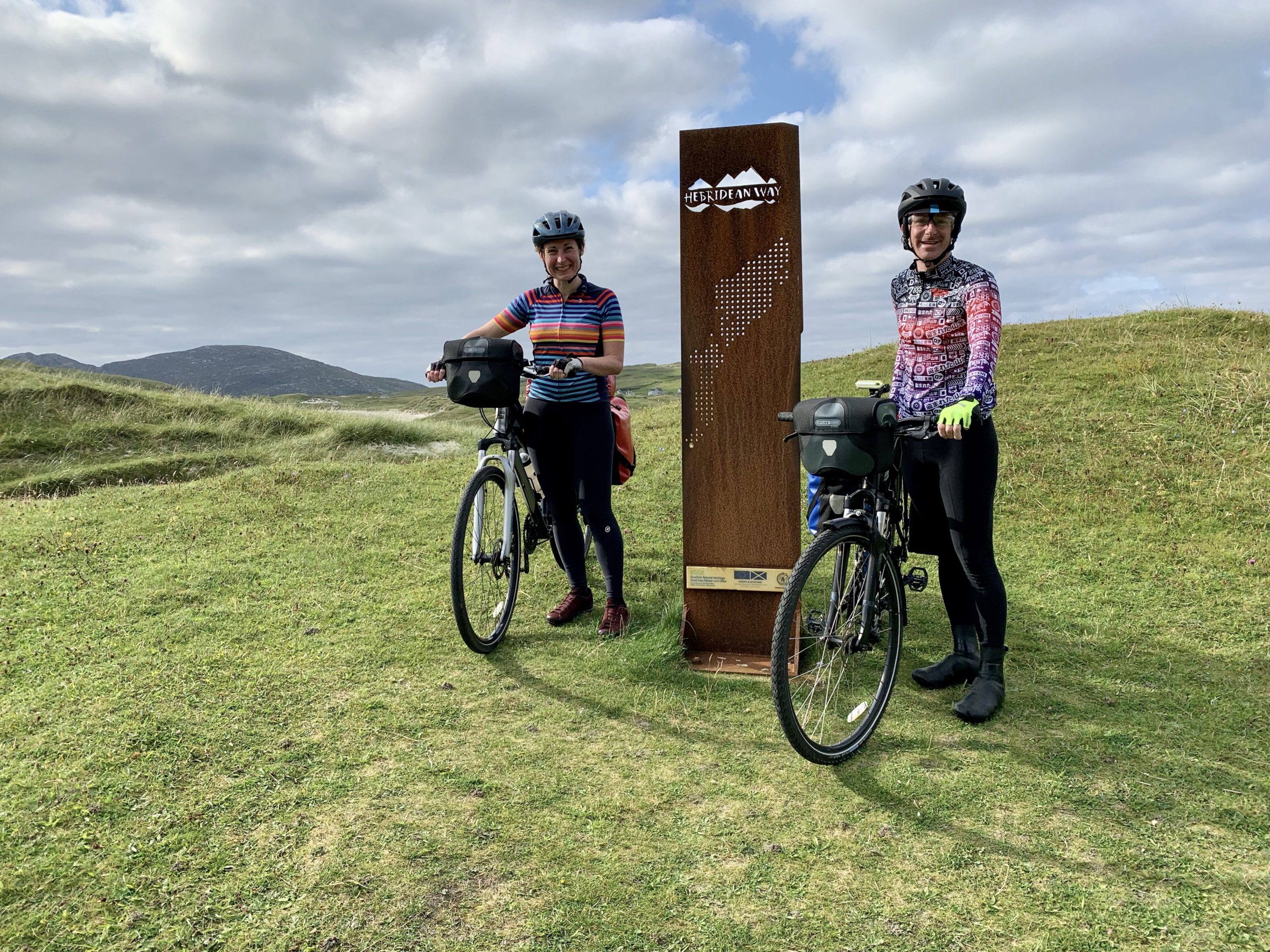
We woke to overcast skies and a bit of a breeze (enough to keep the midges off as Ronald, the campsite owner, said). We turned back towards the south and were soon climbing the steep hill to the war memorial overlooking Castlebay, then zooming down past stacks of lobster pots to the causeway onto our second island, Vatersay. The official start of the Hebridean Way is in the village on tiny Vatersay so we rode the road around the hills, past the wreckage of a WW2 plane crash and towards the spectacular beach as the sun started to break through the clouds. The beaches on the Hebrides are incredible with bright white sand and turquoise water.

Cyclists at the sign marking the start of the Hebridean Way on Vatersay

At the trail start in Vatersay (photo credit and thanks to fellow cyclist Henry!)

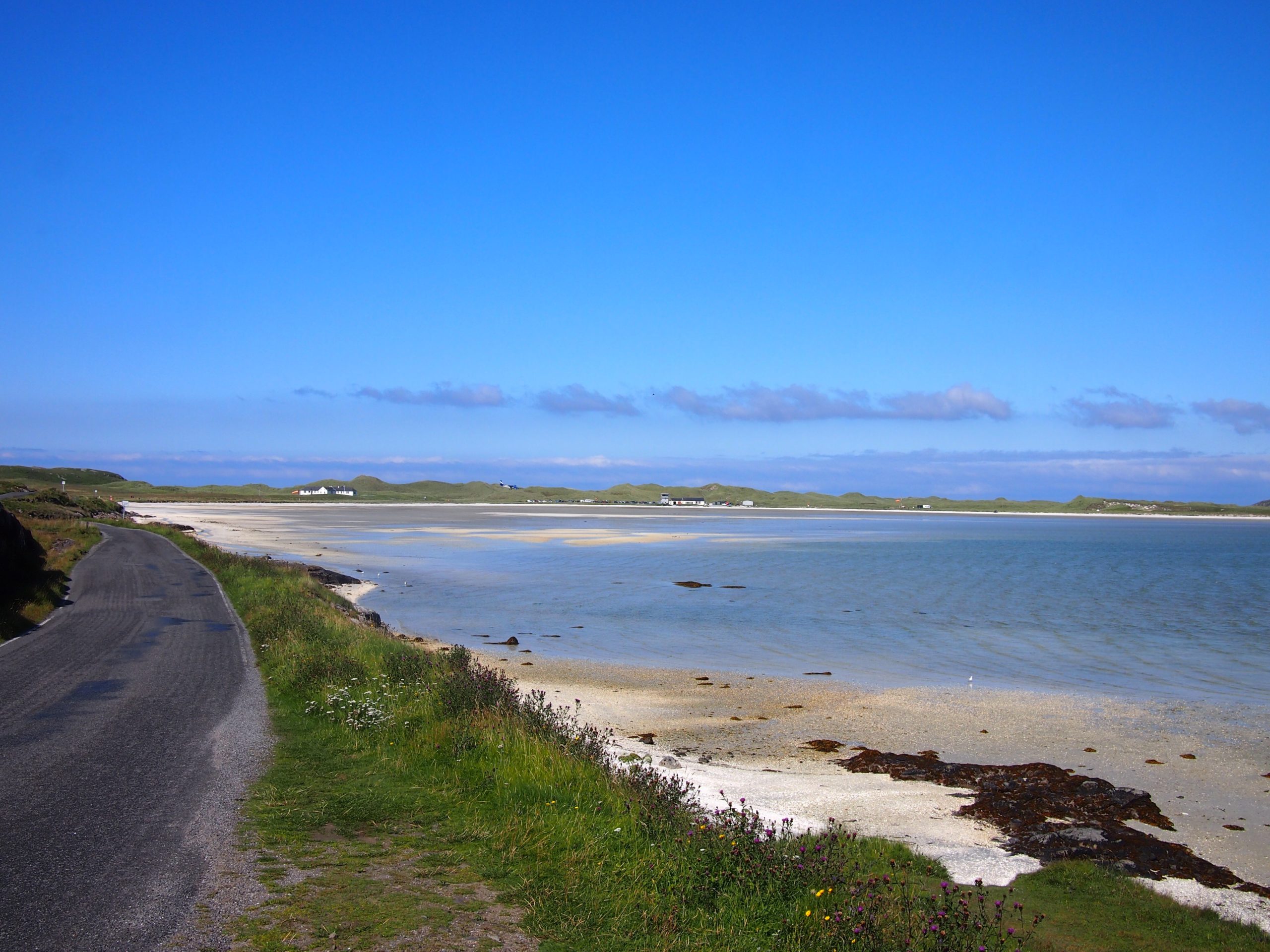
There were quite a few other cyclists as well as campervans on Vatersay but we didn’t hang around, after the obligatory photo at the start marker we headed back the way we’d come and north across Barra admiring the many small coves and beaches and spotting an eagle soaring overhead as we crossed the island’s centre towards the airport. Barra has the only airport in the world where scheduled flights use a runway on a tidal beach. We’d looked up the flight arrival times in advance (2 per day from Glasgow) and were aiming to get there to see the 12.45pm land. We were running a little late when Andrew spotted a plane overhead, and with a quick dash we just managed to crest a hill with a view down the beach to see it landing 10 minutes early.

Plane landing on beach runway at Barra airport

Beach airport on Barra (if you zoom in you can just see the plane to the left of the airport buildings)

After a picnic lunch, we leisurely explored a bit further along the airport road before retracing our steps to wait for the ferry across the Sound of Barra to Eriskay. We had enough waiting time to enjoy an excellent coffee and homemade cake from the small cafe at the terminal, one of the few businesses on the islands which is open on Sunday. Another small island, Eriskay is where SS Politician, loaded with crates of whisky, ran aground in the 1940s much to the delight of the locals, and the basis for the storyline of the 1949 film Whisky Galore. After a short climb up the hill at the centre of the island, we were coasting down to the pub, predictably called Am Politician. We had a quick pint in the sun before crossing the causeway for a short ride to Kilbride campsite on our final island of the day, South Uist.

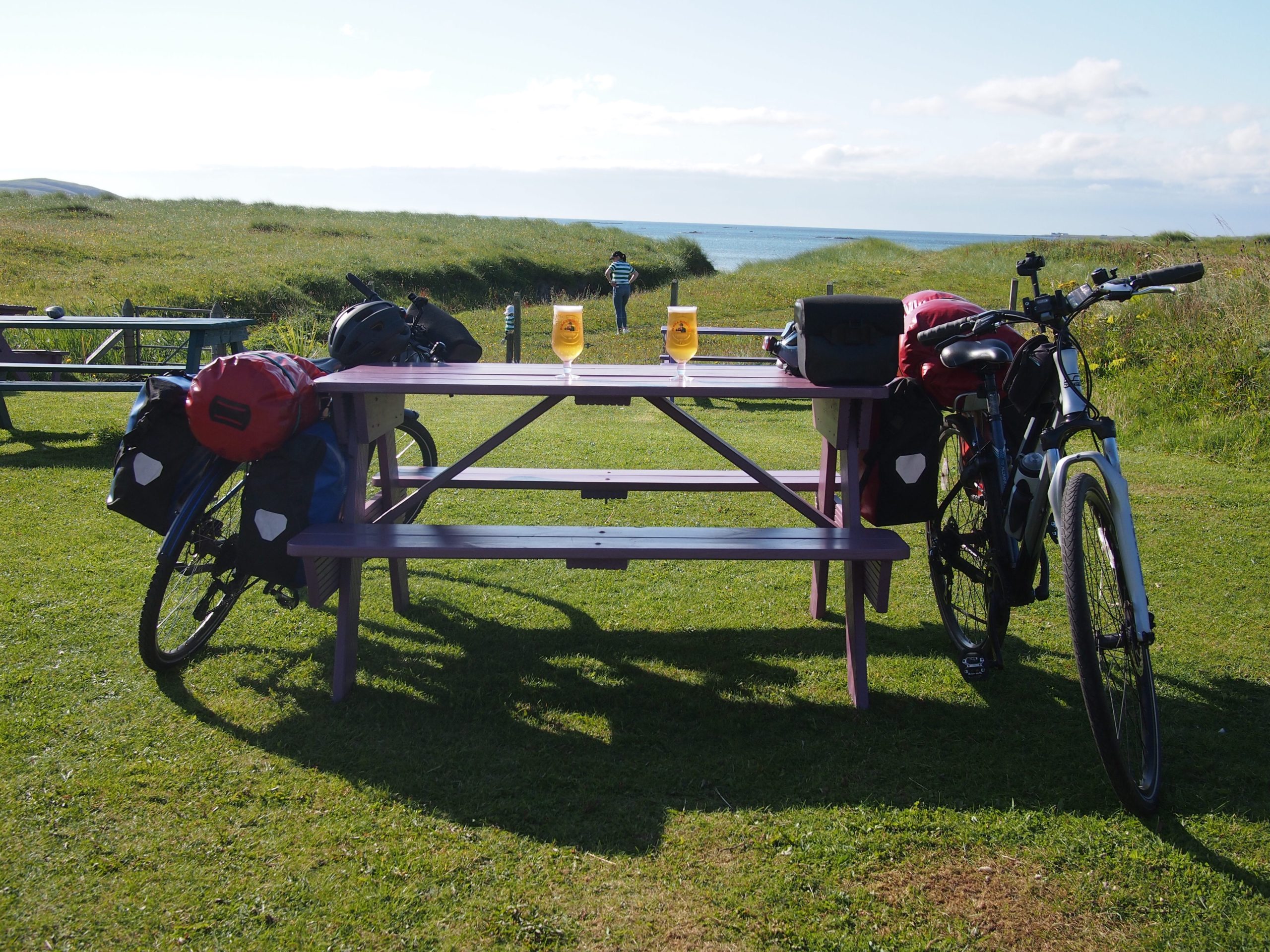
Bikes leaning against picnic table in a sunny beer garden at Am Politician

In the beer garden at Am Politician on Eriskay

Georgia Round Up

What photo takes you right back to Georgia?

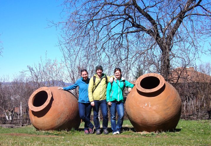
Julie, Jo and I in the Open-Air Ethnographic Museum, Tbilisi, Georgia

Julie, Jo and I in the Open-Air Ethnographic Museum in Tbilisi

As our long-time friend, fellow adventurous traveller and occasional guest-blogger Jo joined us once more, the photo that takes us all back to Georgia is this one of the 3 of us at the Open-Air Ethnographic Museum in Tbilisi. The museum has examples of the older buildings we’d go on to see as we travelled around (specifically the Svan towers of the Caucasus), two giant clay urns called qvevri for fermenting grapes into the wine for which Georgia is famed, and that deep blue sky reminds us of the (mostly) fantastic weather.

Summarise Georgia in three words.

  • khachapuri – if wine is the national drink, then this is the national dish. We planned many a hike so that we could indulge in the cheese, meat and bean-filled deliciousness-es as often as possible
  • mountains – the scenery in Georgia was breathtaking, and before we’d left we were already talking about wanting to return to experience a summer season
  • cable-car – I think Georgia’s fondness for cable-cars is a legacy of their ex-Soviet mining industry as well as the mountainous landscape. We went on 2 in Tbilisi but the ageing ones in Chiatura were the highlight

You really know you’re in Georgia when…

…you’re eating aubergine and walnuts. Yes, we’ve mentioned the khachapuri a few times but the food throughout Georgia was excellent. Julie found an immediate fondness for the side dish of spicy walnut paste spread over roasted aubergine and sprinkled with pomegranate seeds (I think that’s the real reason she wants to go back again!)

What one item should you definitely pack when going to Georgia?

A shot glass! Once the Georgians have made wine, they distill the skins into a grappa-like spirit called cha-cha and some of our fondest memories are making toasts with the happiest, most warmly welcoming hosts we’ve had the pleasure of befriending. Georgia really does have it all!