Tag Archives: Church

Siracusa, Sicily

When we planning where to visit in Sicily, it was easy to start in Catania for logistical reasons as we were arriving by ferry from Malta, and while we had lined up some interesting things to do in Catania, it’d be fair to say we were looking forward to our time in Siracusa more.

Known as ‘Siracusa’ rather than Syracuse to the Sicilians, the city is over 2,700 years old and has a long and important history. Once equalling the size of Athens, it was described by Cicero as “the greatest Greek city and the most beautiful of them all” in the fifth century BC, and is now inscribed in the UNESCO World Heritage List.
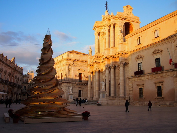
Piazza Duomo in Ortigia, Siracusa, Sicily

Ortigia’s Piazza Duomo, with their funky pallet Christmas tree and the Duomo di Siracusa or Siracusa Cathedral in the centre

However, for us the reality turned out to be the opposite of our expectations. That’s probably in part due to those same expectations being higher for Siracusa than Catania, having had such a great time in Catania, and finding Siracusa to be almost wound-down for winter – this is definitely more of a summer holiday destination.

Don’t get me wrong – we enjoyed our time here, and the setting is certainly more picturesque, but we found more to do and see of the kinds of things we enjoy in Catania.
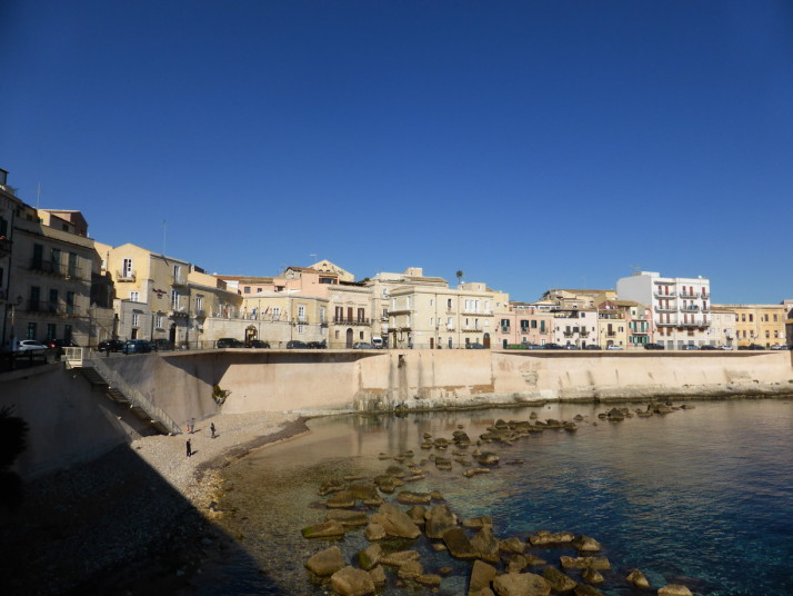
East coast of Ortigia, Siracusa, Sicily

The beautifully clear waters of the Mediterranean lapping the east coast of Ortigia

On our first afternoon we headed straight for Ortigia, the island offshoot of Siracusa surrounded by turquoise Mediterranean to get lost in its narrow twisty cobbled streets. In December, Ortigia has a laid-back touristy feel to it, there are souvenir shops here as you would expect, but “tacky” doesn’t exist in the Italian vocabulary – each of the displays are chic, cute, and tasteful. Taking random turns down little alleyways we eventually found ourselves in Piazza Duomo, the central Cathedral Plaza.
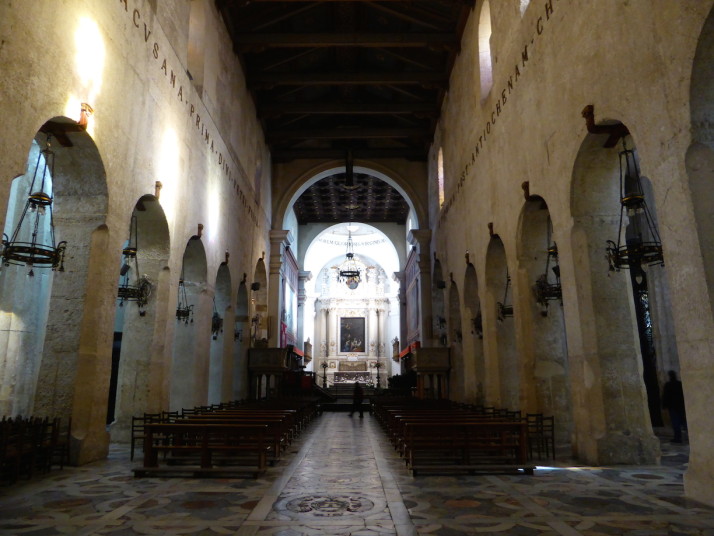
The nave of Siracusa Cathedral, Sicily

The nave of Siracusa Cathedral. We loved the thick, plain walls and massive outer columns down the sides

Venturing inside, we found thick, imposing vaulted walls enclosing the nave, with huge outer columns – reminders of when this used to be a Greek temple of Athena. It was dark and almost empty, the early evening light shining through the row of stained glass windows creating indistinct patterns of colour on the plain stone. To the right of the entrance was Santa Lucia’s Chapel, the normal resting place of Saint Lucy’s remains. Saint Lucy was a young Christian martyr who died during the Diocletianic Persecution in 304.
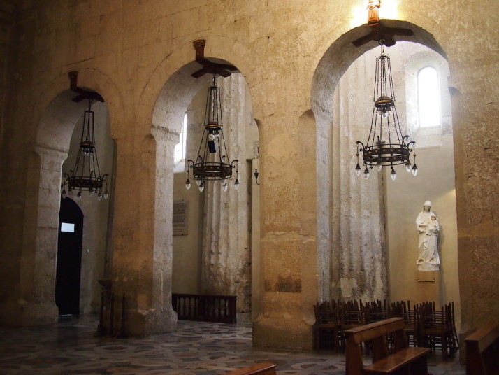
Detail of the chandeliers and columns in Siracusa Cathedral, Sicily

Detail of the chandeliers and the old Greek columns in the Siracusa Cathedral
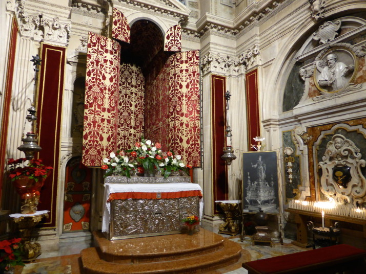
The sanctuary of Santa Lucia, Siracusa Cathedral, Sicily

The sanctuary of Santa Lucia, Siracusa Cathedral, Sicily

The following evening we’d been advised in Italian by our apartment owner that there’d be some sort of event featuring Santa Lucia that would travel right past our apartment. At about 4:20pm we headed out to Corso Umberto I and staked out a spot on one of the park benches. Having sat for maybe 30 minutes we thought it was a little odd that the traffic was still flowing down the street despite a couple of very nicely dressed officials standing on every corner. Another 10 minutes or so later I went over and, gesturing down the street, asked about Santa Lucia.. The traffic policewoman nodded and said “twenty o’clock.” With that, we decided to head home and come back after dinner!
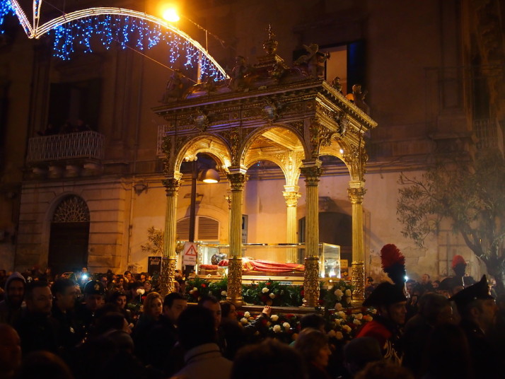
The relics of Santa Lucia in the parade, Siracusa, Sicily

The relics of Santa Lucia being carried in the parade through the streets of Siracusa

3 hours later we returned to find a full street procession heading for Ortigia. Twice a year the relics of Santa Lucia or Saint Lucy, the patron saint of Siracusa who was born here, are paraded through the streets between the Basilica de Santa Lucia and the Siracusa Cathedral. We were surprised how many people made the walk barefoot and carrying candles!
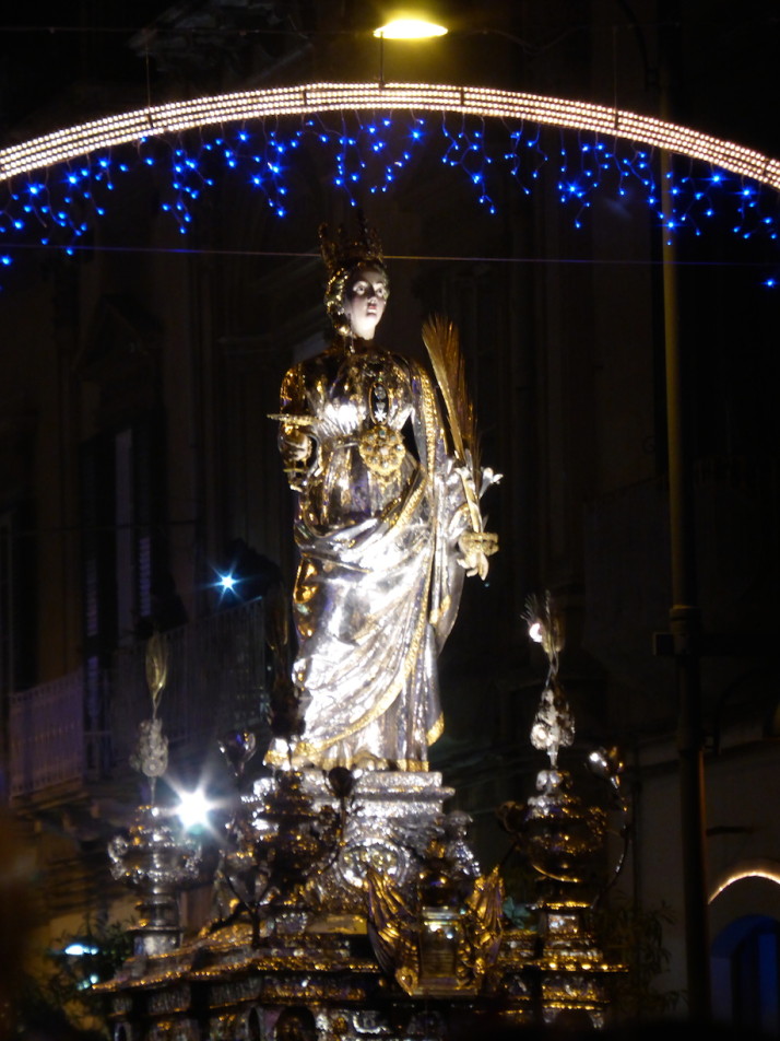
The lifesize silver statue of Santa Lucia in the parade, Siracusa, Sicily

A lifesize silver statue of Santa Lucia passes after the relics in the parade, it’s difficult to make out but it includes a dagger through her throat

At exactly twenty o’clock, the relics and life-size silver statue passed us!

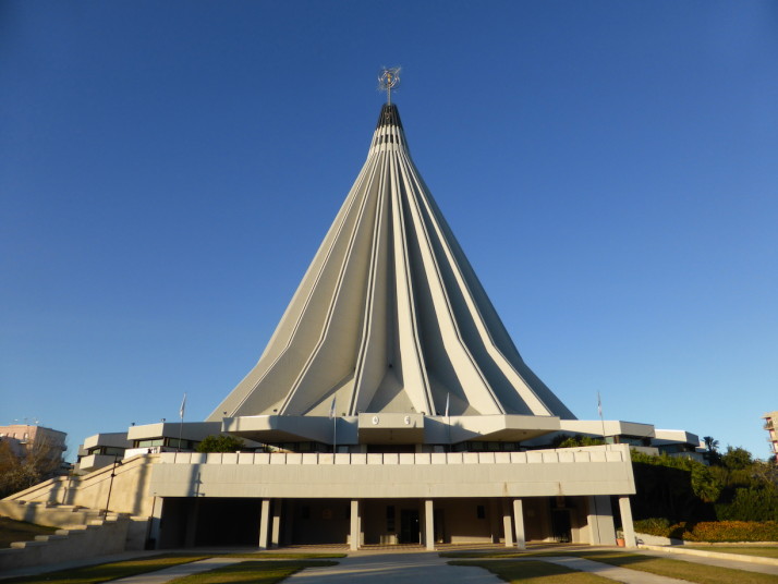
Among the other sights we enjoyed in Siracusa where the coastal cycle path and the pointy Santuario della Madonna delle Lacrime which punctures the skyline. The name of the church translates to “Shrine of Our Lady of Tears” and was built to house a statue of Mary that in 1953 cried repeatedly over 3 days. The result of an international design competition, and not without criticism that caused delays, the giant concrete conical structure was completed in 1994. We liked it, the bold, unmissable structure reminded us of old Soviet architecture and with a certain amount of endearment we nicknamed it “The Cone of Shame!

Santuario della Madonna delle Lacrime, Siracusa, Sicily

The Santuario della Madonna delle Lacrime, literally the Sanctuary of the Crying Madonna or Mary, it’s the tallest building in Siracusa and we nicknamed it “The Cone of Shame” not for any other reason than it’s cone-shaped
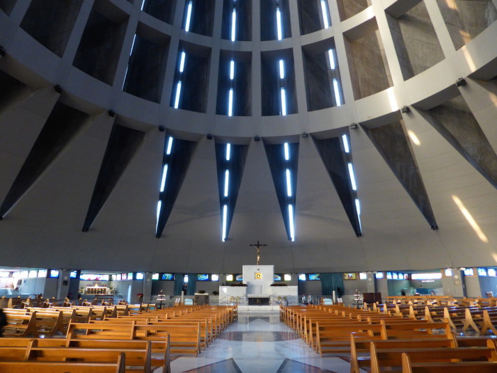
Santuario della Madonna delle Lacrime, Siracusa, Sicily

Inside the Santuario della Madonna delle Lacrime, a wonderful bright and open space, with the crying Madonna having pride of place at the altar

We also took a local train 30 minutes south of Siracusa to Noto, a small town that was devastated by an earthquake in 1693, and was subsequently rebuilt in the baroque style of the day. Much of the original Baroque period centre exists today and it too is a UNESCO World Heritage Site.
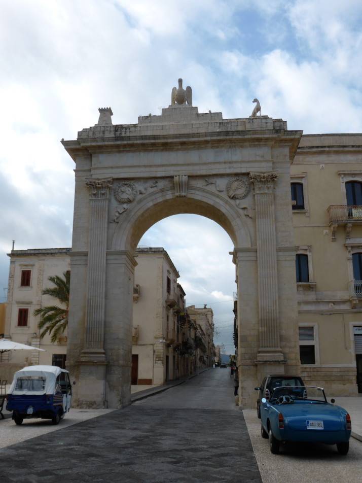
Porta Ferdinandea, Noto, Sicily

The lovely Porta Ferdinandea, in better condition than the other gates we saw in Taormina
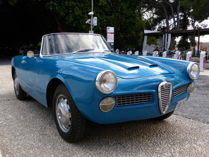
Old Alfa Romeo, Noto, Sicily

You might have seen in the previous photo this old Alfa Romeo parked outside the Porta Ferdinandea. It caught my eye too – I think it’s a ~1959 Alfa Romeo 2000 Spider
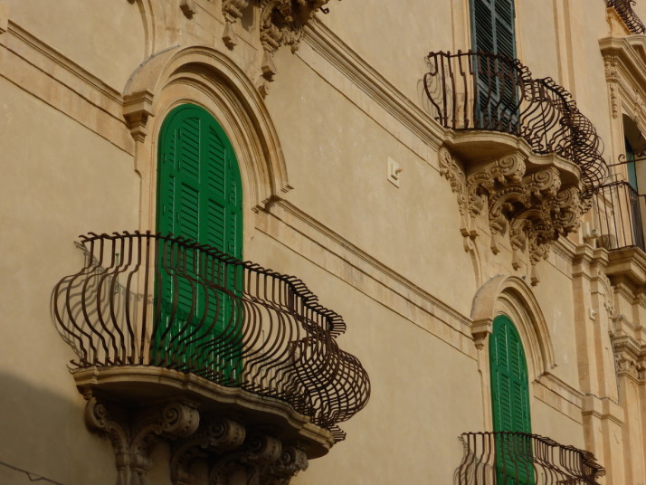
Baroque balconies, Noto, Sicily

We loved the baroque balconies and the bowed metalwork nicely set off with the British racing green shutter doors
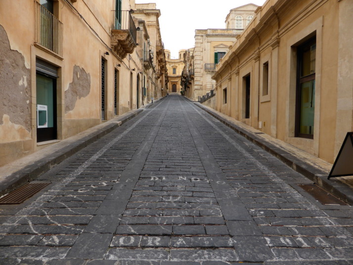
Via Nicolaci, Noto, Sicily

This is Via Nicolaci, the site of an annual festival where the centre of the street is covered in beautiful flowers!
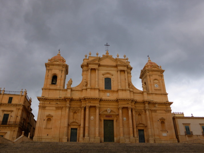
Basilica de San Nicolò, Noto, Sicily

The centre of the baroque old town is the Basilica de San Nicolò, the warm, sandy stone glows in the early evening light

It was a little bit of an uphill trek from the train station through the outskirts to reach the main Corso Vittorio Emanuele, but the reward of intricate and exaggerated buildings one after another was easily worth it. We’d read the town looks best in the warm early evening light, and we just got a glimpse of it before the dark clouds came in.

Catania, Sicily

Catania is nestled at the foot of Mt Etna on Sicily’s north eastern coast. It was our first stop on our circuit of Sicily, the ball to Italy’s boot, and is the island’s second largest city. Although it’s a decent size, with a population of around 300,000, we found the centre to be compact with all of the sights within easy walking distance of each other.
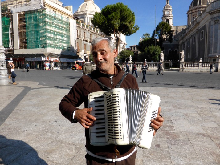
Accordion playerThe first person we met as we walked from the bus to our rented apartment was this cheeky accordion player who deliberately walked in front of Andrew’s camera and posed while playing us Christmassy tunes

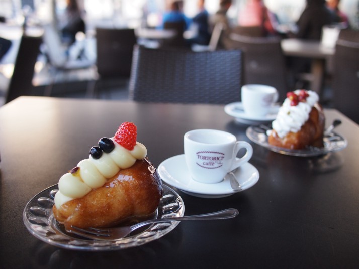
In the centre of the city is the Piazza del Duomo (Cathedral Square) where we started our visit with a spot of people watching and a humongous (and very alcoholic) rum baba at one of the square’s pavement cafes.

Rum baba and espressoRum babas with espresso at a cafe in Piazza del Duomo

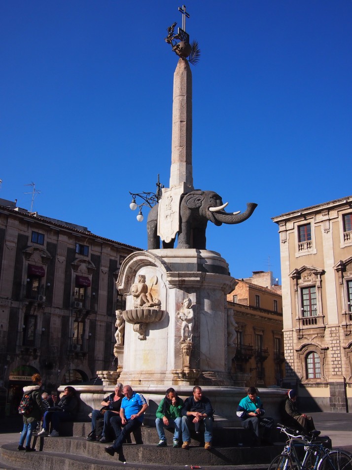
The focal point of the Piazza is a monument consisting of the rather unlikely combination of an Egyptian obelisk and a happy-looking elephant carved from lava stone. It was assembled in 1736 by Giovanni Battista Vaccarini although its origins are unclear and both the elephant and the obelisk predate the assembly by many centuries. It now serves as the emblem of the city.

Elephant obeliskThe elephant obelisk is a popular place from which to watch the world go by

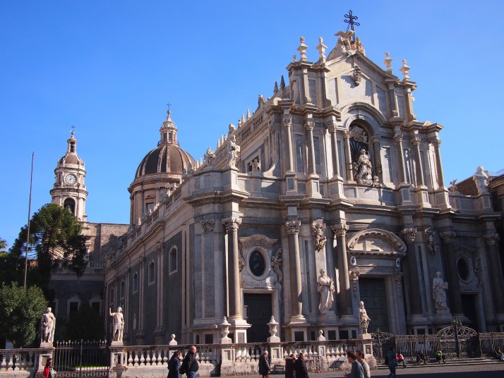
Along the eastern edge of the Piazza is the city’s cathedral, or Duomo, dedicated to St Agatha who was born in Catania in 231AD. The inside is quite plain but nevertheless grand and imposing. In the middle of our visit, music started playing and a soloist began singing beautifully, it turned out to be a service in one of the side chapels, adding a lovely atmosphere.

Catania DuomoCatania’s cathedral is dedicated to St Agatha

Markets

One of the things we were looking forward to in Italy was the world famous food and I was hoping that the markets would be a vibrant place to explore. Catania has two daily markets in the central area and both were great places to look and photograph as well as to shop for provisions. It was easy to tell what was in season with piles of fennel, purple cauliflowers and citrus fruits dominating the scene. We found all of the vendors to be friendly and keen to show off their wares, some of which were unusual for us, such as dried salted cod, huge buckets of globe artichokes and lambs in the butchers shop sliced right down their middle, head included.

Catania markets collageCatania’s markets (clockwise from top left): Fruit and veg stalls in the streets around the fish market; Lambs are sold whole or neatly halved; Crates of fennel were everywhere; Salt cod drying in the sun

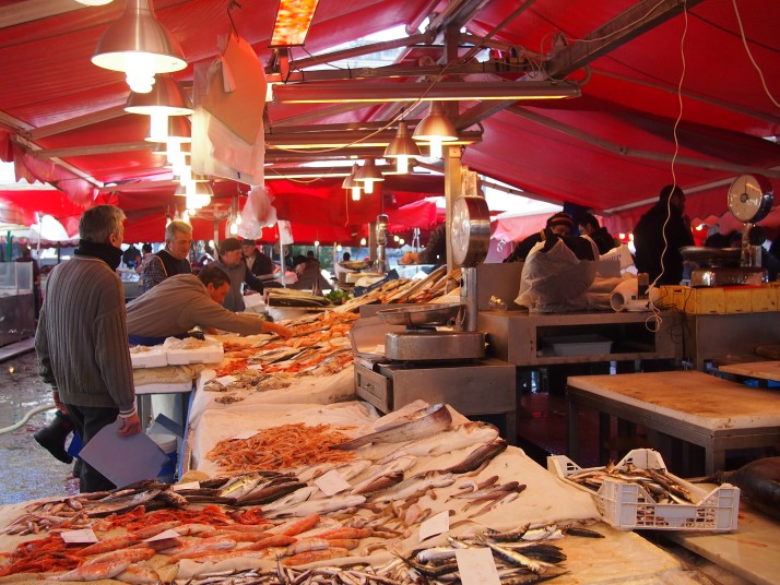
The Fish Market was the closest of the daily markets to where we were staying. Fresh fish always makes an interesting display and the most eyecatching of the fish here were huge swordfish. The fishmongers display the head with attached ‘sword’ at the side of the stall, and slice juicy steaks from the body to order. Wandering between the stalls were roving merchants of lemons and big bunches of parsley to complete the ingredients list for a simple fish supper. As well as the fish stalls, the surrounding streets had fruit and vegetable stalls, butchers, bakers and cheesemongers.

Fish marketThe Fish Market

Teatro Romano

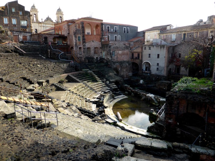
Catania has a long history as a city and there are many historic sights. One of the oldest is the Teatro Romano, a semi-circular Roman theatre dating to the 2nd century AD which was built on the site of a Greek theatre from around 500-600 years earlier. Roman theatres followed a similar design to Greek ones for good acoustics to host plays and musical recitals. The structure is impressive and must have looked striking when in its original form with white marble seating divided by eight stairways of black lava rock.

Teatro RomanoCatania’s Teatro Romano

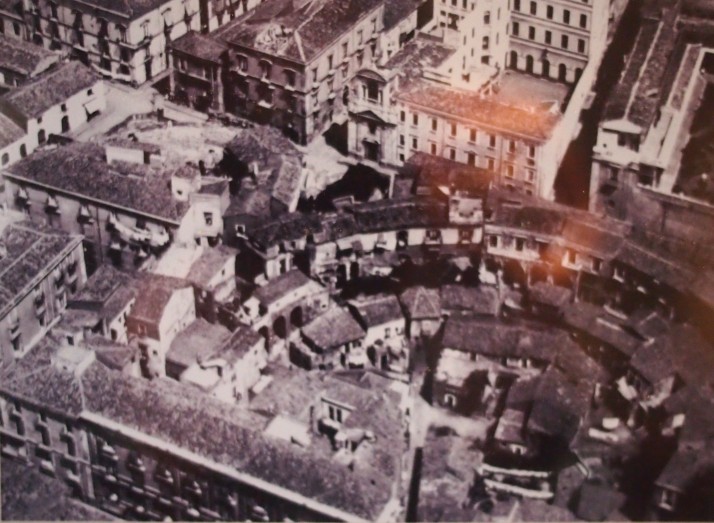
As we paid for our tickets, the heavens opened complete with thunder and lightning so we sought refuge in the small onsite museum. There we learnt that until the mid 20th century houses were built on top of and all around the old theatre, incorporating its stonework into their structures. Since the 1950s, the Antiquities Office has undertaken several projects of excavation, removing the houses and restoring the theatre, and work is ongoing.

Aerial photo of Teatro Romano from 1930sAerial view of the houses built over Teatro Romano from the 1930s [photo credit: Information board inside Teatro Romano]

The museum is housed in one of the encroaching buildings and has been preserved to show the way that the theatre was used through the ages. From there we explored the huge passageways which run beneath the seating before emerging into the theatre itself.

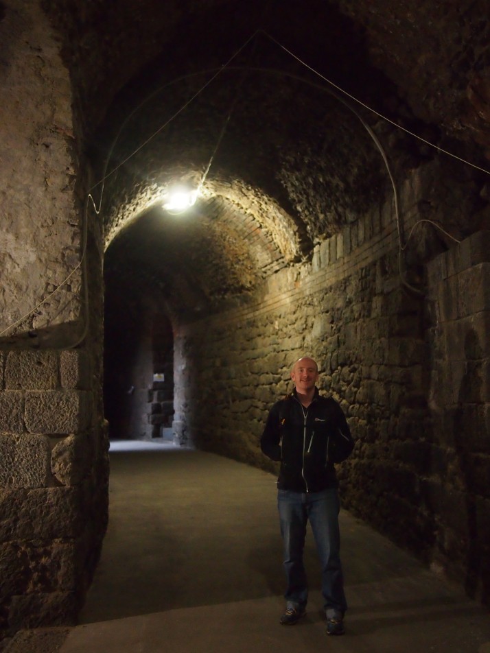
Teatro Romano walkwayAndrew in one of the high passageways beneath the rows of seating

Monastero dei Benedettini

The former Benedictine monastery of San Nicolo is a fascinating building and we joined one of the hourly guided tours to gain access to some of its more interesting corners. I say we joined a tour, but we were the only ones on it and we had to read the information from a printout as our guide only spoke Italian! The monastery’s buildings were confiscated by the Italian state in 1866 and it is now home to the Humanities Department of the University of Catania.

Students at work in the Monastero dei BenedettiniStudy hall in the former Monastero dei Benedettini

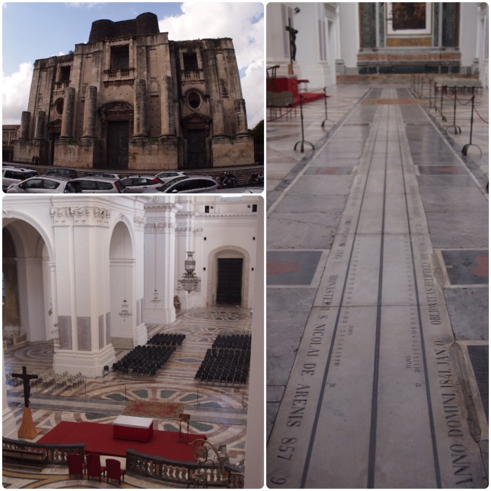
Before the tour we looked around San Nicolo church which is attached to the monastery. Its facade is unfinished and inside it is huge and whitewashed, seemingly not much used. The most interesting feature was the meridian line clock which runs for almost the full width of the church in front of the altar. These types of sundials were used to check the accuracy of calendars.

San Nicolo ChurchSan Nicolo Church (clockwise from top left): the unfinished facade; the meridien clock runs across the width of the church; the empty looking interior

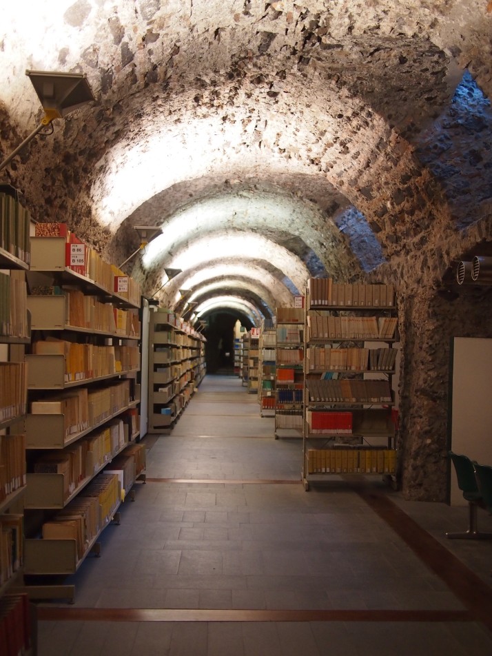
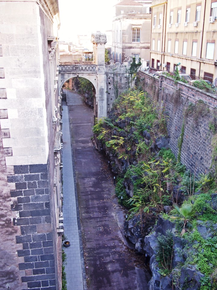
In the second half of the 17th century, two natural disasters befell Catania. First, in 1669, a massive eruption of Mt Etna. We were amazed to learn that it took two months for the lava to travel the 40km to the city and so the monks had time to build a barricade around the monastery leaving it unharmed but with an immovable 12m high ‘shelf’ surrounding it to the north and east. Then in 1693 a massive earthquake flattened the monastery along with much of the city. The only part which survived was the basement which now houses the department’s library.

Basement libraryThe Humanities Department’s library is located in the monastery’s basement – it would make a great location for a murder mystery!

The second floor corridors are very grand with high ceilings and stone doorways, witness to the fact that most of the monks were younger sons from wealthy families and were used to luxurious surroundings. When the monastery was rebuilt after the earthquake, it was extended and, as the lava shelf could not be moved, the architect used it to support the new common areas of the monastery – the kitchens, dining hall, library and even a garden for the novices. Beneath the kitchen our guide led us through the vaults used for food storage.

Lava shelfThe narrow gap between the lava shelf (to the right) and the monastery buildings

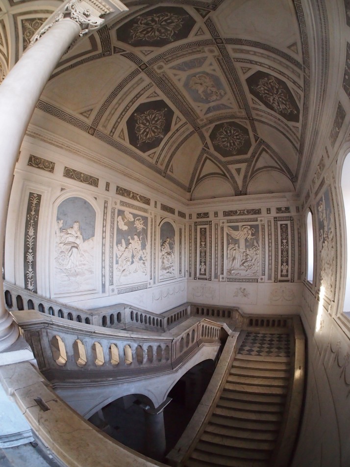
Monumental staircaseThe tour ended with us descending the Monumental Staircase. Its grand scale and stucco bas reliefs would look more at home in a palace than a monastery

Bellini Theatre, churches and Castello Ursino

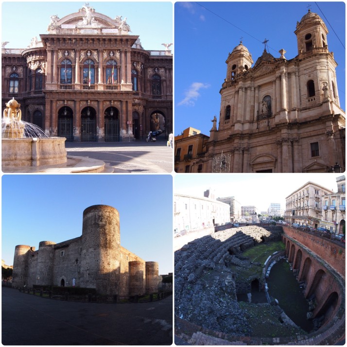
Andrew had found the route for a walking tour online and we enjoyed wandering the streets looking at the various monuments. Many were churches (about as densely sprinkled as the mosques in Istanbul), but we also saw the remains of a Roman amphitheatre (with seats all the way around as opposed to the semi-circular structure of the theatre), and a more modern theatre dedicated to Vincenzo Bellini who was born in Catania and whose tomb we saw in the Duomo. The final sight on the route was Castello Ursino, a medieval castle built between 1239-50 in a strategic position on a cliff next to the sea. Nowadays it’s a kilometre inland as later volcanic eruptions extended the coastline outwards! It is one of the few buildings to have survived the 1693 earthquake though.

Historic structures of CataniaClockwise from top left: Teatro Massimo Bellini; Church of St Francis; Roman amphitheatre remains; Castello Ursino

Countryside walks in Malta

After thoroughly strolling our way through Istanbul, we decided to continue this form of sightseeing experience and we were delighted to find the Malta Tourism Authority provide leaflets for varying length walks that cover most of the island. We picked up copies from the Tourist Information offices in the airport and Valletta, but they’re also available online, and in at least 3 languages: English, French and German.

Of the 7 routes, we did 5 of them over the course of our months stay on Malta..

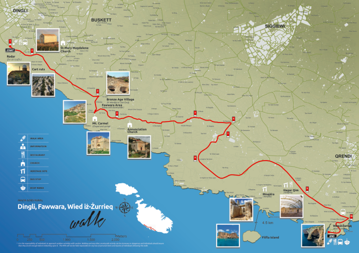
Dingli, Fawwara, Wied iż-Żurrieq Walk

Map: Dingli, Fawwara, Wied iż-Żurrieq Walk
Distance: 11.2km / 7miles
Difficulty: (moderate – long but mostly downhill)
What we liked: Great scenery of the Dingli cliffs, includes the mysterious ‘Cart Ruts’ of Malta and Gozo, goes past the temples of Ħaġar Qim and Mnajdra, and it’s downhill
Dingli - Fawwara - Wied iż-Żurrieq walk map, Malta

Dingli – Fawwara – Wied iż-Żurrieq map. Source: Malta Tourism Authority

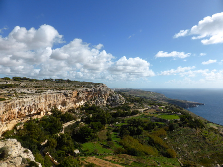
Looking south over the cultivated fields of Fawwara, from a Bronze Age village site that juts out almost to the sea

Looking south over the cliffs near Fawwara

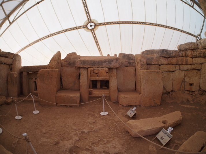
Inside the first chamber of the South Temple of the Mnajdra temple complex

Inside the first chamber of the South Temple of the Mnajdra temple complex

This was the first walk we did on Malta, and gives a great taste of the megalithic history of the islands as it includes the mysterious ‘Cart Ruts‘ near the start, and ends near the megalithic temples of Ħaġar Qim and Mnajdra. We liked that it was largely downhill, and there’s a good variety of sights too. One thing though – bring a packed lunch with you as the route is fairly remote, though there are cafes and restaurants at the end in Wied iż-Żurrieq.

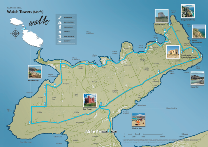
Watchtowers Walk

Map: Watchtowers Walk
Distance: 14.45km / 9miles
Difficulty: (hard – long with some uphill sections)
What we liked: Good variety of sights – watchtowers, beaches, holiday bays, local bird traps and the odd church, and having a beer and a packet of crisps on the Għadira beach at the end!
Watchtowers Walk map, Malta

Watchtowers Walk map. Source: Malta Tourism Authority

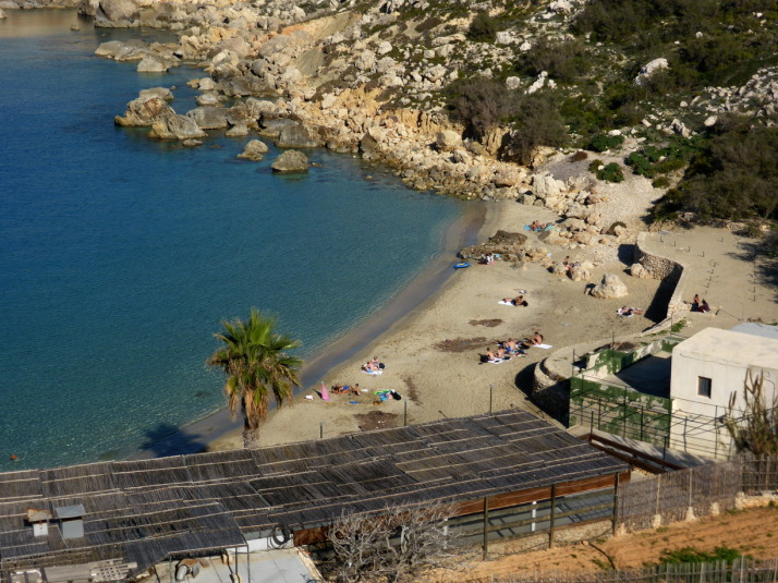
The aptly named Paradise Bay is on the route - don't forget your swimming costume!

The aptly named Paradise Bay is on the route – don’t forget your swimming costume!

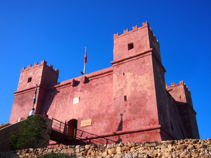
St Agatha's Tower - otherwise known as the Red Tower, dominates the northern peninsula of Malta and is the final stop of the walk

St Agatha’s Tower – otherwise known as the Red Tower, dominates the northern peninsula of Malta and is the final stop of the walk

This walk circumnavigates the very northern outcrop of Malta, and it took us over an hour to get there by bus from Valletta where we were greeted by an uphill hike! As we were off-season a lot of the little holiday bays and lovely secluded beaches were very quiet though I suspect it’d be very different in the summer. Still, this walk includes a nice variety of sights and the highlight of the Red Tower is saved for the end.

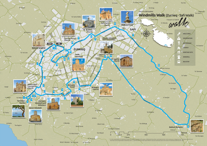
Windmills Walk

Map: Windmills Walk
Distance: 8.8km / 5.5miles
Difficulty: (easy)
What we liked: Spotting the windmills, reading the information boards at the Tal-Ġibjun Garden viewpoint about ⅓rd of the way around
Windmills Walk map, Malta

Windmills Walk map. Source: Malta Tourism Authority

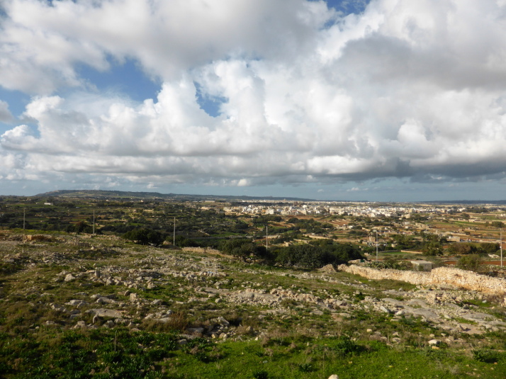
The view across Malta from the Tal-Gibjun Garden viewpoint is worth the visit to Żurrieq even if you don't do the walk!

The view across Malta from the Tal-Ġibjun Garden viewpoint is worth the visit to Żurrieq even if you don’t do the walk!

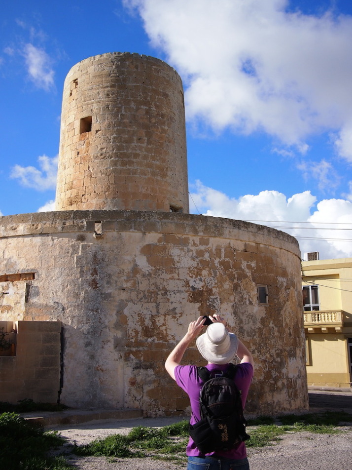
.. but then you'd miss out on the milling history of the island!

.. but then you’d miss out on the milling history of the island!

First, a confession – we skipped out the Bakkari Remains and stayed in Żurrieq because we’d spent so much time at the excellent Tal-Ġibjun Garden viewpoint reading about the sights, events and identifying the landmarks from this natural vantage point. Of all the windmills, only one is still active, and it sits atop some old burial pits! This is quite a compact walk so we twinned it with a stop at the Blue Grotto to make a day of it.

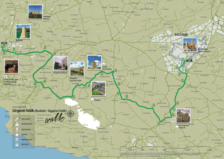
Girgenti Walk

Map: Girgenti Walk
Distance: 7.7km / 4.8miles
Difficulty: (moderate – some uneven ground and an easy scramble to visit the Big Cave)
What we liked: The amazing start – the complicated collection of ‘Cart Ruts’ nicknamed Clapham Junction (yes, seriously!) and the aptly named ‘Big Cave’
Girgenti Walk map, Malta

Girgenti Walk map. Source: Malta Tourism Authority

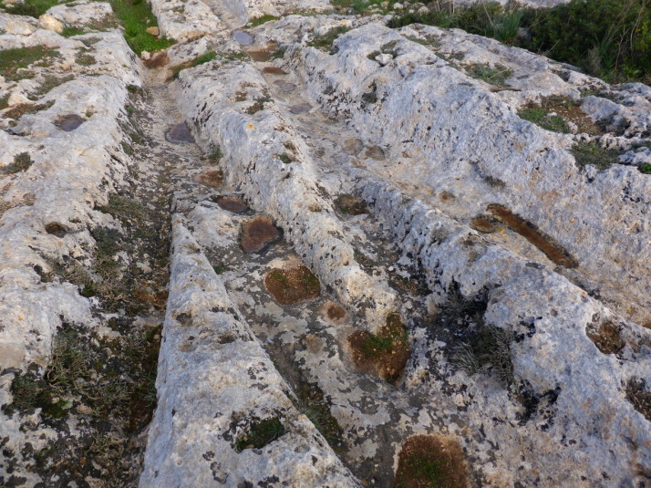
A small section of the 'Cart Ruts' at the so-called 'Clapham Junction' - what were they used for?

A small section of the ‘Cart Ruts’ at the so-called ‘Clapham Junction’ – what were they used for?

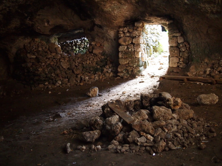
View from inside part of Ghar il-Kbir which literally translates to 'Big Cave'. It's a cave. And, you guessed it, it's big

View from inside part of Ghar il-Kbir which literally translates to ‘Big Cave’. It’s a cave. And, you guessed it, it’s big

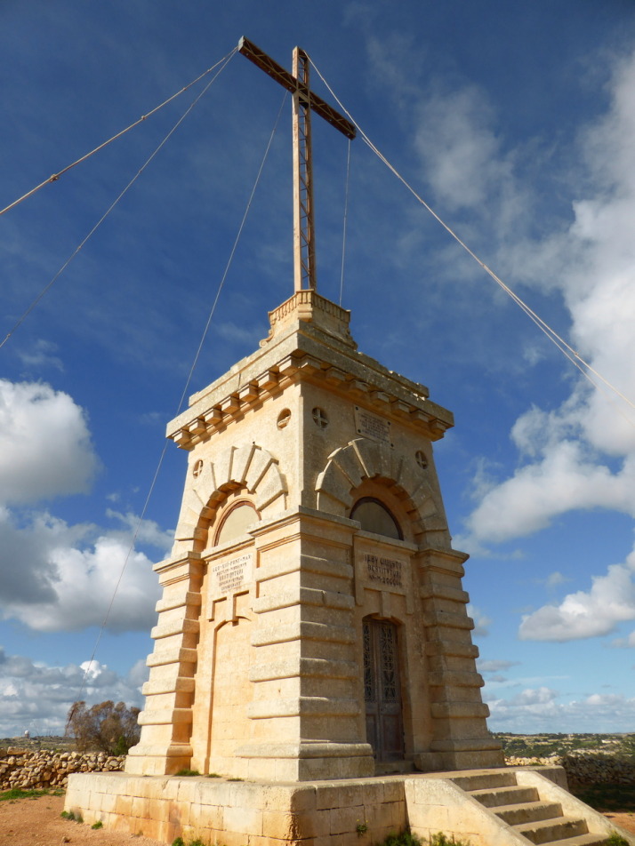
The huge bronze Laferla Cross next to the Assumption Church sits on the edge of the hill with lovely views over the second half of the walk

The huge bronze Laferla Cross next to the Assumption Church sits on the edge of the hill with lovely views over the second half of the walk

This is our favourite of the walks we’ve done on Malta because the detour to the field of ‘Cart Ruts’ just points you at the right place but leaves you to find them. It was really enjoyable trying to actually find the famous ‘Clapham Junction’ and then further up the same field are burial pits and the ‘Big Cave’ that was inhabitanted until 1835. Other highlights for us were the huge bronze Laferla Cross (which we saw from the viewpoint of the previous Windmills walk), the figures surrounding the dome of the Providence Church, and serendipitously visiting on the annual St Nicholas Parish church open day, where they opened up the roof and the organ pit. We got great views from the top of the church, and befriended a local guy who showed us the belfry and invited us to the village festival at the end of July next year!

Maqluba Walk

Map: Maqluba Walk
Distance: 6km / 3.7miles
Difficulty: (easy)
What we liked: The small chapels that bestrew the countryside, getting out into the farming fields of the island
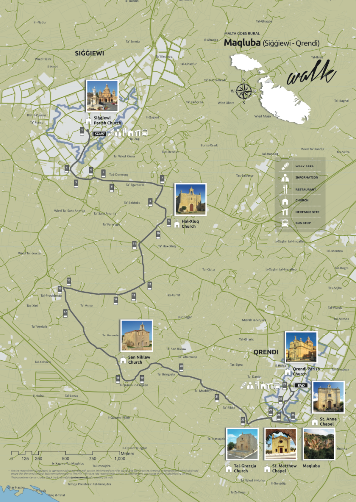
Maqluba Walk map, Malta

Maqluba Walk map. Source: Malta Tourism Authority

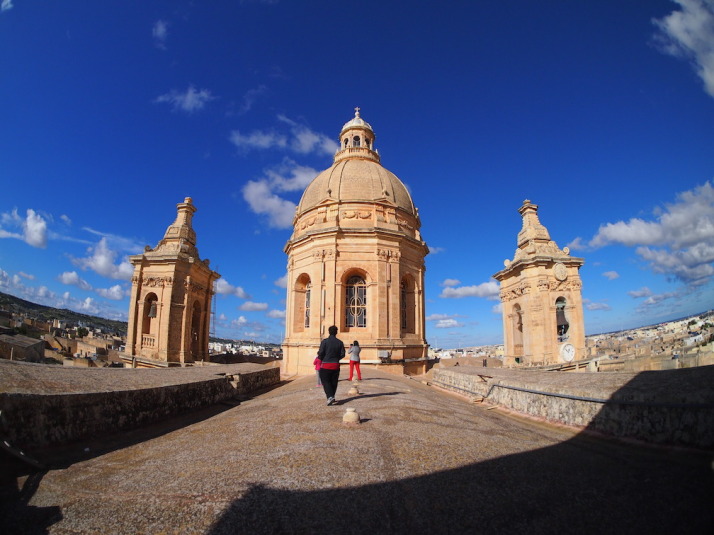
The start of the walk is Siggiewi Parish Church. When we tried to enter we were told that the entrance was through the belfry! For a small mandatory donation we got to climb onto the roof and on the way down we were given an introduction to the church's organ!

The start of the walk is Siġġiewi Parish church. When we tried to enter we were told that the entrance was through the belfry! For a small mandatory donation we got to climb onto the roof and on the way down we were given an introduction to the Church’s organ!

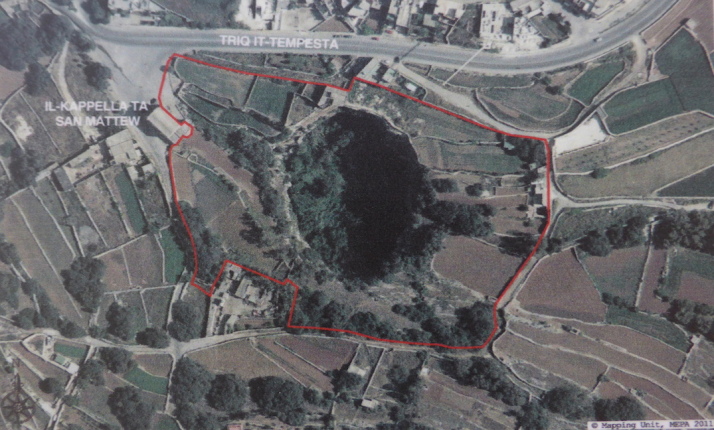
Aerial photo of the giant sinkhole that appeared on the 23rd of November 1343 during a severe winter storm

Aerial photo of the giant sinkhole that appeared on the 23rd of November 1343 near Qrendi during a severe winter storm. Photo source: onsite information board

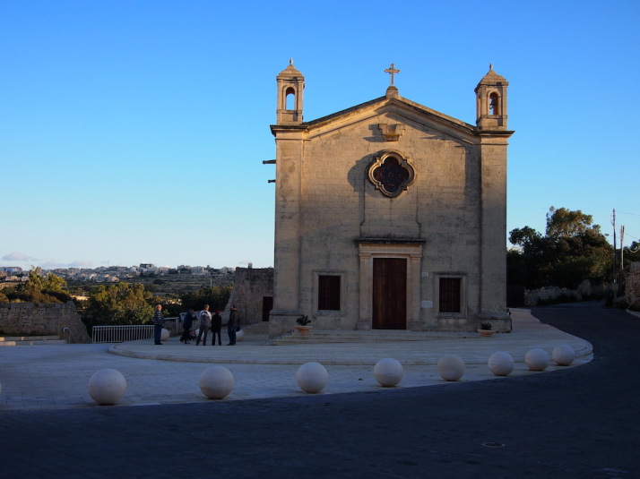
And we end with yet another church - this time Qrendi's St Matthew's Chapel as the sun sets

And we end with yet another church – this time Qrendi’s St Matthew’s Chapel as the sun sets

As this walk starts at the end of the previous Girgenti Walk, we did them both in the same day, stopping in Siġġiewi for a spot of lunch between them. This is very much a rural Maltese countryside walk far from any tourist attractions, but our timing was impeccable as the lovely little Hal-Xluq Church was home to a local artists’ exhibition – which is the only other time of the year the church opens its doors besides the village festivities! The other highlight for us was the giant sinkhole in the Maqluba valley that appeared in 1343, just outside Qrendi, and almost took the then smaller chapel of St. Matthew with it!

Segueing around Gozo, on a Segway!

The country of Malta is a Mediterranean archipelago, and only the 3 largest islands are inhabited. The main one is Malta, then Gozo to the north, and between them is a small island called Comino which only has 4 permanent residents.

Given their proximity, Gozo shares a lot of the same history as Malta, and in looking for places to visit and things to do for a couple of days there we found GozoSegway – a small company that operates guided tours of Gozo while you operate a Segway!

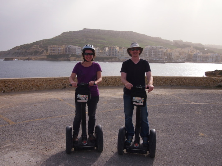
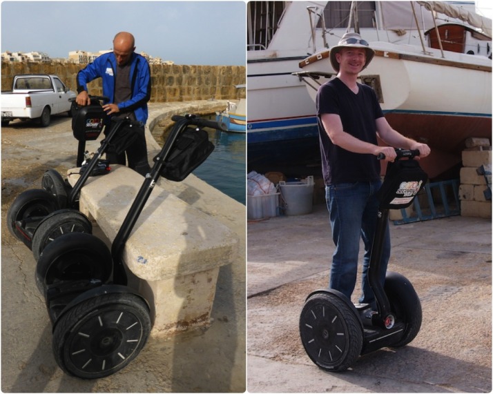
Us on Segways having just passed our Compulsory Basic Training, which consists of an emergency stop, hill start and smiling from ear to ear

Us on Segways having just passed our Compulsory Basic Training, which consists of an emergency stop, hill start and smiling from ear to ear

A Segway is a two-wheeled form of personal transportation, similar to a motorised skateboard, but way smarter – using gyroscopes developed by BAE Systems and a lot of very clever electronics it uses your centre of gravity to control motion and direction. Like us, you may have seen them in movies or in the odd city centre, and riding on one is something I’ve wanted to try since they came out in 2001.

We weren’t sure how easy it was going to be to learn how to ride, and as we wanted to see quite a bit of Gozo we booked their longest 2½ hour tour of north-western coastline.

Kevin (the Boss) and Peter (our Guide) met us in Marsalforn with their truck-full of Segways and after a short explanation we were up and whizzing around the car park like a pair of two-wheeled tearaways, grinning from ear to ear!

Getting acquainted: Peter our guide makes sure he's packed everything we need for the trip; My Segway and I getting to know each other as we whizz up and down the car park of Marsalforn Bay harbour

Getting acquainted: Peter our guide makes sure he’s packed everything we need for the trip; My Segway and I getting to know each other as we whizz up and down the car park of Marsalforn Bay harbour

Our initial concerns about how difficult we’d find them to ride were completely unfounded – basically, if you can stand upright then you’ll have no problems whatsoever controlling a Segway! We could call it an amazing technical achievement, or we could just simply say its magic how they actively maintain balance, and with the slightest shift in weight forward or backward it starts moving exactly how you would expect it to. Very quickly we understood why Peter said that the Segway becomes an extension of the body.

After the Segway driving test equivalent of emergency stops and hill starts, Peter led the way along the coastline towards our first stop – the salt pans of Gozo.

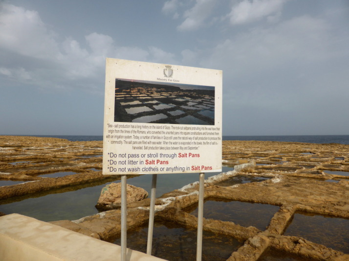
The Gozo Salt Pans, still in use after more than 2000 years

The Gozo Salt Pans, still in use after more than 2000 years

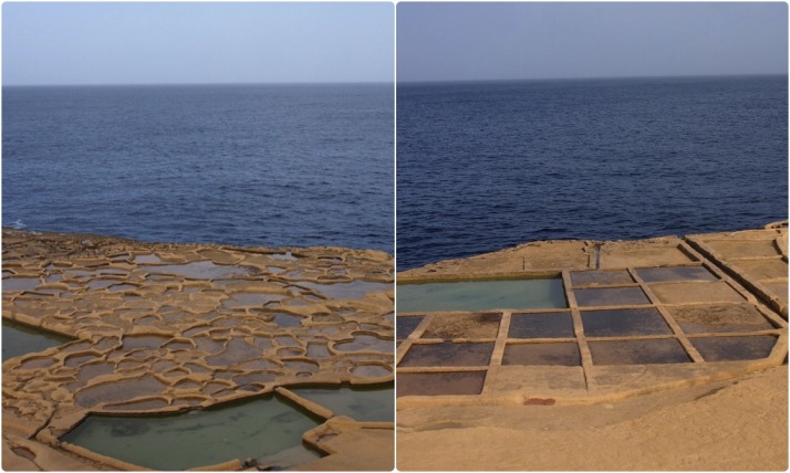
Dating to the time of the Romans (264BC to 395AD), the salt pans have been in use for thousands of years. The closest ones to Marsalforn are irregular and organic in shape as they’re the oldest and were carved out with simple hand tools; further along the pattern of salt pans becomes regular, ordered and each pan is bigger as better tooling and machinery improved not only their creation but the harvesting of the salt.

The evolution of man and tools is evident in the shape of the salt pans. Left: the oldest salt pans were created with crude hand tools; right: modern tools allow larger and more regular salt pans

The evolution of man and tools is evident in the shape of the salt pans. Left: the oldest salt pans were created with crude hand tools; right: modern tools allow larger and more regular salt pans

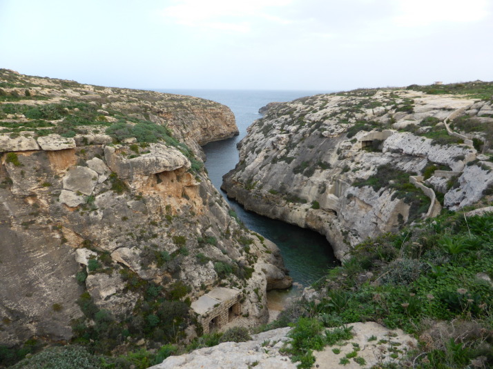
Wied il-Ghasri, a deep valley used by pirates and smugglers of the Mediterranean, so much so that they built a shaft into the side of the cliff to lower supplies and raise booty!

Wied il-Għasri, a deep valley used by pirates and smugglers of the Mediterranean, so much so that they built a shaft into the side of the cliff to lower supplies and raise booty!

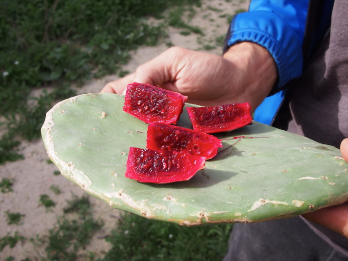
Peter stopped to prepare a prickly pear. Gozo, like Malta, gets a lot of sunshine and the prickly pear, like all the fruit here was very sweet. The thick, heavy leaves of the cactus make a great chopping board too

Peter stopped to prepare a prickly pear. Gozo, like Malta, gets a lot of sunshine and the prickly pear, like all the fruit here was very sweet. The thick, heavy leaves of the cactus make a great chopping board too

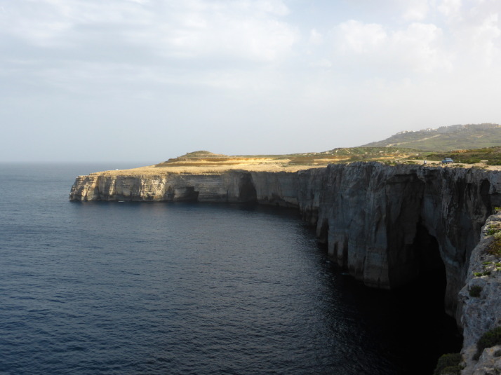
We stopped for a coffee and biscuits a little further along the cliff tops, where we watched a guy raising fishing baskets

We stopped for a coffee and biscuits a little further along the cliff tops, where we watched a guy raising fishing baskets

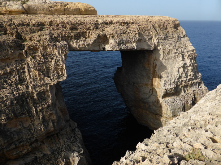
The naturally formed window at the end of Wied il-Mielah, just a little further west along the northern coastline of Gozo

The naturally formed window at the end of Wied il-Mielaħ, just a little further west along the northern coastline of Gozo

Next we headed inland and after a quick glide through the small town of Gharb (in Maltese, ‘gh’ is silent, as you might remember we learned in Mdina & Rabat), and we were back out on the open road towards the dominating Basilica of the Blessed Virgin of Ta’ Pinu.

Famous as a place of pilgrimage for those seeking answers to prayers for miraculous recoveries, the The Basilica of the Blessed Virgin of Ta' Pinu has an extended chapel where letters and artefacts of prayer and gratitude from around the world are on display

Famous as a place of pilgrimage for those seeking answers to prayers for miraculous recoveries, the The Basilica of the Blessed Virgin of Ta’ Pinu has an extended chapel where letters and artefacts of prayer and gratitude from around the world are on display

The Basilica of the Blessed Virgin of Ta’ Pinu. The story goes that in 1833 a spinster by the name of Karmina Grima was walking past the then dilapidated chapel on the site and heard a voice asking her to recite 3 Hail Marys’, she did and shortly afterwards her neighbour’s mother was miraculously healed. As word spread many started pilgrimages to ask for temporal and spiritual favours and the church was rebuilt in 1932 to accommodate both the visitors and their ex-voto.

The basilica is also known for a painting of the Virgin Mary which depicts her hands in prayer though one hand is white and the other is black. It’s not clear if it was the artist’s intent to show her black hand in shadow, or, as some have suggested, a sign of the multi-ethnicity of Christianity.

From here we took a long and winding road back down to Marsalforn and while we waited for Kevin to return with the truck, we chatted with Peter over a coffee about travelling – he’s from Prague in the Czech Republic – how he ended up living on Gozo and, of course, Segways!

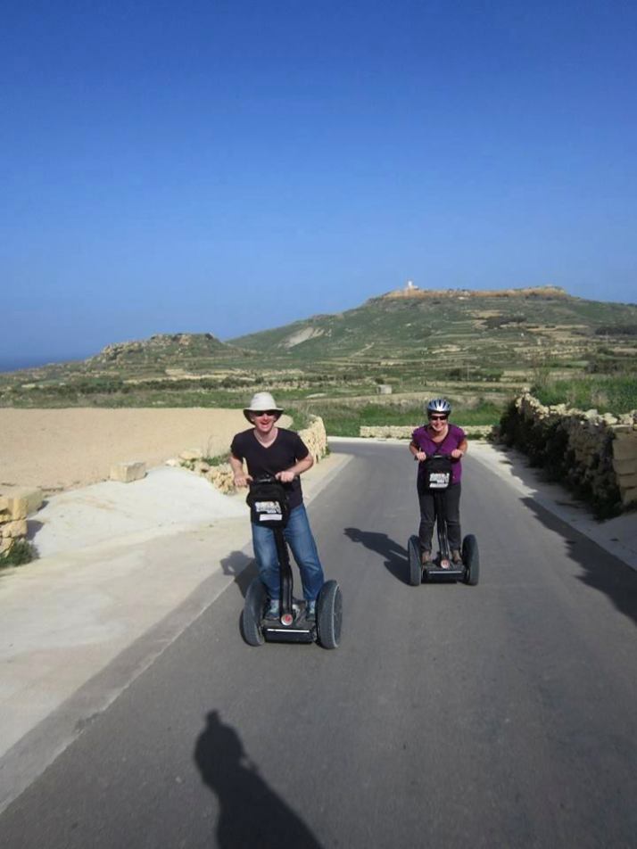
Segways - easily the most enjoyable way to climb the hills of Gozo!

Segways – easily the most enjoyable way to climb the hills of Gozo!

We really enjoyed the experience, the Segways are great fun and a fantastic way to see this hilly little island.

Mdina & Rabat, Malta

Mdina is the ancient capital of Malta, it’s believed that there has been a settlement here for over 2000 years and it easily predates the Knights of St John who landed in 1530 and promptly moved the capital to Vittoriosa, and then to Valletta in 1571. Centrally located atop a hill it looks very much like you would expect an impregnable fortress to look with thick stone walls and a deep moat, although nowadays the moat is a green park.

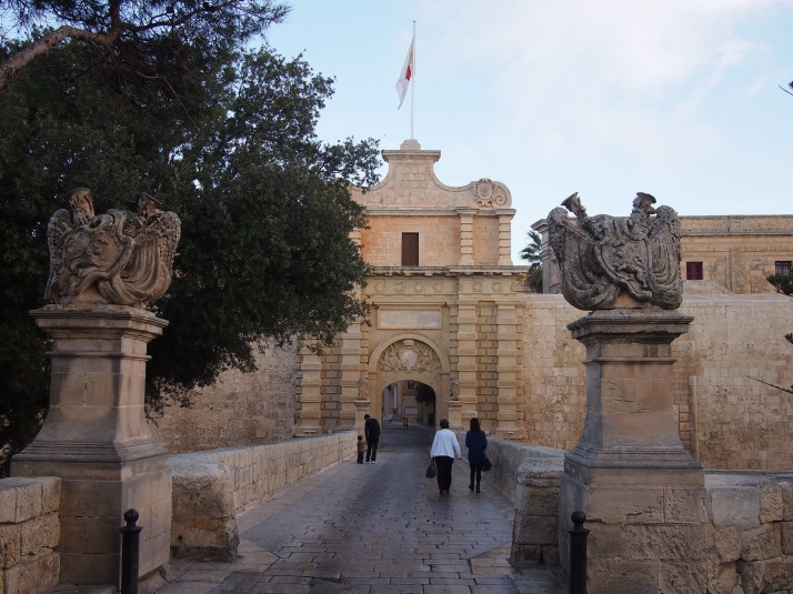
Mdina GateThe city is entered through the impressive Mdina Gate

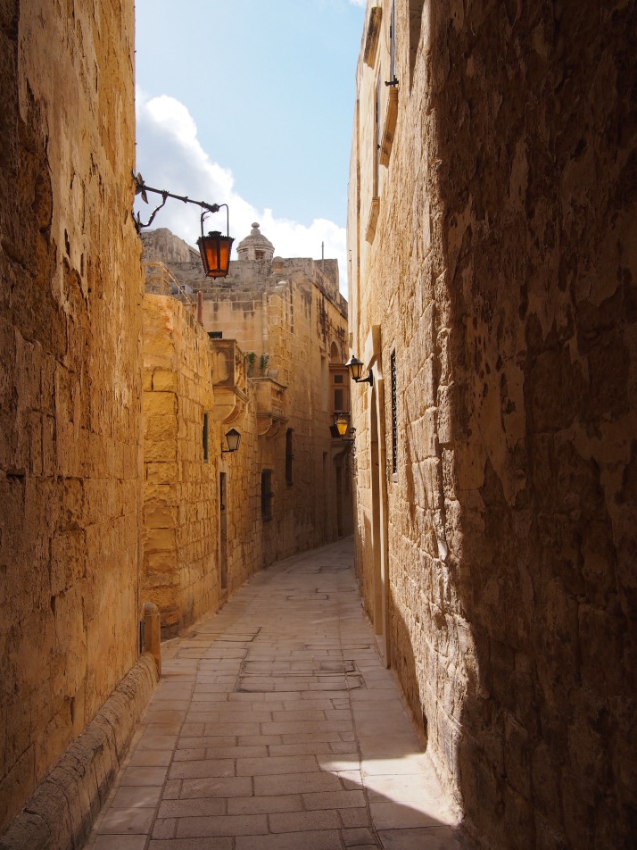
The defensive walls evolved over hundreds of years under different ruling groups. The final changes were made during the Arab occupation of AD870-1250 and the name derives from the Arabic word for city, ‘medina’. To call it a city is perhaps a little misleading, I was surprised by how tiny the area inside the walls is. The narrow streets seem almost labyrinthine but it’s difficult to get lost as before long you inevitably end up at an outer wall or the central street. Still it’s very picturesque and we enjoyed doing a little exploring.

Mdina streetA typical Mdina street

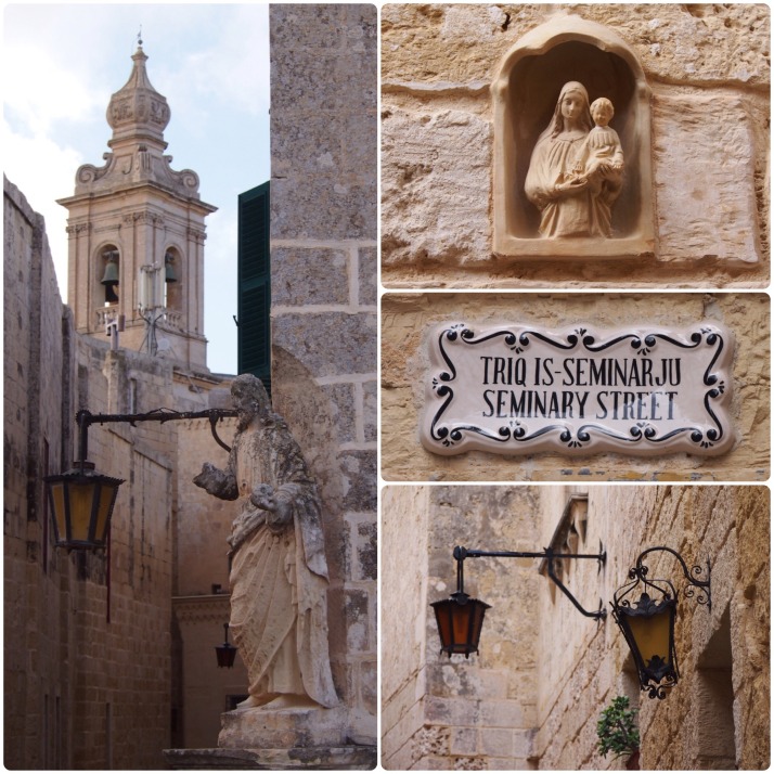
Mdina detailsClockwise from left: there are several churches, convents and monasteries inside the walls along with numerous statues of saints on street corners; nearly every house has a small icon by the door, a feature common across the island; Mdina street sign; at night the streets are lit by lanterns

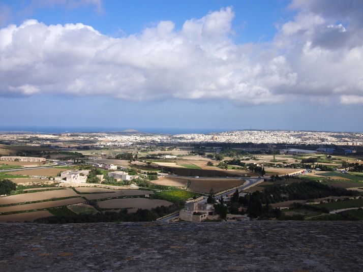
From the north-eastern walls you can see all the way to the coast and to Valletta, and I’m sure that the corner towers command views over pretty much the whole island which I suppose was the idea for defensive purposes.

View from Mdina wallsView to the Mediterranean Sea from Mdina’s walls

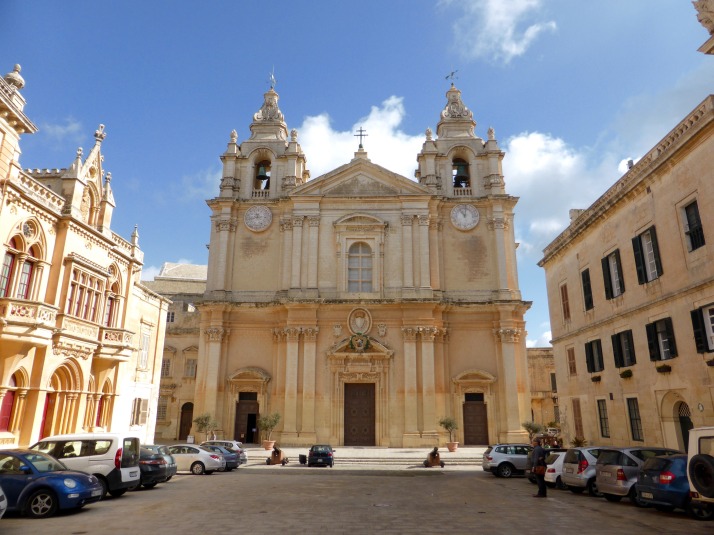
The Bishop of Malta’s palace is situated within Mdina and his seat is the Cathedral here. It’s nowhere near as impressive as St John’s Co-Cathedral in Valletta but in its own way it’s quite pretty and much more peaceful than that busier church.

Mdina CathedralMdina Cathedral makes up one side of St Paul’s Square

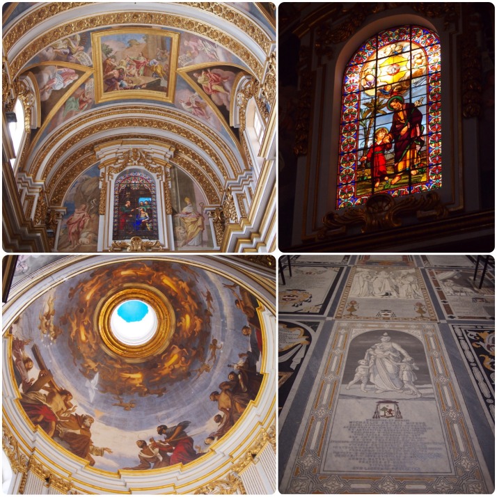
Cathedral detailsCathedral interior (clockwise from top left): frescoes on the walls and ceiling; the cathedral has some beautiful stained glass windows; the floor consists of inlaid marble gravestones; I really liked the paintings inside the dome

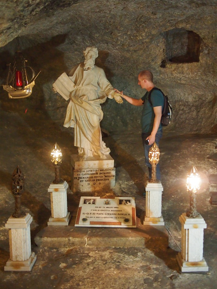
Just outside Mdina’s walls is the town of Rabat, also named from the Arabic it means suburbs. There are a few museums here too, we chose to visit the complex beside and underneath St Paul’s Church – St Paul’s Grotto, World War II Shelters, Catacombs and the Wignacourt Museum which are all on one combined ticket. Like many churches on the island, this one is dedicated to St Paul who was shipwrecked on Malta for three months on his way to Rome in AD60. The first stop downstairs from the ticket desk, and directly underneath the church, is the grotto where St Paul is said to have lived and preached during his time here, nowadays it’s a chapel.

St Paul's GrottoAndrew in St Paul’s Grotto

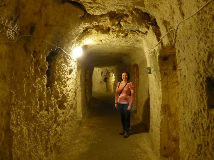
Deeper underground is the entrance to the bomb shelters which were built for the town’s inhabitants during WWII. They seemed to go on forever, there are fifty small rooms directly off the main corridors. However they are now all empty apart from a few floor tiles and there wasn’t much in the way of explanatory notices so we had to use our imaginations to guess what it might have been like to shelter down there. It’s safe to say that the residents spent a lot of time down here as there were 3340 air raid alerts between 1940-44 and during the peak months in the first half of 1942 there were an average of eight or nine alerts every day!

World War II bomb sheltersMe in the corridor of the World War II bomb shelters underneath St Paul’s Church

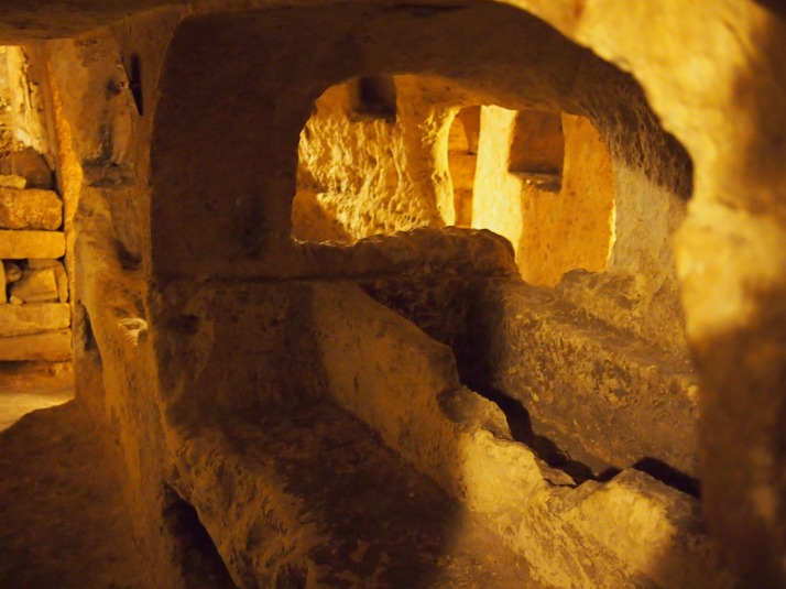
Leading off from the bomb shelters are two sections of catacombs. These pre-date the church and are part of what would have been a large cemetery complex going back to Roman times when it was forbidden to have burials inside the city walls. They are also, thankfully, empty. The structure was quite distinct from the bomb shelters, we found them pretty cramped with narrow, twisting passages.

St Paul's CatacombsSt Paul’s Catacombs

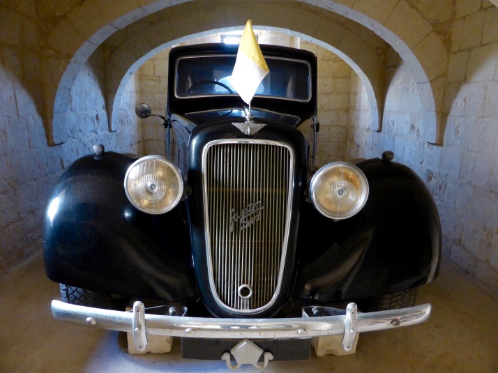
We ended our visit with a quick look around the Wignacourt Museum. It’s pretty modern and nicely set up but the contents consisted mostly of old oil paintings and local religious memorabilia which weren’t of much interest to us. The highlight was a 1937 Austin Six Limousine in mint condition which used to belong to the Bishop of Malta. It seemed to have been assembled in the exhibition room as it was too big to fit through either the door or the window.

Austin Six LimousineAustin Six Limousine in the Wignacourt Museum

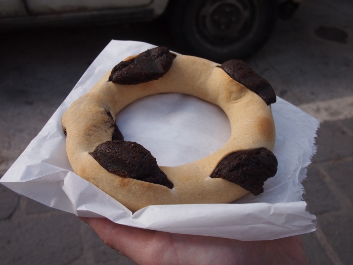
Next door to the museum is a bakery and it would have been rude not to buy a traditional Maltese cake. We chose one that in English is called “honey ring”, it’s a pastry case filled not with honey but a spicy black treacle mixture which tasted like a very dense gingerbread. We asked the girl in the shop how to say its name in Maltese, “Qaghaq tal-ghasel”, she explained that the ‘gh’ is silent, but didn’t look too impressed by our pronunciation efforts… Oh well, it tasted good however you say it.

Honey ringOur Qaghaq tal-ghasel