Tag Archives: Cruise

Hebridean Way: Day 5 – St Kilda boat trip

Distance cycled 0 miles / 0 km
Cumulative distance cycled 117.1 miles / 188.5 km
Islands visited (daily total) Hirta (St Kilda)
Total islands visited 9+1 of 10
Average speed n/a mph / n/a kmph
Weather conditions Overcast

We’d heard of St Kilda before we started researching the Hebrides. The remote archipelago seems to have an almost mythical status as an isolated community which lived apart from the world for hundreds of years before the final residents departed for the mainland in 1930. St Kilda is 40 miles west of the Outer Hebrides. As we left Leverburgh at 8am, there was no wind at all but it was still a chilly and bumpy 3 hour ride in the motor cruiser to get there for our group of 12 plus 2 crew. We were on constant lookout for dolphins and whales but had seen nothing more exciting than a passing container boat and a few seabirds until we were almost in the bay where we got a tantalising glimpse of a Minke Whale’s fin.

A quick transfer by dinghy landed us on the main island, Hirta, where we were greeted by Sue, the warden for the National Trust for Scotland who own the islands. She and her two scientist colleagues live there during the summer alongside a year-round defence contractor’s crew who run the comms station up on the hill. She gave us a brief overview of the place and its history before setting us free to roam for 4 hours.
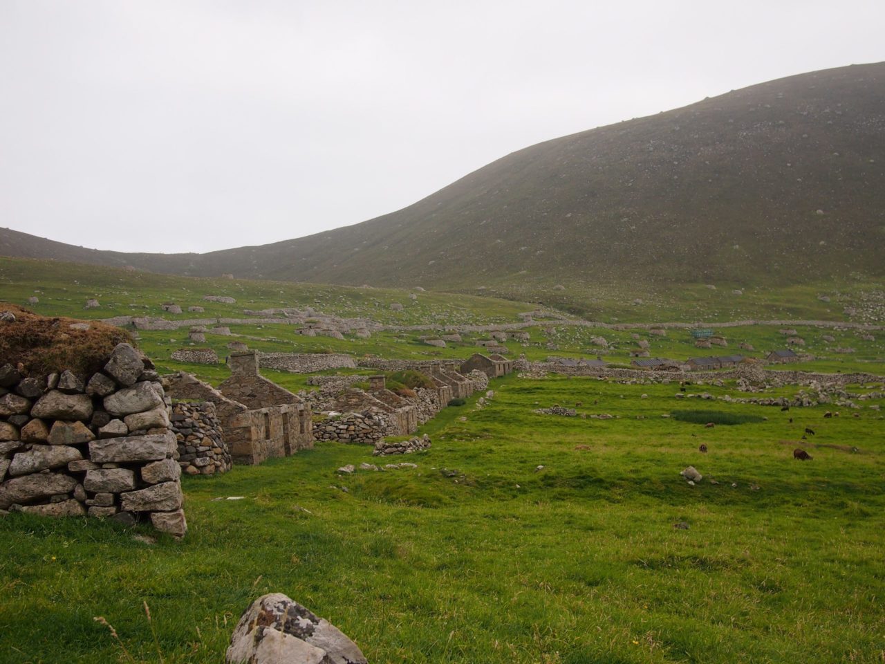
Main street on Hirta

The main street of the village consists of 16 cottages (6 of which have been re-roofed and are in use by The National Trust for Scotland) as well as older blackhouses which were latterly used as byres and stores

St Kilda is the only place in the UK to hold dual UNESCO World Heritage status for both its cultural and natural characteristics. The islands are so remote that unique sub-species of both wren and field mouse have evolved there, Andrew thinks he spotted a mouse but we didn’t make a confirmed sighting of either!
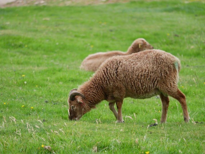
St Kildan sheep

A flock of primitive sheep survived after the evacuation of the human population and now they run wild on Hirta. They are not managed at all but scientists do round them up once a year to take measurements as they are a totally unique breed not found anywhere else

Exploring the ruined cottages on Main Street and reading the information in the small museum started to give us a sense for how hard the lives of the people who’d lived there must have been. They had small crofts and kept sheep and cows but much of their food and their rental payments came from the huge seabird colonies which populate the islands’ cliffs during the summer. Eggs and meat for themselves, feathers and oil for the rent payments.
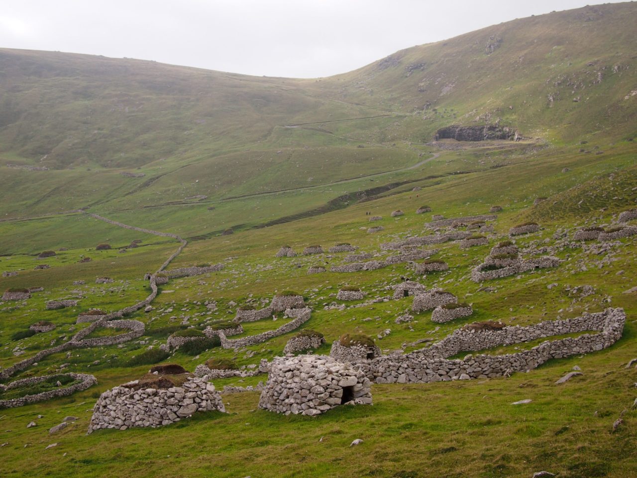
Cleits on the hills of Hirta

The hillsides of Hirta are covered in these small stone structures roofed with turf called cleits. The Kildans used them for storage of food and peat for the winter months

There’s a good climb up and over the main hill on Hirta and back around the other side but it would have taken almost all of our time there and we wanted to have a full exploration of the village so we contented ourselves with a hike up to the Gap, the pass between the 2 hills from where we could look down the steep cliffs on the far side and see towards the sea stacks and uninhabited islands while the fulmars circled overhead.
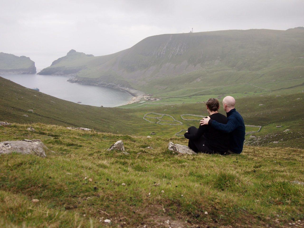
View from the Gap back down towards village bay

View from the Gap back down towards village bay

Once we were back on board the boat and fortified with a cuppa and cake, we set off for a tour around Boreray and the sea stacks which we’d seen from the Gap. We’d both expected this part of the trip to be a bit of an add-on, especially as early September is not the best time for seabird viewing as all of the puffins and many of the other birds have already fledged and gone back out to sea. However, there were still quite a lot of gannets in residence, and as we got closer Darren, our guide, pointed out the paths the Kildans had carved into the cliff face so that they could climb up and harvest the young birds. The thought of even climbing up the narrow ledges was enough to make us feel a bit queasy, never mind trying to do it while carrying a sack of dead birds and being dive-bombed by others, oh and with no safety harnesses either…
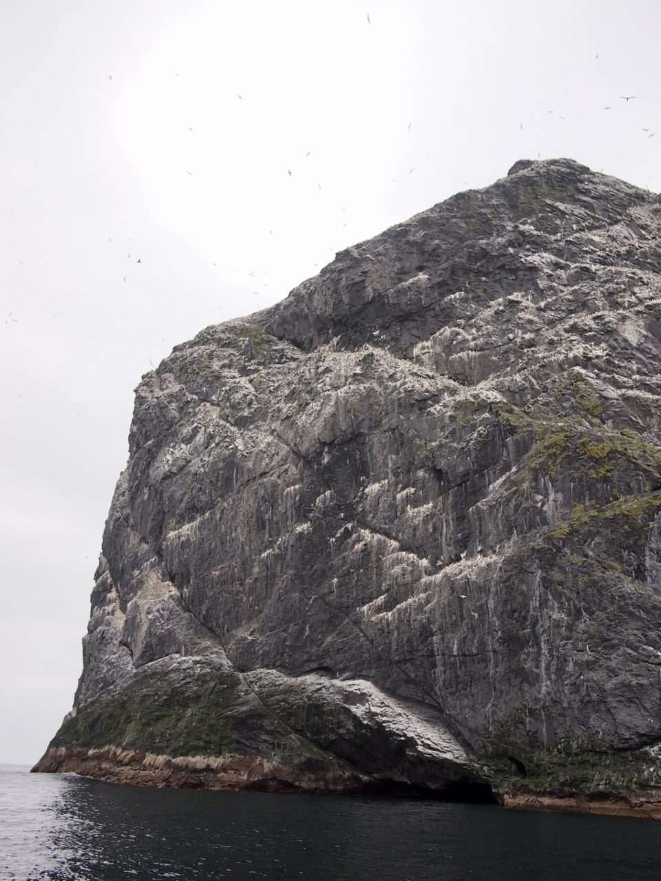
Sea stack with whirling gannets, St Kilda

The sea stacks and islands’ cliffs are home to the most important seabird station in NW Europe, including large colonies of gannets, fulmars and puffins. The diagonal lines up the side of the stack are the Kildans ledge trails

A fantastic day which gave us a renewed sense of awe for the natural world and humans’ ability to survive in even the harshest conditions.

A family trip to the Princes’ Islands, Istanbul

The big downside of being away from home for so long is that we miss our family and friends. Although Skype’s great it’s just not the same as spending time together, especially with our nephews and niece. We’ve been fortunate to have been visited before by Julie’s Mum and Dad (in China) and by our friend Jo (in Vietnam and Uzbekistan), and we were excited to line up another visit in Istanbul, this time from Julie’s sister Steph, brother-in-law Tom and our nephew Olly who was just 12 weeks old when we left on this trip.

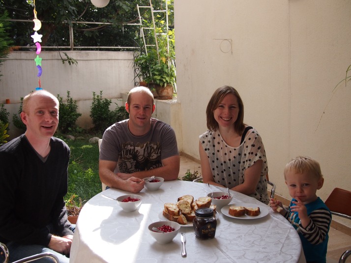
Breakfast in the gardenAndrew, Tom, Steph and Olly enjoying breakfast in the garden of our rented apartment on their first morning in Istanbul

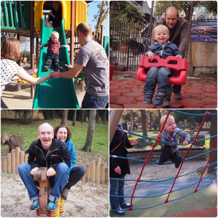
Unfortunately the weather wasn’t very cooperative for much of their 10 day visit with clouds or even outright rain. It seemed that autumn had properly arrived in Istanbul. Still we were able to get out for a few walks, had a go on the slides in the many playparks and chased pigeons wherever we could.

PlayparksLittle and big kids in some of Istanbul’s playparks

Family is very important in Turkey and, in our experience, Turkish people love children (especially super cute and smiley blond haired ones). In every cafe, restaurant or fast food place that we entered, the staff made an effort to find a space for the pushchair, made a fuss of Olly and gave him enough free chips, biscuits and sweets that the rest of us started feeling a bit jealous.

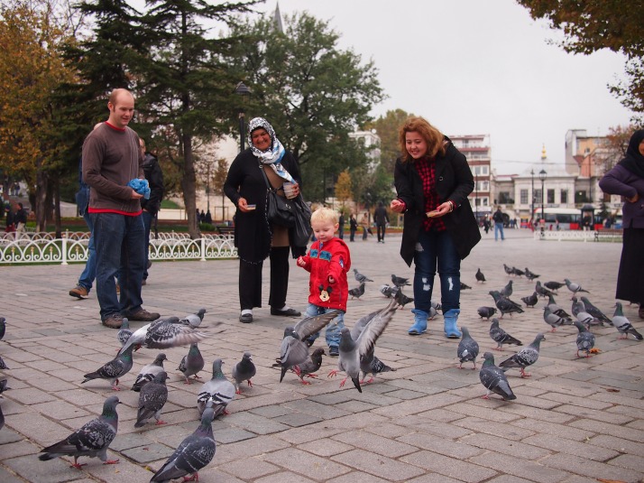
Feeding the pigeonsOlly making friends while feeding the pigeons in Hippodrome Square

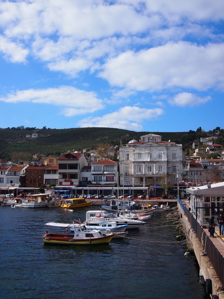
The weather at last brightened up for our final couple of days together and on the last day we took the ferry from Kabataş to the Princes’ Islands. This archipelago of nine islands lies approximately 20km southeast of the mainland in the Sea of Marmara, but is administratively included in the City of Istanbul. Only six of the islands are inhabited but the ferries, of which there are several each day, only stop at the largest four.

Princes' IslandBurgazada, the second ferry stop, seen from the pier

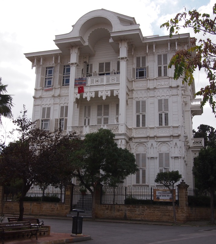
We got off at the final island, Büyükada, which is also the largest and most populous of the group. In summer the population swells as it is a popular holiday destination as well as an easy to reach place for day-trippers. It looks as if the city’s rich might be some of those who retreat there as we saw lots of very large and beautifully kept villas.

Wooden mansion on BuyukadaMany of the houses on Büyükada are wooden and very large though not all are in such good condition as this beautiful villa

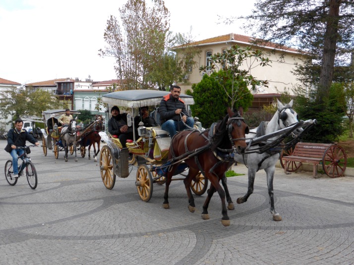
On all of the islands, the only motorised traffic allowed are service vehicles (police, rubbish collection, etc.) so the only ways to get around are on foot, by bicycle or by horse drawn carriage, called fayton. We were ready to stretch our legs after 90 minutes on the ferry and soon noticed that several of the horses pulling faytons looked to be poorly kept so decided to stick to moving under our own steam.

Buyukada horse and carriageFaytons carrying day-trippers around Büyükada

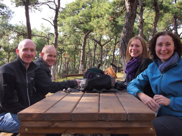
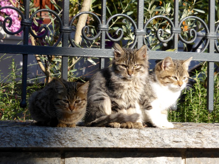
We set off towards the Monastery of St George and viewpoint on top of the southernmost of the island’s two hills. It was very pleasant walking the streets with no traffic noise, eyeing up the grand villas and waving at all the stray cats (hello miaow!). After we’d left the houses behind we noticed areas of picnic tables under the pine trees. They looked like a perfect place for us to eat the sandwiches that we had brought and we settled ourselves down. We were just about to tuck in when a man approached demanding 3TL per person (just under £1) to sit there. That seemed a bit steep, no wonder all the other tables were empty, so we moved on and ate as we wandered.

Picnic lunchShortly before we were moved on from our picnic table (Olly had already devoured his sandwich and is asleep in his pushchair behind the table)

Having eaten our lunch and checked the distances on the map we realised that we wouldn’t have time to walk up to the monastery and make it back in time for the 3pm ferry so we took the other fork in the road and walked in a loop around to the village.

Buyukada catsThere are tons of stray cats in Istanbul and Büyükada was no exception. The locals feed them and for the most part they are in very good condition

On the ferry back we were thrilled to see a school of dolphins leaping across the wake of the boat. A fabulous end to our stay in this beautiful city.

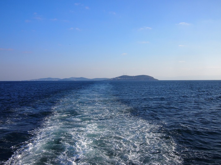
Leaving the Princes' IslandsFarewell to the Princes’ Islands and to Istanbul

Bosphorus Cruise

We’ve done a fair bit of walking through Istanbul so for a change of view we decided to take a cruise. Istanbul is located at the mouth of the Bosphorus Straits, the narrow waterway linking the Sea of Marmara (and beyond that the Mediterranean) with the Black Sea. There are lots of companies offering cruises up the Bosphorus, we opted for the Long Bosphorus cruise offered by Şehir Hatları, the company who run many of the city’s ferry services.

Bosphorus cruise route mapThe route of the cruise we chose is shown by the black line [picture credit: Şehir Hatları]

We were surprised by how busy it was on a Monday in October. Although we’d arrived over half an hour before the cruise was due to depart we were by no means near the front of the queue and we were a little worried that we might not get an outside seat; although there’s plenty of space inside there isn’t much of a view. In the end we managed to snag a place at the back of the boat on the port side which meant we’d be facing Europe on the way out, just what we’d hoped.

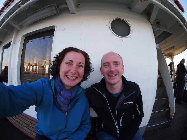
On he Bosphorus cruise ferryUs on the bench seats along the side of the cruise boat – we’d recommend bringing a cushion to soften the wooden seats!

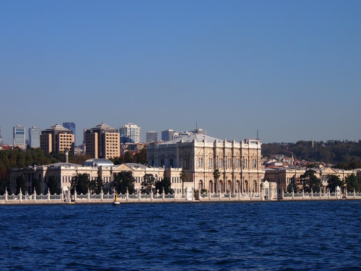
As the ferry sailed away from the city centre we soon passed the impressive Dolmabahçe Sarayı, a waterfront palace completed in the mid 19th century and used by most of the sultans after that date as their principal residence.

Dolmabahçe PalaceThe 284m façade of the Dolmabahçe Palace is a striking feature of the Bosphorus shore

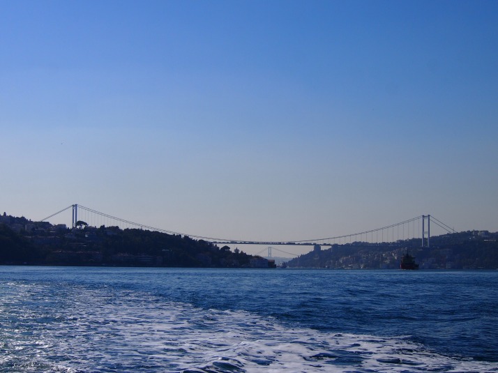
Shortly afterwards we passed under the first of the two suspension bridges which cross the straits. Built in 1973 the first one is rather straightforwardly called the Bosphorus Bridge. 5km further north, the second bridge, Fatih Mehmet Bridge, was opened in 1988 and crosses at the channel’s narrowest point, the same place where Persian king Darius I constructed a bridge of boats in 512BC to attack the Scythians. Today it’s mostly trucks and cars crossing rather than invading armies.

Bosphorus bridgesLooking down the Bosphorus with Fatih Mehmet Bridge in the foreground, underneath its span you can see one of the pillars of the Bosphorus Bridge

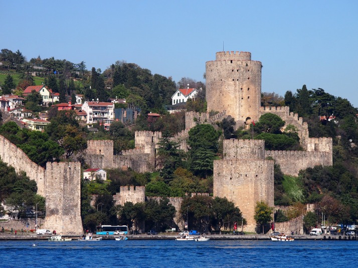
Just before the Fatih Mehmet Bridge is my favourite of the many fortresses which line the Bosphorus’ banks. Rumeli Hisarı was built by the Ottoman Sultan Fatih Mehmet in 1452, the year before he conquered Istanbul, with the aim of cutting off communication and possible aid to the city from the Black Sea. In cooperation with the smaller Anadolu Hisarı on the opposite shore it was successful in its objective. There are another pair of ancient fortresses further along, also standing opposite each other, as well as at least one modern military base.

Rumeli Hisari castleThe fortress at Rumeli Hisarı has three towers. The builders of the towers competed with each other to complete them with the utmost speed and at least one was erected in just four months!

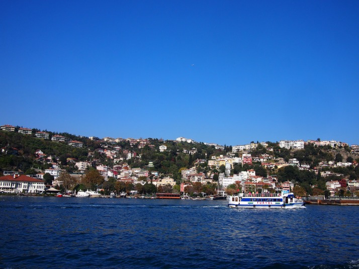
As the boat moved further from the city centre the villages started to appear more distinctly. The houses were perched on steep hillsides surrounded by forest and each village had a harbour.

Bosphorus villageKuruçeşme village sits between the two bridges

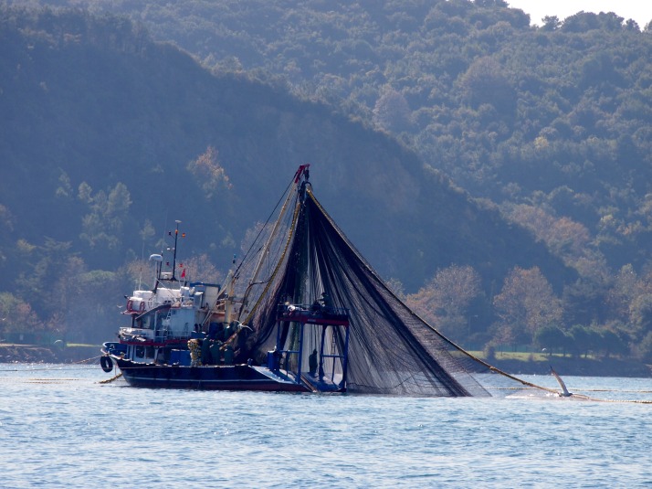
The straits are 30km long and range from 700m to 3.5km in width which sounds quite reasonable until you realise that they are a busy shipping channel with boats of all sizes, including massive container ships and oil tankers, making their way up and down. In the upper reaches we also saw a lot of fishing boats with their nets let out in a circle.

Bosphorus fishing boatFishing boat pulling in its net

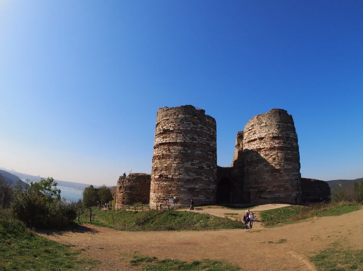
The one-way journey to the final stop at Anadolu Kavagi takes about 90 minutes. The ferry waits here for just under three hours allowing all passengers to disembark. Anadolu Kavagi is a small village bounded on the harbourside by a row of fish restaurants to service the many day trippers and overlooked by Yoros Castle. We ran the gauntlet past the restaurant touts and made the short climb up to the fortress.

Yoros CastleYoros Castle is ruined inside but its wall and towers stand

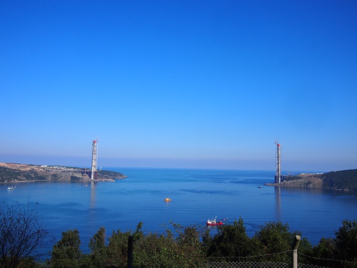
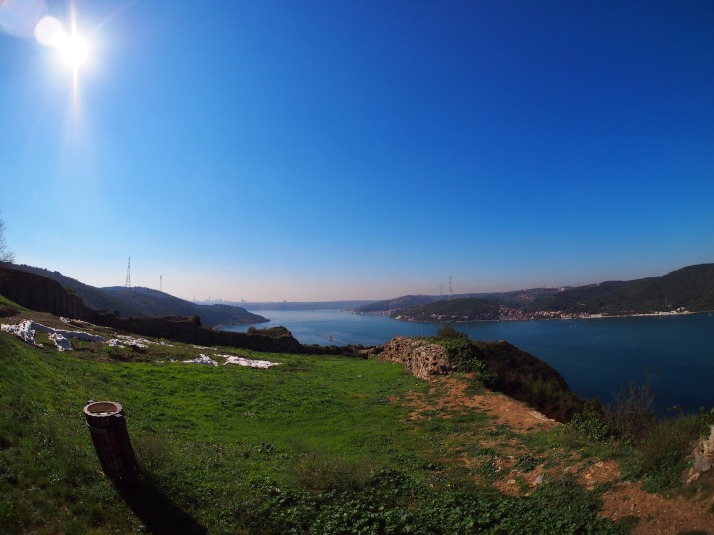
We visited on a bright and clear day and got good views in both directions. To the north is the opening into the Black Sea which is the site of a third bridge, currently under construction and the subject of some controversy due to environmental concerns including the loss of forests and wildlife corridors, as well as potential impacts from increased population migration to the already rapidly growing city. Looking to the south we could see the hills and inlets that we had just cruised by.

Construction of third Bosphorus bridgeView of the third bridge construction, it will be called the Yabuz Sultan Selim Bridge

View to the south from Yoros CastleView down the Bosphorus Straits from Yoros Castle

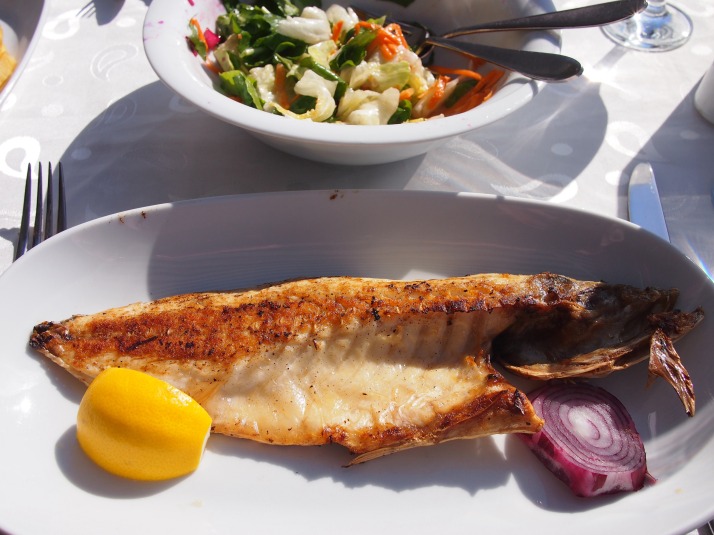
After descending from the castle we were ready for some lunch. We chose one of the seafront restaurants and ordered grilled fish and salad while we watched fish swim in the waters beside our table and gulls squawk at each other from their perches. It was delicious and reminded me of another, equally tasty lunch which I had beside the sea on my first visit to Turkey 16 years ago with my good friend and our occasional travelling companion Jo.

Grilled fish lunchGrilled fish for lunch

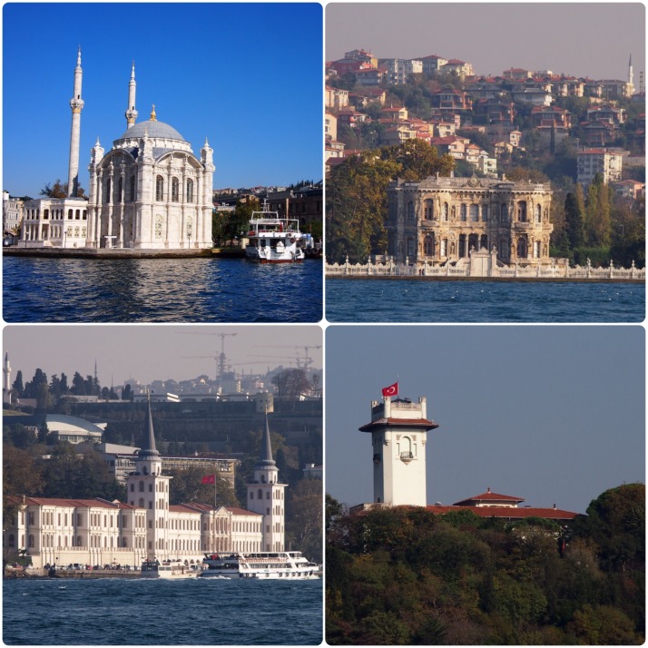
Boarding the ferry for the return journey, we managed to squeeze ourselves onto the port side bench seats once more, but this time we were facing the Asian shore. We again marvelled at some of the waterfront buildings; it obviously has been, and remains, a desirable place to live. There are beautiful mosques, old palaces and more modern looking mansions and hotels.

Waterfront buildingsImpressive buildings on the waterfront (clockwise from top left): Ortaköy Mosque; Küçüksu palace; tower of the palace of the Khedive of Egypt; Kuleli Officers Training College at Vaniköy

The cruise was a nice change of pace from the bustling city streets and a very pleasant way to spend the day for a very reasonable price – just ₺25 (about £7) each for the return journey and although the fish lunch was pricey there were cheaper options in town, or we could have packed a picnic to eat at the castle.

Cat Ba Island, Vietnam

This is a guest post from our good friend Jo who came out to tour Vietnam with us. Take it away, Jo..

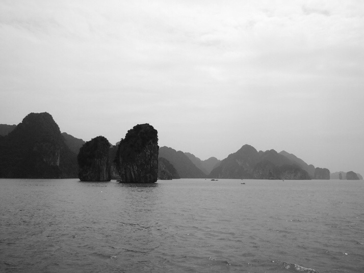
One of the things you’re Supposed To Do in Vietnam is Ha Long Bay, which has featured in several films – the one most people will probably have seen is Tomorrow Never Dies, that otherwise rather forgettable Brosnan Bond movie. It’s a vast area of tall karst (limestone) islands jutting out of the sea. It’s beautiful, and it attracts a lot of tourists. Every hotel in Hanoi advertises Ha Long tours and there are all sorts of options.

20131021-105838.jpgHa Long Bay

So we’d concluded, in doing our research, that we ought to see Ha Long Bay, but we were rather put off by the thought of hordes of tourists. However the ever-helpful Lonely Planet says that if you go to Cat Ba Island, you get to see pretty much the same scenery with far fewer people.

Cat Ba is reached through a long, but not too tedious, bus-bus-boat-bus trip which took about four hours. Our bus out of Hanoi was filled mainly with tourists, plus a few locals, and kept stopping as we left the city to cram yet more enormous parcels into the luggage lockers, deliveries for the city of Hai Phong. As we got into Hai Phong the bus stopped periodically for a very efficient off-loading of the goods. The whole thing was really well-organised, with only short waits as we transferred from one bus to another bus to the boat to another bus, and while long, it wasn’t at all tiring.

Hotpot and cannon

The town of Cat Ba is small, a bit developed and a bit touristy, but very quiet this time of year. After checking into the hostel we headed uphill for a view from Fort Cannon. Built in the 1940s by the Japanese it was then used by the French and Vietnamese. The view was a bit hazy and we felt the 50,000 dong (£1.47) charged for entry was a little steep, but we did have fun exploring the old bunkers and taking pictures of the cannon and old armament boxes.

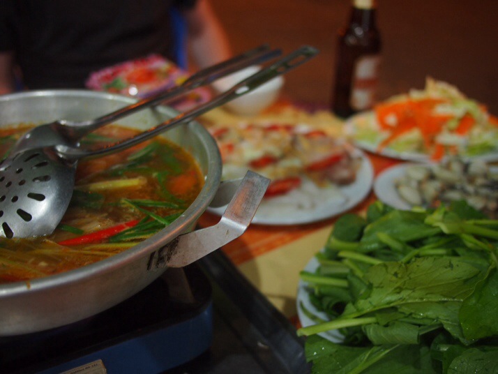
20131021-105821.jpgDelicious seafood hotpot

Dinner in town, after a beer by the seafront, was destined to be seafood hotpot. We caved when one of the restaurant owners who’d previously talked to Julie as we got off the bus gave us his patter, and we were glad we did. We got a dish of broth flavoured with lemongrass, ginger and spring onions, some packet dried noodles, a plate of water spinach, another plate of cabbage and carrot, a plate of clams and one of fish, squid and prawns. You cook the raw food in the hot broth as it bubbles away on a hotplate. It was utterly delicious, even when a small bug jumped out of the water spinach and committed suicide in the broth – anyway, by that point we were stuffed.

Lan Ha and Ha Long Bays

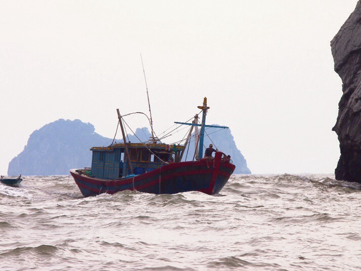
In the morning we were up early for our day’s tour out to Ha Long Bay and the closer Lan Ha Bay, which has much the same sort of formations. It was a windy day – further south, we later discovered, Central Vietnam was being battered by Typhoon Nari – but we got on the boat and chugged out into the harbour. Just before we exited, through a channel between two rocks, it was starting to get a bit rough and a couple of big waves came crashing over the open bows of the boat. The pilot promptly turned around and they called for a bigger boat.

20131021-105831.jpgFishing boat coming back through the channel

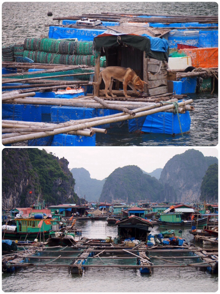
Once on board the bigger boat, our group of 20 spread out on the upper deck and off we went again. She rocked and rolled for about half an hour before it got calmer and more sheltered, and about that time the scenery went from “oh, that’s nice” to “wow”. We cruised through the karsts for perhaps two hours, past floating fishing villages and waving at passing fishermen, moving from Lan Ha to Ha Long.

20131021-105900.jpgFloating village scenes

The group was a mixed one; there were a couple of Yorkshire blokes, a nice English couple, some crazy Italians, a French and Israeli couple, two German lads and a young Vietnamese couple. The Vietnamese girl astounded me and Julie by appearing in properly high heels, though she had also managed to pack a bikini for the watery parts of the trip.

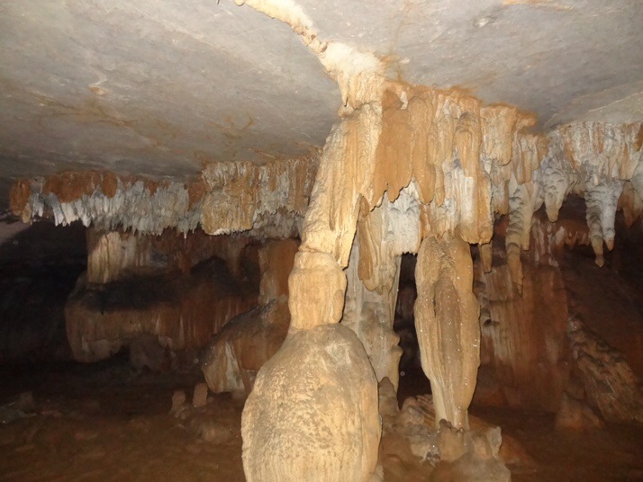
Just before lunch we pulled up – with a couple of tries – next to a karst island, and scrambled ashore into a cave in the middle of the rock. I would not recommend flipflops for caving, but there were some spectacular stalactites and stalagmites hidden in the darkness.

20131021-105844.jpgInside the cave

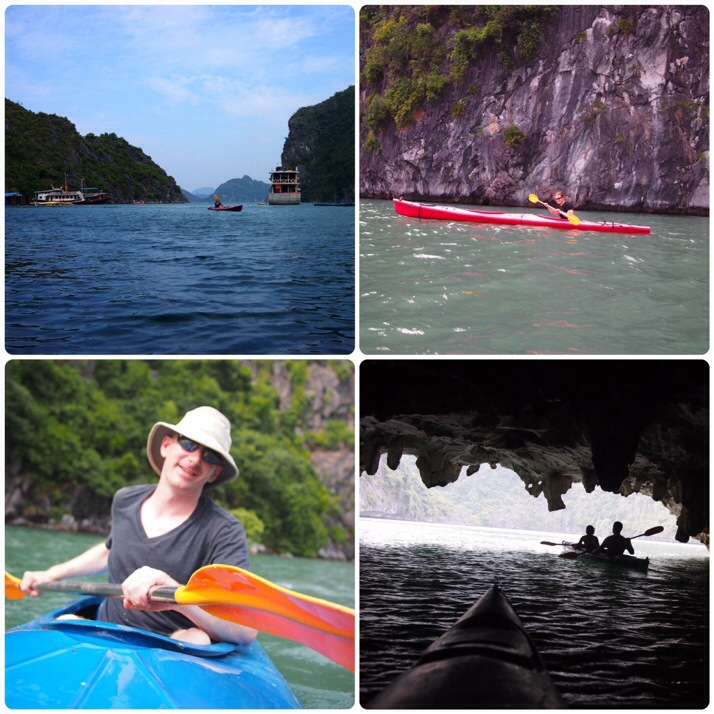
Lunch was a feast of rice, fish and some pretty good spring rolls. Shortly afterwards we got the chance to work it all off with a spot of kayaking. Sadly, they had no one-man kayaks so I had to manoeuvre a two-man by myself. We loved this bit of the day, kayaking through arches in the rock with bats squeaking over our heads. Then there was a swimming stop, where I failed to jump off the edge of the ship but Andrew, encouraged by one of the Yorkshire men, leapt off the very high stern into the warm green water.

20131021-105852.jpgKayaking!

We cruised home, happy, coming into port past an enormous floating village – a town, really, with canals separating the floating houses.

Scooting round Cat Ba

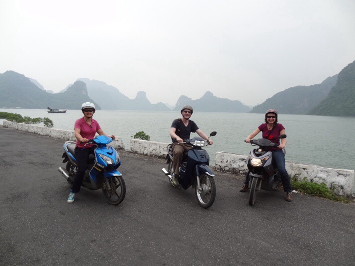
On day two the wind had got up even more. With most of the day to use up before the bus we planned to get back to Hanoi, we rented scooters for a tour of the island.

While Andrew has a proper bike licence and has ridden big motorbikes in the past, my scooter experience consists of tootling very slowly around Aitutaki in the Cook Islands a few years back, and Julie had never been on one before. It turned out we were basically borrowing people’s personal scooters – I had one which belonged to the hostel receptionist – which just added to the nerves. They spent a while showing us how to start and brake, and fiddling with the dodgy battery on mine, before waving us off.

Actually once we’d got through town and the random people stepping or turning out in front of us it was pretty easy riding, with the traffic predominantly two-wheeled save for the odd bus or truck. By the time we made our first stop Julie and I were feeling much more confident.

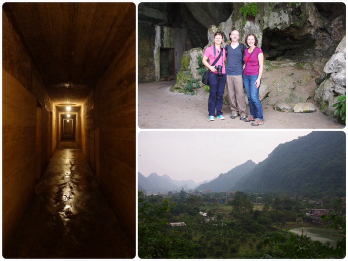
That stop was at Hospital Cave, built by the Vietnamese with help from China in the 1960s. It acted as a hospital and hide-out for the Vietnamese forces, and as well as a first-floor network of concrete bunker-like rooms there’s a huge second-floor cave, with space for a cinema and a small swimming pool, and a third floor we weren’t taken to by our guide. It was a bit bare and damp, but you can imagine the claustrophobia of being hidden away there from the American bombing.

20131021-105910.jpgInside and outside Hospital Cave

Then we continued on our way, doing a loop inland and then back along the coast, via ‘butterfly valley’ – in fact there are lots of stunning butterflies everywhere on Cat Ba, from small yellow and blue ones to enormous, velvety-black specimens. Sadly the really big ones never sat still for long enough to have their photograph taken.

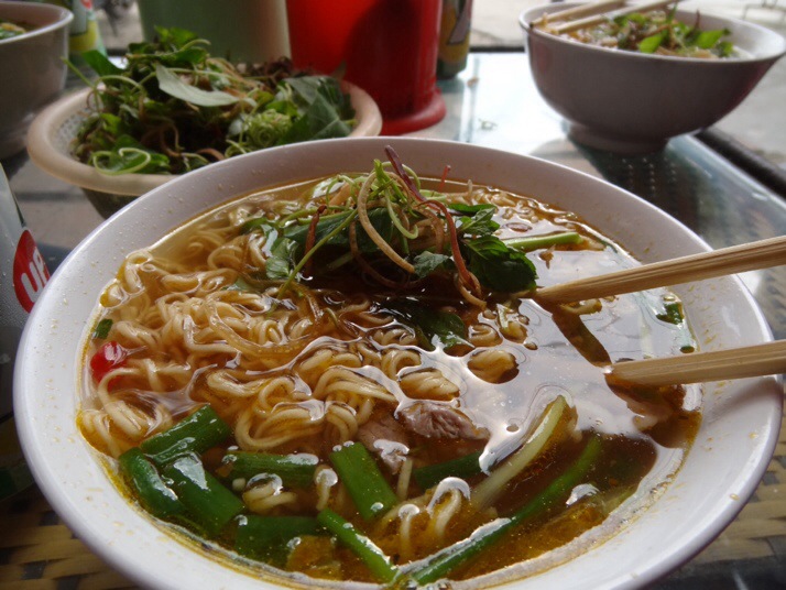
We stopped for lunch in a small village, randomly picking a place with a sign outside it. The family seemed a bit surprised at suddenly having three Western customers, but set to and delivered us three bowls of (instant) noodle soup with mystery meat and a bowl of the herbs you put in soups here. None of us could decide what the meat was; it was vaguely liver-y but also fatty.

20131021-105917.jpgInstant noodle soup

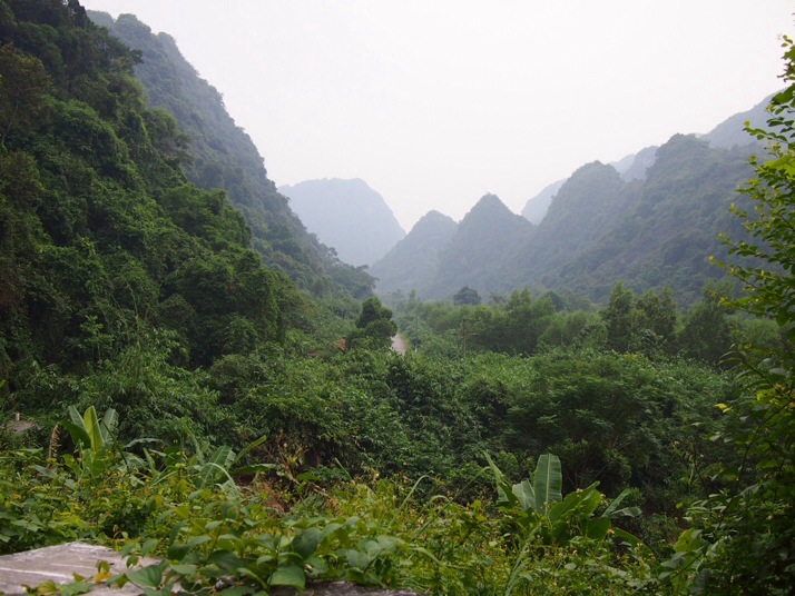
With a little more petrol in the tank (though not quite enough, I had to top up by buying a water bottle full on the way home) we decided to head back up our original road and then carry on north as far as that road went. It was a good idea – the scenery was stunning, through deep valleys of bush-covered karst, out to the sea at the end of the road.

20131021-105926.jpgThe road north

20131021-105935.jpgAt the end of the road

We ended our Cat Ba stay with another bus-boat-bus-bus combo, only this time with far more locals than tourists. The Haiphong – Hanoi leg was slightly crazy. We were ushered on to the bus at the side of the road without even being allowed to put bags in the luggage compartment, so we all piled bags on an empty double seat. But then more people got on. And more. The conductor pushed bags into laps and set out little plastic stools in the aisle, and at various points en route to Hanoi more people would get on and off. At journey’s end, we were nabbed by a taxi driver with a rigged meter who tried to charge us three times the going rate for the trip to the train station, and there we waited for the overnight to Dong Hoi. But that’s another blog.