Tag Archives: Museum

St John’s Co-Cathedral, Valletta

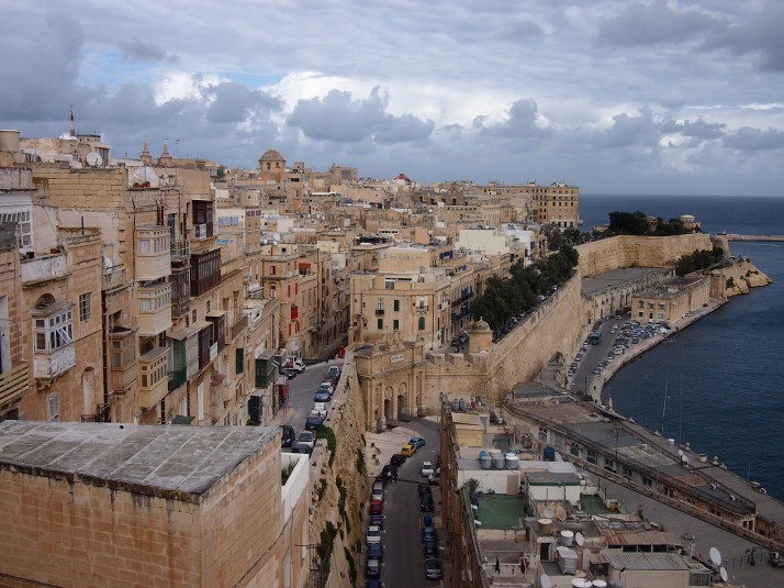
Like many of Europe’s medieval cities, Malta’s capital Valletta is fairly compact and surrounded by walls. Unlike most of the other cities which retain their walls e.g. York, Bruges, Tallinn, here the walls are not surrounded by modern city, because on three sides Valletta’s walls are bounded by the sea.

VallettaValletta’s southern walls meet the sea

The Knights Hospitaller, or Order of St John, was formed in the 11th century as a Christian military order. In 1530 they established themselves on Malta and ruled the island nation for 268 years until it was taken by Napoleon. In the centre of their fortified capital the Knights built St John’s Co-Cathedral, dedicated to the patron saint of their order. It is called Co-Cathedral as it has equal status on the island with St Paul’s Cathedral in the inland fortified city of Mdina, the seat of the Bishop of Malta, although this wasn’t the case until the 1820s.

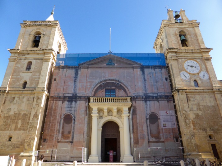
Exterior of St John's Co-CathedralThe exterior of St John’s Co-Cathedral is rather plain and currently undergoing restoration

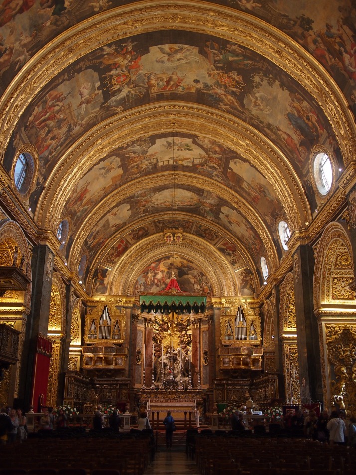
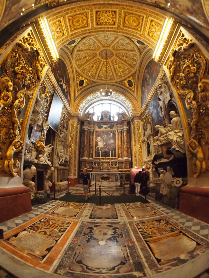
Inside, the cathedral is pretty much the exact opposite of its austere exterior and it seems that every surface is covered with some form of decoration. Whether painted, gilded, carved or inlaid it’s quite an assault on the eyes. The nave is barrel vaulted and each of the six ceiling bays contains three scenes from the life of St John painted by Mattia Preti, unusually using oil based paints directly on the stone.

Nave of St John's Co-CathedralThe spectacular nave with its painted ceiling

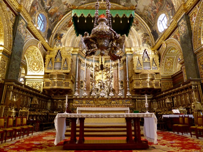
The High Altar is even more extravagant than the rest of the interior adorned with various gifts from Grand Masters and high-ranking knights who seem to have been trying to outdo each other by contributing rare marbles and exquisite carvings. The huge Sanctuary lamp hanging at the front of the space is made of solid silver!

High AltarThe High Altar is the centrepiece of the interior

Along each side of the nave are eight equally elaborately decorated chapels. The Knights were gathered from all across Europe and each of these chapels is dedicated to one of the ‘langues’ or places of origin. It was interesting to try to spot the details which tied the chapels back to the original country, for example, the double headed eagle emblem in the German chapel, or the fleur-de-lys in the French one.

Chapel of AragonChapel of Aragon; we weren’t sure exactly where Aragon was and were interested to find that it is an autonomous community in northern Spain

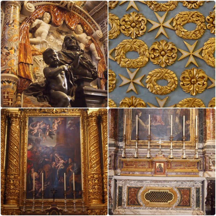
Each chapel has its own altar along with magnificent marble tombs of the langue’s distinguished knights.

Chapel detailsChapel details (clockwise from top left): tomb in the French Chapel; even the ‘plain’ walls are covered with gilded carvings; altar in the Italian Chapel; Spanish Chapel altarpiece

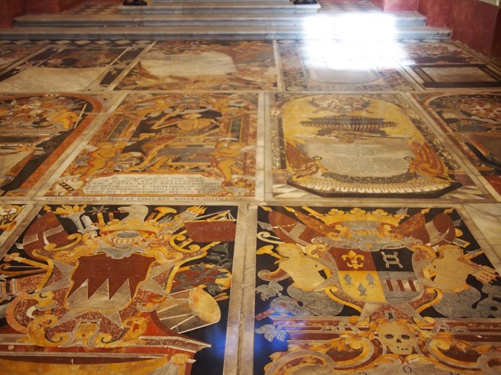
Of all the Cathedral’s magnificence, for us the highlight was definitely the floor. It’s completely made up of gravestones, and not just normal grey gravestones with carved inscriptions, these are brightly coloured pictures often containing crests, weaponry and skeletons as well as an inscription, all made up of inlaid marble in an amazing variety of colours.

Inlaid marble floorInlaid marble gravestones cover the floor of St John’s Co-Cathedral

The audio guide route ends with the cathedral’s museum. In the first room of which, the Oratory, are two paintings by Caravaggio. Caravaggio seems to have been quite a troubled figure, he was quite famous in Rome during his lifetime but was forced to flee after killing a man in a brawl. Arriving in Malta he became a knight and carried out several commissions on the island before landing in prison again, this time for injuring a fellow knight in a fight. The two works in the Oratory are dramatic and show his innovative use of light to illuminate the central figures while leaving much of the scene in darkness.

Caravaggio's Beheading of St John the Baptist
‘The Beheading of St John the Baptist’ by Caravaggio [photo credit: St John’s Co-Cathedral]

The rest of the museum is devoted to the set of enormous 17th century Flemish tapestries which are hung in the nave for special occasions (e.g. when the Pope visited), several beautiful illuminated choral books, various items of ecclesiastical clothing and a few paintings.

We spent a couple of hours exploring the cathedral and trying to take in all of the artwork and spot details (like an elephant on one of the gravestones). In contrast, we saw several groups from the cruise ships which dock in Malta being led in by their guide, doing a quick circuit around the nave and exiting through the gift shop. It seems a shame that they miss out on so much of this showcase of the Knights’ splendour.

Megalithic Malta: A walk along Dingli Cliffs to prehistoric temples

Sitting in the Mediterranean Sea closer to Sicily in the North than Libya and Tunisia to the south, Malta has had a surprisingly long and eventful history for such a tiny landmass of only 315km2 (112 square miles).

Despite its small size, or perhaps because of it, Malta is the 3rd most densely populated country or sovereign state in Europe (after Monaco and Gibraltar) and 8th most in the world – though it magically maintains a desolate, isolated feel as we found out on our first stroll along a section of its south-western coastline.

The walk: Dingli, Fawwara, and Wied iż-Żurrieq

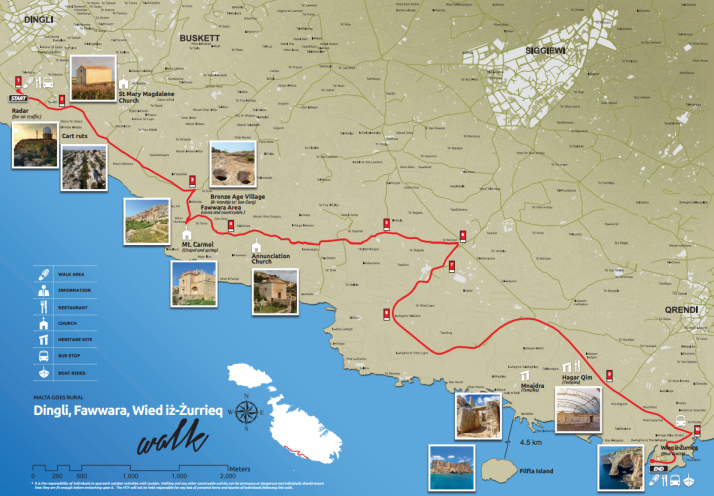
Map of the Dingli Cliffs walk. Source: Malta Tourism Authority

The map of the Dingli Cliffs walk. The Malta Tourism Authority helpfully provide paper versions in all of the Tourist Information offices (including the airport), and online in PDF format too. Source: Malta Tourism Authority

Looking at the map we thought we were in for a long stroll, until we remembered that the entire coastline of Malta is only 196.8km (122 miles) which means this walk is an easy 11.2km, or about 7 miles.

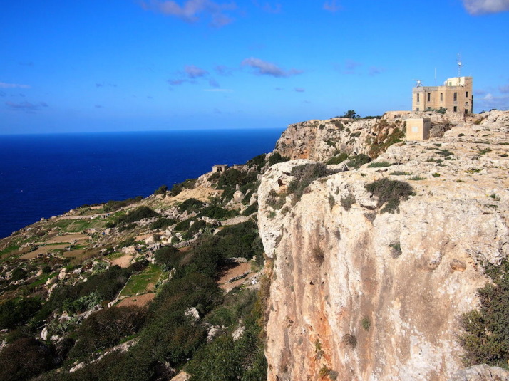
Looking back towards the start of the walk at Dingli Cliffs. Not bad for a day in November

Looking back towards the start of the walk at Dingli Cliffs. Not bad for a day in November

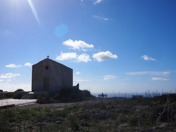
Just past a couple of radar stations at the highest point of the island, we arrived at St Mary Magdalene Church, an isolated, simple place of worship teetering on the cliff edge.

St Mary Magdalene Church on the edge of Dingli Cliffs

Tranquil reflection at St Mary Magdalene Church on the edge of Dingli Cliffs

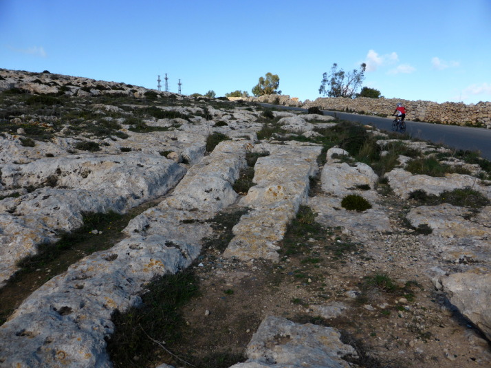
Described as 'Cart Ruts', these man-made grooves in the garigue weren't actually created by carts - the truth is we just don't know how or why they were made!

Described as ‘Cart Ruts’, these man-made grooves in the garigue weren’t actually created by carts – the truth is no-one knows how or why they were made!

From the roadside path it looked like a sheer drop into the Mediterranean from the rocky edge, but when we ventured closer we found that while there was a drop that would probably sting a little bit, there’s a second terraced plateau with yet another sizeable drop-off before the sea. Most of this was given over to agriculture, with the odd house or church between the fields.

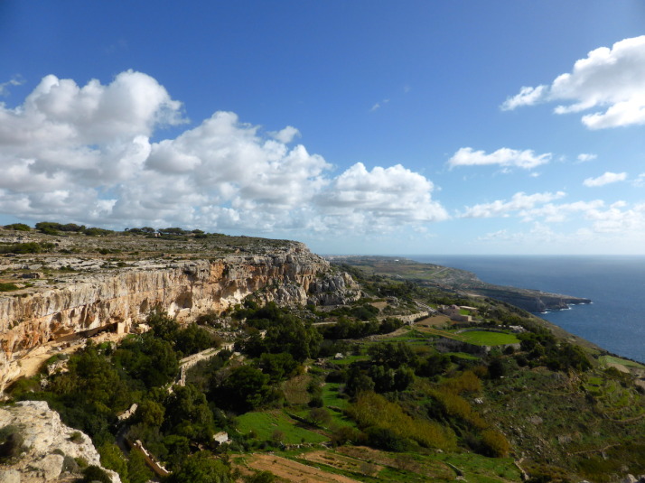
Looking south over the cultivated fields of Fawwara from a Bronze Age village site that juts out almost to the sea

Looking south over the cultivated fields of Fawwara from a Bronze Age village site that juts out almost to the sea

According to the map, there’s an old Bronze Age village site at Fawwara but all that we could discern from the remains was its natural vantage point that extends out from the cliffs almost to the sea, commanding amazing views up and down the coastline.

From here we descended to the lower plateau and continued south to within a kilometre or two of the end where we stopped at Ħaġar Qim and Mnajdra – 2 prehistoric temple sites and outdoor museum..

Megalithic Malta: The temples of Ħaġar Qim and Mnajdra

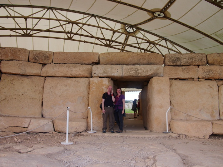
Us at the entrance to Hagar Qim, the 5,000 year-old monolithic temples. I'm listening to the audioguide which poses more questions about the site and its purpose than it answers

Us at the entrance to Ħaġar Qim, the 5,000 year-old megalithic temples. I’m listening to the audioguide which poses more questions about the site and its purpose than it answers

Before we explored the remains of the temples, we wandered through the small but excellent museum, which, given how little is known about the origins of these temples and the peoples that built them, is mostly given over to how we think they were built, how they were rediscovered, and how they’re being preserved.

Here’s a short excerpt from the museum’s guide:

“The prehistoric site of Ħaġar Qim consists of a group of monumental megalithic buildings. These were built during the late Neolithic, around 5,000 years ago. Similar buildings have been found in more than twenty different places in Malta and Gozo. Today these buildings are usually called “temples”. However we know very little about what went on inside them.” – Ħaġar Qim Temples, a brief guide, Heritage Malta

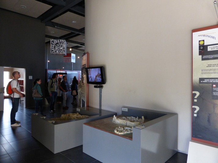
Inside the museum. The 2 models  show how the temples are aligned with the equinoxes and solstices

Inside the museum. The 2 models show how the temples are aligned with the equinoxes and solstices

The museum includes a 10 minute “4D” introduction video experience – the 4th dimension being blasts of cold air and scented water droplets – alongside the 3D visuals that imagine the construction through to the present day ruins. It was well done and the visuals were good as they show the temples against the landscape, which isn’t possible to see anymore because there’s now a giant protective tent over each temple shielding the stone from the elements.

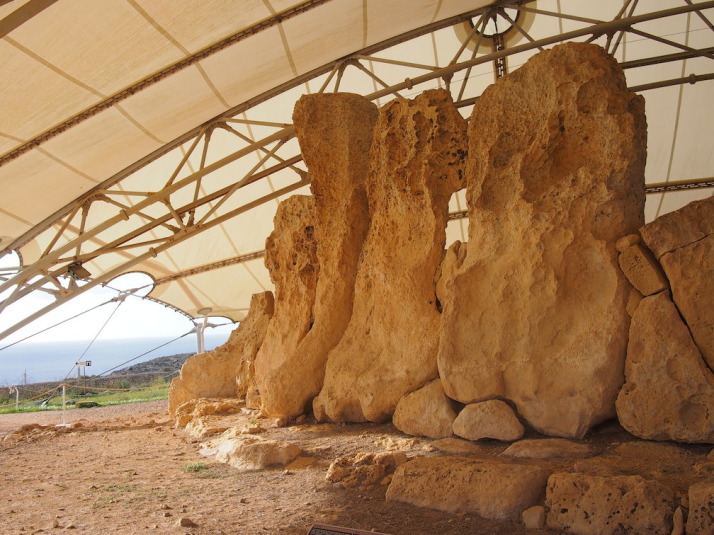
Some of the stones used in the construction are simply massive, and reminded us of Stone Henge back home

Some of the stones used in the construction are simply massive, and reminded us of Stonehenge back in England

Ħaġar Qim is the first of two temple sites and is the more impressive for its relative completeness – it’s more compact and the walls are still standing tall. We enjoyed wandering through the ruins, though some sections are roped off we were still surprised how accessible they were. The audioguide was only €2 more and is good for pointing out the most interesting aspects of the construction, but almost every clip ends with a “what do you think this was for?” or “why do you think this is here?” which left us with more questions than answers!

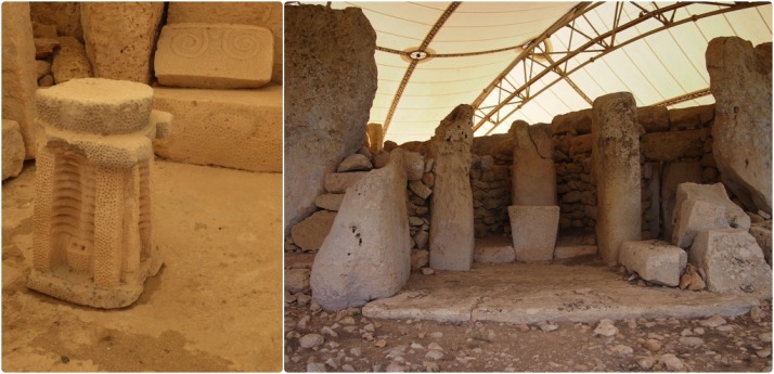
Details of Hagar Qim: relief sculptures found during excavations include altar pieces and decorative stone carvings; One of the many altars of the temple but the only one open to the outside

Details of Ħaġar Qim: relief sculptures found during excavations include altar pieces and decorative stone carvings; One of the many altars of the temple but the only one open to the outside

500 metres down the hillside and closer to the cliffs is the 2nd megalithic temple site of Mnajdra, a much larger set of ruins and in a worse state of repair than Ħaġar Qim.

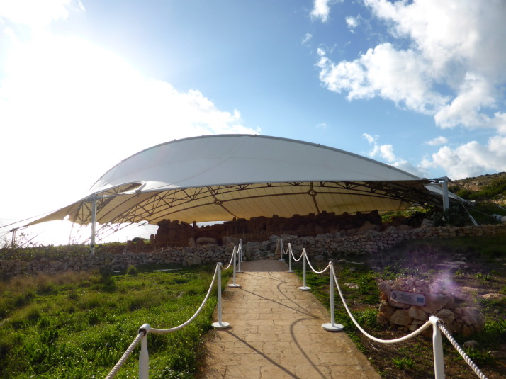
The approach to the Mnajdra Temples, these too are protected from the rain and the sun by a giant tent

The approach to the Mnajdra Temples, these too are protected from the rain and the sun by a giant tent

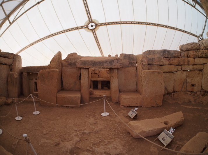
Mnajdra is actually a complex of 3 buildings..

“The first and oldest structure is the small three-apsed temple (on the right), built in the Ġgantija Phase, around 3,600-3,200BC. The South Temple (on the left), with its concave facade was next to be completed early in the Tarxien Phase, shortly after 3,000BC, followed by the Central Temple which was built on an artificial platform between the two earlier buildings.

The South Temple at Mnajdra was built in such a way that its main doorway is aligned with sunrise during the spring and autumn equinoxes (30th March and 22nd September). During the winter and summer solstices (21st June and 21st December) the beams of the rising sun pass along the sides of the main doorway hitting two decorated slabs within the first chamber.” – Mnajdra Temples, a brief guide, Heritage Malta

Inside the first chamber of Mnajdra's South Temple - during the equinoxes and solstices the sunrise hits the blocks either side of this doorway, again reminding us of Stonehenge. Wow!

Inside the first chamber of Mnajdra’s South Temple – during the equinoxes and solstices the sunrise hits the blocks either side of this doorway, again reminding us of Stonehenge. Wow!

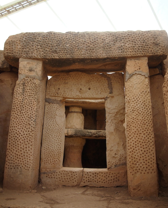
The beautiful pitted decoration of another doorway in the South Temple

The beautiful pitted decoration of another doorway in the South Temple

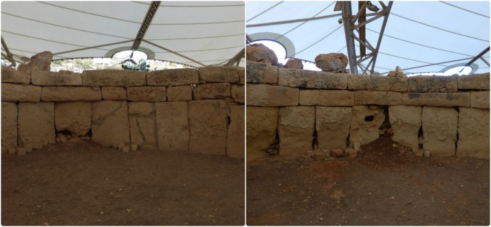
We liked the different levels and scale of these three very different temples which at first glance just looked like one giant building. The middle temple has the most dramatic example of erosion we’ve seen – the north side of the room shows some damage but the south side is almost completely eroded. I’d have thought they’d have been equally damaged because they’d have received equal rainfall, but the museum explained that it’s the sun that does the most damage!

The north facing wall (left) of the Central Temple is in relatively good condition, but the lower south facing stones (right) of the same room have almost completely eroded. Most surprisingly for me was that the heat of the midday sun has done the most damage

The north facing wall (left) of the Central Temple is in relatively good condition, but the lower south facing stones (right) of the same room have almost completely eroded. Most surprisingly for me was that the heat of the midday sun has done the most damage

From the museum there was a final downhill stretch to the tiny fishing village of Wied iż-Żurrieq (which we have no idea how to pronounce!), where we watched the sun set while we waited for our bus back to the other side of the island.

The sun sets on our first day of strolling through the countryside and history of the tiny island of Malta

The sun sets on our first day of strolling through the countryside and history of the tiny island of Malta

We really enjoyed the feeling of remoteness; to walk so closely to the cliff edge with the deep blue Mediterranean stretching out to the horizon on one side, and a view across the island to the Mediterranean on the other, made Malta feel really small. It’s a very easy walk too, it starts near the highest point of the island which means it’s pretty much all downhill!

Haghia Sophia and the Basilica Cistern

As we knew Julie’s sister and family were coming out to join us, we held off visiting two of the best and most exciting sites in Istanbul so we could experience them with Steph, Tom and two-year-old son Oliver.

Haghia Sophia

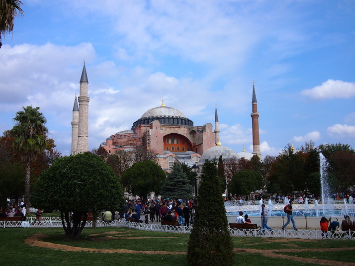
Haghia Sophia, probably the most impressive historical sight, and the second most visited museum in Istanbul

Haghia Sophia – built as an orthodox cathedral in 537, had a brief 57 year stint as a roman catholic church starting in 1204, converted to a mosque in 1453 and finally a museum in 1935

Nearly 1500 years old, Haghia Sophia has seen the pinnacle of the Byzantine and Ottoman periods, held the title of the largest cathedral in the world for a thousand years, and has dominated the Istanbul skyline of the First Hill since it was completed in 537.

The present Haghia Sophia is the 3rd church of that name to have been built on the site, the first two burnt down during separate riots; the first one in 404, and the second in 532. This 3rd one, completed in 537 was rebuilt on the order of Justinian, who envisioned it on an even grander scale than those before.

Haghia Sophia was an Eastern Orthodox cathedral and the seat of the Patriarchate of Constantinople, except for a brief period between 1204 and 1261 when it was converted to a Roman Catholic cathedral under the Latin Empire. When Sultan Mehmet II took Constantinople in 1453 he converted it to a mosque, and in 1931 the doors closed for worship, opening 4 years later in as a museum in 1935.

The entrance walks you past excavated remains of the previous structure on this site - the Theodosian Haghia Sophia built in the 5th century which burnt down during the Nika Revolt in AD 532

The entrance walks you past excavated remains of the previous structure on this site – the Theodosian Haghia Sophia built in the 5th century which burnt down during the Nika Revolt in AD 532

Haghia Sophia is a massive building that, when we first saw it, we wondered what all the fuss was about because, well, I’ll just say it; it’s not very attractive to look at. The intricate dome looks like it has been dropped on some hulking, unfinished, fortress-like structure. It’s only when we learnt that the unsightly rose coloured buttresses were added in 1317 to prevent the weight of the dome from pushing the walls out and causing the whole thing to collapse, that we could start to see the building without its protective concrete corset.

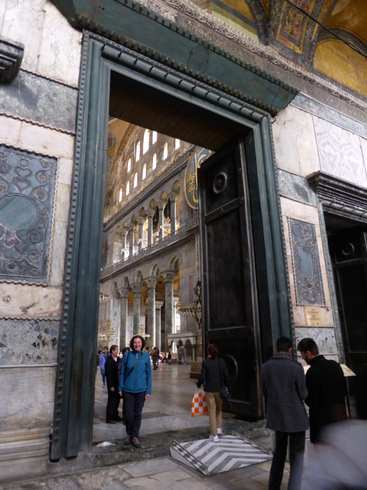
The entrance to Haghia Sophia is through one of the 5 western doors into the exonarthex. The massive central largest door on the left was known as Orea Porta or the Beautiful Gate and was reserved for the Emperor

The entrance to Haghia Sophia is through one of the 5 western doors into the exonarthex. The massive central door on the left was known as Orea Porta or the Beautiful Gate and was reserved for the Emperor

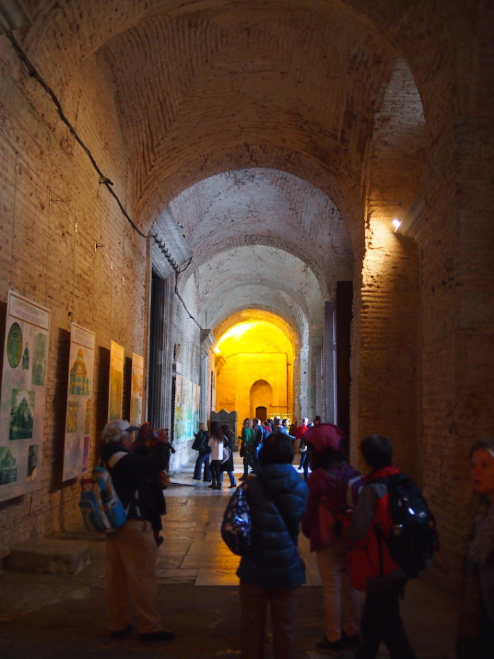
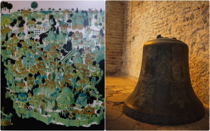
There are two narrow narthexes (or porches) which mark the entrance to the Haghia Sophia. The first one is quite plain and giant posters give an extremely brief summary of the building’s history, though one of them does show a nice illustration of ‘Constantinopolis’ when the Hippodrome still existed.

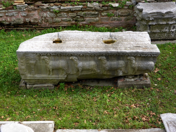
This exonarthex also has a few artefacts on display such as a large bronze Christian bell and a sarcophagus believed to belong to Empress Eirene, wife of Emperor John II (r. 1118 to 1143).

Our favourite of the displays in the exonarthex, an illustration of Constantinopolis that shows Haghia Sophia as a Christian church, the Hippodrome and the aquaduct surrounded by the Theodosian walls; and the bronze bell with Greek inscriptions and Christian crosses

Our favourite of the displays in the exonarthex, an illustration of Constantinopolis that shows Haghia Sophia in its original Orthodox Christian church for (bottom centre), the Hippodrome and the aqueduct, and the city surrounded by the Theodosian walls; the bronze bell with Greek inscriptions and Christian crosses

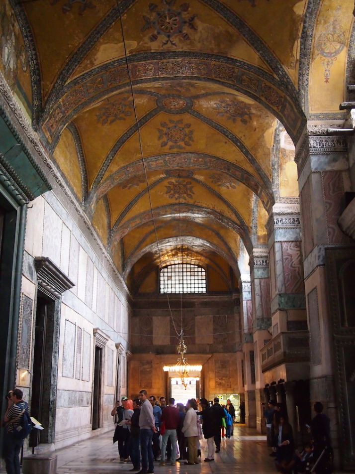
From the exonarthex we passed through the Emperor’s Beautiful Gate and into the narthex, which gave us the best impression of what the newly completed Haghia Sophia would have looked like – according to records, the ceiling of the entire church was covered in gold mosaic tiles and geometric and floral designs, an area of more than 4 square acres – that’s over 16,000m2 or about 2½ football pitches!

This amazing ceiling was rediscovered in 1933. When it was converted to a mosque the mosaics were plastered over - thank goodness they weren't destroyed

This amazing ceiling was rediscovered in 1933. When it was converted to a mosque the mosaics were plastered over – thank goodness they weren’t destroyed

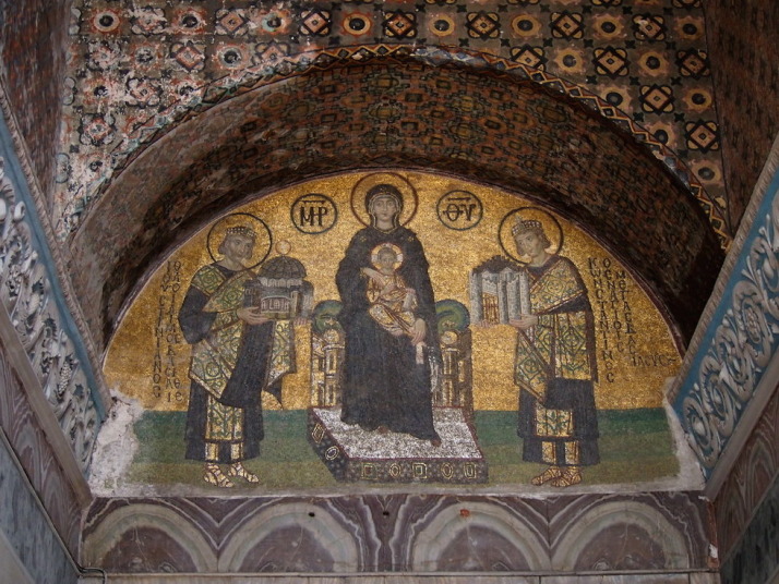
At the end of the narthex is a small corridor known in Byzantine times as the Vestibule of Warriors which is now the public exit, and hung above the bronze-clad doors is a giant mirror so you don’t miss another golden mosaic they found under the plaster and whitewash in 1933..

Mosaic of the Mother of God holding the Christ Child and flanked by Constantine the Great on the left offering a model of Constantinople, and Justinian on the right offering a model Haghia Sophia

Mosaic of the Mother of God holding the Christ Child and flanked by Constantine the Great on the right offering a model of Constantinople, and Justinian on the left offering a model Haghia Sophia

We backtracked into the narthex and stepped through the Imperial Gate into the vast open nave..

Julie standing in the Imperial Gate - the Emperor's door from the narthex into the nave of church. Just how big were these Emperors?!

Julie standing in the Imperial Gate – the Emperor’s door from the narthex into the nave of church. Just how big were these Emperors?!

To borrow our word from Uzbekistan.. Wow.

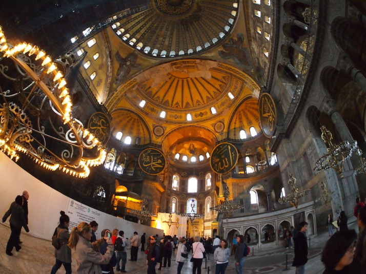
Wow. Standing in the nave is to be dwarfed by the sheer scale of the space and mighty 31.24 diameter dome whose crown is 56 metres from the floor - that's a 15 storey building!

Wow. Standing in the nave is to be dwarfed by the sheer scale of the space and the mighty dome

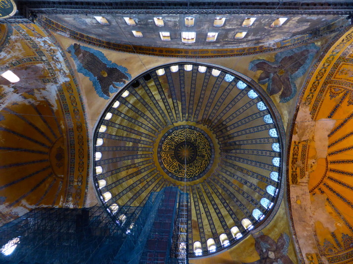
Even the size of the Emperor’s gates just didn’t prepare us for the sheer scale and architectural achievement of Haghia Sophia. The effect is a huge, almost square open space uncluttered by supporting columns, that stretches so high that the size of the dome is nearly lost as an optical illusion. The crown of the dome is 56 metres from the floor – the equivalent of a 15 storey building!!

The dominating dome of Haghia Sophia

The dominating dome of Haghia Sophia

We took our time to explore this resplendent, religiously repurposed super-structure. The Islamic adornments seemed both at home with their extravagant design, but at the same time looked temporary, a bit like birthday party decorations. I guess that’s because the restoration has uncovered the Christian mosaics which makes the museum theologically schizophrenic.

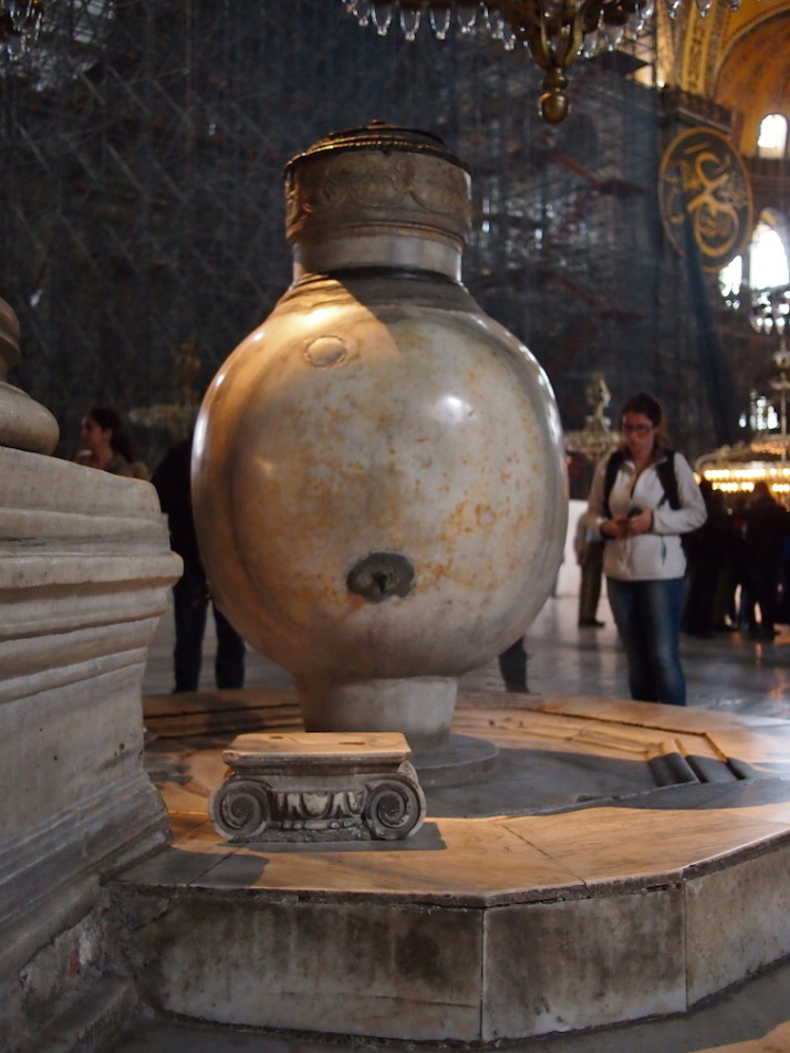
In the nave we loved the mighty marble supporting columns so cleverly engineered to maximise the space which make the dome appear almost unsupported. Also the two lustration (ritual purification) urns either side of the entrance that are hewn from single blocks of marble.

One o f the two huge marble lustration (ritual purification) urns that were brought from Pergamon during the reign of Sultan Murad III (r. 1574 to 1595)

One of the two huge marble lustration urns that were brought from Pergamon during the reign of Sultan Murad III (r. 1574 to 1595)

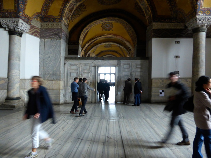
After turning our thumb through 360° in the hole on the weeping column which is believed to cure many illnesses, we headed upstairs to the galleries. A few more golden mosaics have been rediscovered along the galleries, but we liked the Marble Door, and the view past the türbes outside to Sultan Ahmet Camii or The Blue Mosque

The Marble Door. We're not sure if the name comes from the door in the middle, or that either side are double-doors representing Heaven and Hell

The Marble Door. We’re not sure if the name comes from the door in the middle, or that either side are double-doors representing Heaven and Hell

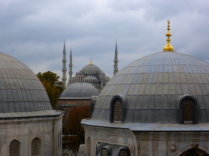
Sultan Ahmet Camii (The Blue Mosque) in the background, past the domes of 3 of the Turbes in the grounds of Haghia Sophia

Sultan Ahmet Camii (The Blue Mosque) in the background, past the domes of 3 of the türbes in the grounds of Haghia Sophia

Despite the lacklustre first impression, we really enjoyed exploring the expansive Haghia Sophia. Describing it as a museum doesn’t really set the right expectations either, as there isn’t a lot of information about it inside – this is one of those places that the more you read about it the more impressive it becomes, and the more you understand the reverence in which it is held.

Basilica Cistern

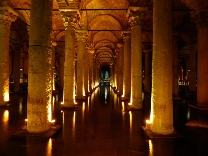
The Basilica Cistern, 9,800m<sup>2</sup> in size, can hold 80,000 cubic metres (2,800,000 cu ft) of water, and was forgotten for nearly a hundred years!

The Basilica Cistern, 9,800m2 in size, can hold 80,000 cubic metres (2,800,000 cu ft) of water, and was forgotten for nearly a hundred years!

When we were researching what to see and do in Istanbul, we read the almost incredulous story of the rediscovery of the Basilica Cistern. To quote our guidebook..

The structure was known in Byzantium as the Basilica Cistern because is lay underneath the Stoa Basilica, the second of the two great squares on the First Hill. The Basilica Cistern was built by Justinian after the Nika Revolt in 532, possibly as an enlargement of an earlier cistern of Constantine. Throughout the Byzantine period the Basilica Cistern was used to store water for the Great Palace and the other buildings on the First Hill, and after the Conquest its waters were used for the gardens of Topkai Sarayi. Nevertheless, general knowledge of the cistern’s existence seems to have been lost in the century after the Conquest, and it was not rediscovered until 1546. In that year Petrus Gyllius, while engaged in his study of the surviving Byzantine antiquities in the city, learned that the people in this neighbourhood obtained water by lowering buckets through holes in their basement floors’ some even cause fish from there. Gyllius made a through search through the neighbourhood and finally found a house through whose basement he could go down into the cistern, probably at the spot where the modern entrance is located. – Strolling Through Istanbul (p135)

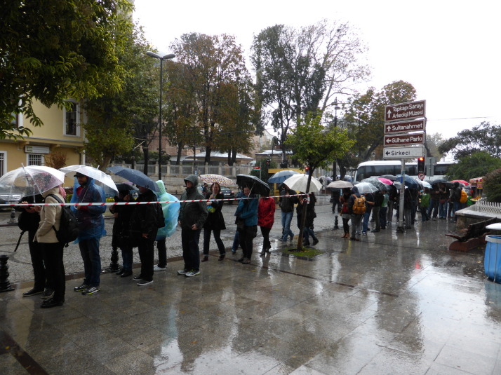
Steph and Julie queueing in the howling, miserable rain while Tom and I look after Olly in the shelter of the modern entrance. Perfect weather for going underground..

Steph and Julie queueing in the howling, miserable rain while Tom and I look after Olly in the shelter of the modern entrance. Perfect weather for going underground..

Descending 100m into the cistern, we were greeted by rows upon rows of marble columns, now standing in a reservoir of about half a metre of water. And yes, there are still plenty of fish, their ghostly shadows cast by the uplight against the pillars. People take food down there for them, and as I guess they’re no longer caught, there are some monsters lurking under the walkways!

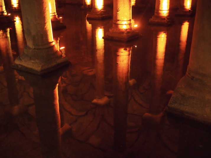
When the fish weren't around the reflections of the columns and the vaulted ceiling where lovely

When the fish weren’t around the reflections of the columns and the vaulted ceiling where lovely

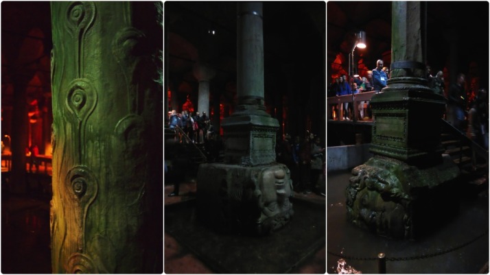
Besides the spectacle of the cistern itself, there are 3 columns to look out for along the route. The first is a column repurposed from the now long gone Triumphal Gate of the Forum of Theodosius I – the distinctive peacock eye relief stands out against all of the other smooth columns.

The second and third are two ancient classical bases that can breathe after centuries underwater. These are depictions of Gorgons, which in Greek mythology are 3 sisters, one of whom you’ll undoubtedly have heard of – Medusa – and indeed she is touted as one of the heads, though according to the legend all three sisters had hair made of living, venomous snakes.

Column details in the Basilica Cistern, from left to right: Supporting column originally from the triumphal arch in the Forum of Theodosius I; The Medusa head Gorgon base which is inverted because it is said to negate the power of the gaze; The second Medusa base, this one rotated which also counts as a negating strategy

Column details in the Basilica Cistern, from left to right: Supporting column originally from the triumphal arch in the Forum of Theodosius I; The Medusa head Gorgon base which is inverted because it is said to negate the power of the gaze; The second Medusa base, this one rotated which also counts as a negating strategy

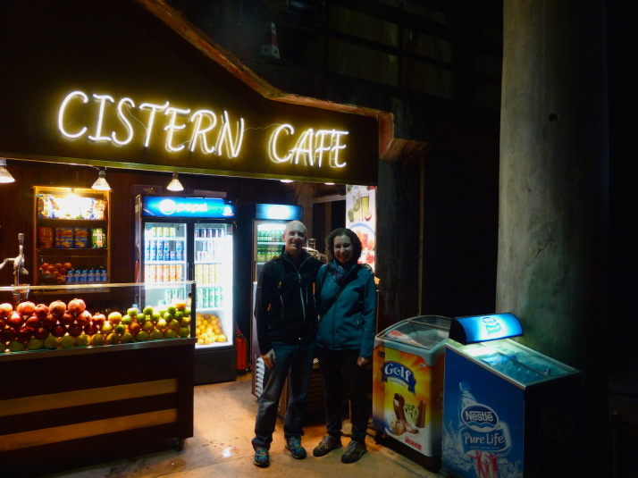
Like Haghia Sophia, we really enjoyed the Basilica Cistern (and dodging the awful weather outside was a bonus!) – they’re both larger than we thought they’d would be, even having read about them before we visited. Indeed, the Basilica Cistern even has a small cafe!

Us at the Cistern Cafe in the Basilica Cistern. We didn't buy anything but the coffee smelled good

Us at the Cistern Cafe in the Basilica Cistern. We didn’t buy anything but the coffee smelled good

Along the Land Walls to the Chora Church

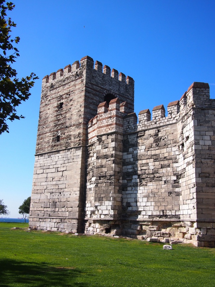
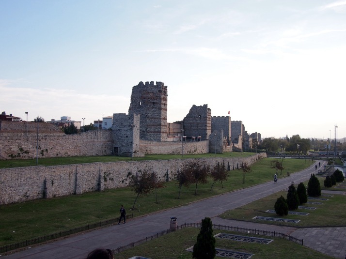
Having explored a section of ancient Istanbul’s sea walls we thought it would be interesting to take a look at the city’s land defences. Running for approximately 6.5km from the Sea of Marmara to the Golden Horn, the Byzantine land walls complete the defences which made Constantinople, as it then was, such a secure place, invulnerable to invasion for centuries. They were initially built in AD413 but an intense earthquake in 447 caused considerable damage and, as Atilla the Hun was advancing on the city, the repairs needed to be speedy. Constantine, the Prefect at that time, threw all of the city’s resources at the task and managed to complete the job in just two months with improvements in the form of an outer wall and moat. Impressive indeed and successful in holding back Atilla.

The Marble TowerThe Marble Tower was the point where the sea walls joined the land walls

We started out from the Sea of Marmara coast at the Marble Tower, so called because its lower half is faced in marble. This structure was the joining point between the sea and land walls although nowadays it is disconnected from both by a busy road. We had a scramble behind the tower and poked about in the remains of its rooms, now being used by some of the city’s homeless for shelter.

Istanbul's Land WallsThe land walls form an imposing landmark in this part of the city

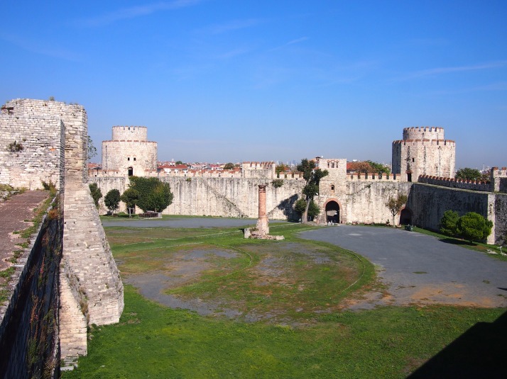
After about 400m walk alongside the wall we came to Yedikule, literally ‘Seven Towers’, a castle within, and a part of, the walls. After the Conquest, the Ottomans built three additional towers and an enclosing wall inside one of the gates of the land wall. The castle was not used for military purposes but partly as a prison and partly as storage for the State Treasury. The tumbledown minaret of a small mosque still stands in the centre of the courtyard.

Inside Yedikule fortressThe interior of Yedikule castle seen from its walls

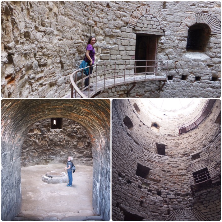
We were able to climb inside some of Yedikule’s towers as well as around its wall, admiring the sturdy construction and getting good views out to the sea and over the city. We even spotted some of the city’s landmark buildings – Haghia Sophia, the Blue Mosque and the Süleymaniye Mosque.

Exploring one of the towers of the Yedikule fortressExploring the Tower of Ambassadors in Yedikule, once used as a prison for foreign envoys

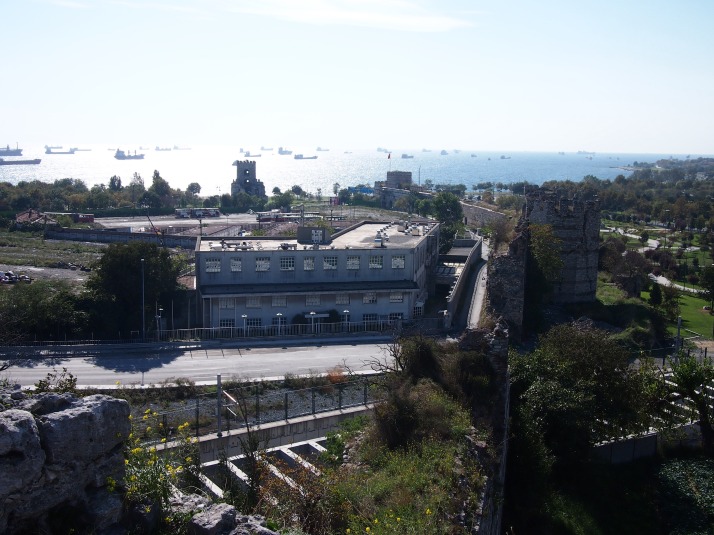
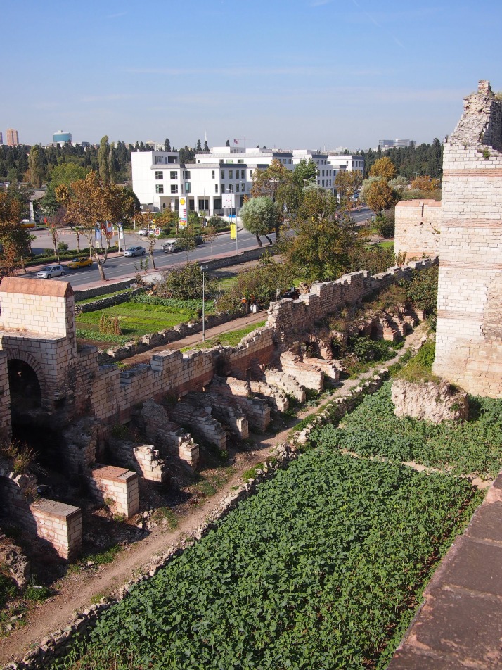
View down the land walls to Sea of MarmaraLooking from the top of the walls of Yedikule along the land walls to the Sea of Marmara. The Marble Tower can be seen beside the sea in the centre left of the photo.

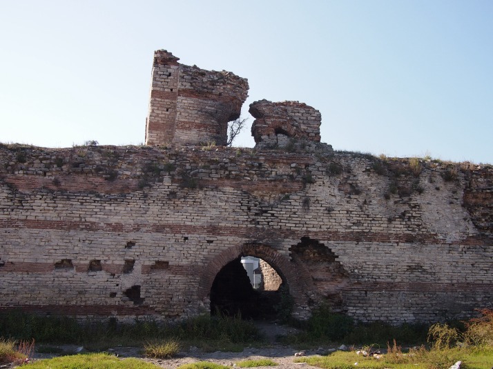
Moving on we found that although some sections of the wall have been restored so that you can walk along them, much of it is crumbling and even if it is possible to walk along the top there are not good ways to get up and down so for the most part we were following small streets as close to the wall as we could get.

Unrestored section of land wallsUnrestored tower in the land walls

Vegetable gardens between the inner and outer wallAlong the outside of a lot of the wall we saw allotments and vegetable gardens

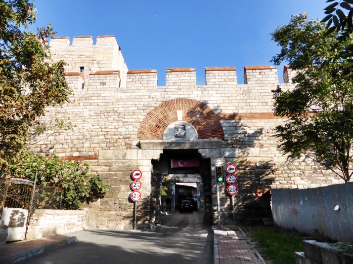
Originally and for centuries afterward there were just ten gates in the whole length of the wall and only five of those crossed the moat allowing access to the outside world. However, in the last hundred or so years sections of the wall have been knocked down to allow the passage of the railway line and several large highways. Even so, the old gates are still in use and given their width (only a little larger than one van or minibus) they must cause bottlenecks of traffic between what is now the city without the walls and the old town.

Gate in land wallsThe narrow Mevlevihane Gate

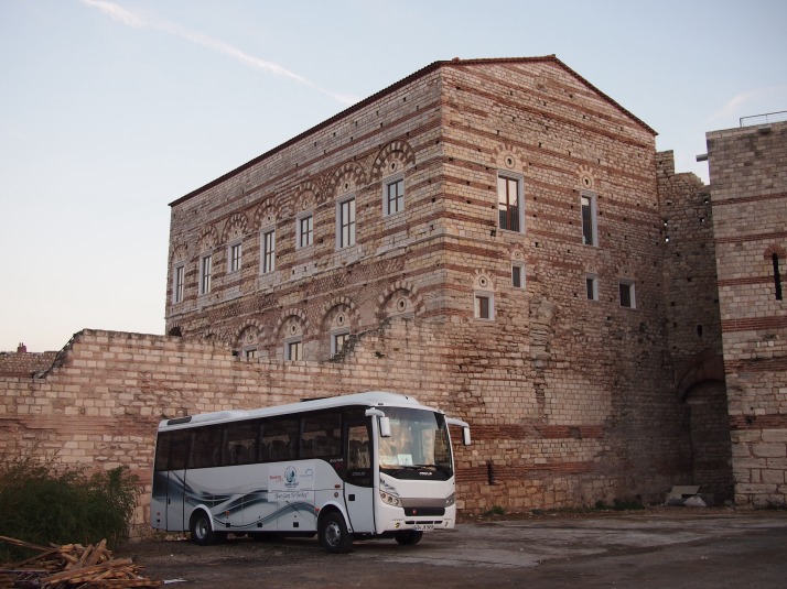
Towards the Golden Horn end of the walls is Tekfur Saray, originally a Byzantine palace but since the end of the 14th century it has had rather a chequered history serving time as a brothel, a pottery and a menagerie for larger kinds of exotic animals amongst other things all the while somehow maintaing its original character. Unfortunately it isn’t open to the public at the moment although it looks like it’s under restoration so perhaps soon it will be. By the time we reached this point of the walk it was late in the afternoon. Walking the streets through the nearby neighbourhood on the descent to the Golden Horn we were amused to see housewives doing their shopping by lowering down baskets from their apartment windows to the stallholders below, presumably with a list and payment inside.

Tekfur SarayThe impressive Tekfur Saray near the Golden Horn end of the land walls

Chora Church Museum

Christ Pantocrater mosaicThe church was dedicated to Christ Pantocrater (the Almighty) shown in this mosaic over the door to the inner narthex

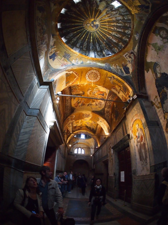
Close to the Golden Horn end of the land walls is the former Church of St Saviour in Chora, known in Turkish as Kariye Muzesi. Like many of the Byzantine churches that we’ve visited in Istanbul, this one was converted into a mosque after the Ottoman Conquest. Fortunately its magnificent mosaics and frescoes were preserved, even if unconsciously, by being covered in plaster and in the 1950s they were restored and the building opened as a museum. Further restoration has begun recently and the nave of the church was closed off for this work during our visit.

Chora Church inner narthexAlthough the church is quite small, the ceilings are absolutely covered in shimmering mosics

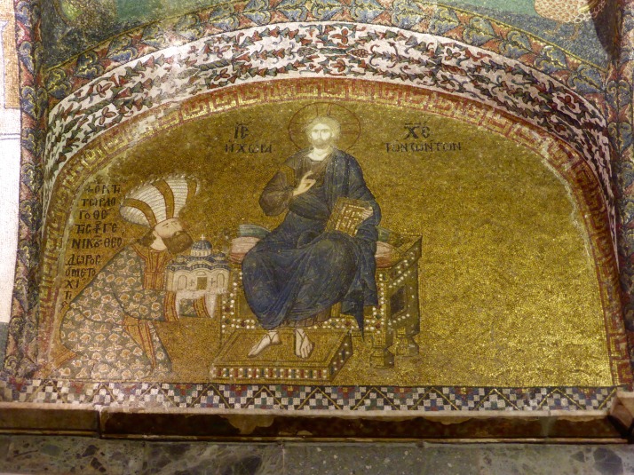
A church or monastery has stood on this spot since before the land walls were built. It underwent several remodellings from the 11th century onwards culminating in the rebuilding and redecoration which gave the church its current form in the early 14th century. The man responsible for this was Theodore Metochites, a high ranking official in the court.

Theodore Metochites presenting his church to ChristMosaic portrait of Theodore Metochites presenting the church as a gift to Christ

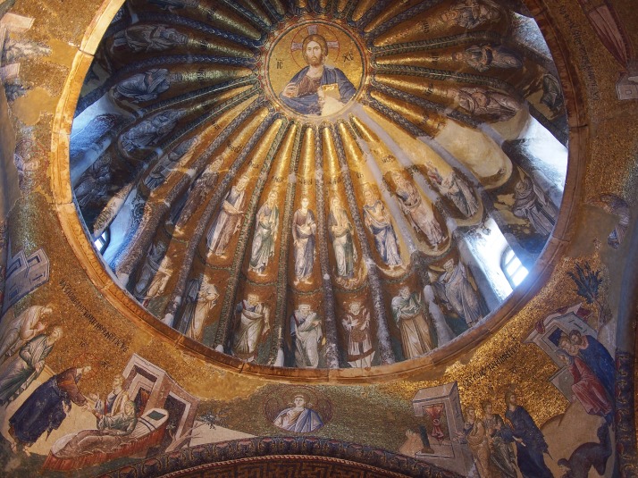
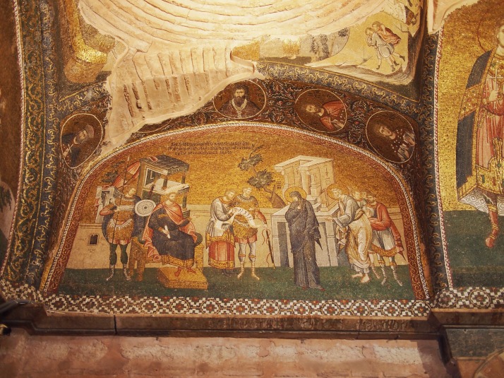
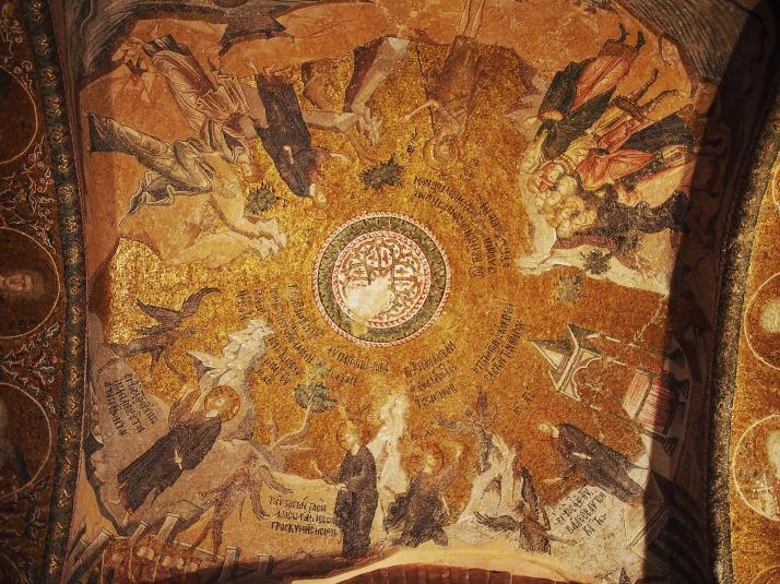
The mosaics form a series of groups including the life of the Virgin Mary, the life of Christ and Christ’s ministry. The Strolling Through Istanbul book highlighted them for us in order which greatly enhanced the experience as we were able to follow the stories being told.

The Ancestry of Christ dome mosaicDome mosaic showing the ancestry of Christ

MosaicMosaic from the life of Christ showing Mary and Joseph arriving in Bethlehem to be taxed

Temptation of Christ mosaicMosaic of Christ’s temptation in one of the domes of the outer narthex

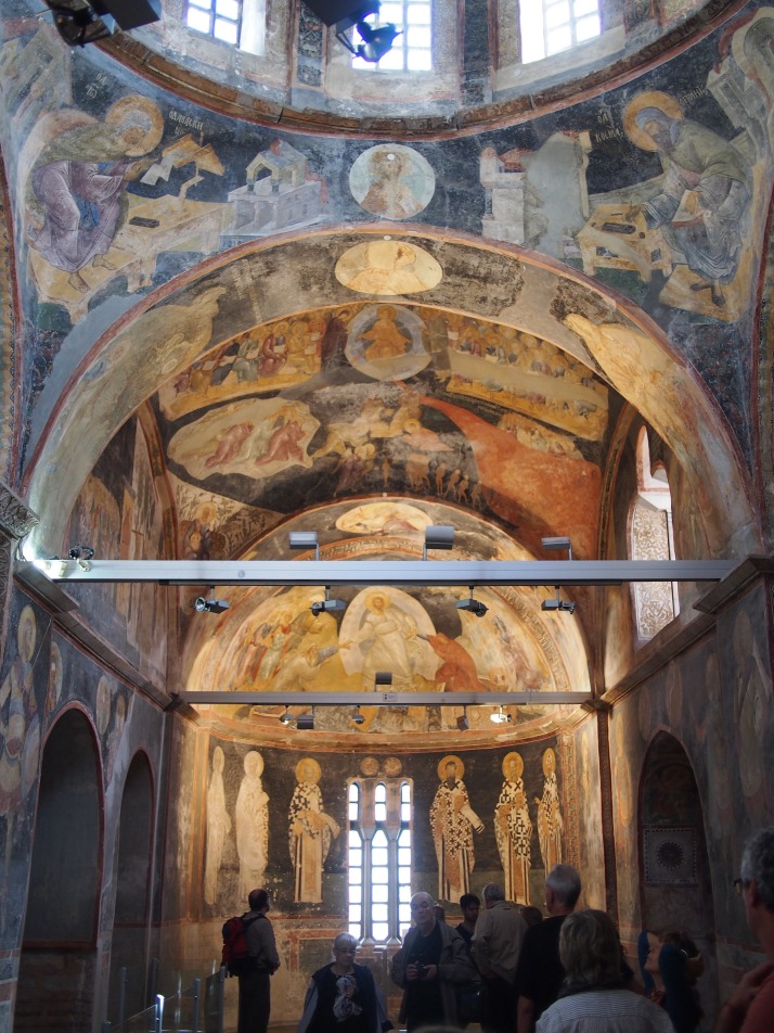
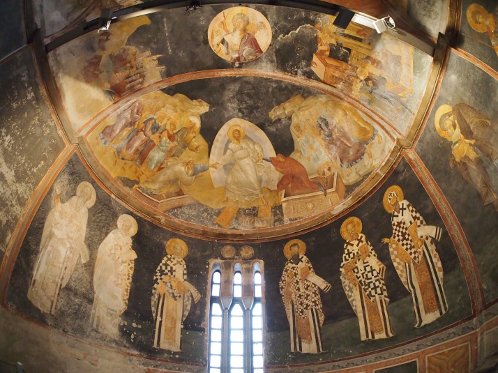
In the south-east corner of the church is the Paracclesion, a type of side chapel. Here, rather than mosaics, the walls and ceiling are covered with frescoes showing various aspects of the passing over from life to death, along with portraits of Orthodox saints. Remarkably it is thought that the same artist responsible for the mosaics also did the frescoes. While undoubtedly masterly these were for us much less spectacular than the wonderful gilded mosaics.

Paraclession frescoesFrescoes in the Paracclesion

Resurrection frescoThe centrepiece of the frescoes is in the semidome over the apse, called the Anastasis in Greek which translates as Resurrection; it shows Christ having broken down the gates of Hell pulling Adam and Eve out of their tombs while various other Biblical figures look on

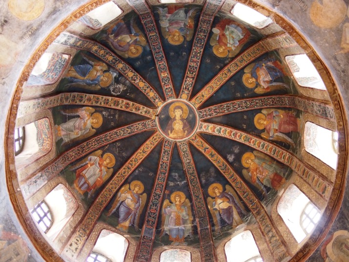
Fresco domeThe dome of the Paracclesion shows the Virgin and Child surrounded by angels

The church was busy but as everything you want to see is at a height and requires looking up other people don’t get in the way so much. For us this was definitely a highlight of our stay and I would say a must see sight for anyone visiting Istanbul.

Around the Blue Mosque and the Sea Walls

Continuing our strolling explorations through Istanbul, we popped our heads into Sultan Ahmet Camii, known in English as the Blue Mosque, which is also the starting point for the day’s walking trail which took us downhill to the edge of the Marmara Sea (chapter 6, page 107).

Sultan Ahmet Camii aka The Blue Mosque
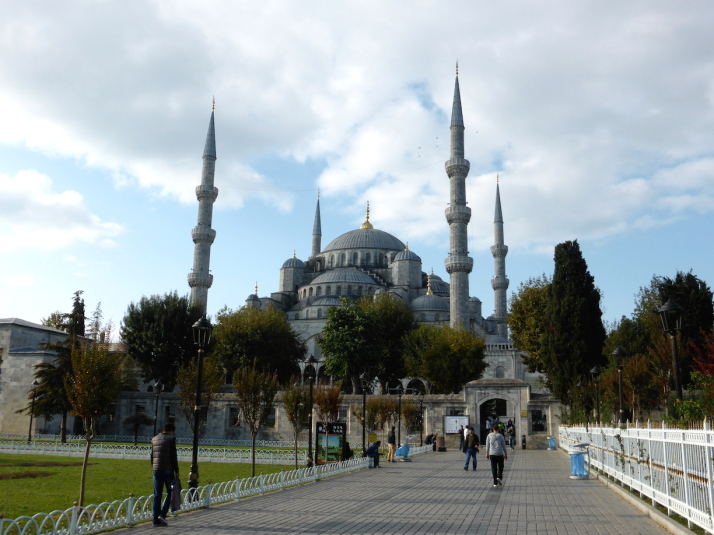
Sultan Ahmet Camii, otherwise known as The Blue Mosque

Sultan Ahmet Camii, also known as The Blue Mosque

The Sultan Ahmet Camii is the most famous purpose-built mosque in Istanbul. I say it that way because, in a “keeping up with the Joneses” kind of way, it sits next to the larger, grander Hagia Sophia. Founded by Sultan Ahmet I, he instructed his architect – a student of the famous Sinan – to build a mosque that surpassed the beauty of Hagia Sophia. There are a few nice tales about its construction.. firstly, the young Sultan was so keen to see it completed that he often pitched in himself; and secondly that when it was unveiled as having 6 minarets rather than 4, Sultan Ahmet was accused of being too self-aggrandising because Mecca was the site of the only other 6-minareted mosque. His solution was to pay for a 7th minaret in Mecca.
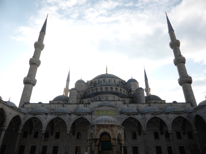
Sultan Ahmet Camii, as viewed from its courtyard on an overcast day

Sultan Ahmet Camii, as viewed from its courtyard on an overcast day. The other two minarets are just behind us

We got there just after the opening time hoping to beat the inevitable queues from the tour busses as this is Istanbul tourist central. Our timing was perfectly coordinated with said coaches, and from the entrance in the south-west corner the queue stretched the length of the mosque, its courtyard, around the corner and half-way up the other side. We were offered expedited entry with a local tour guide for 40 lira (about £13) but being British we secretly like waiting in line and it only took 35 minutes.

Outside, the dark stone of its distinctive silhouette so iconic in Istanbul’s skyline looks fantastically detailed in bright sunlight, but seemed to make it one with the dreary overcast cloudy sky we had. This lowered our expectations for what we were about to find inside..
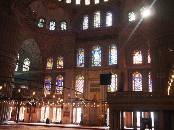
Inside the Sultan Ahmet Camii or Blue Mosque. The colours, light and shapes are almost too much for the senses!
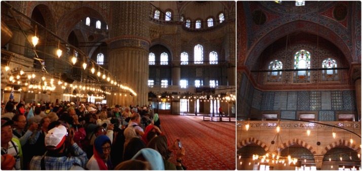
Inside the Sultan Ahmet Camii or Blue Mosque. The colours, light and shapes are almost too much for the senses!

Inside the Blue Mosque: the barriers separate the tourists from the worshippers as this is very much a working mosque

The barriers separate the tourists from the worshippers as this is very much a working mosque. I thought the blue Iznik tiles of the first balcony were the reason for the name ‘Blue Mosque’, but it comes from the main dome..

Despite being restricted to the back 3rd of the main prayer hall, this, like so many times in Uzbekistan, was a “wow” moment. The space is huge, and dominated by the giant red carpet on the floor and the massive, beautifully decorated dome overhead. It’s the blue in the dome’s design that gives the mosque its name.
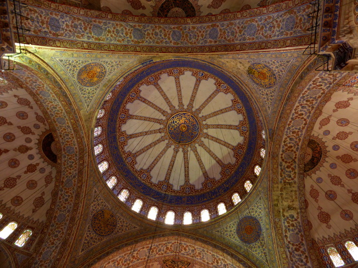
The main dome is decorated with stunning blue and gold painting

The main dome is decorated with stunning blue and gold painting, and this is why the mosque gets its name

Hippodrome
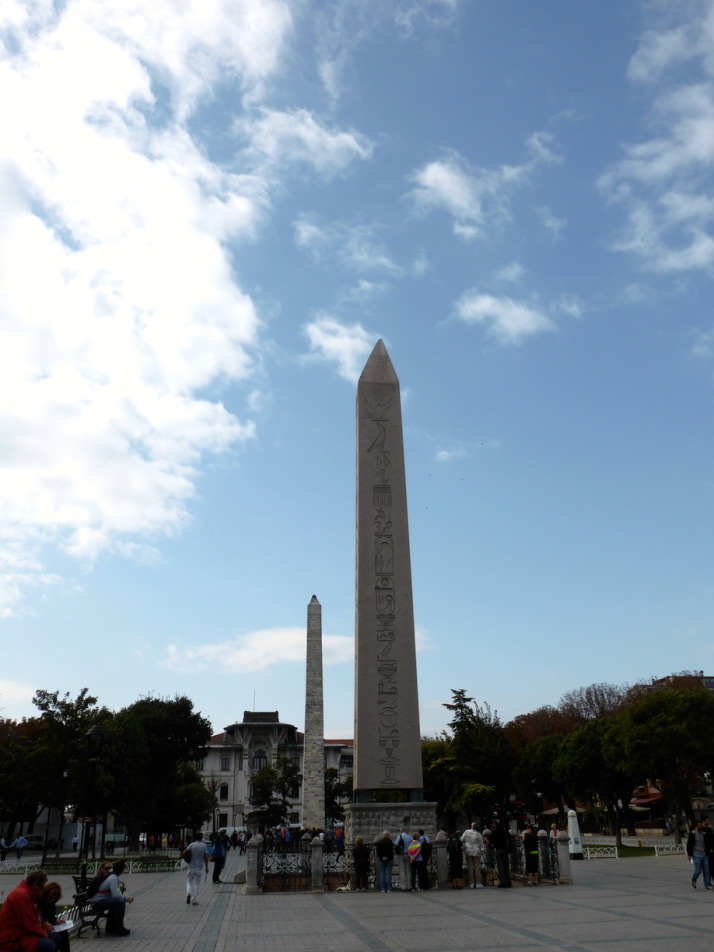
Hippodrome, Istanbul

The central section of the Hippodrome hints at the greatness of this once mighty arena

Just outside the Blue Mosque we stopped for an early packed lunch next to the massive Egyptian obelisk while we read the introduction to the Hippodrome from our guidebook.

Now a narrow park, it was really difficult to appreciate the sheer scale of the once mighty Hippodrome. Even when we read that the courtyard of the Blue Mosque was built on the foundations of the Hippodrome’s seating, we still weren’t able to fully appreciate how big and important this arena was to Byzantine society. In researching this post, I found this reconstructed image..
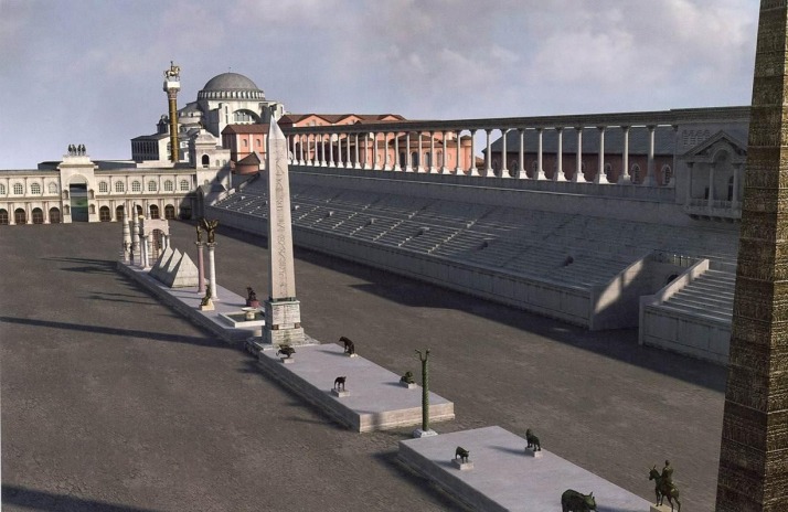
A computer generated reconstruction of the Hippodrome

A computer generated reconstruction of the Hippodrome. The current park is about half the width of the chariot racetrack. The domes in the background are that of Haghia Sophia (source: Byzantine Military)

All that remains of the Hippodrome today are a fountain, 3 central columns, and the foundations of the western rounded end. The largest of the central columns is called, appropriately, Colossus, and having stood next to it in person, to then see it in situ as the middle-marker of the 30,000 seat capacity of the Hippodrome finally gave us a sense of scale.
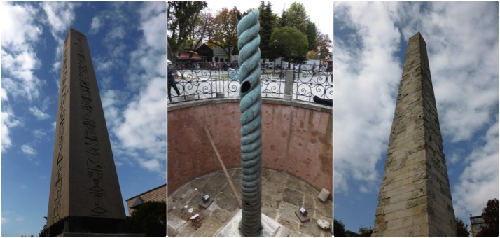
Columns of the Hippodrome: Egyptian obelisk; Serpent column; Colossus

The columns of the Hippodrome: the amazingly well-aged Egyptian obelisk that looks brand new; the bronze Serpent column which has seen many better days; and the Colossus, once covered in metal

[youtube=https://www.youtube.com/watch?v=AjrnvDn2tcA]

Sokullu Mehmet Paşa Camii

Tour guide Julie

Tour guide Julie, reading aloud from the excellent Strolling Through Istanbul

Skipping a few of the smaller sights on the route, we arrived at another of Sinan’s mosques, Sokullu Mehmet Paşa. Built in 1571-2 on the site of a former church, we entered through a long outdoor corridor into the serenity of an empty courtyard and an all but empty mosque – a far cry from the bustle of the Blue Mosque earlier!
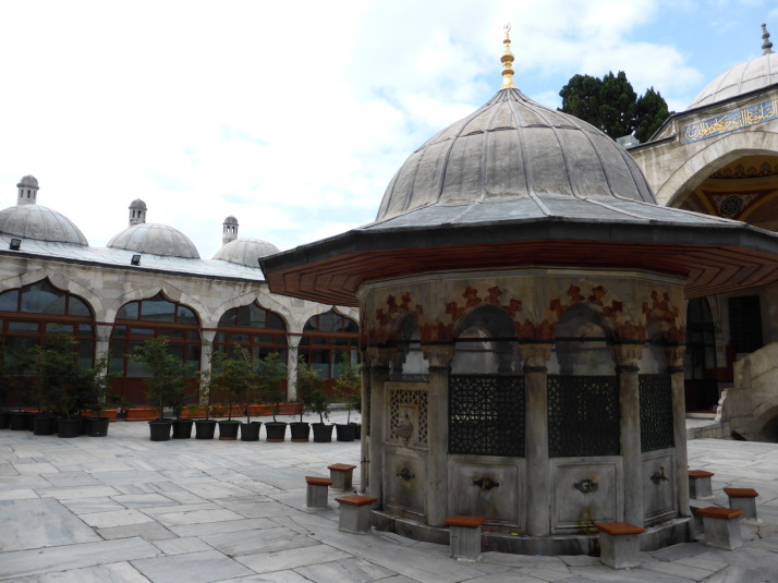
Courtyard of Sokollu Mehmet Paşa Mosque

The lovely quiet courtyard of Sokollu Mehmet Paşa Mosque

We loved the quiet serenity of this mosque, and the 3 reasons why it features on the stroll:

  1. It’s built by Sinan, that automatically gets attention but as there almost 100 of his structures left that doesn’t guarantee a place. The book describes this as “one of the most beautiful of the smaller mosques of Sinan
  2. The Iznik tiles in the mihrab are exquisite, and
  3. There are 3 fragments of black stone from the Kaaba in Mecca embedded into the walls: one above the main entrance, another above the entrance to the mimber and the last in the centre of the mihrab
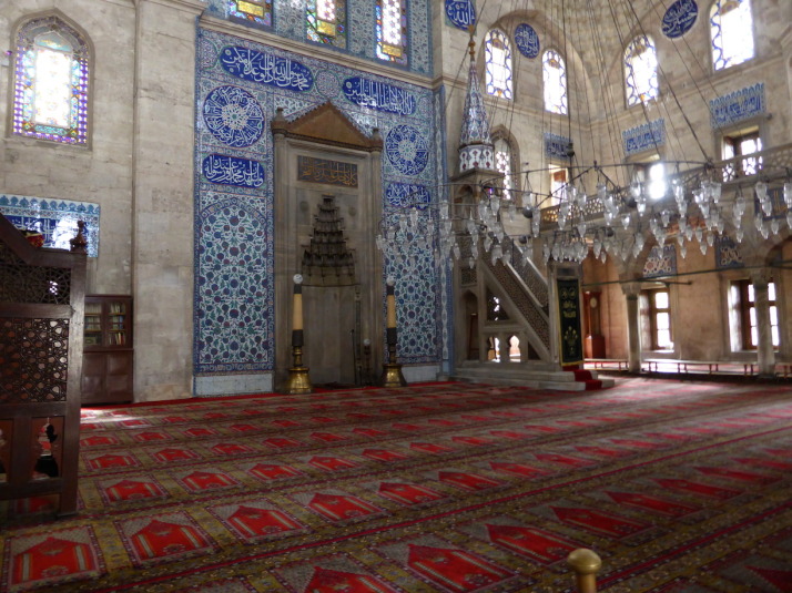
Sneaky picture of Sokollu Mehmet Paşa Mosque

Sneaky picture of Sokollu Mehmet Paşa Mosque while the imam was telling someone else off for taking photographs. The fragments of the Kaaba from Mecca are too small to see in the photo, but they’re just below the panel of writing on both the mihrab and the mimber

Namazgah
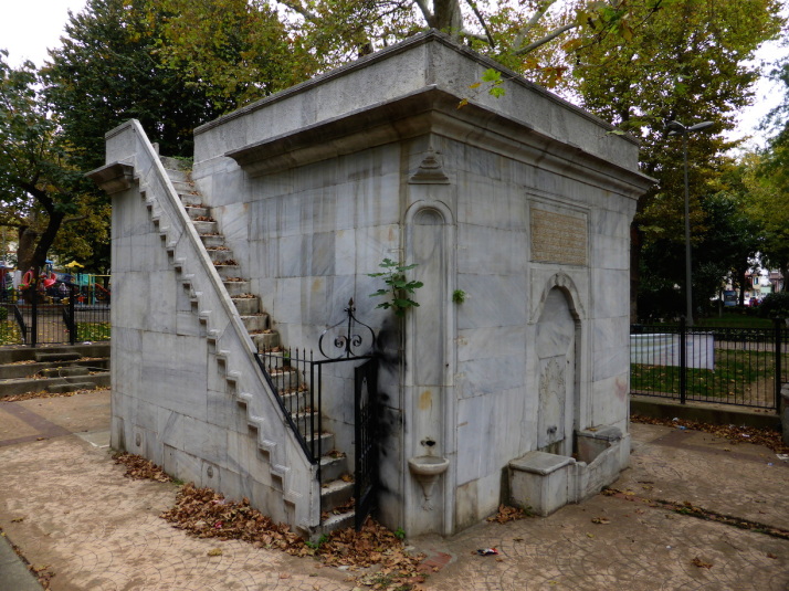
Namazgah of Esma Sultan

Namazgah of Esma Sultan. Nice, but what’s it for?

At first glance we weren’t sure we’d found what we were looking for when we entered a small park and children’s play area and spotted an old stone square fenced off in the corner. On closer inspection it was, as our book describes, the last remaining namazgah within the city walls, and one of 3 left in Istanbul.

So what is it? Well, a namazgah is an outdoor prayer area. We thought it was a really interesting thing to see, and it was a shame we couldn’t get closer than the surrounding fence.

SS Sergius & Bacchus
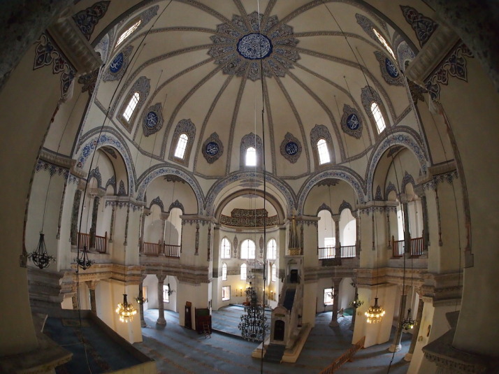
SS Sergius & Bacchus

The lovely light interior of the former Byzantine church of SS Sergius & Bacchus

Approaching the sea, but not yet past the defence of the sea walls, we arrived at SS Sergius & Bacchus, which, like many of the mosques in Istanbul was once a Christian church and subsequently converted to a mosque. Our guidebook introduces it thus:

“SS. Sergius and Bacchus were two Roman soldiers martyred for their espousal of Christianity; later they became the patron saints of Christians in the Roman army. These saints were especially dear to Justinian because they saved his life some years before he came to the throne, in the reign of Anastasius. It seems that Justinian had been accused of plotting against the Emperor and was in danger of being executed, but Sergius and Bacchus appeared in a dream to Anastasius and interceded for him. As soon as Justinian himself became Emperor in 527, he expressed his gratitude to the saints by dedicating to them this church, the first of those with which he adorned the city.” – Strolling through Istanbul, p123

Just like Sokullu Mehmet Paşa earlier, we found SS Sergius & Bacchus to be quiet, and we were encouraged to do something we’ve wanted to do in every mosque we’ve visited with an internal balcony – go upstairs!
SS Sergius & Bacchus

Us inside the Church of SS Sergius & Bacchus, now known as Küçük Aya Sofya Camii – which means “Little Haghia Sofia”

The late afternoon light through the windows was lovely, we loved the light airiness of the decoration and the luxurious sky-blue carpet which felt decadent to walk on.

Byzantine Sea Walls and the Palace of Bucoleon
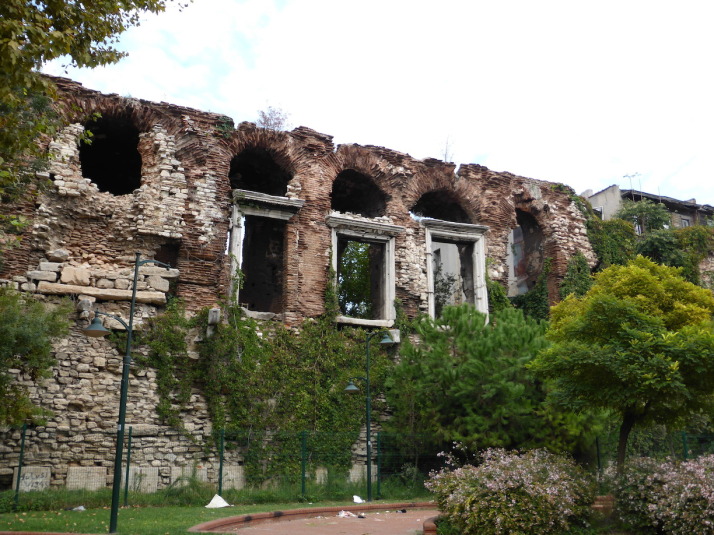
All that remains of the Bucoleon Palace, part of the Grand Palace

All that remains of the Palace of Bucoleon, one of the seaside buildings of the Grand Palace of Byzantium

The route then ducks under the railway lines which once carried the Orient Express, and through the old sea wall defences to highlight some of the oldest parts of the city.

The highlight of this section for us was the huge marble window frames of the Palace of Bucoleon, which was part of the original Grand Palace of Byzantium, once the heart of Constantinople, and sadly all that remains of it above ground. Even though little of this palace remains, it gave us a sense of scale and grandeur.

After the Palace, we passed ruins of old gates into the city, a marble pavilion and the foundations of an old church. A lot of the old vaulted sub-structures and gatehouses are being used for temporary shelter, and while we felt perfectly safe wandering along the sea walls, the smell of impromptu toilets did prevent us from inspecting some of the vaults more closely.
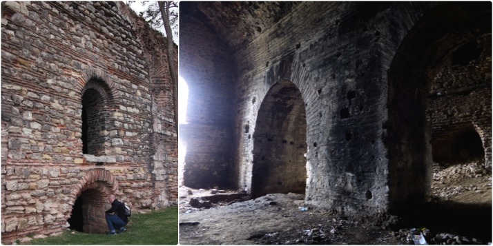
The massive vaulted sub-structures along the sea walls, Istanbul

The massive vaulted sub-structures of the church of St. Saviour Philanthopes. I’m just working out if I can get out once I get in; yes I can, and here’s the view from inside. This was the largest open one we found at 4 chambers wide

Grand Palace Mosaic Museum
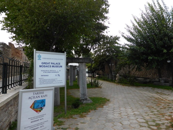
The entrance to the Mosaic Museum behind the Blue Mosque, not a mosaic in sight.. yet..

The entrance to the Grand Palace Mosaic Museum behind the Blue Mosque, not a mosaic in sight.. yet..

The walk ended just behind the Blue Mosque at the Mosaic Museum, which doesn’t look much from the outside but it’s mentioned briefly in our guidebook, and the reviews we’d read elsewhere highly recommended it.
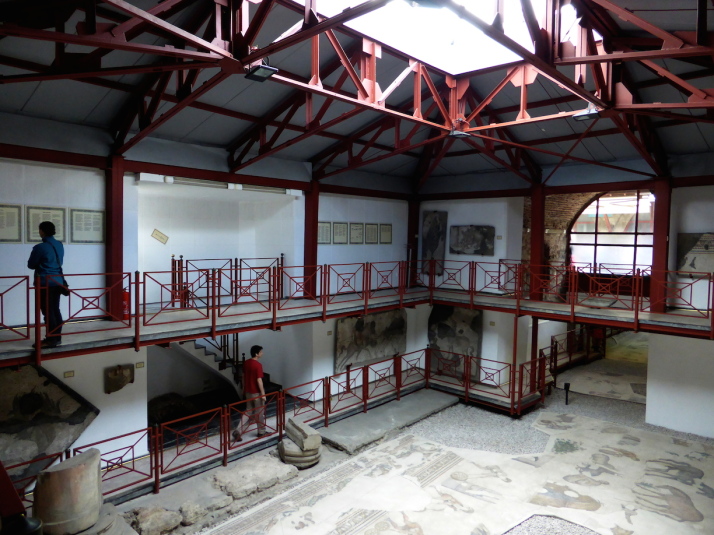
The first room of the Great Palace Mosaic Museum. We weren't expecting so many mosaics!

The first room of the Great Palace Mosaic Museum. We weren’t expecting so many mosaics!

After passing an unkempt garden of old stone columns and capitals, we entered what looked like a temporary shed and found ourselves on a 1st floor catwalk overlooking the restored mosaic peristyle of the Grand Palace.

Thought to date from Justinian’s reign (527-65), and believed to be the floor of the north-east portico of the Grand Palace, the mosaics were uncovered during excavations in 1935 and have since been restored a couple of times.
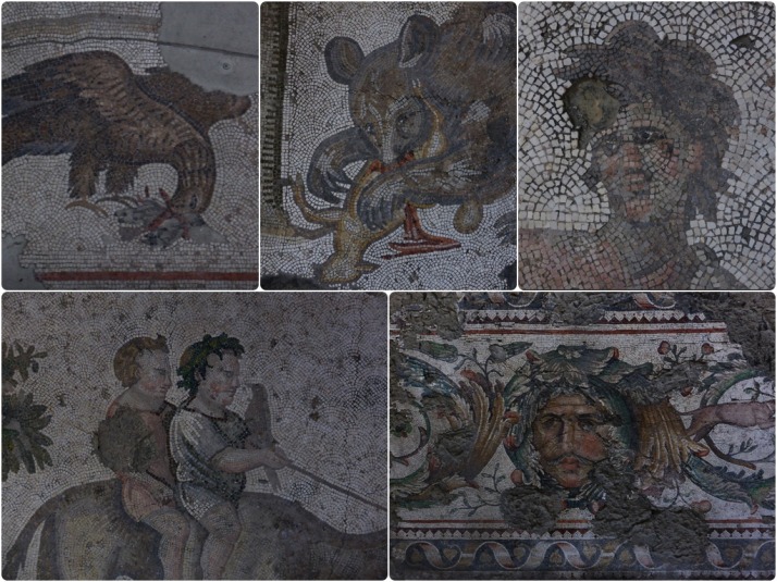
Collage of mosaics from the Great Palace Mosaic Museum, Istanbul

Collage of mosaics from the Great Palace Mosaic Museum. Clockwise from top-left: most of the scenes are of hunting, either humans hunting animals or animals hunting animals like this Eagle with a rodent; A bear feeding on a deer; the head of a boy at play; a very intricate and colourful section of a border; and two boys with a bird riding an ox

The mosaics are wonderful – we weren’t expecting such detailed work or such an extensive collection. The most recent restoration effort is explained in fascinating detail along with what is known about their history in panels throughout.

It was a nice end to another day of strolling, and something quite different to mosques and old walls.