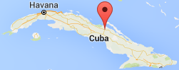
Yearly Archives: 2016

How to: Baracoa to Holguin via Moa – the adventurous route

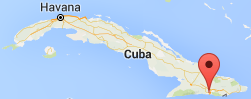
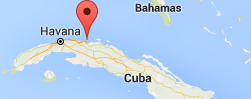
The distance from Baracoa to Holguin is only about 150 miles (250km) by the most direct route, but the only option if you want to travel by the Viazul bus service is to take the bus back to Santiago de Cuba and change there for Holguin. In theory this is possible in one day – if you take the 08:15 bus out of Baracoa which arrives in Santiago 13:45, you could then catch the 16:00 which gets into Holguin at 20:15. This seemed like a very long day along roads that we’d already seen so when we were planning our route through Cuba we decided that we would like to try to go along the notoriously bad road to Moa and there transfer back to Holguin where our flight landed. During our pre-trip research, it was difficult to find any clear information on how to do this and so here’s our trip report from April 2016 if anyone else is planning the same journey.

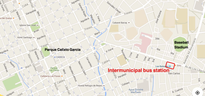
In Baracoa, you need to go to the local transport yard at the corner of Calixto Garcia and Coroneles Galano, just a few blocks from the central square.

Baracoa local transport yard map

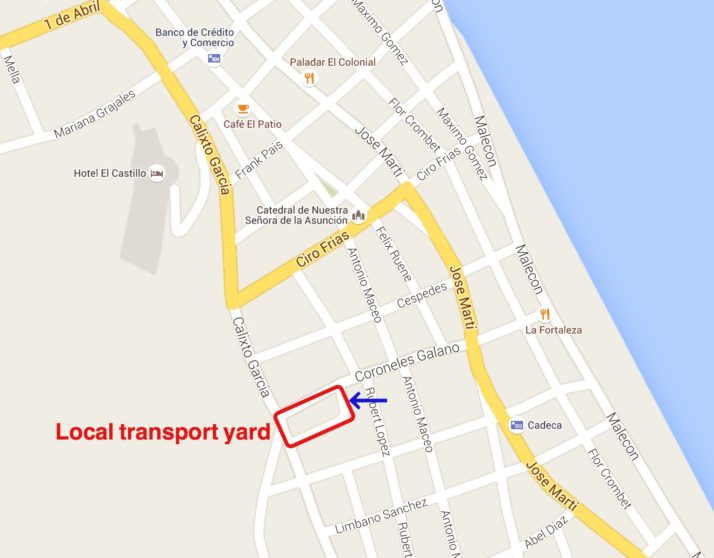
Early morning is best as there are no fixed schedules so you may have to wait for quite a while (we did). We arrived at 07:15. For Moa, wait at the far end closest to Rubert Lopez (see blue arrow in the map above) – place names are painted on the wall around the yard although we didn’t see them at first and asked around. While you’re waiting we recommend grabbing a fried egg sandwich for breakfast from the Terminal Cafeteria.

Baracoa local transport yard
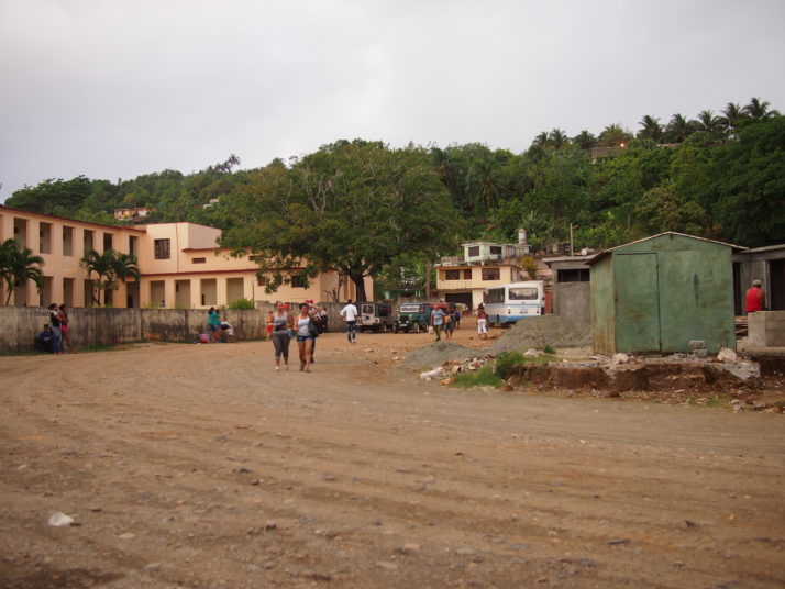
Local transport yard in Baracoa

I get the impression that usually transport is a bit more frequent because by the time the first truck pulled up at 08:30 a LOT of people were waiting. Also, I understand that it’s usually jeeps that do the Baracoa-Moa stretch but in our case it was a passenger truck with bench seats down either side of a covered back section. The guy who takes the money shepherded us in – it’s a bit of a scrum – we were the only tourists and he charged us more so I think we got some kind of priority. Locals were charged 60-70CUP (2.5CUC), we were charged 4CUC each, I tried to argue about this but there was no negotiating he just repeated the price. Our big rucksacks were stowed under the seats and our small rucksacks on our laps. The truck was tightly packed.

Passenger truck
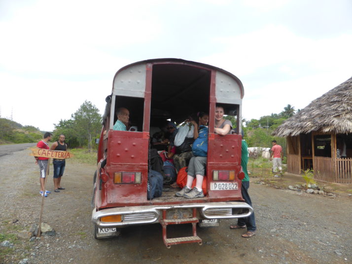
Julie in the back of the passenger truck from Baracoa to Moa

The road from Baracoa to Moa is in a pretty poor state of repair with lots of potholes and it’s quite dusty as the back of the truck is open. We stopped after about 1.5 hours at a roadside cafeteria where it was possible to buy snacks (including cucuruchos at local prices = CUP5 each). The driver also changed the wheel as we had a puncture – lots of guys pitched in and we were on our way within 20 minutes.

Changing the wheel
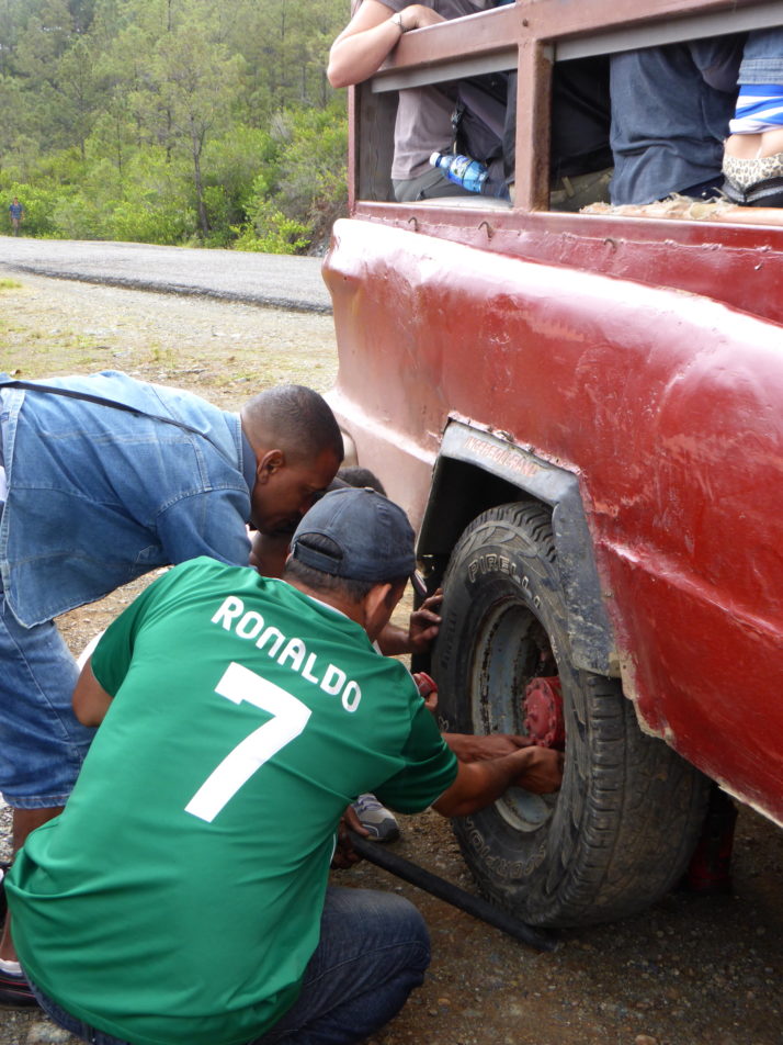
How many Cubans does it take to change a wheel…

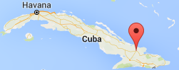
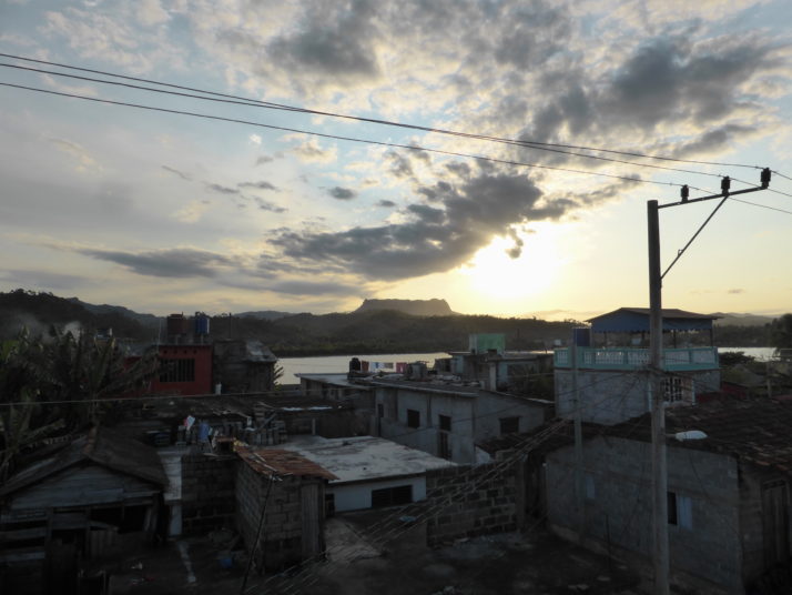
As we approached Moa we noticed a lot more heavy industrial activity compared to the more rural sights that we passed on the first part of the journey. The road passes the huge nickel plant and the wasteland stretching out around it. We eventually arrived at the bus station in Moa at 11:15 (a journey time of 2.75 hours) – this is the last stop so just get off when the truck empties.
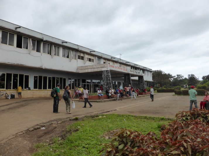
Moa bus stationBus station at Moa

A local couple who came from Baracoa were also going on to Holguin and they adopted us – I don’t know their names but for the purposes of the story we’ll call them Pedro and Maria. We waited inside the bus station with Maria while Pedro went looking for colectivos (private taxis that leave when they’re full) out in front (after first checking the back to see that there were no trucks). The bus station has snacks available from various vendors and toilets (no running water) – follow the corridor behind the seating area to the right when you enter. I noticed on the timetable that the Omnibus Nacionales bus was due to leave at 1pm (37CUP) but Pedro asked at the ticket desk and it was no good for us as you must have a Cuban ID card to travel on that service.

After almost an hour, he found a car that was going to Holguin – if you’re on your own I would recommend just hanging around outside and asking each vehicle that pulls up. The only problem was that the price for Cubans was 100CUP (4CUC) each but the driver said that for us (foreigners) it would be 10CUC each! I tried negotiating, including walking away back to the waiting room where the driver eventually followed us but he absolutely would not budge on the price. If we’d been alone we might have hung around to see if we could find a cheaper alternative but Pedro and Maria seemed to be reluctant to leave without us so we agreed. He did move the other passengers into the back so that we got the whole bench seat behind the driver to ourselves which meant we had lots of space and access to the windows to take photos. We left Moa at 12:15.

Colectivo to Holguin
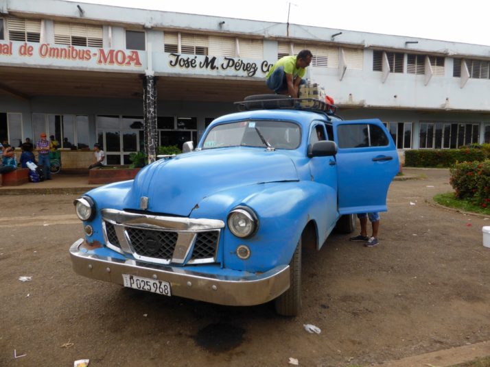
Our large bags were stowed on the roof

Inside our colectivo taxi
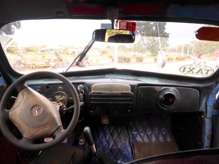
Our colectivo taxi from Moa to Holguin was a very old Pontiac (with a slightly newer Mercedes steering wheel!)

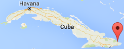
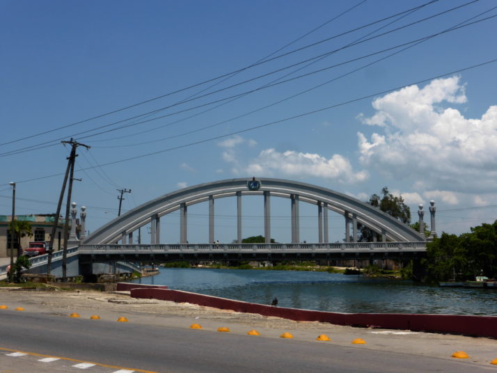
The road between Moa and Holguin is in a much better state of repair and we arrived in Holguin at 15:00 (a journey time of 2.75 hours) at the Intermunicipal Bus station on Avenida de los Libertadores, near the baseball stadium.

Holguin Intermunicipal bus station mapIntermunicipal Bus station in Holguin

Outside Holguin Intermunicipal bus station
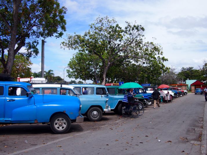
Colectivo taxis outside the Intermunicipal Bus station in Holguin

There are lots of local taxis and bici-taxis hanging around to take you on to your destination, or it’s roughly a 1.5km walk from here to Parque Calixto Garcia in the centre of town.

Another option to get from Baracoa to Holguin would be to arrange a tourist colectivo through your casa particular – we were quoted 30CUC per person based on a car with 4 passengers and our casa owner said he could ring around to find others who wanted to share the journey – obviously this would be much faster as there would be no hanging around at bus stations and it would probably also take you directly to your destination in Holguin.

Transport type (Baracoa to Holguin) Total price per person (CUC) Estimated time incl waiting (hours)
Public transport (via Moa) 14 7.75
Viazul Bus (via Santiago) 26 13
Tourist colectivo taxi (via Moa) 30 ~5

Baracoa, Cuba

Baracoa, perched on Cuba’s eastern edge is the island’s oldest city founded in 1511 and surely also one of its smallest. It is hemmed in by mountains and rainforest, having a microclimate all its own and was isolated from the outside world until the spectacular La Farola road was opened in 1965 connecting the town with Guantanamo City and the south coast.

View from La Farola
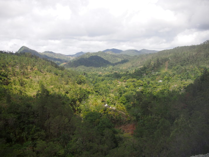
Spectacular views from the bus as we climbed through the mountains on our way to Baracoa along La Farola

El Yunque
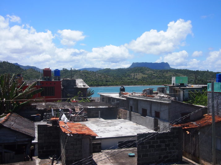
The table top mountain called El Yunque, the Anvil, is the symbol of Baracoa and is visible from many places in town including the roof terrace of our guesthouse.

Baracoa’s tiny cathedral (about the size of your average parish church) is at the centre of the town and is home to the Cruz de la Parra, the only surviving wooden cross of 29 planted in Cuba by Columbus on his first voyage and ‘discovery’ of the island in 1492.

Baracoa centre
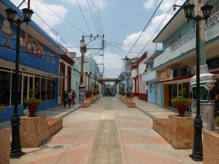
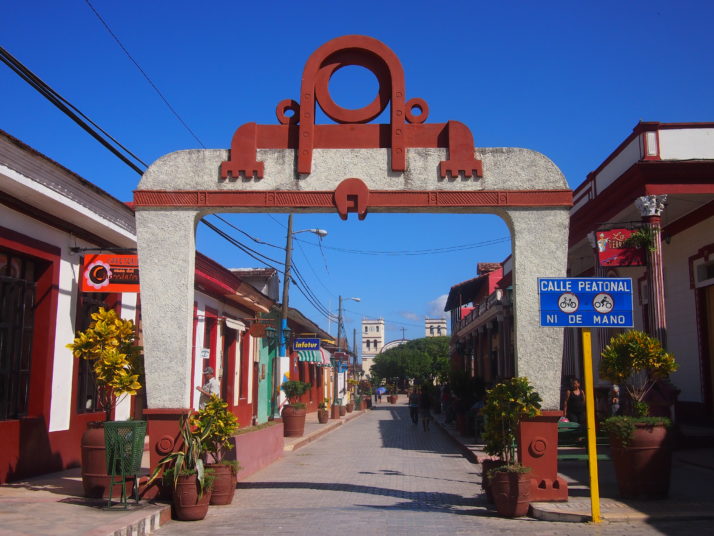
Looking along Baracoa’s walking street towards the cathedral

Cruz de la Parra
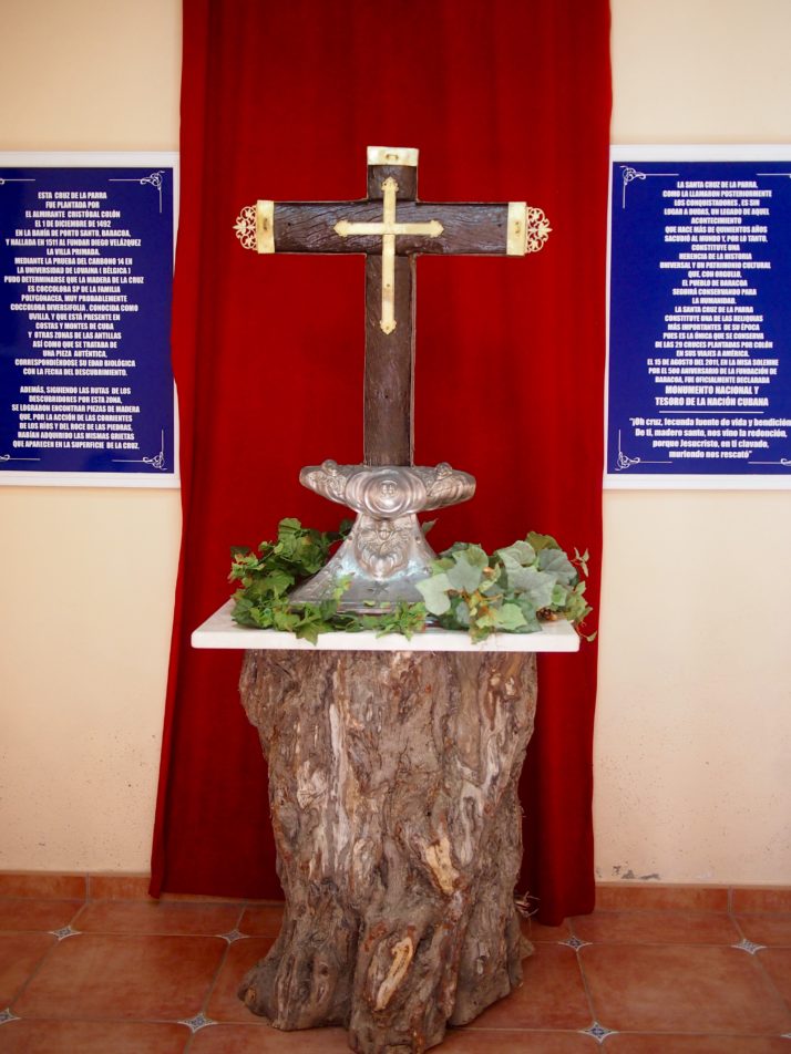
The Cruz de la Parra has been carbon dated to prove that it dates from the correct period but the wood is native Cuban and was not carried from Europe by Columbus as legend has it

The town itself doesn’t have much in the way of sights but we enjoyed strolling along the slightly dilapidated seafront to the even more dilapidated baseball stadium at the end of the beach. We also spent a fascinating hour nursing a beer on a balcony overlooking a street that was being resurfaced. It was amazing to see the hard work done by hand that we’re used to seeing machines do.

Baracoa baseball stadium
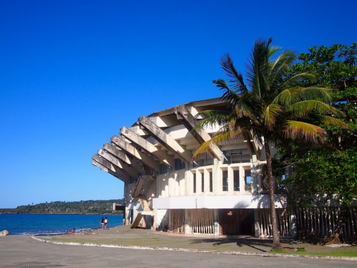
Baseball is Cuba’s national sport but its stadium was host to football practice when we poked our noses in

One morning we walked up the hill through residential streets, puzzling over why all the cockerels seemed to have no feathers on their legs or bellies until we realised they were for cockfighting.

Fighting cockerel
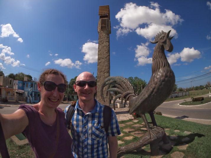
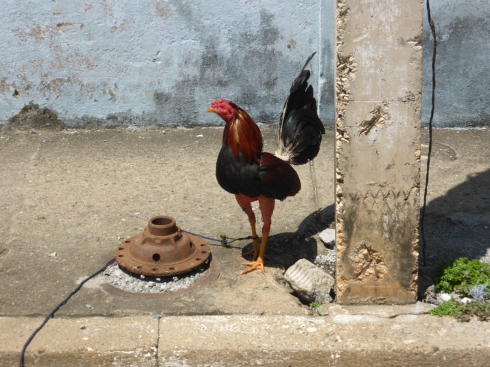
Cockfighting is a popular sport in Cuba judging by the number of cockerels we saw on a short walk through Baracoa’s streets

Dripping with sweat after the short but steep climb we arrived at the Archaeology Museum which has been imaginatively set up in a series of caves where burial chambers of the Taíno peoples had been found. The Taíno arrived in Cuba from Venezuela around 1050AD and were living there peacefully in farming communities when the Spanish arrived in the 15th century. Many died from European diseases and more when they were pressed into harsh slavery by the settlers.

Baracoa Museum of Archaeology
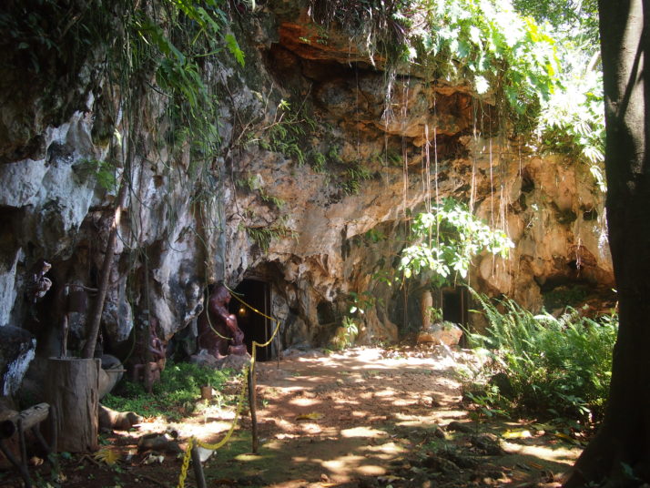
The entrance to Baracoa’s Museum of Archaeology

The displays were not so exciting but the cave setting was a quirky idea, the attendant was friendly and gave us a good explanation in English and the view over the town was superb (it’s from here that we spotted the cemetery that we visited later in our stay).

Museum of Archaeology exhibits
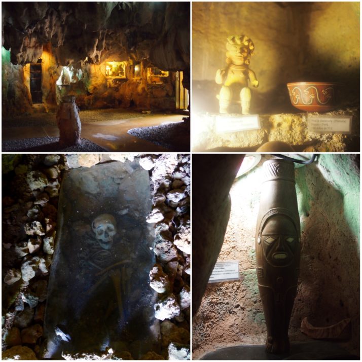
Museum of Archaeology (clockwise from top left): display cases inside the cave; Taíno artefacts; a replica of the Ídolo de Tabaco, one of the most important Taíno finds in the Caribbean; burial chamber

View over Baracoa
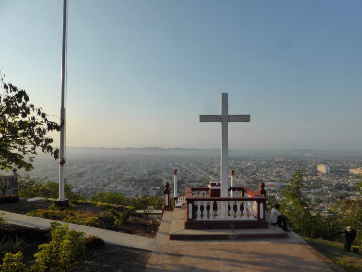
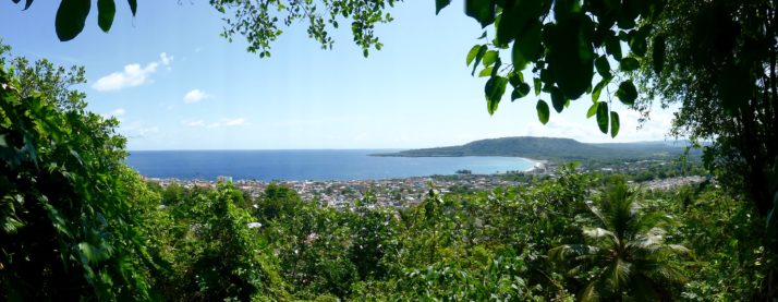
The viewpoint above the museum provides a reward for the uphill climb

We had initially planned a hiking excursion to El Yunque, but changed our minds after hearing the descriptions of the Humboldt National Park, 40km north-west of Baracoa, and went there instead. The road to the north is not in very good condition and so our group of 15 plus our guide Benny were loaded into three jeeps for the dusty hour and a half that it took to bump our way there.

Jeep transport to Humboldt National Park
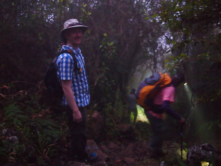
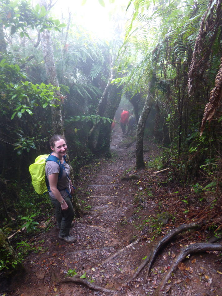
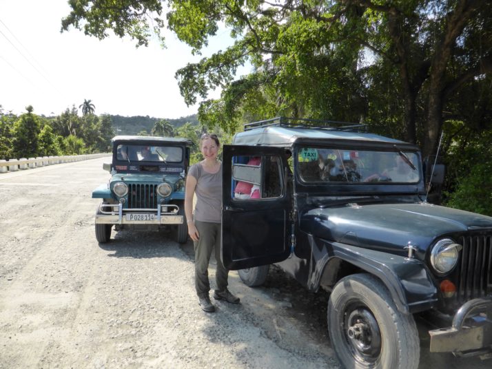
Stretching our legs during a brief pause in the drive to Humboldt National Park

The Humboldt National Park is famous for its biodiversity with lots of endemic species. 70% of the plants as well as lots of amphibians, reptiles and birds are found nowhere else, and the park was declared a UNESCO World Heritage Site in 2001.  We’d hoped that we would see quite a bit of wildlife and certainly at the beginning of the hike we did with Benny stopping to point out Tocororos, woodpeckers and parrots as well as different kinds of plants. But as the path narrowed the group became too spread out to see much and the pace felt too fast for us to fully appreciate the forest.

Flora and fauna in Humboldt National Park
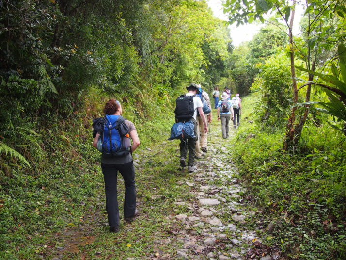
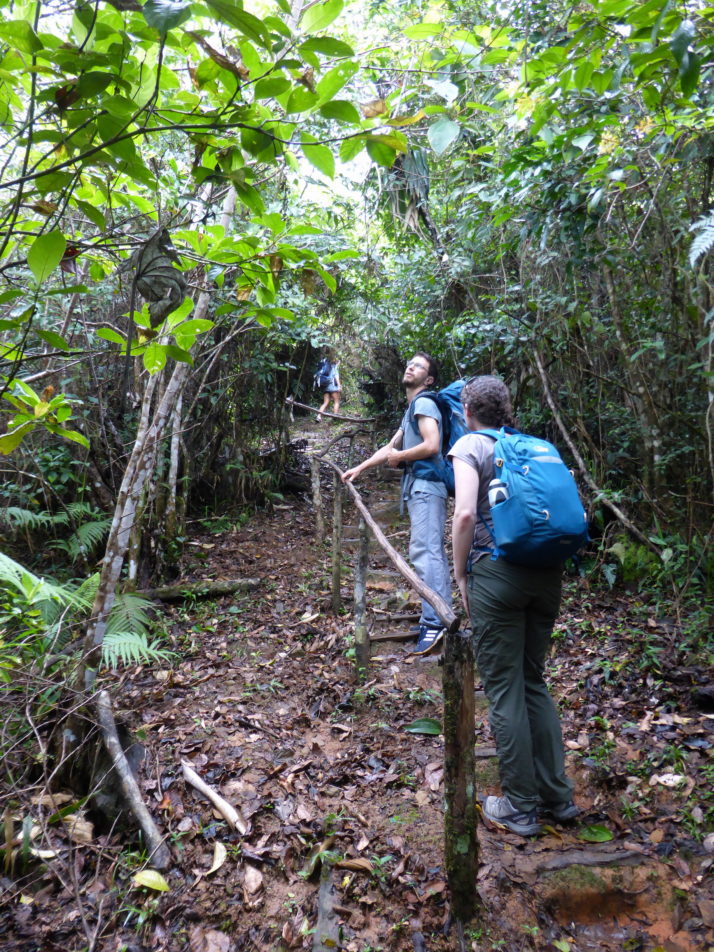
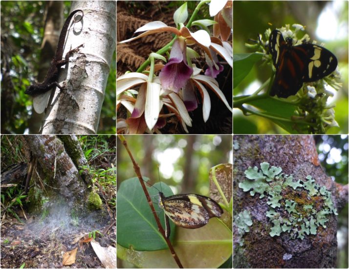
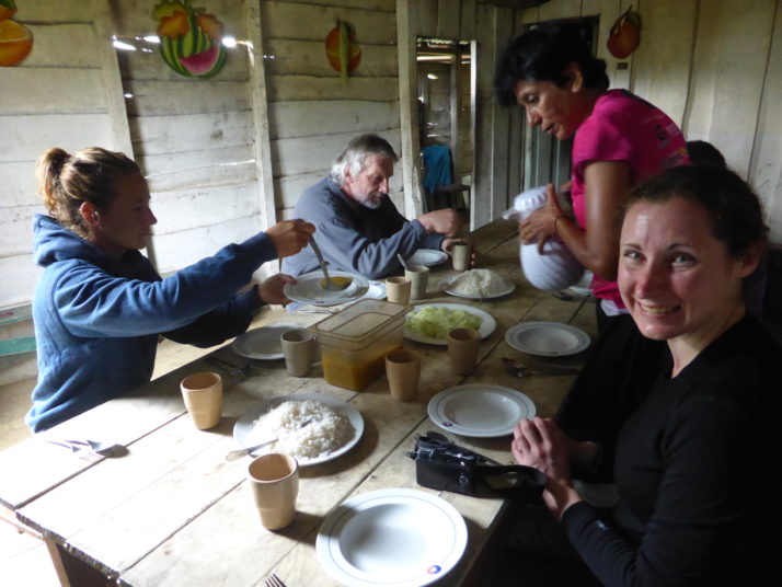
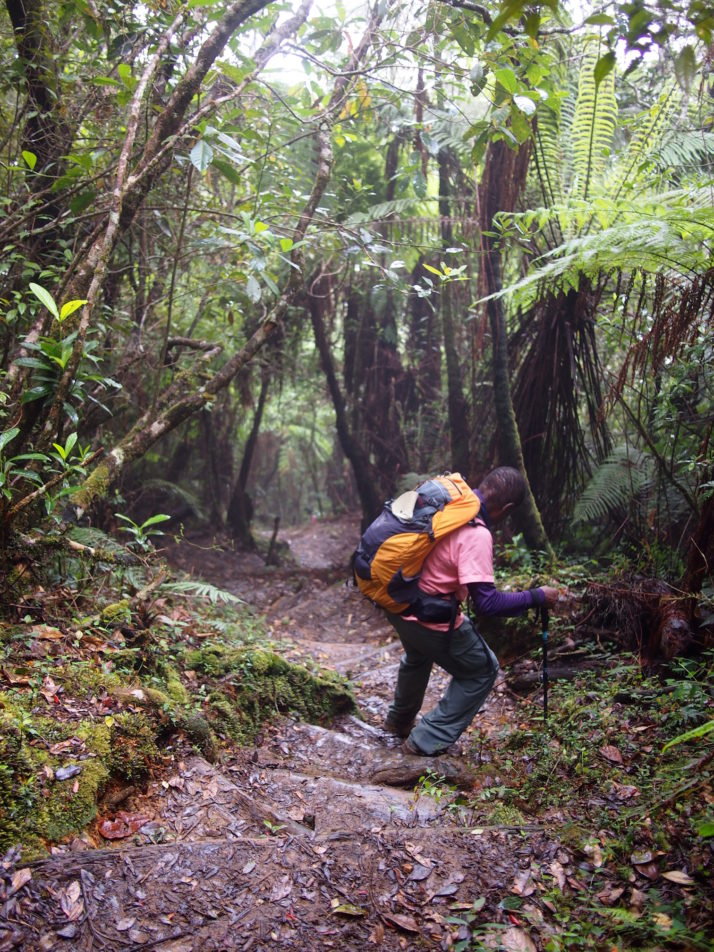
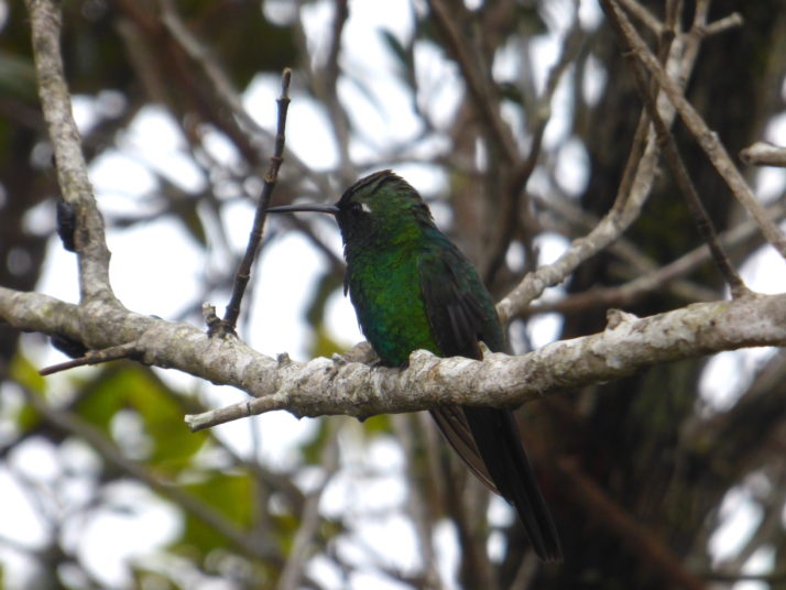
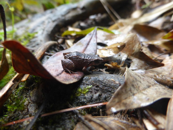
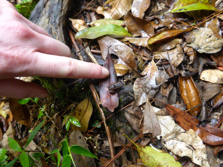
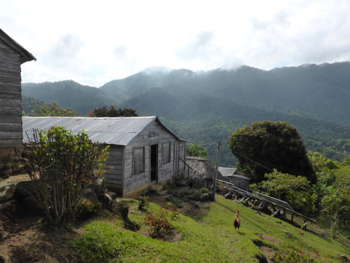
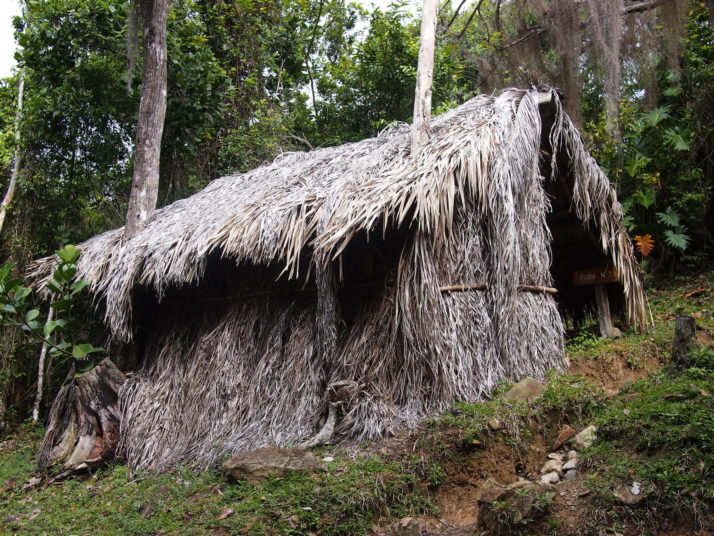
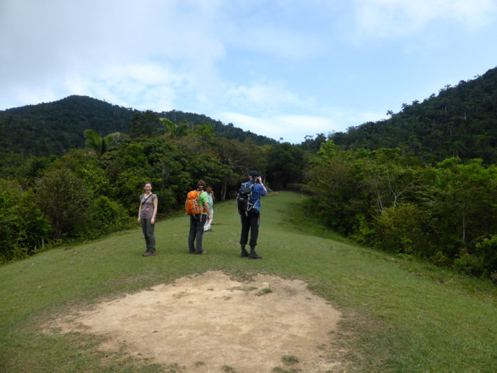
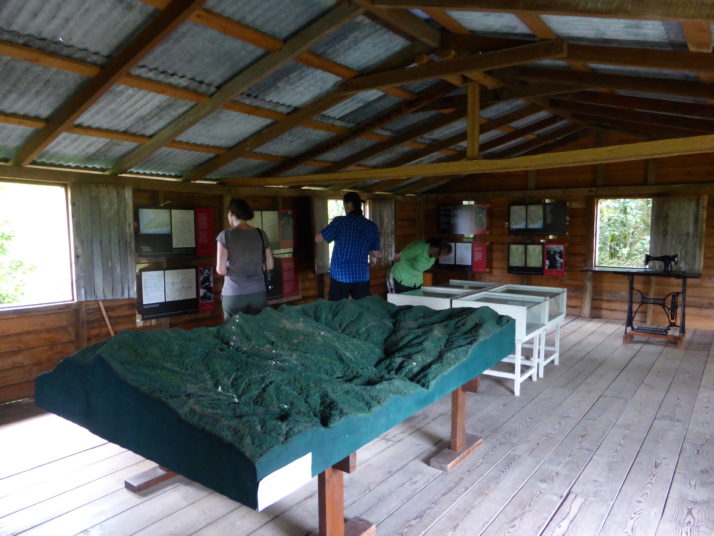
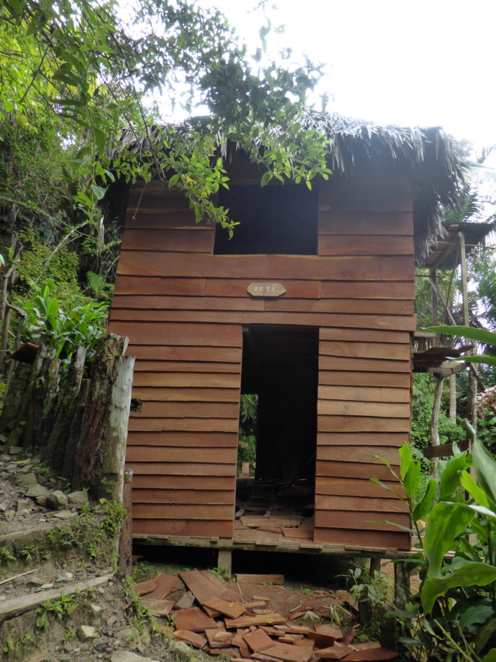
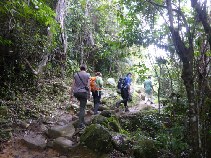
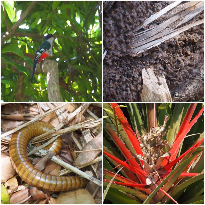
Flora and fauna in Humboldt National Park (clockwise from top left): Cuba’s national bird, the Tocororo; termites; the colourful Rat Pineapple is related to the normal pineapple but doesn’t produce an edible fruit; this huge millipede was about 25cm long and thicker than my thumb

Swimming opportunities seem to be an obligatory feature of excursions in Cuba – it felt like every time someone was trying to sell us an excursion it ended with ‘a chance to swim in the river / pool / sea’ (frankly this usually feels like a waste of excursion time to me but clearly I’m in the minority here).  Anyway this trip was no different; just before lunch we stopped at the top of a waterfall where anyone who wanted to could jump into the pool below and swim downriver to the curve where we would break for lunch. About ten of the group did, the rest of us followed the path along the river to meet them below.

Swimming in the river in Humboldt National Park
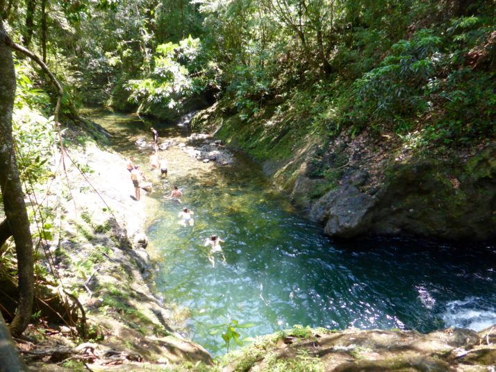
Some of our group swimming down the river to join us at the lunch spot

Crossing the river in the Humboldt National Park
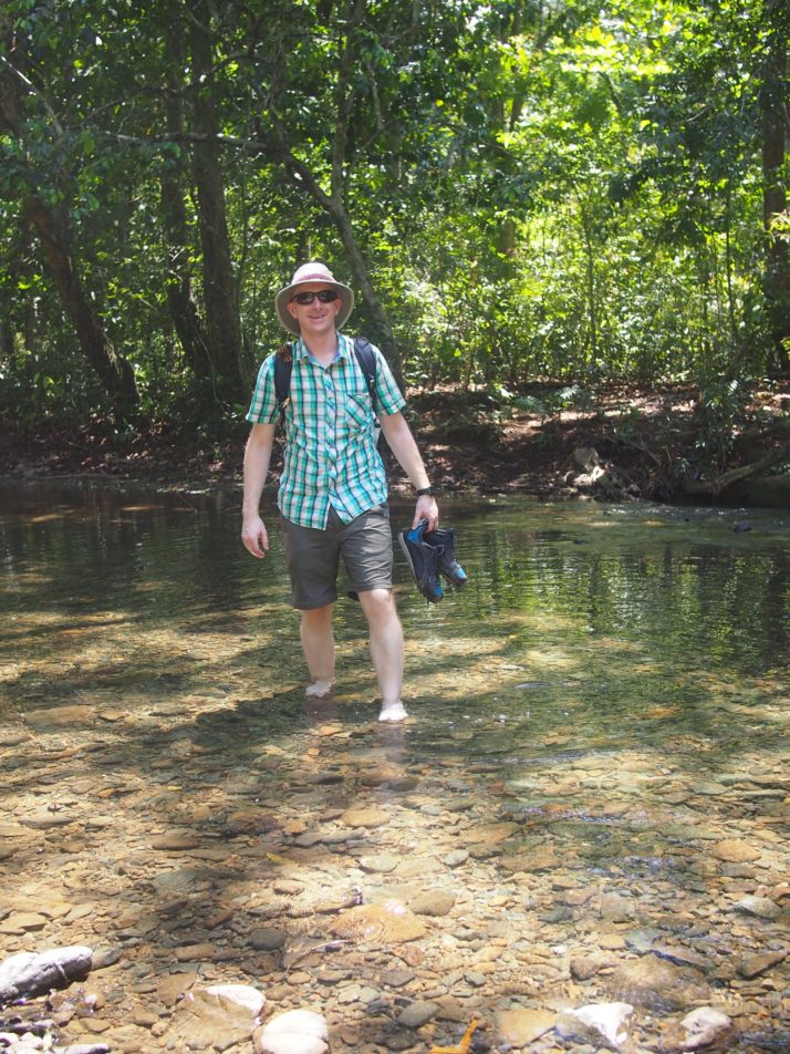
After lunch we had to cross the river 8 times to get back to where we’d left the jeeps. I was glad that I’d carried my flip-flops to cross the stony riverbed, Andrew had to do it barefoot.

On the way back to Baracoa we stopped at Playa Maguana.  It was our first Cuban beach experience and the white sand and turquoise ocean were just as breathtaking in real life as they are in the travel brochure photos.  The sea gets deep quite quickly, and the wave swells were high enough to make bobbing up and down in the water fun.  It also helped that we could take turns with the others in the group watching bags and go into the water together.

Playa Maguana
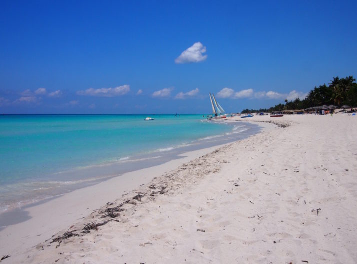
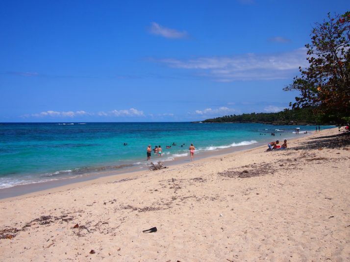
Playa Maguana, there’s even a guy who’ll bring you a drink direct to your beach towel

The Lonely Planet touts Baracoa as the best place for food in Cuba.  Now that’s not saying much as in general the island’s cuisine is not the most exciting, but still I had hoped for more than just one sauce, albeit tasty, which is served with different kinds of seafood.

Prawns in coconut milk sauce
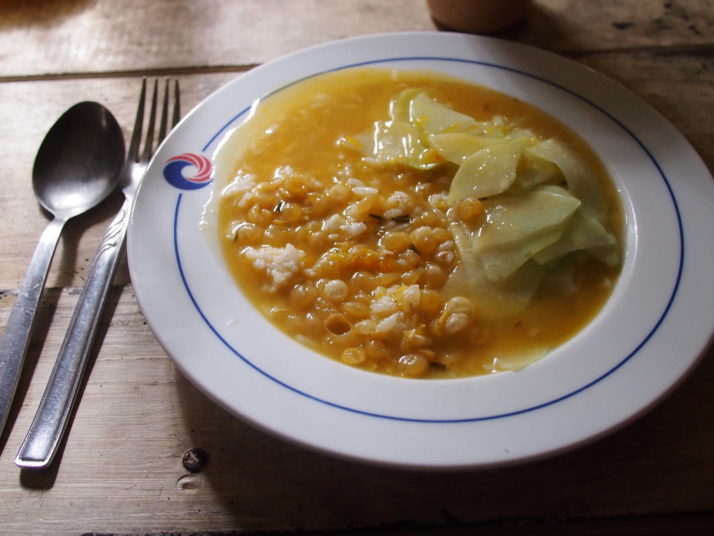
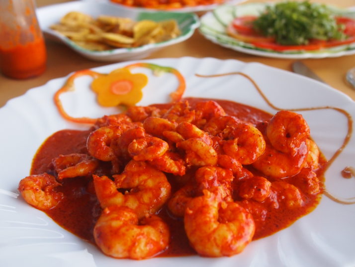
Prawns with the Baracoan sauce made from coconut milk, tomatoes, garlic and spices
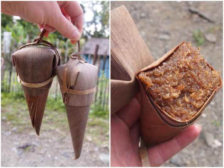
Cucuruchos are the other regional specialty, a cone of palm leaf stuffed with an almost sickly sweet mixture of fruits, coconut and honey. Baracoa is the only region in Cuba where chocolate is grown and processed (the smell wafting from the factory just outside town reminded me of driving past the Rowntrees factory in York) and we really enjoyed the huge flask of hot chocolate that was included with our breakfast each morning.

CucuruchosPeeling a cucurucho

Hiking Pico Turquino and the Comandancia de la Plata, Cuba

Day 1 – Bayamo to Camp Joaquin

Starting at 7am in Bayamo, we arrived by taxi in Santo Domingo at the foot of the Sierra Maestra mountains and the entrance to Turquino National Park at 8:30am.

There was a little waiting around until the 4WDs had ferried various groups to the starting point and then it was our turn. The low-ratio gears in the people carriers made short work of the steepest roads in Cuba (some gradients were up to 45%!), even with 9 of us, everyone’s 2-days worth of luggage, a guide and a driver onboard!

The view of the Santo Domingo valley from the Pico Turquino trail

The view of the Santo Domingo valley from the Pico Turquino trail

The starting point, 950m above sea level, is a concrete plateau or turning circle where a signpost points right for the Comandancia de la Plata, and left to Pico Turquino. From here it’s a 13 km hike where we gain just over 1,000m to reach the summit of Pico Turquino, the highest point in Cuba!

Full of energy, spirit and new faces to get know, we set off apace down the wide and easy-going track, which soon narrowed to near single-file well-maintained forested trail.

Our group starting the hike to Pico Turquino

Our group starting the hike to Pico Turquino

We’d hoped to see plenty of wildlife and we weren’t disappointed: We saw woodpeckers, Tocororos (the national bird of Cuba because its plumage is the colours of the Cuban flag: white, blue and red), a cute little green and white fluff-ball of a bird called the Cuban Tody Flycatcher, and even hummingbirds doing fly-bys right past our heads!

A Northern Flicker Woodpecker and the cute little Cuban Tody Flycatcher

A Northern Flicker Woodpecker and the cute little Cuban Tody Flycatcher

Our guide Raul was very good at stopping to point out the different flora and fauna, and at taking the time to explain a little more about them. He had a smartphone with him, and when he stopped to take a photo with it I knew it must have been for something good and close by; I took a couple of steps back to join him and saw, about 4 metres away, another Tody Flycatcher shouting at the top of his little voice!

Also in our group was a French couple and the guy was just as knowledgeable about the birds as Raul, it turned out he writes books about them!

Julie our informal guide and translator

Julie with our informal guide and translator

The forest was lush with orchids, lichen and various reptiles and insects too..

Collage of reptiles, insects and flowers

Some of the flora and insects. Clockwise from top-left: A small lizard shows off its white throat; wild orchids; we didn’t see many butterflies; but there was plenty of lichen; another rare sighting of a butterfly; blankets of spider’s webs like piled up snow at the foot of trees. We didn’t see any spiders though!

The final kilometre felt like it was really twice as long to our tired legs, and after a particularly muddy section of the trail we emerged at Camp Joaquin just after 3pm, the welcome sign greeted us with an altitude of 1364m though we’d certainly climbed more than the 414m difference since the start given the up and down terrain. After picking our bunks in the shared bunkhouse I decided to take a very cold bucket shower before we sat down for lunch.

Camp Joaquin (camp Joaquin)

Arriving at Camp Joaquin. The bunkhouse is the building on the left

Our group sharing out the well deserved lunch

Our group sharing out the well deserved lunch

Bowl of plain rice, bean soup and chayote - a vegetable that tastes like a cucumber

Mmmm.. a hot meal of plain rice, bean soup and chayote – a vegetable that tastes like cucumber

Day 2 – Camp Joaquin to Pico Turquino, then down to Santo Domingo

Alarms went off at the unsociable hour of 4:30am, and after a simple breakfast we started the final 5km ascent in the dark. I was the only person without a torch, making do with the auto-focus lamp on my camera which was enough in 2 second bursts for me to get my footing. The start was a long section of muddy stairs with the occasional handrail, and we all found it a heads down challenging start to the day.

Andrew hiking in the dark

The second day started in the dark, and involved a lot of up and down as we worked our way towards Pico Turquino

As it started getting lighter, we saw that the cloud that had come in the night before was still with us and we wondered if it would clear or be clearer by the time we made it to the top.

Julie looking from a viewpoint into a whiteout

Mirador means viewpoint in Spanish. Not much of a view past the trees this time!

Raul kept our spirits up with startlingly accurate descriptions of the trail ahead and how long it’d take to reach the next km marker or resting spot. Just before 9am we turned a corner and entered a small, foggy clearing – we’d all made it!

A very cloudy top of Pico Turquino

Made it! The top of Pico Turquino, if you can see it!

Us with Jose Marti at the top of Pico Turquino

Us with José Martí at the top of Pico Turquino

Everyone shared out the various snacks they’d brought, and we took it in turns to have our photo taken with the giant José Martí that had been hauled up some 63 years prior, before bidding him farewell and starting the 5km descent back to the camp.

As I may have mentioned previously, I much prefer hiking up to hiking down, and I don’t think I was the only one who was starting to feel tired legs and sore knees, but the scenery was new because it was now light enough to see it!

Moremi, Julie and I taking it easy on the descent

Moremi, Julie and I taking it easy on the descent

Bright green hummingbird

A hummingbird stopped on a branch next to me to say hello!

Stopping for lunch at the camp was very well received, mostly for the chance to sit down for an hour to rest our legs! Refuelled and re-packed, the only way was to continue the trail down the remaining 8km – it didn’t sound that far considering we’d already done 10km before lunch!

Julie descending in the rain

More downhill – Julie descending with a smile on her face despite the rain

Tiny frog

We’d heard about these tiny little frogs and then heard them the previous night – a chorus of clicking that sounds like a thousand pens being tapped on a wooden desk

Tiny frog with finger for scale

No wonder we couldn’t see them at night, they’re black and tiny!

With about a kilometre or so before the end the misty fog turned to rain. Everyone bar Julie and I donned their waterproofs – we’d left ours behind as we’d tried to pack light, figuring that we’d just get wet – and we got very wet indeed! So wet that we thought the 4WD wouldn’t take us back but they weren’t the least bit concerned!

Getting into the jeep at the end of day 2

Look at the relief! The final stretch of hiking in the rain wasn’t the most pleasant bit – we can’t wait to get into the jeep for a soft-seated sit down having hiked 18km!

Pico Turquino is a beautiful and challenging hike. We saw some colourful wildlife and met some adventurous people though we were all a little disappointed that the weather wasn’t better on the second day.

Day 3 – Comandancia de la Plata

We awoke from our deep restorative slumber to the sound of cockerels. Our legs felt like they’d pretty-much recovered though the soles of our feet were still a little sore and our shoes hadn’t completely dried out from yesterday’s drenching.

Our lovely hostess at Casa Arcadia made sure we were suitably fortified for another day of hiking with a typically huge Cuban breakfast and we made our way to the now familiar park entrance for the much more civilised start time of 8:30am. There was a shorter wait for the 4WD this time and a much smaller group too – just two others; an older couple from Germany and our guide Rogelio who we’d met on the hike down yesterday afternoon.

The start of the Comandancia de la Plata. 3km? After Pico Turquino that should be a doddle!

The start of the Comandancia de la Plata. 3km? After Pico Turquino that should be a doddle!

It’s a much easier hike than Pico Turquino, though the first few downhill steps were enough to remind our legs of yesterday’s soreness! We didn’t spot as much wildlife, and the route soon took us through an old farm. Today, the people who live here maintain the historic site rather than farm the land, but when Fidel and his Los Barbudos (‘the bearded ones’) regrouped and set up camp here, their support in food and silence was vital to the Revolution’s success. In return, the farmers received education and medical treatment.

Farm buildings

An old farm en-route to the Comandancia, now a base for maintenance workers

Just past the farm and up a short but steep section of trail we arrived at one of the checkpoints that encircle the Comandancia. These simple straw huts were used to control access to the camp. Of the few visitors, most weren’t allowed past them, their messages and supplies were relayed to keep the size and location of the actual campsite a secret. It worked too, Batista’s troops and reconnaissance aeroplanes never found it.

Straw hut checkpoint

Checkpoint #1 – this is as close to the camp as most people would get. Messages and supplies would be relayed from here

Just past the checkpoint, the forest and the sky opened up, welcoming us..

Arriving at the Comandancia

Just up the hill from the checkpoint. Incidentally, the hole in the foreground used to be a tree! It was taken down so Fidel’s helicopter could land when he visited on the 50th anniversary of the Revolution

The camp itself is pretty big, at its height it supported 300 troops and is spread out along both sides of the valley. The first building we came to was originally a meeting hall and hospital and is now a sort of visitor’s centre with maps, photos, copies of communications from Fidel and memorabilia such as a sewing machine and medical supplies. Julie did a fantastic job of translating the description of the camp as the centre’s attendant pointed out each building’s purpose in a model of the valley.

Inside the former meeting hall and hospital

The former meeting hall and hospital is now a visitor’s centre and museum

Rogelio then took us deeper into the camp, further than any visitors would have gone as it was explained that if they were allowed through the checkpoint then they’d be met at the meeting hall, where they only had sight of one or two other buildings and so couldn’t gauge the camp’s size. A little further into the camp we passed a signpost that read ‘Radio Rebelde’ (Rebel Radio) which pointed to a nearby peak where the rebels would raise an antennae and broadcast propaganda for a few hours every night.

Path to Radio Rebelde

The path to the peak where the Rebel Radio was broadcast

The next buildings on the trail were the storehouse, ‘cocina’ or kitchen come dining hall, and then down a narrow path and round the back of a small hill we arrived at the highlight of the Comandancia – the very well hidden Casa Fidel.

Casa Fidel, Fidel Castro's house in the mountains

Fidel’s 3-room forest abode. Dropping in unannounced, there was always the risk he wouldn’t be in

Collage of the inside of Casa Fidel

Inside Casa Fidel: the main or entrance room has a kerosene powered fridge which was used for medicines; the bedroom which doubles as an office with a writing desk

We’d read that there were 7 different exits or escape routes from Fidel’s house and it was fun walking round it to try and find them all.

Casa Fidel's outside loo

Fidel even had his own private outside toilet

Just past Casa Fidel was a 2-storey building used as a library and documents storage which was being re-constructed to the same design, simply because being made of wood it had deteriorated after 55 years.

2 storey archive building

The 2 storey archive building was being restored

We continued around the small hill and came out back at the kitchen. From there our guide was quite keen to get us back to the starting point as soon as possible as he suspected it might rain again. We passed a couple of groups heading to the Comandancia on our way back along the trail, and no sooner had we jumped into the 4WD than it did indeed start chucking it down!

Hiking back from the Comandancia

Hiking back from the Comandancia at a pace to avoid the impending rain showers

We really enjoyed the entire Comandancia de la Plata. It’s a very different experience to the Pico Turquino hike as it’s nowhere near as physically challenging even though they’re in the same region and start from the same place. Although we only got to see inside 6 of the many buildings that make up the camp, the significance is not the buildings themselves, but that the Cuban Revolution was planned and orchestrated from these simple wooden huts.

Cemeteries of Cuba: a photo essay

We find cemeteries to be fascinating places to visit – they give an insight into a country’s religion and cultures as well as often containing sculpture and interesting architecture.  All of which makes them great places to take photos.

In Cuba we found cemeteries to be peaceful, hassle-free places to explore, though be warned if you want to follow in our path, there’s rarely any shade and the heat can be brutal in the middle of the day.

Here’s a selection of my favourite photos from the Cuban cemeteries that we visited.

Santa Ifigenia cemetery
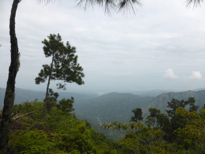
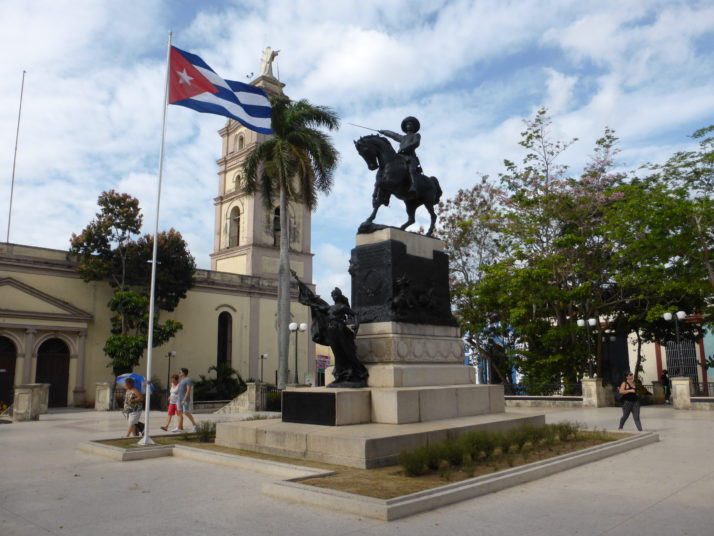
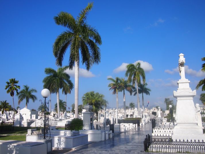
The first cemetery that we visited was Santa Ifigenia in Santiago de Cuba, a sea of white marble and palm trees against the blue Caribbean sky

José Martí Mausoleum
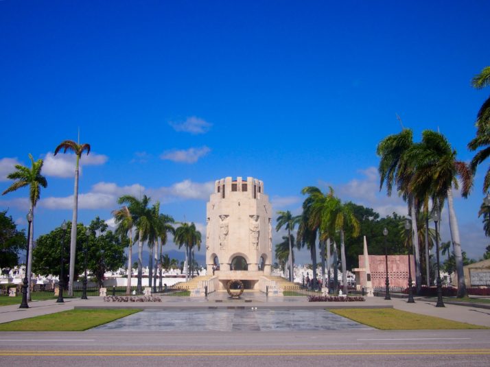
Santa Ifigenia cemetery is the resting place of José Martí, Cuba’s national hero (writer, poet, independence fighter)

Inside José Martí Mausoleum
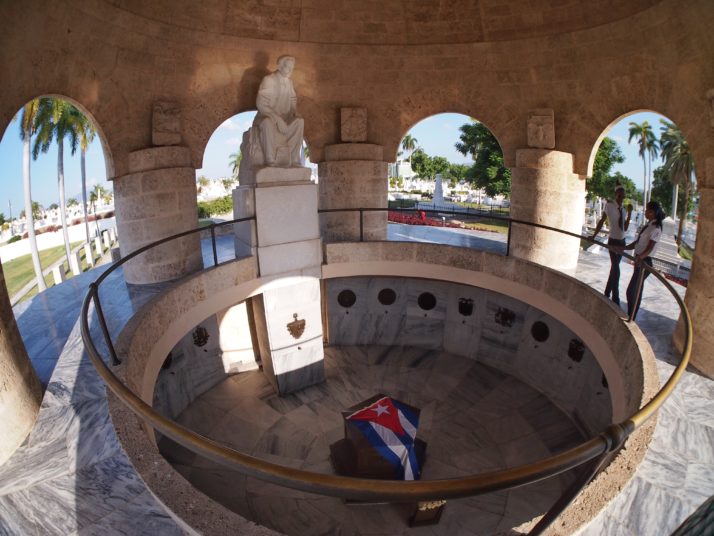
Inside José Martí’s mausoleum, the casket is draped in a Cuban flag and catches daily shafts of sunlight in response to a line in one of his poems about being buried with his visage facing the sun

Changing of the guard at José Martí Mausoleum
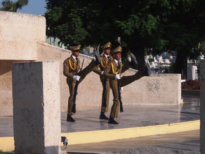
There is a twice hourly changing of the guard ceremony at José Martí’s tomb. At 8.30am we were the only ones there, by 10.30am the audience lining the path was large.

Military memorial
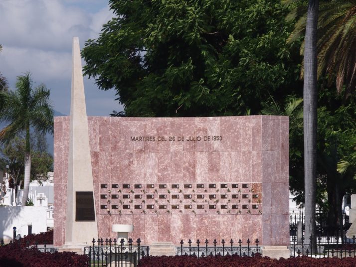
All the cemeteries we visited had mausoleums for soldiers killed during the revolutionary fighting, this one honours those who lost their lives during the Moncada Barracks attacks

Santa Ifigenia tomb detailMost of the gravestones at Santa Ifigenia cemetery were white marble but there were a few exceptions like this metal canopy with a cross

Compay Segundo graveCompay Segundo, guitarist and singer in the Buena Vista Social Club is buried in Santiago de Cuba

Baracoa cemetery
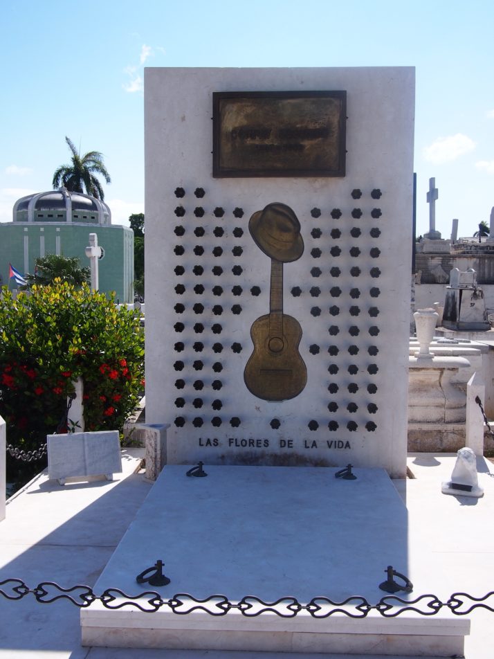
The cemetery in Baracoa was much less grand than the one in Santiago but it had a beautiful setting overlooking the sea

Baracoa cemetery niches
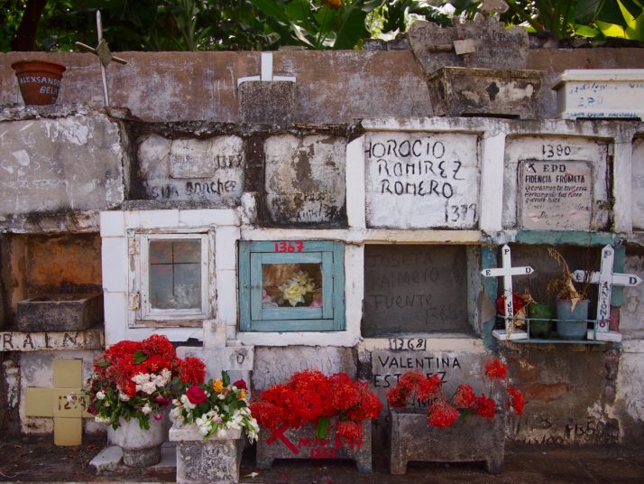
Every cemetery we visited had huge blocks containing square niches, presumably for ashes (there was usually a crematorium building hidden in a back corner as well). Some were simply decorated with the deceased’s name either handpainted or scratched into the wet cement while others had professional plaques, flowers or other decorations

Camagüey cemetery
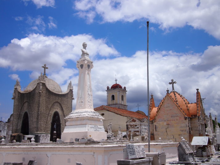
The cemetery in Camagüey was one of my favourites and with barely any other visitors (and no other tourists) we were free to have a good look around. These grand tombs are close to the entrance near the Iglesia de San Cristo de Buen Viaje (Church of St Christopher).

Camagüey cemetery dilapidation
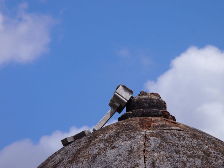
Further into the cemetery more dilapidation was obvious such as this fallen cross

Camagüey cemetery grave
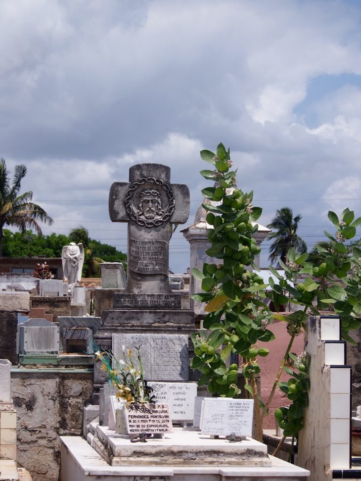
Plots often seemed to contain whole families with a crowd of plaques on top of the grave, each carrying a different name

Camagüey cemetery columns
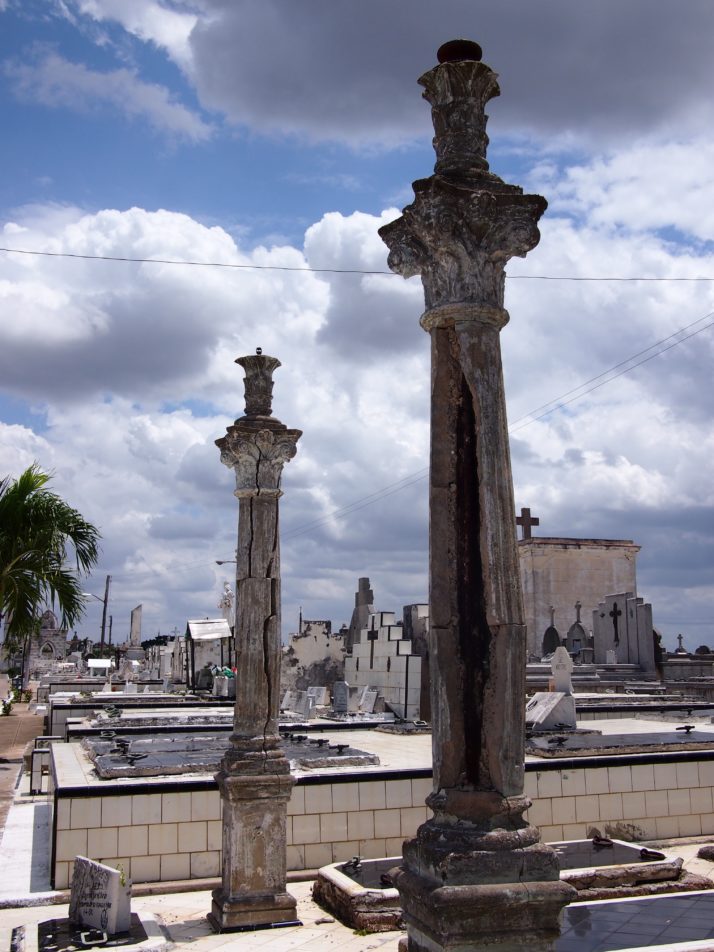
Columns that look as if they’re about to fall apart in Camagüey

Che Guevara Mausoleum
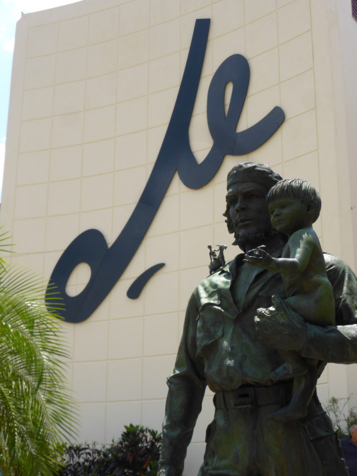
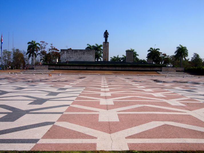
In Santa Clara we didn’t visit the cemetery but the city is home to the most famous mausoleum in the country which contains the remains of Ernesto ‘Che’ Guevara and 16 of the 37 fighters who were killed alongside him in Bolivia. Underneath the statue is a peaceful room of remembrance and an interesting museum documenting Che’s life.

Che Guevara Mausoleum Detail
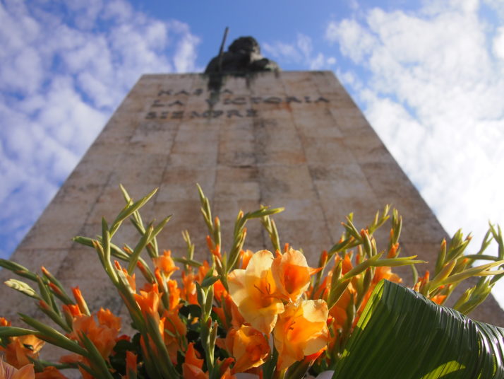
Fresh flowers are placed below the statue of Che each morning.

Necropolis Cristobal Colon Gate
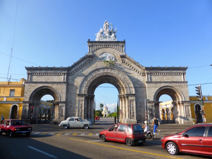
The Necrópolis Cristóbal Colón (Christopher Columbus cemetery) in Havana is enormous and worthy of this imposing entrance gate

Milagrosa plaques
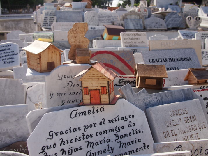
The most famous grave in the cemetery belongs to Amelia Goyri, also known as La Milagrosa or miracle-worker. She died in childbirth in 1901 and was buried with her son. The story goes that when the grave was opened some years late Amelia’s body was uncorrupted and the baby was found not at her feet but in her arms.  Since then locals have prayed for her to help with their hopes for children, new houses, etc and now several nearby plots have been overtaken with thank you messages from thoses whose wishes have been fulfilled.

Modern graves, Necropolis Cristobal Colon
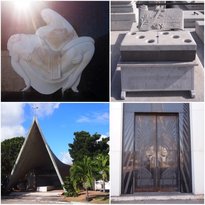
We enjoyed some of the modern graves in the Necrópolis Cristóbal Colón (clockwise from top left): a modern take on the Pietà by sculptor Rita Longa; according to the internet (!), Juana Martin died while playing dominoes; the glass doors on the pantheon of the Baró family were designed by Lalique; tomb of Nuñes Gálvez

Marble statue, Necropolis Cristobal Colon
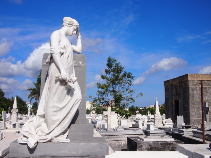
But there is plenty of beautiful white marble as well

Mausoleum of Japanese Colony of Cuba
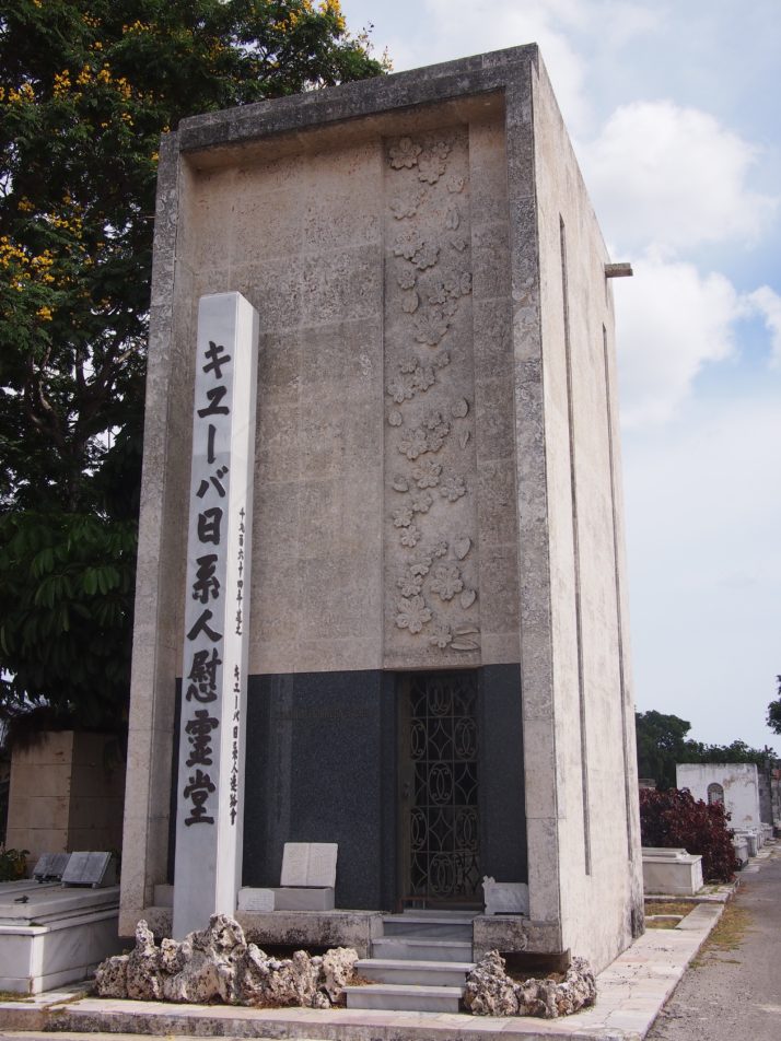
There were a number of mausoleums for societies like this one for the Japanese Colony of Cuba. Inside are walls of square niches.

Tobías Gallery
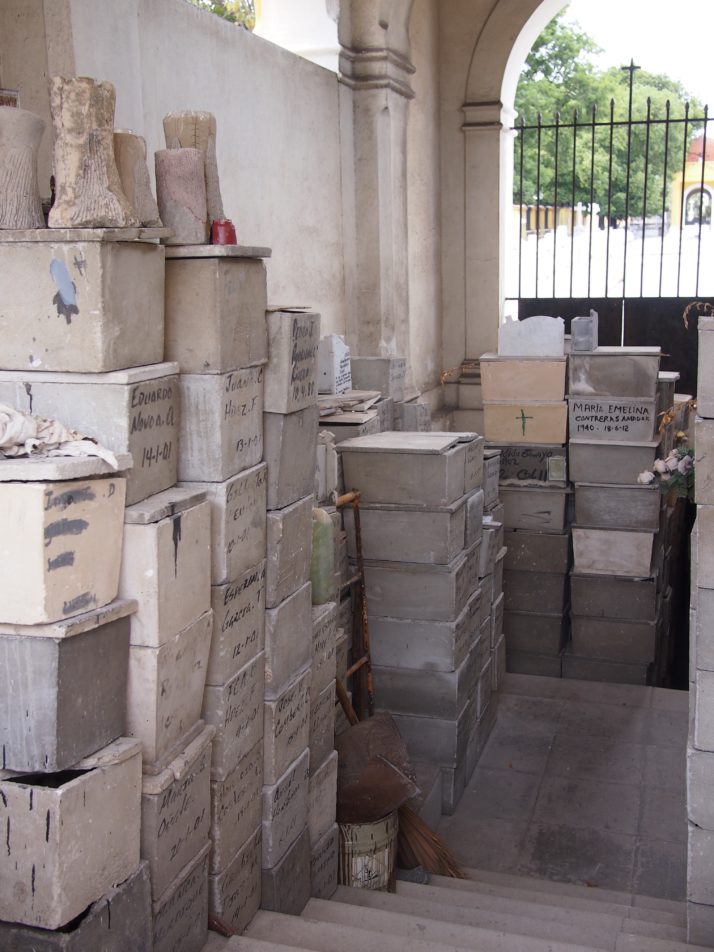
The Tobías Gallery is a 100m long underground gallery. We couldn’t enter but from what we could see from the doorway it looks to be piled high with small boxes like these which presumably contain bones or ashes

Trinidad cemetery
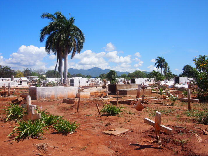
We visited the cemetery in Trinidad mainly to have a destination away from the tourist-filled city centre. We were rewarded with this tropically apocalyptic view.

Dried flowers on grave, Trinidad
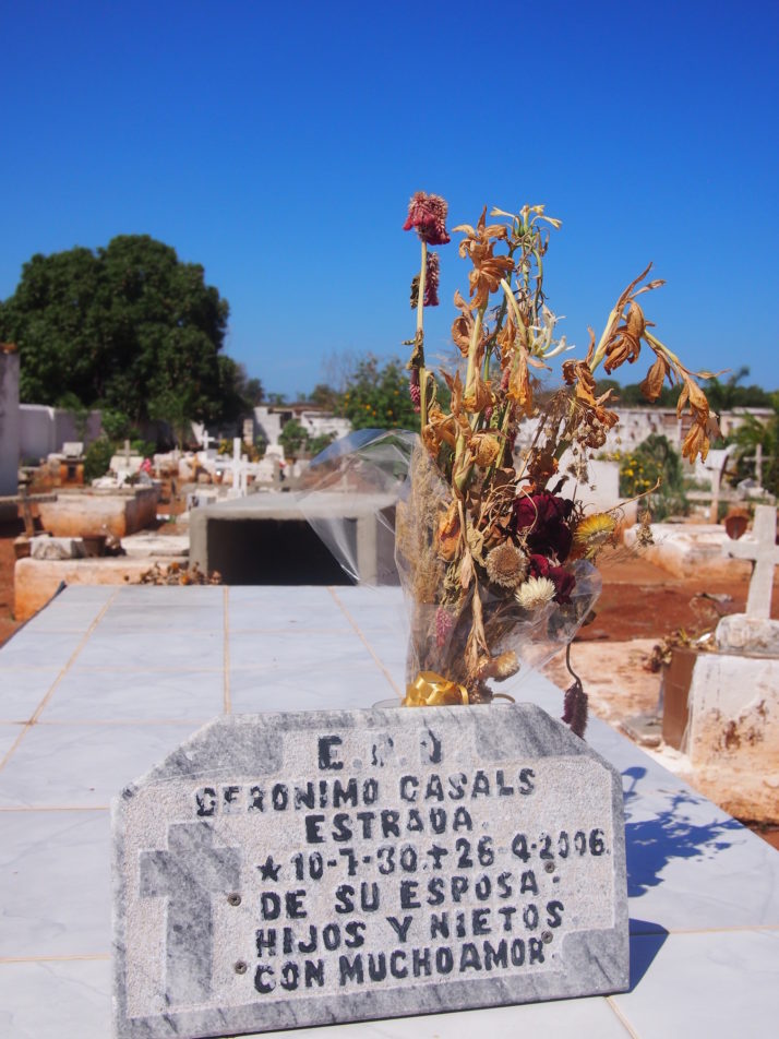
Flowers dry out very quickly in the hot Cuban sun and many graves had fake rather than fresh flowers.

Grave decorations, Trinidad
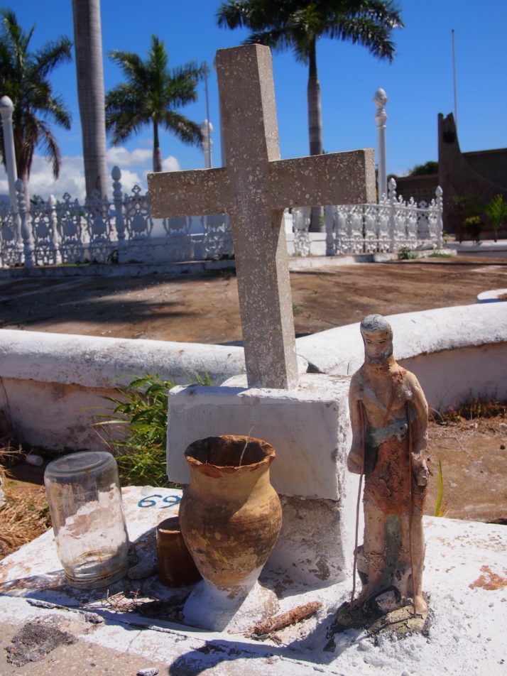
This grave is topped with a statue of Babaluaye, one of the orishas from Santeria, the religion fused from African animisism and Catholicism. It also holds what I think is the remains of a cigar

Cherub tomb decoration
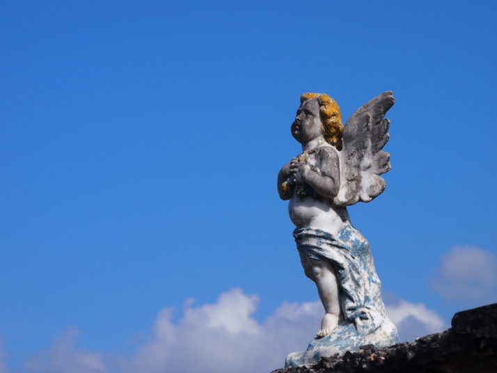
A forlorn and battered cherub tops a tomb in Morón

Cities of Cuba

We’ve just returned from a 6 week long self-organised trip around Cuba. We’ll cover our thoughts about the country as a whole and pick out our highlights in subsequent posts, but for now, here’s our take on the cities and towns we visited:

Holguín

Good for: Classic car spotting

La Loma de la Cruz, Holguín

La Loma de la Cruz, Holguín

Holguín was our arrival city, direct from Manchester with Thomas Cook (flights only). It’s a flat, easily walkable and navigable city with a renovated square, long pedestrian walking street, nice viewpoint and a disproportionately high number of classic American cars.
Holguín was the only place we’d pre-booked accommodation for from the UK, as we’d read that casa particular owners can help with onward travel plans, and I don’t know if our experience is common but it felt like we struck gold by staying at Casa Oscar. He stayed up past 10pm (twice) calling casas the length of Cuba to reserve our beds! He cooks a mean fish dinner too..

Bayamo

Good for: Arts and street performances

General Garcia (Paseo Bayamés), Bayamo

General Garcia (Paseo Bayamés), Bayamo

Bayamo has a quiet, small-town, artisitic vibe. We arrived in the midst of a literary festival and we left with the feeling that cultural events are de rigueur. We hiked Pico Turquino in the Sierra Maestra, the highest point in Cuba, and Bayamo is the closest base to the park’s main entrance.

Santiago de Cuba

Good for: History and José Martí’s mausoleum

Moncada Barracks, Santiago de Cuba

Moncada Barracks, Santiago de Cuba

We found a lot to see and do in Santiago, and it’s one of our favourite cities of the trip. The 16th century Castillo del Morro UNESCO fort was bereft of other tourists when we visited, the 19th century Cafetal la Isabelica coffee plantation is another significant UNESCO sight we enjoyed visiting and Fidel’s fledgling revolutionary force attacked the city’s Moncada Barracks, which is now a museum. We also spent a lot of time in Santiago’s impressive Santa Ifigenia cemetery which we think rivals the Necrópolis Cristóbal Colón in Havana.

Baracoa

Good for: Laid-backness (yes, even more so than the rest of Cuba!)

View of El Yunque (the Anvil) over the rooftops of Baracoa

View of El Yunque (the Anvil) over the rooftops of Baracoa

At the far eastern end of Cuba is the small, sleepy town of Baracoa where we found an even more relaxed pace to the rest of Cuba. We did a little more hiking in the unique environment of Parque Nacional Alejandro de Humboldt, spent an afternoon chilling at the beach and ate a lot of the coconut-based sauce that Baracoa is known for!

Camagüey

Good for: Plazas, market and churches

Parque Ignacio Agramonte, Camagüey

Parque Ignacio Agramonte, Camagüey

We loved wandering the twisty, winding streets between the parks and plazas, a layout which is unique to Camagüey and was designed to thwart looting pirates, admiring the many churches and restored buildings, and of course we had to visit the huge outdoor market where we scored some free cake!

Santa Clara

Good for: The Che Checklist

Che y Niño, Santa Clara

Che y Niño, Santa Clara

For us there’s really only one reason to visit Santa Clara, and that was to get our fill of all things Ernesto ‘Che’ Guevara. His mausoleum has an excellent museum and we also enjoyed the details in the life-sized statue of Che y Niño on the other side of the city. Even walking between all the sights, we had time to spare so we think at day at most is all we’d recommend in this hassle-heavy city.

Varadero

Good for: Beaches. Yes, they’re as good you’ve heard

Varadero beach

Varadero beach

A beautiful beach town that doesn’t feel at all like the rest of Cuba – except for the queuing! It’s cleaner, the cars are immaculate and don’t belch black fumes, but the prices are higher as a result of the single-minded tourist focus. But the beaches and that clear, clear, turquoise water..

Matanzas

Good for: Faded grandeur

Puente Sánchez Figueras, Matanzas

Puente Sánchez Figueras, Matanzas

Known as the city of bridges, Matanzas was just what we needed after a few days in Varadero to gently remind us that we were still in Cuba. A good balance of architecture, history and an excellent pharmacy museum.

Havana

Good for: The Malecón, Habana Vieja’s rejuvenation (Old Town), Cemetery

Plaza Vieja, Havana

Plaza Vieja, Havana

We spent nearly two weeks in the capital city of Havana – walking the length of the famous sea-wall Malecón, admiring the astounding restoration work of the City Historian’s office in the old town (and seeing how much work they have ahead of them), taking our time in the best art museum in Cuba, the Necrópolis Cristóbal Colón cemetery, the Hershey Train, and Fusterlandia are just a handful of our favourite experiences.

Viñales

Good for: Tranquil landscapes

Tobacco drying house and mogote (steep-sided limestone hill), Viñales

Tobacco drying house and mogote (steep-sided limestone hill), Viñales

Our original plan didn’t include the Valle de Viñales as it’s a full day of travel there and back from Havana, but everyone we met who’d been said it was worth it. They were right – strolling and cycling on our own, seeing more farmers than tourists in the lush, mogote strewn, tobacco growing region of Cuba was a tranquil experience we thoroughly enjoyed.

Trindad

Good for: Pretty cobbled streets, restored architecture

Plaza Mayor, Trinidad

Plaza Mayor, Trinidad

Beautiful, picture-postcard and UNESCO appointed Trinidad is a lot smaller than its reputation implies. We loved the quiet cobbled streets, live music and shows just off the main plaza and venturing into the Valle de los Ingenios to learn about Cuba’s sugar producing past.

Sancti Spíritus

Good for: To see Cubans without tourists

Puente Yayabo, Sancti Spíritus

Puente Yayabo, Sancti Spíritus

Known for its pretty little bridge and the invention of the guayabera – a white, 4-pocketed men’s shirt – our brief pause in Sancti Spíritus was a pleasant relief from the heavily touristed Trinidad to experience Cuba as the Cubans do.

Morón

Good for: A giant cockerel that crows at 6am!

Us with the 'Gallo' (cockerel), Morón

Us with the ‘Gallo’ (cockerel), Morón

This rural Cuban town is known as the City of the Cockerel – immortalised by a giant bronze statue that greeted our entrance and crows at 6am every morning. We enjoyed looking around the beautiful old train station too.